Dunly Wood

Wood, Forest in Sussex Wealden

England

Dunly Wood

A267 north of the junction with the B2102 The A267 road is a 21 mile long road from Tunbridge Wells <a href="https://www.geograph.org.uk/photo/6669020">TQ5838 : A26, A267 junction</a> to Horsebridge.
Website: <span class="nowrap"><a title="http://www.sabre-roads.org.uk/wiki/index.php?title=A267" rel="nofollow ugc noopener" href="http://www.sabre-roads.org.uk/wiki/index.php?title=A267">Link</a><img style="margin-left:2px;" alt="External link" title="External link - shift click to open in new window" src="https://s1.geograph.org.uk/img/external.png" width="10" height="10"/></span>
A267 north of the junction with the B2102 Credit: N Chadwick

Dunly Wood, located in Sussex, is a picturesque forest that spans across a vast area. With its serene and tranquil environment, it attracts nature lovers, hikers, and adventurers alike. The wood is renowned for its diverse flora and fauna, making it a haven for wildlife enthusiasts.

The forest boasts an impressive variety of tree species, including oak, beech, birch, and pine, creating a rich and vibrant ecosystem. These trees provide a dense canopy, casting dappled sunlight on the forest floor. The undergrowth is adorned with an array of wildflowers, such as bluebells, primroses, and foxgloves, adding splashes of color to the landscape.

Dunly Wood is home to a multitude of wildlife species. Nature enthusiasts can spot deer, foxes, badgers, and rabbits roaming freely in their natural habitat. The forest is also a haven for birdwatchers, as it attracts a wide range of avian species, including woodpeckers, owls, and various songbirds.

For those seeking outdoor activities, Dunly Wood offers an extensive network of walking and hiking trails. These trails wind through the forest, providing breathtaking views and opportunities to spot wildlife. Visitors can also enjoy picnicking in designated areas, immersing themselves in the peaceful ambiance of the wood.

Managed by local authorities, Dunly Wood is well-maintained, ensuring the preservation of its natural beauty. It provides a perfect escape from the hustle and bustle of everyday life, offering a tranquil retreat for nature lovers and a glimpse into the enchanting world of Sussex's woodlands.

If you have any feedback on the listing, please let us know in the comments section below.
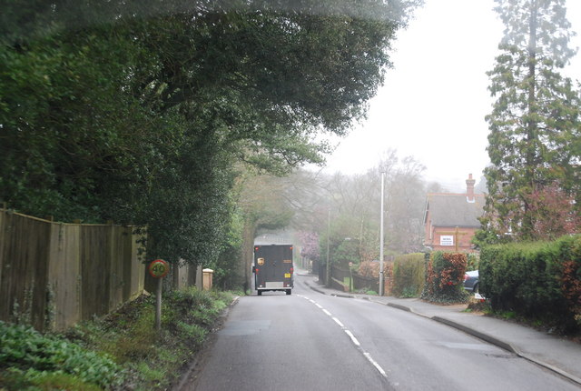
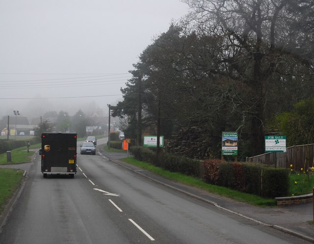
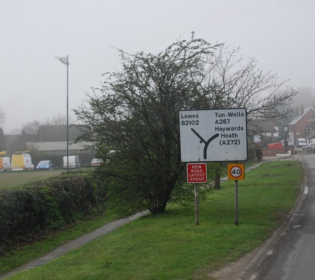
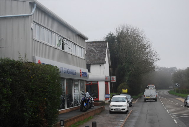
Dunly Wood Images

Images are sourced within 2km of 50.976759/0.22569464 or Grid Reference TQ5622. Thanks to Geograph Open Source API. All images are credited.

A267 north of the junction with the B2102 The A267 road is a 21 mile long road from Tunbridge Wells <a href="https://www.geograph.org.uk/photo/6669020">TQ5838 : A26, A267 junction</a> to Horsebridge.
Website: <span class="nowrap"><a title="http://www.sabre-roads.org.uk/wiki/index.php?title=A267" rel="nofollow ugc noopener" href="http://www.sabre-roads.org.uk/wiki/index.php?title=A267">Link</a><img style="margin-left:2px;" alt="External link" title="External link - shift click to open in new window" src="https://s1.geograph.org.uk/img/external.png" width="10" height="10"/></span>
A267 north of the junction with the B2102
The A267 road is a 21 mile long road from Tunbridge Wells TQ5838 : A26, A267 junction to Horsebridge. Website: LinkExternal link
A267 looking south The A267 road is a 21 mile long road from Tunbridge Wells <a href="https://www.geograph.org.uk/photo/6669020">TQ5838 : A26, A267 junction</a> to Horsebridge.
Website: <span class="nowrap"><a title="http://www.sabre-roads.org.uk/wiki/index.php?title=A267" rel="nofollow ugc noopener" href="http://www.sabre-roads.org.uk/wiki/index.php?title=A267">Link</a><img style="margin-left:2px;" alt="External link" title="External link - shift click to open in new window" src="https://s1.geograph.org.uk/img/external.png" width="10" height="10"/></span>
A267 looking south
The A267 road is a 21 mile long road from Tunbridge Wells TQ5838 : A26, A267 junction to Horsebridge. Website: LinkExternal link
B2102, Nursery Lane junction
The King's Church, Heathfield This building on Station Road was originally the "Recreation Hall" but is now used as an evangelical church.  Church website: <span class="nowrap"><a title="http://www.kcheathfield.org.uk/" rel="nofollow ugc noopener" href="http://www.kcheathfield.org.uk/">Link</a><img style="margin-left:2px;" alt="External link" title="External link - shift click to open in new window" src="https://s1.geograph.org.uk/img/external.png" width="10" height="10"/></span>
The King's Church, Heathfield
This building on Station Road was originally the "Recreation Hall" but is now used as an evangelical church. Church website: LinkExternal link
Date stone of the Recreation Hall The date stone (1909) of a public hall on Station Road, Heathfield that is now used as a church- see <a href="https://www.geograph.org.uk/photo/2382607">TQ5821 : The King's Church, Heathfield</a> for context.
Date stone of the Recreation Hall
The date stone (1909) of a public hall on Station Road, Heathfield that is now used as a church- see TQ5821 : The King's Church, Heathfield for context.
A267 near Heathfield The A267 road is a 21 mile long road from Tunbridge Wells <a href="https://www.geograph.org.uk/photo/6669020">TQ5838 : A26, A267 junction</a> to Horsebridge.
Website: <span class="nowrap"><a title="http://www.sabre-roads.org.uk/wiki/index.php?title=A267" rel="nofollow ugc noopener" href="http://www.sabre-roads.org.uk/wiki/index.php?title=A267">Link</a><img style="margin-left:2px;" alt="External link" title="External link - shift click to open in new window" src="https://s1.geograph.org.uk/img/external.png" width="10" height="10"/></span>
A267 near Heathfield
The A267 road is a 21 mile long road from Tunbridge Wells TQ5838 : A26, A267 junction to Horsebridge. Website: LinkExternal link
A267 north of Little London The A267 road is a 21 mile long road from Tunbridge Wells <a href="https://www.geograph.org.uk/photo/6669020">TQ5838 : A26, A267 junction</a> to Horsebridge.
Website: <span class="nowrap"><a title="http://www.sabre-roads.org.uk/wiki/index.php?title=A267" rel="nofollow ugc noopener" href="http://www.sabre-roads.org.uk/wiki/index.php?title=A267">Link</a><img style="margin-left:2px;" alt="External link" title="External link - shift click to open in new window" src="https://s1.geograph.org.uk/img/external.png" width="10" height="10"/></span>
A267 north of Little London
The A267 road is a 21 mile long road from Tunbridge Wells TQ5838 : A26, A267 junction to Horsebridge. Website: LinkExternal link
Pook Reed Lane off the A267 The A267 road is a 21 mile long road from Tunbridge Wells <a href="https://www.geograph.org.uk/photo/6669020">TQ5838 : A26, A267 junction</a> to Horsebridge.
Website: <span class="nowrap"><a title="http://www.sabre-roads.org.uk/wiki/index.php?title=A267" rel="nofollow ugc noopener" href="http://www.sabre-roads.org.uk/wiki/index.php?title=A267">Link</a><img style="margin-left:2px;" alt="External link" title="External link - shift click to open in new window" src="https://s1.geograph.org.uk/img/external.png" width="10" height="10"/></span>
Pook Reed Lane off the A267
The A267 road is a 21 mile long road from Tunbridge Wells TQ5838 : A26, A267 junction to Horsebridge. Website: LinkExternal link
A267 on the edge of Heathfield The A267 road is a 21 mile long road from Tunbridge Wells <a href="https://www.geograph.org.uk/photo/6669020">TQ5838 : A26, A267 junction</a> to Horsebridge.
Website: <span class="nowrap"><a title="http://www.sabre-roads.org.uk/wiki/index.php?title=A267" rel="nofollow ugc noopener" href="http://www.sabre-roads.org.uk/wiki/index.php?title=A267">Link</a><img style="margin-left:2px;" alt="External link" title="External link - shift click to open in new window" src="https://s1.geograph.org.uk/img/external.png" width="10" height="10"/></span>
A267 on the edge of Heathfield
The A267 road is a 21 mile long road from Tunbridge Wells TQ5838 : A26, A267 junction to Horsebridge. Website: LinkExternal link
A267, Cross in Hand The A267 road is a 21 mile long road from Tunbridge Wells <a href="https://www.geograph.org.uk/photo/6669020">TQ5838 : A26, A267 junction</a> to Horsebridge.
Website: <span class="nowrap"><a title="http://www.sabre-roads.org.uk/wiki/index.php?title=A267" rel="nofollow ugc noopener" href="http://www.sabre-roads.org.uk/wiki/index.php?title=A267">Link</a><img style="margin-left:2px;" alt="External link" title="External link - shift click to open in new window" src="https://s1.geograph.org.uk/img/external.png" width="10" height="10"/></span>
A267, Cross in Hand
The A267 road is a 21 mile long road from Tunbridge Wells TQ5838 : A26, A267 junction to Horsebridge. Website: LinkExternal link
Road sign, Cross in Hand
JW Groombridge, Cross In Hand Cross in Hand is a village in East Sussex, close to Heathfield. It is located around the junction of the A267 and B2102.
Wikipedia: <span class="nowrap"><a title="https://en.wikipedia.org/wiki/Cross_In_Hand" rel="nofollow ugc noopener" href="https://en.wikipedia.org/wiki/Cross_In_Hand">Link</a><img style="margin-left:2px;" alt="External link" title="External link - shift click to open in new window" src="https://s1.geograph.org.uk/img/external.png" width="10" height="10"/></span>
JW Groombridge, Cross In Hand
Cross in Hand is a village in East Sussex, close to Heathfield. It is located around the junction of the A267 and B2102. Wikipedia: LinkExternal link
Dad's Hill off the A267
Junction of B2102 and A267
A267 heading north The A267 road is a 21 mile long road from Tunbridge Wells <a href="https://www.geograph.org.uk/photo/6669020">TQ5838 : A26, A267 junction</a> to Horsebridge.
Website: <span class="nowrap"><a title="http://www.sabre-roads.org.uk/wiki/index.php?title=A267" rel="nofollow ugc noopener" href="http://www.sabre-roads.org.uk/wiki/index.php?title=A267">Link</a><img style="margin-left:2px;" alt="External link" title="External link - shift click to open in new window" src="https://s1.geograph.org.uk/img/external.png" width="10" height="10"/></span>
A267 heading north
The A267 road is a 21 mile long road from Tunbridge Wells TQ5838 : A26, A267 junction to Horsebridge. Website: LinkExternal link
The A267 The A267 road is a 21 mile long road from Tunbridge Wells <a href="https://www.geograph.org.uk/photo/6669020">TQ5838 : A26, A267 junction</a> to Horsebridge.
Website: <span class="nowrap"><a title="http://www.sabre-roads.org.uk/wiki/index.php?title=A267" rel="nofollow ugc noopener" href="http://www.sabre-roads.org.uk/wiki/index.php?title=A267">Link</a><img style="margin-left:2px;" alt="External link" title="External link - shift click to open in new window" src="https://s1.geograph.org.uk/img/external.png" width="10" height="10"/></span>
The A267
The A267 road is a 21 mile long road from Tunbridge Wells TQ5838 : A26, A267 junction to Horsebridge. Website: LinkExternal link
New Mill, Cross in Hand in 1967 In the days when it had all its sails.
New Mill, Cross in Hand in 1967
In the days when it had all its sails.
Show me another place!

Dunly Wood is located at Grid Ref: TQ5622 (Lat: 50.976759, Lng: 0.22569464)

Administrative County: East Sussex

District: Wealden

Police Authority: Sussex

What 3 Words

///pirates.tiling.incisions. Near Heathfield, East Sussex

Related Wikis

Heathfield transmitting station

The Heathfield transmitting station is a facility for FM and television transmission at Heathfield, East Sussex, UK (grid reference TQ566220). Opened in...

Cross-in-Hand

Cross-in-Hand is a small village outside Heathfield town to its west, in the Wealden District situated in East Sussex, England. It is occasionally referred...

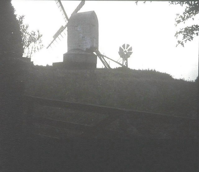
New Mill, Cross-in-Hand

New Mill is a Grade II* listed post mill at Cross in Hand near Heathfield, East Sussex, England. It was the last windmill working commercially by wind...

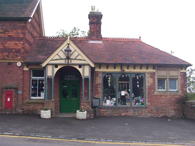
Heathfield railway station (East Sussex)

Heathfield railway station was on the Cuckoo Line between Horam and Mayfield, serving the market town of Heathfield. It was opened in 1880 by London, Brighton...

Holy Cross Priory, Cross-in-Hand

Holy Cross Priory, Cross-in-Hand, is a priory of the Benedictine Sisters of Grace and Compassion which provides homes for the elderly. It was established...

Roser's Cross

Roser's Cross is a village in the Wealden district of East Sussex.

Selwyns Wood

Selwyns Wood is a 11-hectare (27-acre) nature reserve west of Heathfield in Sussex. It is managed by the Sussex Wildlife Trust.This reserve has woodland...

Heathfield, East Sussex

Heathfield is a market town and former civil parish, now in the parish of Heathfield and Waldron, in the Wealden District of East Sussex, England. The...

Nearby Amenities

Located within 500m of 50.976759,0.22569464
Shop: motorcycle
Lat/Long: 50.9738974/0.2228935
Heathfield transmitter
Communication Radio: yes
Communication Television: yes
Height: 135
Man Made: mast
Tower Construction: guyed_lattice
Tower Type: communication
Lat/Long: 50.9767246/0.2305466
Post Box
Collection Times: Mo-Fr 16:45; Sa 09:15
Operator: Royal Mail
Operator Wikidata: Q638098
Post Box Type: pillar
Ref: TN21 29
Royal Cypher: GR
Royal Cypher Wikidata: Q33102273
Source: survey
Lat/Long: 50.9734411/0.2234211
Man Made: tower
Tower Construction: lattice
Tower Type: communication
Lat/Long: 50.977104/0.2310054
Bell Reed Farm
Addr City: Cross In Hand
Addr Postcode: TN21 0SY
Addr Street: Dads Hill
Place: farm
Lat/Long: 50.9758251/0.2187931
Bus Stop
Mayfield Road
Bench: yes
Bin: yes
Bus: yes
Naptan AtcoCode: 1400WE0601
Naptan NaptanCode: esudamtw
Public Transport: platform
Shelter: yes
Lat/Long: 50.9734753/0.2251674
Footpath
Information: guidepost
Operator: East Sussex County Council
Tourism: information
Lat/Long: 50.9766243/0.2313466
Cross in Hand
Operator: UK Power Networks
Operator Wikidata: Q7864927
Power: substation
Lat/Long: 50.9736736/0.2244749
Bus Stop
Mayfield Road
Bench: yes
Bin: yes
Bus: yes
Public Transport: platform
Shelter: yes
Lat/Long: 50.9736782/0.2243966
Atm
Check Date: 2023-06-30
Lat/Long: 50.973938/0.2239159
Bench
Lat/Long: 50.9725954/0.2245787
The data included in this document is from www.openstreetmap.org. The data is made available under ODbL.

Have you been to Dunly Wood?

Leave your review of Dunly Wood below (or comments, questions and feedback).