Card's Wood

Wood, Forest in Sussex Wealden

England

Card's Wood

Oast House An Oast House is a building used to dry fresh hops before they are sent to the brewers, to be used for flavouring beer. A traditional Oast House consists of the 'oast' and the 'stowage'. The oast was a kiln, with a plenum chamber fired by charcoal at ground floor and the drying floor directly above. The steep pitched roof channelled the hot air through the hops to the top. The stowage, was the barn section, it had a cooling floor and press at first floor and storage area at ground floor. Read more <a title="https://www.geograph.org.uk/article/Oast-Houses" href="https://www.geograph.org.uk/article/Oast-Houses">Link</a>
Oast House Credit: Oast House Archive

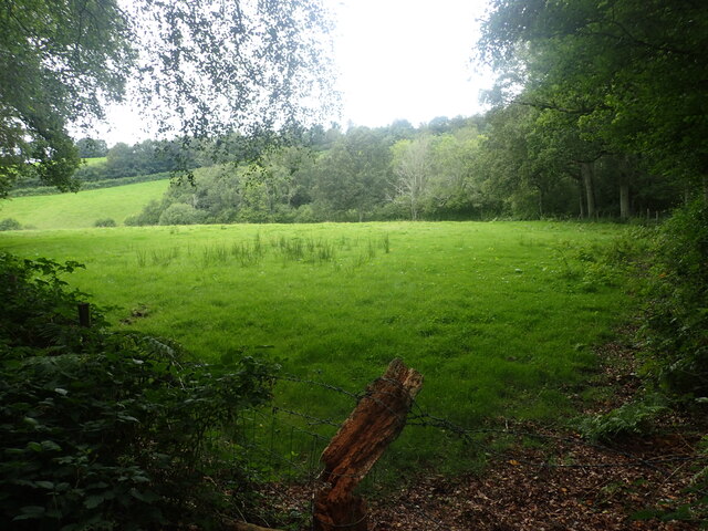
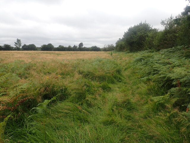
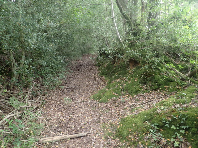
Card's Wood is a picturesque woodland located in the county of Sussex, England. Nestled amidst the rolling hills and tranquil countryside, this enchanting forest covers an area of approximately 50 acres, offering a haven of natural beauty and tranquility.

The woodland is predominantly made up of a diverse range of deciduous trees, including oak, beech, and chestnut, which create a vibrant tapestry of colors throughout the seasons. The forest floor is adorned with a rich carpet of wildflowers, such as bluebells and primroses, adding to the woodland's idyllic charm.

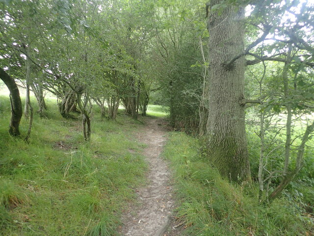
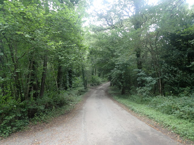
Card's Wood is renowned for its numerous walking trails, which wind their way through the forest, inviting visitors to explore its hidden corners. These well-maintained paths cater to both casual strollers and avid hikers, with options ranging from short, leisurely walks to longer, more challenging routes. Along the way, visitors may encounter native wildlife, such as deer, squirrels, and a myriad of bird species, making it a popular spot for nature enthusiasts and birdwatchers alike.

The wood also features several picnic areas, where visitors can relax and enjoy a leisurely lunch surrounded by the sounds of nature. Additionally, there are designated camping spots for those who wish to spend a night under the stars and experience the true essence of this captivating woodland.

Card's Wood, Sussex, is a true gem for nature lovers, offering a serene and captivating retreat from the hustle and bustle of everyday life. With its stunning scenery, diverse flora and fauna, and well-maintained trails, it provides the perfect setting for a peaceful and rejuvenating outdoor experience.

If you have any feedback on the listing, please let us know in the comments section below.
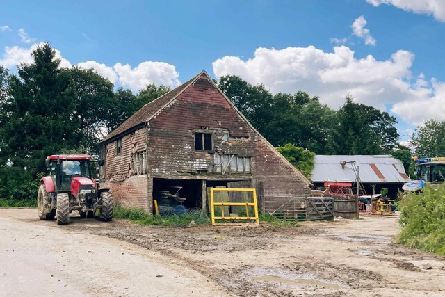
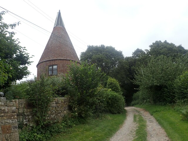
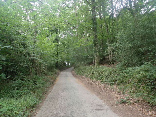
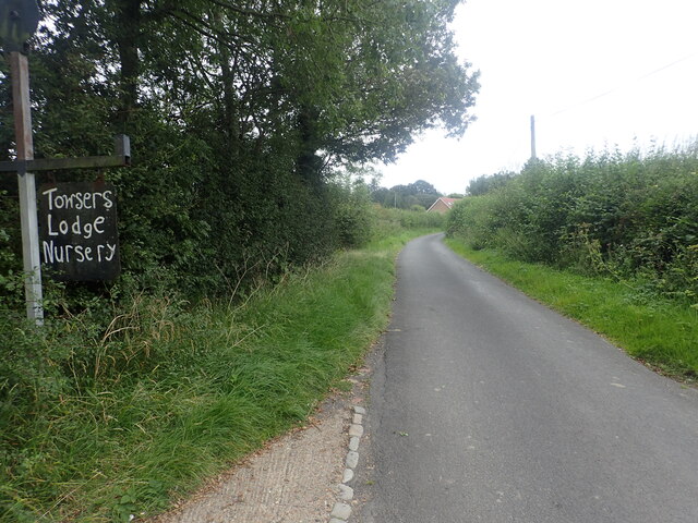
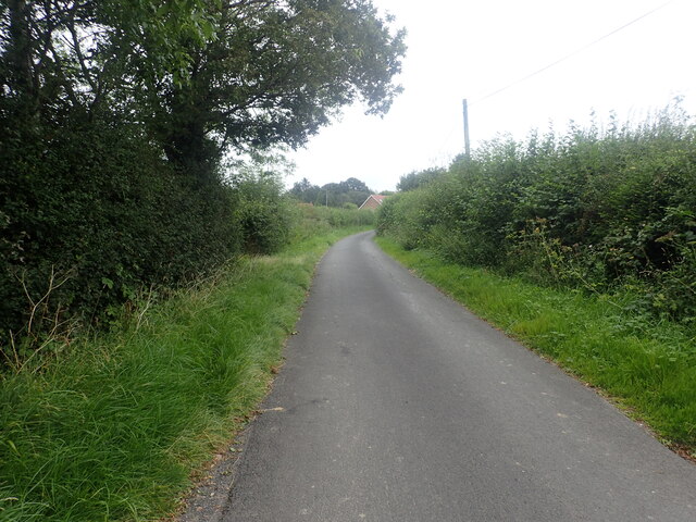
Card's Wood Images

Images are sourced within 2km of 51.066694/0.22905021 or Grid Reference TQ5632. Thanks to Geograph Open Source API. All images are credited.

Oast House An Oast House is a building used to dry fresh hops before they are sent to the brewers, to be used for flavouring beer. A traditional Oast House consists of the 'oast' and the 'stowage'. The oast was a kiln, with a plenum chamber fired by charcoal at ground floor and the drying floor directly above. The steep pitched roof channelled the hot air through the hops to the top. The stowage, was the barn section, it had a cooling floor and press at first floor and storage area at ground floor. Read more <a title="https://www.geograph.org.uk/article/Oast-Houses" href="https://www.geograph.org.uk/article/Oast-Houses">Link</a>
Oast House
An Oast House is a building used to dry fresh hops before they are sent to the brewers, to be used for flavouring beer. A traditional Oast House consists of the 'oast' and the 'stowage'. The oast was a kiln, with a plenum chamber fired by charcoal at ground floor and the drying floor directly above. The steep pitched roof channelled the hot air through the hops to the top. The stowage, was the barn section, it had a cooling floor and press at first floor and storage area at ground floor. Read more Link
Oast House Single round kiln oast house.
Oast House
Single round kiln oast house.
Cowl of Oast House Single round kiln oast house.
Cowl of Oast House
Single round kiln oast house.
Footpath to Brickyard Lane This is the footpath from Mark Cross to Brickyard Lane where it passes through a small woodland.
Footpath to Brickyard Lane
This is the footpath from Mark Cross to Brickyard Lane where it passes through a small woodland.
Brickyard Lane Brickyard Lane drops down ahead to cross a stream which is a tributary of Eridge Brook. Entryhill Wood is to the left.
Brickyard Lane
Brickyard Lane drops down ahead to cross a stream which is a tributary of Eridge Brook. Entryhill Wood is to the left.
View from the edge of Card's Wood The footpath from Brickyard Lane through Card's Wood emerges here, just before Blackdown Lane is reached.
View from the edge of Card's Wood
The footpath from Brickyard Lane through Card's Wood emerges here, just before Blackdown Lane is reached.
View from Redgate Mill Lane to an old railway line This was the Cuckoo Line. It became known as the Cuckoo Line because traditionally, the first cuckoo of spring was released from a cage at Heathfield Fair. The line was opened in two stages - between Polegate and Hailsham opened on 14th May 1849 and northwards from Hailsham to Eridge in 1880, the section here being opened on 1st September 1880. The Cuckoo Line was closed to passengers north of Hailsham on 14th June 1965 and the final stretch of line on 9th September 1968.

See <span class="nowrap"><a title="http://disused-stations.org.uk/r/rotherfield_and_mark_cross/index.shtml" rel="nofollow ugc noopener" href="http://disused-stations.org.uk/r/rotherfield_and_mark_cross/index.shtml">Link</a><img style="margin-left:2px;" alt="External link" title="External link - shift click to open in new window" src="https://s1.geograph.org.uk/img/external.png" width="10" height="10"/></span>  and <span class="nowrap"><a title="https://www.eastsussex.gov.uk/leisureandtourism/discover-east-sussex/countryside-sites/cuckootrail/" rel="nofollow ugc noopener" href="https://www.eastsussex.gov.uk/leisureandtourism/discover-east-sussex/countryside-sites/cuckootrail/">Link</a><img style="margin-left:2px;" alt="External link" title="External link - shift click to open in new window" src="https://s1.geograph.org.uk/img/external.png" width="10" height="10"/></span>  for more information.  This part of the old line is not accessible but can be seen here, just on this side of the woodland.
View from Redgate Mill Lane to an old railway line
This was the Cuckoo Line. It became known as the Cuckoo Line because traditionally, the first cuckoo of spring was released from a cage at Heathfield Fair. The line was opened in two stages - between Polegate and Hailsham opened on 14th May 1849 and northwards from Hailsham to Eridge in 1880, the section here being opened on 1st September 1880. The Cuckoo Line was closed to passengers north of Hailsham on 14th June 1965 and the final stretch of line on 9th September 1968. See LinkExternal link and LinkExternal link for more information. This part of the old line is not accessible but can be seen here, just on this side of the woodland.
The Sussex Border Path near Stitches Farm The Sussex Border Path drops down ahead to the valley of the Eridge Brook which also carries the Uckfield Line between Eridge and Crowborough. See <span class="nowrap"><a title="https://www.walkingenglishman.com/ldp/sussexborderpath.html" rel="nofollow ugc noopener" href="https://www.walkingenglishman.com/ldp/sussexborderpath.html">Link</a><img style="margin-left:2px;" alt="External link" title="External link - shift click to open in new window" src="https://s1.geograph.org.uk/img/external.png" width="10" height="10"/></span>
The Sussex Border Path near Stitches Farm
The Sussex Border Path drops down ahead to the valley of the Eridge Brook which also carries the Uckfield Line between Eridge and Crowborough. See LinkExternal link
The Deer Park Campsite This is just outside the Deer Park Cafe.
The Deer Park Campsite
This is just outside the Deer Park Cafe.
Oast house at Great Hedges Farm This view is from a bridleway leading up from Brickyard Lane. For more information about the oast and for a photograph on a better day see <a title="https://www.geograph.org.uk/photo/1803085" href="https://www.geograph.org.uk/photo/1803085">Link</a>
Oast house at Great Hedges Farm
This view is from a bridleway leading up from Brickyard Lane. For more information about the oast and for a photograph on a better day see Link
Looking down to the former Cuckoo Line This was the Cuckoo Line. It became known as the Cuckoo Line because traditionally, the first cuckoo of spring was released from a cage at Heathfield Fair. The line was opened in two stages - between Polegate and Hailsham opened on 14th May 1849 and northwards from Hailsham to Eridge in 1880, the section here being opened on 1st September 1880. The Cuckoo Line was closed to passengers north of Hailsham on 14th June 1965 and the final stretch of line on 9th September 1968.

See <span class="nowrap"><a title="http://disused-stations.org.uk/r/rotherfield_and_mark_cross/index.shtml" rel="nofollow ugc noopener" href="http://disused-stations.org.uk/r/rotherfield_and_mark_cross/index.shtml">Link</a><img style="margin-left:2px;" alt="External link" title="External link - shift click to open in new window" src="https://s1.geograph.org.uk/img/external.png" width="10" height="10"/></span>  and <span class="nowrap"><a title="https://www.eastsussex.gov.uk/leisureandtourism/discover-east-sussex/countryside-sites/cuckootrail/" rel="nofollow ugc noopener" href="https://www.eastsussex.gov.uk/leisureandtourism/discover-east-sussex/countryside-sites/cuckootrail/">Link</a><img style="margin-left:2px;" alt="External link" title="External link - shift click to open in new window" src="https://s1.geograph.org.uk/img/external.png" width="10" height="10"/></span>  for more information.  This part of the old line is not accessible but can be seen here, just on this side of the woodland.
Looking down to the former Cuckoo Line
This was the Cuckoo Line. It became known as the Cuckoo Line because traditionally, the first cuckoo of spring was released from a cage at Heathfield Fair. The line was opened in two stages - between Polegate and Hailsham opened on 14th May 1849 and northwards from Hailsham to Eridge in 1880, the section here being opened on 1st September 1880. The Cuckoo Line was closed to passengers north of Hailsham on 14th June 1965 and the final stretch of line on 9th September 1968. See LinkExternal link and LinkExternal link for more information. This part of the old line is not accessible but can be seen here, just on this side of the woodland.
Looking towards the former Cuckoo Line This was the Cuckoo Line. It became known as the Cuckoo Line because traditionally, the first cuckoo of spring was released from a cage at Heathfield Fair. The line was opened in two stages - between Polegate and Hailsham opened on 14th May 1849 and northwards from Hailsham to Eridge in 1880, the section here being opened on 1st September 1880. The Cuckoo Line was closed to passengers north of Hailsham on 14th June 1965 and the final stretch of line on 9th September 1968.

See <span class="nowrap"><a title="http://disused-stations.org.uk/r/rotherfield_and_mark_cross/index.shtml" rel="nofollow ugc noopener" href="http://disused-stations.org.uk/r/rotherfield_and_mark_cross/index.shtml">Link</a><img style="margin-left:2px;" alt="External link" title="External link - shift click to open in new window" src="https://s1.geograph.org.uk/img/external.png" width="10" height="10"/></span>  and <span class="nowrap"><a title="https://www.eastsussex.gov.uk/leisureandtourism/discover-east-sussex/countryside-sites/cuckootrail/" rel="nofollow ugc noopener" href="https://www.eastsussex.gov.uk/leisureandtourism/discover-east-sussex/countryside-sites/cuckootrail/">Link</a><img style="margin-left:2px;" alt="External link" title="External link - shift click to open in new window" src="https://s1.geograph.org.uk/img/external.png" width="10" height="10"/></span>  for more information.  This part of the old line is not accessible but can be seen here, between the further hedge and the woodland.
Looking towards the former Cuckoo Line
This was the Cuckoo Line. It became known as the Cuckoo Line because traditionally, the first cuckoo of spring was released from a cage at Heathfield Fair. The line was opened in two stages - between Polegate and Hailsham opened on 14th May 1849 and northwards from Hailsham to Eridge in 1880, the section here being opened on 1st September 1880. The Cuckoo Line was closed to passengers north of Hailsham on 14th June 1965 and the final stretch of line on 9th September 1968. See LinkExternal link and LinkExternal link for more information. This part of the old line is not accessible but can be seen here, between the further hedge and the woodland.
Brickyard Lane Entryhill Wood is to the right. A footpath from Mark Cross crosses the road here. For the view in the other direction see <a title="https://www.geograph.org.uk/photo/6950574" href="https://www.geograph.org.uk/photo/6950574">Link</a>
Brickyard Lane
Entryhill Wood is to the right. A footpath from Mark Cross crosses the road here. For the view in the other direction see Link
Brickyard Lane The A267 and Mark Cross are reached just ahead.
Brickyard Lane
The A267 and Mark Cross are reached just ahead.
Brickyard Lane The A267 and Mark Cross are reached just ahead.
Brickyard Lane
The A267 and Mark Cross are reached just ahead.
Footpath to Brickyard Lane This is the footpath from Mark Cross to Brickyard Lane just before Stonehouse Farm is reached.
Footpath to Brickyard Lane
This is the footpath from Mark Cross to Brickyard Lane just before Stonehouse Farm is reached.
Footpath into Card's Wood This is just after the footpath leaves Cowford Bridge Lane near the crossroads with Eridge Lane and Hackdon Hill.
Footpath into Card's Wood
This is just after the footpath leaves Cowford Bridge Lane near the crossroads with Eridge Lane and Hackdon Hill.
Show me another place!

Card's Wood is located at Grid Ref: TQ5632 (Lat: 51.066694, Lng: 0.22905021)

Administrative County: East Sussex

District: Wealden

Police Authority: Sussex

What 3 Words

///bands.retraced.unguarded. Near Town Row, East Sussex

Related Wikis

Rotherfield and Mark Cross railway station

Rotherfield and Mark Cross (also Rotherfield) is the name of a closed station on the Eridge - Heathfield - Polegate railway (the Cuckoo Line) in East Sussex...

St Joseph's College, Mark Cross

St Joseph's College was a Roman Catholic minor seminary in Mark Cross, outside Rotherfield in East Sussex. It was designed by Edward Pugin and the site...

Jameah Islameah School

Jameah Islameah School was an independent Islamic school in East Sussex. The school was located on a 54 acre site and had residential facilities to house...

Bowles Rocks

Bowles Rocks is a sandstone crag in the county of East Sussex, on the border with Kent, approximately 8 kilometres (5 mi) south of the town of Royal Tunbridge...

Bowles Outdoor Centre

Bowles Outdoor Centre is an outdoor education/outdoor learning centre in southeast England, located between Royal Tunbridge Wells and Crowborough at Bowles...

Walter's Mill, Mark Cross

Walter's Mill is a tower mill at Mark Cross, Sussex, England which has been converted to residential accommodation. == History == Walter's Mill was first...

Rotherfield

Rotherfield is a village and civil parish in the Wealden District of East Sussex, England. It is one of the largest parishes in East Sussex. There are...

Eridge Park

Eridge Park () is a village and historic park located north of the parish of Rotherfield, to the north-east of Crowborough in East Sussex, England. The...

Nearby Amenities

Located within 500m of 51.066694,0.22905021
The data included in this document is from www.openstreetmap.org. The data is made available under ODbL.

Have you been to Card's Wood?

Leave your review of Card's Wood below (or comments, questions and feedback).