Little Newlands Wood

Wood, Forest in Essex Uttlesford

England

Little Newlands Wood

Class 170 Multiple Unit at Stansted Airport
Class 170 Multiple Unit at Stansted Airport Credit: David Robinson

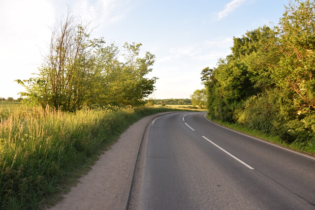
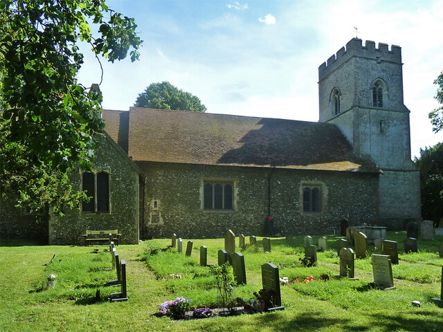
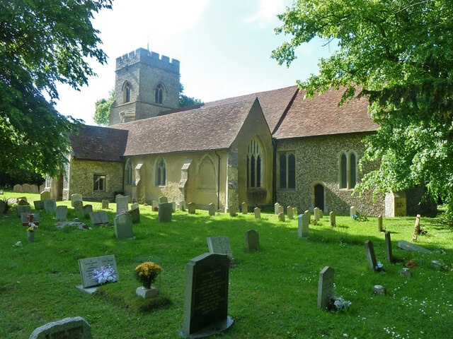
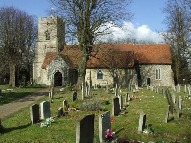
Little Newlands Wood is a charming forest located in the county of Essex, England. Situated in the vicinity of the village of Great Dunmow, this wood offers a peaceful and serene escape from the hustle and bustle of city life.

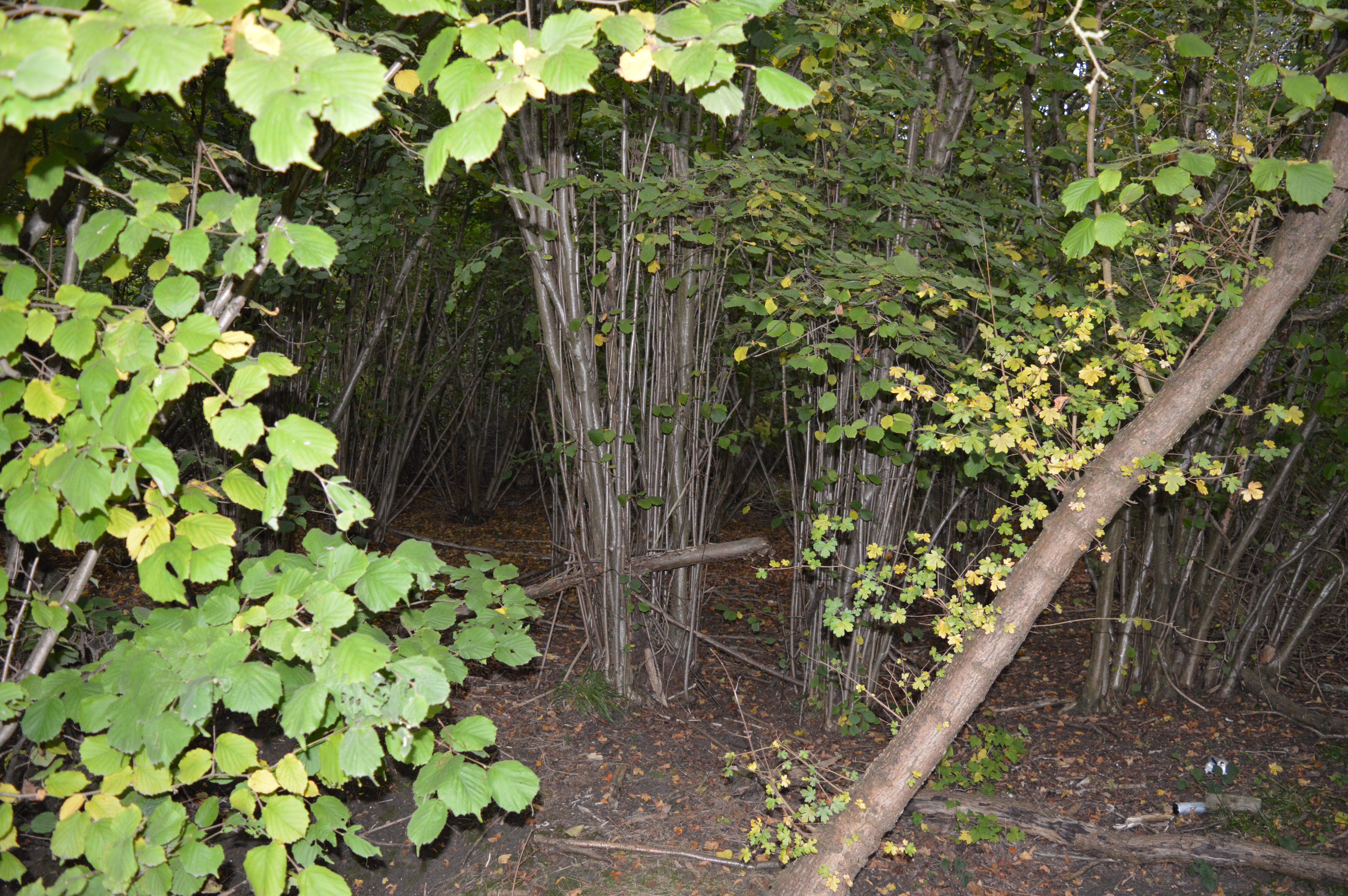
Covering an area of approximately 10 acres, Little Newlands Wood is characterized by its dense vegetation and diverse range of tree species. It is primarily composed of deciduous trees such as oak, beech, and birch, which create a beautiful canopy that provides shade and shelter to the forest floor. The forest floor itself is adorned with a variety of wildflowers and ferns, adding to the wood's natural beauty.

The wood is home to a rich array of wildlife, making it a perfect destination for nature enthusiasts and wildlife lovers. Visitors may spot various bird species, including woodpeckers, owls, and thrushes, as well as small mammals like foxes, squirrels, and hedgehogs. The tranquil atmosphere and secluded nature of the wood provide an ideal habitat for these creatures.

Little Newlands Wood offers a network of well-maintained footpaths and trails, allowing visitors to explore its enchanting surroundings. It is a popular destination for walkers, joggers, and dog owners, who can enjoy the peacefulness and fresh air the wood has to offer.

Located in close proximity to the historic market town of Great Dunmow, Little Newlands Wood is easily accessible by both car and public transportation. It provides a welcome sanctuary for those seeking a break from their daily routines, offering a chance to reconnect with nature in a picturesque and tranquil setting.

If you have any feedback on the listing, please let us know in the comments section below.

Little Newlands Wood Images

Images are sourced within 2km of 51.888275/0.26918508 or Grid Reference TL5623. Thanks to Geograph Open Source API. All images are credited.

Class 170 Multiple Unit at Stansted Airport
Near Le Knell's Cottage On the lane between Stansted Airport and Takeley.
Near Le Knell's Cottage
On the lane between Stansted Airport and Takeley.
Stansted airport permieter A track and perimeter fence around Stansted Airport in north Essex.

This image was taken on a late October day.  Trees were turning golden as they prepared to shed their leaves for the coming winter season.
Stansted airport permieter
A track and perimeter fence around Stansted Airport in north Essex. This image was taken on a late October day. Trees were turning golden as they prepared to shed their leaves for the coming winter season.
Runway approach, Stansted Airport An aircraft approaching Stansted Airport in north Essex.  In the foreground are the runway approach lights, in banks of three.
Runway approach, Stansted Airport
An aircraft approaching Stansted Airport in north Essex. In the foreground are the runway approach lights, in banks of three.
Green Street, near Elsenham Green Street is a minor lane in countryside in north Essex, close to Stansted Airport.

Here, a footpath leads off to the left, crossing a ditch alongside the lane.

This image was taken on a late October day.  There were plenty of fallen leaves on the ground as trees prepared for the coming witner season.
Green Street, near Elsenham
Green Street is a minor lane in countryside in north Essex, close to Stansted Airport. Here, a footpath leads off to the left, crossing a ditch alongside the lane. This image was taken on a late October day. There were plenty of fallen leaves on the ground as trees prepared for the coming witner season.
Molehill Green, near Elsenham Molehill Green is a small hamlet in north Essex.  It lies within the parish of Takeley.
Molehill Green, near Elsenham
Molehill Green is a small hamlet in north Essex. It lies within the parish of Takeley.
The Three Horseshoes, Molehill Green, near Elsenham The Three Horseshoes pub in the small hamlet of Molehill Green in north Essex.  The building, which has a thatched roof, dates from the 17th Century although it incorporates the remains of an older building.  It is Grade II listed .
The Three Horseshoes, Molehill Green, near Elsenham
The Three Horseshoes pub in the small hamlet of Molehill Green in north Essex. The building, which has a thatched roof, dates from the 17th Century although it incorporates the remains of an older building. It is Grade II listed .
Molehill Green, near Elsenham Molehill Green is a small hamlet in north Essex.
Molehill Green, near Elsenham
Molehill Green is a small hamlet in north Essex.
Molehill Green, near Elsenham Molehill Green is a small hamlet in north Essex.  It lies very close to Stansted Airport.  An aeroplane can be seen in this view, coming in to land at Stansted.
Molehill Green, near Elsenham
Molehill Green is a small hamlet in north Essex. It lies very close to Stansted Airport. An aeroplane can be seen in this view, coming in to land at Stansted.
Molehill Green, near Elsenham Modern houses on School Lane in the hamlet of Molehill Green in north Essex.
Molehill Green, near Elsenham
Modern houses on School Lane in the hamlet of Molehill Green in north Essex.
Molehill Green, near Elsenham A minor road leads out of the hamlet of Molehill Green in north Essex, into the neighbouring hamlet of Chapel End.
Molehill Green, near Elsenham
A minor road leads out of the hamlet of Molehill Green in north Essex, into the neighbouring hamlet of Chapel End.
Chapel End, near Elsenham Chapel End is a small hamlet in north Essex.  The cottages on the opposite side of the road are now used by Chapel End Nursery, a plant and garden centre.
Chapel End, near Elsenham
Chapel End is a small hamlet in north Essex. The cottages on the opposite side of the road are now used by Chapel End Nursery, a plant and garden centre.
Molehill Green Road, near Elsenham Molehill Green Road is a minor road in the countryside of north Essex.  The sign indicates that the speed limit changes to 40 miles per hour.

This image was taken on a late October day.  Trees are turning to autumnal shades of yellow as they prepare to shed their leaves for the winter ahead.
Molehill Green Road, near Elsenham
Molehill Green Road is a minor road in the countryside of north Essex. The sign indicates that the speed limit changes to 40 miles per hour. This image was taken on a late October day. Trees are turning to autumnal shades of yellow as they prepare to shed their leaves for the winter ahead.
Molehill Green Road, near Elsenham Molehill Green Road is a minor road through countryside in north Essex.
Molehill Green Road, near Elsenham
Molehill Green Road is a minor road through countryside in north Essex.
Woodgates End, near Elsenham Woodgates End is a minor road with a few cottages in north Essex countryside.
Woodgates End, near Elsenham
Woodgates End is a minor road with a few cottages in north Essex countryside.
Takeley church - porch and tower Holy Trinity is a grade I listed building, oldest part 12th century. The tower and porch are 15th century.
Takeley church - porch and tower
Holy Trinity is a grade I listed building, oldest part 12th century. The tower and porch are 15th century.
Takeley church - north side Holy Trinity is a grade I listed building, oldest part, the nave, 12th century with later alterations.
Takeley church - north side
Holy Trinity is a grade I listed building, oldest part, the nave, 12th century with later alterations.
Takeley church - south side Holy Trinity is a grade I listed building, oldest part, the nave, 12th century with later alterations and additions.
Takeley church - south side
Holy Trinity is a grade I listed building, oldest part, the nave, 12th century with later alterations and additions.
Show me another place!

Little Newlands Wood is located at Grid Ref: TL5623 (Lat: 51.888275, Lng: 0.26918508)

Administrative County: Essex

District: Uttlesford

Police Authority: Essex

What 3 Words

///nudge.ruler.sadly. Near Takeley, Essex

Nearby Locations

Little Newlands Wood

Related Wikis

Stansted Airport railway station

Stansted Airport railway station is on a branch line off the West Anglia Main Line in the East of England and was opened in 1991 to provide a rail link...

Stansted Airport Transit System

The Stansted Airport Track Transit System (TTS) is a fully automated people mover system which operates within London Stansted Airport in the United Kingdom...

Bamber's Green

Bamber's Green is a hamlet in Essex, England. It is located near to Molehill Green and close to London Stansted Airport. The hamlet has approximately 20...
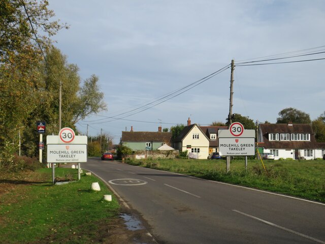
Molehill Green

Molehill Green is a hamlet in Takeley parish in Essex, England, close to the perimeter of London Stansted Airport, The hamlet consists of approximately...

Elsenham Woods

Elsenham Woods is a 44.4-hectare (110-acre) biological Site of Special Scientific Interest east of Elsenham in Essex. It was notified under Section 28...

Takeley Priory

Takeley Priory, dedicated to Saint Valery, was a Benedictine monastery in Takeley, Essex, England, founded by William the Conqueror between 1066 and 1086...

Takeley

Takeley is a village and civil parish in the Uttlesford district of Essex, England. == History == A number of theories have arisen over the origin of the...

The Christian School, Takeley

The Christian School (Takeley) is an independent Christian school located in Takeley, Bishop's Stortford, Essex. The school caters for children of 7 through...

Nearby Amenities

Located within 500m of 51.888275,0.26918508
Crossing
Crossing: zebra
Crossing Island: no
Crossing Markings: zebra
Crossing Ref: zebra
Tactile Paving: yes
Lat/Long: 51.889366/0.2628251
Barrier: lift_gate
Lat/Long: 51.8914809/0.2682187
Crossing
Crossing: zebra
Crossing Island: no
Crossing Markings: zebra
Crossing Ref: zebra
Tactile Paving: yes
Lat/Long: 51.8894349/0.2626953
Crossing
Crossing: zebra
Crossing Island: no
Crossing Markings: zebra
Crossing Ref: zebra
Tactile Paving: yes
Lat/Long: 51.8900923/0.2636845
Bus Stop
High House
Bus: yes
Naptan AtcoCode: 150018014013
Naptan Bearing: SW
Naptan BusStopType: CUS
Naptan CommonName: High House
Naptan Indicator: o/s
Naptan Landmark: High House
Naptan NaptanCode: esxdgama
Naptan Street: Parsonage Road
Naptan Verified: no
Public Transport: platform
Source: naptan_import
Lat/Long: 51.8873586/0.264869
Bus Stop
High House
Bus: yes
Naptan AtcoCode: 150018014Y13
Naptan Bearing: NE
Naptan BusStopType: CUS
Naptan CommonName: High House
Naptan Indicator: Opp
Naptan Landmark: High House
Naptan NaptanCode: esxgtgam
Naptan Street: Parsonage Road
Naptan Verified: no
Public Transport: platform
Source: naptan_import
Lat/Long: 51.8874038/0.2648567
Bus Stop
Coach Station
Bus: yes
Local Ref: 1
Naptan AtcoCode: 1500IM187A
Naptan CommonName: Coach Station
Naptan Indicator: Bay 1
Naptan Landmark: Coach Station
Naptan NaptanCode: esxjamwa
Naptan Street: Terminal Road South
Naptan Verified: no
Public Transport: platform
Shelter: no
Source: naptan_import
Lat/Long: 51.8884564/0.263274
Bus Stop
Coach Station
Bus: yes
Local Ref: 2
Naptan AtcoCode: 1500IM187B
Naptan CommonName: Coach Station
Naptan Indicator: Bay 2
Naptan Landmark: Coach Station
Naptan NaptanCode: esxjamwd
Naptan Street: Terminal Road South
Naptan Verified: no
Public Transport: platform
Shelter: no
Source: naptan_import
Lat/Long: 51.8885077/0.2632593
Bus Stop
Coach Station
Bus: yes
Covered: yes
Local Ref: 23
Naptan AtcoCode: 1500IM187BB
Naptan CommonName: Coach Station
Naptan Indicator: Bay 23
Naptan Landmark: Coach Station
Naptan NaptanCode: esxjapgd
Naptan Street: Terminal Road South
Naptan Verified: no
Public Transport: platform
Source: naptan_import
Lat/Long: 51.8894852/0.2639006
Bus Stop
Coach Station
Bus: yes
Local Ref: 24
Naptan AtcoCode: 1500IM187BC
Naptan CommonName: Coach Station
Naptan Indicator: Bay 24
Naptan Landmark: Coach Station
Naptan NaptanCode: esxjapgj
Naptan Street: Terminal Road South
Naptan Verified: no
Public Transport: platform
Route Ref: A21
Source: naptan_import
Lat/Long: 51.8895113/0.2639455
Bus Stop
Coach Station
Bus: yes
Local Ref: 25
Naptan AtcoCode: 1500IM187BD
Naptan CommonName: Coach Station
Naptan Indicator: Bay 25
Naptan Landmark: Coach Station
Naptan NaptanCode: esxjapgm
Naptan Street: Terminal Road South
Naptan Verified: no
Public Transport: platform
Source: naptan_import
Lat/Long: 51.8895464/0.2639908
Bus Stop
Coach Station
Bench: no
Bus: yes
Covered: yes
Local Ref: 26
Naptan AtcoCode: 1500IM187BE
Naptan CommonName: Coach Station
Naptan Indicator: Bay 26
Naptan Landmark: Coach Station
Naptan NaptanCode: esxjapgp
Naptan Street: Terminal Road South
Naptan Verified: no
Public Transport: platform
Route Ref: A6
Source: naptan_import
Lat/Long: 51.8895812/0.2640507
Bus Stop
Coach Station
Bench: no
Bus: yes
Covered: yes
Local Ref: 27
Naptan AtcoCode: 1500IM187BF
Naptan CommonName: Coach Station
Naptan Indicator: Bay 27
Naptan Landmark: Coach Station
Naptan NaptanCode: esxjapgt
Naptan Street: Terminal Road South
Naptan Verified: no
Public Transport: platform
Source: naptan_import
Lat/Long: 51.8896163/0.2640961
Bus Stop
Coach Station
Bench: no
Bus: yes
Covered: yes
Local Ref: 28
Naptan AtcoCode: 1500IM187BG
Naptan CommonName: Coach Station
Naptan Indicator: Bay 28
Naptan Landmark: Coach Station
Naptan NaptanCode: esxjapgw
Naptan Street: Terminal Road South
Naptan Verified: no
Public Transport: platform
Source: naptan_import
Lat/Long: 51.8896511/0.264156
Bus Stop
Coach Station
Bus: yes
Local Ref: 31
Naptan AtcoCode: 1500IM187BL
Naptan Bearing: NE
Naptan CommonName: Coach Station
Naptan Indicator: Bay 31
Naptan Landmark: Coach Station
Naptan NaptanCode: esxjgagw
Naptan Street: Terminal Road South
Naptan Verified: no
Public Transport: platform
Shelter: yes
Source: naptan_import
Lat/Long: 51.8896665/0.2644593
Bus Stop
Coach Station
Bus: yes
Local Ref: 32
Naptan AtcoCode: 1500IM187BM
Naptan Bearing: NE
Naptan CommonName: Coach Station
Naptan Indicator: Bay 32
Naptan Landmark: Coach Station
Naptan NaptanCode: esxjgaja
Naptan Street: Terminal Road South
Naptan Verified: no
Public Transport: platform
Shelter: yes
Source: naptan_import
Lat/Long: 51.8896466/0.2645601
Bus Stop
Coach Station
Bus: yes
Local Ref: 33
Naptan AtcoCode: 1500IM187BN
Naptan Bearing: NE
Naptan CommonName: Coach Station
Naptan Indicator: Bay 33
Naptan Landmark: Coach Station
Naptan NaptanCode: esxjgajd
Naptan Street: Terminal Road South
Naptan Verified: no
Public Transport: platform
Source: naptan_import
Lat/Long: 51.8896365/0.2646177
Bus Stop
Coach Station
Bus: yes
Local Ref: 35
Naptan AtcoCode: 1500IM187BP
Naptan Bearing: NE
Naptan CommonName: Coach Station
Naptan Indicator: Bay 35
Naptan Landmark: Coach Station
Naptan NaptanCode: esxjgajm
Naptan Street: Terminal Road South
Naptan Verified: no
Public Transport: platform
Source: naptan_import
Lat/Long: 51.889616/0.2647475
Bus Stop
Coach Station
Bus: yes
Local Ref: 34
Naptan AtcoCode: 1500IM187BR
Naptan Bearing: NE
Naptan CommonName: Coach Station
Naptan Indicator: Bay 34
Naptan Landmark: Coach Station
Naptan NaptanCode: esxjgajg
Naptan Street: Terminal Road South
Naptan Verified: no
Public Transport: platform
Source: naptan_import
Lat/Long: 51.8896354/0.2646758
Bus Stop
Coach Station
Bus: yes
Local Ref: 36
Naptan AtcoCode: 1500IM187BS
Naptan Bearing: NE
Naptan CommonName: Coach Station
Naptan Indicator: Bay 36
Naptan Landmark: Coach Station
Naptan NaptanCode: esxjgajp
Naptan Street: Terminal Road South
Naptan Verified: no
Public Transport: platform
Source: naptan_import
Lat/Long: 51.8896057/0.2648196
Bus Stop
Coach Station
Bus: yes
Local Ref: 37
Naptan AtcoCode: 1500IM187BT
Naptan Bearing: NE
Naptan CommonName: Coach Station
Naptan Indicator: Bay 37
Naptan Landmark: Coach Station
Naptan NaptanCode: esxjgajt
Naptan Street: Terminal Road South
Naptan Verified: no
Public Transport: platform
Source: naptan_import
Lat/Long: 51.8895947/0.2649208
Bus Stop
Coach Station
Bus: yes
Local Ref: 39
Naptan AtcoCode: 1500IM187BV
Naptan Bearing: NE
Naptan CommonName: Coach Station
Naptan Indicator: Bay 39
Naptan Landmark: Coach Station
Naptan NaptanCode: esxjgama
Naptan Street: Terminal Road South
Naptan Verified: no
Public Transport: platform
Source: naptan_import
Lat/Long: 51.8895731/0.2651086
Bus Stop
Coach Station
Bus: yes
Local Ref: 3
Naptan AtcoCode: 1500IM187C
Naptan CommonName: Coach Station
Naptan Indicator: Bay 3
Naptan Landmark: Coach Station
Naptan NaptanCode: esxjamwg
Naptan Street: Terminal Road South
Naptan Verified: no
Public Transport: platform
Shelter: no
Source: naptan_import
Lat/Long: 51.8885524/0.2632404
Bus Stop
Coach Station
Bus: yes
Local Ref: 30
Naptan AtcoCode: 1500IM187CK
Naptan Bearing: NE
Naptan CommonName: Coach Station
Naptan Indicator: Bay 30
Naptan Landmark: Coach Station
Naptan NaptanCode: esxjgagp
Naptan Street: Terminal Road South
Naptan Verified: no
Public Transport: platform
Shelter: yes
Source: naptan_import
Lat/Long: 51.8896682/0.2643722
Bus Stop
Coach Station
Bus: yes
Local Ref: 4
Naptan AtcoCode: 1500IM187D
Naptan CommonName: Coach Station
Naptan Indicator: Bay 4
Naptan Landmark: Coach Station
Naptan NaptanCode: esxjamwj
Naptan Street: Terminal Road South
Naptan Verified: no
Public Transport: platform
Shelter: no
Source: naptan_import
Lat/Long: 51.8885938/0.263219
Bus Stop
Coach Station
Bus: yes
Local Ref: 5
Naptan AtcoCode: 1500IM187E
Naptan CommonName: Coach Station
Naptan Indicator: Bay 5
Naptan Landmark: Coach Station
Naptan NaptanCode: esxjamwm
Naptan Street: Terminal Road South
Naptan Verified: no
Public Transport: platform
Shelter: no
Source: naptan_import
Lat/Long: 51.8886401/0.2631976
Bus Stop
Coach Station
Bus: yes
Local Ref: 6
Naptan AtcoCode: 1500IM187F
Naptan CommonName: Coach Station
Naptan Indicator: Bay 6
Naptan Landmark: Coach Station
Naptan NaptanCode: esxjamwp
Naptan Street: Terminal Road South
Naptan Verified: no
Public Transport: platform
Shelter: no
Source: naptan_import
Lat/Long: 51.888689/0.263168
Bus Stop
Coach Station
Bus: yes
Local Ref: 7
Naptan AtcoCode: 1500IM187G
Naptan CommonName: Coach Station
Naptan Indicator: Bay 7
Naptan Landmark: Coach Station
Naptan NaptanCode: esxjamwt
Naptan Street: Terminal Road South
Naptan Verified: no
Public Transport: platform
Shelter: no
Source: naptan_import
Lat/Long: 51.888737/0.2631412
Bus Stop
Coach Station
Bench: yes
Bus: yes
Local Ref: 8
Naptan AtcoCode: 1500IM187H
Naptan CommonName: Coach Station
Naptan Indicator: Bay 8
Naptan Landmark: Coach Station
Naptan NaptanCode: esxjapad
Naptan Street: Terminal Road South
Naptan Verified: no
Public Transport: platform
Shelter: no
Source: naptan_import
Lat/Long: 51.8887825/0.2631251
Bus Stop
Coach Station
Bus: yes
Local Ref: 9
Naptan AtcoCode: 1500IM187J
Naptan CommonName: Coach Station
Naptan Indicator: Bay 9
Naptan Landmark: Coach Station
Naptan NaptanCode: esxjapag
Naptan Street: Terminal Road South
Naptan Verified: no
Public Transport: platform
Shelter: no
Source: naptan_import
Lat/Long: 51.888819/0.263109
Bus Stop
Coach Station
Bus: yes
Local Ref: 10
Naptan AtcoCode: 1500IM187K
Naptan CommonName: Coach Station
Naptan Indicator: Bay 10
Naptan Landmark: Coach Station
Naptan NaptanCode: esxjapaj
Naptan Street: Terminal Road South
Naptan Verified: no
Public Transport: platform
Shelter: no
Source: naptan_import
Lat/Long: 51.8888612/0.2631104
Bus Stop
Coach Station
Bus: yes
Covered: yes
Local Ref: 11
Naptan AtcoCode: 1500IM187L
Naptan CommonName: Coach Station
Naptan Indicator: Bay 11
Naptan Landmark: Coach Station
Naptan NaptanCode: esxjapam
Naptan Street: Terminal Road South
Naptan Verified: no
Public Transport: platform
Source: naptan_import
Lat/Long: 51.8890657/0.2632691
Bus Stop
Coach Station
Bus: yes
Covered: yes
Local Ref: 12
Naptan AtcoCode: 1500IM187M
Naptan CommonName: Coach Station
Naptan Indicator: Bay 12
Naptan Landmark: Coach Station
Naptan NaptanCode: esxjapap
Naptan Street: Terminal Road South
Naptan Verified: no
Public Transport: platform
Source: naptan_import
Lat/Long: 51.8891005/0.263329
Bus Stop
Coach Station
Bus: yes
Covered: yes
Local Ref: 13
Naptan AtcoCode: 1500IM187N
Naptan CommonName: Coach Station
Naptan Indicator: Bay 13
Naptan Landmark: Coach Station
Naptan NaptanCode: esxjapat
Naptan Street: Terminal Road South
Naptan Verified: no
Public Transport: platform
Source: naptan_import
Lat/Long: 51.8891266/0.2633739
Bus Stop
Coach Station
Bus: yes
Covered: yes
Local Ref: 14
Naptan AtcoCode: 1500IM187P
Naptan CommonName: Coach Station
Naptan Indicator: Bay 14
Naptan Landmark: Coach Station
Naptan NaptanCode: esxjapaw
Naptan Street: Terminal Road South
Naptan Verified: no
Public Transport: platform
Source: naptan_import
Lat/Long: 51.8891707/0.2634197
Bus Stop
Coach Station
Bus: yes
Covered: yes
Local Ref: 15
Naptan AtcoCode: 1500IM187Q
Naptan CommonName: Coach Station
Naptan Indicator: Bay 15
Naptan Landmark: Coach Station
Naptan NaptanCode: esxjapda
Naptan Street: Terminal Road South
Naptan Verified: no
Public Transport: platform
Source: naptan_import
Lat/Long: 51.8892055/0.2634796
Bus Stop
Coach Station
Bench: no
Bus: yes
Covered: yes
Local Ref: 16
Naptan AtcoCode: 1500IM187R
Naptan CommonName: Coach Station
Naptan Indicator: Bay 16
Naptan Landmark: Coach Station
Naptan NaptanCode: esxjapdg
Naptan Street: Terminal Road South
Naptan Verified: no
Public Transport: platform
Source: naptan_import
Lat/Long: 51.8892316/0.2635245
Bus Stop
Coach Station
Bench: no
Bus: yes
Covered: yes
Local Ref: 17
Naptan AtcoCode: 1500IM187S
Naptan CommonName: Coach Station
Naptan Indicator: Bay 17
Naptan Landmark: Coach Station
Naptan NaptanCode: esxjapdj
Naptan Street: Terminal Road South
Naptan Verified: no
Public Transport: platform
Source: naptan_import
Lat/Long: 51.8892754/0.2635848
Bus Stop
Coach Station
Bench: no
Bus: yes
Covered: yes
Local Ref: 18
Naptan AtcoCode: 1500IM187T
Naptan CommonName: Coach Station
Naptan Indicator: Bay 18
Naptan Landmark: Coach Station
Naptan NaptanCode: esxjapdm
Naptan Street: Terminal Road South
Naptan Verified: no
Public Transport: platform
Source: naptan_import
Lat/Long: 51.8893105/0.2636302
Bus Stop
Coach Station
Bench: no
Bus: yes
Covered: yes
Lit: yes
Local Ref: 19
Naptan AtcoCode: 1500IM187U
Naptan CommonName: Coach Station
Naptan Indicator: Bay 19
Naptan Landmark: Coach Station
Naptan NaptanCode: esxjapdp
Naptan Street: Terminal Road South
Naptan Verified: no
Public Transport: platform
Source: naptan_import
Tactile Paving: no
Lat/Long: 51.8893453/0.2636901
Bus Stop
Coach Station
Bench: no
Bus: yes
Covered: yes
Local Ref: 20
Naptan AtcoCode: 1500IM187V
Naptan CommonName: Coach Station
Naptan Indicator: Bay 20
Naptan Landmark: Coach Station
Naptan NaptanCode: esxjapdt
Naptan Street: Terminal Road South
Naptan Verified: no
Public Transport: platform
Source: naptan_import
Tactile Paving: no
Lat/Long: 51.8893804/0.2637354
Bus Stop
Coach Station
Bench: no
Bus: yes
Covered: yes
Local Ref: 21
Naptan AtcoCode: 1500IM187W
Naptan CommonName: Coach Station
Naptan Indicator: Bay 21
Naptan Landmark: Coach Station
Naptan NaptanCode: esxjapdw
Naptan Street: Terminal Road South
Naptan Verified: no
Public Transport: platform
Source: naptan_import
Tactile Paving: no
Lat/Long: 51.8894155/0.2637808
Bus Stop
Coach Station
Bench: no
Bus: yes
Covered: yes
Local Ref: 22
Naptan AtcoCode: 1500IM187X
Naptan CommonName: Coach Station
Naptan Indicator: Bay 22
Naptan Landmark: Coach Station
Naptan NaptanCode: esxjapga
Naptan Street: Terminal Road South
Naptan Verified: no
Public Transport: platform
Source: naptan_import
Tactile Paving: no
Lat/Long: 51.8894503/0.2638407
Bus Stop
Coach Station
Bus: yes
Local Ref: 29
Naptan AtcoCode: 1500IN187BH
Naptan Bearing: NE
Naptan CommonName: Coach Station
Naptan Indicator: Bay 29
Naptan Landmark: Coach Station
Naptan NaptanCode: esxjgagt
Naptan Street: Terminal Road South
Naptan Verified: no
Public Transport: platform
Shelter: yes
Source: naptan_import
Lat/Long: 51.8896429/0.2642837
Bus Stop
Coach Station
Bus: yes
Local Ref: 38
Naptan AtcoCode: 1500IN187BU
Naptan Bearing: NE
Naptan CommonName: Coach Station
Naptan Indicator: Bay 38
Naptan Landmark: Coach Station
Naptan NaptanCode: esxjgajw
Naptan Street: Terminal Road South
Naptan Verified: no
Public Transport: platform
Source: naptan_import
Lat/Long: 51.889593/0.2650079
Barrier: lift_gate
Lat/Long: 51.8892569/0.2651016
Post Box
Collection Times: Mo-Fr 16:45; Sa 10:30
Level: 1
Note: Approximate location, as GPS fix wasn't very good.
Post Box Design: indoor
Post Box Location: Arrivals
Post Box Type: pillar
Ref: CM24 368
Royal Cypher: EIIR
Royal Cypher Wikidata: Q33102113
Lat/Long: 51.8901353/0.262816
Crossing
Crossing: uncontrolled
Crossing Markings: zebra
Lat/Long: 51.8898608/0.2642601
Crossing
Crossing: marked
Crossing Ref: zebra
Lat/Long: 51.8891348/0.2644579
Barrier: lift_gate
Lat/Long: 51.8909256/0.2651192
Barrier: lift_gate
Lat/Long: 51.8907941/0.2648832
Barrier: lift_gate
Lat/Long: 51.8903897/0.2666324
Maxspeed: 50 mph
Traffic Sign: maxspeed
Traffic Sign Direction: forward
Lat/Long: 51.8924201/0.2694809
Information: office
Level: 1
Source: Bing
Tourism: information
Lat/Long: 51.8902845/0.2632717
Power: pole
Source: Bing
Lat/Long: 51.8903884/0.2695991
Power: pole
Source: Bing
Lat/Long: 51.891362/0.2721796
Power: pole
Source: Bing
Lat/Long: 51.8908817/0.2708973
Power: pole
Source: Bing
Lat/Long: 51.8901499/0.2684916
Bus: yes
Public Transport: stop_position
Lat/Long: 51.889518/0.2650164
Bus: yes
Public Transport: stop_position
Lat/Long: 51.8892769/0.2636081
Bus: yes
Public Transport: stop_position
Lat/Long: 51.8895771/0.2645741
Stansted Airport
Bus: yes
Public Transport: stop_position
Lat/Long: 51.8895754/0.2640951
Bus: yes
Public Transport: stop_position
Lat/Long: 51.8893805/0.2637661
Bus: yes
Public Transport: stop_position
Lat/Long: 51.8893444/0.2637189
Stansted Airport
Bus: yes
Public Transport: stop_position
Lat/Long: 51.8896157/0.2641562
Bus: yes
Public Transport: stop_position
Lat/Long: 51.8894015/0.2638329
Bus: yes
Public Transport: stop_position
Lat/Long: 51.8895664/0.2646528
Stansted Airport
Bus: yes
Public Transport: stop_position
Lat/Long: 51.8895427/0.2640371
Bus: yes
Public Transport: stop_position
Lat/Long: 51.8895271/0.2649436
Bus: yes
Public Transport: stop_position
Lat/Long: 51.8895543/0.264711
Bus: yes
Public Transport: stop_position
Lat/Long: 51.889603/0.2643357
Stansted Airport
Bus: yes
Public Transport: stop_position
Lat/Long: 51.888739/0.2632304
Bus: yes
Public Transport: stop_position
Lat/Long: 51.8895858/0.2644781
Bus: yes
Public Transport: stop_position
Lat/Long: 51.8895476/0.2647978
Bus: yes
Public Transport: stop_position
Lat/Long: 51.8893116/0.2636637
Bus: yes
Public Transport: stop_position
Lat/Long: 51.8892451/0.2635544
Bus: yes
Public Transport: stop_position
Lat/Long: 51.8895376/0.2648663
Bus: yes
Public Transport: stop_position
Lat/Long: 51.8895949/0.2644163
Childcare
High House Nursery
Website: http://www.highhousenursery.co.uk/
Lat/Long: 51.8870927/0.2639301
Entrance: yes
Lat/Long: 51.8886982/0.2620376
Entrance: yes
Lat/Long: 51.8891699/0.2627533
Entrance: yes
Lat/Long: 51.8898828/0.2638159
Entrance: yes
Lat/Long: 51.8903649/0.2645204
Level: -1
Lat/Long: 51.8893894/0.2623697
Mill End
Place: hamlet
Lat/Long: 51.8872997/0.2661387
Elevator
Indoor: yes
Level: 0;-1;-2
Wheelchair: yes
Lat/Long: 51.8894269/0.2624267
Crossing
Crossing: zebra
Crossing Island: no
Crossing Markings: zebra
Crossing Ref: zebra
Tactile Paving: yes
Lat/Long: 51.8900226/0.2638119
Bus Stop
BusStop for LongStay + Jet Park
Bench: yes
Bin: no
Bus: yes
Lit: yes
Public Transport: platform
Shelter: no
Tactile Paving: no
Lat/Long: 51.8891148/0.2622549
Bus Stop
Bus Stop for Car Rental Village
Bench: yes
Bin: yes
Bus: yes
Public Transport: platform
Shelter: no
Tactile Paving: no
Lat/Long: 51.8902683/0.2639824
Chargeable Exit
Barrier: toll_booth
Lat/Long: 51.8922437/0.2672752
Entrance: yes
Level: 1
Lat/Long: 51.890222/0.2634547
Barrier: customs
Lat/Long: 51.890565/0.2631642
Stansted Airport
Naptan AtcoCode: 9100STANAIR
Network: National Rail
Network Website: https://www.nationalrail.co.uk/stations/ssd/
Network Wikidata: Q26334
Public Transport: station
Railway: station
Ref Crs: SSD
Train: yes
Wikidata: Q2652717
Wikipedia: en:Stansted Airport railway station
Lat/Long: 51.8892596/0.2621537
Bicycle Parking
Access: yes
Capacity: 10
Covered: yes
Fee: no
Website: https://www.stanstedairport.com/getting-to-and-from/by-bike/
Lat/Long: 51.8887241/0.2622911
Stansted Airport
Public Transport: stop_position
Railway: stop
Ref: 3
Train: yes
Lat/Long: 51.8892489/0.2623373
Shop: ticket
Lat/Long: 51.8894846/0.2637575
Shop: ticket
Lat/Long: 51.889727/0.2642174
Airport Bus Express
Shop: ticket
Lat/Long: 51.8904496/0.2637126
Meet&Greet Reception
Office: company
Lat/Long: 51.8892199/0.2632084
Cafe
Caffè Nero
Brand: Caffè Nero
Brand Wikidata: Q675808
Brand Wikipedia: en:Caffè Nero
Contact Website: https://caffenero.com/uk/store/stansted-airport-coach-station-landside-583/
Cuisine: coffee_shop
Takeaway: yes
Lat/Long: 51.8893714/0.2635777
National Express
Level: 1
Shop: ticket
Lat/Long: 51.8900726/0.2631801
Fast Food
West Cornwall Pastry Co
Lat/Long: 51.8896961/0.2642838
Shelter
Access: permissive
Description: waiting room
Public Transport: lounge
Lat/Long: 51.8892163/0.2633525
Bicycle Parking
Bicycle Parking: shed
Covered: yes
Lat/Long: 51.8896723/0.2638715
Barrier: lift_gate
Lat/Long: 51.8885296/0.2637359
Barrier: lift_gate
Lat/Long: 51.8877994/0.2620034
Barrier: lift_gate
Lat/Long: 51.88755/0.2622342
Crossing
Crossing: uncontrolled
Crossing Markings: zebra
Lat/Long: 51.8901546/0.2646254
Crossing
Crossing: uncontrolled
Crossing Markings: zebra
Lat/Long: 51.8903111/0.2648784
Crossing
Crossing: uncontrolled
Crossing Markings: zebra
Crossing Ref: zebra
Lat/Long: 51.8906367/0.2653519
Crossing
Crossing: uncontrolled
Crossing Markings: zebra
Crossing Ref: zebra
Lat/Long: 51.8908329/0.2656438
Crossing
Crossing: uncontrolled
Crossing Markings: zebra
Crossing Ref: zebra
Lat/Long: 51.8909915/0.2658832
Crossing
Crossing: uncontrolled
Crossing Markings: zebra
Crossing Ref: zebra
Lat/Long: 51.8911148/0.2660695
Crossing
Crossing: uncontrolled
Crossing Markings: zebra
Crossing Ref: zebra
Lat/Long: 51.8913059/0.2663579
Crossing
Crossing: uncontrolled
Crossing Markings: zebra
Crossing Ref: zebra
Lat/Long: 51.8915485/0.2667239
Crossing
Crossing: uncontrolled
Crossing Markings: zebra
Crossing Ref: zebra
Lat/Long: 51.8916663/0.2669018
Crossing
Crossing: uncontrolled
Crossing Markings: zebra
Crossing Ref: zebra
Lat/Long: 51.8918488/0.2671774
Crossing
Crossing: uncontrolled
Crossing Markings: zebra
Crossing Ref: zebra
Lat/Long: 51.8919679/0.2673571
Crossing
Crossing: uncontrolled
Crossing Markings: zebra
Crossing Ref: zebra
Lat/Long: 51.8921085/0.2675694
Bicycle: no
Entrance: yes
Foot: yes
Lat/Long: 51.891788/0.2647902
Crossing
Crossing: uncontrolled
Crossing Markings: zebra
Lat/Long: 51.8914224/0.2648518
Crossing
Crossing: uncontrolled
Crossing Markings: zebra
Lat/Long: 51.8913242/0.2650261
Street Lamp
Lat/Long: 51.8927545/0.2690152
Direction: forward
Traffic Calming: cushion
Lat/Long: 51.8903238/0.2642643
Direction: forward
Traffic Calming: cushion
Lat/Long: 51.889947/0.263691
Direction: forward
Traffic Calming: cushion
Lat/Long: 51.8896631/0.2632689
Direction: forward
Traffic Calming: cushion
Lat/Long: 51.8893055/0.2627348
Direction: forward
Traffic Calming: cushion
Lat/Long: 51.8890137/0.2622932
Smoking Area
Lat/Long: 51.8904686/0.2640833
Advertising: billboard
Direction: 0
Lat/Long: 51.8918919/0.269328
Advertising: billboard
Direction: 20
Lat/Long: 51.8903185/0.267256
Advertising: billboard
Direction: 20
Lat/Long: 51.8895322/0.2660785
Advertising: billboard
Direction: 20
Lat/Long: 51.8886176/0.2647173
Advertising: billboard
Direction: 20
Lat/Long: 51.88776/0.2634473
Advertising: billboard
Direction: 20
Lat/Long: 51.8870465/0.2622242
Vending Machine
Change Machine: yes
Currency GBP: yes
Lat/Long: 51.8921584/0.2668237
Crossing
Crossing: uncontrolled
Crossing Markings: zebra
Lat/Long: 51.8915357/0.2650647
Crossing
Crossing: uncontrolled
Crossing Markings: zebra
Lat/Long: 51.8913487/0.264736
Direction: both
Traffic Calming: bump
Lat/Long: 51.8923465/0.2662031
Direction: both
Traffic Calming: bump
Lat/Long: 51.892249/0.2663302
Direction: both
Traffic Calming: bump
Lat/Long: 51.8918891/0.2655094
Direction: both
Traffic Calming: bump
Lat/Long: 51.89179/0.2656339
Bicycle Parking
Bicycle Parking: stands
Capacity: 10
Covered: yes
Lat/Long: 51.8894137/0.2633284
Street Lamp
Lat/Long: 51.8920167/0.2688729
Noexit: yes
Lat/Long: 51.8875207/0.2620835
Barrier: toll_booth
Lat/Long: 51.8880588/0.2631645
Waste Basket
Lat/Long: 51.8923002/0.2677282
Trolley Bay
Lat/Long: 51.8916563/0.2667237
Trolley Bay
Lat/Long: 51.8912143/0.2660545
Trolley Bay
Lat/Long: 51.8909205/0.26562
Motorcycle Parking
Covered: no
Lat/Long: 51.8906035/0.2654698
Man Made: mast
Tower Construction: freestanding
Tower Type: communication
Lat/Long: 51.8893039/0.2664574
Fast Food
LEON
Brand: LEON
Brand Wikidata: Q6524851
Cuisine: burger;sandwich
Takeaway: yes
Lat/Long: 51.8904312/0.2636864
Bus: yes
Public Transport: stop_position
Lat/Long: 51.8895011/0.263982
Bus: yes
Public Transport: stop_position
Lat/Long: 51.8894631/0.2639257
Bus: yes
Public Transport: stop_position
Lat/Long: 51.8894337/0.2638766
Bus: yes
Public Transport: stop_position
Lat/Long: 51.8895062/0.2650982
Bus: yes
Public Transport: stop_position
Lat/Long: 51.8891457/0.263406
Bus: yes
Public Transport: stop_position
Lat/Long: 51.889109/0.2633499
Bus: yes
Public Transport: stop_position
Lat/Long: 51.8890685/0.2632969
Bus: yes
Public Transport: stop_position
Lat/Long: 51.8890407/0.2632493
Bus: yes
Public Transport: stop_position
Lat/Long: 51.8892022/0.2635081
Bus: yes
Public Transport: stop_position
Lat/Long: 51.8891714/0.2634587
Give Way
Lat/Long: 51.8925671/0.2677784
Entrance: yes
Indoor: yes
Level: 1
Lat/Long: 51.8896458/0.2629612
Entrance: yes
Indoor: yes
Level: 1
Lat/Long: 51.8896053/0.2629008
Entrance: yes
Indoor: yes
Level: 1
Lat/Long: 51.8895614/0.2628338
Entrance: yes
Indoor: yes
Level: 1
Lat/Long: 51.8892907/0.2624215
Entrance: yes
Indoor: yes
Level: 1
Lat/Long: 51.8893475/0.2625107
The data included in this document is from www.openstreetmap.org. The data is made available under ODbL.

Have you been to Little Newlands Wood?

Leave your review of Little Newlands Wood below (or comments, questions and feedback).