Charterhouse Plantation

Wood, Forest in Cambridgeshire South Cambridgeshire

England

Charterhouse Plantation

A fine willow at Dotterell Lodge The rolling road from Balsham to Cambridge on a late-September morning.
A fine willow at Dotterell Lodge Credit: John Sutton

Charterhouse Plantation is a scenic woodland located in Cambridgeshire, England. Situated in the heart of the county, this vast and picturesque forest covers an area of approximately 500 acres. The plantation is a beloved destination for nature enthusiasts and hikers alike, offering a tranquil retreat away from the hustle and bustle of city life.

The woodland is predominantly composed of native British tree species such as oak, beech, ash, and birch. These towering trees provide a rich habitat for a variety of wildlife, including deer, foxes, and a diverse array of bird species. Charterhouse Plantation is a designated Site of Special Scientific Interest, recognizing its importance for the conservation of local flora and fauna.

Visitors to the plantation can explore a network of well-maintained trails that wind through the forest, providing opportunities for leisurely walks and outdoor activities. The trails are suitable for all ages and fitness levels, with some routes offering accessible options for wheelchair users.

In addition to its natural beauty, Charterhouse Plantation also boasts historical significance. The plantation was once part of a larger estate that dates back to the 17th century, and remnants of its past can still be seen today. This includes the remains of an old coach house and an ancient boundary wall, adding charm and intrigue to the woodland's ambiance.

Overall, Charterhouse Plantation in Cambridgeshire offers visitors a chance to immerse themselves in the beauty of nature, while also providing a glimpse into the region's rich history. Whether it's a leisurely stroll or a wildlife-spotting adventure, this woodland sanctuary is a must-visit destination for outdoor enthusiasts.

If you have any feedback on the listing, please let us know in the comments section below.

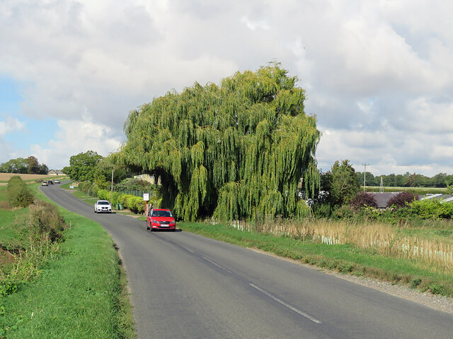
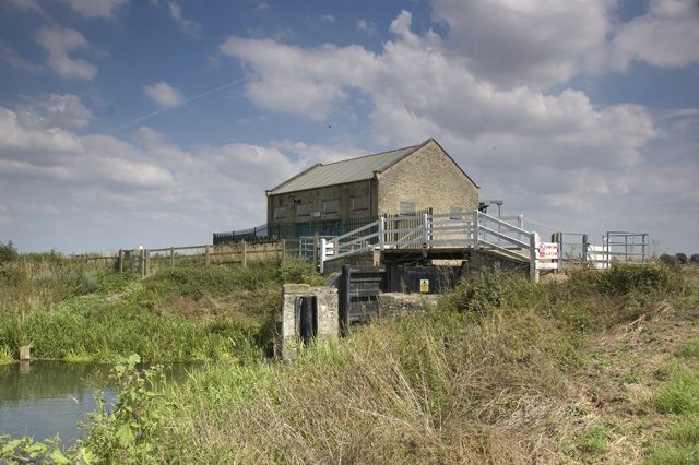
Charterhouse Plantation Images

Images are sourced within 2km of 52.154279/0.26915339 or Grid Reference TL5553. Thanks to Geograph Open Source API. All images are credited.

A fine willow at Dotterell Lodge The rolling road from Balsham to Cambridge on a late-September morning.
A fine willow at Dotterell Lodge
The rolling road from Balsham to Cambridge on a late-September morning.
Chalk path leading to Mutlow Hill A warm summer's day but hardly anybody about.
Chalk path leading to Mutlow Hill
A warm summer's day but hardly anybody about.
Wadlow wind turbines from Mutlow Hill
Mutlow Hill, Fleam Dyke Not apparent from this photo, but this is a point where the route meets a busy road ahead beyond the trees.
Mutlow Hill, Fleam Dyke
Not apparent from this photo, but this is a point where the route meets a busy road ahead beyond the trees.
Tumulus on Mutlow Hill
New Camgrain access road Replacing the older single track road <a href="https://www.geograph.org.uk/photo/1084570">TL5654 : Single track lane</a> which was no longer sufficient for the rapidly expanding Camgrain plant <a href="https://www.geograph.org.uk/photo/2251050">TL5654 : The entrance to Camgrain Advanced Processing Centre</a>
New Camgrain access road
Replacing the older single track road TL5654 : Single track lane which was no longer sufficient for the rapidly expanding Camgrain plant TL5654 : The entrance to Camgrain Advanced Processing Centre
Charterhouse Bridge, A11 The A11 is a major road in Eastern England. It runs roughly north east for 111 miles from London to Norwich, With the M11 opening in the 1970s and then the A12 extension in 1999, a lengthy section has been downgraded between the suburbs of east London and the north-west corner of the county of Essex. It also overlaps with the A14 on the Newmarket bypass.
<span class="nowrap"><a title="http://www.sabre-roads.org.uk/wiki/index.php?title=A11" rel="nofollow ugc noopener" href="http://www.sabre-roads.org.uk/wiki/index.php?title=A11">Link</a><img style="margin-left:2px;" alt="External link" title="External link - shift click to open in new window" src="https://s1.geograph.org.uk/img/external.png" width="10" height="10"/></span>
Charterhouse Bridge, A11
The A11 is a major road in Eastern England. It runs roughly north east for 111 miles from London to Norwich, With the M11 opening in the 1970s and then the A12 extension in 1999, a lengthy section has been downgraded between the suburbs of east London and the north-west corner of the county of Essex. It also overlaps with the A14 on the Newmarket bypass. LinkExternal link
Footbridge over the A11 The A11 is a major road in Eastern England. It runs roughly north east for 111 miles from London to Norwich, With the M11 opening in the 1970s and then the A12 extension in 1999, a lengthy section has been downgraded between the suburbs of east London and the north-west corner of the county of Essex. It also overlaps with the A14 on the Newmarket bypass.
<span class="nowrap"><a title="http://www.sabre-roads.org.uk/wiki/index.php?title=A11" rel="nofollow ugc noopener" href="http://www.sabre-roads.org.uk/wiki/index.php?title=A11">Link</a><img style="margin-left:2px;" alt="External link" title="External link - shift click to open in new window" src="https://s1.geograph.org.uk/img/external.png" width="10" height="10"/></span>
Footbridge over the A11
The A11 is a major road in Eastern England. It runs roughly north east for 111 miles from London to Norwich, With the M11 opening in the 1970s and then the A12 extension in 1999, a lengthy section has been downgraded between the suburbs of east London and the north-west corner of the county of Essex. It also overlaps with the A14 on the Newmarket bypass. LinkExternal link
Pylon by the A11
Pylon by the A11
A11 southbound The A11 is a major road in Eastern England. It runs roughly north east for 111 miles from London to Norwich, With the M11 opening in the 1970s and then the A12 extension in 1999, a lengthy section has been downgraded between the suburbs of east London and the north-west corner of the county of Essex. It also overlaps with the A14 on the Newmarket bypass.
<span class="nowrap"><a title="http://www.sabre-roads.org.uk/wiki/index.php?title=A11" rel="nofollow ugc noopener" href="http://www.sabre-roads.org.uk/wiki/index.php?title=A11">Link</a><img style="margin-left:2px;" alt="External link" title="External link - shift click to open in new window" src="https://s1.geograph.org.uk/img/external.png" width="10" height="10"/></span>
A11 southbound
The A11 is a major road in Eastern England. It runs roughly north east for 111 miles from London to Norwich, With the M11 opening in the 1970s and then the A12 extension in 1999, a lengthy section has been downgraded between the suburbs of east London and the north-west corner of the county of Essex. It also overlaps with the A14 on the Newmarket bypass. LinkExternal link
Bridge over the A11 This footbridge carries the Harcamlow Way over the A11.
Bridge over the A11
This footbridge carries the Harcamlow Way over the A11.
Charterhouse Bridge, A11 The A11 is a major road in Eastern England. It runs roughly north east for 111 miles from London to Norwich, With the M11 opening in the 1970s and then the A12 extension in 1999, a lengthy section has been downgraded between the suburbs of east London and the north-west corner of the county of Essex. It also overlaps with the A14 on the Newmarket bypass.
<span class="nowrap"><a title="http://www.sabre-roads.org.uk/wiki/index.php?title=A11" rel="nofollow ugc noopener" href="http://www.sabre-roads.org.uk/wiki/index.php?title=A11">Link</a><img style="margin-left:2px;" alt="External link" title="External link - shift click to open in new window" src="https://s1.geograph.org.uk/img/external.png" width="10" height="10"/></span>
Charterhouse Bridge, A11
The A11 is a major road in Eastern England. It runs roughly north east for 111 miles from London to Norwich, With the M11 opening in the 1970s and then the A12 extension in 1999, a lengthy section has been downgraded between the suburbs of east London and the north-west corner of the county of Essex. It also overlaps with the A14 on the Newmarket bypass. LinkExternal link
A11 The A11 is a major road in Eastern England. It runs roughly north east for 111 miles from London to Norwich, With the M11 opening in the 1970s and then the A12 extension in 1999, a lengthy section has been downgraded between the suburbs of east London and the north-west corner of the county of Essex. It also overlaps with the A14 on the Newmarket bypass.
<span class="nowrap"><a title="http://www.sabre-roads.org.uk/wiki/index.php?title=A11" rel="nofollow ugc noopener" href="http://www.sabre-roads.org.uk/wiki/index.php?title=A11">Link</a><img style="margin-left:2px;" alt="External link" title="External link - shift click to open in new window" src="https://s1.geograph.org.uk/img/external.png" width="10" height="10"/></span>
A11
The A11 is a major road in Eastern England. It runs roughly north east for 111 miles from London to Norwich, With the M11 opening in the 1970s and then the A12 extension in 1999, a lengthy section has been downgraded between the suburbs of east London and the north-west corner of the county of Essex. It also overlaps with the A14 on the Newmarket bypass. LinkExternal link
Farmland by the A11
Farmland by the A11
Plantation near Fleam Dyke A recreation of <a href="https://www.geograph.org.uk/photo/1983030">TL5652 : Plantation near Fleam Dyke</a> from a year previous, with <a href="https://www.geograph.org.uk/photo/2253348">TL5652 : Plantation and ploughland in January</a> taken in between. The brambles had grown significantly and the footpath itself was overgrown in places.
Plantation near Fleam Dyke
A recreation of TL5652 : Plantation near Fleam Dyke from a year previous, with TL5652 : Plantation and ploughland in January taken in between. The brambles had grown significantly and the footpath itself was overgrown in places.
Hedge and new wind turbine Compare with <a href="https://www.geograph.org.uk/photo/1983037">TL5652 : Trimmed hedge off Fleam Dyke</a>. Wadlow Wind Farm is still under construction and the turbines were not operational. There will be 13 2MW turbines when finished.
Hedge and new wind turbine
Compare with TL5652 : Trimmed hedge off Fleam Dyke. Wadlow Wind Farm is still under construction and the turbines were not operational. There will be 13 2MW turbines when finished.
Charterhouse Plantation South of Fleam Dyke.
Charterhouse Plantation
South of Fleam Dyke.
Show me another place!

Charterhouse Plantation is located at Grid Ref: TL5553 (Lat: 52.154279, Lng: 0.26915339)

Administrative County: Cambridgeshire

District: South Cambridgeshire

Police Authority: Cambridgeshire

What 3 Words

///hush.fidgeted.contents. Near Balsham, Cambridgeshire

Related Wikis

Fleam Dyke

Fleam Dyke is a linear earthwork between Fulbourn and Balsham in Cambridgeshire, initiated at some timepoint between AD 330 and AD 510. It is three miles...

Balsham Road railway station

Balsham Road railway station served Balsham and Fulbourn in Cambridgeshire. It closed in 1851, along with its line (the Newmarket and Chesterford Railway...

Roman Road, Cambridgeshire

The Roman Road in Cambridgeshire, also known as Worsted Street Roman Road, is a 12.4-hectare (31-acre) linear biological Site of Special Scientific Interest...

Cambridgeshire Lodes

The Cambridgeshire Lodes are a series of man-made waterways, believed to be Roman in origin, located in the county of Cambridgeshire, England. Bottisham...

Fulbourn Fen

Fulbourn Fen is a 27.3-hectare (67-acre) biological Site of Special Scientific Interest east of Fulbourn, Cambridgeshire. It is privately owned and managed...

South East Cambridgeshire (UK Parliament constituency)

South East Cambridgeshire is a constituency represented in the House of Commons of the UK Parliament since 2015 by Lucy Frazer, a member of the Conservative...

Zouches Manor

Zouches Manor (also Zouches Castle) was an Anglo-Saxon moated manor in Fulbourn Fen, a Site of Special Scientific Interest in the village of Fulbourn,...

Six Mile Bottom railway station

Six Mile Bottom railway station is a disused railway station on the Ipswich to Cambridge line between Dullingham and Fulbourn. It served the village of...

Nearby Amenities

Located within 500m of 52.154279,0.26915339
Power: pole
Lat/Long: 52.1534448/0.2739715
Power: pole
Lat/Long: 52.1542679/0.2745616
Power: pole
Lat/Long: 52.1512726/0.2722076
Material: wood
Power: pole
Transformer: distribution
Lat/Long: 52.1507685/0.2717455
Power: pole
Lat/Long: 52.1519193/0.2728435
Power: pole
Lat/Long: 52.1549354/0.2752863
Power: pole
Lat/Long: 52.1524854/0.27342
Information: board
Tourism: information
Lat/Long: 52.1564386/0.2748643
The data included in this document is from www.openstreetmap.org. The data is made available under ODbL.

Have you been to Charterhouse Plantation?

Leave your review of Charterhouse Plantation below (or comments, questions and feedback).