Berwick Wood

Wood, Forest in Essex

England

Berwick Wood

Old Boundary Marker on Kilmartin Way, Hornchurch Air Ministry Boundary Marker against the garden fence of No.87 Wood Lane or the northwest side of the junction with Kilmartin Way, Hornchurch. The Air Ministry existed from 1918 to 1964. RAF Hornchurch closed in 1962.

Milestone Society National ID: EX_AMHORN01em
Old Boundary Marker on Kilmartin Way, Hornchurch Credit: M Bardell

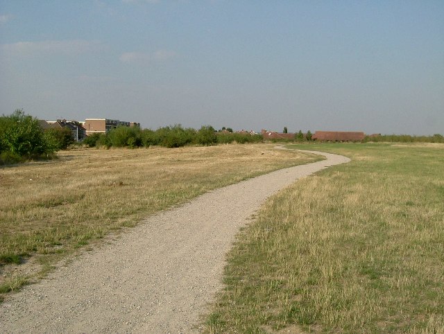
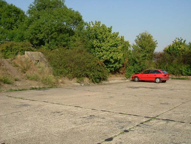
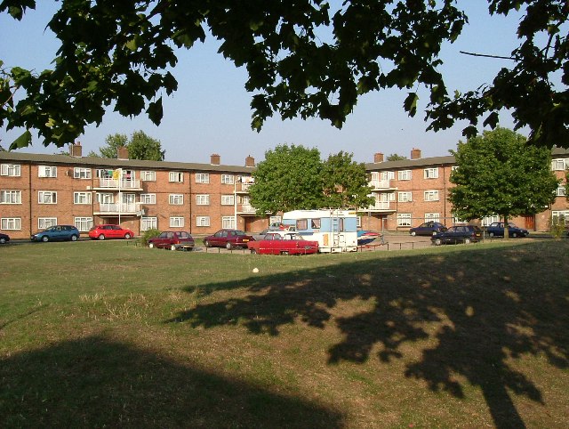
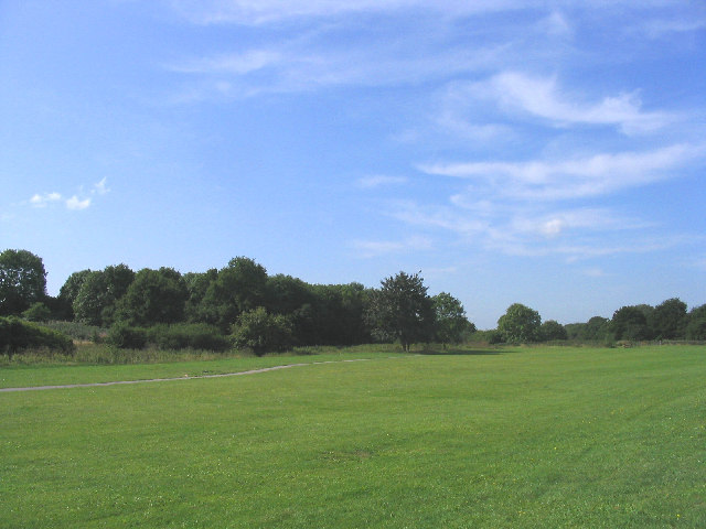
Berwick Wood is a picturesque woodland area located in Essex, England. Covering an area of approximately 100 hectares, it is a tranquil and diverse natural environment that attracts nature lovers and outdoor enthusiasts alike.

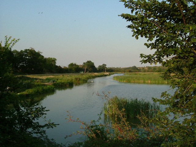
The wood is home to a wide range of flora and fauna, including ancient oak and beech trees that create a dense canopy, allowing only dappled sunlight to filter through. This creates a unique and enchanting atmosphere for visitors to explore.

Walking through Berwick Wood, one can encounter various wildlife species such as deer, rabbits, and a multitude of bird species. The wood provides a haven for these creatures, offering ample food sources and shelter.

The wood is crisscrossed by well-maintained footpaths, making it easily accessible for walkers and hikers. These paths lead visitors through different sections of the woodland, offering different views and experiences. There are also several designated picnic areas where visitors can enjoy a leisurely lunch amidst the peaceful surroundings.

Berwick Wood is not only a natural treasure but also holds historical significance. It is believed that the wood has been in existence for centuries, with mentions of it dating back to medieval times. Its ancient trees and rich biodiversity give it an air of timelessness and make it a valuable asset to both the local community and the wider region.

Overall, Berwick Wood in Essex is a captivating destination for those seeking solace in nature, offering a chance to escape the hustle and bustle of everyday life and immerse oneself in the beauty of the natural world.

If you have any feedback on the listing, please let us know in the comments section below.
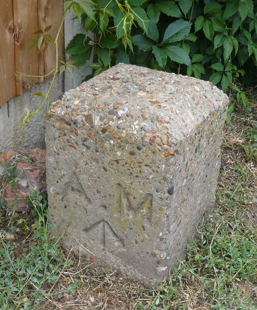
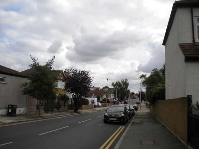
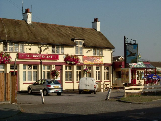
Berwick Wood Images

Images are sourced within 2km of 51.533625/0.21900004 or Grid Reference TQ5483. Thanks to Geograph Open Source API. All images are credited.

Old Boundary Marker on Kilmartin Way, Hornchurch Air Ministry Boundary Marker against the garden fence of No.87 Wood Lane or the northwest side of the junction with Kilmartin Way, Hornchurch. The Air Ministry existed from 1918 to 1964. RAF Hornchurch closed in 1962.

Milestone Society National ID: EX_AMHORN01em
Old Boundary Marker on Kilmartin Way, Hornchurch
Air Ministry Boundary Marker against the garden fence of No.87 Wood Lane or the northwest side of the junction with Kilmartin Way, Hornchurch. The Air Ministry existed from 1918 to 1964. RAF Hornchurch closed in 1962. Milestone Society National ID: EX_AMHORN01em
Kent Drive, Hornchurch Off Suttons Lane.
Kent Drive, Hornchurch
Off Suttons Lane.
Vaughan Avenue, Hornchurch Off Suttons Lane.
Vaughan Avenue, Hornchurch
Off Suttons Lane.
Gated back lane off Vaughan Avenue, Hornchurch
South end of Crystal Avenue, Hornchurch Seen from the north end of Ascot Gardens (the sign on the lamppost on the right marks the boundary), with the end of Vaughan Avenue on the left.
South end of Crystal Avenue, Hornchurch
Seen from the north end of Ascot Gardens (the sign on the lamppost on the right marks the boundary), with the end of Vaughan Avenue on the left.
Winifred Avenue, Hornchurch Off Crystal Avenue.
Winifred Avenue, Hornchurch
Off Crystal Avenue.
The London Loop A new footpath, part of the London Loop to the south of the Hornchurch Country Park. Picture was taken looking north.
The London Loop
A new footpath, part of the London Loop to the south of the Hornchurch Country Park. Picture was taken looking north.
The Road to Hell? A pub on South End Road serving the residents of the "Airfield Estate". The road to hell was paved with the good intent of Flying Officer Raimund Sanders-Draper an American airman posted to RAF Hornchurch. His exploits were the subject of a Musical Play produced at the Queens Theatre in Hornchurch in 2003. Sanders-Draper was killed in 1943 during a crash landing, he stayed with his stricken aircraft so he could avoid crashing into the local school,  he had sufficient height to bail out but chose to save the children. The school in Suttons Lane was renamed Sanders-Draper in his honour.
The Road to Hell?
A pub on South End Road serving the residents of the "Airfield Estate". The road to hell was paved with the good intent of Flying Officer Raimund Sanders-Draper an American airman posted to RAF Hornchurch. His exploits were the subject of a Musical Play produced at the Queens Theatre in Hornchurch in 2003. Sanders-Draper was killed in 1943 during a crash landing, he stayed with his stricken aircraft so he could avoid crashing into the local school, he had sufficient height to bail out but chose to save the children. The school in Suttons Lane was renamed Sanders-Draper in his honour.
Swords into Ploughshares One of the few parts of the old RAF Hornchurch that have survived. The concrete aircraft dispersal is surrounded with an air raid shelter in the blast protection mound, is now used as a car park for the country park. RAF Hornchurch opened in 1917 as Suttons Farm but closed at the end of WW1. A new station was opened in 1928. Spitfires from Hornchurch took part in the infamous Battle of Barking Creek in late 1939 when two Hurricanes from RAF North Weald were shot down, one of the pilots was killed <span class="nowrap"><a title="http://en.wikipedia.org/wiki/Battle_of_Barking_Creek" rel="nofollow ugc noopener" href="http://en.wikipedia.org/wiki/Battle_of_Barking_Creek">Link</a><img style="margin-left:2px;" alt="External link" title="External link - shift click to open in new window" src="https://s1.geograph.org.uk/img/external.png" width="10" height="10"/></span>. Hornchurch was a one of the most important of 11 Group's Sector stations during the Battle of Britain. It remained an RAF fighter station until spring of 1945. From 1952-62 it was the Aircrew selection centre it finally closed in 1963. Much of the airfield was built over but there are some relics in the country park. You can see some unusual airfield defences at <a href="https://www.geograph.org.uk/photo/168505">TQ5384 : Tett Turrets</a>. To go to the next field in an alphabetical tour of Essex WW2 airfields click on 
<a href="https://www.geograph.org.uk/photo/221842">TL5543 : RAF Little Walden</a>. Much information was gleaned from Graham Smith’s book “Essex Airfields In The Second World <span class="nowrap"><a title="https://books.google.co.uk/books/about/Essex_Airfields_in_the_Second_World_War.html?id=u3atAAAACAAJ&redir_esc=y" rel="nofollow ugc noopener" href="https://books.google.co.uk/books/about/Essex_Airfields_in_the_Second_World_War.html?id=u3atAAAACAAJ&redir_esc=y">Link</a><img style="margin-left:2px;" alt="External link" title="External link - shift click to open in new window" src="https://s1.geograph.org.uk/img/external.png" width="10" height="10"/></span>
Swords into Ploughshares
One of the few parts of the old RAF Hornchurch that have survived. The concrete aircraft dispersal is surrounded with an air raid shelter in the blast protection mound, is now used as a car park for the country park. RAF Hornchurch opened in 1917 as Suttons Farm but closed at the end of WW1. A new station was opened in 1928. Spitfires from Hornchurch took part in the infamous Battle of Barking Creek in late 1939 when two Hurricanes from RAF North Weald were shot down, one of the pilots was killed LinkExternal link. Hornchurch was a one of the most important of 11 Group's Sector stations during the Battle of Britain. It remained an RAF fighter station until spring of 1945. From 1952-62 it was the Aircrew selection centre it finally closed in 1963. Much of the airfield was built over but there are some relics in the country park. You can see some unusual airfield defences at TQ5384 : Tett Turrets. To go to the next field in an alphabetical tour of Essex WW2 airfields click on TL5543 : RAF Little Walden. Much information was gleaned from Graham Smith’s book “Essex Airfields In The Second World LinkExternal link
Jewish Cemetery Rainham The cemetery is located on Upminster Rd North. See inside at <a href="https://www.geograph.org.uk/photo/1417299">TQ5482 : "House of the Living"</a>
Jewish Cemetery Rainham
The cemetery is located on Upminster Rd North. See inside at TQ5482 : "House of the Living"
Berwick Pond Yet another pleasant patch of water with private fishing rights, unsurprisingly on Berwick Pond Lane! Picture was taken from the road that divides the pond looking east.
Berwick Pond
Yet another pleasant patch of water with private fishing rights, unsurprisingly on Berwick Pond Lane! Picture was taken from the road that divides the pond looking east.
For The Brylcreem Boys This memorial is in the grounds of a primary school named after the chief designer of the Spitfire, R.J Mitchell. It reads "Site of RAF Hornchurch sector airfield for No 11 Group. To all aircrew & ground personnel who served here 1928-1962". Some of the famous names who served here include Douglas Bader, Bob Stanford Tuck and A.G "Sailor" Malan.
For The Brylcreem Boys
This memorial is in the grounds of a primary school named after the chief designer of the Spitfire, R.J Mitchell. It reads "Site of RAF Hornchurch sector airfield for No 11 Group. To all aircrew & ground personnel who served here 1928-1962". Some of the famous names who served here include Douglas Bader, Bob Stanford Tuck and A.G "Sailor" Malan.
Malan Square South Hornchurch Low rise social housing built around a green, a large portion of which is now a car park.
Malan Square South Hornchurch
Low rise social housing built around a green, a large portion of which is now a car park.
St George's Hospital St George's is now part of Havering Hospitals NHS Trust which was established in 1993. The North East London Strategic Health Authority is considering closing the hospital. The property developers must be drooling at the prospect of a brown-field site surrounded on two sides by countryside!
St George's Hospital
St George's is now part of Havering Hospitals NHS Trust which was established in 1993. The North East London Strategic Health Authority is considering closing the hospital. The property developers must be drooling at the prospect of a brown-field site surrounded on two sides by countryside!
Recycling Centre, Gerpins Lane, Upminster What we used to call the 'council tip' is now a 'Re-use & Recycling Centre' run by private contractors for Havering Council
Recycling Centre, Gerpins Lane, Upminster
What we used to call the 'council tip' is now a 'Re-use & Recycling Centre' run by private contractors for Havering Council
Fishing Lakes, Warwick Lane, Rainham This is a private fishing lake owned by Thurrock Angling Club. Like most lakes in this area, this was a gravel pit.
Fishing Lakes, Warwick Lane, Rainham
This is a private fishing lake owned by Thurrock Angling Club. Like most lakes in this area, this was a gravel pit.
Ingrebourne Valley Green Way, Hornchurch, Essex Part of the Hornchurch Country Park, the Ingrebourne Valley Green Way forms part of the London Loop urban footpath.
Ingrebourne Valley Green Way, Hornchurch, Essex
Part of the Hornchurch Country Park, the Ingrebourne Valley Green Way forms part of the London Loop urban footpath.
"Field Blockade", Berwick Pond Road, Hornchurch A familiar sight around this area, is old heavy farm equipment blockading access to fields from the 'travelling' community.
"Field Blockade", Berwick Pond Road, Hornchurch
A familiar sight around this area, is old heavy farm equipment blockading access to fields from the 'travelling' community.
Show me another place!

Berwick Wood is located at Grid Ref: TQ5483 (Lat: 51.533625, Lng: 0.21900004)

Unitary Authority: Havering

Police Authority: Metropolitan

What 3 Words

///reds.shunts.card. Near Elm Park, London

Nearby Locations

Berwick Wood

Related Wikis

Ingrebourne Valley

Ingrebourne Valley is a local nature reserve (LNR) in Hornchurch in the London Borough of Havering. It is owned and managed by Havering Council, and has...

Ingrebourne Marshes

Ingrebourne Marshes are a 74.8 hectare biological Site of Special Scientific Interest in Hornchurch in the London Borough of Havering. Ingrebourne Valley...

Hornchurch Country Park

Hornchurch Country Park is a 104.5-hectare park on the former site of Hornchurch Airfield, south of Hornchurch in the London Borough of Havering, east...

RAF Hornchurch

Royal Air Force Hornchurch, or more simply RAF Hornchurch, is a former Royal Air Force sector station in the parish of Hornchurch, Essex (now the London...

Eastern London Cemetery

Eastern London Cemetery is a new cemetery in the East of London opening in 2018.The new cemetery will provide around 20,000 new burial plots for London...

Hornchurch (UK Parliament constituency)

Hornchurch was a borough constituency represented in the House of Commons of the Parliament of the United Kingdom. It elected one Member of Parliament...

Hacton

Hacton is a small dispersed settlement in Greater London, England, located within the London Borough of Havering and in East London, and beyond London...

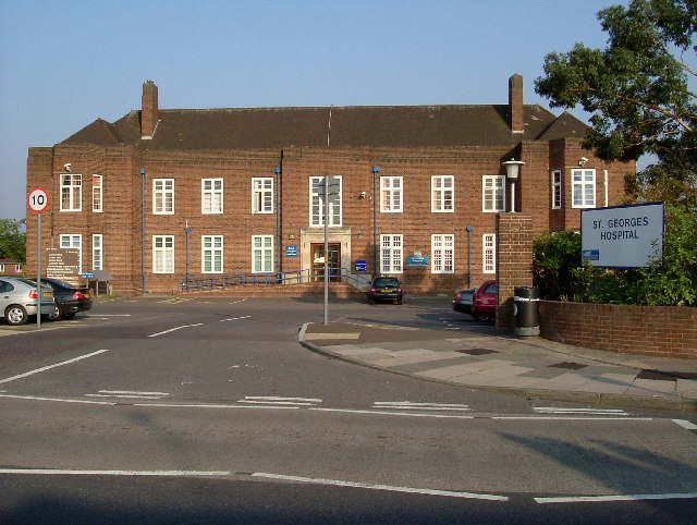
St George's Hospital, Havering

St George's Hospital was a hospital on Suttons Lane in Hornchurch in the London Borough of Havering, in northeast London, England. It opened in 1938 and...

Nearby Amenities

Located within 500m of 51.533625,0.21900004
Bench
Backrest: yes
Check Date: 2022-07-19
Historic: memorial
Inscription: Dedicated to Jean, Peter and Pip. To Rene, to Shep, to Adam Arthur Hennelly, to Jet.
Material: wood
Memorial: bench
Lat/Long: 51.5361617/0.2139229
Information: board
Tourism: information
Lat/Long: 51.5355745/0.2135241
Building: bunker
Bunker Type: gun_emplacement
Disused: yes
Military: bunker
Lat/Long: 51.5348246/0.2129417
Building: bunker
Bunker Type: gun_emplacement
Disused: yes
Military: bunker
Lat/Long: 51.5346067/0.2130478
Bench
Lat/Long: 51.5360818/0.2137864
Bench
Backrest: no
Lat/Long: 51.5313919/0.2151297
Bench
Backrest: no
Lat/Long: 51.5308678/0.2145895
Bench
Backrest: yes
Lat/Long: 51.5364497/0.2196007
Bench
Backrest: yes
Lat/Long: 51.5352717/0.2208057
Leisure: picnic_table
Lat/Long: 51.5371203/0.2232173
Leisure: picnic_table
Lat/Long: 51.5371208/0.2231474
Bench
Lat/Long: 51.5354475/0.2130742
Barrier: block
Lat/Long: 51.5330406/0.2240792
Bench
Lat/Long: 51.5359094/0.2239313
Waste Basket
Check Date: 2022-07-19
Waste: trash
Lat/Long: 51.5347507/0.2126413
Check Date: 2022-07-19
Covered: no
Leisure: picnic_table
Lat/Long: 51.5346716/0.2125342
Check Date: 2022-07-19
Covered: no
Leisure: picnic_table
Lat/Long: 51.5348706/0.2126254
Natural: shrub
Lat/Long: 51.5344727/0.2124118
Natural: shrub
Lat/Long: 51.534443/0.2125885
Access: yes
Check Date: 2022-07-19
Fitness Station: wall_bars
Leisure: fitness_station
Sport: fitness
Lat/Long: 51.5345294/0.2124709
Access: yes
Check Date: 2022-07-19
Fitness Station: horizontal_bar
Leisure: fitness_station
Sport: fitness
Lat/Long: 51.5336604/0.2118839
Information: guidepost
Tourism: information
Lat/Long: 51.5367954/0.2145934
Waste Basket
Check Date: 2022-07-19
Waste: trash
Lat/Long: 51.5361947/0.2139817
Natural: shrub
Lat/Long: 51.5358333/0.2137969
Bench
Backrest: yes
Check Date: 2022-07-19
Colour: green
Lat/Long: 51.535392/0.2130975
Natural: shrub
Lat/Long: 51.5346986/0.2129436
Natural: shrub
Lat/Long: 51.5345075/0.2128298
Natural: shrub
Lat/Long: 51.534616/0.2128402
Natural: shrub
Lat/Long: 51.5340934/0.2124211
Natural: shrub
Lat/Long: 51.5341866/0.2125842
Barrier: bollard
Bollard: fixed
Lat/Long: 51.5367389/0.2147288
Barrier: horse_stile
Bicycle: no
Horse: yes
Wheelchair: no
Lat/Long: 51.5367841/0.2147516
The data included in this document is from www.openstreetmap.org. The data is made available under ODbL.

Have you been to Berwick Wood?

Leave your review of Berwick Wood below (or comments, questions and feedback).