Aytton's Wood

Wood, Forest in Sussex Wealden

England

Aytton's Wood

Forest Way The former East Grinstead to Tunbridge Wells railway opened in 1866 and was closed as part of the Beeching cuts in 1967. East Sussex County Council purchased the track bed in 1971 and opened it as a long distance footpath in 1979. This section is located between the B2110 and the B2188.
Forest Way Credit: Simon Carey

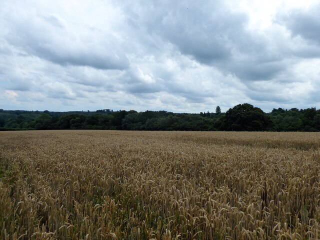
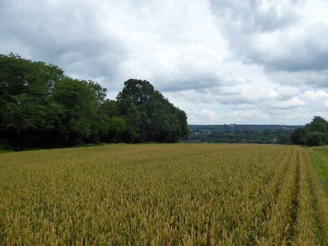
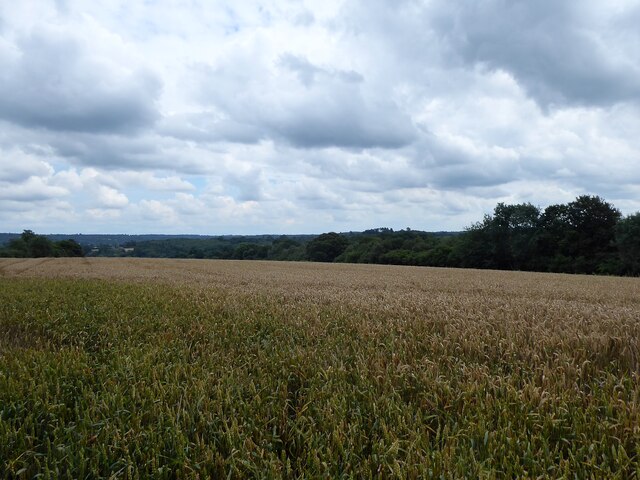
Aytton's Wood is a picturesque woodland located in the county of Sussex, England. Covering a vast area of approximately 100 acres, this ancient forest is nestled within the South Downs National Park, offering visitors a tranquil and enchanting escape from the hustle and bustle of everyday life.

The wood is predominantly made up of broadleaf trees, with a rich variety of species such as oak, beech, ash, and maple. These towering trees create a dense canopy overhead, filtering the sunlight and casting beautiful dappled shadows on the forest floor. The undergrowth is lush and diverse, with ferns, bluebells, and wild garlic carpeting the forest during the spring months.

Aytton's Wood is home to a wide array of wildlife, making it a haven for nature enthusiasts. Deer, foxes, badgers, and squirrels can often be spotted darting between the trees, while birdsong fills the air as various species of birds, including woodpeckers and owls, make their homes in the wood.

The woodland offers a network of well-maintained walking trails, allowing visitors to explore its beauty at their own pace. These paths wind through the forest, leading to hidden clearings, babbling streams, and even a small lake nestled within the wood. The tranquility and seclusion of Aytton's Wood make it the perfect destination for nature walks, picnics, and wildlife spotting.

With its natural beauty, diverse ecosystem, and peaceful atmosphere, Aytton's Wood is a true gem of Sussex, offering visitors a chance to connect with nature and experience the wonders of an ancient woodland.

If you have any feedback on the listing, please let us know in the comments section below.

Aytton's Wood Images

Images are sourced within 2km of 51.107145/0.18820969 or Grid Reference TQ5336. Thanks to Geograph Open Source API. All images are credited.

Forest Way The former East Grinstead to Tunbridge Wells railway opened in 1866 and was closed as part of the Beeching cuts in 1967. East Sussex County Council purchased the track bed in 1971 and opened it as a long distance footpath in 1979. This section is located between the B2110 and the B2188.
Forest Way
The former East Grinstead to Tunbridge Wells railway opened in 1866 and was closed as part of the Beeching cuts in 1967. East Sussex County Council purchased the track bed in 1971 and opened it as a long distance footpath in 1979. This section is located between the B2110 and the B2188.
Hopes Field The name of the field according to Withyham's 1842 tithe map bounded by the former East Grinstead-Tunbrdge Wells railway to the south, the current Uckfield branch railway to the north and east and Withyham Road, the B2110, to the west.
Hopes Field
The name of the field according to Withyham's 1842 tithe map bounded by the former East Grinstead-Tunbrdge Wells railway to the south, the current Uckfield branch railway to the north and east and Withyham Road, the B2110, to the west.
Hendal Field/Weir Mead The name of the fields according to Withyham's 1842 tithe map that have been merged to form a larger unit. Hendal Field was in the foreground adjacent to Hendal Hill, the B2188, whilst Weir Mead was at the western end. Both are bounded by the Forest Way to the north and Mottsmill Stream to the south.
Hendal Field/Weir Mead
The name of the fields according to Withyham's 1842 tithe map that have been merged to form a larger unit. Hendal Field was in the foreground adjacent to Hendal Hill, the B2188, whilst Weir Mead was at the western end. Both are bounded by the Forest Way to the north and Mottsmill Stream to the south.
Hudsons Brook The name of the field according to Withyham's 1842 tithe map that is bounded by Hendal Hill, the B2188, to the west, the Forest Way to the north and Mottsmill Stream to the south.
Hudsons Brook
The name of the field according to Withyham's 1842 tithe map that is bounded by Hendal Hill, the B2188, to the west, the Forest Way to the north and Mottsmill Stream to the south.
Middle Coneyburrow Brook The name of the field according to Withyham's 1842 tithe map bounded by the Forest Way to the north and Mottsmill Stream to the south.
Middle Coneyburrow Brook
The name of the field according to Withyham's 1842 tithe map bounded by the Forest Way to the north and Mottsmill Stream to the south.
Coneyburrow Brook The name of the field according to Withyham's 1842 tithe map that has been split in two by the construction of the Uckfield branch railway. The tree to the right is western limit of the field and the only survivor of the field boundary with neighbouring <a href="https://www.geograph.org.uk/photo/6922715">TQ5236 : Middle Coneyburrow Brook</a>.
Coneyburrow Brook
The name of the field according to Withyham's 1842 tithe map that has been split in two by the construction of the Uckfield branch railway. The tree to the right is western limit of the field and the only survivor of the field boundary with neighbouring TQ5236 : Middle Coneyburrow Brook.
Groombridge Water Treatment Works Located on Corseley Road to the north of Erdige Stream.
Groombridge Water Treatment Works
Located on Corseley Road to the north of Erdige Stream.
Eridge Stream A tributary of Mottsmill Stream that rises in Eridge Park. Viewed from Corseley Road bridge.
Eridge Stream
A tributary of Mottsmill Stream that rises in Eridge Park. Viewed from Corseley Road bridge.
Corseley Road Heading south from Groombridge towards Mott's Mill and Eridge.
Corseley Road
Heading south from Groombridge towards Mott's Mill and Eridge.
Great Mead The name of the field according to Withyham's 1842 tithe map bounded by Corseley Road to the east and Eridge Stream to the north.
Great Mead
The name of the field according to Withyham's 1842 tithe map bounded by Corseley Road to the east and Eridge Stream to the north.
Five Acres/Clays Land The name of the fields according to Withyham's 1842 tithe map that have been merged to form a larger unit. Five Acres was to the right where the footpath to Mott's Mill is, whilst Clays Land was to the east.
Five Acres/Clays Land
The name of the fields according to Withyham's 1842 tithe map that have been merged to form a larger unit. Five Acres was to the right where the footpath to Mott's Mill is, whilst Clays Land was to the east.
Type 24 Pillboxes Two in close proximity to the south of Groombridge, an important railway junction during World War Two.
Type 24 Pillboxes
Two in close proximity to the south of Groombridge, an important railway junction during World War Two.
Great Hammonds Mead The name of the field according to Withyham's 1842 tithe map that is bounded by Mottsmill Stream to the north and the public footpath to Sherlock's Farm to the east.
Great Hammonds Mead
The name of the field according to Withyham's 1842 tithe map that is bounded by Mottsmill Stream to the north and the public footpath to Sherlock's Farm to the east.
Little Hammonds Mead The name of the field according to Withyham's 1842 tithe map bounded by Mottsmill Stream to the north and Sherlock's Wood to the south.
Little Hammonds Mead
The name of the field according to Withyham's 1842 tithe map bounded by Mottsmill Stream to the north and Sherlock's Wood to the south.
Wet Field The name of the field according to Withyham's 1842 tithe map bounded by Long Shaw to the east and the public footpath to Sherlock's Farm to the west.
Wet Field
The name of the field according to Withyham's 1842 tithe map bounded by Long Shaw to the east and the public footpath to Sherlock's Farm to the west.
Ten Acres The name of the field according to Withyham's 1842 tithe map that is bounded by Long Shaw to the east and the public footpath to Sherlock's Farm to the west.
Ten Acres
The name of the field according to Withyham's 1842 tithe map that is bounded by Long Shaw to the east and the public footpath to Sherlock's Farm to the west.
Hard Field The name of the field according to Withyham's 1842 tithe map bounded by Sherlock's Farm to the south, the public footpath to Sherlock's Farm to the east and Sherlock's Wood to the west.
Hard Field
The name of the field according to Withyham's 1842 tithe map bounded by Sherlock's Farm to the south, the public footpath to Sherlock's Farm to the east and Sherlock's Wood to the west.
Cow Field The name of the field according to Withyham's 1842 tithe map that is bounded by Long Shaw to the east and the public footpath to Sherlock's Farm to the west. It has been merged with <a href="https://www.geograph.org.uk/photo/6923109">TQ5235 : Ten Acres</a> to the south.
Cow Field
The name of the field according to Withyham's 1842 tithe map that is bounded by Long Shaw to the east and the public footpath to Sherlock's Farm to the west. It has been merged with TQ5235 : Ten Acres to the south.
Show me another place!

Aytton's Wood is located at Grid Ref: TQ5336 (Lat: 51.107145, Lng: 0.18820969)

Administrative County: East Sussex

District: Wealden

Police Authority: Sussex

What 3 Words

///feasted.segmented.leopard. Near Groombridge, East Sussex

Related Wikis

Groombridge railway station

Groombridge railway station is a station on the Spa Valley Railway (SVR) in Groombridge, East Sussex, England. Once a busy station serving four directions...

Groombridge

Groombridge is a village of about 1,600 people. It straddles the border between Kent and East Sussex, in England. The nearest large town is Royal Tunbridge...
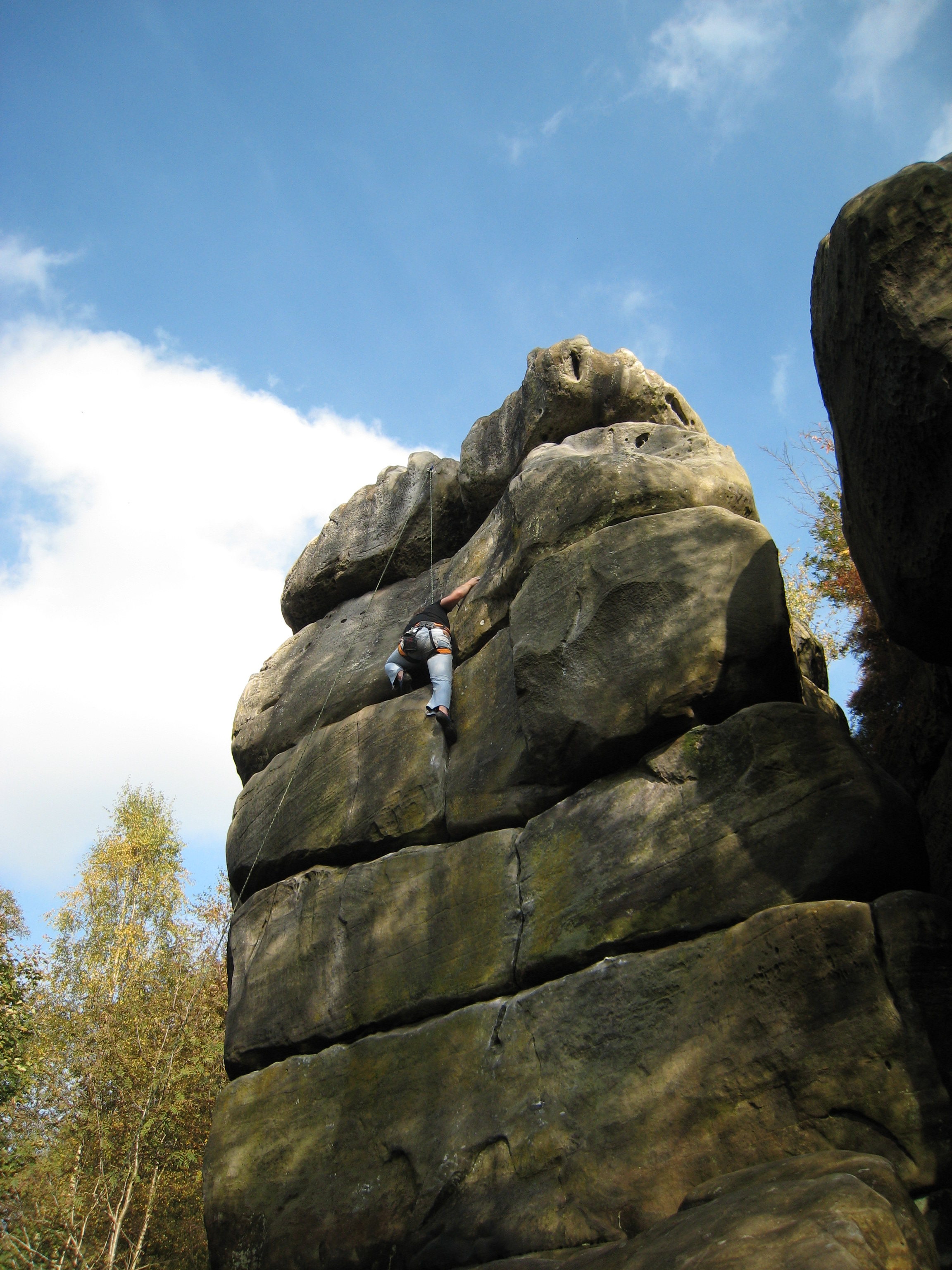
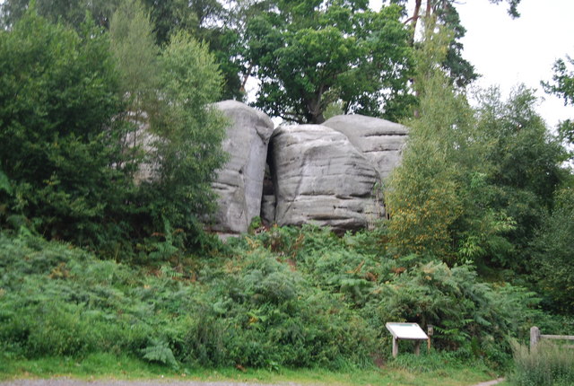
Harrison's Rocks

Harrison's Rocks is a series of sandstone crags approximately 1.5 kilometres (1 mi) south of the village of Groombridge in the county of East Sussex. The...

Groombridge Place

Groombridge Place is a moated manor house in the village of Groombridge near Tunbridge Wells, Kent, England. It has become a tourist attraction, noted...

Penn's Rocks

Penn's Rocks is a 10.2-hectare (25-acre) biological Site of Special Scientific Interest north of Crowborough in East Sussex.This site is a steep sided...

Arun Valley line

The Arun Valley line, also known as the Mid Sussex line, is part of the Southern- and Thameslink-operated railway services. For the initial part of the...

Eridge railway station

Eridge railway station is on the Uckfield branch of the Oxted line in southern England and serves a rural district around Eridge in East Sussex. It is...

Eridge Green

Eridge Green is a 8.4-hectare (21-acre) biological Site of Special Scientific Interest north-east of Crowborough in East Sussex. It is part of the 44 hectares...

Nearby Amenities

Located within 500m of 51.107145,0.18820969
Source: Landsat photo
Lat/Long: 51.1042055/0.1829496
Source: Landsat photo
Lat/Long: 51.105944/0.1815414
Groombridge Junction
Railway: switch
Source: Railway Track Diagrams Southern & TFL
Lat/Long: 51.1100463/0.1863167
Millennium Milepost Corseley Road
Description: 1) Forest Row 7, East Grinstead 9.75 2) Groombridge 0.5, Royal Tunbridge Wells 4.5 3) Eridge Station 2
Image: https://www.cyclestreets.net/location/186468/cyclestreets186468-size640.jpg
Information: guidepost
Ncn Milepost: rowe
Sustrans Ref: MP880
Tourism: information
Lat/Long: 51.1078659/0.1819979
Railway: switch
Lat/Long: 51.1093009/0.1860739
Barrier: kissing_gate
Lat/Long: 51.10931/0.1892343
Turning Circle
Lat/Long: 51.1115769/0.1890148
Barrier: stile
Material: wood
Stile: stepover
Lat/Long: 51.1070946/0.1828226
Railway: switch
Lat/Long: 51.1099571/0.1862553
Railway: switch
Lat/Long: 51.1098769/0.1861728
Birchden
Place: hamlet
Source: OS_OpenData_Streetview
Lat/Long: 51.1073483/0.193162
Post Box
Operator: Royal Mail
Operator Wikidata: Q638098
Post Box Type: wall
Ref: TN3 73D
Royal Cypher: VR
Royal Cypher Wikidata: Q33102356
Lat/Long: 51.1101752/0.183932
Groombridge Junction
Railway: junction
Lat/Long: 51.1099285/0.1862621
The data included in this document is from www.openstreetmap.org. The data is made available under ODbL.

Have you been to Aytton's Wood?

Leave your review of Aytton's Wood below (or comments, questions and feedback).