Eggs Wood

Wood, Forest in Sussex Wealden

England

Eggs Wood

The church without dedication, East Hoathly
The church without dedication, East Hoathly Credit: Stephen Dawson

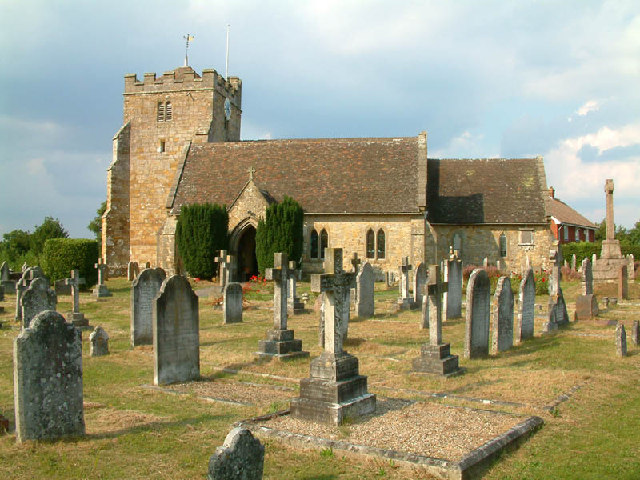
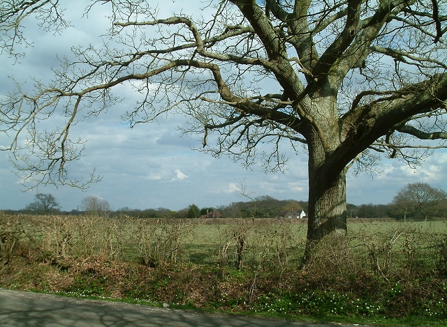
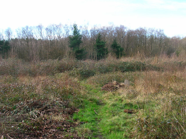
Eggs Wood is a picturesque forest located in Sussex, England. Situated in the South East of the county, it covers an area of approximately 100 hectares. The wood is part of the High Weald Area of Outstanding Natural Beauty, known for its diverse wildlife and stunning landscapes.

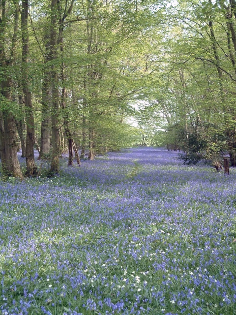
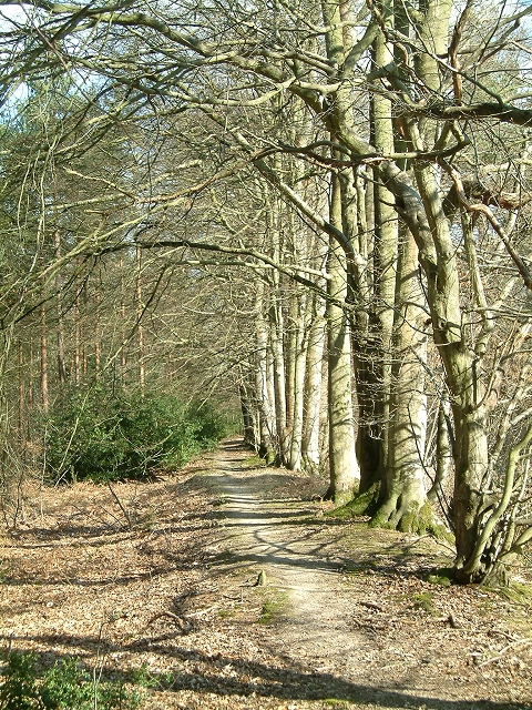
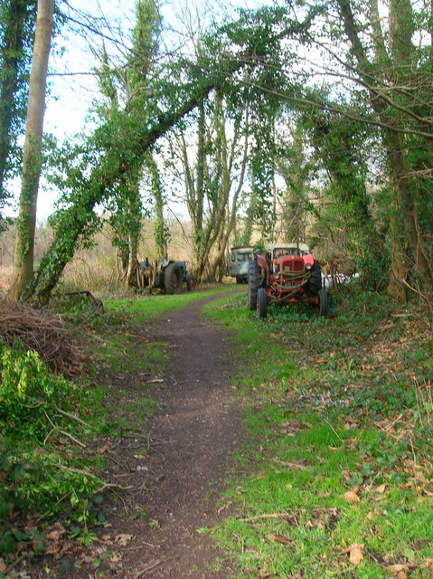
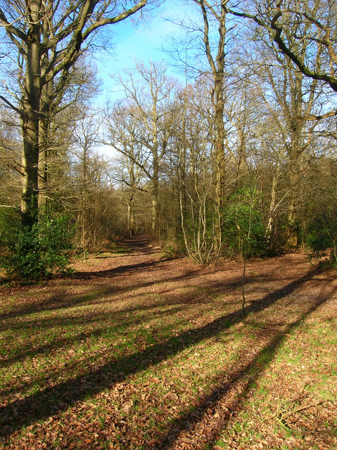
Eggs Wood is predominantly made up of broadleaf trees, including oak, beech, and birch. These trees create a dense canopy that provides shade and shelter for a variety of flora and fauna. The forest floor is covered in a rich carpet of mosses, ferns, and wildflowers, adding to its natural beauty.

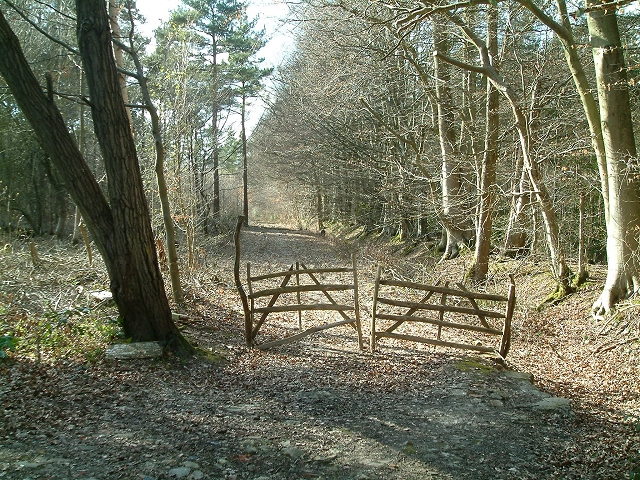
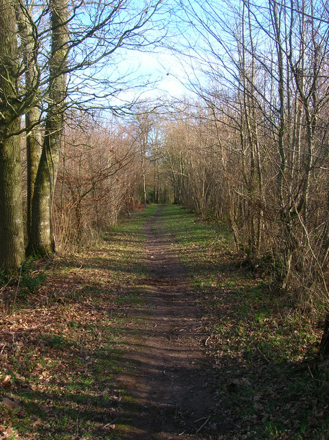
The wood is crisscrossed by a network of footpaths and trails, making it a popular destination for walkers, hikers, and nature enthusiasts. The paths meander through the forest, offering visitors the chance to explore the tranquil surroundings and discover the hidden gems of the wood.

Eggs Wood is also home to a range of wildlife species. Birdwatchers can spot various birds, such as woodpeckers, thrushes, and owls, while woodland mammals like deer, foxes, and badgers can often be seen roaming the area. In the spring, the wood comes alive with the sound of chirping birds and the vibrant colors of wildflowers in full bloom.

Managed by the local authorities, Eggs Wood is well-maintained, ensuring the preservation of its natural beauty and biodiversity. It provides a peaceful retreat from the hustle and bustle of everyday life, offering visitors a chance to reconnect with nature and enjoy the tranquility of the Sussex countryside.

If you have any feedback on the listing, please let us know in the comments section below.

Eggs Wood Images

Images are sourced within 2km of 50.914399/0.17692194 or Grid Reference TQ5315. Thanks to Geograph Open Source API. All images are credited.

The church without dedication, East Hoathly
Chiddingly Church With a spire of 128'.
Chiddingly Church
With a spire of 128'.
Gray Wood Gray Wood, East Hoathly - in late April the Wood is anything but gray!  The woodland in private, but can be viewed from the Vanguard Way footpath.
Gray Wood
Gray Wood, East Hoathly - in late April the Wood is anything but gray! The woodland in private, but can be viewed from the Vanguard Way footpath.
Woodbank at Rowlands Wood This historic wooded bank, with many mature beech and hornbeam trees forms the southern boundary of Rowlands Wood, and also bounds the site of the Butterfly Conservation Nature Reserve where traditional coppicing and heathland management takes place.
Woodbank at Rowlands Wood
This historic wooded bank, with many mature beech and hornbeam trees forms the southern boundary of Rowlands Wood, and also bounds the site of the Butterfly Conservation Nature Reserve where traditional coppicing and heathland management takes place.
Hedgerow Oak at Whitesmith Low Weald landscape looking towards Randall's Farm, with Chiddingly Church in the distance.
Hedgerow Oak at Whitesmith
Low Weald landscape looking towards Randall's Farm, with Chiddingly Church in the distance.
Line of Trees on historic Boundary bank Old Beech and Hornbeam trees on woodbank at Rowlands Wood, Park Corner.
Line of Trees on historic Boundary bank
Old Beech and Hornbeam trees on woodbank at Rowlands Wood, Park Corner.
Mile marker East Hoathly 48 Miles to Bow Bells
Mile marker East Hoathly
48 Miles to Bow Bells
Oast House, Holdens Farm The rather dreary day has obscured the view to Chiddingly church, whose spire can be viewed between the oast house and tree.
Oast House, Holdens Farm
The rather dreary day has obscured the view to Chiddingly church, whose spire can be viewed between the oast house and tree.
Field opposite Broomfield Farm Looking towards Minepit Wood and Summersbrook Wood.
Field opposite Broomfield Farm
Looking towards Minepit Wood and Summersbrook Wood.
Moat, Moat Wood The remnants of an medieval settlement possibly a farmstead or a hunting lodge. The island is to the right of the water. Moat Wood is joint owned by East Hoathly parish council and the Woodland Trust.
Moat, Moat Wood
The remnants of an medieval settlement possibly a farmstead or a hunting lodge. The island is to the right of the water. Moat Wood is joint owned by East Hoathly parish council and the Woodland Trust.
Footpath, Moat Wood Taken from the entrance near the A22. Moat Wood is owned jointly by East Hoathly parish council and the Woodland Trust. Its wildlife includes Black Adders and Nightingales.
Footpath, Moat Wood
Taken from the entrance near the A22. Moat Wood is owned jointly by East Hoathly parish council and the Woodland Trust. Its wildlife includes Black Adders and Nightingales.
Moat Wood This view is from the footpath near to the East Hoathly entrance.
Moat Wood
This view is from the footpath near to the East Hoathly entrance.
Tractor's Graveyard There are a couple more vehicles out of shot lining the footpath from East Hoathly into Moat Wood.
Tractor's Graveyard
There are a couple more vehicles out of shot lining the footpath from East Hoathly into Moat Wood.
Moat Wood Jointly owned by East Hoathly parish council and the Woodland Trust and home to such wildlife as Black Adders and Nightingales. This part of the open access wood heads north westwards away from the moat.
Moat Wood
Jointly owned by East Hoathly parish council and the Woodland Trust and home to such wildlife as Black Adders and Nightingales. This part of the open access wood heads north westwards away from the moat.
Field near Tourle's Farm An outbuilding can be seen on the ridge to the right. Somewhere to the right a footpath leads up there but is overgrown and impassable.
Field near Tourle's Farm
An outbuilding can be seen on the ridge to the right. Somewhere to the right a footpath leads up there but is overgrown and impassable.
Derelict Depot Currently fenced off awaiting development. The footpath hugs the back of the depot then turns south to the left of the photographer.
Derelict Depot
Currently fenced off awaiting development. The footpath hugs the back of the depot then turns south to the left of the photographer.
Inside the Derelict Depot. Taken from the footpath on the northern side of the depot (see <a href="https://www.geograph.org.uk/photo/323319">TQ5215 : Derelict Depot</a> ) the inside of which seems to be a children's playground.
Inside the Derelict Depot.
Taken from the footpath on the northern side of the depot (see TQ5215 : Derelict Depot ) the inside of which seems to be a children's playground.
Converted Barn, South Street At least I think that what it is. There is a well to the left of the building which stands in the entrance road of the works.
Converted Barn, South Street
At least I think that what it is. There is a well to the left of the building which stands in the entrance road of the works.
Show me another place!

Eggs Wood is located at Grid Ref: TQ5315 (Lat: 50.914399, Lng: 0.17692194)

Administrative County: East Sussex

District: Wealden

Police Authority: Sussex

What 3 Words

///takeovers.multiples.formation. Near Horam, East Sussex

Related Wikis

Whitesmith maze

A plantation of willows near Whitesmith, East Sussex, in England forms a maze in the shape of a quotation from the Bible. The maze was planted by local...

Chiddingly

Chiddingly ( CHID-ing-lye) is an English village and civil parish in the Wealden District of the administrative county of East Sussex, within historic...

East Hoathly with Halland

East Hoathly with Halland is a civil parish in the Wealden District of East Sussex, England. The parish contains the two villages of East Hoathly and...

Park Corner Heath

Park Corner Heath is a 2.9-hectare (7.2-acre) biological Site of Special Scientific Interest about 1.2 miles (2 km) south of East Hoathly, adjacent to...

Farleys House

Farleys House near Chiddingly, East Sussex, has been converted into a museum and archive featuring the lives and work of its former residents, the photographer...

Burgh Hill Farm Meadow

Burgh Hill Farm Meadow is a 0.9-hectare (2.2-acre) biological Site of Special Scientific Interest west of Hailsham in East Sussex.This meadow is managed...

Golden Cross, East Sussex

Golden Cross is a small village in the Wealden district of East Sussex, England. Its nearest town is Hailsham, which lies approximately 3+1⁄2 miles (6...

Gun Hill, East Sussex

Gun Hill is a hamlet in the civil parish of Chiddingly in the Wealden district of East Sussex, England. It is one of the seven hills of the parish in which...

Nearby Amenities

Located within 500m of 50.914399,0.17692194
Highlands Farm
Place: farm
Source Name: OS_OpenData_Streetview
Lat/Long: 50.9133836/0.1793539
Coldharbour Farm
Place: farm
Source Name: OS_OpenData_Streetview
Lat/Long: 50.9131266/0.1759744
The data included in this document is from www.openstreetmap.org. The data is made available under ODbL.

Have you been to Eggs Wood?

Leave your review of Eggs Wood below (or comments, questions and feedback).