Riversfield Belt
Wood, Forest in Essex Uttlesford
England
Riversfield Belt

Riversfield Belt is a picturesque woodland located in Essex, England. Situated near the town of Wood and the Forest of Essex, this area is known for its natural beauty and serene atmosphere. Spanning over a vast area, Riversfield Belt offers a tranquil escape from the hustle and bustle of city life.
The woodland is characterized by a diverse range of tree species, including oak, beech, and birch. These trees create a canopy that provides shade and shelter for an array of wildlife, making Riversfield Belt an important ecological habitat. It is home to various bird species, such as woodpeckers and thrushes, as well as mammals like deer and foxes.
Visitors to Riversfield Belt can enjoy a variety of outdoor activities. The woodland is crisscrossed with walking trails, allowing visitors to explore the natural surroundings at their own pace. The tranquil rivers that flow through the area provide opportunities for fishing and boating, adding to the recreational appeal of the region.
In addition to its natural beauty, Riversfield Belt also has historical significance. Ancient remains and archaeological sites have been discovered in the area, indicating human habitation dating back thousands of years. This adds to the allure of the woodland and provides a glimpse into the rich history of the region.
Overall, Riversfield Belt in Essex is a stunning woodland that offers a peaceful retreat for nature enthusiasts and history buffs alike. Its diverse flora and fauna, coupled with its tranquil ambiance, make it a must-visit destination for anyone seeking to connect with nature.
If you have any feedback on the listing, please let us know in the comments section below.
Riversfield Belt Images
Images are sourced within 2km of 52.010252/0.21327485 or Grid Reference TL5236. Thanks to Geograph Open Source API. All images are credited.


Riversfield Belt is located at Grid Ref: TL5236 (Lat: 52.010252, Lng: 0.21327485)
Administrative County: Essex
District: Uttlesford
Police Authority: Essex
What 3 Words
///craziest.warmers.afflicted. Near Saffron Walden, Essex
Nearby Locations
Related Wikis
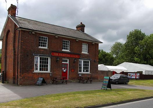
Waldstock Festival UK
Waldstock is an annual charity music festival held in the grounds of the Fighting Cocks Public House, Wendens Ambo, Essex. Waldstock is organised entirely...

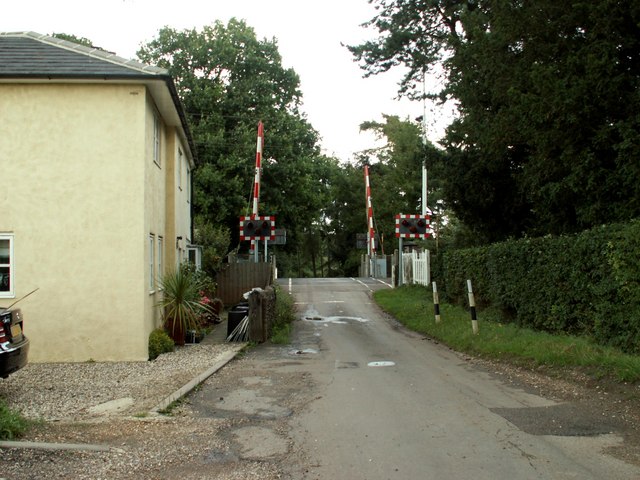
Audley End railway station
Audley End railway station is on the West Anglia Main Line serving the village of Wendens Ambo and the town of Saffron Walden in Essex, England. It is...

Wendens Ambo
Wendens Ambo is a village in the Uttlesford district of Essex, England. The population at the 2011 census was measured at 473. Its name originates from...

St Mary the Virgin Church, Wendens Ambo
St Mary the Virgin Church is a Church of England parish church in the village of Wendens Ambo in Essex, England. It is listed Grade I for its architectural...
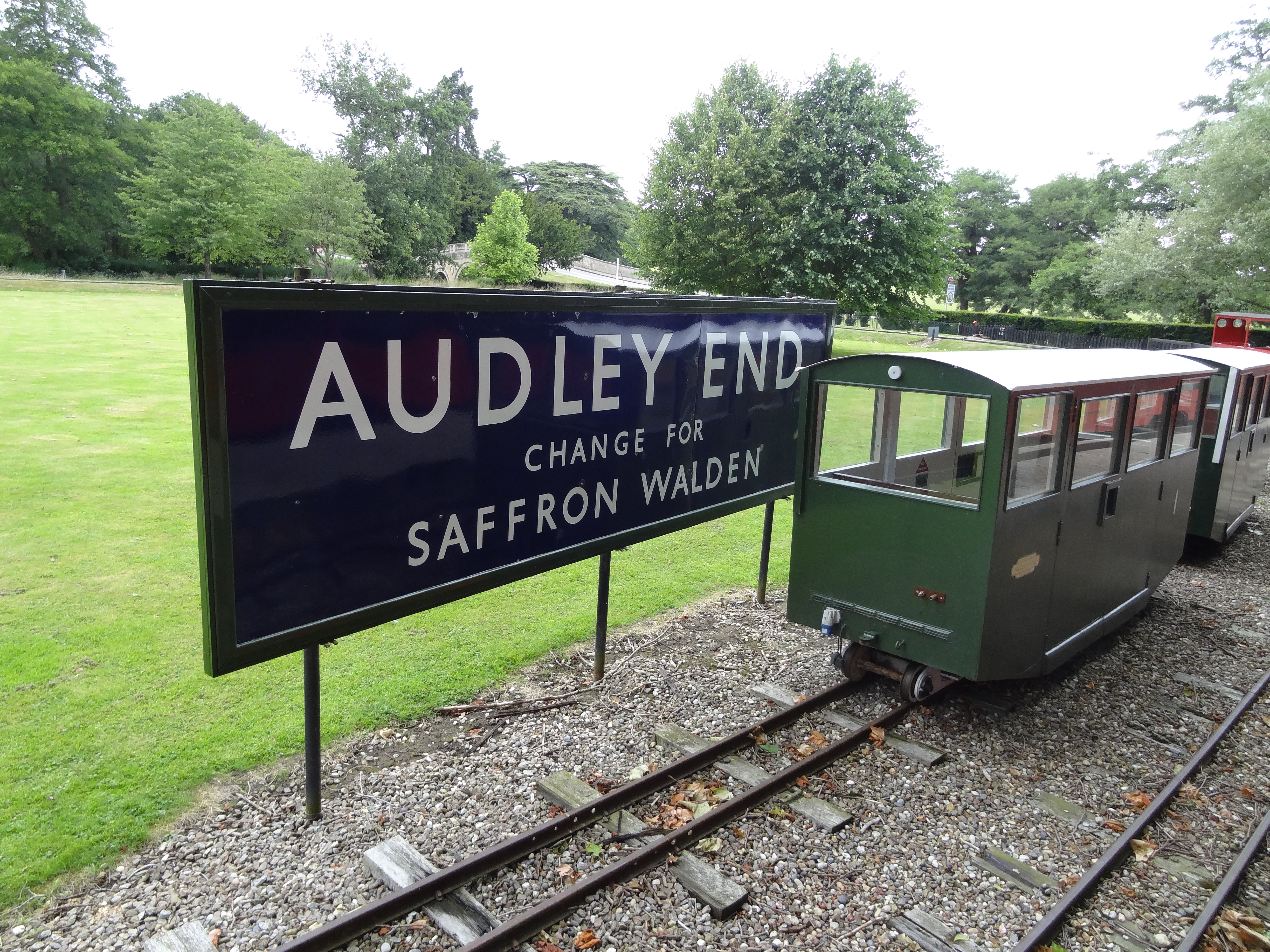
Audley End Railway
The Audley End Miniature Railway is a miniature railway in Essex, England. == Overview == The 10+1⁄4 in (260 mm)-gauge circuit was built by Lord Braybrooke...
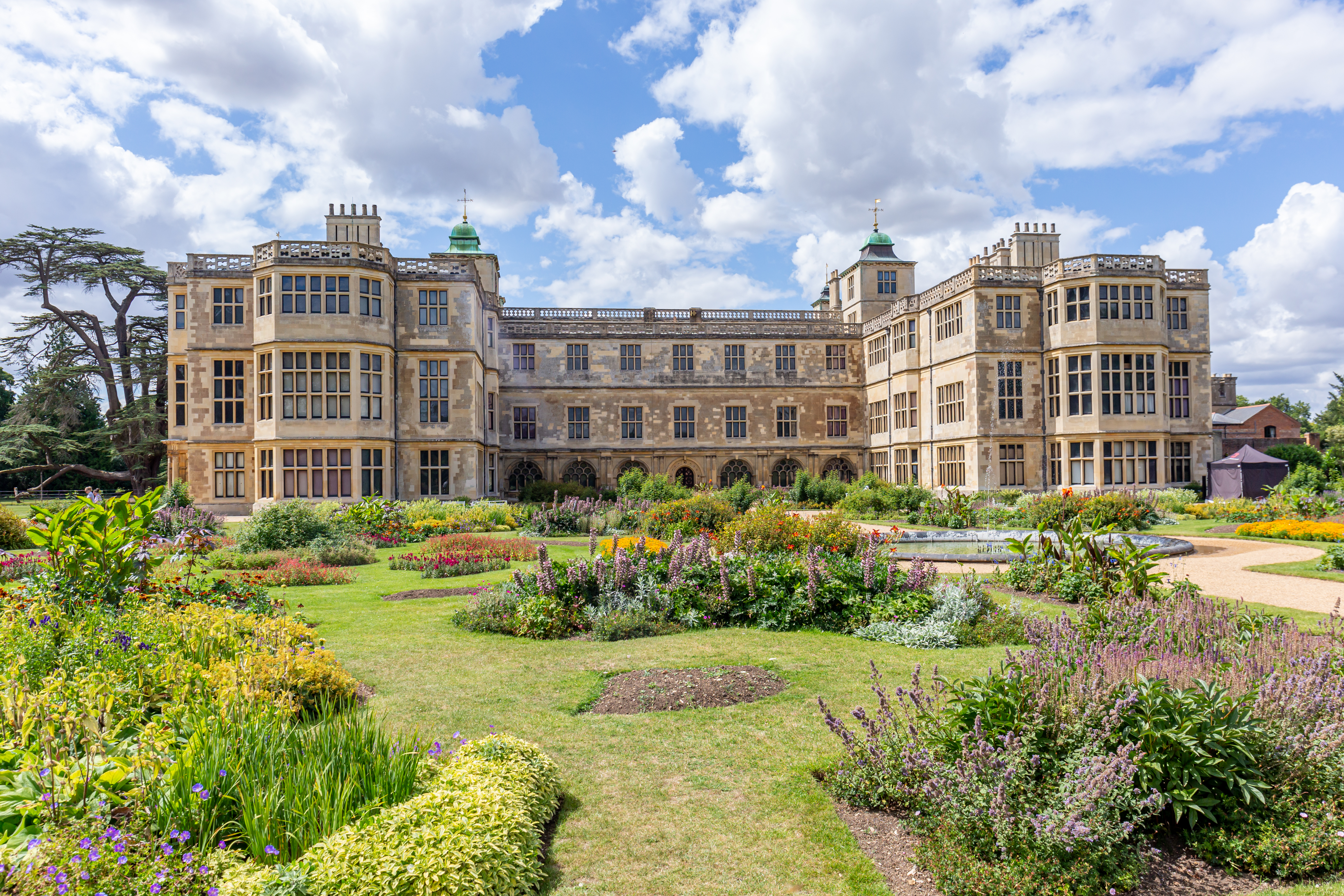
Audley End House
Audley End House is a largely early 17th-century country house outside Saffron Walden, Essex, England. It is a prodigy house, known as one of the finest...

Audley End Airfield
Audley End Airfield is located to the south west of Saffron Walden near to Saffron Walden County High School in the Uttlesford district of Essex, England...
Garden Organic
Garden Organic, formerly known as the Henry Doubleday Research Association (HDRA), is a UK organic growing charity dedicated to researching and promoting...
Nearby Amenities
Located within 500m of 52.010252,0.21327485Have you been to Riversfield Belt?
Leave your review of Riversfield Belt below (or comments, questions and feedback).