Black Poplar Wood

Wood, Forest in Essex

England

Black Poplar Wood

Houses on Oldchurch Road, Romford
Houses on Oldchurch Road, Romford Credit: JThomas

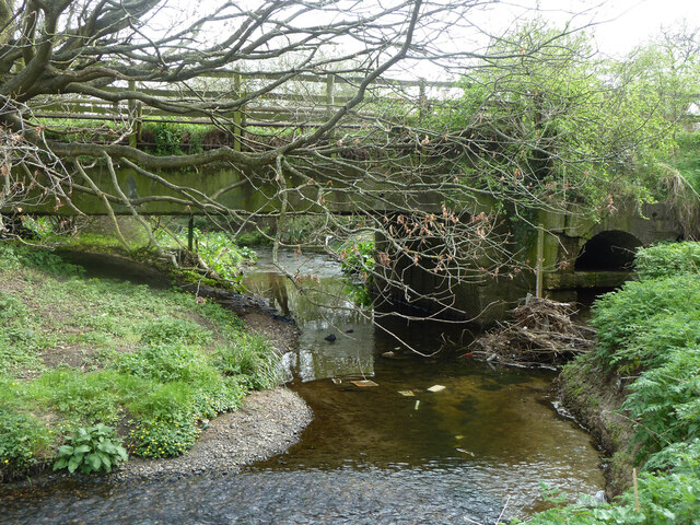
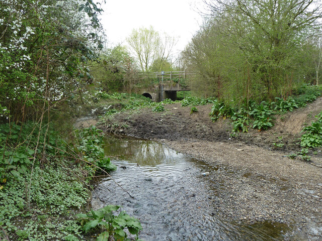
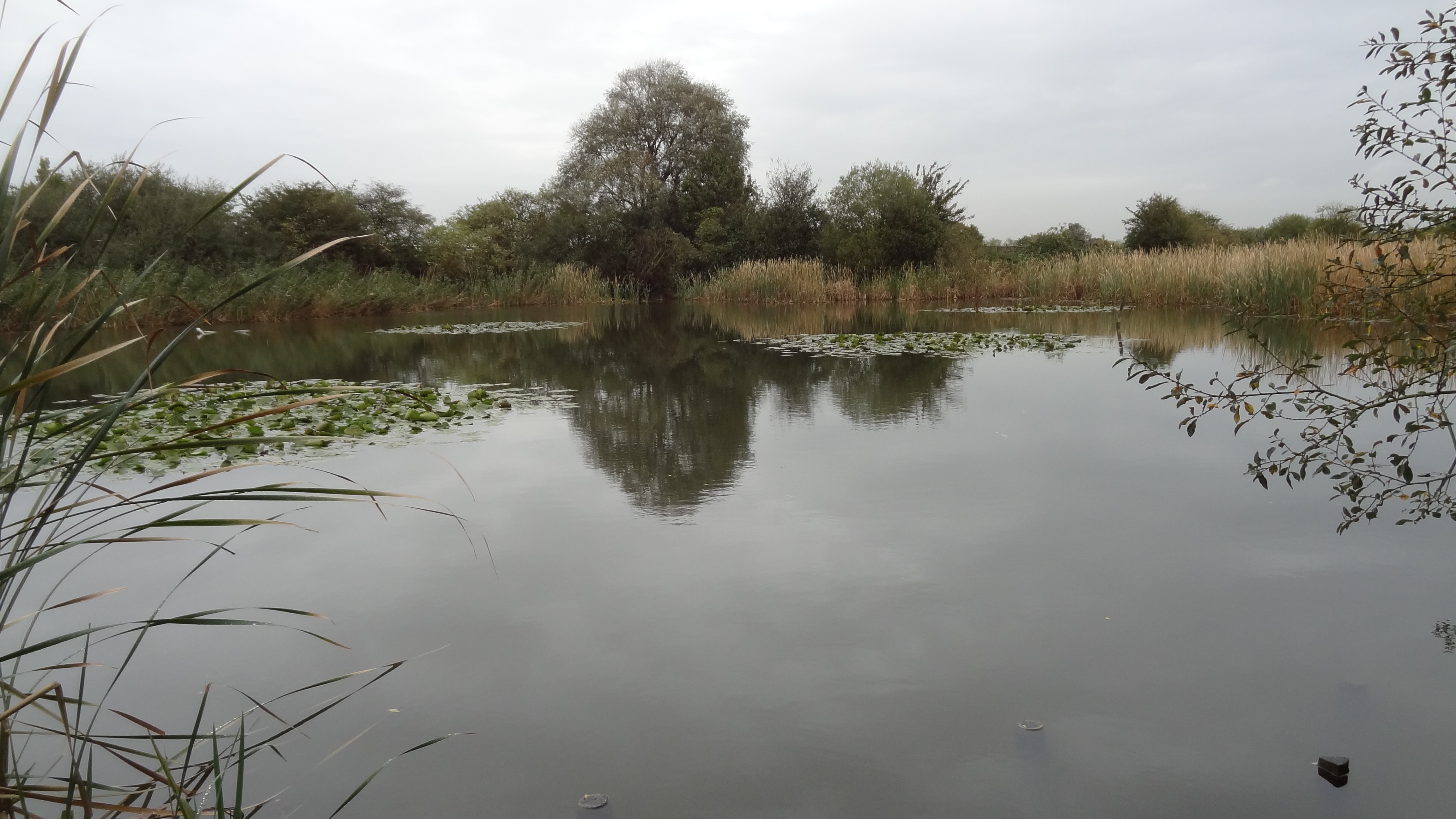
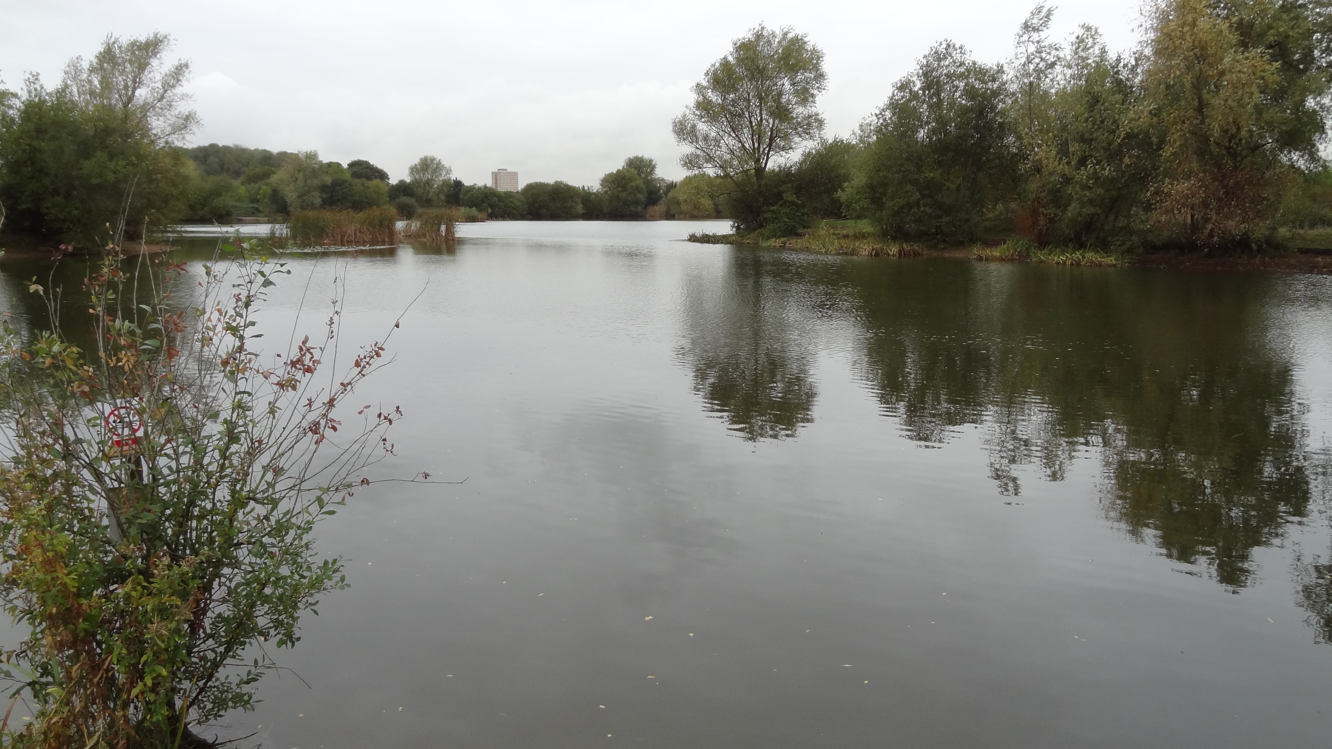
Black Poplar Wood is a forest located in Essex, England. It covers an area of approximately 100 acres and is known for its significant population of black poplar trees (Populus nigra). These trees are native to Europe and are the rarest and most endangered native timber tree in the United Kingdom.

The woodland is characterized by its dense tree coverage, with the black poplars dominating the landscape. These trees can grow up to 100 feet in height and have distinctive dark grey bark that becomes deeply furrowed as they mature. The leaves of the black poplars are triangular in shape and have serrated edges. In spring, the forest comes alive with the vibrant green foliage of these trees.

Black Poplar Wood is an important habitat for a variety of wildlife species. The dense canopy provides shelter and nesting sites for birds such as woodpeckers, owls, and warblers. Mammals like foxes, deer, and badgers can also be found within the forest. The woodland floor is rich in biodiversity, with a diverse range of plant species including bluebells, ferns, and mosses.

The forest is popular among nature enthusiasts, hikers, and photographers who visit to admire the natural beauty and tranquility it offers. There are several walking trails that wind through the woods, allowing visitors to explore and appreciate the unique ecosystem. Black Poplar Wood is also part of ongoing conservation efforts to protect and preserve the endangered black poplar trees, ensuring their survival for future generations to enjoy.

If you have any feedback on the listing, please let us know in the comments section below.

Black Poplar Wood Images

Images are sourced within 2km of 51.553616/0.18789064 or Grid Reference TQ5186. Thanks to Geograph Open Source API. All images are credited.

Houses on Oldchurch Road, Romford
Pavement up, South Street, Romford Something to do with gas.
Pavement up, South Street, Romford
Something to do with gas.
Buses on South Street, Romford, 2011 The green area at Roneo Corner has since been built on.
Buses on South Street, Romford, 2011
The green area at Roneo Corner has since been built on.
Road works for gas, Roneo Corner Looking towards Hornchurch.
Road works for gas, Roneo Corner
Looking towards Hornchurch.
Lake, Harrow Lodge Park
Fountain in lake, Harrow Lodge Park
In Harrow Lodge Park
Footbridge, Harrow Lodge Park One of two bridging across the lake via a large island.
Footbridge, Harrow Lodge Park
One of two bridging across the lake via a large island.
Lake, Harrow Lodge Park
Waterfowl, Harrow Lodge Park
Blackthorn in bloom, The Chase Local Nature Reserve
River Rom In The Chase Local Nature Reserve, just above the bridge for The Chase. This might be still called the Beam River, its name lower down. But this is above the confluence with the Ravensbourne, so let's call it Rom.
River Rom
In The Chase Local Nature Reserve, just above the bridge for The Chase. This might be still called the Beam River, its name lower down. But this is above the confluence with the Ravensbourne, so let's call it Rom.
The Chase bridge over River Rom This might be still called the Beam River, its name lower down. But this is above the confluence with the Ravensbourne, so let's call it Rom. There are old flood arches to the right, looking rather buried viewed from the other side. They look as if they predate the current generous main span.
The Chase bridge over River Rom
This might be still called the Beam River, its name lower down. But this is above the confluence with the Ravensbourne, so let's call it Rom. There are old flood arches to the right, looking rather buried viewed from the other side. They look as if they predate the current generous main span.
River Rom below The Chase bridge This might be still called the Beam River, its name lower down. But this is above the confluence with the Ravensbourne, so let's call it Rom.
River Rom below The Chase bridge
This might be still called the Beam River, its name lower down. But this is above the confluence with the Ravensbourne, so let's call it Rom.
Blocked flood arches under The Chase
Eastbrook Pond Day ticket fishing is available.
Eastbrook Pond
Day ticket fishing is available.
Farmhouse Tavern - another closed pub, 2011 Although a sign still claims "Open all day", it is clear it has been many days since this last opened. The van suggests there might still be someone taking care of it. It is now in 2022 a 'premium wedding and events venue' and looking much tidier.
Farmhouse Tavern - another closed pub, 2011
Although a sign still claims "Open all day", it is clear it has been many days since this last opened. The van suggests there might still be someone taking care of it. It is now in 2022 a 'premium wedding and events venue' and looking much tidier.
Permissive path towards Foxlands Crescent Between playing fields.
Permissive path towards Foxlands Crescent
Between playing fields.
Show me another place!

Black Poplar Wood is located at Grid Ref: TQ5186 (Lat: 51.553616, Lng: 0.18789064)

Unitary Authority: Barking and Dagenham

Police Authority: Metropolitan

What 3 Words

///hike.grace.tribune. Near Elm Park, London

Related Wikis

The Rom

The Rom is a Grade II listed skatepark in Hornchurch, East London, England. Built in 1978, and designed by Adrian Rolt of G-Force, it is the most completely...

The Chase Nature Reserve

The Chase is a nature reserve in Dagenham in London. Most of it is in the London Borough of Barking and Dagenham, with a small part in Havering. It is...

Harrow Lodge Park

Harrow Lodge Park is a large public park in Hornchurch in the London Borough of Havering. It was created by Hornchurch Urban District Council, partly on...

Eastbrookend Country Park

Eastbrookend Country Park is an 84-hectare park and Local Nature Reserve in Dagenham in the London Borough of Barking and Dagenham, in England. Together...

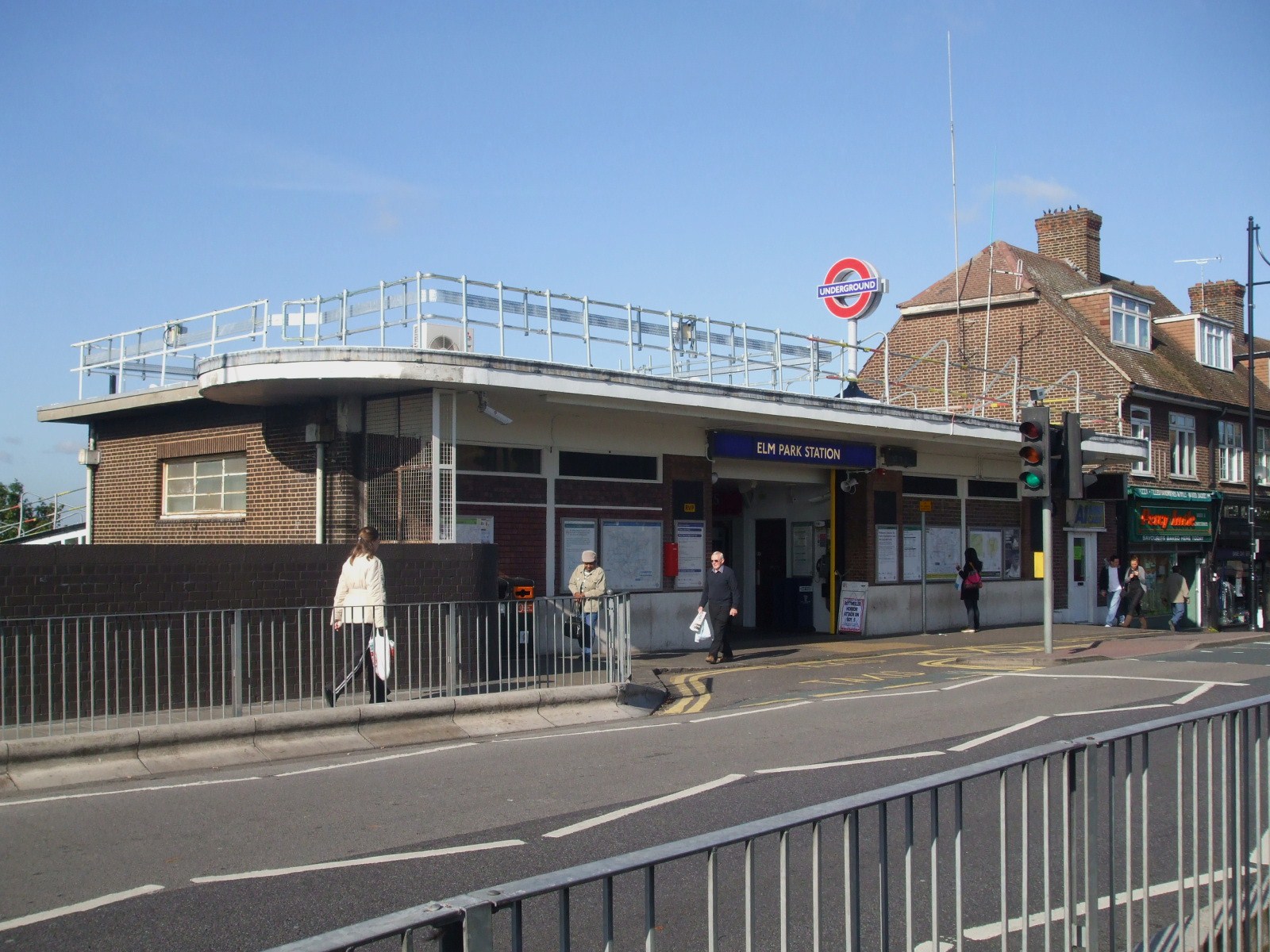
Elm Park tube station

Elm Park is a London Underground station serving Elm Park in the London Borough of Havering, east London. It is on the District line between Dagenham East...

Elm Park

Elm Park is a suburban planned community in East London and part of the London Borough of Havering. Located 14.3 miles (23.0 km) east-northeast of Charing...

Hornchurch High School

Hornchurch High School is a mixed secondary school with academy status, located in the Hornchurch area of the London Borough of Havering, England. Until...

Elm Park (ward)

Elm Park is an electoral ward in the London Borough of Havering. The ward has existed since the creation of the borough on 1 April 1965 and was first used...

Nearby Amenities

Located within 500m of 51.553616,0.18789064
Turning Circle
Lat/Long: 51.5574114/0.1916242
Ref GB Tflcid: RWG122248
Traffic Calming: hump
Lat/Long: 51.5530975/0.1943828
Ref GB Tflcid: RWG122247
Traffic Calming: hump
Lat/Long: 51.5525064/0.193533
Bus Stop
Carfax Road
Local Ref: F
Naptan AtcoCode: 490004781W
Naptan Bearing: W
Naptan CommonName: Carfax Road (Havering)
Naptan Indicator: Stop F
Naptan Verified: no
Public Transport: platform
Lat/Long: 51.5510614/0.1918463
Bus Stop
Harrow Lodge Park
Local Ref: RP
Naptan AtcoCode: 490007852N
Naptan Bearing: N
Naptan CommonName: Harrow Lodge Park Rainham Rd
Naptan Indicator: Stop RP
Naptan Street: UPPER RAINHAM ROAD
Naptan Verified: no
Public Transport: platform
Lat/Long: 51.5531446/0.1911341
Bus Stop
Harrow Lodge Park
Local Ref: RM
Naptan AtcoCode: 490007852S
Naptan Bearing: S
Naptan CommonName: Harrow Lodge Park Rainham Rd
Naptan Indicator: Stop RM
Naptan Street: UPPER RAINHAM ROAD
Naptan Verified: no
Public Transport: platform
Lat/Long: 51.5534521/0.1913455
Bus Stop
Laburnum Avenue
Local Ref: RQ
Naptan AtcoCode: 490008892N
Naptan Bearing: N
Naptan CommonName: Laburnum Avenue
Naptan Indicator: Stop RQ
Naptan Verified: no
Public Transport: platform
Lat/Long: 51.5566701/0.1889594
Bus Stop
Laburnum Avenue
Local Ref: RL
Naptan AtcoCode: 490008892S
Naptan Bearing: S
Naptan CommonName: Laburnum Avenue
Naptan Indicator: Stop RL
Naptan Verified: no
Public Transport: platform
Lat/Long: 51.5562098/0.1895287
Bus Stop
Carfax Road
Local Ref: J
Naptan AtcoCode: 490014235E
Naptan Bearing: E
Naptan CommonName: Warren Drive
Naptan Indicator: Stop J
Naptan Verified: no
Public Transport: platform
Lat/Long: 51.5508673/0.1928703
Doctors
Maylands Healthcare
Addr City: Hornchurch
Addr Housenumber: 300
Addr Postcode: RM12 4EQ
Addr Street: Upper Rainham Road
Lat/Long: 51.5528765/0.1906019
Eastminster Riding School
Building: yes
Lat/Long: 51.5545327/0.1838986
Pharmacy
Maylands Pharmacy
Lat/Long: 51.5529219/0.1907601
Dentist
Maylands Dental Practice
Lat/Long: 51.5527448/0.1905304
Bench
Source: gps+mapnoter
Lat/Long: 51.5556766/0.1857891
Barrier: bollard
Lat/Long: 51.5492758/0.1890873
Post Box
Drive Through: no
Royal Cypher: GR
Royal Cypher Wikidata: Q33102273
Lat/Long: 51.5510514/0.1919057
Bench
Lat/Long: 51.5503427/0.1838903
The Chase
Information: board
Tourism: information
Lat/Long: 51.550357/0.1837765
Bench
Lat/Long: 51.5517967/0.1855143
Bench
Lat/Long: 51.5518624/0.1854854
Barrier: bollard
Lat/Long: 51.5544129/0.1817231
Ref GB Tflcid: RWG122246
Traffic Calming: hump
Lat/Long: 51.5517991/0.1930075
Ref GB Tflcid: RWG122293
Traffic Calming: hump
Lat/Long: 51.5558295/0.1900367
Ref GB Tflcid: RWG122242
Traffic Calming: hump
Lat/Long: 51.5508866/0.192623
Ref GB Tflcid: RWG122244
Traffic Calming: hump
Lat/Long: 51.5511479/0.1925861
Bicycle Parking
Bicycle Parking: stands
Capacity: 12
Ref GB Tflcid: RWG122730
Lat/Long: 51.5535727/0.1923191
The data included in this document is from www.openstreetmap.org. The data is made available under ODbL.

Have you been to Black Poplar Wood?

Leave your review of Black Poplar Wood below (or comments, questions and feedback).