Buxted Wood

Wood, Forest in Sussex Wealden

England

Buxted Wood

A pull-in on the A272 A useful thing to remember on this sort of road, the trouble is, they are often hogged by a lorry. This is by the entrance to Five Chimneys Cottage, according to the sign. The road here is called The Toll, a clue to its turnpike origins.
A pull-in on the A272 Credit: Robin Webster

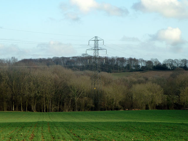
Buxted Wood is a picturesque woodland located in East Sussex, England. Covering an area of approximately 165 hectares, it is a part of the wider Buxted Park Estate. The wood is situated in the High Weald Area of Outstanding Natural Beauty, ensuring its protected status and contributing to its rich biodiversity.

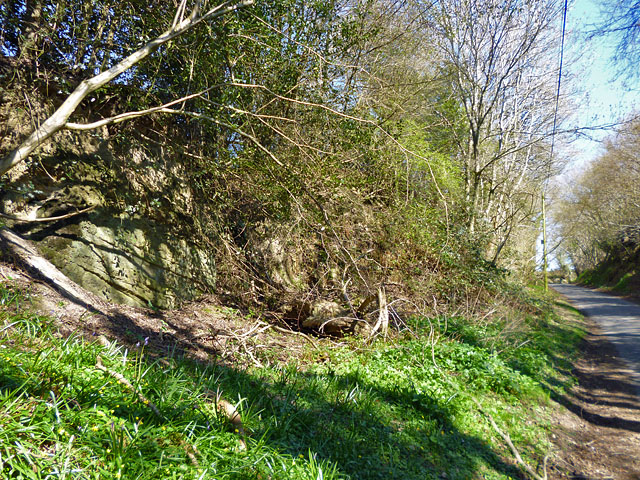
The woodland is predominantly made up of broadleaved trees, with species such as oak, beech, ash, and birch dominating the landscape. These trees form a dense canopy, creating a shaded and tranquil environment for visitors to enjoy. In spring, the forest floor comes alive with a vibrant carpet of bluebells, adding a splash of color to the scenery.

Buxted Wood is home to a diverse range of wildlife, providing a habitat for numerous species. Birdwatchers will be delighted to spot woodland birds including nuthatches, woodpeckers, and tawny owls. The wood is also inhabited by mammals such as deer, foxes, and badgers, which can occasionally be seen roaming through the undergrowth.

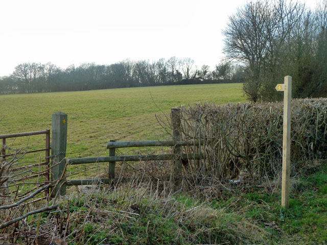
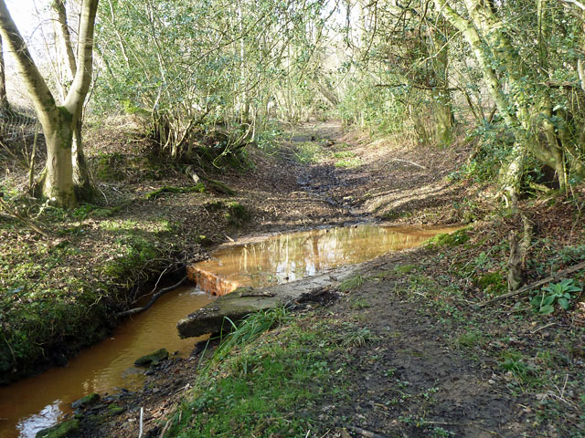
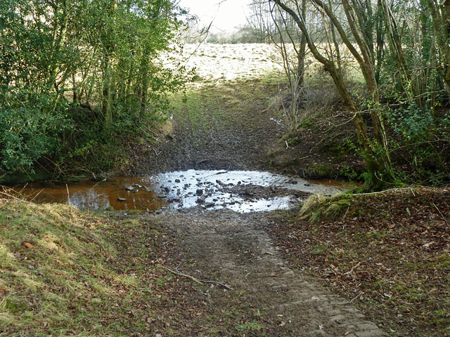
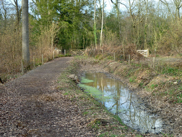
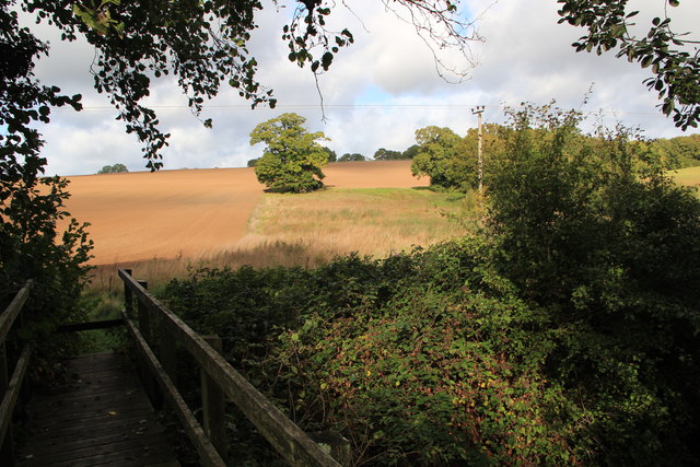
A network of well-maintained footpaths and trails crisscrosses the wood, enabling visitors to explore its beauty on foot. The paths wind through ancient trees, past tranquil ponds, and alongside babbling streams. These trails offer opportunities for walking, jogging, and horse riding, catering to a variety of outdoor enthusiasts.

Buxted Wood provides a peaceful escape from the busy modern world, allowing visitors to reconnect with nature and enjoy the beauty of the Sussex countryside. With its diverse wildlife, stunning flora, and well-maintained trails, it is a haven for those seeking tranquility and a deeper connection with the natural world.

If you have any feedback on the listing, please let us know in the comments section below.
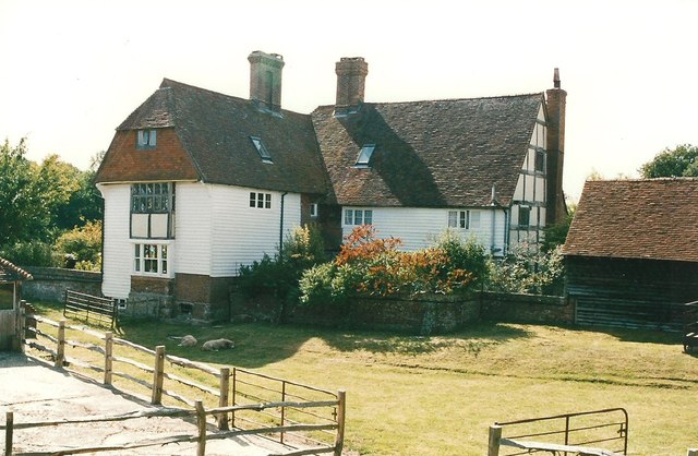
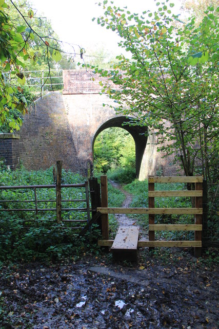
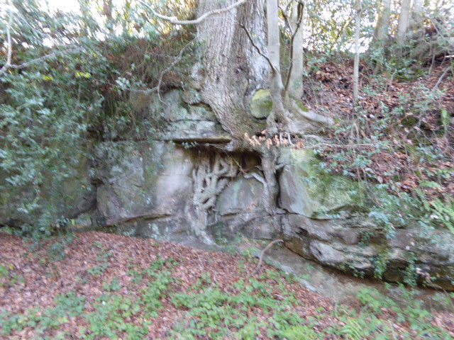
Buxted Wood Images

Images are sourced within 2km of 51.012616/0.15913529 or Grid Reference TQ5125. Thanks to Geograph Open Source API. All images are credited.

A pull-in on the A272 A useful thing to remember on this sort of road, the trouble is, they are often hogged by a lorry. This is by the entrance to Five Chimneys Cottage, according to the sign. The road here is called The Toll, a clue to its turnpike origins.
A pull-in on the A272
A useful thing to remember on this sort of road, the trouble is, they are often hogged by a lorry. This is by the entrance to Five Chimneys Cottage, according to the sign. The road here is called The Toll, a clue to its turnpike origins.
Footpath towards Tibbs Mill Lane Path Hadlow Down 7 starts here on Hastingford Lane.
Footpath towards Tibbs Mill Lane
Path Hadlow Down 7 starts here on Hastingford Lane.
Pylon and woods The near woodland runs along a gill for some considerable distance.
Pylon and woods
The near woodland runs along a gill for some considerable distance.
Ford on footpath Rotherfield 3b The otherwise excellent East Sussex interactive rights of way map marks this with a bridge. There was no sign of any bridge being here in the recent past. Fortunately the stream is narrow enough to jump on the left.
Ford on footpath Rotherfield 3b
The otherwise excellent East Sussex interactive rights of way map marks this with a bridge. There was no sign of any bridge being here in the recent past. Fortunately the stream is narrow enough to jump on the left.
Ford on footpath Rotherfield 51 The otherwise excellent East Sussex interactive rights of way map marks this with a bridge, so does the OS map. There was no sign here of there ever being a bridge. Perhaps it lurks in the undergrowth a little further up the stream?
Ford on footpath Rotherfield 51
The otherwise excellent East Sussex interactive rights of way map marks this with a bridge, so does the OS map. There was no sign here of there ever being a bridge. Perhaps it lurks in the undergrowth a little further up the stream?
Bridleway Buxted 36b A bridleway improved not so long ago, and consequently pleasant going. The wayside pond is a nice feature.
Bridleway Buxted 36b
A bridleway improved not so long ago, and consequently pleasant going. The wayside pond is a nice feature.
Land near Hastingford Farm The river Uck runs behind the trees on the right of the photo.
Land near Hastingford Farm
The river Uck runs behind the trees on the right of the photo.
Drive to Huggetts Furnace Farm
Rocky bank on Fowly Lane An Ardingly Sandstone exposure by the lane which passes though a sunken section on the hill up from a stream valley.
Rocky bank on Fowly Lane
An Ardingly Sandstone exposure by the lane which passes though a sunken section on the hill up from a stream valley.
Hastingford Lane at River Uck bridge There is a curious skew crossing here. The posts on the left protect the west parapet of the bridge, which is opposite the drive on the right. The east parapet is out of shot this side of the drive.
Hastingford Lane at River Uck bridge
There is a curious skew crossing here. The posts on the left protect the west parapet of the bridge, which is opposite the drive on the right. The east parapet is out of shot this side of the drive.
London Bound Looking from a pedestrian and agricultural bridge over the London-Uckfield line at the London bound train on its way.
London Bound
Looking from a pedestrian and agricultural bridge over the London-Uckfield line at the London bound train on its way.
Cloud form Cumulus cloud over a field in Wealden, East Sussex
Cloud form
Cumulus cloud over a field in Wealden, East Sussex
Railway Viaduct , Uckfield Line This is on a slight curve, with this view of the convex side.
Railway Viaduct , Uckfield Line
This is on a slight curve, with this view of the convex side.
Huggett's Furnace Huggett's Furnace, an Ironmaster's House.  The iron industry has existed in Sussex since Roman times.  It is claimed that Master Huggett made the first cannon in 1543. A well known little ditty goes:
Master Huggett and his son John,
They did cast the first cannon.
The iron industry in Sussex flourished until 1828 when the last furnace closed.
Huggett's Furnace
Huggett's Furnace, an Ironmaster's House. The iron industry has existed in Sussex since Roman times. It is claimed that Master Huggett made the first cannon in 1543. A well known little ditty goes: Master Huggett and his son John, They did cast the first cannon. The iron industry in Sussex flourished until 1828 when the last furnace closed.
Huggett's Furnace Huggett's Furnace, an Ironmaster's House.  The iron industry has existed in Sussex since Roman Times.  It is claimed that Master Huggett made the first cannon in 1543   A well-known little ditty goes
Master Huggett and his son John,
They did cast the first Cannon.

The iron industry in Sussex flourished until 1828, when the last furnace closed.
Huggett's Furnace
Huggett's Furnace, an Ironmaster's House. The iron industry has existed in Sussex since Roman Times. It is claimed that Master Huggett made the first cannon in 1543 A well-known little ditty goes Master Huggett and his son John, They did cast the first Cannon. The iron industry in Sussex flourished until 1828, when the last furnace closed.
Rail Tunnel at Stones Rough This is where the Vanguard Way footpath crosses under the railway near Buxted
Rail Tunnel at Stones Rough
This is where the Vanguard Way footpath crosses under the railway near Buxted
Footbridge over River Uck Part of the Vanguard Way.  The Oak in the centre of the picture is hiding a pillbox.
Footbridge over River Uck
Part of the Vanguard Way. The Oak in the centre of the picture is hiding a pillbox.
Five Chimneys Oast, Curtains Hill, Hadlow Down Single round kiln oast house, missing cowl.
Five Chimneys Oast, Curtains Hill, Hadlow Down
Single round kiln oast house, missing cowl.
Show me another place!

Buxted Wood is located at Grid Ref: TQ5125 (Lat: 51.012616, Lng: 0.15913529)

Administrative County: East Sussex

District: Wealden

Police Authority: Sussex

What 3 Words

///window.adapt.overpaid. Near Buxted, East Sussex

Nearby Locations

Buxted Wood Grove Wood

Related Wikis

Hastingford Cutting

Hastingford Cutting is a 0.04-hectare (0.099-acre) geological Site of Special Scientific Interest south of Crowborough in East Sussex. It is a Geological...

Stockland Farm Meadows

Stockland Farm Meadows is a 5.8-hectare (14-acre) biological Site of Special Scientific Interest south of Crowborough in East Sussex.These two species...

Hadlow Down

Hadlow Down is a village and civil parish in the Wealden District of East Sussex, England. It is located on the A272 road three miles (4.8 km) north-west...

Richard Hill (RAF officer)

Lieutenant Richard Frank Hill (28 April 1899 – 17 September 1918) was a British World War I flying ace credited with seven aerial victories. == Biography... ==

High Hurstwood

High Hurstwood is a village in the Wealden district of East Sussex. == External links == High Hurstwood village history Holy Trinity Church, High Hurstwood...

St Mark's Church, Hadlow Down

St Mark's Church (dedicated to St Mark the Evangelist) is an Anglican church in the village of Hadlow Down in the district of Wealden, one of six local...

Five Ash Down Independent Chapel

Five Ash Down Independent Chapel is an independent Evangelical church in the Reformed (Calvinist) tradition in the hamlet of Five Ash Down, East Sussex...

Providence Chapel, Hadlow Down

Providence Chapel is a former independent Calvinistic place of worship in the village of Hadlow Down in Wealden, one of six local government districts...

Nearby Amenities

Located within 500m of 51.012616,0.15913529
ROTHERFIELDNo1
Disused: yes
Man Made: petroleum_well
Ref GB Decc: LS/26-8
Source: DECC
Lat/Long: 51.015/0.1650556
Barrier: stile
Lat/Long: 51.0101279/0.1565489
Barrier: stile
Lat/Long: 51.0132617/0.1560334
Barrier: stile
Lat/Long: 51.0133536/0.1569402
Barrier: stile
Lat/Long: 51.0144394/0.1582314
Barrier: stile
Lat/Long: 51.0145334/0.1582835
Waterway: waterfall
Lat/Long: 51.0136222/0.155027
The data included in this document is from www.openstreetmap.org. The data is made available under ODbL.

Have you been to Buxted Wood?

Leave your review of Buxted Wood below (or comments, questions and feedback).