Clayton's Wood
Wood, Forest in Kent Tunbridge Wells
England
Clayton's Wood

Clayton's Wood, located in the county of Kent, is a serene and picturesque forest that covers an area of approximately 100 acres. Nestled amidst the rolling countryside, this woodland haven provides a tranquil escape for nature enthusiasts and outdoor adventurers alike.
The woodland is characterized by its diverse range of tree species, including oak, beech, and birch, which create a rich and varied ecosystem. The dense canopy allows only dappled sunlight to filter through, creating a mystical ambiance as it illuminates the forest floor.
Walking through Clayton's Wood, one can encounter an array of wildlife. The forest is home to a variety of bird species, such as woodpeckers, owls, and thrushes, adding a melodic soundtrack to the natural surroundings. Additionally, small mammals like foxes, rabbits, and squirrels can often be spotted darting through the undergrowth.
Trails wind their way through the forest, providing visitors with the opportunity to explore its beauty at their own pace. These well-maintained paths offer a sense of tranquility, inviting individuals to immerse themselves in the peacefulness of the woodland. Along the way, there are numerous benches strategically placed, allowing visitors to rest and absorb the serenity of the surroundings.
Moreover, Clayton's Wood is a popular destination for outdoor activities such as hiking, nature photography, and picnicking. Its natural beauty and peaceful atmosphere make it an ideal spot for families and individuals seeking a break from the bustling city life.
In conclusion, Clayton's Wood in Kent is a captivating forest that enchants visitors with its diverse flora and fauna, serene trails, and tranquil ambiance. It serves as an idyllic retreat for those seeking solace in nature's embrace and offers a glimpse into the beauty of Kent's countryside.
If you have any feedback on the listing, please let us know in the comments section below.
Clayton's Wood Images
Images are sourced within 2km of 51.121083/0.15833022 or Grid Reference TQ5137. Thanks to Geograph Open Source API. All images are credited.


Clayton's Wood is located at Grid Ref: TQ5137 (Lat: 51.121083, Lng: 0.15833022)
Administrative County: Kent
District: Tunbridge Wells
Police Authority: Kent
What 3 Words
///plea.spearing.sprain. Near Groombridge, East Sussex
Nearby Locations
Related Wikis
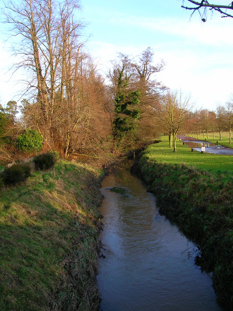
River Grom
The River Grom is a short tributary of the River Medway near Tunbridge Wells in south-east England. Flowing westwards through High Rocks and Groombridge...

Arun Valley line
The Arun Valley line, also known as the Mid Sussex line, is part of the Southern- and Thameslink-operated railway services. For the initial part of the...

Ashurst railway station
Ashurst railway station is on the Uckfield branch of the Oxted line in southern England and serves Ashurst in Kent (very close to the East Sussex border...
Ashurst, Kent
Ashurst is a village and former civil parish, now in the parish of Speldhurst, in the Tunbridge Wells district, in the county of Kent, England. It is 5...

Stone Cross, Tunbridge Wells
The placename Stone Cross occurs in several parts of England, including two other smaller places in Kent: one near Sandwich, and one southeast of Ashford...

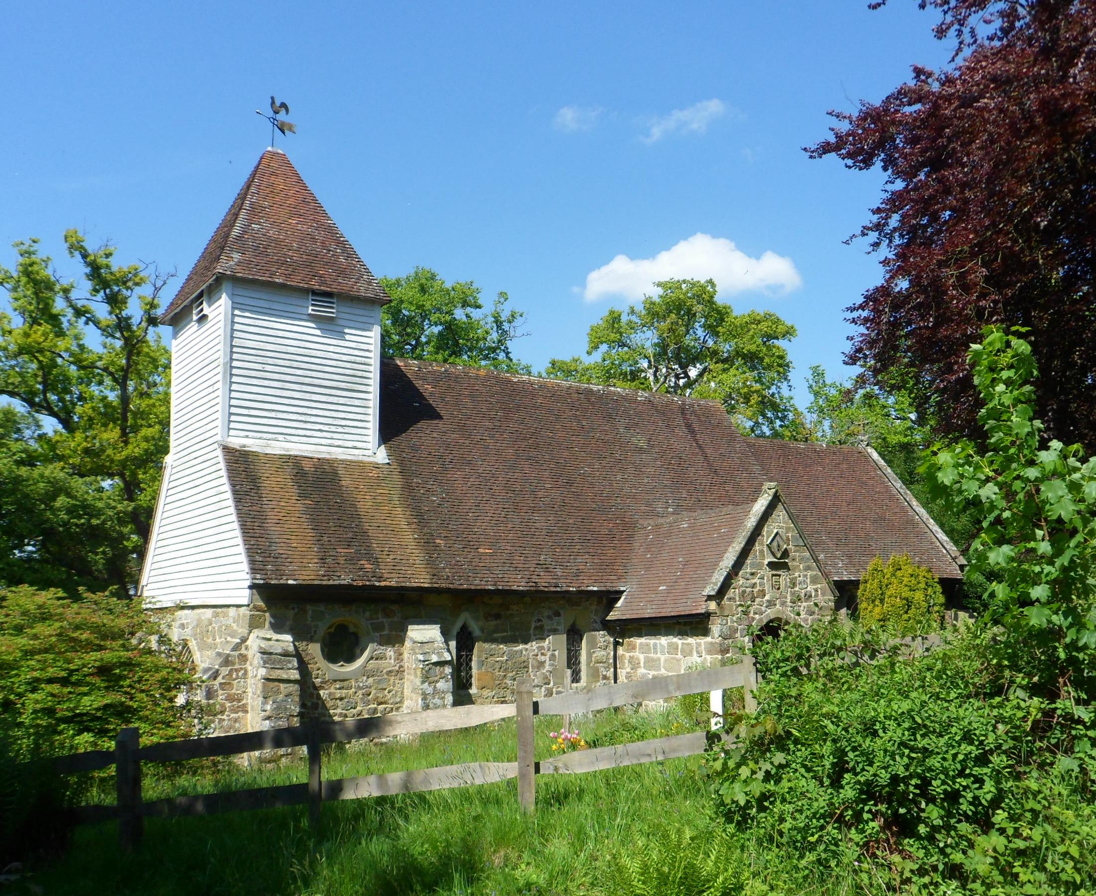
Blackham
Blackham is a village in the Wealden district of East Sussex. It lies within the Withyham civil parish. Its nearest town is Royal Tunbridge Wells, which...
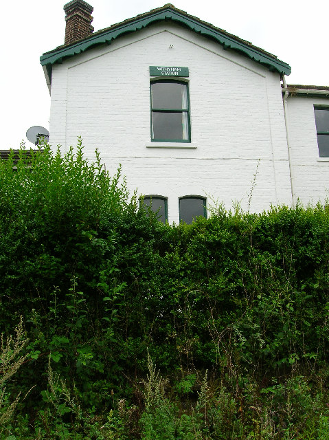
Withyham railway station
Withyham was a railway station on the Three Bridges to Tunbridge Wells Central Line which closed in 1967, a casualty of the Beeching Axe. The station opened...
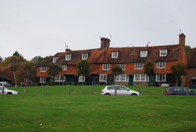
Groombridge
Groombridge is a village of about 1,600 people. It straddles the border between Kent and East Sussex, in England. The nearest large town is Royal Tunbridge...
Nearby Amenities
Located within 500m of 51.121083,0.15833022Have you been to Clayton's Wood?
Leave your review of Clayton's Wood below (or comments, questions and feedback).