Avenue Wood
Wood, Forest in Essex
England
Avenue Wood
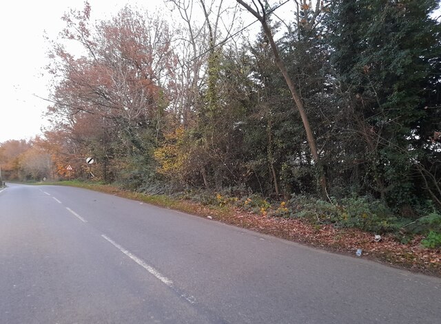
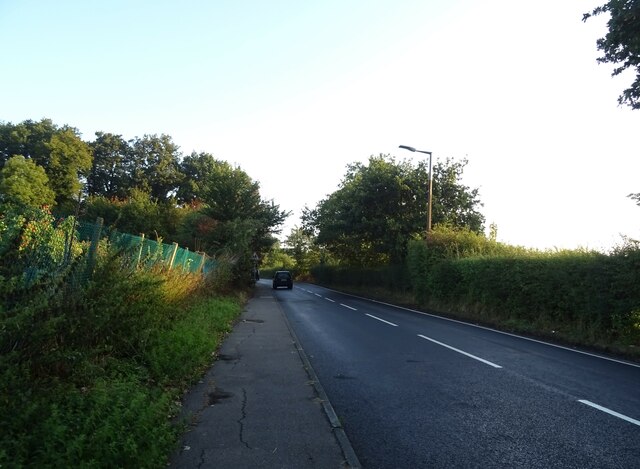
Avenue Wood, located in Essex, England, is a picturesque woodland area known for its natural beauty and serene atmosphere. Situated within the larger Forest of Essex, Avenue Wood is a popular destination for nature lovers and outdoor enthusiasts.
The woodland is characterized by a variety of tall, mature trees, including oak, beech, and birch, which provide a dense canopy that offers shade and shelter. The forest floor is covered with a rich carpet of mosses, ferns, and wildflowers, adding to the enchanting allure of the area.
A network of well-maintained paths and trails wind through Avenue Wood, allowing visitors to explore and appreciate its natural wonders. These pathways provide access to different parts of the woodland, each offering unique sights and experiences. Along the way, visitors may encounter an abundance of wildlife, including squirrels, rabbits, and various species of birds.
Avenue Wood is a haven for birdwatchers, as it serves as a nesting ground and migratory stopover for numerous avian species. Ornithologists and bird enthusiasts can spot woodpeckers, owls, and many other feathered friends amidst the tranquil setting of the woodland.
The forest is also home to a diverse array of plant life, with numerous rare and protected species finding refuge within its boundaries. Conservation efforts have been undertaken in Avenue Wood to ensure the preservation of these precious plants and the overall ecological balance of the area.
Overall, Avenue Wood in Essex provides visitors with a peaceful retreat from the hustle and bustle of urban life. Its natural beauty, varied wildlife, and well-maintained trails make it a perfect destination for a leisurely stroll or a day of exploration in the heart of nature.
If you have any feedback on the listing, please let us know in the comments section below.
Avenue Wood Images
Images are sourced within 2km of 51.616719/0.17140872 or Grid Reference TQ5093. Thanks to Geograph Open Source API. All images are credited.


Avenue Wood is located at Grid Ref: TQ5093 (Lat: 51.616719, Lng: 0.17140872)
Unitary Authority: Havering
Police Authority: Metropolitan
What 3 Words
///ropes.defend.until. Near Collier Row, London
Nearby Locations
Related Wikis

Havering Country Park
Havering Country Park is a varied environment open space in the London Borough of Havering. It includes 100 acres (0.40 km2) of woodland. It is one of...

Havering Palace
Havering Palace was an old royal residence in England, in the village of Havering-atte-Bower (formerly in Essex, since 1965 in the London Borough of Havering...

Church of St John the Evangelist, Havering-atte-Bower
St John the Evangelist, Havering-atte-Bower is a Church of England religious building in the village of Havering-atte-Bower, an outlying settlement of...
Bower House
The Bower House is a grade I listed Palladian mansion in Havering-atte-Bower, England. It was built in 1729 by Henry Flitcroft. The stable block is separately...

The Round House (Havering)
The Round House is a Grade II* listed late Georgian elliptical stuccoed villa located on Broxhill Road in Havering-atte-Bower, London. The house was built...
Havering-atte-Bower
Havering-atte-Bower () is a village in Greater London, England, in the far north of the London Borough of Havering. The village lies 15 miles (24 km) northeast...
Bower Park Academy
Bower Park Academy is a secondary school with academy status, located in the Romford area of the London Borough of Havering, London, England. == History... ==

Bedfords Park
Bedfords Park is public open space of 215 acres or approximately 87½ hectares near Havering-atte-Bower in the London Borough of Havering in England. It...
Nearby Amenities
Located within 500m of 51.616719,0.17140872Have you been to Avenue Wood?
Leave your review of Avenue Wood below (or comments, questions and feedback).