Anisbirches Wood

Wood, Forest in Kent Sevenoaks

England

Anisbirches Wood

M25 Clockwise Situated just behind the Polhill Arms on the A224 this spectacular bridge - a landmark for thousands of travellers each day - carries a small track over the M25 where the motorway itself crosses over the London to Sevenoaks railway
M25 Clockwise Credit: rafflesbear

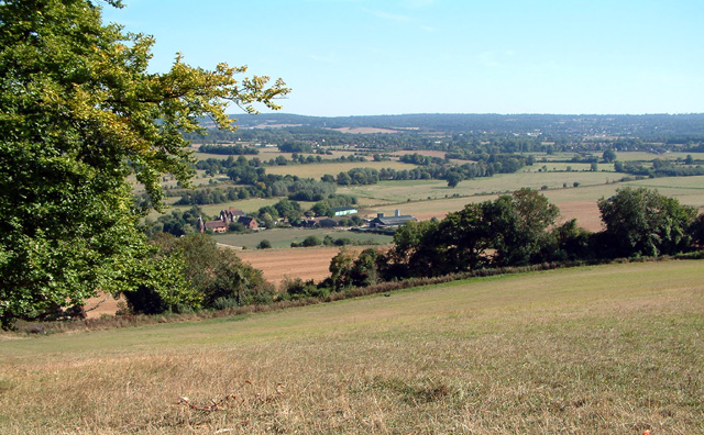
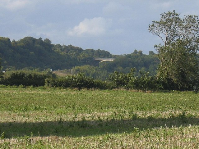
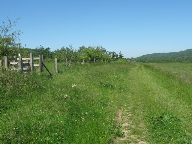
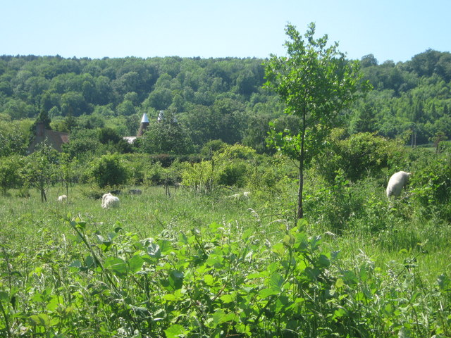
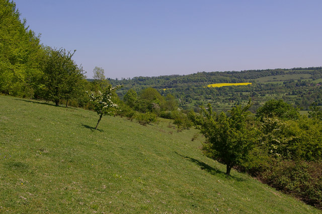
Anisbirches Wood is a picturesque forest located in Kent, England. Covering an area of approximately 100 acres, it is known for its stunning natural beauty and diverse wildlife. The wood is named after the abundance of birch trees found within its boundaries, which lend an enchanting atmosphere to the surroundings.

The wood is easily accessible, with well-maintained footpaths and trails that allow visitors to explore its various features. Walking through the wood, one can admire the towering birch trees, their slender trunks reaching towards the sky, while the rustling of leaves creates a soothing ambiance. The woodland floor is covered with a carpet of vibrant wildflowers during the spring and summer months, adding bursts of color to the landscape.

Anisbirches Wood is home to a wide range of wildlife, including various bird species, small mammals, and insects. Birdwatchers can look out for woodpeckers, nuthatches, and tawny owls among the trees. The wood also provides a habitat for deer, foxes, and badgers, making it a popular spot for nature enthusiasts and photographers.

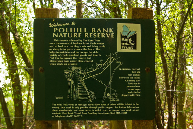
The wood is managed by a local conservation group, ensuring the preservation of its natural features and biodiversity. Visitors are encouraged to respect the environment and abide by the guidelines provided, such as refraining from littering and keeping dogs on a leash.

Anisbirches Wood offers a tranquil escape from the bustle of city life, providing a serene environment for relaxation, nature walks, and wildlife observation. Whether one seeks solitude or a family outing, this enchanting woodland is a must-visit destination in Kent.

If you have any feedback on the listing, please let us know in the comments section below.

Anisbirches Wood Images

Images are sourced within 2km of 51.311285/0.15179058 or Grid Reference TQ5059. Thanks to Geograph Open Source API. All images are credited.

M25 Clockwise Situated just behind the Polhill Arms on the A224 this spectacular bridge - a landmark for thousands of travellers each day - carries a small track over the M25 where the motorway itself crosses over the London to Sevenoaks railway
M25 Clockwise
Situated just behind the Polhill Arms on the A224 this spectacular bridge - a landmark for thousands of travellers each day - carries a small track over the M25 where the motorway itself crosses over the London to Sevenoaks railway
Darent Valley showing Filston Hall & Farm View looking south-east from the hillside between Meenfield Wood and Pilot's Wood, showing the Darent Valley which lies to the north of Sevenoaks, Kent.
Darent Valley showing Filston Hall & Farm
View looking south-east from the hillside between Meenfield Wood and Pilot's Wood, showing the Darent Valley which lies to the north of Sevenoaks, Kent.
M25 hidden by trees
M25 hidden by trees
Bridge Over The   M25 This sweeping span carries a bridle path across the M25 near Halstead and Shoreham Kent
Bridge Over The M25
This sweeping span carries a bridle path across the M25 near Halstead and Shoreham Kent
The 'Polhill Arms', near Halstead, Kent The Polhill Arms stands on the A224 (former A21) where it runs very close to the M25 motorway, which bisects this grid square from north to south.  But from the pub, a path run via a footbridge over the motorway, into the lovely Pilots Wood, especially worth a visit at bluebell time.
The 'Polhill Arms', near Halstead, Kent
The Polhill Arms stands on the A224 (former A21) where it runs very close to the M25 motorway, which bisects this grid square from north to south. But from the pub, a path run via a footbridge over the motorway, into the lovely Pilots Wood, especially worth a visit at bluebell time.
Bridle Path Span This bridge carries a bridle path over the M25 it is the only bridge in this area of the Motorway with the supporting arch type of construction. You can see a view of it from the road at <a href="https://www.geograph.org.uk/photo/10406">TQ5060 : M25 Clockwise</a>.
Bridle Path Span
This bridge carries a bridle path over the M25 it is the only bridge in this area of the Motorway with the supporting arch type of construction. You can see a view of it from the road at TQ5060 : M25 Clockwise.
View From The Bridle Path Bridge This is the M25 looking southbound viewed from the bridle path bridge that can be seen in  <a href="https://www.geograph.org.uk/photo/10406">TQ5060 : M25 Clockwise</a>.
View From The Bridle Path Bridge
This is the M25 looking southbound viewed from the bridle path bridge that can be seen in TQ5060 : M25 Clockwise.
M25 Northbound Oh the joys of Classic Car motoring! The MG came to an unscheduled stop a few moments before, northbound on the M25. The shot was taken from

 <a href="https://www.geograph.org.uk/photo/191465">TQ5060 : Bridle Path Span</a>
M25 Northbound
Oh the joys of Classic Car motoring! The MG came to an unscheduled stop a few moments before, northbound on the M25. The shot was taken from TQ5060 : Bridle Path Span
Polhill Bank Nature Reserve Chalk downland managed by the Kent Wildlife Trust (see <a href="https://www.geograph.org.uk/photo/796306">TQ5060 : Polhill Bank Nature Reserve sign</a> for picture of sign)
Polhill Bank Nature Reserve
Chalk downland managed by the Kent Wildlife Trust (see TQ5060 : Polhill Bank Nature Reserve sign for picture of sign)
Polhill Bank Nature Reserve sign Sign at entrance to reserve (see <a href="https://www.geograph.org.uk/photo/796305">TQ5060 : Polhill Bank Nature Reserve</a>).
Polhill Bank Nature Reserve sign
Sign at entrance to reserve (see TQ5060 : Polhill Bank Nature Reserve).
Polhill Arms Compare with <a href="https://www.geograph.org.uk/photo/163651">TQ5060 : The 'Polhill Arms', near Halstead, Kent</a> - it now has a hanging sign, missing from the earlier photo.
Polhill Arms
Compare with TQ5060 : The 'Polhill Arms', near Halstead, Kent - it now has a hanging sign, missing from the earlier photo.
M25, view from Bridlepath, near Halstead, Kent
M25, view from bridlepath near Halstead Kent
Polhill, near Halstead, Kent
Car Dealer, London Road, near Halstead, Kent
Bridge over M25 The M25 is a 117 mile orbital motorway that encircles London. It was constructed between 1975 and 1986.
The motorway is not a continuous loop as a section to the East of London at The Dartford Crossing is an A-Road.
Wikipedia; <span class="nowrap"><a title="http://en.wikipedia.org/wiki/M25_motorway" rel="nofollow ugc noopener" href="http://en.wikipedia.org/wiki/M25_motorway">Link</a><img style="margin-left:2px;" alt="External link" title="External link - shift click to open in new window" src="https://s1.geograph.org.uk/img/external.png" width="10" height="10"/></span>
Bridge over M25
The M25 is a 117 mile orbital motorway that encircles London. It was constructed between 1975 and 1986. The motorway is not a continuous loop as a section to the East of London at The Dartford Crossing is an A-Road. Wikipedia; LinkExternal link
Footpath junction near Sepham Farm Path No.SR10 from Twitton Lane, leads past Sepham Farm to Filston Farm. Another path heads left over a stile into an orchard and heads to M25 footbridge towards Polhill.
Footpath junction near Sepham Farm
Path No.SR10 from Twitton Lane, leads past Sepham Farm to Filston Farm. Another path heads left over a stile into an orchard and heads to M25 footbridge towards Polhill.
Sheep in Orchard, near Sepham Farm Sepham Farm Oast in the background.
Sheep in Orchard, near Sepham Farm
Sepham Farm Oast in the background.
Show me another place!

Anisbirches Wood is located at Grid Ref: TQ5059 (Lat: 51.311285, Lng: 0.15179058)

Administrative County: Kent

District: Sevenoaks

Police Authority: Kent

What 3 Words

///rides.common.games. Near Otford, Kent

Related Wikis

Related Videos

Knockholt Circular: Scenic Hiking Trails Near London | UK Walking Tours 🇬🇧

Embark on an adventure as we explore the picturesque trails of the Knockholt Circular, a hidden gem near London. From its lush ...

Walks in Kent. Shoreham to Lullingstone Park.

A very pleasant route through the Darrent Valley that passes Lullingstone Castle, which has a fascinating World Garden and lies ...

8 Andrews Wood Aug 2022

A morning Bank Holiday walk in a picturesque wood near Shoreham, Kent.

Nearby Amenities

Located within 500m of 51.311285,0.15179058
Old Grove
Natural: wood
Source: os_street_view
Lat/Long: 51.3145193/0.1545162
Barrier: stile
Lat/Long: 51.3084183/0.1547709
The data included in this document is from www.openstreetmap.org. The data is made available under ODbL.

Have you been to Anisbirches Wood?

Leave your review of Anisbirches Wood below (or comments, questions and feedback).