Keysden Wood

Wood, Forest in Kent Sevenoaks

England

Keysden Wood

Wealden field south of Blackham The soil lies damp here.
Wealden field south of Blackham Credit: Jonathan Billinger

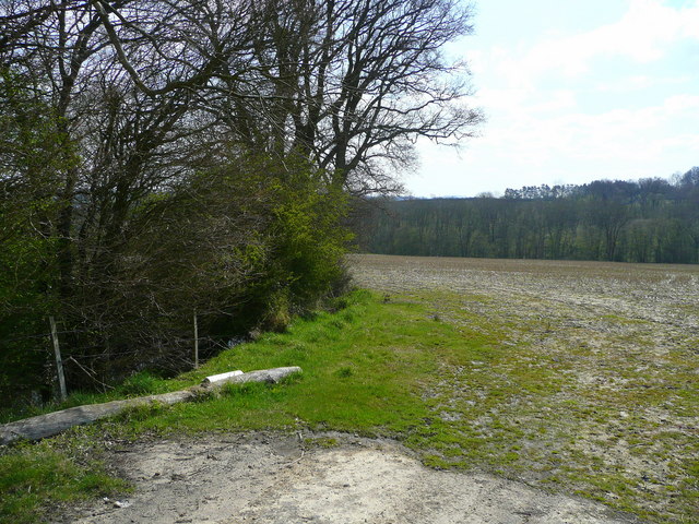
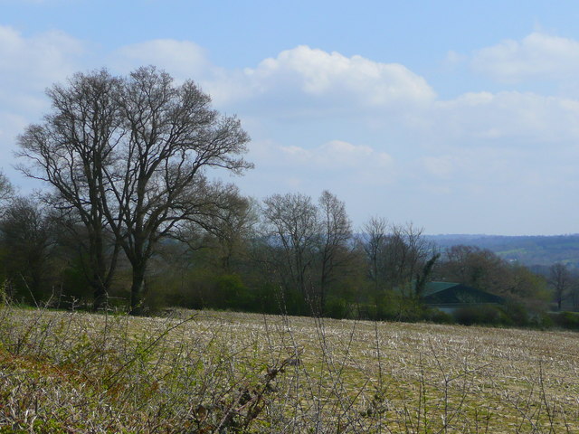
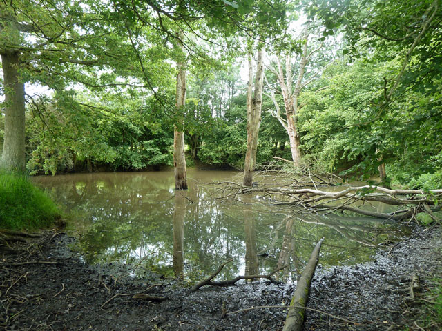
Keysden Wood is a picturesque woodland located in the county of Kent, England. Situated near the village of Keysden, the wood covers an area of approximately 100 acres and is known for its diverse flora and fauna.

The woodland is primarily composed of broadleaf trees, including oak, beech, and ash, which create a dense canopy that provides shade and shelter for a variety of wildlife. Bluebells carpet the forest floor during the spring months, creating a stunning display of vibrant colors.

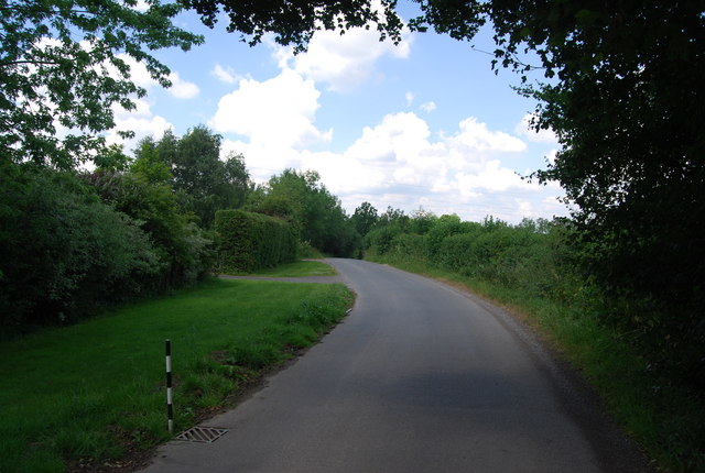
The wood is crisscrossed by a network of footpaths, making it an ideal destination for nature enthusiasts and hikers. These trails allow visitors to explore the wood at their own pace, immersing themselves in the tranquil surroundings and enjoying the sounds of birdsong.

Wildlife is abundant in Keysden Wood, with many species calling it home. Deer can often be spotted grazing in the early morning or evening, and the wood is also home to a variety of birds, including woodpeckers, owls, and songbirds. Squirrels scurry through the trees, adding to the lively atmosphere of the wood.

Keysden Wood is a popular destination for both locals and tourists, offering a peaceful retreat from the hustle and bustle of everyday life. Whether it's a leisurely stroll or a more challenging hike, this woodland provides a serene and beautiful setting for outdoor activities.

If you have any feedback on the listing, please let us know in the comments section below.

Keysden Wood Images

Images are sourced within 2km of 51.15391/0.13672399 or Grid Reference TQ4941. Thanks to Geograph Open Source API. All images are credited.

Wealden field south of Blackham The soil lies damp here.
Wealden field south of Blackham
The soil lies damp here.
Unploughed field near Blackham A building at Stephnett's Farm can just be seen.
Unploughed field near Blackham
A building at Stephnett's Farm can just be seen.
Oast House, Salehurst, Blackham, East Sussex Single round kiln oast house.
Oast House, Salehurst, Blackham, East Sussex
Single round kiln oast house.
Lane north of Teasley Mead, Blackham
Field near Blackham
Field near Blackham
Lane to Blackham
Lane to Blackham
Summerfields Barn, Blackham
Bridge on lane from Blackham to Ashurst Whether this lane has a name could not be determined.
Bridge on lane from Blackham to Ashurst
Whether this lane has a name could not be determined.
Pond by the railway The railway is not very obvious in this view, but the Uckfield line is on a high embankment behind the pond. A faint horizontal line halfway up the trees is the track.
Pond by the railway
The railway is not very obvious in this view, but the Uckfield line is on a high embankment behind the pond. A faint horizontal line halfway up the trees is the track.
Sandstone outcrop Nearly the most easterly of a long line of crags, most of which are rather overgrown, along the south side of the valley,
Sandstone outcrop
Nearly the most easterly of a long line of crags, most of which are rather overgrown, along the south side of the valley,
A secluded field Having emerged from gill woodland behind the camera, footpath SR537 faintly follows the field margin around the bend to the right.
A secluded field
Having emerged from gill woodland behind the camera, footpath SR537 faintly follows the field margin around the bend to the right.
Curds This pair of cottages are labelled 'Curds' on the larger scale maps. A rather secluded spot, but footpath SR534 does pass them by. In principle this footpath should head straight across the field towards them from the viewpoint.
Curds
This pair of cottages are labelled 'Curds' on the larger scale maps. A rather secluded spot, but footpath SR534 does pass them by. In principle this footpath should head straight across the field towards them from the viewpoint.
View towards Horseshoe Green The large barn is part of Horseshoe Green Farm, and seems to be a milking barn, judging by the number of cows in the yard and the loud humming noise radiating from it when passed at about 16:45.
View towards Horseshoe Green
The large barn is part of Horseshoe Green Farm, and seems to be a milking barn, judging by the number of cows in the yard and the loud humming noise radiating from it when passed at about 16:45.
Pond by road north of Hoath Corner This is one of several in this area, excavated in the Wadhurst Clay either to extract marl for use on more acid soils, or to extract ironstone.
Pond by road north of Hoath Corner
This is one of several in this area, excavated in the Wadhurst Clay either to extract marl for use on more acid soils, or to extract ironstone.
Cowden station, 1987 View NW, towards Oxted and London: ex-London, Brighton & South Coast Railway, London - Oxted - Ashurst - Tunbridge Wells West/Uckfield - Lewes - Brighton/Eridge - Eastbourne lines. Since 8/7/85, when the Tunbridge Wells West line was closed, trains have run through here only to Uckfield. (See also <a href="https://www.geograph.org.uk/photo/3322860">TQ4741 : Cowden station, 1987</a>).
Cowden station, 1987
View NW, towards Oxted and London: ex-London, Brighton & South Coast Railway, London - Oxted - Ashurst - Tunbridge Wells West/Uckfield - Lewes - Brighton/Eridge - Eastbourne lines. Since 8/7/85, when the Tunbridge Wells West line was closed, trains have run through here only to Uckfield. (See also TQ4741 : Cowden station, 1987).
Cowden station, 1987 View SE, towards Ashurst and Uckfield: ex-London, Brighton & South Coast Railway, London - Oxted - Ashurst - Tunbridge Wells West/Uckfield - Lewes - Brighton/Eridge - Eastbourne lines. Since 8/7/85 when the Tunbridge Wells West line closed, trains through here have gone no further than Uckfield. (See also <a href="https://www.geograph.org.uk/photo/3322842">TQ4741 : Cowden station, 1987</a>).
Cowden station, 1987
View SE, towards Ashurst and Uckfield: ex-London, Brighton & South Coast Railway, London - Oxted - Ashurst - Tunbridge Wells West/Uckfield - Lewes - Brighton/Eridge - Eastbourne lines. Since 8/7/85 when the Tunbridge Wells West line closed, trains through here have gone no further than Uckfield. (See also TQ4741 : Cowden station, 1987).
Cowden railway station, Kent Opened in 1888 by the London Brighton & South Coast Railway on the line from Oxted to Uckfield. View north west towards Hever and Oxted.
Cowden railway station, Kent
Opened in 1888 by the London Brighton & South Coast Railway on the line from Oxted to Uckfield. View north west towards Hever and Oxted.
Chiddingstone Hoath, Kent
Show me another place!

Keysden Wood is located at Grid Ref: TQ4941 (Lat: 51.15391, Lng: 0.13672399)

Administrative County: Kent

District: Sevenoaks

Police Authority: Kent

What 3 Words

///vibe.unhelpful.tinted. Near Groombridge, East Sussex

Related Wikis

Chiddingstone Hoath

Chiddingstone Hoath is a hamlet in the Sevenoaks District of Kent, England. Notable buildings include Hoath House, and Stonewall Park, for some time home...

Cowden Meadow

Cowden Meadow is a 1.1-hectare (2.7-acre) biological Site of Special Scientific Interest east of Cowden in Kent.This site has flora which are found on...

Cowden rail crash

The Cowden rail crash occurred on 15 October 1994, near Cowden Station in Kent (UK), when two trains collided head-on, killing five and injuring thirteen...

Cowden railway station

Cowden railway station is on the Uckfield branch of the Oxted line in southern England and serves Cowden in Kent. It is 29 miles 26 chains (29.33 miles...

Blackham

Blackham is a village in the Wealden district of East Sussex. It lies within the Withyham civil parish. Its nearest town is Royal Tunbridge Wells, which...

LeeFest

Neverworld, formerly known as LeeFest, is a music festival that takes place each Summer in Kent, England. The festival began in founder Lee Denny's garden...

Markbeech

Markbeech (sometimes styled Mark Beech) is a village in the civil parish of Hever in the Sevenoaks district of Kent, England. The village is located on...

Ashurst railway station

Ashurst railway station is on the Uckfield branch of the Oxted line in southern England and serves Ashurst in Kent (very close to the East Sussex border...

Nearby Amenities

Located within 500m of 51.15391,0.13672399
Barrier: stile
Lat/Long: 51.153981/0.1382912
Barrier: stile
Lat/Long: 51.1558566/0.1326791
Barrier: stile
Lat/Long: 51.1518996/0.1378184
Barrier: stile
Lat/Long: 51.1539001/0.1358306
The data included in this document is from www.openstreetmap.org. The data is made available under ODbL.

Have you been to Keysden Wood?

Leave your review of Keysden Wood below (or comments, questions and feedback).