Deal Grove

Wood, Forest in Cambridgeshire South Cambridgeshire

England

Deal Grove

Footpath diverging from Sawston Road Footpath diverging from Sawston Road near Church Farm. At the horizon there are the buildings of Sawston visible.
Footpath diverging from Sawston Road Credit: Oda Stoevesandt and Karsten Koehler

Deal Grove is a small village located in the district of Cambridgeshire, England. Nestled amidst the picturesque landscape, it is renowned for its abundant woodlands and lush forests, earning it the nickname "Wood" or "Forest" among locals. The village is situated in close proximity to the historic city of Cambridge, offering a tranquil retreat from the bustling urban environment.

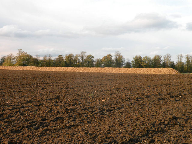
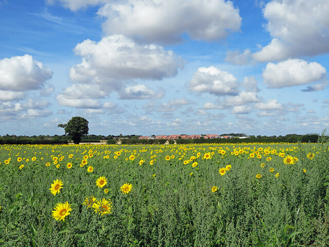
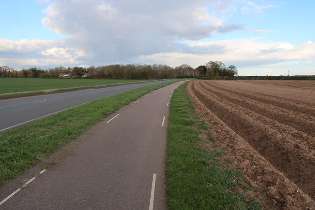
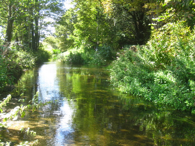
The natural beauty of Deal Grove is one of its main attractions, with vast stretches of woodland covering the area. The forest is home to a diverse range of flora and fauna, providing a haven for nature enthusiasts and hikers. Walking trails and paths meander through the woods, allowing visitors to explore the serene surroundings and immerse themselves in the tranquility of nature.

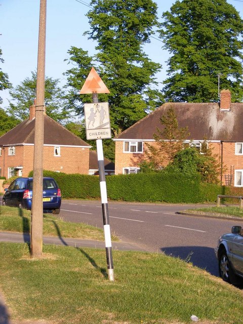
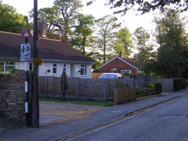
The village itself exudes a charming and idyllic atmosphere, with traditional cottages dotting the landscape. The local community is tight-knit and welcoming, adding to the village's appeal. A small selection of amenities can be found within the village, including a local pub and a village hall, where residents can gather for social events and activities.

Deal Grove's location also offers convenient access to nearby attractions. The city of Cambridge is just a short drive away, providing opportunities for cultural exploration and shopping. Furthermore, the village is well-connected by road and public transportation, making it easily accessible for both residents and visitors.

In summary, Deal Grove in Cambridgeshire offers a peaceful and picturesque retreat, surrounded by woodlands and forests. Its natural beauty and close proximity to Cambridge make it an attractive destination for those seeking a tranquil escape from urban life.

If you have any feedback on the listing, please let us know in the comments section below.
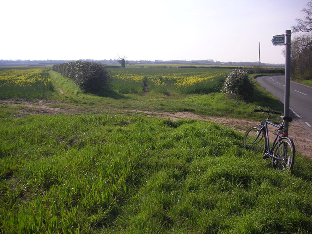
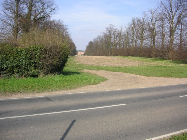
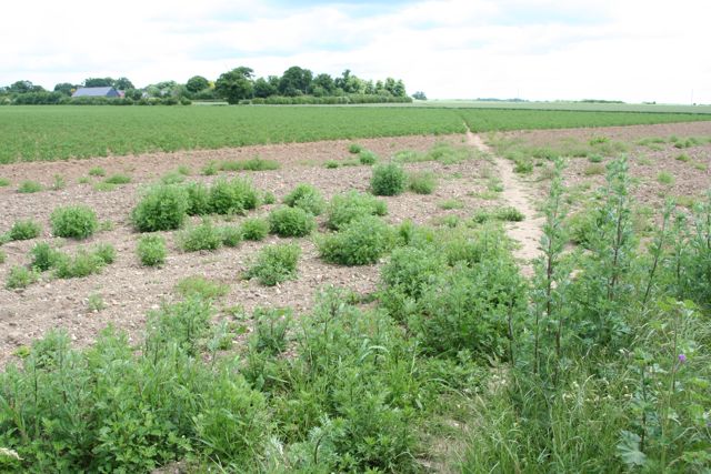
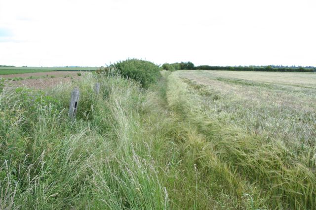
Deal Grove Images

Images are sourced within 2km of 52.131019/0.17211974 or Grid Reference TL4850. Thanks to Geograph Open Source API. All images are credited.

Footpath diverging from Sawston Road Footpath diverging from Sawston Road near Church Farm. At the horizon there are the buildings of Sawston visible.
Footpath diverging from Sawston Road
Footpath diverging from Sawston Road near Church Farm. At the horizon there are the buildings of Sawston visible.
Babraham Hall viewed from Sawston Road Babraham Hall viewed from Sawston Road near Church Farm
Babraham Hall viewed from Sawston Road
Babraham Hall viewed from Sawston Road near Church Farm
Track from Babraham to Sawston At this point it crosses a dismantled railway.
Track from Babraham to Sawston
At this point it crosses a dismantled railway.
Track from Babraham to Sawston Showing the line of the dismantled railway.
Track from Babraham to Sawston
Showing the line of the dismantled railway.
The Great Wall of Sugar-Beet
Sunflowers, sky and the new edge of Sawston Looking west from the cycle path near Church Farm towards the red roofs of the new estate going up off Babraham Road, on the north-eastern edge of Sawston (in <a href="https://www.geograph.org.uk/gridref/TL4950">TL4950</a>).
Sunflowers, sky and the new edge of Sawston
Looking west from the cycle path near Church Farm towards the red roofs of the new estate going up off Babraham Road, on the north-eastern edge of Sawston (in TL4950).
Cyclepath by Sawston Road With the field prepared for potatoes.
Cyclepath by Sawston Road
With the field prepared for potatoes.
Mill Lane, Sawston One of two pre-Worboys road signs that can be found either side of the local school. This sign is across the road from the local fire station.
Mill Lane, Sawston
One of two pre-Worboys road signs that can be found either side of the local school. This sign is across the road from the local fire station.
Mill Lane, Sawston Historic pre-Worboys school road sign as seen from entering from the High Street
Mill Lane, Sawston
Historic pre-Worboys school road sign as seen from entering from the High Street
This way to London Liverpool Street View from the Spicers crossing at Whittlesford.
This way to London Liverpool Street
View from the Spicers crossing at Whittlesford.
River Cam near Mill Farm
Harvested field - Sawston
Harvested field & buildings
Fields by the Cam - Whittlesford
Cycleway to Sawston
Cycleway to Sawston
Harvested field - Sawston
Harvested fields by the Cam
Farmland north of Whittlesford
Show me another place!

Deal Grove is located at Grid Ref: TL4850 (Lat: 52.131019, Lng: 0.17211974)

Administrative County: Cambridgeshire

District: South Cambridgeshire

Police Authority: Cambridgeshire

What 3 Words

///thrashed.slacker.riper. Near Sawston, Cambridgeshire

Nearby Locations

Deal Grove

Related Wikis

Spicer's Sports Ground

Spicers Sports Ground is a cricket ground in Sawston, Cambridgeshire. The first recorded match on the ground was in 1950, when Cambridgeshire played Huntingdonshire...

Sawston

Sawston is a large village in Cambridgeshire in England, situated on the River Cam about seven miles (11 km) south of Cambridge. It has a population of...

Sawston Village College

Sawston Village College is an academy school in Sawston, Cambridgeshire, England. It was previously the first community college in the country and the...
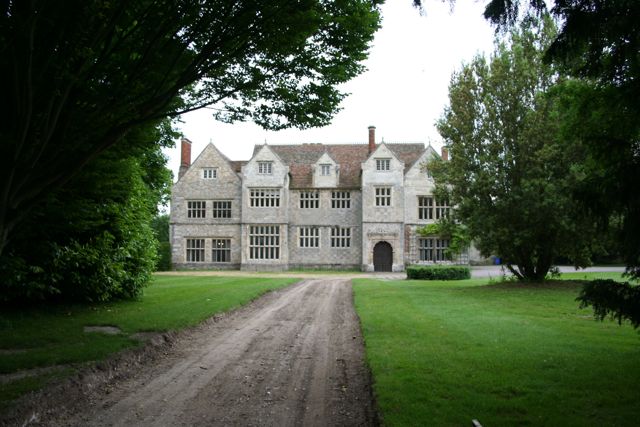
Sawston Hall

Sawston Hall is a Grade I listed Tudor manor house in Sawston, Cambridgeshire dating from the 16th century. It has many fine features, such as the magnificent...

Pampisford

Pampisford is a village, south of Cambridge, on the A505 road near Sawston, Cambridgeshire, England. The remaining section of a defensive ditch, dug to...

Sawston Hall Meadows

Sawston Hall Meadows is a 7.4-hectare (18-acre) biological Site of Special Scientific Interest in Sawston in Cambridgeshire.This site has spring fed peat...

Bottisham Village College

Bottisham Village College is a mixed secondary school located in Bottisham, Cambridgeshire, England. The school opened in 1937 as the second village college...

Dernford Fen

Dernford Fen is a 10.3-hectare (25-acre) biological Site of Special Scientific Interest north-west of Sawston in Cambridgeshire.The site is a rare surviving...

Nearby Amenities

Located within 500m of 52.131019,0.17211974
Man Made: water_tower
Lat/Long: 52.1276289/0.1747296
Post Box
Collection Times: Mo-Fr 16:45; Sa 11:30
Operator: Royal Mail
Post Box Type: wall
Ref: CB22 480
Royal Cypher: EIIR
Royal Cypher Wikidata: Q33102113
Source: survey
Lat/Long: 52.1291868/0.1712367
Post Box
Collection Times: Mo-Fr 17:00; Sa 11:30
Operator: Royal Mail
Post Box Design: type_b
Post Box Type: pillar
Ref: CB22 475
Royal Cypher: GR
Royal Cypher Wikidata: Q33102273
Source: survey
Lat/Long: 52.1267222/0.1710638
Bus Stop
Ashley Way
Naptan AtcoCode: 0500SSAWS006
Naptan Bearing: E
Naptan BusStopType: CUS
Naptan CommonName: Ashley Way
Naptan Indicator: near
Naptan Landmark: Ashley Way
Naptan NaptanCode: cmbgapmd
Naptan ShortCommonName: Ashley Way
Naptan Street: Babraham Road
Naptan Verified: no
Source: naptan_import
Lat/Long: 52.1272651/0.1750504
Bus Stop
Water Tower
Naptan AtcoCode: 0500SSAWS009
Naptan Bearing: S
Naptan CommonName: Water Tower
Naptan Indicator: opp
Naptan Landmark: Babraham Road
Naptan NaptanCode: cmbgapmp
Naptan ShortCommonName: Water Tower
Naptan Street: Sunderland Avenue
Naptan Verified: no
Public Transport: platform
Source: naptan_import
Lat/Long: 52.1269569/0.1746993
Bus Stop
Ashley Way
Naptan AtcoCode: 0500SSAWS013
Naptan Bearing: W
Naptan CommonName: Ashley Way
Naptan Indicator: opp
Naptan Landmark: Ashley Way
Naptan NaptanCode: cmbgaptd
Naptan ShortCommonName: Ashley Way
Naptan Street: Babraham Road
Naptan Verified: no
Source: naptan_import
Lat/Long: 52.1271658/0.1750747
Bus Stop
Queensway
Bus: yes
Naptan AtcoCode: 0500SSAWS016
Naptan Bearing: N
Naptan CommonName: Queensway
Naptan Indicator: opp
Naptan Landmark: Babraham Road
Naptan NaptanCode: cmbgaptm
Naptan ShortCommonName: Queensway
Naptan Street: Churchfield Avenue
Naptan Verified: no
Public Transport: platform
Shelter: yes
Source: naptan_import
Lat/Long: 52.126794/0.1715159
Bus Stop
Churchfield Avenue
Naptan AtcoCode: 0500SSAWS017
Naptan Bearing: E
Naptan CommonName: Churchfield Avenue
Naptan Indicator: opp
Naptan Landmark: Churchfield Avenue
Naptan NaptanCode: cmbgaptp
Naptan ShortCommonName: Churchfield Avenue
Naptan Street: Babraham Road
Naptan Verified: no
Public Transport: platform
Source: naptan_import
Lat/Long: 52.1268934/0.1718033
Generator Method: photovoltaic
Generator Output Electricity: yes
Generator Source: solar
Generator Type: solar_photovoltaic_panel
Location: roof
Power: generator
Lat/Long: 52.1288359/0.1705483
Generator Method: photovoltaic
Generator Output Electricity: yes
Generator Source: solar
Generator Type: solar_photovoltaic_panel
Location: roof
Power: generator
Lat/Long: 52.1290532/0.1715353
Generator Method: photovoltaic
Generator Output Electricity: yes
Generator Source: solar
Generator Type: solar_photovoltaic_panel
Location: roof
Power: generator
Lat/Long: 52.1283543/0.1738206
Generator Method: photovoltaic
Generator Output Electricity: yes
Generator Source: solar
Generator Type: solar_photovoltaic_panel
Location: roof
Power: generator
Lat/Long: 52.1284086/0.1743248
Generator Method: photovoltaic
Generator Output Electricity: yes
Generator Source: solar
Generator Type: solar_photovoltaic_panel
Location: roof
Power: generator
Lat/Long: 52.1283905/0.1742846
Generator Method: photovoltaic
Generator Output Electricity: yes
Generator Source: solar
Generator Type: solar_photovoltaic_panel
Location: roof
Power: generator
Lat/Long: 52.1278076/0.1745126
Generator Method: photovoltaic
Generator Output Electricity: yes
Generator Source: solar
Generator Type: solar_photovoltaic_panel
Location: roof
Power: generator
Lat/Long: 52.1283378/0.1693144
Generator Method: photovoltaic
Generator Output Electricity: yes
Generator Source: solar
Generator Type: solar_photovoltaic_panel
Location: roof
Power: generator
Lat/Long: 52.1284037/0.1692662
Generator Method: photovoltaic
Generator Output Electricity: yes
Generator Source: solar
Generator Type: solar_photovoltaic_panel
Location: roof
Power: generator
Lat/Long: 52.1287313/0.169647
Generator Method: photovoltaic
Generator Output Electricity: yes
Generator Source: solar
Generator Type: solar_photovoltaic_panel
Location: roof
Power: generator
Lat/Long: 52.1291611/0.1704141
Generator Method: photovoltaic
Generator Output Electricity: yes
Generator Source: solar
Generator Type: solar_photovoltaic_panel
Location: roof
Power: generator
Lat/Long: 52.1294163/0.1716372
Generator Method: photovoltaic
Generator Output Electricity: yes
Generator Source: solar
Generator Type: solar_photovoltaic_panel
Location: roof
Power: generator
Lat/Long: 52.1297505/0.1711678
Generator Method: photovoltaic
Generator Output Electricity: yes
Generator Source: solar
Generator Type: solar_photovoltaic_panel
Location: roof
Power: generator
Lat/Long: 52.1300552/0.1711974
Generator Method: photovoltaic
Generator Output Electricity: yes
Generator Source: solar
Generator Type: solar_photovoltaic_panel
Location: roof
Power: generator
Lat/Long: 52.1296666/0.1745394
Generator Method: photovoltaic
Generator Output Electricity: yes
Generator Source: solar
Generator Type: solar_photovoltaic_panel
Location: roof
Power: generator
Lat/Long: 52.1302182/0.172745
Generator Method: photovoltaic
Generator Output Electricity: yes
Generator Source: solar
Generator Type: solar_photovoltaic_panel
Location: roof
Power: generator
Lat/Long: 52.1294196/0.16958
Generator Method: photovoltaic
Generator Output Electricity: yes
Generator Source: solar
Generator Type: solar_photovoltaic_panel
Location: roof
Power: generator
Lat/Long: 52.1297785/0.1700467
Street Lamp
Lat/Long: 52.1278928/0.1670735
Street Lamp
Lat/Long: 52.1276672/0.1674181
Street Lamp
Lat/Long: 52.1281921/0.1670258
Street Lamp
Lat/Long: 52.128502/0.1667308
Street Lamp
Lat/Long: 52.1293142/0.1657967
Street Lamp
Lat/Long: 52.1290734/0.1661065
Street Lamp
Lat/Long: 52.1287914/0.1664445
Power: pole
Source: Bing
Lat/Long: 52.1291397/0.1660931
Power: pole
Source: Bing
Lat/Long: 52.1294945/0.1659255
The data included in this document is from www.openstreetmap.org. The data is made available under ODbL.

Have you been to Deal Grove?

Leave your review of Deal Grove below (or comments, questions and feedback).