Grange Wood

Wood, Forest in Lincolnshire East Lindsey

England

Grange Wood

Dam Close and Willoughby: aerial 2021 "Dam Close" appears to be two fortified enclosures with entrances on the north and south sides. The banks have been reduced in height to the north west and end in a small hollow and subsidiary enclosure. To the south east the area has been levelled. There are no signs of foundations within the enclosure. See:
<span class="nowrap"><a title="http://www.heritagegateway.org.uk/Gateway/Results_Single.aspx?uid=MLI42004&resourceID=1006" rel="nofollow ugc noopener" href="http://www.heritagegateway.org.uk/Gateway/Results_Single.aspx?uid=MLI42004&resourceID=1006">Link</a><img style="margin-left:2px;" alt="External link" title="External link - shift click to open in new window" src="https://s1.geograph.org.uk/img/external.png" width="10" height="10"/></span>
Dam Close and Willoughby: aerial 2021 Credit: Simon Tomson

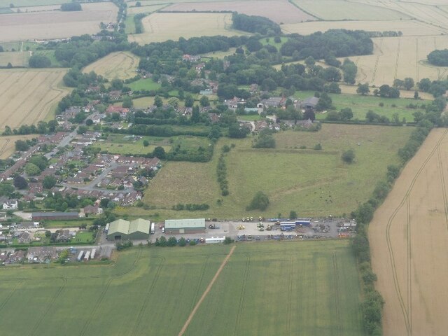
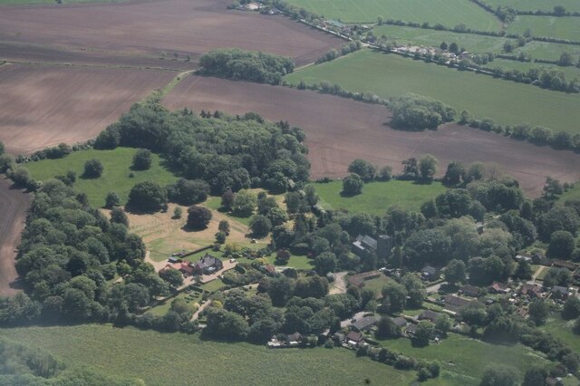
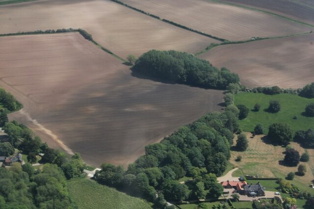
Grange Wood is a picturesque forest located in the county of Lincolnshire, England. Covering an area of approximately 100 acres, this woodland is a haven of tranquility and natural beauty. It is situated near the village of Grange de Lings, just a few miles south of the city of Lincoln.

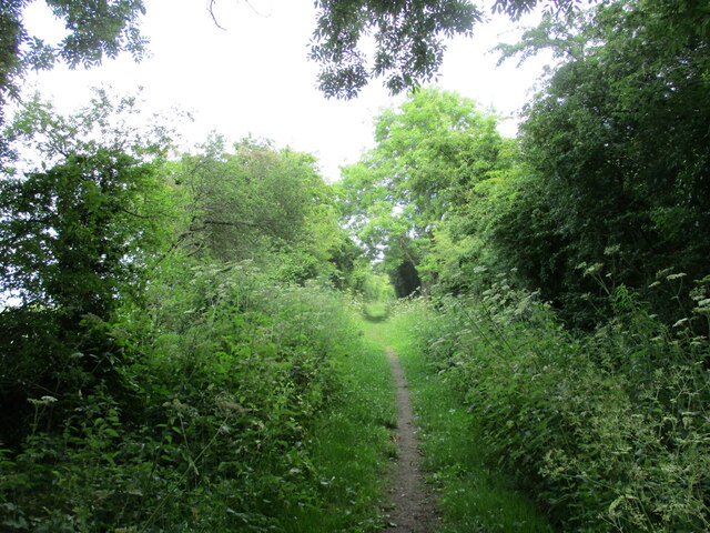
The wood is predominantly composed of deciduous trees, with a mix of oak, beech, ash, and birch creating a diverse and vibrant ecosystem. The dense canopy provides shade during the warmer months, making it a perfect spot for a leisurely stroll or a peaceful picnic. The forest floor is covered in a lush carpet of ferns, wildflowers, and mosses, adding to the enchanting atmosphere.

Grange Wood is home to a variety of wildlife, including deer, rabbits, squirrels, and an array of bird species. Nature lovers and birdwatchers frequently visit the wood to catch glimpses of woodpeckers, owls, and other woodland birds.

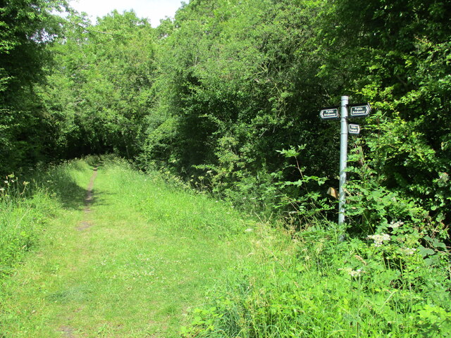
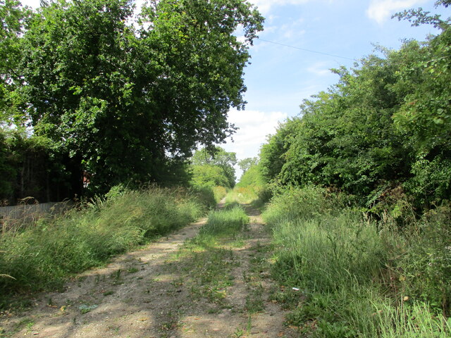
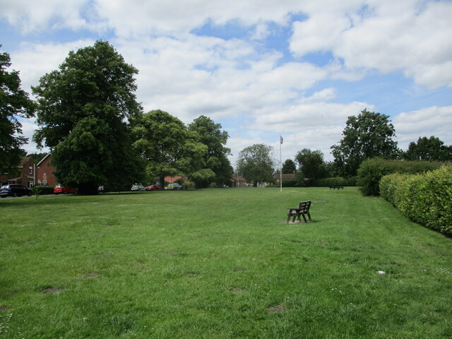
The woodland is crisscrossed by a network of well-maintained footpaths, allowing visitors to explore its natural wonders. There are also several wooden benches strategically placed throughout the forest, providing idyllic spots to rest and take in the surroundings.

Grange Wood is easily accessible, with ample parking available nearby. It has become a popular destination for families, dog walkers, and nature enthusiasts seeking a peaceful retreat from the hustle and bustle of everyday life.

In summary, Grange Wood in Lincolnshire is a charming forest that offers a serene escape into nature. With its diverse flora and fauna, well-maintained trails, and tranquil ambiance, it is a perfect destination for those seeking solace in the beauty of the natural world.

If you have any feedback on the listing, please let us know in the comments section below.

Grange Wood Images

Images are sourced within 2km of 53.223204/0.20951641 or Grid Reference TF4771. Thanks to Geograph Open Source API. All images are credited.

Dam Close and Willoughby: aerial 2021 "Dam Close" appears to be two fortified enclosures with entrances on the north and south sides. The banks have been reduced in height to the north west and end in a small hollow and subsidiary enclosure. To the south east the area has been levelled. There are no signs of foundations within the enclosure. See:
<span class="nowrap"><a title="http://www.heritagegateway.org.uk/Gateway/Results_Single.aspx?uid=MLI42004&resourceID=1006" rel="nofollow ugc noopener" href="http://www.heritagegateway.org.uk/Gateway/Results_Single.aspx?uid=MLI42004&resourceID=1006">Link</a><img style="margin-left:2px;" alt="External link" title="External link - shift click to open in new window" src="https://s1.geograph.org.uk/img/external.png" width="10" height="10"/></span>
Dam Close and Willoughby: aerial 2021
"Dam Close" appears to be two fortified enclosures with entrances on the north and south sides. The banks have been reduced in height to the north west and end in a small hollow and subsidiary enclosure. To the south east the area has been levelled. There are no signs of foundations within the enclosure. See: LinkExternal link
Number Eight Crossing Cottage At a former level crossing on the Willoughby to Mablethorpe line. The thatched extension is a modern addition.
Number Eight Crossing Cottage
At a former level crossing on the Willoughby to Mablethorpe line. The thatched extension is a modern addition.
Bridleway on the Willoughby Branch Line Nature Reserve The bridleway follows the line of the former railway from Willoughby to Mablethorpe.
Bridleway on the Willoughby Branch Line Nature Reserve
The bridleway follows the line of the former railway from Willoughby to Mablethorpe.
Junction of bridleway and footpath The bridleway follows the line of the former Willoughby to Mablethorpe railway.
Junction of bridleway and footpath
The bridleway follows the line of the former Willoughby to Mablethorpe railway.
Bridleway towards Farlesthorpe
The village green, Willoughby
Drainage work near Willoughby Duck Pond Spinney in the background.
Drainage work near Willoughby
Duck Pond Spinney in the background.
Drain near Bonthorpe
Grain transfer plant, Elsom Farm, Bonthorpe
The Grange, Willoughby: aerial 2023
Cropmarks near Willoughby Grange: aerial 2023 (1)
TF4772 : Cropmarks near Willoughby Grange: aerial 2023 (2)
Church of St Helena, Willoughby, Lincs The church is early 14th, late 14th, & early 15th Century. Consisting of Western tower, clerestoried nave, aisles, chancel, & south porch. There was a major restoration by James Fowler of Louth in 1880. The construction is squared coursed greenstone rubble, limestone ashlar rubble, red brick patching, with slate and lead roofs (<span class="nowrap"><a title="www.willoughbylincs.f9.co.uk/churches/w-history-04.html)" rel="nofollow ugc noopener" href="http://www.willoughbylincs.f9.co.uk/churches/w-history-04.html)">Link</a><img style="margin-left:2px;" alt="External link" title="External link - shift click to open in new window" src="https://s1.geograph.org.uk/img/external.png" width="10" height="10"/></span>
Church of St Helena, Willoughby, Lincs
The church is early 14th, late 14th, & early 15th Century. Consisting of Western tower, clerestoried nave, aisles, chancel, & south porch. There was a major restoration by James Fowler of Louth in 1880. The construction is squared coursed greenstone rubble, limestone ashlar rubble, red brick patching, with slate and lead roofs (LinkExternal link
Hanby Lane Gatehouse, Willoughby, Lincs Former gatehouse on the disused East Lincolnshire line from Firsby to Louth, where my great-grandfather was platelayer and gateman from 1856 until c.1910; now a private residence.
Hanby Lane Gatehouse, Willoughby, Lincs
Former gatehouse on the disused East Lincolnshire line from Firsby to Louth, where my great-grandfather was platelayer and gateman from 1856 until c.1910; now a private residence.
Willoughby Arms, Willoughby, Lincs – on Church Lane, selling Bateman's Real Ale.
Willoughby Arms, Willoughby, Lincs
– on Church Lane, selling Bateman's Real Ale.
Old Rectory and drive, Willoughby, Lincs – adjacent to the church, but in private ownership since 1993.
Old Rectory and drive, Willoughby, Lincs
– adjacent to the church, but in private ownership since 1993.
Willoughby World War 1 Plaque This is a white marble plaque listing 10 men who left Willoughby to fight in the Great War and never returned. It is fixed to the south wall of the Parish Church of St Helena.
Willoughby World War 1 Plaque
This is a white marble plaque listing 10 men who left Willoughby to fight in the Great War and never returned. It is fixed to the south wall of the Parish Church of St Helena.
Farlesthorpe Brick Sitting on the very edge of this square this is the remains of the former Farlesthorpe brickworks.  It is one of the few Scotch kilns to have survived in Lincolnshire.
Farlesthorpe Brick
Sitting on the very edge of this square this is the remains of the former Farlesthorpe brickworks. It is one of the few Scotch kilns to have survived in Lincolnshire.
Show me another place!

Grange Wood is located at Grid Ref: TF4771 (Lat: 53.223204, Lng: 0.20951641)

Administrative County: Lincolnshire

District: East Lindsey

Police Authority: Lincolnshire

What 3 Words

///forwarded.swinging.noses. Near Alford, Lincolnshire

Related Wikis

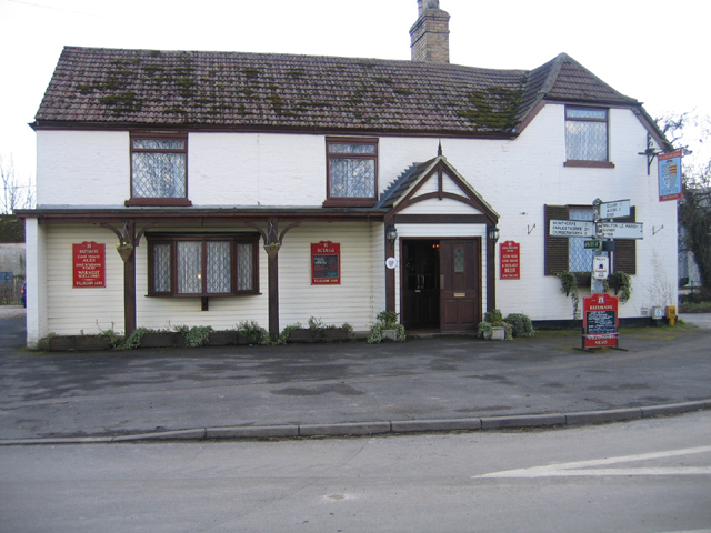
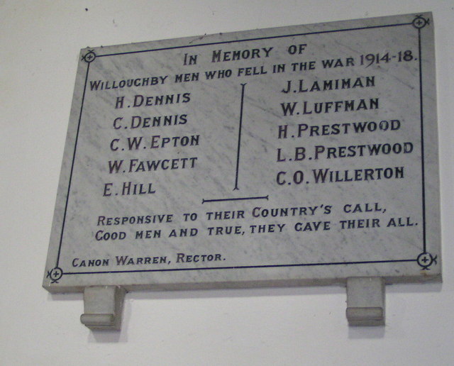
Willoughby, Lincolnshire

Willoughby is a village in the district of East Lindsey, Lincolnshire, England. It is situated three miles (five kilometres) south from the market town...

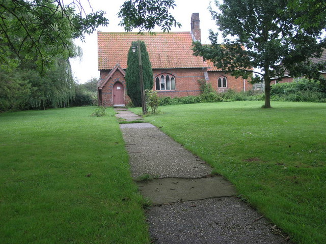
Willoughby railway station

Willoughby was a railway station on the East Lincolnshire Railway which served the village of Willoughby in Lincolnshire between 1848 and 1970. In 1886...

Bonthorpe

Bonthorpe is a hamlet in the East Lindsey district of Lincolnshire, England. It is situated 1 mile (1.6 km) north-east from the village of Willoughby....

Willoughby with Sloothby

Willoughby with Sloothby is a civil parish in the East Lindsey district of Lincolnshire in the East Midlands of England. The parish includes the settlements...

Mawthorpe

Mawthorpe is a hamlet in the East Lindsey district of Lincolnshire, England. It is situated 2 miles (3 km) south from Alford and 1 mile (1.6 km) north...

Sloothby

Sloothby is a small village in the East Lindsey district of Lincolnshire, England. It is situated approximately 5 miles (8 km) south from the Lincolnshire...

Farlesthorpe

Farlesthorpe is a hamlet in the East Lindsey district of Lincolnshire, England. It is situated approximately 2 miles (3 km) south-east from Alford, and...

Thwaite Priory

Thwaite Priory was a monastery at Welton le Marsh in Lincolnshire, England. It was a house of Augustinian Canons Regular, dependent on Thornton Abbey...

Nearby Amenities

Located within 500m of 53.223204,0.20951641
Bus Stop
Willoughby Arms PH
Naptan AtcoCode: 270000009844
Naptan Bearing: W
Naptan CommonName: Willoughby Arms PH
Naptan Indicator: adj
Naptan Landmark: Willoughby Arms PH
Naptan NaptanCode: linjgapj
Naptan Street: Church Lane
Naptan Verified: no
Source: naptan_import
Lat/Long: 53.2236759/0.2025221
Bus Stop
Willoughby Arms PH
Naptan AtcoCode: 270000009845
Naptan Bearing: E
Naptan CommonName: Willoughby Arms PH
Naptan Indicator: opp
Naptan Landmark: Willoughby Arms PH
Naptan NaptanCode: linjgapm
Naptan Street: Church Lane
Naptan Verified: no
Source: naptan_import
Lat/Long: 53.2237649/0.2025716
Willow End
Place: neighbourhood
Lat/Long: 53.2252704/0.203245
Village Farm
Place: farm
Source: Bing
Lat/Long: 53.2228903/0.2025177
Village Farm
Place: farm
Source: Bing
Lat/Long: 53.222575/0.2028412
The Grange
Place: farm
Source: Bing
Lat/Long: 53.2251735/0.2066601
Pub
The Willoughby Arms
Addr City: Alford
Addr Country: GB
Addr Postcode: LN13 9SU
Addr Street: Church Lane
Addr Village: Willoughby
Fhrs Authority: East Lindsey
Fhrs Id: 156269
Fhrs Local Authority Id: EHFDI/02559/08
Lat/Long: 53.2235661/0.2024142
The data included in this document is from www.openstreetmap.org. The data is made available under ODbL.

Have you been to Grange Wood?

Leave your review of Grange Wood below (or comments, questions and feedback).