Poundpit Wood

Wood, Forest in Sussex Wealden

England

Poundpit Wood

Hamilton Palace
Hamilton Palace Credit: N Chadwick

Poundpit Wood is a picturesque woodland located in the county of Sussex, England. Spanning approximately 20 acres, it is nestled in the heart of the South Downs National Park, offering visitors a tranquil escape from the bustling city life. The wood is situated near the village of Ditchling, just a short distance from the historic town of Lewes.

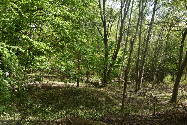
This ancient woodland boasts a diverse range of tree species, including oak, beech, ash, and birch, which create a stunning canopy overhead. The forest floor is covered in a rich carpet of wildflowers and ferns, adding to the area's natural beauty. Poundpit Wood is also home to a variety of wildlife, such as deer, badgers, foxes, and numerous bird species, making it a haven for nature enthusiasts and birdwatchers.

The wood offers a network of well-maintained footpaths and trails, allowing visitors to explore its enchanting surroundings at their own pace. As they wander through the woodland, visitors can enjoy the soothing sounds of birdsong and the gentle rustling of leaves in the breeze. The wood also features picnic areas, providing a perfect spot for visitors to relax and enjoy a picnic amidst the serene surroundings.

Poundpit Wood is a popular destination for outdoor activities such as walking, cycling, and horse riding. The diverse terrain and scenic views make it particularly appealing for those seeking a peaceful and immersive outdoor experience. With its natural charm and abundant wildlife, Poundpit Wood truly offers a delightful escape into nature for locals and tourists alike.

If you have any feedback on the listing, please let us know in the comments section below.

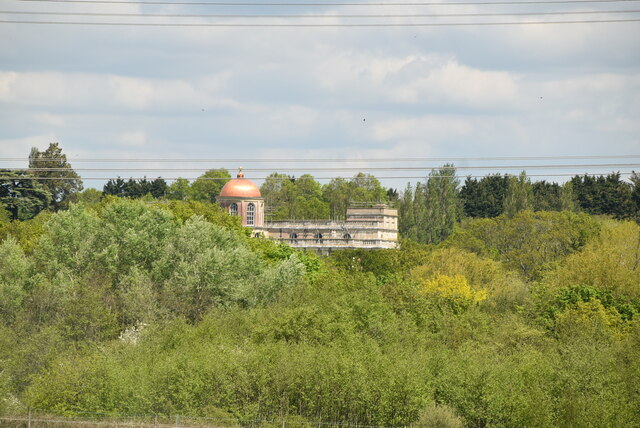
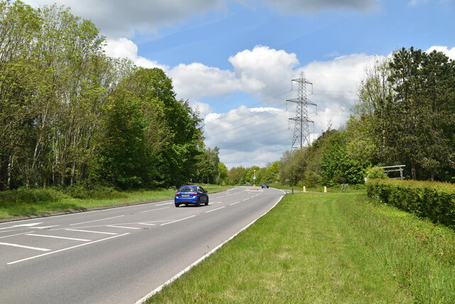
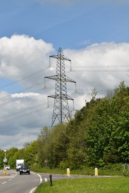
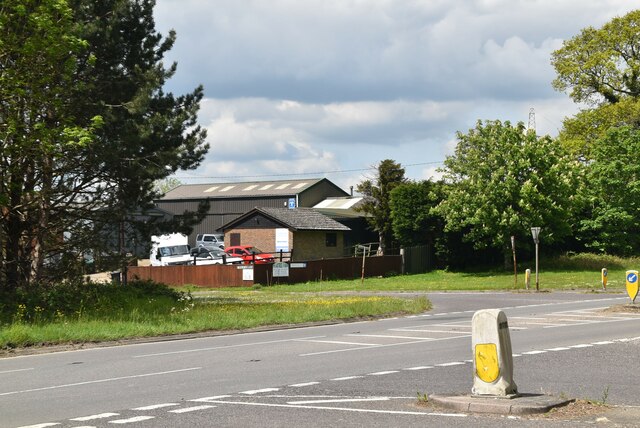
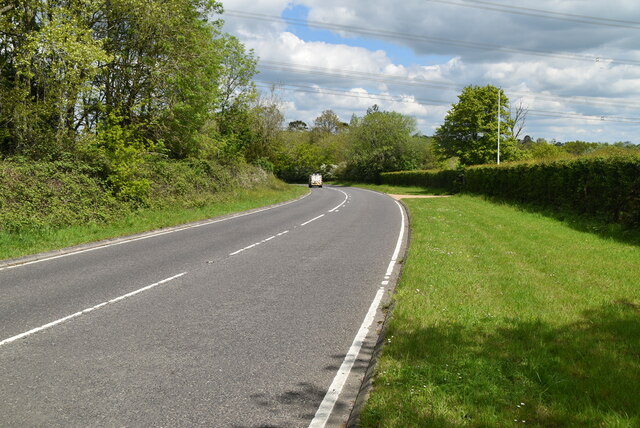
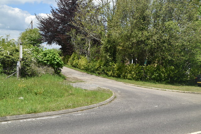
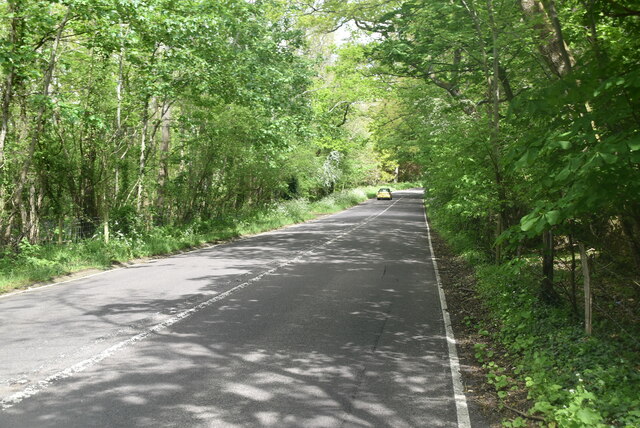
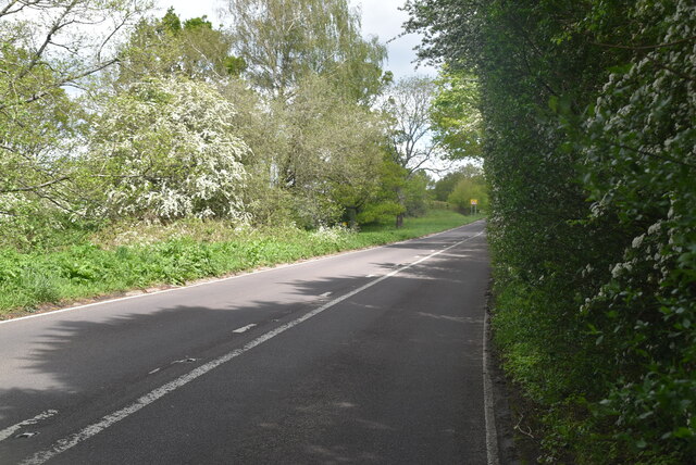
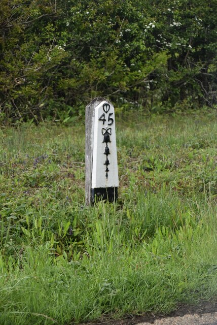
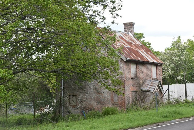
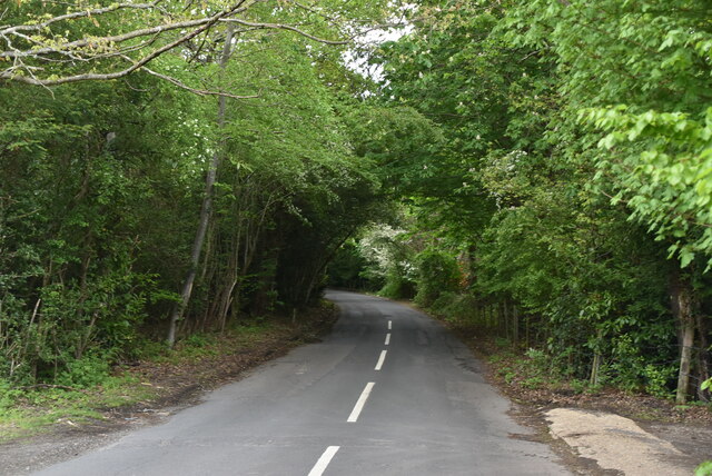
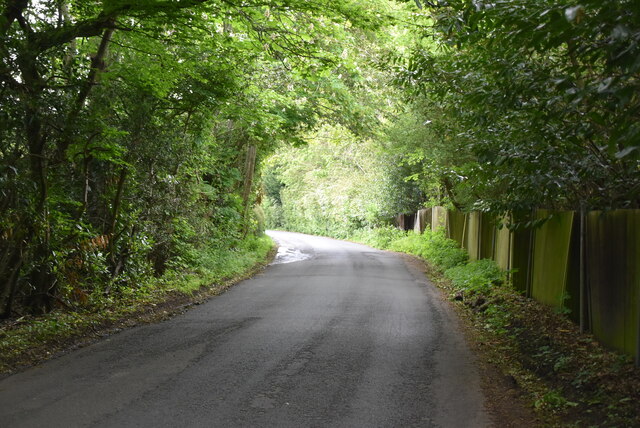
Poundpit Wood Images

Images are sourced within 2km of 50.951879/0.094112959 or Grid Reference TQ4719. Thanks to Geograph Open Source API. All images are credited.

Hamilton Palace
Hamilton Palace
A22 The A22 is one of the  major roads in the south east of England. It carries traffic from London to Eastbourne on the East Sussex coast. The route goes through Purley, East Grinstead, Forest Row, Hailsham and Polegate. A distance of 48 miles.
<span class="nowrap"><a title="http://www.sabre-roads.org.uk/wiki/index.php?title=B2104" rel="nofollow ugc noopener" href="http://www.sabre-roads.org.uk/wiki/index.php?title=B2104">Link</a><img style="margin-left:2px;" alt="External link" title="External link - shift click to open in new window" src="https://s1.geograph.org.uk/img/external.png" width="10" height="10"/></span>
A22
The A22 is one of the major roads in the south east of England. It carries traffic from London to Eastbourne on the East Sussex coast. The route goes through Purley, East Grinstead, Forest Row, Hailsham and Polegate. A distance of 48 miles. LinkExternal link
Junction on A22
Junction on A22
Pear Tree Farm
Pear Tree Farm
Eastbourne Rd
Eastbourne Rd
Track to High Cross Farm
Eastbourne Rd
Eastbourne Rd
Woodland by Eastbourne Rd
Eastbourne Rd
Eastbourne Rd
Eastbourne Rd
Eastbourne Rd
Old milestone
Old milestone
Old milestone
Old milestone
derelict building
derelict building
Eastbourne Rd, High Cross junction
Eastbourne Rd
Eastbourne Rd
High Cross
High Cross
High Cross
High Cross
High Cross
High Cross
Show me another place!

Poundpit Wood is located at Grid Ref: TQ4719 (Lat: 50.951879, Lng: 0.094112959)

Administrative County: East Sussex

District: Wealden

Police Authority: Sussex

What 3 Words

///guideline.seasonal.resist. Near Uckfield, East Sussex

Related Wikis

Little Horsted

Little Horsted (also known as Horsted Parva) is a village and civil parish in the Wealden district of East Sussex, England. It is located two miles (3...

Horsted Place

Horsted Place is a Tudor Revival country house, now a hotel, in Little Horsted, East Sussex, England. The current building dates to 1850, when it was built...

East Sussex National Golf Club

East Sussex National Golf Club is a golf course located near to Uckfield in East Sussex. It is considered one of the finer golf courses in the British...

Uckfield Town F.C.

Uckfield Town F.C. was a football club based in Uckfield, East Sussex, England. For their final season, 2013–14, they were members of the Sussex County...

Uckfield railway station

Uckfield railway station is the southern terminus of a branch of the Oxted Line in England, serving the town of Uckfield, East Sussex. It is 46 miles 8...

Hempstead Meadow

Hempstead Meadow is a 1.6-hectare (4.0-acre) Local Nature Reserve in Uckfield in East Sussex. It is owned and managed by Uckfield Town Council.The site...

Uckfield

Uckfield () is a town in the Wealden District of East Sussex in South East England. The town is on the River Uck, one of the tributaries of the River Ouse...

Copping Hall

Copping Hall is a Grade II* listed house in Uckfield, East Sussex, England. It is located at 1 Pudding Cake Lane, Uckfield, East Sussex TN22 1BT. Built...

Related Videos

UCKFIELD DELIVERING!

Make sure to press the subscribe button! Tiktok - https://vm.tiktok.com/ZMRmUmaqd/ Instagram bio - ...

Holiday Camps at Sky High at Fun Abounds 🤸‍♀️

Come and fun with us during the holidays at our Holiday Camps located at our dedicated gymnastics facility located in Uckfield, ...

Nearby Amenities

Located within 500m of 50.951879,0.094112959
Power: tower
Lat/Long: 50.9483245/0.0950585
Power: tower
Lat/Long: 50.949739/0.0899291
Material: wood
Power: pole
Source: bing
Lat/Long: 50.950094/0.0884951
Material: wood
Power: pole
Source: bing
Lat/Long: 50.9502124/0.0890726
Material: wood
Power: pole
Source: bing
Lat/Long: 50.9503919/0.0900086
Material: wood
Power: pole
Source: bing
Lat/Long: 50.9506361/0.0913167
Material: wood
Power: pole
Source: bing
Lat/Long: 50.9508485/0.0923593
Power: pole
Lat/Long: 50.951964/0.0954998
Power: pole
Lat/Long: 50.952605/0.0961924
Power: pole
Lat/Long: 50.9532437/0.0968576
Power: pole
Lat/Long: 50.953776/0.0974236
Post Box
Collection Times: Mo-Fr 09:00, Sa 07:00
Operator: Royal Mail
Post Box Type: lamp
Ref: TN22 91D
Royal Cypher: EIIR
Royal Cypher Wikidata: Q33102113
Lat/Long: 50.9505879/0.0940122
Bridleway
Information: guidepost
Tourism: information
Lat/Long: 50.9509652/0.0948246
Public Footpath
Information: guidepost
Tourism: information
Lat/Long: 50.9508664/0.0967703
Horstedpond Farm
Addr City: Uckfield
Addr Postcode: TN22 5TR
Addr Street: Lewes Road
Place: farm
Lat/Long: 50.9518444/0.0990734
Barrier: kissing_gate
Lat/Long: 50.9525708/0.0926389
Barrier: kissing_gate
Lat/Long: 50.9517475/0.0884689
Barrier: stile
Lat/Long: 50.9514478/0.0873654
Barrier: kissing_gate
Lat/Long: 50.9516434/0.0881461
Life Ring
Emergency: life_ring
Lat/Long: 50.9550761/0.0896326
Bench
Material: wood
Lat/Long: 50.9530482/0.0899458
Tourism: information
Lat/Long: 50.9550628/0.0895608
Board Type: nature
Information: board
Tourism: information
Lat/Long: 50.9517571/0.088337
Bench
Lat/Long: 50.9515342/0.0931471
Bench
Lat/Long: 50.9519406/0.0931966
Pond Orchard
Note: Identifies the species of tree and location in Pond Orchard
Tourism: information
Lat/Long: 50.9526021/0.0926506
Barrier: kissing_gate
Lat/Long: 50.9511773/0.0931189
Generator Method: photovoltaic
Generator Output Electricity: yes
Generator Source: solar
Generator Type: solar_photovoltaic_panel
Location: roof
Power: generator
Lat/Long: 50.9516827/0.0936882
Addr Housenumber: 1
Addr Street: Wheatsheaf Avenue
Building: yes
Lat/Long: 50.9557683/0.0955925
Addr Housenumber: 63
Addr Street: Trefoil Way
Building: yes
Lat/Long: 50.9557097/0.094474
Addr Housenumber: 65
Addr Street: Trefoil Way
Building: yes
Lat/Long: 50.9556702/0.0946845
Entrance: main
Lat/Long: 50.9554119/0.0943185
Entrance: main
Lat/Long: 50.9552174/0.0942853
Addr Housenumber: 12
Addr Street: Ayrshire Lane
Building: yes
Lat/Long: 50.9534402/0.0966747
Addr Housenumber: 44
Addr Street: Hereford Way
Building: yes
Lat/Long: 50.9533303/0.0965115
Addr Housenumber: 46
Addr Street: Hereford Way
Building: yes
Lat/Long: 50.9532021/0.0964492
Addr Housenumber: 42
Addr Street: Hereford Way
Building: yes
Lat/Long: 50.9534543/0.0962576
Addr Housenumber: 52
Addr Street: Hereford Way
Building: yes
Lat/Long: 50.9529183/0.0961357
Addr Housenumber: 50
Addr Street: Hereford Way
Building: yes
Lat/Long: 50.9530046/0.0962292
Addr Housenumber: 29
Addr Street: Hereford Way
Building: yes
Lat/Long: 50.9535698/0.0963531
Addr Housenumber: 48
Addr Street: Hereford Way
Building: yes
Lat/Long: 50.9530831/0.0963288
Addr Housenumber: 2
Addr Street: Wheatsheaf Avenue
Building: yes
Lat/Long: 50.9560903/0.0959776
Addr Housenumber: 1
Addr Street: Brome Grove
Building: yes
Lat/Long: 50.9560787/0.0953748
Addr Housenumber: 2
Addr Street: Brome Grove
Building: yes
Lat/Long: 50.9562363/0.0953151
Addr Housenumber: 4
Building: yes
Lat/Long: 50.9560684/0.0958055
Life Ring
Emergency: life_ring
Lat/Long: 50.9539873/0.0932526
Life Ring
Emergency: life_ring
Lat/Long: 50.9538756/0.0927849
Addr Housenumber: 15
Addr Street: Ayrshire Lane
Building: yes
Lat/Long: 50.9540717/0.0973392
Addr Housenumber: 2
Addr Street: White Park Avenue
Building: yes
Lat/Long: 50.9531965/0.0958355
Addr Housenumber: 9
Addr Street: Ayrshire Lane
Building: yes
Lat/Long: 50.9542606/0.0966609
Addr Housenumber: 5
Addr Street: White Park Avenue
Building: yes
Lat/Long: 50.953396/0.095696
Addr Housenumber: 7
Addr Street: Ayrshire Lane
Building: yes
Lat/Long: 50.9543624/0.0968595
Addr Housenumber: 17
Addr Street: Hereford Way
Building: yes
Lat/Long: 50.9541119/0.0958449
Addr Housenumber: 2
Building: yes
Lat/Long: 50.953582/0.0952897
Addr Housenumber: 5
Addr Street: Ayrshire Lane
Building: yes
Lat/Long: 50.9543071/0.0963357
Addr Housenumber: 6
Building: yes
Lat/Long: 50.9533369/0.0948842
Addr Street: Hereford Way
Building: yes
Lat/Long: 50.9531966/0.0950524
Addr Housenumber: 1
Addr Street: White Park Avenue
Building: yes
Lat/Long: 50.9533185/0.0955994
Addr Housenumber: 1
Building: yes
Lat/Long: 50.9537266/0.0952181
Addr Housenumber: 28
Addr Street: Hereford Way
Building: yes
Lat/Long: 50.9538069/0.0946236
Addr Housenumber: 4
Building: yes
Lat/Long: 50.953428/0.0953344
Addr Housenumber: 8
Addr Street: White Park Avenue
Building: yes
Lat/Long: 50.9533818/0.0960411
Addr Housenumber: 2
Addr Street: Hereford Way
Building: yes
Lat/Long: 50.9530041/0.0958118
Addr Housenumber: 32
Addr Street: Hereford Way
Building: yes
Lat/Long: 50.9538086/0.0949258
Addr Housenumber: 30
Addr Street: Hereford Way
Building: yes
Lat/Long: 50.9537964/0.0948363
Addr Street: Hereford Way
Building: yes
Lat/Long: 50.9536976/0.0961248
Addr Street: Ayrshire Lane
Building: yes
Lat/Long: 50.9540967/0.0963744
Addr Street: Hereford Way
Building: yes
Lat/Long: 50.9538499/0.0959017
Addr Housenumber: 8
Addr Street: Ayrshire Lane
Building: yes
Lat/Long: 50.9538138/0.0969913
Addr Housenumber: 6
Addr Street: White Park Avenue
Building: yes
Lat/Long: 50.9533308/0.0959913
Addr Housenumber: 7
Building: yes
Lat/Long: 50.9534092/0.0948723
Addr Housenumber: 4
Addr Street: White Park Avenue
Building: yes
Lat/Long: 50.9532358/0.0958729
Addr Housenumber: 9
Building: yes
Lat/Long: 50.9535801/0.0948857
Addr Street: Hereford Way
Building: yes
Lat/Long: 50.9536544/0.0962145
Addr Housenumber: 38
Addr Street: Hereford Way
Building: yes
Lat/Long: 50.9537115/0.0956767
Addr Housenumber: 11
Addr Street: Ayrshire Lane
Building: yes
Lat/Long: 50.9540746/0.096863
Addr Housenumber: 10
Building: yes
Lat/Long: 50.9537191/0.0950675
Addr Housenumber: 6
Addr Street: Ayrshire Lane
Building: yes
Lat/Long: 50.9539223/0.0965783
Addr Street: Hereford Way
Building: yes
Lat/Long: 50.9531314/0.0954649
Addr Housenumber: 34
Addr Street: Hereford Way
Building: yes
Lat/Long: 50.9538809/0.0954227
Addr Housenumber: 4
Addr Street: Ayrshire Lane
Building: yes
Lat/Long: 50.9538946/0.0964254
Addr Housenumber: 1
Addr Street: Ayrshire Lane
Building: yes
Lat/Long: 50.9540093/0.0961459
Addr Housenumber: 19
Addr Street: Hereford Way
Building: yes
Lat/Long: 50.9539879/0.0956302
Addr Housenumber: 5
Building: yes
Lat/Long: 50.9533463/0.0953374
Addr Street: Hereford Way
Building: yes
Lat/Long: 50.9531613/0.0952493
Addr Housenumber: 8
Building: yes
Lat/Long: 50.9535144/0.0948857
Addr Housenumber: 36
Addr Street: Hereford Way
Building: yes
Lat/Long: 50.9537559/0.0955929
Addr Housenumber: 3
Building: yes
Lat/Long: 50.9535229/0.0953031
Addr Housenumber: 40
Addr Street: Hereford Way
Building: yes
Lat/Long: 50.9536074/0.0958788
Addr Housenumber: 4
Addr Street: Hereford Way
Building: yes
Lat/Long: 50.9530575/0.0956747
Addr Housenumber: 13
Addr Street: Ayrshire Lane
Building: yes
Lat/Long: 50.9539522/0.0971811
Addr Housenumber: 10
Addr Street: White Park Avenue
Building: yes
Lat/Long: 50.9534258/0.0960897
Addr Housenumber: 10
Addr Street: Ayrshire Lane
Building: yes
Lat/Long: 50.9536333/0.0968225
Addr Housenumber: 3
Addr Street: White Park Avenue
Building: yes
Lat/Long: 50.9533594/0.0956345
Addr Housenumber: 26
Addr Street: Hereford Way
Building: yes
Lat/Long: 50.9538107/0.0945267
The data included in this document is from www.openstreetmap.org. The data is made available under ODbL.

Have you been to Poundpit Wood?

Leave your review of Poundpit Wood below (or comments, questions and feedback).