Boothland Wood

Wood, Forest in Sussex Wealden

England

Boothland Wood

Entrance Gates
Entrance Gates Credit: N Chadwick

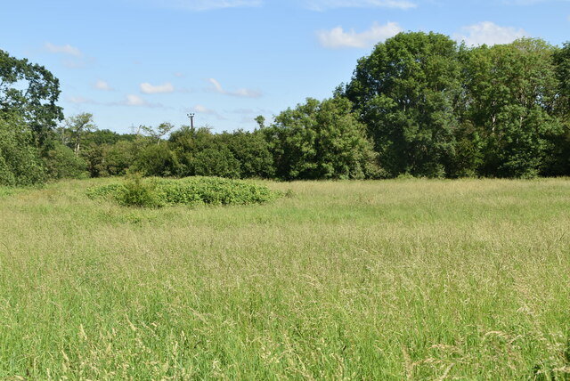
Boothland Wood is a picturesque forest located in the county of Sussex, England. Covering an expansive area of approximately 500 acres, this ancient woodland is renowned for its diverse ecosystem and rich biodiversity. The wood is nestled in the heart of the South Downs National Park, offering visitors a tranquil retreat from the bustling city life.

The forest is predominantly composed of broadleaf trees, including oak, ash, beech, and birch, which create a dense canopy that provides shade and shelter for a wide array of flora and fauna. The forest floor is adorned with a colorful carpet of bluebells, primroses, and wild garlic during the spring season, creating a breathtaking sight for nature enthusiasts and photographers.

Boothland Wood is home to a variety of wildlife species, such as deer, badgers, foxes, and numerous bird species, including woodpeckers, owls, and songbirds. The forest's serene atmosphere and abundant food sources attract a wide range of avian species, making it a popular destination for birdwatchers.

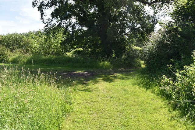
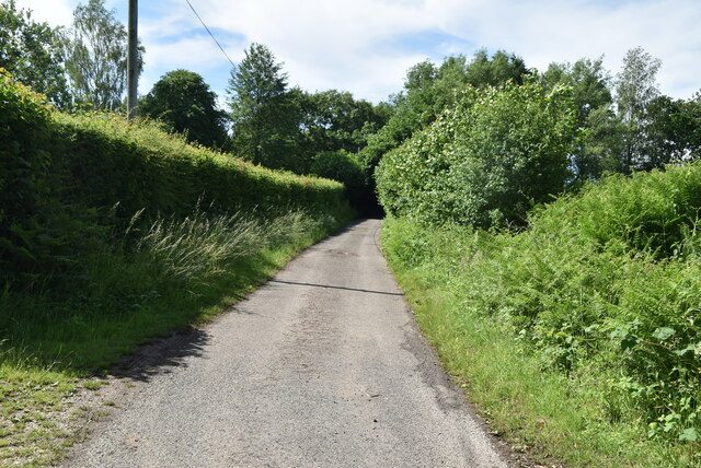
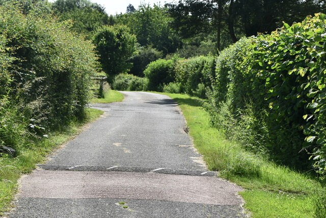
The wood offers several walking trails and footpaths, allowing visitors to explore its natural beauty at their own pace. These well-maintained paths wind through the forest, offering glimpses of picturesque meadows, babbling brooks, and ancient trees. The wood also features a picnic area, providing visitors with the opportunity to enjoy a leisurely lunch amidst the serene surroundings.

Boothland Wood is not only a haven for nature enthusiasts but also plays a vital role in preserving the region's natural heritage. Its ancient woodland status ensures that the forest remains protected and allows future generations to experience the beauty and tranquility of this remarkable natural treasure.

If you have any feedback on the listing, please let us know in the comments section below.

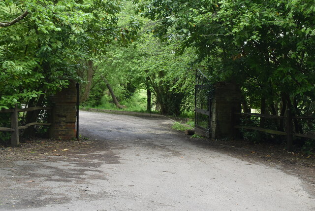
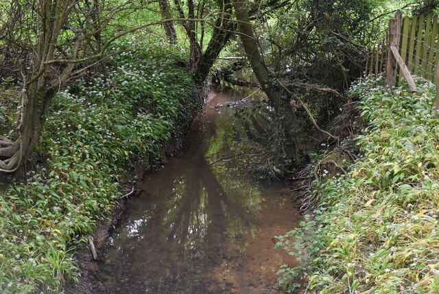
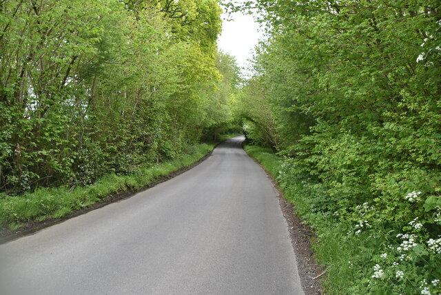
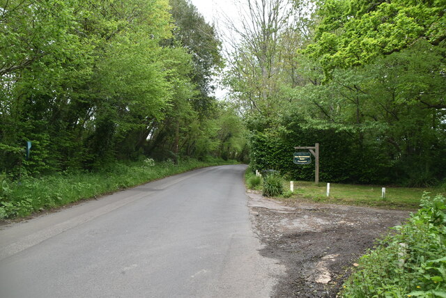
Boothland Wood Images

Images are sourced within 2km of 50.961294/0.094194494 or Grid Reference TQ4720. Thanks to Geograph Open Source API. All images are credited.

Entrance Gates
Entrance Gates
Framfield Stream
Framfield Stream
Brookhouse Lane
Brookhouse Lane
Entrance to Upper Brookhouse Farm
Meadow by River Uck
Meadow by River Uck
Grassy footpath
Grassy footpath
Worth Lane
Worth Lane
Worth Lane
Worth Lane
Flood level indicator, Worth Lane
Worth Lane
Worth Lane
Keens Lodge
Keens Lodge
Footpath to Lower Barn Farm
Track, Lower Barn Farm
Footpath through trees
Pylon near Horsted Green
Daisy meadow
Daisy meadow
Horsted Pond Lane
Horsted Pond Lane
Horsted Pond Lane
Horsted Pond Lane
Show me another place!

Boothland Wood is located at Grid Ref: TQ4720 (Lat: 50.961294, Lng: 0.094194494)

Administrative County: East Sussex

District: Wealden

Police Authority: Sussex

What 3 Words

///gurgling.cafe.youthful. Near Uckfield, East Sussex

Related Wikis

Uckfield Town F.C.

Uckfield Town F.C. was a football club based in Uckfield, East Sussex, England. For their final season, 2013–14, they were members of the Sussex County...

Uckfield railway station

Uckfield railway station is the southern terminus of a branch of the Oxted Line in England, serving the town of Uckfield, East Sussex. It is 46 miles 8...

Hempstead Meadow

Hempstead Meadow is a 1.6-hectare (4.0-acre) Local Nature Reserve in Uckfield in East Sussex. It is owned and managed by Uckfield Town Council.The site...

Uckfield

Uckfield () is a town in the Wealden District of East Sussex in South East England. The town is on the River Uck, one of the tributaries of the River Ouse...

Little Horsted

Little Horsted (also known as Horsted Parva) is a village and civil parish in the Wealden district of East Sussex, England. It is located two miles (3...

Copping Hall

Copping Hall is a Grade II* listed house in Uckfield, East Sussex, England. It is located at 1 Pudding Cake Lane, Uckfield, East Sussex TN22 1BT. Built...

Uckfield College

Uckfield College (formerly Uckfield Community Technology College) is a community college situated in Uckfield, UK. It has approximately 1,720 students...

West Park, Uckfield

West Park is a 10.5-hectare (26-acre) Local Nature Reserve on the western outskirts of Uckfield in East Sussex. It is owned and managed by Uckfield Town...

Nearby Amenities

Located within 500m of 50.961294,0.094194494
Mini Roundabout
Direction: clockwise
Lat/Long: 50.9587259/0.0994136
Crossing
Crossing: unmarked
Crossing Island: no
Crossing Markings: no
Tactile Paving: yes
Traffic Calming: no
Lat/Long: 50.9607676/0.0994019
Turning Circle
Lat/Long: 50.9638183/0.0999937
Turning Circle
Lat/Long: 50.9641523/0.0996215
Mini Roundabout
Direction: clockwise
Lat/Long: 50.9596968/0.0993752
Post Box
Brand: Royal Mail
Brand Wikidata: Q638098
Brand Wikipedia: en:Royal Mail
Operator: Royal Mail
Operator Wikidata: Q638098
Post Box Type: wall
Ref: TN22 19D
Royal Cypher: GR
Royal Cypher Wikidata: Q33102273
Lat/Long: 50.9641018/0.0979478
Post Box
Brand: Royal Mail
Brand Wikidata: Q638098
Brand Wikipedia: en:Royal Mail
Operator: Royal Mail
Operator Wikidata: Q638098
Post Box Type: lamp
Ref: TN22 93D
Lat/Long: 50.9592289/0.0994443
Bus Stop
New Place
Bench: no
Bus: yes
Covered: no
Public Transport: platform
Ref: esuawmpt
Shelter: no
Lat/Long: 50.9637378/0.0981792
Bus Stop
New Place
Bench: yes
Bus: yes
Covered: no
Public Transport: platform
Ref: esuawmpw
Shelter: no
Lat/Long: 50.963317/0.098272
Bus Stop
Catholic Church
Bench: no
Bus: yes
Covered: no
Naptan AtcoCode: 1400WE1132
Naptan NaptanCode: esudjgda
Public Transport: platform
Ref: esudjgda
Shelter: no
Lat/Long: 50.9647524/0.0972402
Bus Stop
The Highlands
Bench: no
Bus: yes
Covered: no
Naptan AtcoCode: 1400WE0276
Naptan NaptanCode: esuawmtm
Public Transport: platform
Ref: esuawmtm
Shelter: no
Lat/Long: 50.9614494/0.0999556
Bus Stop
The Highlands
Bench: yes
Bus: yes
Covered: no
Naptan AtcoCode: 1400WE95646
Naptan NaptanCode: esudgawt
Public Transport: platform
Ref: esudgawt
Shelter: no
Lat/Long: 50.9616735/0.0991017
Bus Stop
Highview Lane
Bench: yes
Bus: yes
Covered: no
Naptan AtcoCode: 1400WE95656
Naptan NaptanCode: esudgdap
Public Transport: platform
Shelter: no
Lat/Long: 50.9591171/0.0994584
Bus Stop
The Highlands
Bench: no
Bus: yes
Covered: no
Naptan AtcoCode: 1400WE0275
Naptan NaptanCode: esuawmtj
Public Transport: platform
Ref: esuawmtj
Shelter: no
Lat/Long: 50.9614325/0.1001922
Bus Stop
The Highlands
Bus: yes
Covered: yes
Naptan AtcoCode: 1400WE95644
Naptan NaptanCode: esudgawp
Public Transport: platform
Ref: esudgawp
Shelter: yes
Lat/Long: 50.9611933/0.0993826
Bus Stop
Highview Lane
Bench: no
Bin: no
Bus: yes
Covered: no
Naptan AtcoCode: 1400WE95654
Naptan NaptanCode: esudgdam
Public Transport: platform
Shelter: no
Tactile Paving: no
Lat/Long: 50.9592759/0.0993027
Addr City: Uckfield
Addr Housenumber: 34
Addr Postcode: TN22 5ET
Addr Street: Sand Ridge
Lat/Long: 50.9604776/0.0987903
Addr City: Uckfield
Addr Housenumber: 41
Addr Postcode: TN22 5ET
Addr Street: Sand Ridge
Lat/Long: 50.9603914/0.0989807
Addr City: Uckfield
Addr Housenumber: 47
Addr Postcode: TN22 5ET
Addr Street: Sand Ridge
Lat/Long: 50.9593496/0.0977723
Addr City: Uckfield
Addr Housenumber: 48
Addr Postcode: TN22 5ET
Addr Street: Sand Ridge
Lat/Long: 50.9593631/0.0979198
Addr City: Uckfield
Addr Housenumber: 49
Addr Postcode: TN22 5ET
Addr Street: Sand Ridge
Lat/Long: 50.9596875/0.0982765
Addr City: Uckfield
Addr Housenumber: 54
Addr Postcode: TN22 5ET
Addr Street: Sand Ridge
Lat/Long: 50.9595802/0.0982403
Addr City: Uckfield
Addr Housenumber: 55
Addr Postcode: TN22 5ET
Addr Street: Sand Ridge
Lat/Long: 50.9594569/0.0982671
Addr City: Uckfield
Addr Housenumber: 61
Addr Postcode: TN22 5ET
Addr Street: Sand Ridge
Lat/Long: 50.9593589/0.0981008
Power: substation
Lat/Long: 50.9624182/0.0986672
Information: guidepost
Tourism: information
Lat/Long: 50.9617217/0.096385
Information: guidepost
Tourism: information
Lat/Long: 50.9618165/0.0960234
Information: guidepost
Tourism: information
Lat/Long: 50.9624249/0.0972217
Barrier: stile
Lat/Long: 50.9611137/0.0945833
Addr Housename: Ridgefield House
Addr Street: Lewes Road
Building: house
Lat/Long: 50.9584274/0.0965421
Sussex Support Service Ltd
Addr Housename: Victoria Pavilion
Addr Place: Victoria Pleasure Ground
Addr Postcode: TN22 5DJ
Addr Street: Old Timbers Lane
Fhrs Id: 852547
Leisure: sports_centre
Source Addr: FHRS Open Data
Lat/Long: 50.9648564/0.094936
Uckfield Cricket Club
Addr Housename: Victoria Pavilion
Addr Place: Victoria Pleasure Ground
Addr Postcode: TN22 5DJ
Addr Street: Old Timbers Lane
Club: sport
Fhrs Id: 701254
Source Addr: FHRS Open Data
Sport: cricket
Lat/Long: 50.9647285/0.0948545
Public Footpath
Information: guidepost
Tourism: information
Lat/Long: 50.9637445/0.0980249
Addr City: Uckfield
Addr Housename: Larkshill
Addr Postcode: TN22 5SJ
Addr Street: Lewes Road
Building: house
Lat/Long: 50.9590711/0.0974522
Addr City: Uckfield
Addr Housename: Ridgedown
Addr Postcode: TN22 5SJ
Addr Street: Lewes Road
Building: house
Lat/Long: 50.9590568/0.0985686
Addr City: Uckfield
Addr Housename: Martins Hill
Addr Postcode: TN22 5SJ
Addr Street: Lewes Road
Building: house
Lat/Long: 50.9590605/0.098233
Addr City: Uckfield
Addr Housename: Finwood
Addr Postcode: TN22 5SJ
Addr Street: Lewes Road
Building: house
Lat/Long: 50.9590582/0.0978209
Defibrillator
Emergency: defibrillator
Lat/Long: 50.964857/0.0948226
Generator Method: photovoltaic
Generator Output Electricity: yes
Generator Solar Modules: 8
Generator Source: solar
Generator Type: solar_photovoltaic_panel
Location: roof
Power: generator
Lat/Long: 50.9621544/0.0977062
Generator Method: photovoltaic
Generator Output Electricity: yes
Generator Solar Modules: 20
Generator Source: solar
Generator Type: solar_photovoltaic_panel
Location: roof
Power: generator
Lat/Long: 50.9621662/0.0978926
Generator Method: photovoltaic
Generator Orientation: 260
Generator Output Electricity: yes
Generator Source: solar
Generator Type: solar_photovoltaic_panel
Location: roof
Power: generator
Lat/Long: 50.9621646/0.0981702
Generator Method: photovoltaic
Generator Orientation: 200
Generator Output Electricity: yes
Generator Source: solar
Generator Type: solar_photovoltaic_panel
Location: roof
Power: generator
Lat/Long: 50.9629425/0.0982118
Generator Method: photovoltaic
Generator Output Electricity: yes
Generator Source: solar
Generator Type: solar_photovoltaic_panel
Location: roof
Power: generator
Lat/Long: 50.9643382/0.0978948
Footpath
Information: guidepost
Operator: East Sussex County Council
Tourism: information
Lat/Long: 50.9593574/0.092025
Ford: yes
Lat/Long: 50.9624116/0.0931412
Crossing
Crossing: unmarked
Crossing Island: no
Crossing Markings: no
Tactile Paving: yes
Traffic Calming: no
Lat/Long: 50.9640393/0.0979448
Entrance: yes
Lat/Long: 50.9616088/0.0996309
Charging Station
Access: yes
Capacity: 4
Lat/Long: 50.9611972/0.0995367
Parking Space
Capacity: 2
Parking Space: disabled
Lat/Long: 50.9610624/0.0998462
Crossing
Crossing: unmarked
Crossing Island: no
Tactile Paving: yes
Traffic Calming: no
Lat/Long: 50.9606528/0.0994816
Addr Housenumber: 26
Addr Street: Wheatsheaf Avenue
Building: yes
Lat/Long: 50.9570647/0.0963175
Addr Housenumber: 25
Addr Street: Red Clover Road
Building: yes
Lat/Long: 50.9577292/0.09641
Addr Housenumber: 30
Building: yes
Lat/Long: 50.9571758/0.0958335
Addr Housenumber: 19
Addr Street: Red Clover Road
Building: yes
Lat/Long: 50.9572222/0.0963588
Addr Housenumber: 44
Addr Street: Wheatsheaf Avenue
Building: yes
Lat/Long: 50.9577939/0.0958224
Addr Housenumber: 22
Addr Street: Wheatsheaf Avenue
Building: yes
Lat/Long: 50.9569591/0.095869
Addr Housenumber: 28
Addr Street: Wheatsheaf Avenue
Building: yes
Lat/Long: 50.957078/0.0959334
Addr Housenumber: 1
Addr Street: Pasture Place
Building: yes
Lat/Long: 50.9569647/0.0954472
Addr Housenumber: 37
Addr Street: Wheatsheaf Avenue
Building: yes
Lat/Long: 50.9578037/0.0955671
Addr Housenumber: 56
Addr Street: Red Clover Road
Building: yes
Lat/Long: 50.9577218/0.0966305
Addr Housenumber: 2
Addr Street: Pasture Place
Building: yes
Lat/Long: 50.9570905/0.095445
Leisure: playground
Lat/Long: 50.9581428/0.0944522
Addr Housenumber: 12
Addr Street: Pasture Place
Building: yes
Lat/Long: 50.9577137/0.0949945
Bicycle Parking
Bicycle Parking: stands
Capacity: 8
Lat/Long: 50.9581107/0.0947437
Addr Housenumber: 4
Addr Street: Pasture Place
Building: yes
Lat/Long: 50.9571919/0.0949137
The data included in this document is from www.openstreetmap.org. The data is made available under ODbL.

Have you been to Boothland Wood?

Leave your review of Boothland Wood below (or comments, questions and feedback).