Pudding Acre

Wood, Forest in Cambridgeshire South Cambridgeshire

England

Pudding Acre

This way to London Liverpool Street View from the Spicers crossing at Whittlesford.
This way to London Liverpool Street Credit: Mr Ignavy

Pudding Acre is a picturesque woodland area located in Cambridgeshire, England. Nestled amidst the scenic countryside, this idyllic forest covers an area of approximately 100 acres and is renowned for its natural beauty and tranquility.

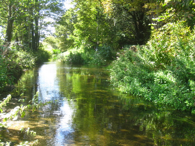
The woodland is characterized by its dense canopy of broad-leaved trees, including oak, beech, and ash, which provide ample shade and shelter for various flora and fauna. The forest floor is adorned with a rich carpet of moss, ferns, and wildflowers, adding to its enchanting charm. Pudding Acre is also home to a diverse range of wildlife, including squirrels, deer, and numerous bird species, making it a popular spot for nature enthusiasts and birdwatchers.

Traversing through Pudding Acre, visitors will find a network of well-maintained walking trails, offering an opportunity to explore the forest's hidden treasures. These trails wind through the woods, leading to scenic viewpoints, tranquil streams, and small ponds teeming with aquatic life. The forest also features picnic areas and benches, providing ample opportunities for visitors to relax and enjoy the serene surroundings.

Pudding Acre is well-loved by locals and tourists alike, providing a much-needed escape from the hustle and bustle of everyday life. It offers a peaceful retreat for individuals seeking solace in nature, as well as a place for families to enjoy outdoor activities like hiking, birdwatching, and exploring the forest's many wonders.

Overall, Pudding Acre in Cambridgeshire is a hidden gem, offering a slice of tranquility and natural beauty for those who venture into its embrace.

If you have any feedback on the listing, please let us know in the comments section below.
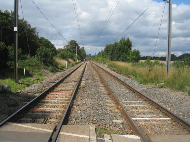
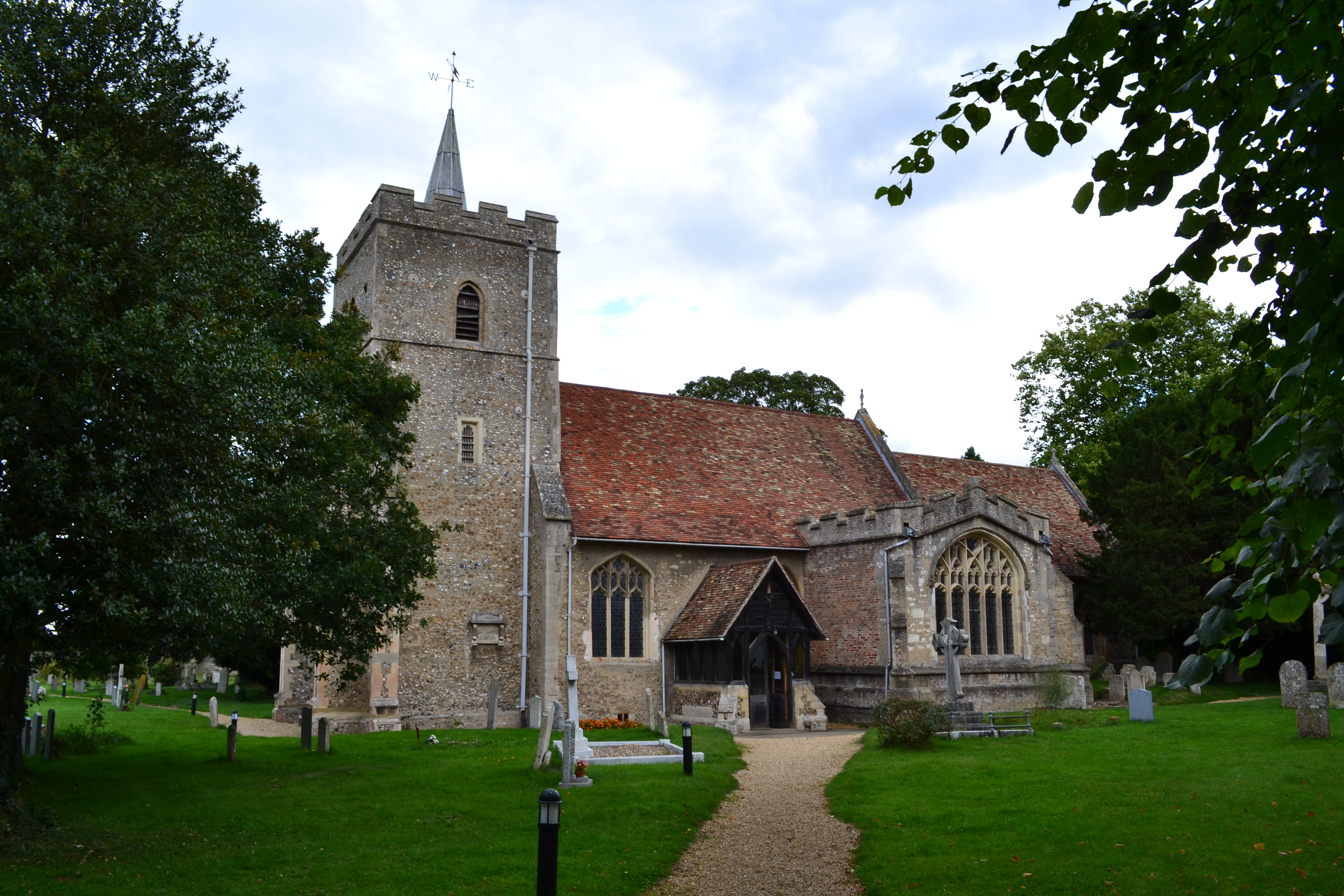
Pudding Acre Images

Images are sourced within 2km of 52.135661/0.13704099 or Grid Reference TL4650. Thanks to Geograph Open Source API. All images are credited.

This way to London Liverpool Street View from the Spicers crossing at Whittlesford.
This way to London Liverpool Street
View from the Spicers crossing at Whittlesford.
River Cam near Mill Farm
Harvested field - Sawston
Harvested field & buildings
Fields by the Cam - Whittlesford
Cycleway to Sawston
Cycleway to Sawston
Harvested field - Sawston
Farmland north of Whittlesford
The harvest is in
The harvest is in
Harvested field - Whittlesford
Cycling to and from Newton Two cyclists, one with serious kit, the other with a camera, are about to pass on the bridleway which links Newton and Stapleford. It was a hot Sunday morning during the heatwave of autumn 2011.
Cycling to and from Newton
Two cyclists, one with serious kit, the other with a camera, are about to pass on the bridleway which links Newton and Stapleford. It was a hot Sunday morning during the heatwave of autumn 2011.
Sunday-morning traffic on the M11 Looking towards Cambridge from the bridge which carries the Newton-Stapleford bridleway.
Sunday-morning traffic on the M11
Looking towards Cambridge from the bridge which carries the Newton-Stapleford bridleway.
Bridle path and motorway bridge The bridge carries the Newton-Stapleford bridleway and was built with farm vehicles in mind. The sign gives early warning of Trumpington Park & Ride, near the next turn-off, Junction 11.
Bridle path and motorway bridge
The bridge carries the Newton-Stapleford bridleway and was built with farm vehicles in mind. The sign gives early warning of Trumpington Park & Ride, near the next turn-off, Junction 11.
M11 northbound Ahead is a farm accommodation and public bridleway bridge.
M11 northbound
Ahead is a farm accommodation and public bridleway bridge.
Towards Cambridge A Stansted Airport to Birmingham diesel train heads north from the level crossing serving Spicer's paper mill at Sawston. In the right foreground are the remains of a concrete platelayers' hut and some semaphore signalling equipment
Towards Cambridge
A Stansted Airport to Birmingham diesel train heads north from the level crossing serving Spicer's paper mill at Sawston. In the right foreground are the remains of a concrete platelayers' hut and some semaphore signalling equipment
Cycle path bridges The path from Whittlesford to Sawston is part of National Cycle Network Route 11. The nearer bridge crosses a drainage ditch, the further one the Granta, the eastern stem of the River Cam.
Cycle path bridges
The path from Whittlesford to Sawston is part of National Cycle Network Route 11. The nearer bridge crosses a drainage ditch, the further one the Granta, the eastern stem of the River Cam.
The River Cam (or Granta) near Sawston The two branches of the Cam join a couple of miles north of here, near Trumpington. There is no public access to the river below the cycle bridge from the side of which this picture was taken as the land is owned by Spicer's, the stationery manufacturers, whose factories are beyond the trees on the right.
The River Cam (or Granta) near Sawston
The two branches of the Cam join a couple of miles north of here, near Trumpington. There is no public access to the river below the cycle bridge from the side of which this picture was taken as the land is owned by Spicer's, the stationery manufacturers, whose factories are beyond the trees on the right.
Whittlesford Road
Whittlesford Road
Show me another place!

Pudding Acre is located at Grid Ref: TL4650 (Lat: 52.135661, Lng: 0.13704099)

Administrative County: Cambridgeshire

District: South Cambridgeshire

Police Authority: Cambridgeshire

What 3 Words

///silence.stealthier.chilling. Near Sawston, Cambridgeshire

Nearby Locations

Pudding Acre

Related Wikis

Dernford Fen

Dernford Fen is a 10.3-hectare (25-acre) biological Site of Special Scientific Interest north-west of Sawston in Cambridgeshire.The site is a rare surviving...

Bottisham Village College

Bottisham Village College is a mixed secondary school located in Bottisham, Cambridgeshire, England. The school opened in 1937 as the second village college...

Great Shelford F.C.

Great Shelford Football Club are a football club based in Great Shelford, near Cambridge, England. Established in 1912, they currently play in the Cambridgeshire...

Stapleford, Cambridgeshire

Stapleford is a village located approximately 4 miles to the south of Cambridge, in the county of Cambridgeshire, in eastern England on the right-hand...

Church of All Saints, Little Shelford

The Church of All Saints is a Church of England parish church in Little Shelford, Cambridgeshire. The church is a Grade II* listed building, and dates...

Little Shelford

Little Shelford is a village located to the south of Cambridge, in the county of Cambridgeshire, in eastern England. The River Granta lies between it...

ACE Cultural Tours

ACE Cultural Tours is an operator of educational and cultural travel tours. Specialising in small group tours with expert leaders such as Humphrey Burton...

Shelford railway station

Shelford railway station is on the West Anglia Main Line serving the villages of Great Shelford, Little Shelford and Stapleford in Cambridgeshire, England...

Nearby Amenities

Located within 500m of 52.135661,0.13704099
Post Box
Collection Times: Mo-Fr 16:00; Sa 09:15
Operator: Royal Mail
Post Box Type: wall
Ref: CB22 412
Royal Cypher: EVIIR
Royal Cypher Wikidata: Q33102324
Source: survey
Lat/Long: 52.1336138/0.1311085
Railway: level_crossing
Lat/Long: 52.1350915/0.1429831
Power: pole
Lat/Long: 52.1337352/0.1435627
Power: pole
Lat/Long: 52.1337319/0.1417391
Power: pole
Lat/Long: 52.132698/0.1383807
Power: pole
Lat/Long: 52.1335013/0.1405801
Power: pole
Lat/Long: 52.1332611/0.1394592
Power: pole
Lat/Long: 52.1341633/0.1390244
Power: pole
Lat/Long: 52.1312753/0.1368625
Power: pole
Lat/Long: 52.1320098/0.1376243
Power: pole
Lat/Long: 52.1391277/0.1367799
Power: pole
Lat/Long: 52.1382194/0.1371469
Power: pole
Lat/Long: 52.134927/0.1386167
Power: pole
Lat/Long: 52.1365371/0.1378442
Power: pole
Lat/Long: 52.1357239/0.1382412
Power: pole
Lat/Long: 52.139597/0.1336338
Power: pole
Lat/Long: 52.1393631/0.1352029
Power: pole
Lat/Long: 52.1373176/0.1374741
Power: pole
Lat/Long: 52.1354014/0.1436266
Power: pole
Lat/Long: 52.138167/0.1417547
Power: pole
Lat/Long: 52.1347262/0.1436427
Power: pole
Lat/Long: 52.1372156/0.1418406
Power: pole
Lat/Long: 52.1365011/0.1426291
Power: pole
Lat/Long: 52.1390691/0.1414817
Power: pole
Lat/Long: 52.1357415/0.1433372
Railway: level_crossing
Lat/Long: 52.1351273/0.1430276
Waste Basket
Waste: dog_excrement
Lat/Long: 52.1367881/0.1431696
The data included in this document is from www.openstreetmap.org. The data is made available under ODbL.

Have you been to Pudding Acre?

Leave your review of Pudding Acre below (or comments, questions and feedback).