Spring Shaw

Wood, Forest in Kent

England

Spring Shaw

Day nursery, Queen Mary's Hospital, Sidcup, Kent Queen Mary's is a very large hospital, so this purpose-built day nursery is provided where doctors, nurses and other staff can leave babies and small children to be looked after during the day.
And that, I believe, concludes the TQ47 hectad, to which I have contributed, by my reckoning, 64 first geographs.  No prizes, I know - it's been hard work, but very, very enjoyable!  See you soon in TQ46!
Day nursery, Queen Mary's Hospital, Sidcup, Kent Credit: Dr Neil Clifton

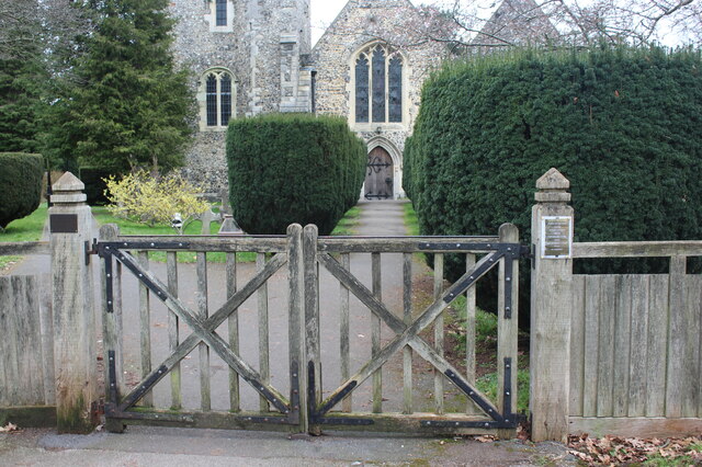
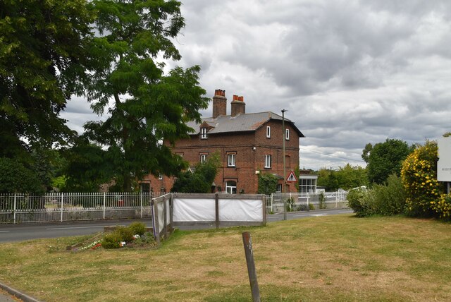
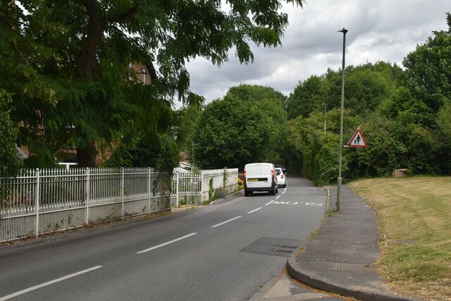
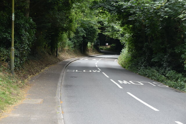
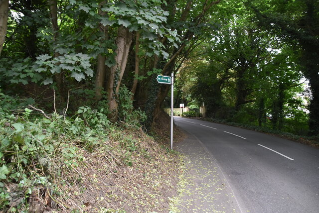
Spring Shaw is a picturesque woodland area located in Kent, England. Known for its natural beauty and serene atmosphere, this forested region covers a vast expanse of land and is a popular destination for nature enthusiasts and outdoor adventurers.

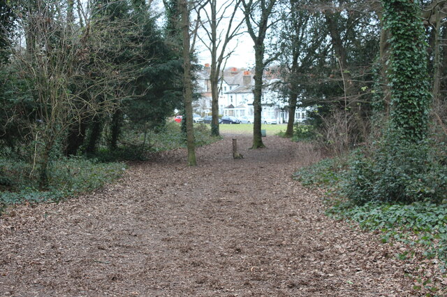
The woodland is characterized by its dense growth of trees, predominantly consisting of oak, beech, and ash. These tall, majestic trees provide ample shade and create a tranquil environment for visitors to explore and enjoy. The forest floor is covered in a lush carpet of green moss, interspersed with vibrant wildflowers during the spring months.

Numerous walking trails wind their way through the woods, offering visitors the opportunity to immerse themselves in nature and discover the area's diverse wildlife. Birdwatchers will delight in the variety of avian species that call Spring Shaw home, including woodpeckers, owls, and various songbirds.

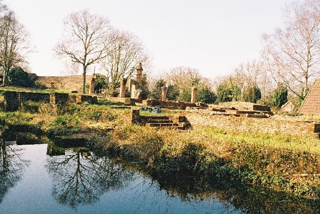
In addition to its natural beauty, Spring Shaw also boasts historical significance. The woodland is dotted with remnants of ancient settlements, including burial mounds and prehistoric earthworks, providing a glimpse into the area's rich past.

For those seeking a peaceful retreat or an escape from the hustle and bustle of everyday life, Spring Shaw in Kent is a perfect destination. With its tranquil atmosphere, stunning natural surroundings, and historical intrigue, it offers a truly unique and memorable experience for all who visit.

If you have any feedback on the listing, please let us know in the comments section below.
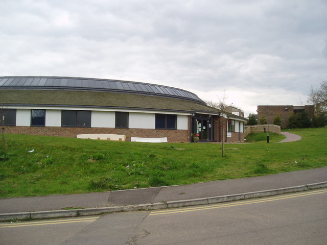
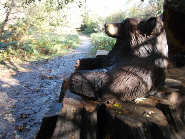
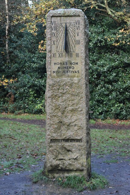
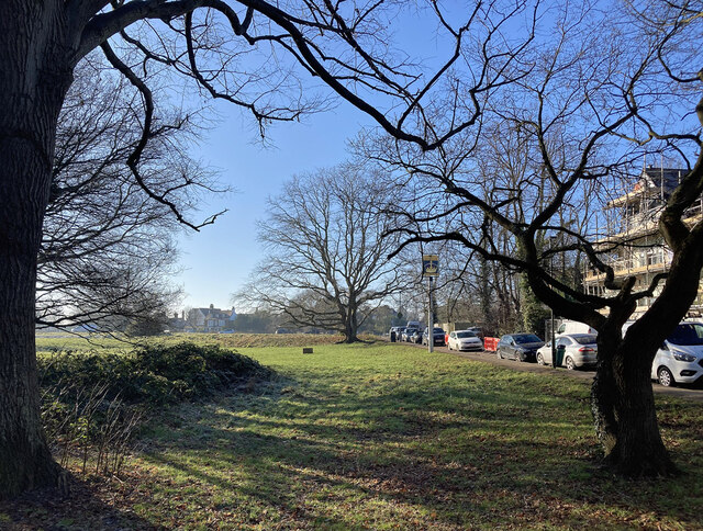
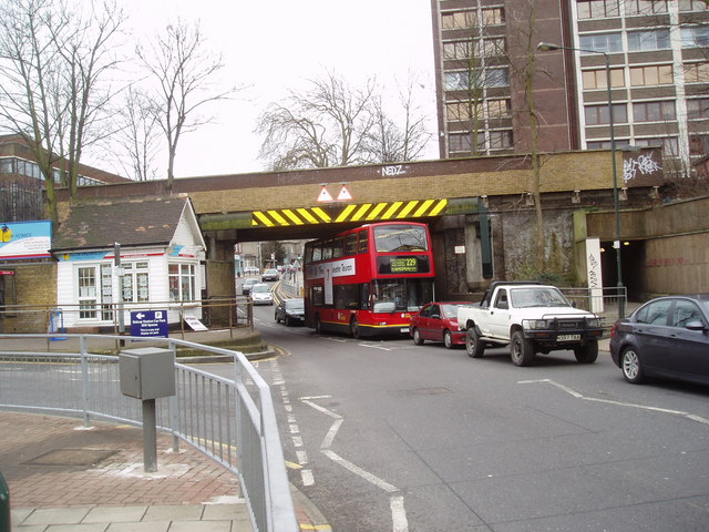
Spring Shaw Images

Images are sourced within 2km of 51.416981/0.099696766 or Grid Reference TQ4670. Thanks to Geograph Open Source API. All images are credited.

Day nursery, Queen Mary's Hospital, Sidcup, Kent Queen Mary's is a very large hospital, so this purpose-built day nursery is provided where doctors, nurses and other staff can leave babies and small children to be looked after during the day.
And that, I believe, concludes the TQ47 hectad, to which I have contributed, by my reckoning, 64 first geographs.  No prizes, I know - it's been hard work, but very, very enjoyable!  See you soon in TQ46!
Day nursery, Queen Mary's Hospital, Sidcup, Kent
Queen Mary's is a very large hospital, so this purpose-built day nursery is provided where doctors, nurses and other staff can leave babies and small children to be looked after during the day. And that, I believe, concludes the TQ47 hectad, to which I have contributed, by my reckoning, 64 first geographs. No prizes, I know - it's been hard work, but very, very enjoyable! See you soon in TQ46!
Bear hug sculpture seat, Scadbury Park
Junction of Sevenoaks Way and Midfield Way
Autumn leaves beside Midfield Way
Houses in Midfield Way
Grassy slope above Hoblingwell Wood
William Willett memorial, Petts Wood Sundial memorial to William Willett, who campaigned for the introduction of British Summer Time.
William Willett memorial, Petts Wood
Sundial memorial to William Willett, who campaigned for the introduction of British Summer Time.
Village Green, Chislehurst (1) A local name for this patch of green, sometimes also perhaps referred to as Chislehurst Common (which encompasses several green spaces). It has some good gnarly old oaks.
Village Green, Chislehurst (1)
A local name for this patch of green, sometimes also perhaps referred to as Chislehurst Common (which encompasses several green spaces). It has some good gnarly old oaks.
Path from Church Row to St Nicholas Church Gates for path west from Church Row.
Path from Church Row to St Nicholas Church
Gates for path west from Church Row.
Woodland path towards Church Row The houses on Church Row can be seen in the background on the far side of a grass area.
Woodland path towards Church Row
The houses on Church Row can be seen in the background on the far side of a grass area.
Home Farmhouse
Home Farmhouse
Sandy Lane
Sandy Lane
Sandy Lane
Sandy Lane
Sandy Lane
Sandy Lane
Main Road
Main Road
Scadbury Park, Sidcup, Kent The water is part of the moat belonging to the manor house which once stood on this site.
Scadbury Park, Sidcup, Kent
The water is part of the moat belonging to the manor house which once stood on this site.
Rush Pond, Chislehurst, Kent This pond, which derives from old gravel workings, has no natural feed from any spring or stream.  In recent years it has almost dried out as the water table in the area has dropped.  However, active conservation work is in progress which should see the pond restored to its former very attractive appearance within a couple of years.
Rush Pond, Chislehurst, Kent
This pond, which derives from old gravel workings, has no natural feed from any spring or stream. In recent years it has almost dried out as the water table in the area has dropped. However, active conservation work is in progress which should see the pond restored to its former very attractive appearance within a couple of years.
Railway overbridge, Sidcup, Kent Originally this bridge, which adjoins Sidcup station, was so low that it could only be passed by single-deck buses.  But following World War 2, the roadway was lowered to allow the passage of double-deckers, as seen here on the long Route 229 to Thamesmead Town Centre.
Railway overbridge, Sidcup, Kent
Originally this bridge, which adjoins Sidcup station, was so low that it could only be passed by single-deck buses. But following World War 2, the roadway was lowered to allow the passage of double-deckers, as seen here on the long Route 229 to Thamesmead Town Centre.
Show me another place!

Spring Shaw is located at Grid Ref: TQ4670 (Lat: 51.416981, Lng: 0.099696766)

Unitary Authority: Bromley

Police Authority: Metropolitan

What 3 Words

///cakes.calms.sadly. Near Sidcup, London

Related Wikis

Queen Mary's Hospital, Sidcup

Queen Mary's Hospital is an acute district general hospital in Sidcup, South East London, serving the population of the London Borough of Bexley. It was...
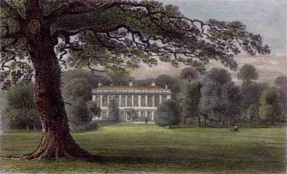
Frognal House

Frognal House is a Jacobean mansion in London, England, standing on the border of Sidcup in the London Borough of Bexley, and Chislehurst, in the London...

Scadbury Park

Scadbury Park is a Local Nature Reserve in Chislehurst in the London Borough of Bromley. It is also a Site of Metropolitan Importance for Nature Conservation...

Manor of Scadbury

Scadbury is a historic manor in the parish of Chislehurst in the London Borough of Bromley, England. Much of the estate is preserved today as Scadbury...

Metrogas F.C.

Metrogas Football Club is a football club based in Thamesmead, England. == History == Metrogas was founded in 1888, two years after the completion of the...

Erith Town F.C.

Erith Town Football Club is a football club based in Thamesmead in South East London, England. They are currently members of the Southern Counties East...

Sporting Club Thamesmead F.C.

Sporting Club Thamesmead F.C. is an English football club located in Thamesmead in the London Borough of Bexley. The club is affiliated to the Kent Football...

Chislehurst School for Girls

Chislehurst School for Girls is a secondary school in Chislehurst, in outer South East London, England. It caters for girls in academic years 7-11 and...

Nearby Amenities

Located within 500m of 51.416981,0.099696766
Mini Roundabout
Lat/Long: 51.4192584/0.1052047
Motorway Junction
Lat/Long: 51.4155624/0.1043571
Motorway Junction
Lat/Long: 51.4152586/0.1054954
Barrier: swing_gate
Height: 1.2
Locked: yes
Material: metal
Width: 2.9
Lat/Long: 51.4138001/0.1021461
Barrier: kissing_gate
Bicycle: no
Depth: 0.6
Foot: yes
Horse: no
Material: metal
Motor Vehicle: no
Width: 1.1
Lat/Long: 51.4180381/0.0988181
Traffic Signals
Lat/Long: 51.4205048/0.0992633
Bus Stop
Leas Green
Bench: yes
Bus: yes
Local Ref: HK
Naptan AtcoCode: 490009041HK
Naptan Bearing: N
Naptan CommonName: Leas Green
Naptan Indicator: HK
Naptan Verified: no
Public Transport: platform
Ref: 53804
Shelter: yes
Source Ref: naptan
Lat/Long: 51.4182611/0.0938101
Bus Stop
Leas Green
Bus: yes
Local Ref: HL
Naptan AtcoCode: 490009041HL
Naptan Bearing: N
Naptan CommonName: Leas Green
Naptan Indicator: HL
Naptan Verified: no
Public Transport: platform
Ref: 74703
Source Ref: naptan
Lat/Long: 51.4178732/0.0930341
Bus Stop
Queen Mary's Hospital / Cancer Unit
Local Ref: HB
Naptan AtcoCode: 490011319HB
Naptan Bearing: W
Naptan CommonName: Queen Mary's Hospital B Block
Naptan Indicator: Stop HB
Naptan Verified: no
Public Transport: platform
Lat/Long: 51.4186561/0.104779
Bus Stop
Queen Mary's Hospital / Main Entrance
Bus: yes
Local Ref: HA
Naptan AtcoCode: 490011321HA
Naptan Bearing: N
Naptan CommonName: Queen Marys Hospital A&E
Naptan Indicator: HA
Naptan Street: FROGNAL PLACE
Naptan Verified: no
Public Transport: platform
Ref: 54995
Source Ref: naptan
Lat/Long: 51.4196932/0.1020001
Bus Stop
Sidcup / Queen Mary's Hospital
Bus: yes
Local Ref: HE
Naptan AtcoCode: 490012139HE
Naptan Bearing: N
Naptan CommonName: Sidcup Queen Mary's Hospital
Naptan Indicator: HE
Naptan Street: FROGNAL AVENUE
Naptan Verified: no
Public Transport: platform
Ref: 48039
Source Ref: naptan
Lat/Long: 51.4198955/0.0996081
Bus Stop
Queen Mary's Hospital
Bus: yes
Local Ref: HH
Naptan AtcoCode: 490012139HH
Naptan Bearing: N
Naptan CommonName: Sidcup Queen Mary's Hospital
Naptan Indicator: Stop HH
Naptan Verified: no
Public Transport: platform
Ref: 58550
Lat/Long: 51.4195145/0.099048
Bus Stop
Queen Mary's Hospital
Bus: yes
Local Ref: HJ
Naptan AtcoCode: 490012139HJ
Naptan Bearing: N
Naptan CommonName: Sidcup Queen Mary's Hospital
Naptan Indicator: Stop HJ
Naptan Verified: no
Public Transport: platform
Ref: 48721
Lat/Long: 51.4203056/0.0991117
Bus Stop
Queen Mary's Hospital / Frognal Avenue
Bus: yes
Naptan AtcoCode: 490012139N
Naptan Bearing: N
Naptan CommonName: Sidcup Queen Mary's Hospital
Naptan Indicator: Stop
Naptan Verified: no
Note: Alighting point only.
Public Transport: platform
Ref: 54512
Source Ref: naptan
Lat/Long: 51.419411/0.0993075
Bus Stop
Queen Mary's Hospital / Chislehurst Road
Bus: yes
Naptan AtcoCode: 490012139S
Naptan Bearing: S
Naptan CommonName: Sidcup Queen Mary's Hospital
Naptan Indicator: Stop
Naptan Verified: no
Note: Alighting point only.
Public Transport: platform
Ref: 72097
Source Ref: naptan
Lat/Long: 51.4203199/0.0996441
Bus Stop
Sidcup / Queen Mary's Hospital
Bus: yes
Naptan AtcoCode: 490012139W
Naptan Bearing: NW
Naptan CommonName: Sidcup Queen Mary's Hospital
Naptan Indicator: Stop
Naptan Verified: no
Public Transport: platform
Lat/Long: 51.4193918/0.096433
Bus Stop
Sidcup / Queen Mary's Hospital
Bus: yes
Naptan AtcoCode: 490012139W1
Naptan Bearing: W
Naptan CommonName: Sidcup Queen Mary's Hospital
Naptan Indicator: Stop
Naptan Verified: no
Note: Bus stand. Buses do not pick up passengers here.
Public Transport: platform
Lat/Long: 51.4196421/0.0994404
Crossing
Crossing: traffic_signals
Lat/Long: 51.4205879/0.0994339
Crossing
Crossing: traffic_signals
Lat/Long: 51.4205461/0.0992778
Cafe
Cuisine: coffee_shop
Lat/Long: 51.4188045/0.1037156
Traffic Signals
Lat/Long: 51.4206292/0.0994418
Bus Stop
Sidcup / Queen Mary's Hospital
Bus: yes
Naptan AtcoCode: 490012139E
Naptan Bearing: SE
Naptan CommonName: Sidcup Queen Mary's Hospital
Naptan Indicator: Stop
Naptan Verified: no
Public Transport: platform
Lat/Long: 51.4184394/0.0991509
Frognal Corner
Lat/Long: 51.4188115/0.0979052
Crossing
Lat/Long: 51.4186587/0.1049022
Street Lamp
Lamp Model: CU Phosco P850
Lamp Type: LED
Light Count: 1
Source: Survey
Lat/Long: 51.4159752/0.1031165
Street Lamp
Lamp Model: CU Phosco P850
Lamp Type: LED
Light Count: 1
Source: Survey
Lat/Long: 51.4160734/0.1038175
Street Lamp
Lamp Model: CU Phosco P850
Lamp Type: LED
Light Count: 1
Source: Survey
Lat/Long: 51.4162741/0.1034015
Street Lamp
Lamp Model: CU Phosco P850
Lamp Type: LED
Light Count: 1
Source: Survey
Lat/Long: 51.4158321/0.1034971
Street Lamp
Lamp Model: CU Phosco P850
Lamp Type: LED
Light Count: 1
Source: Survey
Lat/Long: 51.415899/0.1041904
Street Lamp
Lamp Model: CU Phosco P850
Lamp Type: LED
Light Count: 1
Source: Survey
Lat/Long: 51.415659/0.1039517
Street Lamp
Lamp Model: CU Phosco P850
Lamp Type: LED
Light Count: 1
Source: Survey
Lat/Long: 51.4154727/0.1044211
Street Lamp
Lamp Model: CU Phosco P850
Lamp Type: LED
Light Count: 1
Source: Survey
Lat/Long: 51.4150954/0.1053749
Street Lamp
Lamp Model: CU Phosco P850
Lamp Type: LED
Light Count: 1
Source: Survey
Lat/Long: 51.4152833/0.1048975
Street Lamp
Lamp Model: CU Phosco P850
Lamp Type: LED
Light Count: 1
Source: Survey
Lat/Long: 51.4157011/0.1046507
Street Lamp
Lamp Model: CU Phosco P850
Lamp Type: LED
Light Count: 1
Source: Survey
Lat/Long: 51.415512/0.1051146
Street Lamp
Lamp Model: CU Phosco P850
Lamp Type: LED
Light Count: 1
Source: Survey
Lat/Long: 51.4153401/0.1055676
Street Lamp
Lamp Model: CU Phosco P850
Lamp Type: LED
Light Count: 1
Source: Survey
Lat/Long: 51.4149058/0.1058435
Street Lamp
Lamp Model: CU Phosco P850
Lamp Type: LED
Light Count: 1
Source: Survey
Lat/Long: 51.4151537/0.106065
Bench
Backrest: no
Direction: SW
Length: 2.4
Material: wood
Seats: 3
Lat/Long: 51.4157968/0.1005444
Entrance: yes
Lat/Long: 51.4189511/0.1034136
Cafe
Cuisine: coffee_shop
Lat/Long: 51.4189045/0.1031559
Camera Mount: gantry
Camera Type: fixed
Description: automatic number plate recognition for London Low Emission Zone
Direction: 120
Man Made: surveillance
Surveillance: public
Surveillance Purpose: London_LEZ
Surveillance Type: ALPR
Surveillance Zone: traffic
Lat/Long: 51.4151648/0.1054475
Camera Mount: gantry
Camera Type: fixed
Description: automatic number plate recognition for London Low Emission Zone
Direction: 300
Man Made: surveillance
Surveillance: public
Surveillance Purpose: London_LEZ
Surveillance Type: ALPR
Surveillance Zone: traffic
Lat/Long: 51.4151288/0.1057345
Frognal Corner
Place: locality
Lat/Long: 51.4189295/0.0966153
Bus Stop
Bus: yes
Public Transport: platform
Lat/Long: 51.4198335/0.101331
Information: board
Tourism: information
Lat/Long: 51.4197191/0.1018429
Crossing
Crossing: unmarked
Crossing Markings: no
Lat/Long: 51.4196407/0.1022101
Bench
Lat/Long: 51.4195106/0.1003945
Leisure: picnic_table
Lat/Long: 51.4195859/0.1003786
Leisure: picnic_table
Lat/Long: 51.4196141/0.100249
Leisure: picnic_table
Lat/Long: 51.4196375/0.1001401
Frognal
Place: quarter
Lat/Long: 51.4170111/0.1041519
Height: 2
Information: guidepost
Material: wood
Tourism: information
Lat/Long: 51.4157844/0.1005614
Bench
Backrest: no
Direction: N
Material: wood
Lat/Long: 51.4155293/0.0975962
Bench
Backrest: yes
Direction: S
Material: wood
Lat/Long: 51.4156528/0.0928883
Bicycle Parking
Bicycle Parking: stands
Capacity: 4
Ref GB Tflcid: RWG291003
Lat/Long: 51.4201927/0.0947149
Crossing
Lat/Long: 51.4193866/0.105266
Crossing
Lat/Long: 51.419258/0.1027004
Crossing
Lat/Long: 51.4191347/0.1028684
Crossing
Lat/Long: 51.4192146/0.1032434
Crossing
Lat/Long: 51.4190861/0.1038615
Crossing
Lat/Long: 51.4190706/0.1031733
Crossing
Lat/Long: 51.4189413/0.1037881
Barrier: kissing_gate
Depth: 1.1
Height: 1.4
Material: metal
Width: 1.1
Lat/Long: 51.4137933/0.1021684
Information: board
Tourism: information
Lat/Long: 51.4180353/0.0988375
The data included in this document is from www.openstreetmap.org. The data is made available under ODbL.

Have you been to Spring Shaw?

Leave your review of Spring Shaw below (or comments, questions and feedback).