Foxberry Wood

Wood, Forest in Kent

England

Foxberry Wood

Cudham Shaws Camp Site Formerly a camp site for Girl Guides, the camp site was taken over by Bexley Scout District from April 2022 - see <span class="nowrap"><a title="www.bexleyscouts.org.uk/district-campsite" rel="nofollow ugc noopener" href="http://www.bexleyscouts.org.uk/district-campsite">Link</a><img style="margin-left:2px;" alt="External link" title="External link - shift click to open in new window" src="https://s1.geograph.org.uk/img/external.png" width="10" height="10"/></span>  It is at the bottom of a steep valley between Cudham and Downe.
Cudham Shaws Camp Site Credit: Marathon

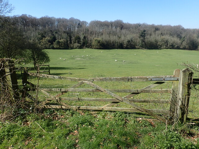
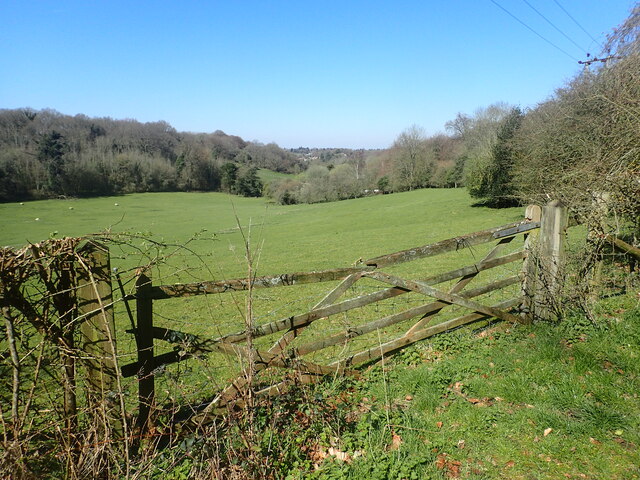
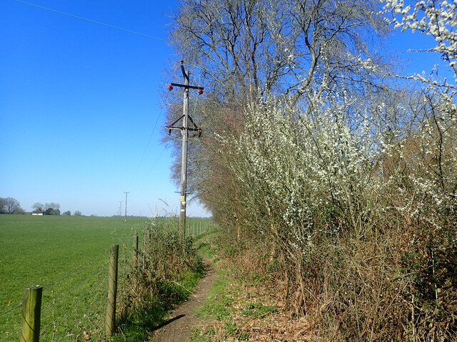
Foxberry Wood is a picturesque woodland located in the county of Kent, England. Spanning over 20 acres, this enchanting forest is renowned for its natural beauty and diverse wildlife. Situated in a rural area, it offers a tranquil escape from the hustle and bustle of everyday life.

The wood is predominantly made up of deciduous trees, such as oak, beech, and birch, which provide ample shade during the summer months. The forest floor is adorned with a carpet of vibrant wildflowers in spring, creating a stunning display of colors.

This woodland is home to a wide variety of animal species, making it a haven for nature enthusiasts and wildlife photographers. Visitors may catch glimpses of foxes, badgers, rabbits, and a myriad of bird species, including woodpeckers, owls, and finches. The rich ecosystem of Foxberry Wood supports a delicate balance of flora and fauna, offering a unique opportunity to observe nature in its purest form.

There are several well-maintained walking trails that wind through the forest, allowing visitors to explore its beauty at their own pace. These paths are suitable for all ages and offer a chance to immerse oneself in the peaceful surroundings. Many visitors also enjoy picnicking on the grassy clearings or simply finding a quiet spot to relax and enjoy the serenity of the wood.

Foxberry Wood is a cherished natural treasure in Kent, offering a delightful escape for those seeking solace in nature's embrace. Whether it's a leisurely stroll or a bird-watching adventure, this enchanting woodland is sure to captivate the hearts of all who visit.

If you have any feedback on the listing, please let us know in the comments section below.

Foxberry Wood Images

Images are sourced within 2km of 51.333464/0.088083199 or Grid Reference TQ4561. Thanks to Geograph Open Source API. All images are credited.

Cudham Shaws Camp Site Formerly a camp site for Girl Guides, the camp site was taken over by Bexley Scout District from April 2022 - see <span class="nowrap"><a title="www.bexleyscouts.org.uk/district-campsite" rel="nofollow ugc noopener" href="http://www.bexleyscouts.org.uk/district-campsite">Link</a><img style="margin-left:2px;" alt="External link" title="External link - shift click to open in new window" src="https://s1.geograph.org.uk/img/external.png" width="10" height="10"/></span>  It is at the bottom of a steep valley between Cudham and Downe.
Cudham Shaws Camp Site
Formerly a camp site for Girl Guides, the camp site was taken over by Bexley Scout District from April 2022 - see LinkExternal link It is at the bottom of a steep valley between Cudham and Downe.
Coal Tax post on Cudham Lane This is one of the City of London Coal Tax posts. Coal Tax posts were marker posts, first erected in 1851 and forming a rough circle about twenty miles from the centre of London to mark the points where taxes on coal and wine due to the Corporation of London had to be paid. Of the original 250 or so, 211 have survived. They are often found now in very out of the way and unlikely places. 

A remarkable 13 of these can be seen on the two mile walk across Banstead Heath, which continues across Walton Heath Golf Course to Colley Hill - see <a title="www.geograph.org.uk/photo/4045637" href="https://www.geograph.org.uk/photo/4045637">Link</a>
Coal Tax post on Cudham Lane
This is one of the City of London Coal Tax posts. Coal Tax posts were marker posts, first erected in 1851 and forming a rough circle about twenty miles from the centre of London to mark the points where taxes on coal and wine due to the Corporation of London had to be paid. Of the original 250 or so, 211 have survived. They are often found now in very out of the way and unlikely places. A remarkable 13 of these can be seen on the two mile walk across Banstead Heath, which continues across Walton Heath Golf Course to Colley Hill - see Link
Field near Hookwood Road A footpath leads from Hookwood Road and passes through Lattice Coppice to reach Perrys Lane. This is remote countryside, although it is in Greater London. In this view, just after leaving Hookwood Road, Lattice Coppice is across the valley.
Field near Hookwood Road
A footpath leads from Hookwood Road and passes through Lattice Coppice to reach Perrys Lane. This is remote countryside, although it is in Greater London. In this view, just after leaving Hookwood Road, Lattice Coppice is across the valley.
Field near Hookwood Road A footpath leads from Hookwood Road and passes through Lattice Coppice to reach Perrys Lane. This is remote countryside, although it is in Greater London. In this view, just after leaving Hookwood Road, Lattice Coppice is across the valley on the left.
Field near Hookwood Road
A footpath leads from Hookwood Road and passes through Lattice Coppice to reach Perrys Lane. This is remote countryside, although it is in Greater London. In this view, just after leaving Hookwood Road, Lattice Coppice is across the valley on the left.
Footpath near Rushmore Hill Farm A footpath leads from Perry Lane and passes through Lattice Coppice to reach Hookwood Road ahead. This is remote countryside, although it is in Greater London. In this view, Lattice Coppice is across the valley on the left.
Footpath near Rushmore Hill Farm
A footpath leads from Perry Lane and passes through Lattice Coppice to reach Hookwood Road ahead. This is remote countryside, although it is in Greater London. In this view, Lattice Coppice is across the valley on the left.
Footpath through woodland A footpath leads from Hookwood Road and passes through Lattice Coppice to reach Perrys Lane. This is remote countryside, although it is in Greater London. In this view, the path is climbing through the woodland with Lattice Coppice to the right and Birchingbank Wood to the left.
Footpath through woodland
A footpath leads from Hookwood Road and passes through Lattice Coppice to reach Perrys Lane. This is remote countryside, although it is in Greater London. In this view, the path is climbing through the woodland with Lattice Coppice to the right and Birchingbank Wood to the left.
Fairtrough Road This is remote countryside, although it is in Greater London.
Fairtrough Road
This is remote countryside, although it is in Greater London.
Upper Brooms Wood This is a fairly spaced-out woodland. It is seen from Fairtrough Road. This is remote countryside, although it is in Greater London.
Upper Brooms Wood
This is a fairly spaced-out woodland. It is seen from Fairtrough Road. This is remote countryside, although it is in Greater London.
Fairtrough Road Fairtrough Cottage is just ahead which operates as a cattery. This is remote countryside, although it is in Greater London.
Fairtrough Road
Fairtrough Cottage is just ahead which operates as a cattery. This is remote countryside, although it is in Greater London.
Fairtrough Road Fairtrough Cottage is just ahead which operates as a cattery. This is remote countryside, although it is in Greater London.
Fairtrough Road
Fairtrough Cottage is just ahead which operates as a cattery. This is remote countryside, although it is in Greater London.
Footpath alongside Birchingbank Wood A footpath leads from Perry Lane and passes between Lattice Coppice and Birchingbank Wood to reach Hookwood Road close to Coolings Garden Centre. This is remote countryside, although it is in Greater London. Perry Lane is just behind and Birchingbank Wood is on the right.
Footpath alongside Birchingbank Wood
A footpath leads from Perry Lane and passes between Lattice Coppice and Birchingbank Wood to reach Hookwood Road close to Coolings Garden Centre. This is remote countryside, although it is in Greater London. Perry Lane is just behind and Birchingbank Wood is on the right.
Sheep near Rushmore Hill Farm A footpath leads from Perry Lane and passes between Lattice Coppice and Birchingbank Wood to reach Hookwood Road close to Coolings Garden Centre. This is remote countryside, although it is in Greater London. This is after passing through the woodland.
Sheep near Rushmore Hill Farm
A footpath leads from Perry Lane and passes between Lattice Coppice and Birchingbank Wood to reach Hookwood Road close to Coolings Garden Centre. This is remote countryside, although it is in Greater London. This is after passing through the woodland.
A21 Sevenoaks Road at the junction with Charmwood Lane
Newyears Wood
Newyears Wood
Newyears Wood
Newyears Wood
Newyears Wood
Newyears Wood
Footpath across misty field
Show me another place!

Foxberry Wood is located at Grid Ref: TQ4561 (Lat: 51.333464, Lng: 0.088083199)

Unitary Authority: Bromley

Police Authority: Metropolitan

What 3 Words

///cakes.spoon.vets. Near Farnborough, London

Related Wikis

London Borough of Bromley

The London Borough of Bromley ( ) is a borough in London, England. It borders the county of Kent, of which it formed part of until 1965. The borough's...

Hazelwood, London

Hazelwood is a hamlet in Greater London, England. It is located within the London Borough of Bromley, to the east of Downe. == References ==

Downe Bank

Downe Bank is a nature reserve owned and managed by the Kent Wildlife Trust in the North Downs, close to Downe in the London Borough of Bromley. It is...

Pratt's Bottom

Pratt's Bottom is a village in Greater London, England, within the London Borough of Bromley and, prior to 1965, within the historic county of Kent. It...

Nearby Amenities

Located within 500m of 51.333464,0.088083199
Barrier: kissing_gate
Foot: yes
Material: wood
Source: survey
Lat/Long: 51.3312927/0.0931616
Power: pole
Lat/Long: 51.3315563/0.0821282
Power: pole
Lat/Long: 51.3325979/0.0816892
Power: pole
Lat/Long: 51.3339343/0.0811241
The data included in this document is from www.openstreetmap.org. The data is made available under ODbL.

Have you been to Foxberry Wood?

Leave your review of Foxberry Wood below (or comments, questions and feedback).