Parish Wood

Wood, Forest in Kent

England

Parish Wood

Wyncham Avenue October 1987 In the great storm of October 1987 trees fell across southern England at an average rate of 600 trees a second for seven hours on end.  The leafy suburbs of Sidcup were not immune and this was the scene soon after as the clear-up began.
Wyncham Avenue October 1987 Credit: rafflesbear

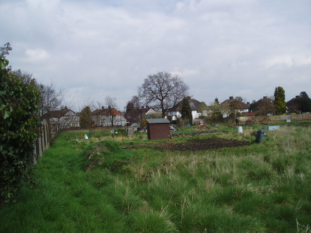
Parish Wood, located in Kent, England, is a picturesque forest known for its natural beauty and peaceful ambiance. Covering an area of approximately 100 hectares, this enchanting woodland is a haven for nature lovers and wildlife enthusiasts alike.

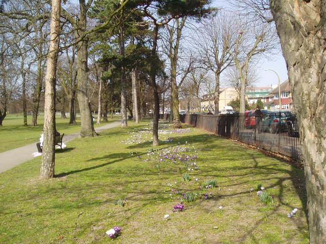
The wood is predominantly composed of broadleaf trees, including oak, beech, and ash, which create a dense canopy that filters sunlight and provides a sheltered environment for a diverse range of flora and fauna. The forest floor is adorned with a carpet of vibrant wildflowers, ferns, and mosses, adding to the area's charm.

Parish Wood is crisscrossed by a network of well-maintained walking trails, allowing visitors to explore its tranquil surroundings at their own pace. These paths wind through the woods, meandering alongside babbling brooks and small ponds, enhancing the serene atmosphere. The sound of bird songs and rustling leaves create a symphony of nature that further immerses visitors in their surroundings.

The forest is home to a variety of wildlife, including deer, foxes, and a multitude of bird species. Birdwatchers can spot woodpeckers, owls, and warblers among the treetops, while lucky visitors might catch a glimpse of a shy badger or hedgehog darting through the underbrush.

Parish Wood is a popular destination for outdoor activities such as nature photography, picnics, and family outings. It offers a tranquil escape from the hustle and bustle of city life, providing a sanctuary where visitors can reconnect with nature and enjoy the simple pleasures of the countryside.

If you have any feedback on the listing, please let us know in the comments section below.
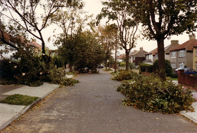
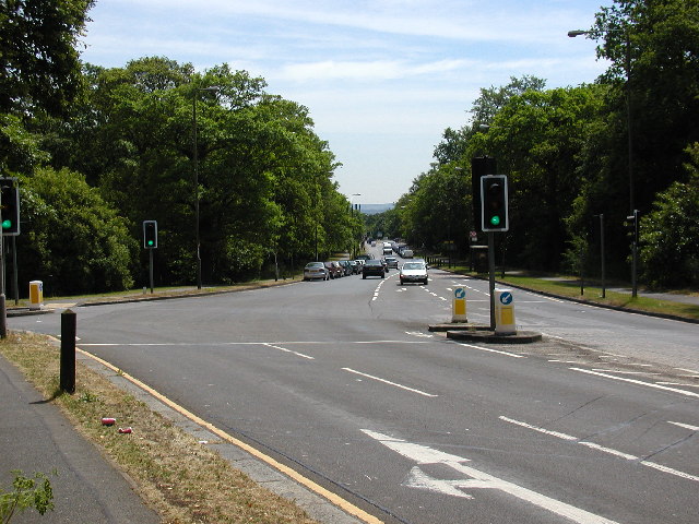
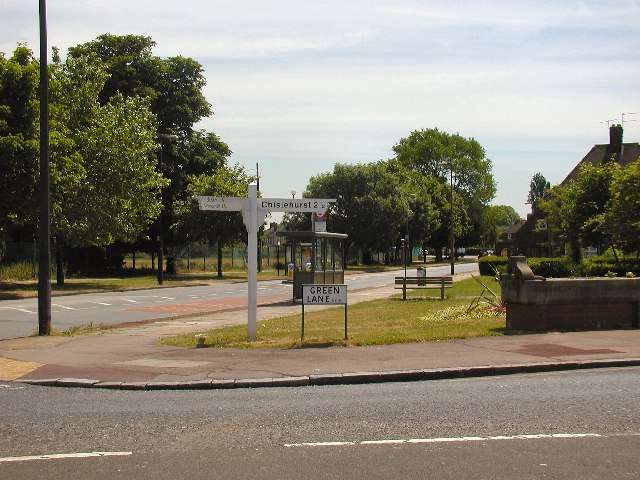
Parish Wood Images

Images are sourced within 2km of 51.447972/0.090079696 or Grid Reference TQ4574. Thanks to Geograph Open Source API. All images are credited.

Wyncham Avenue October 1987 In the great storm of October 1987 trees fell across southern England at an average rate of 600 trees a second for seven hours on end.  The leafy suburbs of Sidcup were not immune and this was the scene soon after as the clear-up began.
Wyncham Avenue October 1987
In the great storm of October 1987 trees fell across southern England at an average rate of 600 trees a second for seven hours on end. The leafy suburbs of Sidcup were not immune and this was the scene soon after as the clear-up began.
Rochester Way, junction with Welling Way This stretch of road was one long rush hour traffic jam twice a day until the Rochester Way Relief Road was opened in the 1980s. This road junction is at the southern edge of Oxleas Woods, and ancient woodland that's been saved from the road builders by dedicated campaigners.
Rochester Way, junction with Welling Way
This stretch of road was one long rush hour traffic jam twice a day until the Rochester Way Relief Road was opened in the 1980s. This road junction is at the southern edge of Oxleas Woods, and ancient woodland that's been saved from the road builders by dedicated campaigners.
Footscray Road, SE9 You don't often see these old signposts nowadays - well, certainly not in London. The Charlton Athletic Training Ground is in the fields on the other side of the road.
Footscray Road, SE9
You don't often see these old signposts nowadays - well, certainly not in London. The Charlton Athletic Training Ground is in the fields on the other side of the road.
Eltham Park South A fine public open space on the southern side of Rochester Way
Eltham Park South
A fine public open space on the southern side of Rochester Way
Trees and crocuses in Avery Hill Park, Eltham, Kent This large attractive park is enjoyed by students at Avery Hill College, which stands in the park.
Trees and crocuses in Avery Hill Park, Eltham, Kent
This large attractive park is enjoyed by students at Avery Hill College, which stands in the park.
Football changing rooms, Charterhouse Sports club, Eltham, Kent This functional building has obviously been the subject of attention by sad yobs who have nothing better to do.
Football changing rooms, Charterhouse Sports club, Eltham, Kent
This functional building has obviously been the subject of attention by sad yobs who have nothing better to do.
Railway overbridge, Sidcup, Kent Originally this bridge, which adjoins Sidcup station, was so low that it could only be passed by single-deck buses.  But following World War 2, the roadway was lowered to allow the passage of double-deckers, as seen here on the long Route 229 to Thamesmead Town Centre.
Railway overbridge, Sidcup, Kent
Originally this bridge, which adjoins Sidcup station, was so low that it could only be passed by single-deck buses. But following World War 2, the roadway was lowered to allow the passage of double-deckers, as seen here on the long Route 229 to Thamesmead Town Centre.
Burnt Oak Primary School, Sidcup, Kent Opened 1903 and built in the substantial style of the Edwardian period.
Burnt Oak Primary School, Sidcup, Kent
Opened 1903 and built in the substantial style of the Edwardian period.
Danson Junior School, Danson Lane, Welling, Kent On the North side of Danson Lane.  Bexley Grammar School stands opposite, behind the photographer, and down the lane to the right is Danson Park.
Danson Junior School, Danson Lane, Welling, Kent
On the North side of Danson Lane. Bexley Grammar School stands opposite, behind the photographer, and down the lane to the right is Danson Park.
A2 Flyover over Westwood Lane, Blackfen, Kent Formerly there was an at-grade junction of Westwood Lane (in which the photographer is standing) with the A2 at this point, but the latter has now been upgraded for fast traffic.
A2 Flyover over Westwood Lane, Blackfen, Kent
Formerly there was an at-grade junction of Westwood Lane (in which the photographer is standing) with the A2 at this point, but the latter has now been upgraded for fast traffic.
Welling Methodist Church On the south side of the busy Bellegrove Road (A 207).
Welling Methodist Church
On the south side of the busy Bellegrove Road (A 207).
Railway overbridge, Welling, Kent This bridge carries the Bexleyheath line over the busy A207 (Bellegrove Road). Welling Methodist Church is visible through the bridge on the left.
Railway overbridge, Welling, Kent
This bridge carries the Bexleyheath line over the busy A207 (Bellegrove Road). Welling Methodist Church is visible through the bridge on the left.
Premier Used Car Centre, Blackfen, Kent You can buy any make of used car here.  Or, even better, you can choose not to buy one, but to use public transport, a bicycle, or walk.
Premier Used Car Centre, Blackfen, Kent
You can buy any make of used car here. Or, even better, you can choose not to buy one, but to use public transport, a bicycle, or walk.
Allotment gardens, off Longlands Road, Sidcup, Kent Behind the photographer is a couple of acres of green field, one of several green spaces within this gridsquare.
Allotment gardens, off Longlands Road, Sidcup, Kent
Behind the photographer is a couple of acres of green field, one of several green spaces within this gridsquare.
Avery Hill Park Winter Gardens Avery Hill Winter Gardens built as a tropical hothouse in the 19th century by Colonel North. Still maintained and full of wonderful plant specimens, now part of the University of Greenwich. All set in beautiful Parkland in Eltham Southeast London.
Avery Hill Park Winter Gardens
Avery Hill Winter Gardens built as a tropical hothouse in the 19th century by Colonel North. Still maintained and full of wonderful plant specimens, now part of the University of Greenwich. All set in beautiful Parkland in Eltham Southeast London.
Semi-Detached Houses, New Eltham - Sidcup The housing in this quarter of the square is almost exclusively semi-detached, built in the mid-late 1930s, with a lot of the chalet style buildings fashionable at the time. Some were sold in 1937 for £700 (2007 price un-extended, around £300,000) The road surface (apart from patches) is still the original hard concrete packed with tiny stones and pebbles. Many of these three bedroom semis have been extended.
Semi-Detached Houses, New Eltham - Sidcup
The housing in this quarter of the square is almost exclusively semi-detached, built in the mid-late 1930s, with a lot of the chalet style buildings fashionable at the time. Some were sold in 1937 for £700 (2007 price un-extended, around £300,000) The road surface (apart from patches) is still the original hard concrete packed with tiny stones and pebbles. Many of these three bedroom semis have been extended.
Semi-Detached Houses, New Eltham - Sidcup Most of the housing in this quarter of the square was built in the mid-late 1930s, and most is semi-detached, often extended now from 3 to 4 bedrooms. The original very durable concrete (with pebble-chip) road surface remains, patched occasionally. The original grey 1930s heavy paving slabs have been relaid after cable TV installed their pipes and other equipment. The pink ones are post-war replacements for cracked slabs. Parking restrictions and yellow lines appeared in the 1990s.
Semi-Detached Houses, New Eltham - Sidcup
Most of the housing in this quarter of the square was built in the mid-late 1930s, and most is semi-detached, often extended now from 3 to 4 bedrooms. The original very durable concrete (with pebble-chip) road surface remains, patched occasionally. The original grey 1930s heavy paving slabs have been relaid after cable TV installed their pipes and other equipment. The pink ones are post-war replacements for cracked slabs. Parking restrictions and yellow lines appeared in the 1990s.
Semi-Detached Housing, New Eltham - Sidcup This quarter of the square is almost exclusively made up of 1930s semi-detached housing, around half of it in the fashionable (at the time) chalet style with downstairs toilet and bathroom.
Since the 1970s many have been extended in a variety of ways. This image shows the original shape with original 1937 castellated front garden wall, and the next one which is now four bedroomed. The house by the telegraph pole still has the original 1937 castellated brick garden wall.
Semi-Detached Housing, New Eltham - Sidcup
This quarter of the square is almost exclusively made up of 1930s semi-detached housing, around half of it in the fashionable (at the time) chalet style with downstairs toilet and bathroom. Since the 1970s many have been extended in a variety of ways. This image shows the original shape with original 1937 castellated front garden wall, and the next one which is now four bedroomed. The house by the telegraph pole still has the original 1937 castellated brick garden wall.
Show me another place!

Parish Wood is located at Grid Ref: TQ4574 (Lat: 51.447972, Lng: 0.090079696)

Unitary Authority: Bexley

Police Authority: Metropolitan

What 3 Words

///orders.rocket.glaze. Near Welling, London

Nearby Locations

Parish Wood Blackfen

Related Wikis

Blackfen

Blackfen is an area of South East London, England, within the London Borough of Bexley. It is located north of Sidcup and south of Welling. Prior to the...

Wyncham Stream

Wyncham Stream (Also spelt Wincham Stream) is a small river within the London Boroughs of Bexley and Bromley in southeast London, England, United Kingdom...

Avery Hill

Avery Hill is an area of South East London mainly within Royal Borough of Greenwich, and with some parts in the London Borough of Bexley. It is located...

Stationers' Crown Woods Academy

Stationers' Crown Woods Academy is a coeducational secondary school and sixth form with academy status, located in the Eltham area of the Royal Borough...

Nearby Amenities

Located within 500m of 51.447972,0.090079696
Crossing
Crossing: unmarked
Crossing Island: yes
Crossing Markings: no
Lat/Long: 51.450526/0.0866475
Ref GB Tflcid: RWG194160
Traffic Calming: hump
Lat/Long: 51.4466728/0.0872337
Turning Circle
Lat/Long: 51.4475713/0.0932342
Crossing
Crossing: unmarked
Crossing Island: no
Crossing Markings: no
Traffic Calming: table
Lat/Long: 51.4479858/0.0828997
Traffic Calming: choker
Lat/Long: 51.4483618/0.0871097
Traffic Calming: choker
Lat/Long: 51.4487217/0.087019
Barrier: kissing_gate
Material: metal
Lat/Long: 51.4456279/0.0953244
Crossing
Crossing: unmarked
Crossing Island: no
Crossing Markings: no
Tactile Paving: yes
Lat/Long: 51.4465568/0.0936863
Bus Stop
Blackfen Road / Boundary Road
Naptan AtcoCode: 490004183E
Naptan Bearing: N
Naptan CommonName: Blackfen Road Boundary Road
Naptan Verified: no
Public Transport: platform
Lat/Long: 51.4512681/0.0890312
Bus Stop
Blackfen Road / Boundary Road
Naptan AtcoCode: 490004183W
Naptan Bearing: N
Naptan CommonName: Blackfen Road Boundary Road
Naptan Verified: no
Public Transport: platform
Lat/Long: 51.4508666/0.0883508
Bus Stop
Hail & Ride Days Lane
Bus: yes
Naptan AtcoCode: 490004619N
Naptan Bearing: N
Naptan CommonName: Burnt Oak Lane Days Lane
Naptan Indicator: Stop V
Naptan Street: DAYS LANE
Naptan Verified: no
Public Transport: platform
Lat/Long: 51.4471424/0.0971641
Bus Stop
Hail & Ride Fen Grove
Bus: yes
Naptan AtcoCode: 490006793S
Naptan Bearing: N
Naptan CommonName: Fen Grove Days Lane
Naptan Street: DAYS LANE
Naptan Verified: no
Public Transport: platform
Lat/Long: 51.4461485/0.0952357
Bus Stop
Rennets Wood Road
Bus: yes
Local Ref: AL
Naptan AtcoCode: 490011524E
Naptan Bearing: E
Naptan CommonName: Rennets Wood Road
Naptan Indicator: Stop AL
Naptan Street: BEXLEY ROAD
Naptan Verified: no
Public Transport: platform
Ref: 54274
Source Ref: naptan
Lat/Long: 51.4506715/0.0845313
Bus Stop
Hail & Ride Rosebery Avenue
Bus: yes
Naptan AtcoCode: 490011680S1
Naptan Bearing: N
Naptan CommonName: Rosebery Avenue Days Lane
Naptan Street: DAYS LANE
Naptan Verified: no
Public Transport: platform
Lat/Long: 51.4454703/0.093201
Bus Stop
Hail & Ride Norfolk Crescent
Bus: yes
Naptan AtcoCode: 490015614E
Naptan Bearing: E
Naptan CommonName: Norfolk Crescent
Naptan Street: DAYS LANE
Naptan Verified: no
Public Transport: platform
Lat/Long: 51.4443837/0.0910765
Bus Stop
Hail & Ride Norfolk Crescent
Bus: yes
Naptan AtcoCode: 490015614W
Naptan Bearing: W
Naptan CommonName: Norfolk Crescent
Naptan Street: DAYS LANE
Naptan Verified: no
Public Transport: platform
Lat/Long: 51.4442162/0.0910612
Crossing
Crossing: unmarked
Crossing Island: no
Crossing Markings: no
Tactile Paving: yes
Lat/Long: 51.4479248/0.0844036
Turning Circle
Lat/Long: 51.4469043/0.093885
Barrier: kissing_gate
Lat/Long: 51.447156/0.0905664
Post Box
Brand: Royal Mail
Brand Wikidata: Q638098
Brand Wikipedia: en:Royal Mail
Collection Times: Mo-Fr 17:30; Sa 12:00; Su off
Drive Through: no
Operator: Royal Mail
Operator Wikidata: Q638098
Post Box Design: type_b
Post Box Type: pillar
Ref: SE9 85
Royal Cypher: GVIR
Royal Cypher Wikidata: Q33102169
Source: survey
Lat/Long: 51.4475131/0.0845217
Barrier: kissing_gate
Lat/Long: 51.4481772/0.0884711
Barrier: kissing_gate
Lat/Long: 51.4457801/0.0877791
Barrier: kissing_gate
Lat/Long: 51.4471682/0.0905706
Turning Circle
Lat/Long: 51.4475733/0.0857505
Ref GB Tflcid: RWG194151
Traffic Calming: hump
Lat/Long: 51.4491865/0.0868565
Crossing
Crossing: unmarked
Crossing Markings: no
Lat/Long: 51.4461757/0.0949419
Crossing
Crossing: unmarked
Crossing Markings: no
Lat/Long: 51.447278/0.0874225
Turning Circle
Lat/Long: 51.4475901/0.0863145
Give Way
Direction: forward
Lat/Long: 51.4461654/0.0949516
Give Way
Direction: forward
Lat/Long: 51.4460049/0.0946584
Crossing
Lat/Long: 51.4460237/0.0949134
Give Way
Direction: forward
Lat/Long: 51.4461741/0.0862864
Traffic Calming: bump
Lat/Long: 51.4460656/0.0857714
Give Way
Direction: backward
Lat/Long: 51.4459447/0.0847613
Give Way
Direction: forward
Lat/Long: 51.4459551/0.0849074
Traffic Calming: bump
Lat/Long: 51.4459683/0.0849848
Crossing
Crossing: unmarked
Crossing Island: no
Crossing Markings: no
Tactile Paving: yes
Lat/Long: 51.4459392/0.0849409
Crossing
Lat/Long: 51.4459607/0.0849357
Crossing
Lat/Long: 51.4462001/0.0862791
Traffic Calming: bump
Lat/Long: 51.446276/0.0867111
Barrier: cycle_barrier
Material: metal
Lat/Long: 51.4456228/0.0953096
Waste Basket
Lat/Long: 51.4456124/0.09537
Boot Cleaner
Lat/Long: 51.4455865/0.0953408
Waste Basket
Waste: dog_excrement
Lat/Long: 51.4455672/0.0953569
Boot Cleaner
Lat/Long: 51.4471463/0.0905093
Waste Basket
Lat/Long: 51.4471472/0.0905308
Barrier: cycle_barrier
Lat/Long: 51.4471619/0.0905654
Bench
Material: metal
Surface: wood
Lat/Long: 51.4464812/0.0890214
Bench
Material: metal
Surface: wood
Lat/Long: 51.4466157/0.0890899
Waste Basket
Lat/Long: 51.4467445/0.0891686
Waste Basket
Waste: dog_excrement
Lat/Long: 51.4471367/0.0903799
Waste Basket
Lat/Long: 51.4465973/0.0879868
Bench
Material: metal
Surface: wood
Lat/Long: 51.4465512/0.0885079
Barrier: bollard
Bollard Count: 3
Foot: yes
Material: concrete
Lat/Long: 51.4476627/0.0871316
Barrier: swing_gate
Foot: yes
Material: metal
Lat/Long: 51.4476473/0.0871479
Barrier: swing_gate
Foot: yes
Material: metal
Lat/Long: 51.4472824/0.0874789
Waste Basket
Waste: recycling
Lat/Long: 51.4479276/0.0842442
Note: This alley was overgrown in Sept 2021 to the NE of ths node to the extent that it couldn't be walked
Lat/Long: 51.444666/0.0927072
Ref GB Tflcid: RWG194184
Traffic Calming: hump
Lat/Long: 51.4493655/0.0840735
Ref GB Tflcid: RWG194145
Traffic Calming: hump
Lat/Long: 51.4498723/0.0839847
Ref GB Tflcid: RWG194149
Traffic Calming: hump
Lat/Long: 51.4495363/0.0860791
Ref GB Tflcid: RWG194147
Traffic Calming: hump
Lat/Long: 51.4496488/0.0850109
Ref GB Tflcid: RWG194170
Traffic Calming: hump
Lat/Long: 51.4470326/0.0846114
Ref GB Tflcid: RWG194168
Traffic Calming: hump
Lat/Long: 51.4463799/0.0847627
Ref GB Tflcid: RWG194153
Traffic Calming: hump
Lat/Long: 51.4485797/0.0870548
Ref GB Tflcid: RWG194148
Traffic Calming: hump
Lat/Long: 51.4492833/0.0854965
Ref GB Tflcid: RWG194146
Traffic Calming: hump
Lat/Long: 51.4496752/0.084259
Ref GB Tflcid: RWG194177
Traffic Calming: hump
Lat/Long: 51.4471856/0.0860061
Ref GB Tflcid: RWG196121
Traffic Calming: hump
Lat/Long: 51.4449546/0.0850342
Ref GB Tflcid: RWG194176
Traffic Calming: hump
Lat/Long: 51.4465115/0.0861758
Ref GB Tflcid: RWG194144
Traffic Calming: hump
Lat/Long: 51.4502849/0.083954
Ref GB Tflcid: RWG194185
Traffic Calming: hump
Lat/Long: 51.449669/0.0836168
Ref GB Tflcid: RWG194195
Traffic Calming: hump
Lat/Long: 51.447512/0.0829925
Bicycle Parking
Bicycle Parking: stands
Capacity: 2
Ref GB Tflcid: RWG197553
Lat/Long: 51.446268/0.0951604
Tactile Paving: yes
Lat/Long: 51.4479824/0.0828637
Tactile Paving: yes
Lat/Long: 51.4479894/0.0829377
Addr City: London
Addr Housenumber: 10-22
Addr Postcode: DA15 8TH
Addr Street: Parish Gate Drive
Entrance: main
Lat/Long: 51.4497716/0.087392
Addr City: London
Addr Housenumber: 24-32
Addr Postcode: DA15 8TH
Addr Street: Parish Gate Drive
Entrance: main
Lat/Long: 51.4497899/0.087574
Addr City: London
Addr Housenumber: 34-44
Addr Postcode: DA15 8TH
Addr Street: Parish Gate Drive
Entrance: main
Lat/Long: 51.4497392/0.0877853
Addr City: London
Addr Housenumber: 46-56
Addr Postcode: DA15 8TH
Addr Street: Parish Gate Drive
Entrance: main
Lat/Long: 51.449653/0.0878604
Addr City: London
Addr Housenumber: 70-80
Addr Postcode: DA15 8TH
Addr Street: Parish Gate Drive
Entrance: main
Lat/Long: 51.4493585/0.0879989
Addr City: London
Addr Housenumber: 82-92
Addr Postcode: DA15 8TH
Addr Street: Parish Gate Drive
Entrance: main
Lat/Long: 51.4491836/0.0880584
Addr City: London
Addr Housenumber: 94-104
Addr Postcode: DA15 8TH
Addr Street: Parish Gate Drive
Entrance: main
Lat/Long: 51.4490871/0.0881214
Addr City: London
Addr Housenumber: 58-68
Addr Postcode: DA15 8TH
Addr Street: Parish Gate Drive
Entrance: main
Lat/Long: 51.449418/0.0878012
Addr City: London
Addr Housenumber: 106-116
Addr Postcode: DA15 8TH
Addr Street: Parish Gate Drive
Entrance: main
Lat/Long: 51.44895/0.0880092
Addr City: London
Addr Housenumber: 108-128
Addr Postcode: DA15 8TH
Addr Street: Parish Gate Drive
Entrance: main
Lat/Long: 51.4489188/0.0878861
Entrance: main
Lat/Long: 51.4501634/0.088882
Entrance: main
Lat/Long: 51.4500906/0.0889068
The data included in this document is from www.openstreetmap.org. The data is made available under ODbL.

Have you been to Parish Wood?

Leave your review of Parish Wood below (or comments, questions and feedback).