Church Wood

Wood, Forest in Sussex Wealden

England

Church Wood

Cottage near Holtye, Kent/Sussex border This cottage stands on the site of an old ironworks. The road runs across the dam that supplied the water to power the bellows that worked the furnace.
Cottage near Holtye, Kent/Sussex border Credit: Ron Strutt

Church Wood is an enchanting woodland located in Sussex, England. Spanning over a vast area of lush greenery, this tranquil forest is a haven for nature lovers and a cherished destination for those seeking solace amidst the beauty of the outdoors. The wood is situated near the picturesque village of East Dean, nestled within the heart of the South Downs National Park.

As the name suggests, Church Wood owes its title to the quaint St. Simon and St. Jude Church, which stands at the edge of the woodland. This historic church, dating back to the 12th century, adds a touch of charm and heritage to the already captivating surroundings.

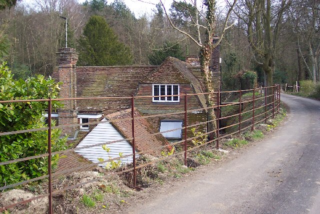
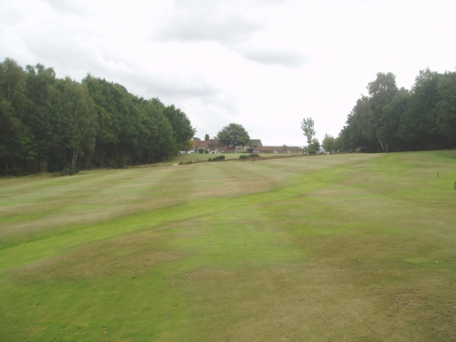
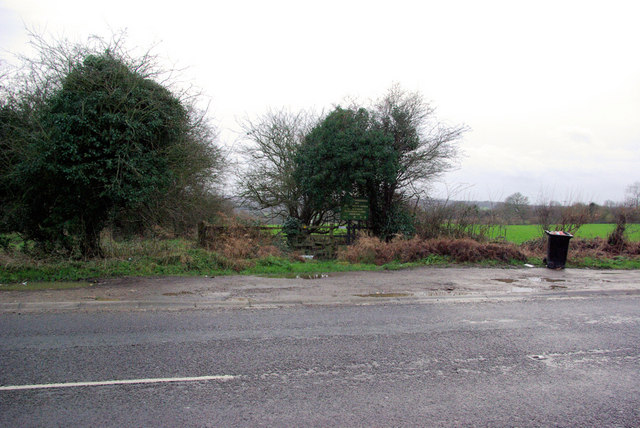
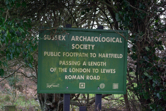
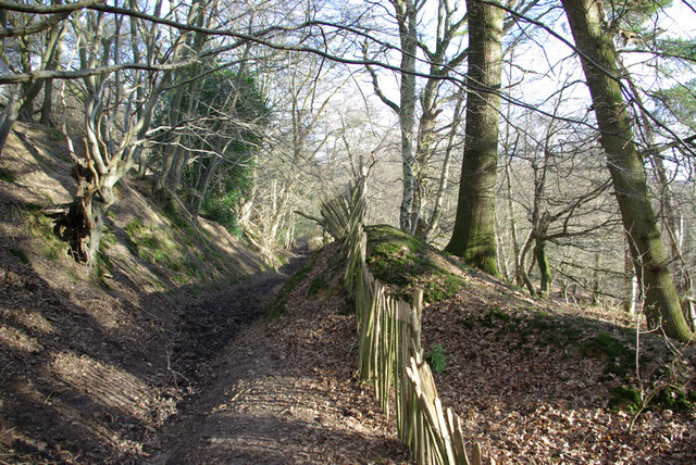
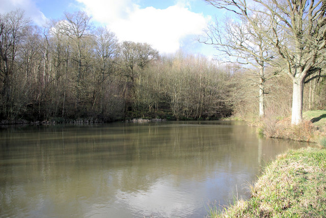
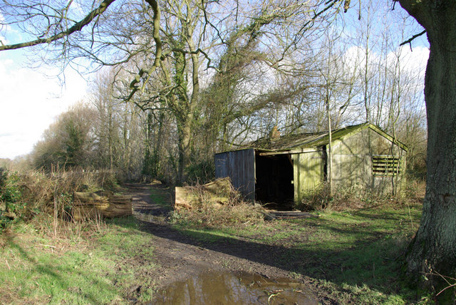
The woodland itself is a diverse blend of ancient trees, including oak, beech, and ash, creating a rich and varied ecosystem. A network of well-maintained footpaths weaves through the forest, allowing visitors to explore its beauty at their own pace. The forest floor is adorned with a vibrant tapestry of wildflowers, providing a colorful backdrop to the towering trees above.

Church Wood is home to a plethora of wildlife, making it a fantastic location for birdwatching and wildlife spotting. Visitors may be lucky enough to catch a glimpse of elusive species such as deer, badgers, and foxes, as well as a variety of bird species including woodpeckers and owls.

With its captivating beauty, abundant wildlife, and historical significance, Church Wood offers a truly unforgettable experience for those who venture into its depths. Whether it be a peaceful stroll, a moment of reflection, or an exploration of nature, Church Wood is a true gem in the heart of Sussex.

If you have any feedback on the listing, please let us know in the comments section below.

Church Wood Images

Images are sourced within 2km of 51.120203/0.073793756 or Grid Reference TQ4537. Thanks to Geograph Open Source API. All images are credited.

Cottage near Holtye, Kent/Sussex border This cottage stands on the site of an old ironworks. The road runs across the dam that supplied the water to power the bellows that worked the furnace.
Cottage near Holtye, Kent/Sussex border
This cottage stands on the site of an old ironworks. The road runs across the dam that supplied the water to power the bellows that worked the furnace.
Roman road near Holtye Near Holtye a section of the Roman road from London to Lewes was excavated and bought for preservation by the Sussex Archaeological Society.
Roman road near Holtye
Near Holtye a section of the Roman road from London to Lewes was excavated and bought for preservation by the Sussex Archaeological Society.
Holtye Golf Club Dating from 1893 and originally called the Liliput it is a 9 hole doubling to 18 holes testing course. <span class="nowrap"><a title="www.holtye.com" rel="nofollow ugc noopener" href="http://www.holtye.com">Link</a><img style="margin-left:2px;" alt="External link" title="External link - shift click to open in new window" src="https://s1.geograph.org.uk/img/external.png" width="10" height="10"/></span>
Holtye Golf Club
Dating from 1893 and originally called the Liliput it is a 9 hole doubling to 18 holes testing course. LinkExternal link
Cansiron / Butcherfield Lane, Hartfield On the right angled corner looking east along Butcherfield Lane and at the entrance (behind) to Great Cansiron Farm
Cansiron / Butcherfield Lane, Hartfield
On the right angled corner looking east along Butcherfield Lane and at the entrance (behind) to Great Cansiron Farm
Bassett's Manor Looking northwards from the road/path towards Bassett's Manor farm buildings. Cattle in the far field.
Bassett's Manor
Looking northwards from the road/path towards Bassett's Manor farm buildings. Cattle in the far field.
Bassett's Manor fields Looking south west over the farm buildings towards the distant sunshine
Bassett's Manor fields
Looking south west over the farm buildings towards the distant sunshine
A264 crossing of London-Lewes Roman Road The start of a footpath which passes further downhill a preserved section of Roman Road. The sign draws attention to this.
A264 crossing of London-Lewes Roman Road
The start of a footpath which passes further downhill a preserved section of Roman Road. The sign draws attention to this.
Roman Road sign on A264 A sign at the start of a path which passes a preserved section of Roman Road.
Roman Road sign on A264
A sign at the start of a path which passes a preserved section of Roman Road.
Dog Gate Lodge At a crossroads of tracks. The Vanguard way comes from the south and turns initially west (out of sight), a private track goes north, and a public bridleway goes east.
Dog Gate Lodge
At a crossroads of tracks. The Vanguard way comes from the south and turns initially west (out of sight), a private track goes north, and a public bridleway goes east.
Hammerwood House Hammer Wood is to the right. The Hammer reference is derived from the Wealden iron industry.
Hammerwood House
Hammer Wood is to the right. The Hammer reference is derived from the Wealden iron industry.
Owletts Cottage Not a whimsical name - there is a nearby Owlett's Farm.
Owletts Cottage
Not a whimsical name - there is a nearby Owlett's Farm.
Bridleway, Highams Wood There was a badger sett in the mound in the centre.
Bridleway, Highams Wood
There was a badger sett in the mound in the centre.
Lake above Ashdown Park Farm One of a series of lakes or reservoirs on the hillside.
Lake above Ashdown Park Farm
One of a series of lakes or reservoirs on the hillside.
Shed by the Bridleway A disused shed with a chimney. Possibly something to do with fruit, as an orchard is marked on the map, although not obvious now.
Shed by the Bridleway
A disused shed with a chimney. Possibly something to do with fruit, as an orchard is marked on the map, although not obvious now.
Power Line Gap A power line heads east in the general direction of Great Cansiron Farm, hidden behind the modestly named Acre Wood in the distance.
Power Line Gap
A power line heads east in the general direction of Great Cansiron Farm, hidden behind the modestly named Acre Wood in the distance.
Cowshed, Owlett's Farm The moment they saw the camera, the cows retreated from the mangers into the depths of the shed.
Cowshed, Owlett's Farm
The moment they saw the camera, the cows retreated from the mangers into the depths of the shed.
Cansiron Lane A snowy morning.
Cansiron Lane
A snowy morning.
Butcherfield Lane in the snow The snow was increasing.
Butcherfield Lane in the snow
The snow was increasing.
Show me another place!

Church Wood is located at Grid Ref: TQ4537 (Lat: 51.120203, Lng: 0.073793756)

Administrative County: East Sussex

District: Wealden

Police Authority: Sussex

What 3 Words

///choppers.preoccupied.steaming. Near Forest Row, East Sussex

Related Wikis

Bassetts Manor

Bassetts Manor is a Grade II-listed building in Hartfield, East Sussex, England. == Location == The manor is located North of the village of Hartfield...

Hammerwood Park

Hammerwood Park is a country house in Hammerwood, near East Grinstead, in East Sussex, England. It is a Grade I listed building. One of the first houses...

Hammerwood

Hammerwood is a hamlet in the civil parish of Forest Row in East Sussex, England. Its nearest town is East Grinstead, which lies approximately 3.5 miles...

Ashdown House, East Sussex

Ashdown House is a country house and former school near Forest Row, East Sussex, England, a Grade II* listed building. One of the first houses in England...

Bolebroke Castle

Bolebroke Castle is a 15th-century hunting lodge located north of the village of Hartfield, East Sussex, England. It is a Grade II* listed building.The...

Bolebroke Castle Miniature Railway

The Bolebroke Castle Miniature Railway or Bolebroke Castle and Lakes Railway (often abbreviated to BC&LR) was a 7+1⁄4 inches (180 mm) railway that ran...

Emerson College (UK)

Emerson College, UK was founded in 1962 by Francis Edmunds. It is now situated on Pixton Hill, Forest Row in East Sussex, UK. It was named after Ralph...

Cowden

Cowden () is a small village and civil parish in the Sevenoaks District of Kent, England. The parish is located on the northern slopes of the Weald, south...

Nearby Amenities

Located within 500m of 51.120203,0.073793756
Barrier: stile
Foot: yes
Lat/Long: 51.1207264/0.0679343
Barrier: stile
Foot: yes
Lat/Long: 51.1205165/0.0673272
Barrier: stile
Bicycle: no
Foot: yes
Material: wood
Stile: stepover
Lat/Long: 51.1244922/0.0726503
Turning Circle
Lat/Long: 51.1208407/0.0700642
The data included in this document is from www.openstreetmap.org. The data is made available under ODbL.

Have you been to Church Wood?

Leave your review of Church Wood below (or comments, questions and feedback).