Redoak Wood

Wood, Forest in Essex Epping Forest

England

Redoak Wood

Rolling Essex farmland
Rolling Essex farmland Credit: N Chadwick

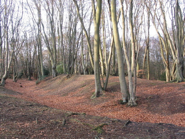
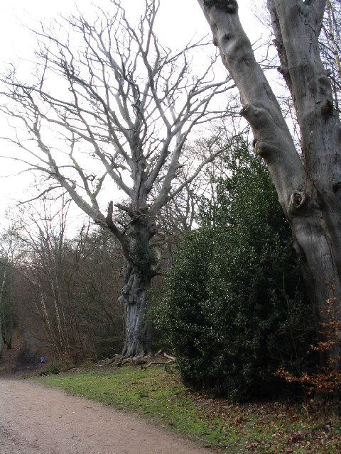
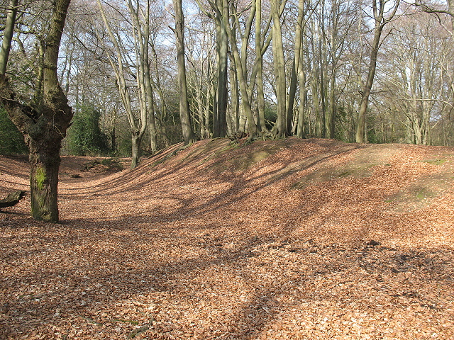
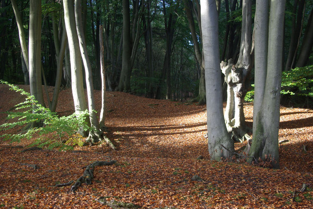
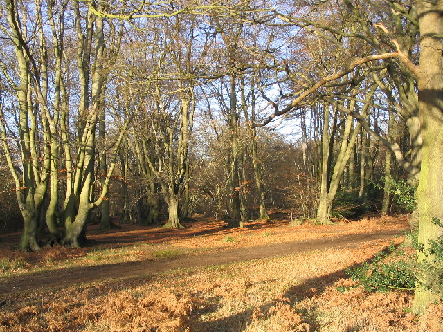
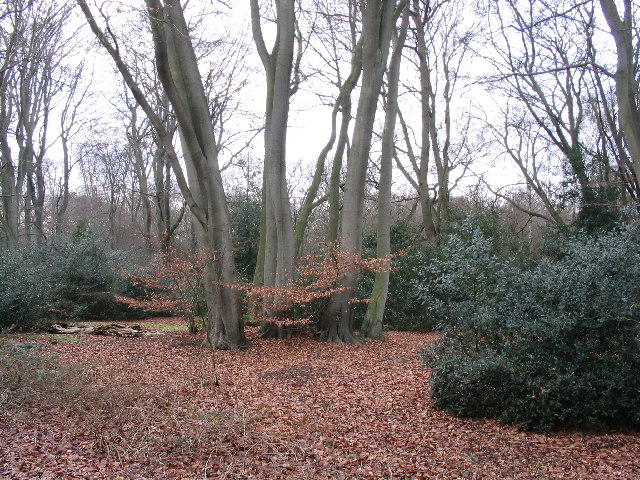
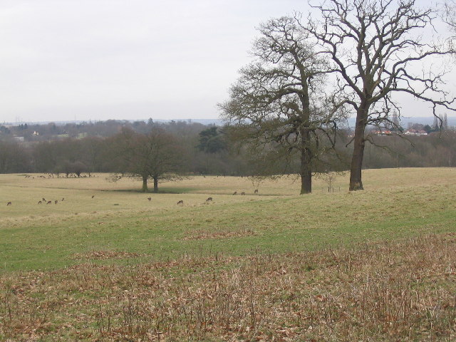
Redoak Wood is a picturesque woodland located in Essex, England. With its dense canopy of oak trees, it offers a serene and tranquil environment for nature enthusiasts and visitors alike. The wood covers an area of approximately 100 acres and is situated in the heart of the Essex countryside.

The woodland is known for its rich biodiversity and is home to a variety of flora and fauna species. The dominant tree species found here is the English oak (Quercus robur), which gives the wood its name. These majestic trees create a dense canopy that provides shade and shelter for a diverse range of plant life, including bluebells, wood anemones, and wild garlic, which carpet the forest floor during the spring months.

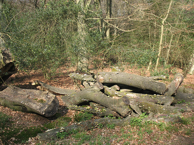
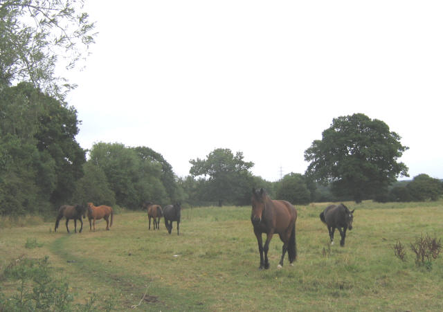
Redoak Wood is also a haven for wildlife. The woodland provides a suitable habitat for a variety of bird species, such as woodpeckers, owls, and thrushes. Small mammals like squirrels, rabbits, and hedgehogs can also be spotted in the wood.

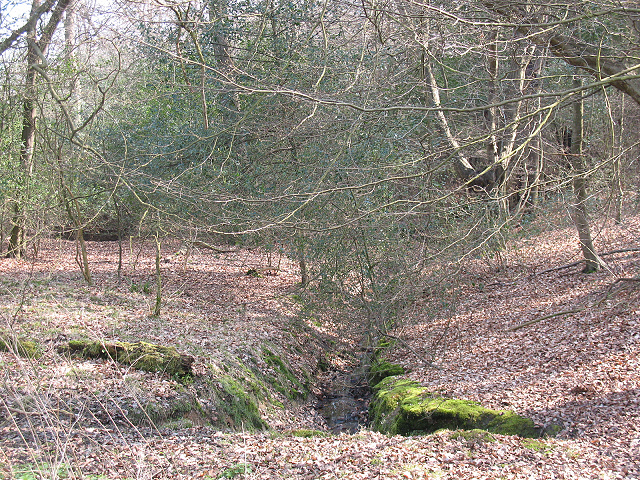
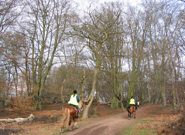
The woodland is crisscrossed by a network of well-maintained footpaths, allowing visitors to explore the enchanting surroundings. These paths lead to hidden clearings, babbling brooks, and secluded ponds, adding to the charm and appeal of the wood.

Redoak Wood is a popular destination for nature walks, picnics, and birdwatching. It offers a peaceful retreat from the bustling city life and provides a chance to reconnect with nature in a serene and idyllic setting.

If you have any feedback on the listing, please let us know in the comments section below.

Redoak Wood Images

Images are sourced within 2km of 51.668908/0.090935501 or Grid Reference TQ4498. Thanks to Geograph Open Source API. All images are credited.

Rolling Essex farmland
Essex farmland
Essex farmland
Approach to Junction 27 of M25 M25 Eastbound showing the approach to Junction 27 where M25 meets Junction 6 of the M11
Approach to Junction 27 of M25
M25 Eastbound showing the approach to Junction 27 where M25 meets Junction 6 of the M11
Beeches on Ambresbury Banks Ambresbury Banks is an Iron Age hill fort, situated at one of the highest points of Epping forest.
Beeches on Ambresbury Banks
Ambresbury Banks is an Iron Age hill fort, situated at one of the highest points of Epping forest.
Centenary Walk near Epping Thicks The Centenary Walk is a broad path, running for many miles through Epping Forest.  The photo was taken on the descent from Ambresbury Banks towards Epping.  This area has many old beech pollards, coppards and other variations on mature beech.   This is an unusual tree; it doesn't look like most old pollards, but I don't know how it came to be this way.
Centenary Walk near Epping Thicks
The Centenary Walk is a broad path, running for many miles through Epping Forest. The photo was taken on the descent from Ambresbury Banks towards Epping. This area has many old beech pollards, coppards and other variations on mature beech. This is an unusual tree; it doesn't look like most old pollards, but I don't know how it came to be this way.
Epping Forest: minor stream The forest covers an undulating landscape with many minor streams such as this feeding a few larger watercourses.
Epping Forest: minor stream
The forest covers an undulating landscape with many minor streams such as this feeding a few larger watercourses.
Epping Forest: log pile with fungi A pile of logs that has been left by the roadside, possibly intentionally, for biodiversity.  They had sprouted a fine crop of fungi.
Epping Forest: log pile with fungi
A pile of logs that has been left by the roadside, possibly intentionally, for biodiversity. They had sprouted a fine crop of fungi.
Epping Forest: Ambresbury Banks Another winter view of <a href="https://www.geograph.org.uk/photo/110134">TL4300 : Beeches on Ambresbury Banks</a>.  According to the information board, the Banks are believed to have been built around 500 BCE, and been in use as animal corrals until at least the Roman invasion in 55 BCE.  Local legend apparently claims the site as that of the death of the Queen Boudicca, though the story has no historical basis.
Epping Forest: Ambresbury Banks
Another winter view of TL4300 : Beeches on Ambresbury Banks. According to the information board, the Banks are believed to have been built around 500 BCE, and been in use as animal corrals until at least the Roman invasion in 55 BCE. Local legend apparently claims the site as that of the death of the Queen Boudicca, though the story has no historical basis.
A track in the forest
Ambresbury Banks Hidden among the beech trees at the northern end of Epping Forest, are earthworks believed to date from around 500BC. They may have been built as animal folds or possibly as a lookout or boundary marker between the territories of rival tribes. What is known for certain is that , despite local legend, this is not where Queen Boudicca was defeated and killed.
Ambresbury Banks
Hidden among the beech trees at the northern end of Epping Forest, are earthworks believed to date from around 500BC. They may have been built as animal folds or possibly as a lookout or boundary marker between the territories of rival tribes. What is known for certain is that , despite local legend, this is not where Queen Boudicca was defeated and killed.
Epping Forest Winter sunshine on the beeches near Lodge Road.  Lodge Road would once have provided an impressive long approach to the now ruined Copped Hall.
Epping Forest
Winter sunshine on the beeches near Lodge Road. Lodge Road would once have provided an impressive long approach to the now ruined Copped Hall.
Debden streetscene The Western part of this square has changed totally in the last 70 years. It is covered by housing and schools, but with some recreational open space.  This photograph was taken in Willingdale Road, near the entrance to the playing fields.  The brook, which runs from the forest down towards the Roding, is one feature which remains from the 1940s map.
Debden streetscene
The Western part of this square has changed totally in the last 70 years. It is covered by housing and schools, but with some recreational open space. This photograph was taken in Willingdale Road, near the entrance to the playing fields. The brook, which runs from the forest down towards the Roding, is one feature which remains from the 1940s map.
Beeches near Theydon Bois This is an odd cluster of beeches, close to the Theydon Loop ride and Wormleyton pits. I think that they are really one tree, coppiced long ago.  This area is dominated by beech, so there is not much undergrowth, apart from holly in places.  Some areas nearby have new growth of silver birch - possibly filling in clearings from old fires (1976 perhaps ?).
Beeches near Theydon Bois
This is an odd cluster of beeches, close to the Theydon Loop ride and Wormleyton pits. I think that they are really one tree, coppiced long ago. This area is dominated by beech, so there is not much undergrowth, apart from holly in places. Some areas nearby have new growth of silver birch - possibly filling in clearings from old fires (1976 perhaps ?).
Epping Forest This is the green ride (shown on maps as the Centenary Walk) near Furze Ground, a gorse covered slope, which rises from the Tippa Burn and Hangboy Slade.  Some of the old beeches here have fallen and birch is taking over in a few places.  This is a good place for children to tip-toe along fallen tree trunks.
Epping Forest
This is the green ride (shown on maps as the Centenary Walk) near Furze Ground, a gorse covered slope, which rises from the Tippa Burn and Hangboy Slade. Some of the old beeches here have fallen and birch is taking over in a few places. This is a good place for children to tip-toe along fallen tree trunks.
Deer Sanctuary near Theydon Bois Taken from the wood to the South East of the sanctuary, one of the less visited parts of Epping Forest.
Deer Sanctuary near Theydon Bois
Taken from the wood to the South East of the sanctuary, one of the less visited parts of Epping Forest.
horses in a field horses near Theydon Bois in Essex
horses in a field
horses near Theydon Bois in Essex
Motorway bridge- M11 Public footbridge on right of way crossing the M11 in Essex near Loughton.
Motorway bridge- M11
Public footbridge on right of way crossing the M11 in Essex near Loughton.
Cemetery gates Well kept cemetery with attractive entrance
Cemetery gates
Well kept cemetery with attractive entrance
Show me another place!

Redoak Wood is located at Grid Ref: TQ4498 (Lat: 51.668908, Lng: 0.090935501)

Administrative County: Essex

District: Epping Forest

Police Authority: Essex

What 3 Words

///issue.scary.noble. Near Theydon Bois, Essex

Nearby Locations

Gaunt's Wood Redoak Wood

Related Wikis

Epping Forest (UK Parliament constituency)

Epping Forest is a constituency in Essex represented in the House of Commons of the UK Parliament since 1997 by Eleanor Laing, a Conservative. == Constituency... ==

Davenant Foundation School

Davenant Foundation School is a Christian Ecumenical secondary school, founded in 1680, currently in Loughton, Essex, England. == History == === Foundation... ===

Theydon Bois

Theydon Bois ( or ) is a village and civil parish in the Epping Forest district of Essex, England. It is 1 mile (1.6 km) south of Epping, 1 mile (1.6 km...

Theydon Bois tube station

Theydon Bois (, ) is a London Underground station in the village of Theydon Bois in Essex, England. It is served by the Central line and is between Debden...

Debden House

Debden House is a conference centre and campsite located in Loughton, Essex, England. The house is owned and operated by Newham London Borough Council...

Home Mead

Home Mead is a 1.8 hectare Local Nature Reserve in Loughton in Essex. It is owned and managed by Epping Forest District Council.This site has woodland...

Bell Common

Bell Common is a settlement in Essex, England and is south of the town of Epping. == Tunnel == The Bell Common Tunnel is a covered section of the M25 motorway...

Debden Park High School

Debden Park High School is a mixed academy school situated in Loughton. The current headteacher is Helen Gascoyne, and the previous one, being Cristian...

Nearby Amenities

Located within 500m of 51.668908,0.090935501
Coal tax post
Historic: boundary_stone
Inscription: 24 & 25 VICT CAP 42
Material: iron
Note: Coal tax boundary marker 11
Lat/Long: 51.6655507/0.0890159
Noexit: yes
Lat/Long: 51.6663918/0.0957119
Noexit: yes
Lat/Long: 51.6670279/0.0946555
Noexit: yes
Lat/Long: 51.6690796/0.097927
Noexit: yes
Lat/Long: 51.6698017/0.0959674
Noexit: yes
Lat/Long: 51.6702316/0.0952137
Noexit: yes
Lat/Long: 51.6708907/0.0936421
Post Box
Post Box Type: pillar
Royal Cypher: GR
Source: survey
Lat/Long: 51.6726715/0.0944032
Redoak Wood
Place: locality
Lat/Long: 51.6690802/0.0910763
Gaunts Wood
Place: locality
Lat/Long: 51.666831/0.0892309
Ripley Grange
Place: locality
Lat/Long: 51.6668591/0.0861717
Noexit: yes
Lat/Long: 51.6726321/0.0901316
Noexit: yes
Lat/Long: 51.6701438/0.096255
Noexit: yes
Lat/Long: 51.6704578/0.0960438
Give Way
Direction: backward
Lat/Long: 51.6727034/0.0947041
Give Way
Direction: backward
Lat/Long: 51.6726469/0.0946771
Noexit: yes
Lat/Long: 51.6697145/0.0976434
Give Way
Direction: forward
Traffic Sign: GB:1003A
Lat/Long: 51.6719587/0.0952534
Give Way
Direction: forward
Traffic Sign: GB:1003A
Lat/Long: 51.6711152/0.0960442
Give Way
Direction: backward
Lat/Long: 51.6730263/0.0909599
Noexit: yes
Lat/Long: 51.6699159/0.0927147
Noexit: yes
Lat/Long: 51.6705367/0.0931187
Give Way
Direction: backward
Traffic Sign: GB:1003A
Lat/Long: 51.6684113/0.0936731
Give Way
Direction: backward
Traffic Sign: GB:1003A
Lat/Long: 51.6683976/0.0954977
Noexit: yes
Lat/Long: 51.6701024/0.0951514
Noexit: yes
Lat/Long: 51.6691517/0.0978778
Give Way
Direction: forward
Traffic Sign: GB:1003A
Lat/Long: 51.6690007/0.0932279
Description: SLOW
Traffic Sign Backward: GB:1024
Traffic Sign Forward: GB:1024
Lat/Long: 51.6691505/0.0935497
Give Way
Direction: backward
Traffic Sign: GB:1003A
Lat/Long: 51.6699972/0.0948493
Noexit: yes
Lat/Long: 51.6711893/0.0943501
Noexit: yes
Lat/Long: 51.6719258/0.0918712
Post Box
Collection Times: Mo-Fr 09:00; Sa 07:00
Ref: CM16 314D
Royal Cypher: GR
Royal Cypher Wikidata: Q33102273
Lat/Long: 51.6707217/0.0955381
The data included in this document is from www.openstreetmap.org. The data is made available under ODbL.

Have you been to Redoak Wood?

Leave your review of Redoak Wood below (or comments, questions and feedback).