Rocky Wood

Wood, Forest in Sussex Wealden

England

Rocky Wood

Owlsbury Poultry Farm
Owlsbury Poultry Farm Credit: N Chadwick

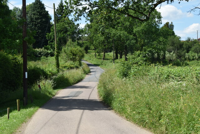
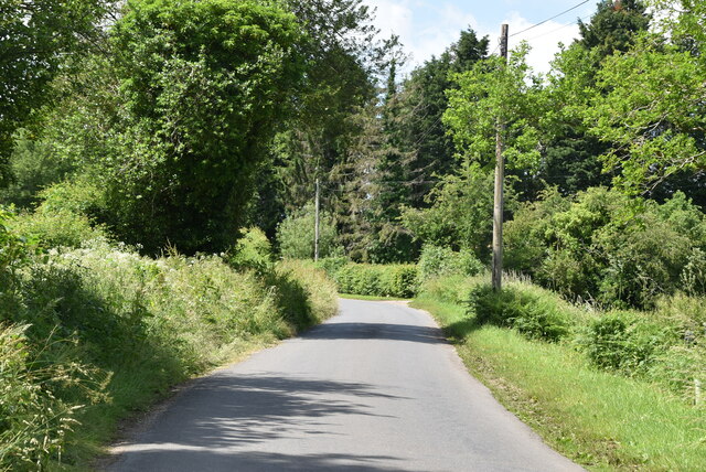
Rocky Wood is a picturesque forest located in Sussex, England. It is known for its natural beauty, diverse wildlife, and stunning views, making it a popular destination for nature lovers and outdoor enthusiasts.

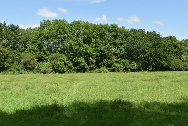
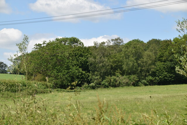
Covering an area of approximately 100 acres, Rocky Wood is characterized by its dense woodland and rugged terrain. The forest is predominantly composed of deciduous trees, including oak, beech, and ash, which create a vibrant canopy during the summer months. The forest floor is carpeted with a rich variety of flora, such as bluebells, wild garlic, and ferns, adding to the enchanting atmosphere.

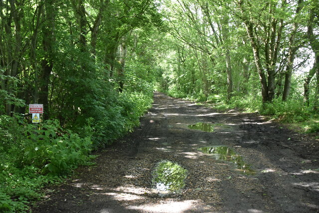
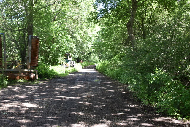
The wood is crisscrossed with a network of well-maintained walking trails, allowing visitors to explore its hidden corners and discover its hidden treasures. These trails range in difficulty, catering to both casual strollers and more adventurous hikers. Along the way, visitors may encounter various wildlife species, including deer, foxes, and a wide variety of birds, making it an ideal spot for birdwatching.

Rocky Wood not only provides a haven for wildlife, but also offers several recreational activities for visitors. There are designated picnic areas and barbecue spots where families and friends can enjoy a day out in nature. The forest is also a popular spot for camping, with designated campsites available for overnight stays.

Overall, Rocky Wood is a place of natural beauty and tranquility. Its diverse ecosystem and stunning scenery create a peaceful retreat for those seeking to escape the hustle and bustle of daily life and immerse themselves in the wonders of nature.

If you have any feedback on the listing, please let us know in the comments section below.
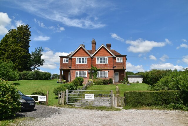
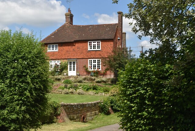
Rocky Wood Images

Images are sourced within 2km of 50.964085/0.056095262 or Grid Reference TQ4420. Thanks to Geograph Open Source API. All images are credited.

Owlsbury Poultry Farm
Owlsbury Cottages
Owlsbury Cottages
Cattle grazing
Cattle grazing
Owlsbury Cottages
Owlsbury Cottages
Owlsbury Wood
Owlsbury Wood
Owlsbury Wood
Owlsbury Wood
Footpath across field
Dismantled railway line The Wealden line ran from Tunbridge Wells to Lewes via Uckfield. The line was built in between 1846 & 1858. Most of the line has now closed to regular services. Lewes to Uckfield closed in 1969, Tunbridge Wells to Eridge closed in 1985. Eidge to Uckfield remains open as part of the Oxted line <a title="https://www.geograph.org.uk/snippet/4332" href="https://www.geograph.org.uk/snippet/4332">Link</a> . The Spa Valley Railway has re-opened the section between Tunbridge Wells West and Groombridge as a preservation line. Isfield station has been re-opened as the Lavender line.
Wikipedia: <span class="nowrap"><a title="http://en.wikipedia.org/wiki/Wealden_Line" rel="nofollow ugc noopener" href="http://en.wikipedia.org/wiki/Wealden_Line">Link</a><img style="margin-left:2px;" alt="External link" title="External link - shift click to open in new window" src="https://s1.geograph.org.uk/img/external.png" width="10" height="10"/></span>
Dismantled railway line
The Wealden line ran from Tunbridge Wells to Lewes via Uckfield. The line was built in between 1846 & 1858. Most of the line has now closed to regular services. Lewes to Uckfield closed in 1969, Tunbridge Wells to Eridge closed in 1985. Eidge to Uckfield remains open as part of the Oxted line Link . The Spa Valley Railway has re-opened the section between Tunbridge Wells West and Groombridge as a preservation line. Isfield station has been re-opened as the Lavender line. Wikipedia: LinkExternal link
Owlsbury Farm
Owlsbury Farm
Dismantled railway line The Wealden line ran from Tunbridge Wells to Lewes via Uckfield. The line was built in between 1846 & 1858. Most of the line has now closed to regular services. Lewes to Uckfield closed in 1969, Tunbridge Wells to Eridge closed in 1985. Eidge to Uckfield remains open as part of the Oxted line <a title="https://www.geograph.org.uk/snippet/4332" href="https://www.geograph.org.uk/snippet/4332">Link</a> . The Spa Valley Railway has re-opened the section between Tunbridge Wells West and Groombridge as a preservation line. Isfield station has been re-opened as the Lavender line.
Wikipedia: <span class="nowrap"><a title="http://en.wikipedia.org/wiki/Wealden_Line" rel="nofollow ugc noopener" href="http://en.wikipedia.org/wiki/Wealden_Line">Link</a><img style="margin-left:2px;" alt="External link" title="External link - shift click to open in new window" src="https://s1.geograph.org.uk/img/external.png" width="10" height="10"/></span>
Dismantled railway line
The Wealden line ran from Tunbridge Wells to Lewes via Uckfield. The line was built in between 1846 & 1858. Most of the line has now closed to regular services. Lewes to Uckfield closed in 1969, Tunbridge Wells to Eridge closed in 1985. Eidge to Uckfield remains open as part of the Oxted line Link . The Spa Valley Railway has re-opened the section between Tunbridge Wells West and Groombridge as a preservation line. Isfield station has been re-opened as the Lavender line. Wikipedia: LinkExternal link
Broomlye Oast
Broomlye Oast
Sharpbridge Lane
Sharpbridge Lane
Woodland
Woodland
Sharpbridge Lane
Sharpbridge Lane
Broomlye Cottage
Broomlye Cottage
Broomlye Cottage
Broomlye Cottage
Broomlye Listed buildings and structures are officially designated as being of special architectural, historical or cultural significance. There are over half a million listed structures in the United Kingdom, covered by around 375,000 listings.
Listed status is more commonly associated with buildings or groups of buildings, however it can cover many other structures, including bridges, headstones, steps, ponds, monuments, walls, phone boxes, wrecks, parks, and heritage sites, and in more recent times a road crossing (Abbey Road) and graffiti art (Banksy 'Spy-booth') have been included.

In England and Wales there are three main listing designations;
Grade I (2.5%) - exceptional interest, sometimes considered to be internationally important.
Grade II* (5.5%) - particularly important buildings of more than special interest. 
Grade II (92%) - nationally important and of special interest. 

There are also locally listed structures (at the discretion of local authorities) using A, B and C designations.

In Scotland three classifications are also used but the criteria are different. There are around 47,500 Listed buildings.
Category A (8%)- generally equivalent to Grade I and II* in England and Wales
Category B (51%)- this appears generally to cover the ground of Grade II, recognising national importance.
Category C (41%)- buildings of local importance, probably with some overlap with English Grade II.

In Northern Ireland the criteria are similar to Scotland, but the classifications are:
Grade A (2.3%)
Grade B+ (4.7%)
Grade B (93%)

Read more at Wikipedia <span class="nowrap"><a title="http://en.wikipedia.org/wiki/Listed_building" rel="nofollow ugc noopener" href="http://en.wikipedia.org/wiki/Listed_building">Link</a><img style="margin-left:2px;" alt="External link" title="External link - shift click to open in new window" src="https://s1.geograph.org.uk/img/external.png" width="10" height="10"/></span>
Broomlye
Listed buildings and structures are officially designated as being of special architectural, historical or cultural significance. There are over half a million listed structures in the United Kingdom, covered by around 375,000 listings. Listed status is more commonly associated with buildings or groups of buildings, however it can cover many other structures, including bridges, headstones, steps, ponds, monuments, walls, phone boxes, wrecks, parks, and heritage sites, and in more recent times a road crossing (Abbey Road) and graffiti art (Banksy 'Spy-booth') have been included. In England and Wales there are three main listing designations; Grade I (2.5%) - exceptional interest, sometimes considered to be internationally important. Grade II* (5.5%) - particularly important buildings of more than special interest. Grade II (92%) - nationally important and of special interest. There are also locally listed structures (at the discretion of local authorities) using A, B and C designations. In Scotland three classifications are also used but the criteria are different. There are around 47,500 Listed buildings. Category A (8%)- generally equivalent to Grade I and II* in England and Wales Category B (51%)- this appears generally to cover the ground of Grade II, recognising national importance. Category C (41%)- buildings of local importance, probably with some overlap with English Grade II. In Northern Ireland the criteria are similar to Scotland, but the classifications are: Grade A (2.3%) Grade B+ (4.7%) Grade B (93%) Read more at Wikipedia LinkExternal link
Show me another place!

Rocky Wood is located at Grid Ref: TQ4420 (Lat: 50.964085, Lng: 0.056095262)

Administrative County: East Sussex

District: Wealden

Police Authority: Sussex

What 3 Words

///eased.identity.bidder. Near Uckfield, East Sussex

Nearby Locations

Darvel Wood Rocky Wood

Related Wikis

West Park, Uckfield

West Park is a 10.5-hectare (26-acre) Local Nature Reserve on the western outskirts of Uckfield in East Sussex. It is owned and managed by Uckfield Town...

Piltdown

Piltdown is a series of hamlets in East Sussex, England, located south of Ashdown Forest. It is best known for the Piltdown Man hoax where amateur archaeologist...

River Uck

The River Uck is a river in East Sussex, United Kingdom, which drains a catchment starting near Crowborough in the North, Hadlow Down to the East and Laughton...

Uckfield Town F.C.

Uckfield Town F.C. was a football club based in Uckfield, East Sussex, England. For their final season, 2013–14, they were members of the Sussex County...

Piltdown Man

The Piltdown Man was a paleoanthropological fraud in which bone fragments were presented as the fossilised remains of a previously unknown early human...

Little Horsted

Little Horsted (also known as Horsted Parva) is a village and civil parish in the Wealden district of East Sussex, England. It is located two miles (3...

Uckfield railway station

Uckfield railway station is the southern terminus of a branch of the Oxted Line in England, serving the town of Uckfield, East Sussex. It is 46 miles 8...

Copping Hall

Copping Hall is a Grade II* listed house in Uckfield, East Sussex, England. It is located at 1 Pudding Cake Lane, Uckfield, East Sussex TN22 1BT. Built...

Nearby Amenities

Located within 500m of 50.964085,0.056095262
Power: tower
Lat/Long: 50.9642624/0.050937
Power: tower
Lat/Long: 50.9604676/0.0571582
Hippocrene Farm
Place: farm
Source Name: OS_OpenData_Streetview
Lat/Long: 50.9667238/0.059265
Sharpsbridge Farm
Place: farm
Source Name: OS_OpenData_StreetView
Lat/Long: 50.9669105/0.050683
Buckham Hill Farm
Place: farm
Wikidata: Q26279295
Lat/Long: 50.9622612/0.0621645
Barrier: stile
Stile: squeezer
Lat/Long: 50.9656031/0.0536126
Barrier: stile
Lat/Long: 50.9661409/0.0513501
Waterway: weir
Lat/Long: 50.9685354/0.0565345
The data included in this document is from www.openstreetmap.org. The data is made available under ODbL.

Have you been to Rocky Wood?

Leave your review of Rocky Wood below (or comments, questions and feedback).