Wisper Wood

Wood, Forest in Sussex Wealden

England

Wisper Wood

Nutley Windmill, Ashdown Forest (East Sussex) Nutley windmill is an open-trestle post mill, one of only five remaining in the UK. It is "open-trestle" because the supporting timbers (cross-trees, quarter-bars and upright post) are open to the elements. Most post mills have their trestle enclosed in a brick roundhouse.
Nutley Windmill, Ashdown Forest (East Sussex) Credit: Roy Henderson

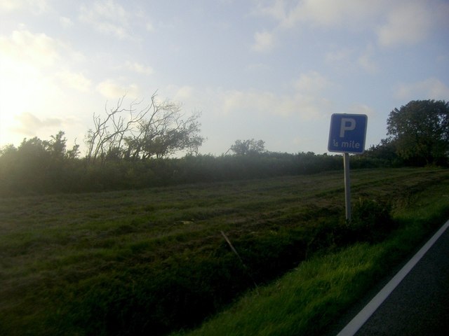
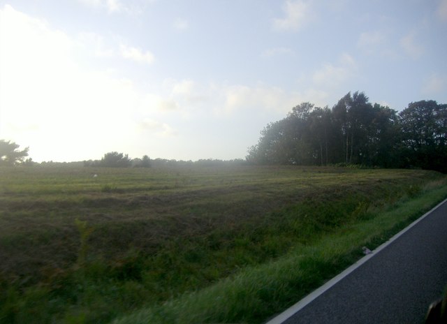
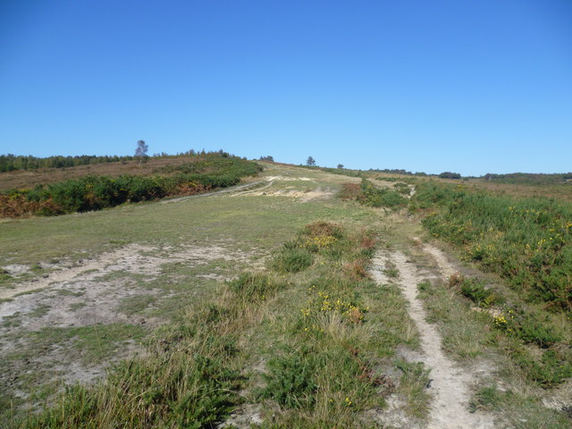
Wisper Wood is a picturesque forest located in Sussex, England. Spanning over a vast area, it is known for its dense foliage, tranquil atmosphere, and diverse wildlife. The woodland is predominantly made up of a mixture of deciduous and coniferous trees, creating a stunning blend of colors during the changing seasons.

The forest is crisscrossed by well-maintained walking trails, allowing visitors to explore its natural beauty and discover its hidden treasures. The trails wind through towering trees, moss-covered rocks, and babbling brooks, providing a truly immersive experience in nature. Along the way, visitors may encounter a variety of plant and animal species, including deer, squirrels, and a myriad of bird species.

Wisper Wood is not only a haven for nature enthusiasts but also a popular spot for outdoor activities. Many visitors come here for picnics, camping, and hiking, taking advantage of the serene surroundings and fresh air. The forest's peaceful ambiance makes it an ideal place for those seeking solitude and tranquility.

Furthermore, Wisper Wood has historical significance, with evidence of human habitation dating back centuries. Archaeological excavations have uncovered ancient artifacts and remnants of settlements, offering glimpses into the area's rich past.

Overall, Wisper Wood is a captivating destination that showcases the beauty of Sussex's natural landscapes. With its lush greenery, diverse wildlife, and historical significance, it is a place that both nature enthusiasts and history buffs will find delight in exploring.

If you have any feedback on the listing, please let us know in the comments section below.

Wisper Wood Images

Images are sourced within 2km of 51.033092/0.058121251 or Grid Reference TQ4427. Thanks to Geograph Open Source API. All images are credited.

Nutley Windmill, Ashdown Forest (East Sussex) Nutley windmill is an open-trestle post mill, one of only five remaining in the UK. It is "open-trestle" because the supporting timbers (cross-trees, quarter-bars and upright post) are open to the elements. Most post mills have their trestle enclosed in a brick roundhouse.
Nutley Windmill, Ashdown Forest (East Sussex)
Nutley windmill is an open-trestle post mill, one of only five remaining in the UK. It is "open-trestle" because the supporting timbers (cross-trees, quarter-bars and upright post) are open to the elements. Most post mills have their trestle enclosed in a brick roundhouse.
Ice Cream Van in layby on A22
Junction of Clock House Lane and the A22, Nutley
Stratton car sales, Horney Common
Houses on High Street Nutley
High Street Nutley Looking towards the signed double road junction
High Street Nutley
Looking towards the signed double road junction
Sun setting over the fields, Millbrook Hill
Fields by Millbrook Hill
Ashdown Forest View from Hollies car park, South Downs on horizon, lone sheep grazing.
Ashdown Forest
View from Hollies car park, South Downs on horizon, lone sheep grazing.
Ashdown Forest above the Misbourne Valley Ashdown Forest is a former medieval hunting forest, and is the highest ridge of the High Weald. At ten square miles it is the largest open access area in the South East. Ashdown Forest was purchased by East Sussex County Council from the De La Warr family in 1988. It is now managed by a Board of Conservators. Nearly two thirds of it is heathland, areas of which can be seen on both sides of the wide path here which acts as a firebreak. The sandy nature of the soil is also evident. The path leads from the Airman's Grave up to Hollies car park.
Ashdown Forest above the Misbourne Valley
Ashdown Forest is a former medieval hunting forest, and is the highest ridge of the High Weald. At ten square miles it is the largest open access area in the South East. Ashdown Forest was purchased by East Sussex County Council from the De La Warr family in 1988. It is now managed by a Board of Conservators. Nearly two thirds of it is heathland, areas of which can be seen on both sides of the wide path here which acts as a firebreak. The sandy nature of the soil is also evident. The path leads from the Airman's Grave up to Hollies car park.
The Airman's Grave, Misbourne Valley, Ashdown Forest Ashdown Forest is a former medieval hunting forest, and is the highest ridge of the High Weald. At ten square miles it is the largest open access area in the South East. Despite its name, nobody is buried at the Airman's Grave. It is a memorial to the six man crew of a Wellington bomber who were all killed when it crashed here on 31st July 1941. They were part of a 100 plane bombing mission to Cologne but were forced to turn back in bad weather with engine trouble. Annual remembrance services are still held here with hundreds attending.

More about the Airman's Grave can be seen at <span class="nowrap"><a title="http://thebignote.com/2016/02/15/ashdown-forest-the-airmens-grave/" rel="nofollow ugc noopener" href="http://thebignote.com/2016/02/15/ashdown-forest-the-airmens-grave/">Link</a><img style="margin-left:2px;" alt="External link" title="External link - shift click to open in new window" src="https://s1.geograph.org.uk/img/external.png" width="10" height="10"/></span>
The Airman's Grave, Misbourne Valley, Ashdown Forest
Ashdown Forest is a former medieval hunting forest, and is the highest ridge of the High Weald. At ten square miles it is the largest open access area in the South East. Despite its name, nobody is buried at the Airman's Grave. It is a memorial to the six man crew of a Wellington bomber who were all killed when it crashed here on 31st July 1941. They were part of a 100 plane bombing mission to Cologne but were forced to turn back in bad weather with engine trouble. Annual remembrance services are still held here with hundreds attending. More about the Airman's Grave can be seen at LinkExternal link
The Airman's Grave, Misbourne Valley, Ashdown Forest Ashdown Forest is a former medieval hunting forest, and is the highest ridge of the High Weald. At ten square miles it is the largest open access area in the South East. Despite its name, nobody is buried at the Airman's Grave. It is a memorial to the six man crew of a Wellington bomber who were all killed when it crashed here on 31st July 1941. They were part of a 100 plane bombing mission to Cologne but were forced to turn back in bad weather with engine trouble. Annual remembrance services are still held here with hundreds attending. 

More about the Airman's Grave can be seen at <span class="nowrap"><a title="http://thebignote.com/2016/02/15/ashdown-forest-the-airmens-grave/" rel="nofollow ugc noopener" href="http://thebignote.com/2016/02/15/ashdown-forest-the-airmens-grave/">Link</a><img style="margin-left:2px;" alt="External link" title="External link - shift click to open in new window" src="https://s1.geograph.org.uk/img/external.png" width="10" height="10"/></span>
The Airman's Grave, Misbourne Valley, Ashdown Forest
Ashdown Forest is a former medieval hunting forest, and is the highest ridge of the High Weald. At ten square miles it is the largest open access area in the South East. Despite its name, nobody is buried at the Airman's Grave. It is a memorial to the six man crew of a Wellington bomber who were all killed when it crashed here on 31st July 1941. They were part of a 100 plane bombing mission to Cologne but were forced to turn back in bad weather with engine trouble. Annual remembrance services are still held here with hundreds attending. More about the Airman's Grave can be seen at LinkExternal link
Detail of the Airman's Grave, Misbourne Valley, Ashdown Forest Ashdown Forest is a former medieval hunting forest, and is the highest ridge of the High Weald. At ten square miles it is the largest open access area in the South East. Despite its name, nobody is buried at the Airman's Grave. It is a memorial to the six man crew of a Wellington bomber who were all killed when it crashed here on 31st July 1941. They were part of a 100 plane bombing mission to Cologne but were forced to turn back in bad weather with engine trouble. Annual remembrance services are still held here with hundreds attending. 

More about the Airman's Grave can be seen at <span class="nowrap"><a title="http://thebignote.com/2016/02/15/ashdown-forest-the-airmens-grave/" rel="nofollow ugc noopener" href="http://thebignote.com/2016/02/15/ashdown-forest-the-airmens-grave/">Link</a><img style="margin-left:2px;" alt="External link" title="External link - shift click to open in new window" src="https://s1.geograph.org.uk/img/external.png" width="10" height="10"/></span>
Detail of the Airman's Grave, Misbourne Valley, Ashdown Forest
Ashdown Forest is a former medieval hunting forest, and is the highest ridge of the High Weald. At ten square miles it is the largest open access area in the South East. Despite its name, nobody is buried at the Airman's Grave. It is a memorial to the six man crew of a Wellington bomber who were all killed when it crashed here on 31st July 1941. They were part of a 100 plane bombing mission to Cologne but were forced to turn back in bad weather with engine trouble. Annual remembrance services are still held here with hundreds attending. More about the Airman's Grave can be seen at LinkExternal link
The Airman's Grave, Misbourne Valley, Ashdown Forest Ashdown Forest is a former medieval hunting forest, and is the highest ridge of the High Weald. At ten square miles it is the largest open access area in the South East. Nearly two thirds of it is heathland, some of which can be seen in the distance. The sandy nature of the soil is also evident. This is the Airman's Grave on the side of the Misbourne Valley. Despite its name, nobody is buried at the Airman's Grave. It is a memorial to the six man crew of a Wellington bomber who were all killed when it crashed here on 31st July 1941. They were part of a 100 plane bombing mission to Cologne but were forced to turn back in bad weather with engine trouble. Annual remembrance services are still held here with hundreds attending. 

More about the Airman's Grave can be seen at <span class="nowrap"><a title="http://thebignote.com/2016/02/15/ashdown-forest-the-airmens-grave/" rel="nofollow ugc noopener" href="http://thebignote.com/2016/02/15/ashdown-forest-the-airmens-grave/">Link</a><img style="margin-left:2px;" alt="External link" title="External link - shift click to open in new window" src="https://s1.geograph.org.uk/img/external.png" width="10" height="10"/></span>
The Airman's Grave, Misbourne Valley, Ashdown Forest
Ashdown Forest is a former medieval hunting forest, and is the highest ridge of the High Weald. At ten square miles it is the largest open access area in the South East. Nearly two thirds of it is heathland, some of which can be seen in the distance. The sandy nature of the soil is also evident. This is the Airman's Grave on the side of the Misbourne Valley. Despite its name, nobody is buried at the Airman's Grave. It is a memorial to the six man crew of a Wellington bomber who were all killed when it crashed here on 31st July 1941. They were part of a 100 plane bombing mission to Cologne but were forced to turn back in bad weather with engine trouble. Annual remembrance services are still held here with hundreds attending. More about the Airman's Grave can be seen at LinkExternal link
Ashdown Forest above the Misbourne Valley Ashdown Forest is a former medieval hunting forest, and is the highest ridge of the High Weald. At ten square miles it is the largest open access area in the South East. Ashdown Forest was purchased by East Sussex County Council from the De La Warr family in 1988. It is now managed by a Board of Conservators. Nearly two thirds of it is heathland, areas of which can be seen here alongside the path up the west side of the Misbourne Valley to Stonehill car park. The sandy nature of the soil is also evident.
Ashdown Forest above the Misbourne Valley
Ashdown Forest is a former medieval hunting forest, and is the highest ridge of the High Weald. At ten square miles it is the largest open access area in the South East. Ashdown Forest was purchased by East Sussex County Council from the De La Warr family in 1988. It is now managed by a Board of Conservators. Nearly two thirds of it is heathland, areas of which can be seen here alongside the path up the west side of the Misbourne Valley to Stonehill car park. The sandy nature of the soil is also evident.
Ashdown Forest above the Misbourne Valley Ashdown Forest is a former medieval hunting forest, and is the highest ridge of the High Weald. At ten square miles it is the largest open access area in the South East. Ashdown Forest was purchased by East Sussex County Council from the De La Warr family in 1988. It is now managed by a Board of Conservators. Nearly two thirds of it is heathland, areas of which can be seen here, either side of the path up the west side of the Misbourne Valley to Stonehill car park. The wide path also acts as a fire break. The sandy nature of the soil is evident.
Ashdown Forest above the Misbourne Valley
Ashdown Forest is a former medieval hunting forest, and is the highest ridge of the High Weald. At ten square miles it is the largest open access area in the South East. Ashdown Forest was purchased by East Sussex County Council from the De La Warr family in 1988. It is now managed by a Board of Conservators. Nearly two thirds of it is heathland, areas of which can be seen here, either side of the path up the west side of the Misbourne Valley to Stonehill car park. The wide path also acts as a fire break. The sandy nature of the soil is evident.
The heathland of Ashdown Forest Ashdown Forest is a former medieval hunting forest, and is the highest ridge of the High Weald. At ten square miles it is the largest open access area in the South East. Ashdown Forest was purchased by East Sussex County Council from the De La Warr family in 1988. It is now managed by a Board of Conservators. Nearly two thirds of it is heathland, areas of which can be seen on both sides of the wide path here which acts as a firebreak. The sandy nature of the soil is also evident. The path leads up the west side of the Misbourne Valley to Stonehill car park.
The heathland of Ashdown Forest
Ashdown Forest is a former medieval hunting forest, and is the highest ridge of the High Weald. At ten square miles it is the largest open access area in the South East. Ashdown Forest was purchased by East Sussex County Council from the De La Warr family in 1988. It is now managed by a Board of Conservators. Nearly two thirds of it is heathland, areas of which can be seen on both sides of the wide path here which acts as a firebreak. The sandy nature of the soil is also evident. The path leads up the west side of the Misbourne Valley to Stonehill car park.
Heathland on Ashdown Forest Ashdown Forest is a former medieval hunting forest, and is the highest ridge of the High Weald. At ten square miles it is the largest open access area in the South East. Ashdown Forest was purchased by East Sussex County Council from the De La Warr family in 1988. It is now managed by a Board of Conservators. Nearly two thirds of it is heathland, areas of which can be seen on both sides of the wide path here which acts as a firebreak. The path leads from the Airman's Grave up to Hollies car park.
Heathland on Ashdown Forest
Ashdown Forest is a former medieval hunting forest, and is the highest ridge of the High Weald. At ten square miles it is the largest open access area in the South East. Ashdown Forest was purchased by East Sussex County Council from the De La Warr family in 1988. It is now managed by a Board of Conservators. Nearly two thirds of it is heathland, areas of which can be seen on both sides of the wide path here which acts as a firebreak. The path leads from the Airman's Grave up to Hollies car park.
Show me another place!

Wisper Wood is located at Grid Ref: TQ4427 (Lat: 51.033092, Lng: 0.058121251)

Administrative County: East Sussex

District: Wealden

Police Authority: Sussex

What 3 Words

///punctuate.harnessed.resonated. Near Horsted Keynes, West Sussex

Related Wikis

Nutley, East Sussex

Nutley is a village in the Wealden District of East Sussex, England. It lies about 5 mi (8.0 km) north-west of Uckfield, the main road being the A22. Nutley...
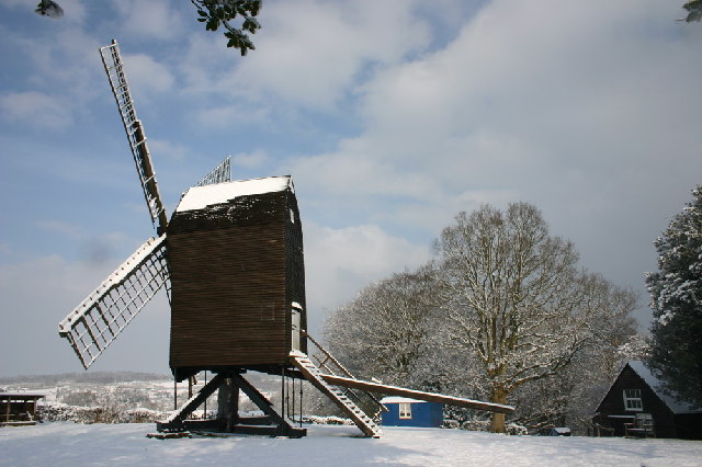
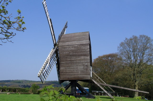
Nutley Windmill

Nutley Windmill is a grade II* listed open trestle post mill at Nutley, East Sussex, England which has been restored to working order. == History == Nutley...

Byline Festival

The Byline Festival is a festival whose aim is to promote independent journalism and free speech. The festival was founded by Stephen Colegrave and Peter...
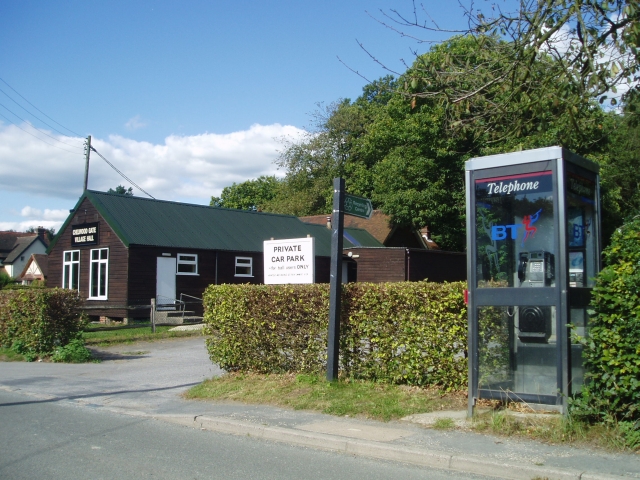
Chelwood Gate

Chelwood Gate is a small village within the civil parish of Danehill in the Wealden district of East Sussex, England. Its nearest town is Uckfield, which...

Duddleswell

Duddleswell is a village in the Wealden district, East Sussex in England, United Kingdom.

Fairwarp

Fairwarp is a small village within the civil parish of Maresfield in the Wealden district of East Sussex, England. Its nearest town is Uckfield, which...

Old Lodge

Old Lodge is a 103.1-hectare (255-acre) Local Nature Reserve west of Crowborough in East Sussex. It is privately owned. It is managed by Sussex Wildlife...

Brickfield Meadow

Brickfield Meadow is a 1.4-hectare (3.5-acre) nature reserve north of Maresfield in East Sussex. It is managed by the Sussex Wildlife Trust.This wildflower...

Nearby Amenities

Located within 500m of 51.033092,0.058121251
Nutley
Place: village
Source: OS_OpenData_StreetView
Wikidata: Q7070465
Lat/Long: 51.0302572/0.0565017
Post Box
Collection Times: Mo-Fr 16:15; Sa 10:30
Operator: Royal Mail
Post Box Type: wall
Ref: TN22 34
Royal Cypher: GR
Royal Cypher Wikidata: Q33102273
Source: survey
Lat/Long: 51.0288141/0.0562388
Recycling
Lat/Long: 51.033106/0.0551474
Townhall
Nutley War Memorial Hall
Lat/Long: 51.0334366/0.0548551
Speed Camera
Lat/Long: 51.0305101/0.0556519
Post Box
Collection Times: Mo-Fr 09:00; Sa 07:00
Operator: Royal Mail
Post Box Type: lamp
Ref: TN22 33D
Royal Cypher: EIIR
Royal Cypher Wikidata: Q33102113
Source: survey
Lat/Long: 51.03332/0.0555437
Nursing Home
Tall Timbers
Lat/Long: 51.0295254/0.056541
Give Way
Direction: backward
Lat/Long: 51.0345913/0.0550986
The data included in this document is from www.openstreetmap.org. The data is made available under ODbL.

Have you been to Wisper Wood?

Leave your review of Wisper Wood below (or comments, questions and feedback).