Northbank Wood

Wood, Forest in Sussex Wealden

England

Northbank Wood

Ice Cream Van in layby on A22
Ice Cream Van in layby on A22 Credit: PAUL FARMER

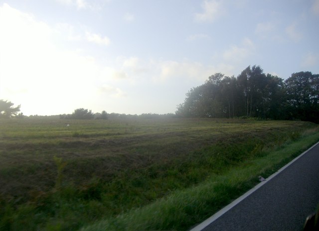
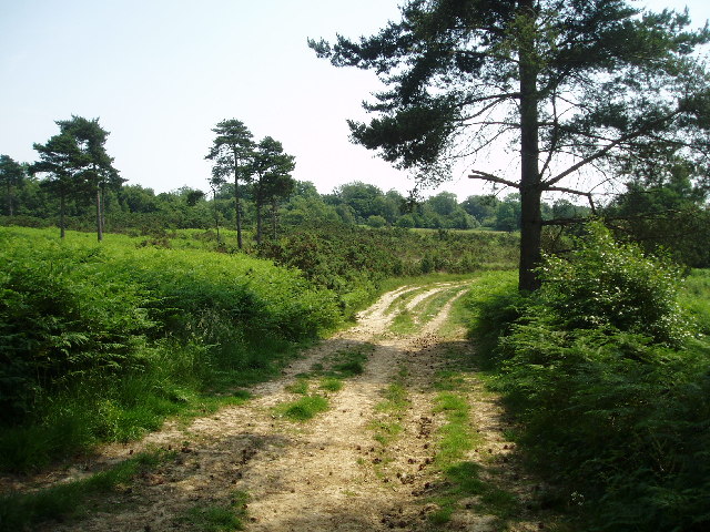
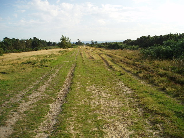
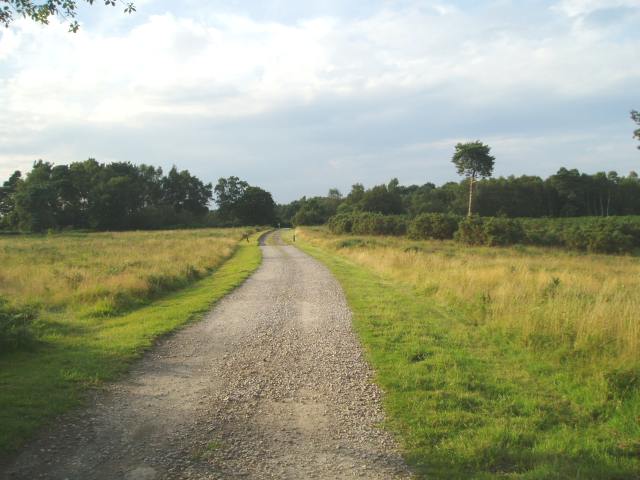
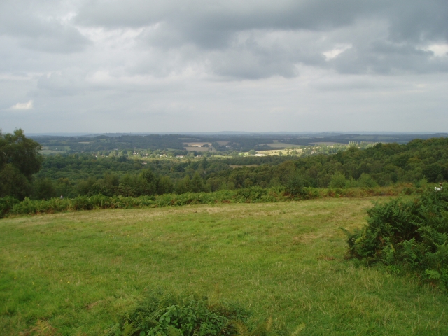
Northbank Wood is a picturesque forest located in the county of Sussex, England. Covering an area of approximately 100 acres, it is nestled on the southern bank of the River Adur, hence its name. The wood is a designated Site of Special Scientific Interest (SSSI), owing to its diverse and unique ecosystem.

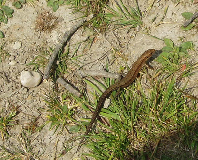
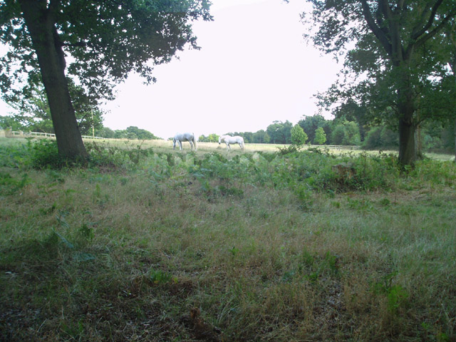
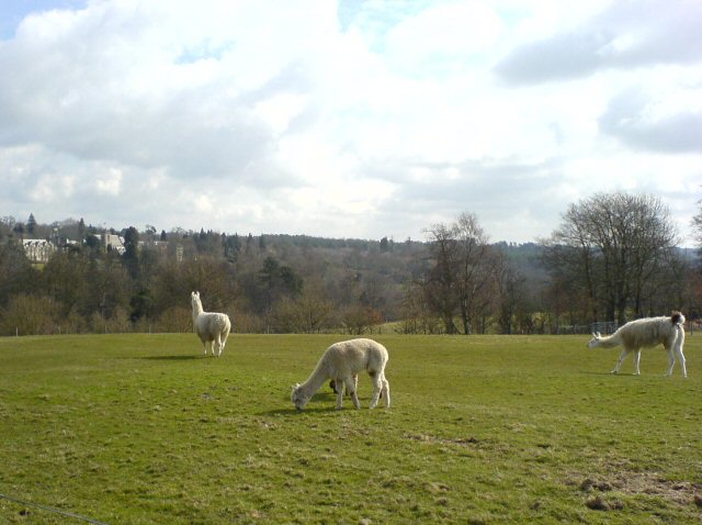
The woodland consists primarily of deciduous trees, including oak, beech, and birch, which create a lush and vibrant canopy during the spring and summer months. These trees provide a habitat for a wide range of wildlife, such as deer, badgers, and various bird species, making Northbank Wood a haven for nature enthusiasts and birdwatchers alike.

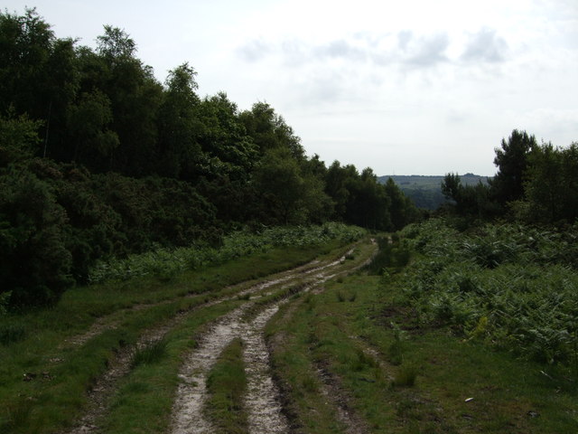
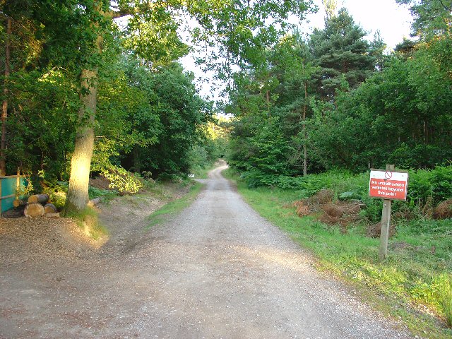
Walking through the forest, visitors can explore a network of well-maintained trails that meander through the wood, offering stunning views of the surrounding countryside. The paths are suitable for both leisurely strolls and more challenging hikes, accommodating visitors of all ages and abilities.

In addition to its natural beauty, Northbank Wood also boasts a rich cultural history. The remains of ancient earthworks, believed to date back to the Iron Age, can be found within the woodland. These archaeological features provide a fascinating glimpse into the region's past and offer visitors a chance to delve into the area's historical significance.

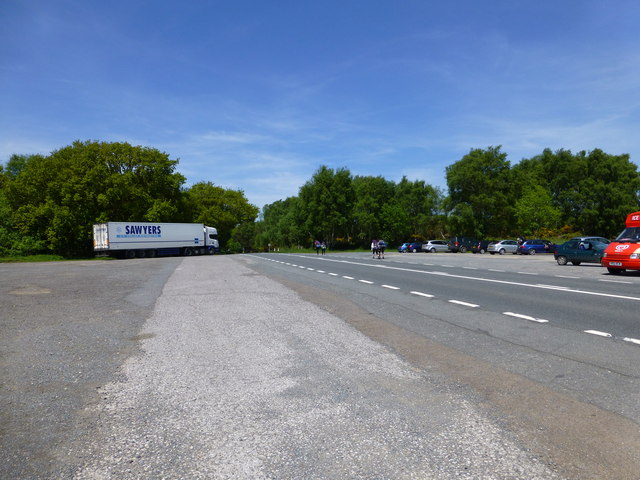
Access to Northbank Wood is free, and there are designated parking areas available nearby. The wood is open to the public year-round, allowing visitors to experience its beauty in every season. Whether you are seeking tranquility, wildlife spotting, or a recreational outing, Northbank Wood offers a delightful escape into nature's embrace.

If you have any feedback on the listing, please let us know in the comments section below.

Northbank Wood Images

Images are sourced within 2km of 51.066219/0.048657248 or Grid Reference TQ4331. Thanks to Geograph Open Source API. All images are credited.

Ice Cream Van in layby on A22
Fields by Millbrook Hill
Forestry track in Ashdown Forest north of Nutley, E.Sussex
Ashdown Forest, view from A22 Described as a "heath with here and there a few birch scrubs upon it, verily the most villainously ugly spot I ever saw in England" by William Cobbett in his Rural Rides written and published in the 1820s, much of the landscape has changed little from his time though tastes have in regard of the Ashdown Forest. Much of what is seen today has been shaped by centuries of man's uses of the region.

Originally the area was part of what became known as Andredswald, the huge tract of wood, that covered much of the area known as the Weald. Lying on silty sandstones in the highest part of the Weald with poor drainage, higher rainfall and shorter cultivating period than elsewhere in Sussex meant arable farming was always going to be extremely limited. Thus little incursion was made until the Iron Age when a few prehistoric bloomeries appeared that were continued and expanded by the Romans who built the main London-Lewes road through the forest which runs parallel to the modern B2026. The deep valleys provided the water power and the woods the fuel for these foundries. When the Romans left, many fell into disuse.

During the medieval period it was obtained by the Normans who used the poor land for hunting purposes, particularly deer, but allowed common rights for neighbouring settlements. With the deer, cattle and pigs grazing much of the land became a heath during this period with many areas becoming warrens for the keeping of rabbits adding to the low fertility of the soil that by 1500 it was described as being barren heathland with a few beech coverts. The apogee of the deer park was the 14th century when it was owned by John of Gaunt between 1372-99, thereafter they began falling out of fashion and by the 16th century was under attack by improvers, squatters and a newly invigorated iron industry.

The latter removed much of the remaining tree cover whilst Tudor neglect encouraged rapid encroachment by landowners big and small which reached a head in the 17th century when the Commonwealth sequestrated the forest and began a process of enclosure which resulted in a 1658 proposal to split the use of the forest into tree cultivation and pasture. The restoration halted this scheme with the Crown letting it to Thomas Williams who began large scale private enclosures but came up against the commoners who now fought tooth and nail to save their rights. Attempts to reach an agreement were unsuccessful until 1693 when a compromise was agreed to whereby common land pasture was to amount to 6400 acres (out of 15000) and more importantly was to be based geographically on need with the common areas being close to the villages and settlements that used them. This decision has largely influenced the look of the forest on today's map, the open access lands follow the borders of the former deer park with the private lands roughly being consigned to the middle. Another of the beneficiaries was Five Hundred Acre Wood which was planted in the 18th century. 

The battle between enclosure and common was to rear its head again in the 19th century, particularly the new owners, the De La Warrs who periodically tried to enclose the forest and stop cutting and encroachment. Another battle loomed and was fought in the courts between 1880-82 with the commoners once more successfully defending their rights and through an act of Parliament introduced a board of Conservators to manage the forest whose powers were reinforced by further acts in 1949 and 1974.

Thus the forest today has been shaped by those using it and the current map indicative of the battles fought from the 17th-19th centuries. The common land is now open access and has become a popular public destination and one of the few in Sussex to retain large tracts of open heathland.
Ashdown Forest, view from A22
Described as a "heath with here and there a few birch scrubs upon it, verily the most villainously ugly spot I ever saw in England" by William Cobbett in his Rural Rides written and published in the 1820s, much of the landscape has changed little from his time though tastes have in regard of the Ashdown Forest. Much of what is seen today has been shaped by centuries of man's uses of the region. Originally the area was part of what became known as Andredswald, the huge tract of wood, that covered much of the area known as the Weald. Lying on silty sandstones in the highest part of the Weald with poor drainage, higher rainfall and shorter cultivating period than elsewhere in Sussex meant arable farming was always going to be extremely limited. Thus little incursion was made until the Iron Age when a few prehistoric bloomeries appeared that were continued and expanded by the Romans who built the main London-Lewes road through the forest which runs parallel to the modern B2026. The deep valleys provided the water power and the woods the fuel for these foundries. When the Romans left, many fell into disuse. During the medieval period it was obtained by the Normans who used the poor land for hunting purposes, particularly deer, but allowed common rights for neighbouring settlements. With the deer, cattle and pigs grazing much of the land became a heath during this period with many areas becoming warrens for the keeping of rabbits adding to the low fertility of the soil that by 1500 it was described as being barren heathland with a few beech coverts. The apogee of the deer park was the 14th century when it was owned by John of Gaunt between 1372-99, thereafter they began falling out of fashion and by the 16th century was under attack by improvers, squatters and a newly invigorated iron industry. The latter removed much of the remaining tree cover whilst Tudor neglect encouraged rapid encroachment by landowners big and small which reached a head in the 17th century when the Commonwealth sequestrated the forest and began a process of enclosure which resulted in a 1658 proposal to split the use of the forest into tree cultivation and pasture. The restoration halted this scheme with the Crown letting it to Thomas Williams who began large scale private enclosures but came up against the commoners who now fought tooth and nail to save their rights. Attempts to reach an agreement were unsuccessful until 1693 when a compromise was agreed to whereby common land pasture was to amount to 6400 acres (out of 15000) and more importantly was to be based geographically on need with the common areas being close to the villages and settlements that used them. This decision has largely influenced the look of the forest on today's map, the open access lands follow the borders of the former deer park with the private lands roughly being consigned to the middle. Another of the beneficiaries was Five Hundred Acre Wood which was planted in the 18th century. The battle between enclosure and common was to rear its head again in the 19th century, particularly the new owners, the De La Warrs who periodically tried to enclose the forest and stop cutting and encroachment. Another battle loomed and was fought in the courts between 1880-82 with the commoners once more successfully defending their rights and through an act of Parliament introduced a board of Conservators to manage the forest whose powers were reinforced by further acts in 1949 and 1974. Thus the forest today has been shaped by those using it and the current map indicative of the battles fought from the 17th-19th centuries. The common land is now open access and has become a popular public destination and one of the few in Sussex to retain large tracts of open heathland.
Lorry Parked by A22
Lorry Parked by A22
Car park on the A22 north of Nutley
Ashdown Forest Centre Visitor Centre for the Ashdown Forest.
Ashdown Forest Centre
Visitor Centre for the Ashdown Forest.
Ashdown Forest This area of the Ashdown Forest is high and nearby a water reservoir is to be found. From nearby Chelwood Gate to this point, locals sometimes refer to it as the Isle of Thorns.
Ashdown Forest
This area of the Ashdown Forest is high and nearby a water reservoir is to be found. From nearby Chelwood Gate to this point, locals sometimes refer to it as the Isle of Thorns.
Lacerta vivipara - THE COMMON LIZARD To be seen on the Ashdown Forest when the sun is shining !
Lacerta vivipara - THE COMMON LIZARD
To be seen on the Ashdown Forest when the sun is shining !
Admin office and Camp Shop, Broadstone Warren Scout Campsite, Nr Forest Row, West Sussex Near the entrance to this popular scout campsite is the camp office and shop. Broadstone Warren Campsite dominates the grid squares TQ4232 and TQ4233 and spreads into the adjacent squares to the E too. The area is almost entirely covered by mixed mature woodland.
Admin office and Camp Shop, Broadstone Warren Scout Campsite, Nr Forest Row, West Sussex
Near the entrance to this popular scout campsite is the camp office and shop. Broadstone Warren Campsite dominates the grid squares TQ4232 and TQ4233 and spreads into the adjacent squares to the E too. The area is almost entirely covered by mixed mature woodland.
Track through woodland. Broadstone Warren Scout Camp Site, West Sussex This view shows a track, leading SE from the main campsite car park. A public footpath leads along this track.
Track through woodland. Broadstone Warren Scout Camp Site, West Sussex
This view shows a track, leading SE from the main campsite car park. A public footpath leads along this track.
Ashdown Forest - Long Walk  The word “forest” is derived from the Latin foris, meaning “outside” and in Medieval England came to mean land outside cultivation and belonging by default to the Crown.
Ashdown Forest - Long Walk
The word “forest” is derived from the Latin foris, meaning “outside” and in Medieval England came to mean land outside cultivation and belonging by default to the Crown.
Looking north View from the lane leading down to a few houses known as Chelwood Vachery.
Looking north
View from the lane leading down to a few houses known as Chelwood Vachery.
Private pasture Looking eastwards from the public footpath next to Chelwood vachery
Private pasture
Looking eastwards from the public footpath next to Chelwood vachery
Nutley Windmill from Millbrook (East) Car park on the A22 A good spot to rest on the drive south towards Eastbourne. The windmill at Nutley can be seen to the south east, and nearby pines known as Friends Clump
Nutley Windmill from Millbrook (East) Car park on the A22
A good spot to rest on the drive south towards Eastbourne. The windmill at Nutley can be seen to the south east, and nearby pines known as Friends Clump
Ashdown Forest - Linton's car park View from Linton's car park towards the north.
Ashdown Forest - Linton's car park
View from Linton's car park towards the north.
Ashdown Forest Llama Park One llama looks wistfully towards the Ashdown Park Hotel & Country Club, which nestles in the SW corner of TQ4332. The foreground creature is an alpaca.
Ashdown Forest Llama Park
One llama looks wistfully towards the Ashdown Park Hotel & Country Club, which nestles in the SW corner of TQ4332. The foreground creature is an alpaca.
36 Miles to Bow Bells This old cast iron Milepost was probably cast locally, in one of the foundries which once covered the Ashdown Forest in smoke and consumed its trees as fuel.
36 Miles to Bow Bells
This old cast iron Milepost was probably cast locally, in one of the foundries which once covered the Ashdown Forest in smoke and consumed its trees as fuel.
Show me another place!

Northbank Wood is located at Grid Ref: TQ4331 (Lat: 51.066219, Lng: 0.048657248)

Administrative County: East Sussex

District: Wealden

Police Authority: Sussex

What 3 Words

///jumps.unspoiled.outlawing. Near Forest Row, East Sussex

Related Wikis

Landscape of Ashdown Forest

Ashdown Forest, a former royal hunting forest situated some 30 miles south-east of London, is a large area of lowland heathland whose ecological importance...

Ashdown Forest

Ashdown Forest is an ancient area of open heathland occupying the highest sandy ridge-top of the High Weald Area of Outstanding Natural Beauty. It is situated...

Byline Festival

The Byline Festival is a festival whose aim is to promote independent journalism and free speech. The festival was founded by Stephen Colegrave and Peter...

Wych Cross

Wych Cross is a location in Ashdown Forest, in the Wealden district of East Sussex. It lies on the sandstone forest ridge of the High Weald on the principal...
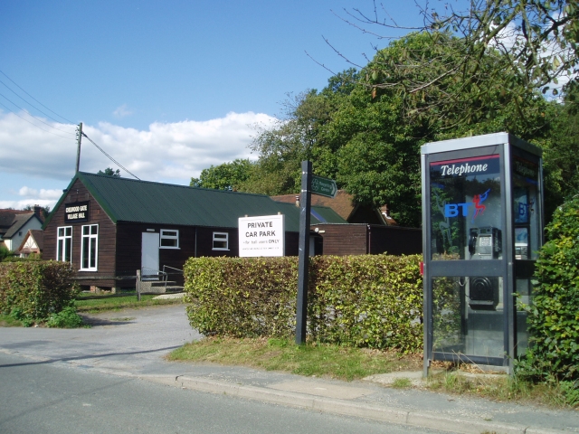
Chelwood Gate

Chelwood Gate is a small village within the civil parish of Danehill in the Wealden district of East Sussex, England. Its nearest town is Uckfield, which...

Old Lodge

Old Lodge is a 103.1-hectare (255-acre) Local Nature Reserve west of Crowborough in East Sussex. It is privately owned. It is managed by Sussex Wildlife...

Birch Grove

Birch Grove, Horsted Keynes, West Sussex, England is a country house dating from 1926. It was the family home of the British prime minister Harold Macmillan...
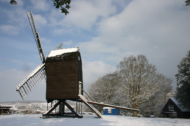
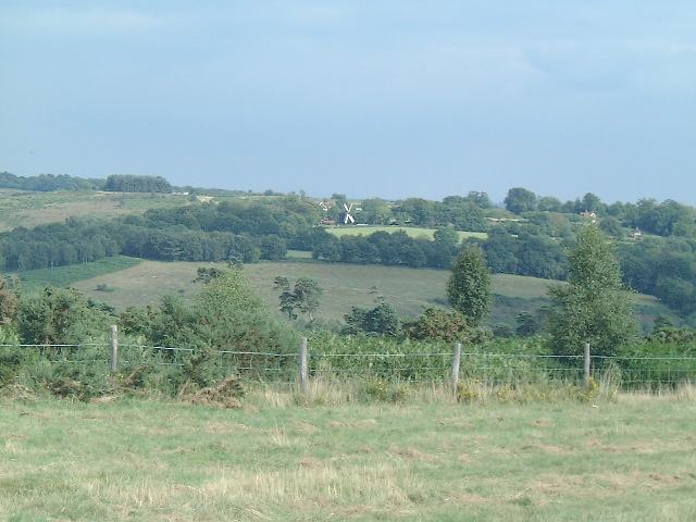
Nutley Windmill

Nutley Windmill is a grade II* listed open trestle post mill at Nutley, East Sussex, England which has been restored to working order. == History == Nutley...

Have you been to Northbank Wood?

Leave your review of Northbank Wood below (or comments, questions and feedback).