Ranscombe Holt

Wood, Forest in Sussex Lewes

England

Ranscombe Holt

Chandlers Wharf development The re-development of Chandlers Wharf for riverside living
Chandlers Wharf development Credit: Marvin653

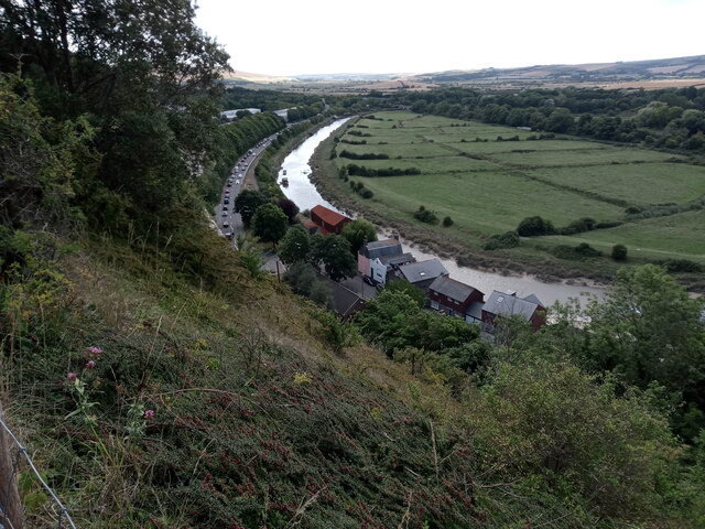
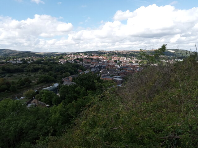
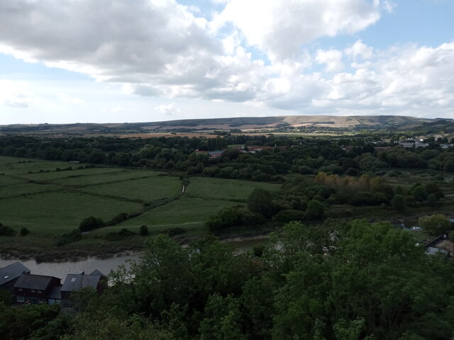
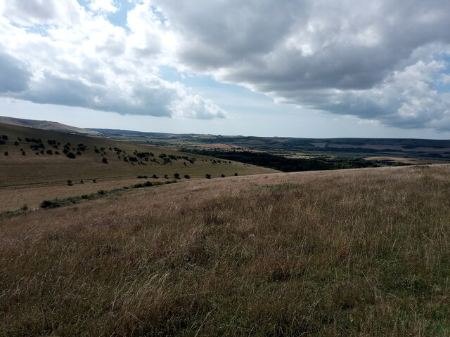
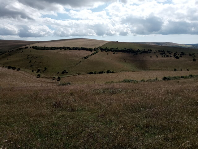
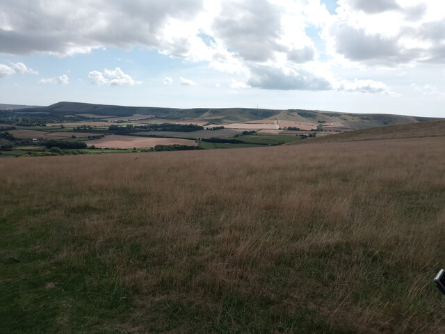
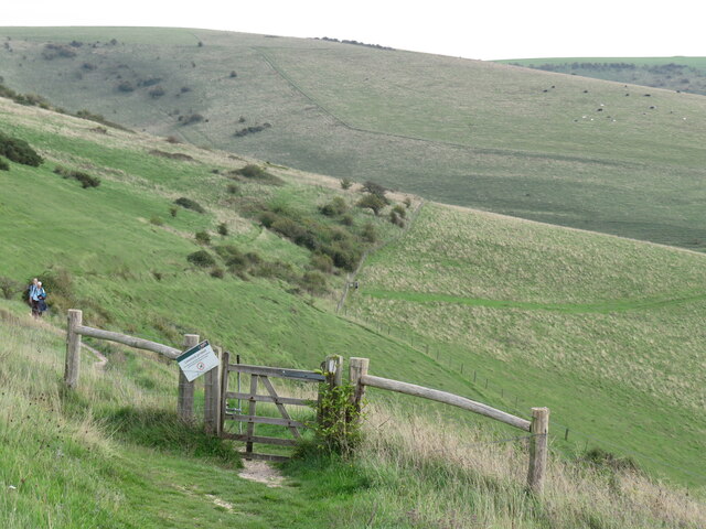
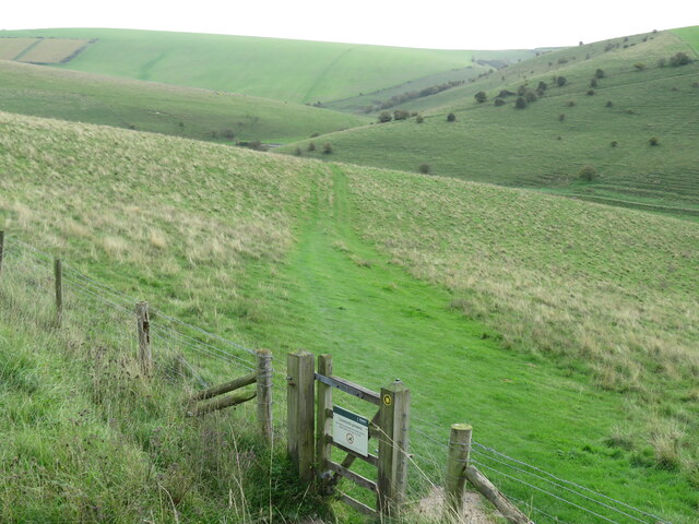
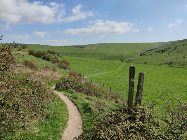
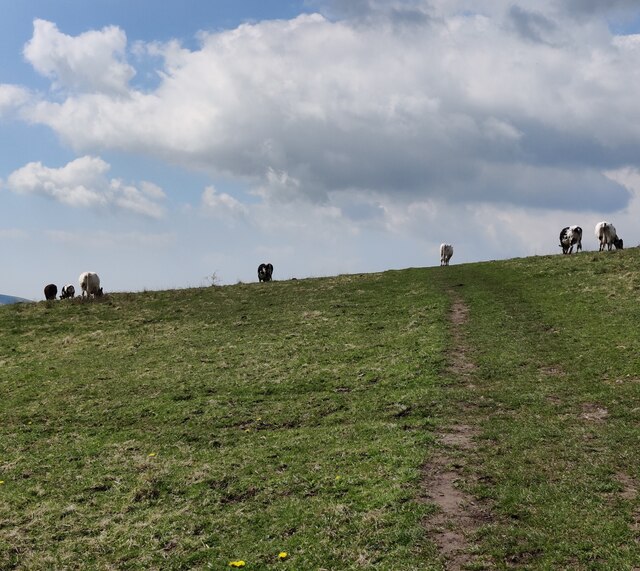
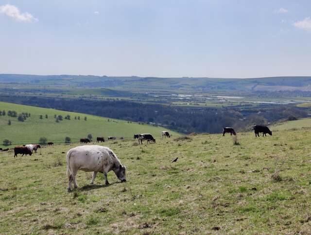
Ranscombe Holt is a picturesque woodland area located in Sussex, England. Spanning over a vast area, it is renowned for its natural beauty and serene atmosphere. The holt is nestled amidst the rolling hills of Sussex, with dense trees and lush vegetation covering the landscape.

The woodland is predominantly made up of various species of trees, including oak, beech, and birch, which provide a stunning display of colors throughout the seasons. The forest floor is carpeted with a rich layer of moss, ferns, and wildflowers, creating a vibrant and diverse ecosystem.

Ranscombe Holt is also home to a wide array of wildlife. Visitors have the opportunity to spot various species of birds, such as woodpeckers, owls, and thrushes, as well as small mammals like badgers, foxes, and deer. The tranquil setting of the holt makes it an ideal spot for nature enthusiasts and birdwatchers.

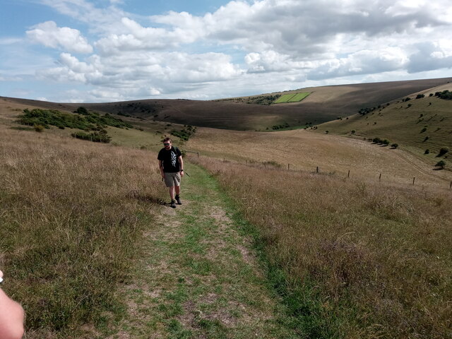
In addition to its natural beauty, Ranscombe Holt offers a network of walking trails, allowing visitors to explore the woodland at their own pace. These well-maintained paths wind through the trees, offering breathtaking views and an immersive experience in nature.

The holt is managed by a dedicated team of conservationists who strive to preserve its natural integrity. They organize regular events and educational programs to raise awareness about the importance of protecting this unique habitat.

Overall, Ranscombe Holt in Sussex is a haven for nature lovers, offering a peaceful retreat from the hustle and bustle of everyday life. Its stunning woodland, diverse wildlife, and well-maintained trails make it a must-visit destination for anyone seeking solace in nature.

If you have any feedback on the listing, please let us know in the comments section below.

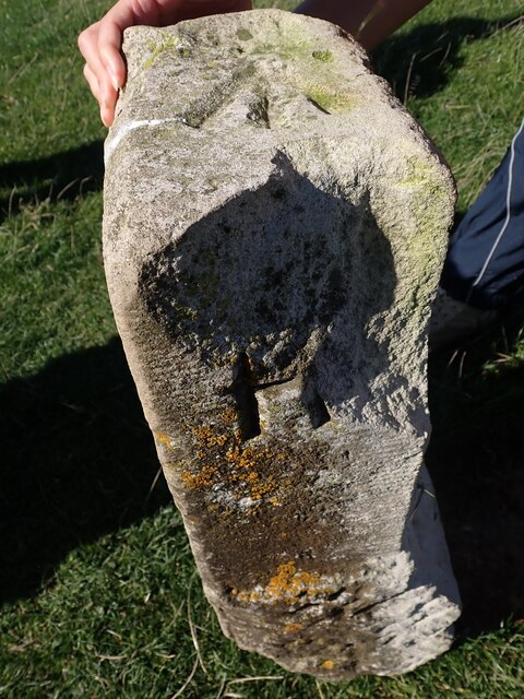
Ranscombe Holt Images

Images are sourced within 2km of 50.861641/0.039591714 or Grid Reference TQ4308. Thanks to Geograph Open Source API. All images are credited.

Chandlers Wharf development The re-development of Chandlers Wharf for riverside living
Chandlers Wharf development
The re-development of Chandlers Wharf for riverside living
View of the River Ouse meandering alongside the A26 near Lewes from the footpath leading from Chapel Hill to Lewes Golf Club Looking south-southeast.
View of the River Ouse meandering alongside the A26 near Lewes from the footpath leading from Chapel Hill to Lewes Golf Club
Looking south-southeast.
View of Lewes from the footpath leading from Chapel Hill to Lewes Golf Club Looking south-southwest.
View of Lewes from the footpath leading from Chapel Hill to Lewes Golf Club
Looking south-southwest.
View over the South Downs from the footpath leading from Chapel Hill to Lewes Golf Club Looking south.
View over the South Downs from the footpath leading from Chapel Hill to Lewes Golf Club
Looking south.
View over the South Downs from the footpath leading from Chapel Hill to Lewes Golf Club #2 Looking south-southwest.
View over the South Downs from the footpath leading from Chapel Hill to Lewes Golf Club #2
Looking south-southwest.
View over the South Downs from the footpath leading from Chapel Hill to Lewes Golf Club #3 Looking south-southeast.
View over the South Downs from the footpath leading from Chapel Hill to Lewes Golf Club #3
Looking south-southeast.
View over Bible Bottom from the path leading from Chapel Hill to Lewes Golf Club Looking south.
View over Bible Bottom from the path leading from Chapel Hill to Lewes Golf Club
Looking south.
View over the South Downs from the footpath leading from Chapel Hill to Lewes Golf Club #4 Looking south-southwest.
View over the South Downs from the footpath leading from Chapel Hill to Lewes Golf Club #4
Looking south-southwest.
Old Boundary Marker at Saxon Cross Parish Boundary Marker at Saxon Cross, found fallen beside a footpath on Saxon Down between the opera house and a golf club. Inscribed G, M and R on three faces. On the former boundary of Glynde, South Malling and Ringmer parishes, then Glynde, South Malling Without and Ringmer parishes from 1894, but since 1984 just Glynd and Ringmer parishes. See also <a title="https://www.geograph.org.uk/photo/3134471" href="https://www.geograph.org.uk/photo/3134471">Link</a>.

Milestone Society National ID: SX_GLYRIN01pb
Old Boundary Marker at Saxon Cross
Parish Boundary Marker at Saxon Cross, found fallen beside a footpath on Saxon Down between the opera house and a golf club. Inscribed G, M and R on three faces. On the former boundary of Glynde, South Malling and Ringmer parishes, then Glynde, South Malling Without and Ringmer parishes from 1894, but since 1984 just Glynd and Ringmer parishes. See also Link. Milestone Society National ID: SX_GLYRIN01pb
Bags of Books Children's bookshop on the corner of Chapel Hill and South Street.
Bags of Books
Children's bookshop on the corner of Chapel Hill and South Street.
Chapel Hill in Lewes A steep climb from Cliffe to the Golf Club and paths to Caburn.
Chapel Hill in Lewes
A steep climb from Cliffe to the Golf Club and paths to Caburn.
On the way to Oxteddle The path from Lewes leads through the Southerham reserve managed by the Sussex Wildlife Trust.
On the way to Oxteddle
The path from Lewes leads through the Southerham reserve managed by the Sussex Wildlife Trust.
The descent to Oxteddle Bottom Not a house in sight! On the path from Lewes to Glynde that passes Oxteddle Bottom.
The descent to Oxteddle Bottom
Not a house in sight! On the path from Lewes to Glynde that passes Oxteddle Bottom.
Houses and flats on the north side of the River Ouse
House on the north side of the River Ouse This could also be flats. I'm not sure.
House on the north side of the River Ouse
This could also be flats. I'm not sure.
Path towards Oxteddle Bottom
Cows along the footpath to Lewes
Cows at the Southerham Farm Nature Reserve
Show me another place!

Ranscombe Holt is located at Grid Ref: TQ4308 (Lat: 50.861641, Lng: 0.039591714)

Administrative County: East Sussex

District: Lewes

Police Authority: Sussex

What 3 Words

///ledge.fattest.circulate. Near Lewes, East Sussex

Nearby Locations

Ranscombe Holt

Related Wikis

Southerham Machine Bottom Pit

Southerham Machine Bottom Pit is a 1.8-hectare (4.4-acre) geological Site of Special Scientific Interest in Lewes in the East Sussex. It is a Geological...

Mount Caburn

Mount Caburn is a 150-metre (492 ft) prominent landmark in East Sussex, England, about one mile (1.6 km) east of Lewes overlooking the village of Glynde...

Southerham Grey Pit

Southerham Grey Pit is a 8.5-hectare (21-acre) geological Site of Special Scientific Interest south-east of Lewes in East Sussex. It is a Geological Conservation...

Lewes Downs

Lewes Downs is a 165-hectare (410-acre) biological Site of Special Scientific Interest east of Lewes in East Sussex. It is a Nature Conservation Review...

Southerham Works Pit

Southerham Works Pit is a 1-hectare (2.5-acre) geological Site of Special Scientific Interest in Lewes in East Sussex. It is a Geological Conservation...

Lewes and Laughton Levels

The Lewes and Laughton Levels are an area of low-lying land bordering the River Ouse near Lewes and the Glynde Reach near Laughton in East Sussex, England...

Beddingham

Beddingham is an English village and civil parish in the Lewes district of East Sussex, at the junction between the London–Newhaven (A26) and south coast...

Glynde Reach

Glynde Reach is a river in East Sussex, England and tributary of the River Ouse. The main channel is fed from sources near Laughton, Rushy Green on the...

Nearby Amenities

Located within 500m of 50.861641,0.039591714
Ele: 25.908
Source: NPE
Lat/Long: 50.860919/0.0367022
Created By: Potlatch 0.10f
Historic: archaeological_site
Source: NPE
Lat/Long: 50.8641097/0.0351089
The data included in this document is from www.openstreetmap.org. The data is made available under ODbL.

Have you been to Ranscombe Holt?

Leave your review of Ranscombe Holt below (or comments, questions and feedback).