Ash Plantation

Wood, Forest in Essex

England

Ash Plantation

Triple Detached? Tomswood Hill (L) and Fencepiece Road (R) meet at quite a sharp angle with a sort of triangular plot on the inside of the junction. Three houses jointly occupy the space in a sort of angled terrace arrangement.
Triple Detached? Credit: Des Blenkinsopp

Ash Plantation is a woodland area located in Essex, England. It is a part of the larger Epping Forest, which spans across 2,400 hectares. The plantation is known for its dense and thriving ash tree population, which gives it its name.

Covering an area of approximately 100 hectares, Ash Plantation is a popular destination for nature enthusiasts, hikers, and families looking to enjoy the outdoors. The woodland is characterized by its tall and mature ash trees, which provide a rich habitat for a variety of wildlife. Visitors can expect to see an array of bird species, such as woodpeckers and nuthatches, as well as small mammals like squirrels and foxes.

The plantation boasts a network of well-maintained trails, allowing visitors to explore the area on foot or by bike. These paths wind through the woodland, offering picturesque views of the surrounding nature. The tranquil atmosphere of Ash Plantation makes it an ideal spot for those seeking a peaceful retreat away from the hustle and bustle of city life.

In addition to its natural beauty, Ash Plantation also has historical significance. It has been a part of Epping Forest since the 19th century and has been carefully managed to preserve its ecological value. The conservation efforts in the area have helped maintain the diverse ecosystem and ensure its sustainability for years to come.

Overall, Ash Plantation in Essex is a captivating woodland destination that offers a serene environment, diverse wildlife, and a glimpse into the region's natural and historical heritage.

If you have any feedback on the listing, please let us know in the comments section below.

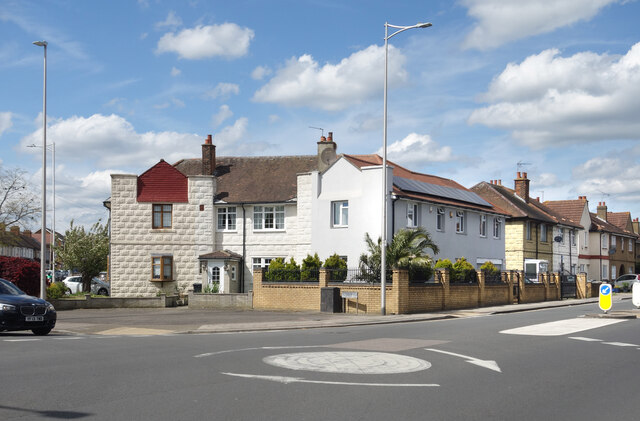
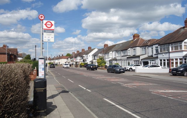
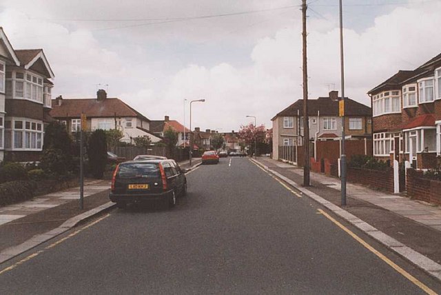
Ash Plantation Images

Images are sourced within 2km of 51.597556/0.05962999 or Grid Reference TQ4290. Thanks to Geograph Open Source API. All images are credited.

Triple Detached? Tomswood Hill (L) and Fencepiece Road (R) meet at quite a sharp angle with a sort of triangular plot on the inside of the junction. Three houses jointly occupy the space in a sort of angled terrace arrangement.
Triple Detached?
Tomswood Hill (L) and Fencepiece Road (R) meet at quite a sharp angle with a sort of triangular plot on the inside of the junction. Three houses jointly occupy the space in a sort of angled terrace arrangement.
Fencepiece Road, Fairlop
Fencepiece Road at Neville Road
High Road, Woodford Bridge, Essex Looking north, with St. Paul's Church
High Road, Woodford Bridge, Essex
Looking north, with St. Paul's Church
M11 Motorway and River Roding, Woodford Bridge Here the M11 (centre and right) runs alongside the River Roding.  The view is looking north from the footbridge which connects Ray Lodge park with the riverside path on the east bank. The blue speck in the centre (by the poplar tree) is the Essex county boundary sign
M11 Motorway and River Roding, Woodford Bridge
Here the M11 (centre and right) runs alongside the River Roding. The view is looking north from the footbridge which connects Ray Lodge park with the riverside path on the east bank. The blue speck in the centre (by the poplar tree) is the Essex county boundary sign
Ray Lodge Park, Woodford Bridge Looking east over the River Roding and M11 motorway to the ridge where Chigwell lies.  The footbridge over the river, from which the view in <a href="https://www.geograph.org.uk/gridref/TQ4292">TQ4292</a> was taken, can be seen just to the left of the tree
Ray Lodge Park, Woodford Bridge
Looking east over the River Roding and M11 motorway to the ridge where Chigwell lies. The footbridge over the river, from which the view in TQ4292 was taken, can be seen just to the left of the tree
Charlie Brown's This South Woodford junction has always been known as Charlie Brown's, presumably after the landlord of a pub which stood here rather than the cartoon character. Today it's a concrete jungle of flyovers, but with the modest River Roding flowing beneath.  In this view looking north, we are standing under the M11, the bus is travelling west from Ilford towards Walthamstow and the two levels of flyovers in the background carry the spur roads which link the North Circular Road with the motorway.
Charlie Brown's
This South Woodford junction has always been known as Charlie Brown's, presumably after the landlord of a pub which stood here rather than the cartoon character. Today it's a concrete jungle of flyovers, but with the modest River Roding flowing beneath. In this view looking north, we are standing under the M11, the bus is travelling west from Ilford towards Walthamstow and the two levels of flyovers in the background carry the spur roads which link the North Circular Road with the motorway.
Chigwell villas Chigwell is very much 'Footballers Wives' country with flamboyant modern mansions surrounded by security fences.  Some pleasanter areas survive though, such as these houses in Forest Lane.
Chigwell villas
Chigwell is very much 'Footballers Wives' country with flamboyant modern mansions surrounded by security fences. Some pleasanter areas survive though, such as these houses in Forest Lane.
Typically Chigwell Say no more .. (but see also <a href="https://www.geograph.org.uk/gridref/TQ4392">TQ4392</a>)
Typically Chigwell
Say no more .. (but see also TQ4392)
Claybury Park A modern country-park style recreational area for walking and cycling developed in recent years from disused farmland, Claybury Park offers wonderful views over Docklands and the City of London
Claybury Park
A modern country-park style recreational area for walking and cycling developed in recent years from disused farmland, Claybury Park offers wonderful views over Docklands and the City of London
Entrance Drive, Repton Park Executive Housing The former Claybury Mental Hospital was originally Dr Barnardo's first Children's Home and is now converted to an executive housing gated community and re-named Repton Park (evidently after the landscape gardener Humphrey Repton, although he had no connection with the area).
Entrance Drive, Repton Park Executive Housing
The former Claybury Mental Hospital was originally Dr Barnardo's first Children's Home and is now converted to an executive housing gated community and re-named Repton Park (evidently after the landscape gardener Humphrey Repton, although he had no connection with the area).
Traditional Weather-boarded Cottages Few traditional Essex-style cottages with pastel painted weatherboarding survive in the London area.  This well-maintained example is in Manor Road, Woodford Bridge, opposite The Green.
Traditional Weather-boarded Cottages
Few traditional Essex-style cottages with pastel painted weatherboarding survive in the London area. This well-maintained example is in Manor Road, Woodford Bridge, opposite The Green.
Roding Primary School Roding Primary School, Roding Lane North, Woodford Bridge, built 1939 and used by the Fire Service during WW2, it became a county junior school in 1946 and was later known as North Woodford Primary school.
Roding Primary School
Roding Primary School, Roding Lane North, Woodford Bridge, built 1939 and used by the Fire Service during WW2, it became a county junior school in 1946 and was later known as North Woodford Primary school.
Wedmore Avenue This grid square is a largely residential area within the London Borough of Redbridge. There is parkland adjacent to these houses in Wedmore Avenue, just behind the photographer.
Wedmore Avenue
This grid square is a largely residential area within the London Borough of Redbridge. There is parkland adjacent to these houses in Wedmore Avenue, just behind the photographer.
Shops below flats Taken from a flat in Coopersale Close
Shops below flats
Taken from a flat in Coopersale Close
Flats in Coopersale Close
River Roding near Buckhurst Hill This was taken during the blanket fog that covered much of the country during the middle of December 2006.
River Roding near Buckhurst Hill
This was taken during the blanket fog that covered much of the country during the middle of December 2006.
Virginia Gardens Virginia Gardens, Barkingside from its junction with Starch House Lane, looking towards the junction with Craven Gardens.
Virginia Gardens
Virginia Gardens, Barkingside from its junction with Starch House Lane, looking towards the junction with Craven Gardens.
Show me another place!

Ash Plantation is located at Grid Ref: TQ4290 (Lat: 51.597556, Lng: 0.05962999)

Unitary Authority: Redbridge

Police Authority: Metropolitan

What 3 Words

///snow.stick.wider. Near Grange Hill, Essex

Related Wikis

Caterham High School

Caterham High School is a mixed, comprehensive 11-18 school in Clayhall, London. There are 1100 students in the school. The school is supported by the...

St Cedd's Church, Ilford

St Cedd's Church, Barkingside (also St Cedd's Church, Ilford and St Cedd's Church, Marston Road) is a Church of England parish church in the Barkingside...

Clayhall

Clayhall is a district of Ilford in the London Borough of Redbridge in east London, England. It is a suburban development. The name is derived from an...

Claybury Hospital

Claybury Hospital was a psychiatric hospital in Woodford Bridge, London. It was built to a design by the English architect George Thomas Hine who was...

Nearby Amenities

Located within 500m of 51.597556,0.05962999
Mini Roundabout
Lat/Long: 51.5958474/0.0595477
Direction: both
Surface: asphalt
Traffic Calming: hump
Lat/Long: 51.5948703/0.0543107
Turning Circle
Lat/Long: 51.5982202/0.0568429
Turning Circle
Lat/Long: 51.6004442/0.0542994
Post Box
Lat/Long: 51.5948465/0.0564706
Bus Stop
Copper Beech Close
Bus: yes
Local Ref: FC
Naptan AtcoCode: 490005586S
Naptan Bearing: S
Naptan CommonName: Copper Beech Close
Naptan Indicator: Stop FC
Naptan Street: FULLWELL AVENUE
Naptan Verified: no
Public Transport: platform
Ref: 49180
Lat/Long: 51.5974929/0.0655606
Bus Stop
Clayhall / The Glade
Bus: yes
Local Ref: FA
Naptan AtcoCode: 490005375S
Naptan Bearing: S
Naptan CommonName: Clayhall The Glade
Naptan Indicator: Stop FA
Naptan Street: FULLWELL AVENUE
Naptan Verified: no
Public Transport: platform
Ref: 56202
Lat/Long: 51.5962109/0.0609741
Bus Stop
Owen Waters House
Bus: yes
Local Ref: FB
Naptan AtcoCode: 490011530E
Naptan Bearing: E
Naptan CommonName: Repton Grove
Naptan Indicator: Stop FB
Naptan Street: FULLWELL AVENUE
Naptan Verified: no
Public Transport: platform
Ref: 57514
Lat/Long: 51.5976776/0.063034
Bus Stop
Copper Beech Close
Bus: yes
Local Ref: FK
Naptan AtcoCode: 490014332W
Naptan Bearing: W
Naptan CommonName: Wedmore Avenue
Naptan Indicator: Stop FK
Naptan Street: FULLWELL AVENUE
Naptan Verified: no
Public Transport: platform
Ref: 51084
Lat/Long: 51.5974593/0.0651322
Barrier: kissing_gate
Bicycle: no
Lat/Long: 51.6011434/0.0563165
Barrier: bollard
Source: survey
Lat/Long: 51.5967238/0.0602666
Turning Circle
Turning Circle: circle
Lat/Long: 51.5959064/0.055239
Barrier: kissing_gate
Bicycle: no
Source: survey
Lat/Long: 51.598714/0.0664827
Bench
Source: survey
Lat/Long: 51.6008634/0.0594318
Bench
Backrest: yes
Check Date: 2021-04-04
Source: survey
Lat/Long: 51.6006501/0.0572807
Waste Basket
Source: survey
Lat/Long: 51.6008883/0.0594479
Barrier: kissing_gate
Bicycle: yes
Lat/Long: 51.6002298/0.0555143
Noexit: yes
Lat/Long: 51.5983003/0.0536182
Historic: memorial
Memorial: plaque
Note: 50th anniversary of V E Day, 1995, willow tree planted by John Churchill
Lat/Long: 51.5981535/0.0525873
Bench
Source: survey
Lat/Long: 51.5982203/0.0535995
Bench
Source: survey
Lat/Long: 51.5976123/0.0530067
Barrier: kissing_gate
Source: survey
Lat/Long: 51.5981612/0.0581931
Bench
Backrest: yes
Source: survey
Lat/Long: 51.5998415/0.0565767
Barrier: kissing_gate
Source: survey
Lat/Long: 51.5983572/0.059619
Post Box
Collection Times: Mo-Fr 18:00; Sa 12:15
Operator: Royal Mail
Operator Wikidata: Q638098
Ref: IG5 65
Lat/Long: 51.5942021/0.061942
Noexit: yes
Lat/Long: 51.5939267/0.0619081
Noexit: yes
Lat/Long: 51.5986934/0.0560608
Noexit: yes
Lat/Long: 51.5951754/0.0607034
Barrier: kissing_gate
Bicycle: yes
Source: survey
Lat/Long: 51.5989007/0.0569025
Barrier: log
Lat/Long: 51.5982882/0.05956
Barrier: bollard
Lat/Long: 51.6001769/0.0547402
Noexit: yes
Lat/Long: 51.5968723/0.0665806
Noexit: yes
Lat/Long: 51.5947453/0.0611582
Noexit: yes
Lat/Long: 51.5950134/0.060939
Waste Basket
Waste: trash
Lat/Long: 51.5998379/0.0565872
Give Way
Direction: forward
Lat/Long: 51.5958379/0.0594615
Natural: rock
Lat/Long: 51.5979555/0.0619432
Natural: rock
Lat/Long: 51.5979548/0.0619594
Natural: rock
Lat/Long: 51.5979645/0.0619711
Natural: rock
Lat/Long: 51.5979771/0.0619624
Waste Basket
Lat/Long: 51.5979462/0.0619348
Waste Basket
Lat/Long: 51.5979177/0.0620224
Fixme: I don't really know what this is. Looks like a suction cup.
Playground: seat
Lat/Long: 51.5979544/0.0619888
Bench
Backrest: yes
Colour: silver
Material: metal
Lat/Long: 51.5979282/0.0619917
Bench
Backrest: yes
Colour: silver
Material: metal
Lat/Long: 51.5979712/0.0620043
Bicycle Parking
Bicycle Parking: stands
Capacity: 6
Ref GB Tflcid: RWG220506
Lat/Long: 51.6002373/0.055712
Bicycle Parking
Bicycle Lock: provided
Bicycle Parking: stands
Capacity: 20
Covered: yes
Ref GB Tflcid: RWG156571
Lat/Long: 51.5977585/0.0635686
Bicycle Parking
Bicycle Parking: stands
Capacity: 6
Ref GB Tflcid: RWG156570
Lat/Long: 51.5980283/0.0571241
Information: board
Tourism: information
Lat/Long: 51.5971534/0.0666313
Crossing
Crossing: unmarked
Crossing Markings: no
Tactile Paving: yes
Lat/Long: 51.5971737/0.0667021
Give Way
Direction: backward
Lat/Long: 51.595913/0.0595481
Advertising: board
Lit: no
Lat/Long: 51.5946294/0.0562189
Waste Basket
Colour: Black
Material: plastic
Operator: Redbridge Council
Source: aerial imagery
Waste: trash
Lat/Long: 51.5947444/0.0559334
Waste Basket
Colour: Black
Material: plastic
Operator: Redbridge Council
Source: aerial imagery
Waste: trash
Lat/Long: 51.5947973/0.0560803
Give Way
Direction: forward
Lat/Long: 51.597073/0.0563371
Give Way
Direction: forward
Lat/Long: 51.5979281/0.0571071
Give Way
Direction: forward
Lat/Long: 51.594887/0.0597968
Give Way
Direction: forward
Lat/Long: 51.5946588/0.0599945
Give Way
Direction: backward
Lat/Long: 51.5939581/0.0573091
Direction: both
Traffic Calming: hump
Lat/Long: 51.5941652/0.0570976
Noexit: yes
Lat/Long: 51.5939971/0.0605412
Give Way
Direction: backward
Lat/Long: 51.5948851/0.054268
Give Way
Direction: forward
Lat/Long: 51.5948562/0.0543515
Give Way
Direction: backward
Lat/Long: 51.5942809/0.0554529
Give Way
Direction: forward
Lat/Long: 51.5946703/0.0565819
Give Way
Direction: backward
Lat/Long: 51.5947213/0.0565304
Give Way
Direction: backward
Lat/Long: 51.5958603/0.0596473
Give Way
Direction: forward
Lat/Long: 51.595786/0.0595763
Give Way
Direction: backward
Lat/Long: 51.5959171/0.0599238
Give Way
Direction: forward
Lat/Long: 51.5961571/0.0574142
Give Way
Direction: backward
Lat/Long: 51.595431/0.0583379
Turning Circle
Lat/Long: 51.5954804/0.0563899
Crossing
Crossing: unmarked
Crossing Island: no
Crossing Markings: no
Tactile Paving: yes
Traffic Calming: table
Lat/Long: 51.5948418/0.0543931
Crossing
Crossing: unmarked
Crossing Island: no
Crossing Markings: no
Tactile Paving: yes
Traffic Calming: table
Lat/Long: 51.5949242/0.054359
Crossing
Crossing: unmarked
Crossing Island: no
Crossing Markings: no
Tactile Paving: yes
Traffic Calming: table
Lat/Long: 51.5948204/0.054266
Crossing
Crossing: unmarked
Crossing Island: no
Crossing Markings: no
Tactile Paving: yes
Traffic Calming: table
Lat/Long: 51.5949011/0.0542218
Brooks Jewellery Services
Addr City: Ilford
Addr Housenumber: 45
Addr Postcode: IG5 0PQ
Addr Street: Atherton Road
Phone: +44 02085517999
Shop: jewelry
Lat/Long: 51.5947602/0.0557477
Revive Beauty Clinic
Addr City: Ilford
Addr Housenumber: 47
Addr Postcode: IG5 0PQ
Addr Street: Atherton Road
Beauty: aesthetic;hair_removal
Phone: +44 02085512700
Shop: beauty
Website: www.revive-laser-beauty.co.uk/
Lat/Long: 51.594807/0.055813
Anna's Sweets & News
Addr City: Ilford
Addr Housenumber: 49
Addr Postcode: IG5 0PQ
Addr Street: Atherton Road
Shop: lottery
Lat/Long: 51.5948376/0.0558897
Pet Universe Cat & Dog Grooming Salon
Addr City: Ilford
Addr Housenumber: 51
Addr Postcode: IG5 0PQ
Addr Street: Atherton Road
Phone: +44 02085500430
Shop: pet_grooming
Lat/Long: 51.5948502/0.0559805
Glades Food & Wine
Addr City: Ilford
Addr Housenumber: 53
Addr Postcode: IG5 0PQ
Addr Street: Atherton Road
Phone: +44 02085519070
Shop: convenience
Lat/Long: 51.594879/0.0560536
Community Centre
Clayhall Community Centre
Addr City: Ilford
Addr Housenumber: 55
Addr Postcode: IG5 0PQ
Addr Street: Atherton Road
Lat/Long: 51.5949122/0.056134
Noexit: yes
Lat/Long: 51.5983064/0.0553672
Crossing
Crossing: unmarked
Crossing Island: yes
Crossing Markings: no
Tactile Paving: yes
Lat/Long: 51.5972117/0.0529718
Direction: forward
Traffic Calming: cushion
Lat/Long: 51.5971786/0.0529468
Direction: backward
Traffic Calming: cushion
Lat/Long: 51.5972456/0.0529976
Crossing
Crossing: unmarked
Crossing Island: no
Crossing Markings: no
Tactile Paving: no
Lat/Long: 51.5970648/0.056361
Crossing
Crossing: unmarked
Crossing Island: no
Crossing Markings: no
Tactile Paving: no
Lat/Long: 51.596145/0.0573879
Crossing
Crossing: unmarked
Crossing Island: no
Crossing Markings: no
Tactile Paving: yes
Lat/Long: 51.595446/0.0583201
Crossing
Crossing: unmarked
Crossing Island: no
Crossing Markings: no
Tactile Paving: yes
Lat/Long: 51.5958238/0.059426
Crossing
Crossing: unmarked
Crossing Island: no
Crossing Markings: no
Tactile Paving: yes
Lat/Long: 51.5958828/0.0597197
Crossing
Crossing: unmarked
Crossing Island: no
Crossing Markings: no
Tactile Paving: yes
Lat/Long: 51.5957495/0.0595879
Crossing
Crossing: unmarked
Crossing Island: no
Crossing Markings: no
Tactile Paving: yes
Lat/Long: 51.5947364/0.0565153
Crossing
Crossing: unmarked
Crossing Island: no
Crossing Markings: no
Tactile Paving: yes
Lat/Long: 51.5946536/0.056599
Crossing
Crossing: unmarked
Crossing Island: no
Crossing Markings: no
Tactile Paving: no
Lat/Long: 51.5948503/0.0563283
Crossing
Crossing: unmarked
Crossing Island: no
Crossing Markings: no
Tactile Paving: yes
Lat/Long: 51.5945552/0.0560641
Crossing
Crossing: unmarked
Crossing Island: no
Crossing Markings: no
Tactile Paving: yes
Lat/Long: 51.59397/0.0572969
Crossing
Crossing: unmarked
Crossing Island: no
Crossing Markings: no
Tactile Paving: yes
Lat/Long: 51.5948817/0.0597786
Crossing
Crossing: unmarked
Crossing Island: no
Crossing Markings: no
Tactile Paving: no
Lat/Long: 51.5946644/0.0600441
Crossing
Crossing: unmarked
Crossing Island: no
Crossing Markings: no
Tactile Paving: no
Lat/Long: 51.5942891/0.0554407
Barrier: bollard
Bicycle: yes
Foot: yes
Lat/Long: 51.5974222/0.0609572
The data included in this document is from www.openstreetmap.org. The data is made available under ODbL.

Have you been to Ash Plantation?

Leave your review of Ash Plantation below (or comments, questions and feedback).