Bidbury Wood

Wood, Forest in Surrey Tandridge

England

Bidbury Wood

Orchards Nursery Originally this was the kitchen garden and fruit orchard serving the main house known as Orchards which was linked by a bridge across the road. Now a busy family owned nursery. The high wall supports the greenhouses on the south facing side.
Orchards Nursery Credit: Nigel Freeman

Bidbury Wood is a picturesque woodland located in Surrey, England. Spanning an area of approximately 100 acres, it is a captivating destination for nature enthusiasts and outdoor lovers alike. The wood is situated in close proximity to the village of Bidbury, adding to its accessibility and popularity.

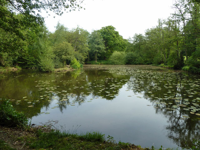
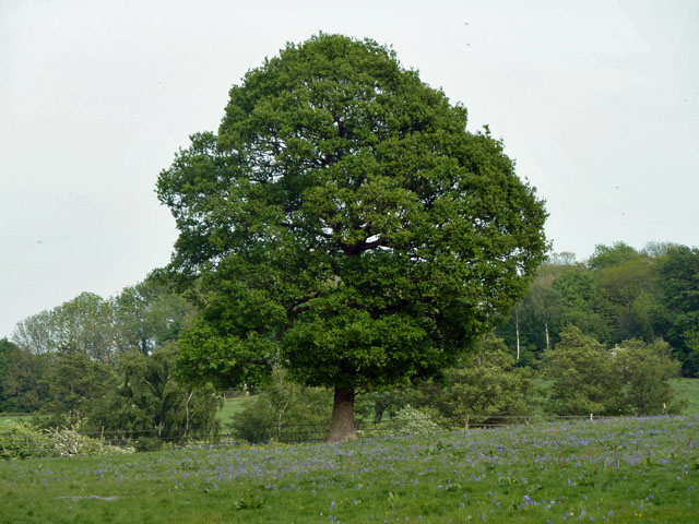
This ancient woodland boasts a diverse range of flora and fauna, with a rich variety of trees such as oak, beech, and hornbeam dominating the landscape. The dense canopy provides a haven for numerous bird species, making it an ideal spot for birdwatching enthusiasts. Additionally, the forest floor is adorned with an array of wildflowers, adding vibrant colors to the woodland during spring and summer months.

Bidbury Wood offers a network of well-maintained footpaths and trails, allowing visitors to explore its beauty at their own pace. Whether it's a leisurely walk or a challenging hike, there are options available for all fitness levels. The wood also features a small stream that meanders through its heart, enhancing the tranquility of the surroundings.

The wood is managed by a local conservation organization, ensuring its preservation and protection. This commitment to conservation has led to the establishment of designated nature reserves within the woodland, further safeguarding the unique ecosystem found here.

Bidbury Wood is not only a haven for wildlife and flora, but also a cherished recreational space for the local community. Families often gather here for picnics, and children enjoy the natural playground that the wood provides.

Overall, Bidbury Wood is a captivating and well-preserved woodland, offering a delightful escape into nature for visitors of all ages.

If you have any feedback on the listing, please let us know in the comments section below.
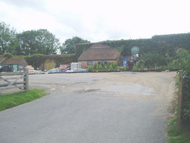
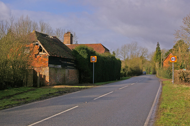
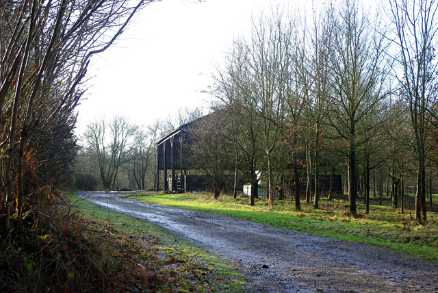
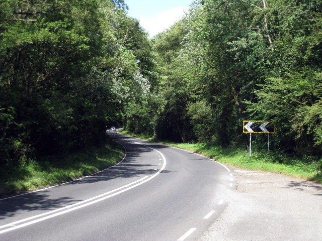
Bidbury Wood Images

Images are sourced within 2km of 51.150737/0.030091662 or Grid Reference TQ4241. Thanks to Geograph Open Source API. All images are credited.

Orchards Nursery Originally this was the kitchen garden and fruit orchard serving the main house known as Orchards which was linked by a bridge across the road. Now a busy family owned nursery. The high wall supports the greenhouses on the south facing side.
Orchards Nursery
Originally this was the kitchen garden and fruit orchard serving the main house known as Orchards which was linked by a bridge across the road. Now a busy family owned nursery. The high wall supports the greenhouses on the south facing side.
Oast House at The Barn, Old Surrey Hall, Lingfield, Surrey
Surrey/West Sussex/East Sussex meeting point The three counties meet on this bridge over the small stream visible on the left of the photo.  West Sussex is in the left foreground, East Sussex is in the right foreground and Surrey is beyond the stream.
Surrey/West Sussex/East Sussex meeting point
The three counties meet on this bridge over the small stream visible on the left of the photo. West Sussex is in the left foreground, East Sussex is in the right foreground and Surrey is beyond the stream.
County boundary This lane, which leads from Gotwick Farm on the A264 to Old Surrey Hall, forms the boundary between West Sussex (on the left) and East Sussex (on the right).  These two counties then meet Surrey at the dip in the distance (see <a href="https://www.geograph.org.uk/photo/1205436">TQ4139 : Surrey/West Sussex/East Sussex meeting point</a> for close up).
County boundary
This lane, which leads from Gotwick Farm on the A264 to Old Surrey Hall, forms the boundary between West Sussex (on the left) and East Sussex (on the right). These two counties then meet Surrey at the dip in the distance (see TQ4139 : Surrey/West Sussex/East Sussex meeting point for close up).
Pumphouse Farm Pumphouse Farm is on the left of the road, which is the A264 running from Tunbridge Wells to East Grinstead.  The building on the right is part of Gotwick Farm.  Both are grade II listed - for listing particulars see <span class="nowrap"><a title="www.historicengland.org.uk/listing/the-list/list-entry/1248943" rel="nofollow ugc noopener" href="http://www.historicengland.org.uk/listing/the-list/list-entry/1248943">Link</a><img style="margin-left:2px;" alt="External link" title="External link - shift click to open in new window" src="https://s1.geograph.org.uk/img/external.png" width="10" height="10"/></span> and <span class="nowrap"><a title="www.historicengland.org.uk/listing/the-list/list-entry/1248942" rel="nofollow ugc noopener" href="http://www.historicengland.org.uk/listing/the-list/list-entry/1248942">Link</a><img style="margin-left:2px;" alt="External link" title="External link - shift click to open in new window" src="https://s1.geograph.org.uk/img/external.png" width="10" height="10"/></span> respectively.
Pumphouse Farm
Pumphouse Farm is on the left of the road, which is the A264 running from Tunbridge Wells to East Grinstead. The building on the right is part of Gotwick Farm. Both are grade II listed - for listing particulars see LinkExternal link and LinkExternal link respectively.
Border crossing Looking into West Sussex from East Sussex on the A264, the border being somewhere in the vicinity of the assorted road signs.
Border crossing
Looking into West Sussex from East Sussex on the A264, the border being somewhere in the vicinity of the assorted road signs.
Barn near Gotwick Manor Behind a gate off Shepherdsgrove Lane.
Barn near Gotwick Manor
Behind a gate off Shepherdsgrove Lane.
A264, Holtye Road
A264, Holtye Road
Road junction on A264 Holtye Road This road leads from Tunbridge Wells (via Ashurst and Holtye) leading towards East Grinstead. Shepherdsgrove Lane leads right towards Dormansland. 

Also the Vanguard Way (long distance path) crosses the A264 and heads right down the lane.
Road junction on A264 Holtye Road
This road leads from Tunbridge Wells (via Ashurst and Holtye) leading towards East Grinstead. Shepherdsgrove Lane leads right towards Dormansland. Also the Vanguard Way (long distance path) crosses the A264 and heads right down the lane.
Mobile Phone Mast on Shepherdsgrove Lane This road leads from the A264 Holtye Road towards Dormansland.
Mobile Phone Mast on Shepherdsgrove Lane
This road leads from the A264 Holtye Road towards Dormansland.
Entrance gateway to Gotwick Manor On Shepherd's Grove Road.
Entrance gateway to Gotwick Manor
On Shepherd's Grove Road.
Bridge on Shepherdsgrove Lane This lane leads from Dormansland towards the A264 Holtye Road.
It crosses over Kent Water (a stream on the Kent Sussex boundary), but confusingly it is now the border between Surrey and East Sussex. Seen from the Surrey side. 

Also the Vanguard Way (long distance path) uses this quiet lane to head towards The A264 and Brookland Wood.
Bridge on Shepherdsgrove Lane
This lane leads from Dormansland towards the A264 Holtye Road. It crosses over Kent Water (a stream on the Kent Sussex boundary), but confusingly it is now the border between Surrey and East Sussex. Seen from the Surrey side. Also the Vanguard Way (long distance path) uses this quiet lane to head towards The A264 and Brookland Wood.
Kent Water - looking upstream This stream is on the Kent / Sussex boundary, but confusingly, it starts from Old Surrey Hall and is now the border between Surrey and East Sussex. Surrey is on the right.
Kent Water - looking upstream
This stream is on the Kent / Sussex boundary, but confusingly, it starts from Old Surrey Hall and is now the border between Surrey and East Sussex. Surrey is on the right.
Pond, Greathed Manor Within the parkland surrounding Greathed and Park Manors.
Pond, Greathed Manor
Within the parkland surrounding Greathed and Park Manors.
Oak and bluebells near Hoopers Farm It is unusual in these parts for bluebells to grow thickly in an open field. Perhaps it was once a wood? Indeed it was. Kiln Wood is roughly square in late Victorian maps, extending over this area. Now it is a much smaller triangle behind and right of the viewpoint.
Oak and bluebells near Hoopers Farm
It is unusual in these parts for bluebells to grow thickly in an open field. Perhaps it was once a wood? Indeed it was. Kiln Wood is roughly square in late Victorian maps, extending over this area. Now it is a much smaller triangle behind and right of the viewpoint.
St John's church - north end The liturgical east end of the church, which actually faces nearly north (parallel to Dormans High Street).
St John's church - north end
The liturgical east end of the church, which actually faces nearly north (parallel to Dormans High Street).
St John's church: lychgate This is not strictly a "lychgate" (place for resting a coffin), more a 19th century reproduction of a mediaeval idea, but covered churchyard entrances like this are usually referred to as such.
St John's church: lychgate
This is not strictly a "lychgate" (place for resting a coffin), more a 19th century reproduction of a mediaeval idea, but covered churchyard entrances like this are usually referred to as such.
Gate to St John's churchyard  A small wooden gate with large metal hinges.
Gate to St John's churchyard
A small wooden gate with large metal hinges.
Show me another place!

Bidbury Wood is located at Grid Ref: TQ4241 (Lat: 51.150737, Lng: 0.030091662)

Administrative County: Surrey

District: Tandridge

Police Authority: Surrey

What 3 Words

///itself.flash.rubble. Near Dormansland, Surrey

Nearby Locations

Nappers Wood Bidbury Wood

Related Wikis

Greathed Manor

Greathed Manor, Dormansland, Surrey, is a Victorian country house. Designed by the architect Robert Kerr in 1862–8, it is a Grade II listed building....

Dormansland, Surrey

Dormansland is a large village and civil parish with a low population approximately one mile south of Lingfield in Surrey, England. It was founded in the...

Dormans railway station

Dormans railway station is on the East Grinstead branch of the Oxted line in southern England and serves Dormansland and Dormans Park in Surrey. It is...

Hammerwood

Hammerwood is a hamlet in the civil parish of Forest Row in East Sussex, England. Its nearest town is East Grinstead, which lies approximately 3.5 miles...

Queen Victoria Hospital

The Queen Victoria Hospital (QVH), located in East Grinstead, West Sussex, England is the specialist reconstructive surgery centre for the south east of...

East Grinstead Meridian (electoral division)

East Grinstead Meridian is an electoral division of West Sussex in the United Kingdom, and returns one member to sit on West Sussex County Council. �...

East Grinstead Town F.C.

East Grinstead Town Football Club is a football club based in East Grinstead, West Sussex, England. They are currently members of the Isthmian League South...

Hammerwood Park

Hammerwood Park is a country house in Hammerwood, near East Grinstead, in East Sussex, England. It is a Grade I listed building. One of the first houses...

Nearby Amenities

Located within 500m of 51.150737,0.030091662
Lower Stonehurst Farm
Landuse: farm
Note Retag: CS #48756035
Source: npe
Lat/Long: 51.1486398/0.0292153
Barrier: stile
Lat/Long: 51.1524192/0.0295163
Barrier: stile
Lat/Long: 51.1524452/0.0295817
Barrier: stile
Lat/Long: 51.1523988/0.0326691
Barrier: stile
Lat/Long: 51.1541148/0.0326829
Barrier: stile
Lat/Long: 51.1508363/0.0284189
Barrier: stile
Lat/Long: 51.1496752/0.0271906
Barrier: stile
Lat/Long: 51.1524332/0.0327441
Barrier: stile
Lat/Long: 51.1524084/0.027794
Power: pole
Lat/Long: 51.1511215/0.023582
Power: pole
Lat/Long: 51.1511316/0.0233942
Power: pole
Lat/Long: 51.1537831/0.0253683
Power: pole
Lat/Long: 51.1536805/0.0251055
Power: pole
Lat/Long: 51.15274/0.0246495
Power: pole
Lat/Long: 51.1527871/0.0244966
Power: pole
Lat/Long: 51.151914/0.0241157
Power: pole
Lat/Long: 51.1519712/0.0239575
Power: pole
Lat/Long: 51.1467318/0.0284582
Power: pole
Lat/Long: 51.1473207/0.0271386
Power: pole
Lat/Long: 51.1480005/0.025658
Power: pole
Lat/Long: 51.1487307/0.0240809
Power: pole
Lat/Long: 51.1511754/0.0348741
Power: pole
Lat/Long: 51.1494256/0.0353703
Power: pole
Lat/Long: 51.1485523/0.035609
Barrier: stile
Lat/Long: 51.1523018/0.0337556
Barrier: stile
Lat/Long: 51.1524342/0.0283134
The data included in this document is from www.openstreetmap.org. The data is made available under ODbL.

Have you been to Bidbury Wood?

Leave your review of Bidbury Wood below (or comments, questions and feedback).