Leafy Grove

Wood, Forest in Kent

England

Leafy Grove

View over Leaves Green Road to London Docklands The distinctive skyline  at Canary Wharf is 11.5 miles away.
View over Leaves Green Road to London Docklands Credit: David Martin

Leafy Grove, Kent (Wood, Forest) is a picturesque and tranquil area located in the county of Kent, England. Situated amidst the stunning countryside, this idyllic woodland offers visitors a serene escape from the hustle and bustle of city life.

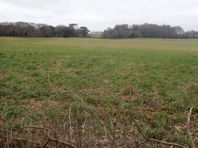
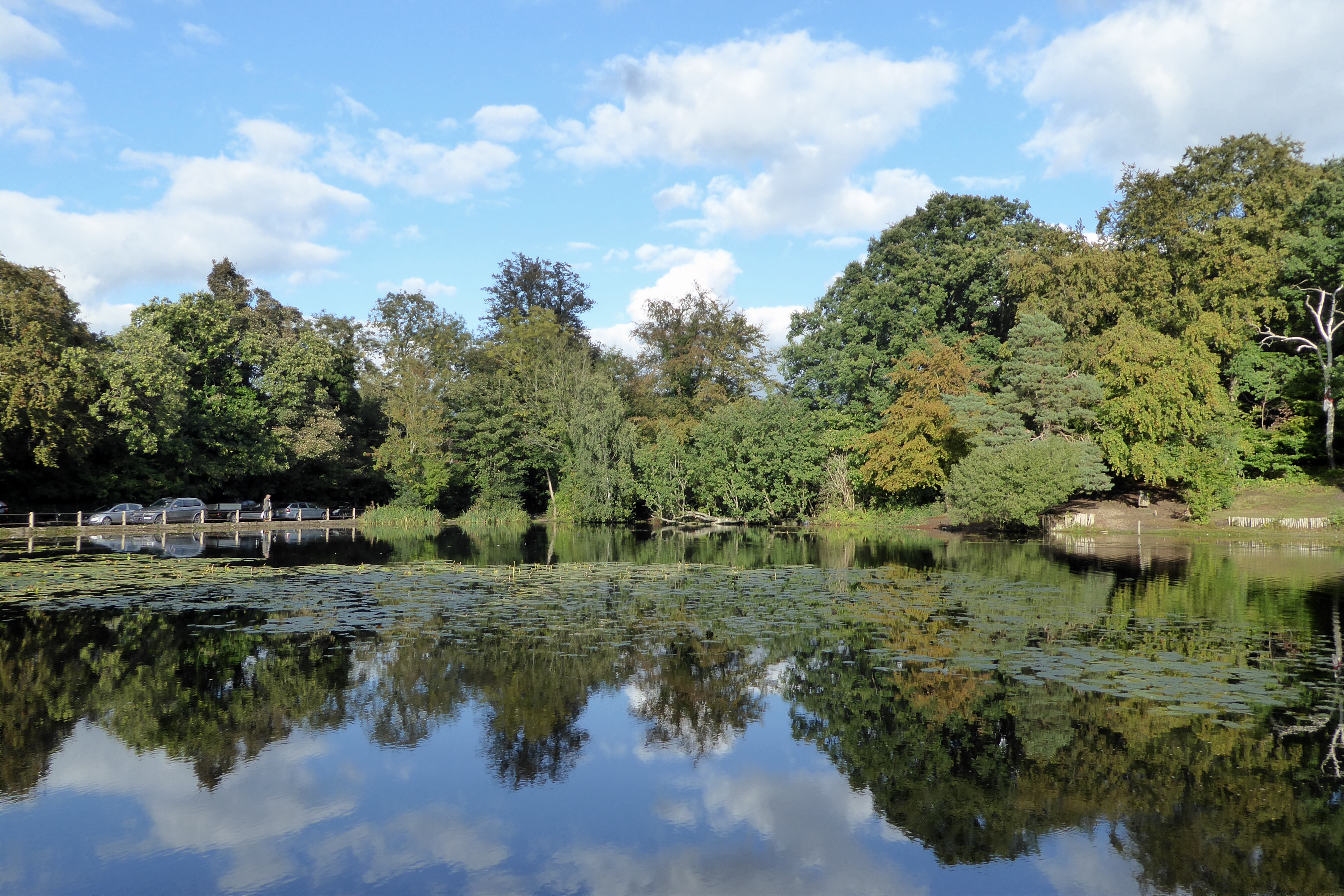
Covering a vast area of approximately 500 acres, Leafy Grove is renowned for its abundant native flora and diverse wildlife. The woodland is predominantly populated by a variety of deciduous trees, including oak, beech, and birch, which create a stunning tapestry of colors during the autumn months. The lush green canopy provides a haven for numerous bird species, such as woodpeckers, thrushes, and owls, making it a haven for birdwatching enthusiasts.

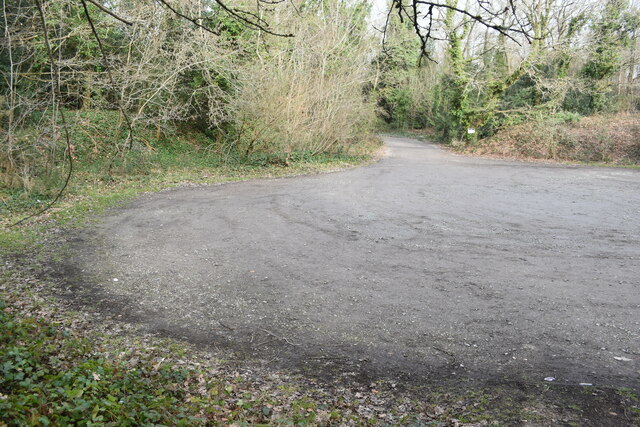
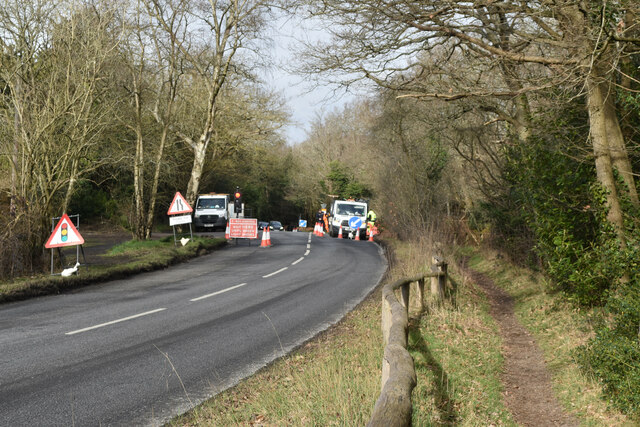
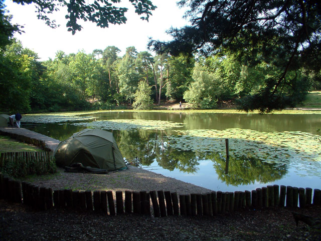
Leafy Grove boasts a network of well-maintained walking trails, allowing visitors to explore its natural beauty at their leisure. The trails meander through the woodland, providing glimpses of enchanting wildflowers, bubbling brooks, and small ponds along the way. The forest floor is carpeted with a rich tapestry of mosses, ferns, and bluebells, creating a magical atmosphere that enchants visitors all year round.

In addition to its natural beauty, Leafy Grove also offers various recreational activities for visitors to enjoy. There are picnic areas dotted throughout the woodland, providing the perfect spot to relax and soak up the peaceful ambiance. The forest also offers opportunities for camping, allowing nature enthusiasts to immerse themselves in the serenity of the surroundings.

Leafy Grove, Kent (Wood, Forest) is a hidden gem that showcases the beauty of nature in all its glory. Whether it's a leisurely stroll through the woodland or a day spent birdwatching, this enchanting area offers an unforgettable experience for all who visit.

If you have any feedback on the listing, please let us know in the comments section below.

Leafy Grove Images

Images are sourced within 2km of 51.355147/0.030268091 or Grid Reference TQ4163. Thanks to Geograph Open Source API. All images are credited.

View over Leaves Green Road to London Docklands The distinctive skyline  at Canary Wharf is 11.5 miles away.
View over Leaves Green Road to London Docklands
The distinctive skyline at Canary Wharf is 11.5 miles away.
Footpath across field northwest of Biggin Hill Airport
Footpath on field track to Leaves Green Road
Spitfire TE308 taking off from Biggin Hill A two-seat Spitfire used for heritage flights, seen from the footpath to the northwest of the airport.
Spitfire TE308 taking off from Biggin Hill
A two-seat Spitfire used for heritage flights, seen from the footpath to the northwest of the airport.
Gulfstream G550 taking off from Biggin Hill US-registered business jet seen just beyond the northern end of the runway - the undercarriage is still being retracted.
Gulfstream G550 taking off from Biggin Hill
US-registered business jet seen just beyond the northern end of the runway - the undercarriage is still being retracted.
Stile between paddocks near Farthing Street
Houses on the corner of Shire Lane
Pylon line north of Biggin Hill These are part of a section of shorter, wider pylons passing to the north of the airport runway.
Pylon line north of Biggin Hill
These are part of a section of shorter, wider pylons passing to the north of the airport runway.
Path and pylon north of Biggin Hill One of several shorter, wider pylons which pass to the north of the airport.
Path and pylon north of Biggin Hill
One of several shorter, wider pylons which pass to the north of the airport.
Farthing Street meets Bogey Lane Bogey Lane is an ancient sunken trackway which is followed here by the London LOOP between Keston and High Elms. It can become very muddy so the official advice is to follow the field edge path just uphill to the south. In this photograph the start of Bogey Lane is seen from Farthing Street. It is hard to believe that this remote path is still in Greater London but in fact it is in the London Borough of Bromley. See also <a title="www.geograph.org.uk/photo/3949662" href="https://www.geograph.org.uk/photo/3949662">Link</a>
Farthing Street meets Bogey Lane
Bogey Lane is an ancient sunken trackway which is followed here by the London LOOP between Keston and High Elms. It can become very muddy so the official advice is to follow the field edge path just uphill to the south. In this photograph the start of Bogey Lane is seen from Farthing Street. It is hard to believe that this remote path is still in Greater London but in fact it is in the London Borough of Bromley. See also Link
Distant view of Holwood House This is seen from the London Loop where it runs parallel to Shire Lane. Holwood House was designed by Decimus Burton and built between 1823 and 1826 in the Greek Revival style. See en.wikipedia.org/wiki/Holwood_House for more information.
Distant view of Holwood House
This is seen from the London Loop where it runs parallel to Shire Lane. Holwood House was designed by Decimus Burton and built between 1823 and 1826 in the Greek Revival style. See en.wikipedia.org/wiki/Holwood_House for more information.
Lines of pylons seen from near Holwood Farm This view looks across New Road Hill and is taken from the footpath heading south to Downe and Luxted.
Lines of pylons seen from near Holwood Farm
This view looks across New Road Hill and is taken from the footpath heading south to Downe and Luxted.
Lines of pylons seen from near Holwood Farm This view is taken from the footpath heading south to Downe and Luxted.
Lines of pylons seen from near Holwood Farm
This view is taken from the footpath heading south to Downe and Luxted.
Notice at Holwood Farm Shop I thought that this was rather witty.
Notice at Holwood Farm Shop
I thought that this was rather witty.
Croydon Road crossing Hayes Common
Road junction on Hayes Common
Car park on Hayes Common
Roadworks on Barton Manor Road Just outside Baston Manor.
Roadworks on Barton Manor Road
Just outside Baston Manor.
Show me another place!

Leafy Grove is located at Grid Ref: TQ4163 (Lat: 51.355147, Lng: 0.030268091)

Unitary Authority: Bromley

Police Authority: Metropolitan

What 3 Words

///gift.eating.privately. Near Farnborough, London

Nearby Locations

Leafy Grove Jackass Shaw

Related Wikis

Keston Windmill

Keston Windmill is a grade I listed Post mill in Keston, formerly in Kent and now in the London Borough of Bromley. The mill was built in 1716 and is...

Keston Common

Keston Common is a 55 hectare area of public open space in Keston in the London Borough of Bromley. Most of it is heathland and dry acid grassland on the...

Keston Roman villa

The Keston Roman villa is an archaeological site in Keston in the London Borough of Bromley, England. The villa consisted of several buildings including...

Keston

Keston is a village in Greater London, England, located within the London Borough of Bromley, Greater London. Prior to 1965 it was within the historic...

Holwood House

Holwood House is a 25,060-square-foot (2,328 m2) country house in Keston, near Hayes, in the London Borough of Bromley, England. The house was designed...

Ravens Wood School

Ravens Wood School, formerly Bromley Technical High School, located in Keston, London Borough of Bromley, England, is an all-boys school. The sixth form...

Hayes Common

Hayes Common is a 79-Hectare (195 acre) area of public open land in Hayes in the London Borough of Bromley. It is owned and managed by Bromley Council...

Princess Royal University Hospital

Princess Royal University Hospital or PRUH is a large acute district general hospital situated in Locksbottom, near Farnborough, in the London Borough...

Nearby Amenities

Located within 500m of 51.355147,0.030268091
Kerb: no
Lat/Long: 51.3582631/0.0319756
Westerham Road / Heathfield Road
Local Ref: WS
Naptan AtcoCode: 490008000N
Naptan Bearing: N
Naptan CommonName: Heathfield RoadWesterham Road
Naptan Indicator: Stop WS
Naptan Street: WESTERHAM ROAD
Naptan Verified: no
Lat/Long: 51.3546084/0.0335329
Bus Stop
Westerham Road / Heathfield Road
Local Ref: KJ
Naptan AtcoCode: 490008000N2
Naptan Bearing: N
Naptan CommonName: Heathfield RoadWesterham Road
Naptan Indicator: Stop KJ
Naptan Street: HEATHFIELD ROAD
Naptan Verified: no
Public Transport: platform
Shelter: yes
Lat/Long: 51.3541656/0.0326851
Bus Stop
Westerham Road / Heathfield Road
Local Ref: WH
Naptan AtcoCode: 490008000S
Naptan Bearing: S
Naptan CommonName: Heathfield RoadWesterham Road
Naptan Indicator: Stop WH
Naptan Street: WESTERHAM ROAD
Naptan Verified: no
Public Transport: platform
Lat/Long: 51.3545052/0.0336443
Bus Stop
Heathfield Road / Keston Common
Local Ref: KD
Naptan AtcoCode: 490008000S2
Naptan Bearing: S
Naptan CommonName: Heathfield RoadWesterham Road
Naptan Indicator: Stop KD
Naptan Verified: no
Public Transport: platform
Lat/Long: 51.3549605/0.0328331
Westerham Road / Keston Common
Local Ref: WG
Naptan AtcoCode: 490008682S
Naptan Bearing: S
Naptan CommonName: Westerham Road Keston Common
Naptan Indicator: Stop WG
Naptan Street: WESTERHAM ROAD
Naptan Verified: no
Lat/Long: 51.3563976/0.0365145
Bus Stop
Keston Village Hall
Bench: no
Bin: no
Lit: yes
Local Ref: KC
Naptan AtcoCode: 490008684N1
Naptan Bearing: S
Naptan CommonName: Keston Village Hall
Naptan Indicator: Stop KC
Naptan Verified: no
Public Transport: platform
Shelter: no
Tactile Paving: no
Lat/Long: 51.3566691/0.0323574
Bus Stop
Keston Village Hall
Bench: no
Bin: yes
Lit: yes
Local Ref: KK
Naptan AtcoCode: 490008684N2
Naptan Bearing: N
Naptan CommonName: Keston Village Hall
Naptan Indicator: Stop KK
Naptan Verified: no
Public Transport: platform
Shelter: no
Tactile Paving: no
Lat/Long: 51.3565057/0.0322246
Bus Stop
Leafy Grove
Local Ref: KL
Naptan AtcoCode: 490015686N
Naptan Bearing: N
Naptan CommonName: Leafy Grove
Naptan Indicator: Stop KL
Naptan Street: HEATHFIELD ROAD
Naptan Verified: no
Public Transport: platform
Lat/Long: 51.3588682/0.0310363
Bus Stop
Leafy Grove
Bench: no
Bin: no
Lit: yes
Local Ref: KG
Naptan AtcoCode: 490015686S
Naptan Bearing: S
Naptan CommonName: Leafy Grove
Naptan Street: HEATHFIELD ROAD
Naptan Verified: no
Public Transport: platform
Shelter: no
Tactile Paving: no
Lat/Long: 51.3591837/0.0309884
Tourism: picnic_site
Lat/Long: 51.3555023/0.0319288
Keston War Memorial
Historic: memorial
Memorial: war_memorial
Wikidata: Q26677289
Lat/Long: 51.3579627/0.0320358
Crossing
Crossing: unmarked
Crossing Island: yes
Lat/Long: 51.3543269/0.0331906
Crossing
Crossing: unmarked
Crossing Island: yes
Lat/Long: 51.3544366/0.0328512
Barrier: bollard
Bollard Count: 1
Material: wood
Lat/Long: 51.3548111/0.0341051
Barrier: bollard
Bollard Count: 1
Material: wood
Lat/Long: 51.3549248/0.0340372
The data included in this document is from www.openstreetmap.org. The data is made available under ODbL.

Have you been to Leafy Grove?

Leave your review of Leafy Grove below (or comments, questions and feedback).