Blackhatch Wood

Wood, Forest in Surrey Tandridge

England

Blackhatch Wood

Cook's Pond Viaduct Dormans Park. Confusingly, the water is now called Wilderness Lake. This Surrey County Council page <span class="nowrap"><a title="http://www.surreycc.gov.uk/sccwebsite/sccwspublications.nsf/WebLookupFileResourcesByUNID/docidD191D18A952E56438025704300522D14?openDocument" rel="nofollow ugc noopener" href="http://www.surreycc.gov.uk/sccwebsite/sccwspublications.nsf/WebLookupFileResourcesByUNID/docidD191D18A952E56438025704300522D14?openDocument">Link</a><img style="margin-left:2px;" alt="External link" title="External link - shift click to open in new window" src="https://s1.geograph.org.uk/img/external.png" width="10" height="10"/></span> states that the viaduct is the largest structure on the Croydon to East Grinstead railway.
Cook's Pond Viaduct Credit: Roger W Haworth

Blackhatch Wood is a serene and enchanting forest located in the picturesque county of Surrey, England. Spanning an area of approximately 100 acres, this ancient woodland is a haven for nature enthusiasts and provides a tranquil escape from the hustle and bustle of everyday life.

The forest is primarily composed of tall, majestic oak trees that create a dense canopy, allowing only dappled sunlight to filter through. The forest floor is covered in a carpet of lush green moss, interspersed with vibrant wildflowers during the spring and summer months. This creates a stunning display of colors and scents that envelop visitors in a sensory experience.

Blackhatch Wood is home to a diverse range of wildlife, including various bird species such as woodpeckers, owls, and thrushes. Squirrels can be spotted darting through the trees, while rabbits and deer can occasionally be seen grazing in the clearings. The forest also supports a rich ecosystem of insects, including butterflies and bees, which contribute to the vibrant biodiversity of the area.

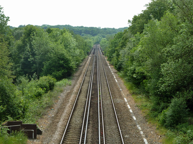
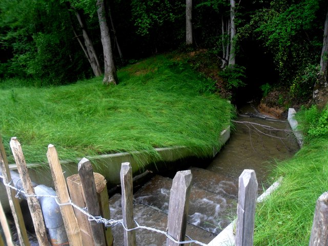
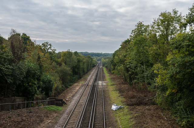
A network of well-maintained trails weaves through the woodland, providing visitors with the opportunity to explore its hidden treasures. These paths lead to secluded glades, babbling brooks, and picturesque ponds, offering peaceful spots for picnicking, wildlife observation, or simply immersing oneself in nature's embrace.

Blackhatch Wood is a true gem in Surrey's natural landscape, offering visitors an escape into a tranquil and pristine environment. Whether for a leisurely walk, a family outing, or a peaceful retreat, this enchanting forest provides an unforgettable experience for nature lovers and those seeking solace in the beauty of the outdoors.

If you have any feedback on the listing, please let us know in the comments section below.

Blackhatch Wood Images

Images are sourced within 2km of 51.139832/0.012715751 or Grid Reference TQ4039. Thanks to Geograph Open Source API. All images are credited.

Cook's Pond Viaduct Dormans Park. Confusingly, the water is now called Wilderness Lake. This Surrey County Council page <span class="nowrap"><a title="http://www.surreycc.gov.uk/sccwebsite/sccwspublications.nsf/WebLookupFileResourcesByUNID/docidD191D18A952E56438025704300522D14?openDocument" rel="nofollow ugc noopener" href="http://www.surreycc.gov.uk/sccwebsite/sccwspublications.nsf/WebLookupFileResourcesByUNID/docidD191D18A952E56438025704300522D14?openDocument">Link</a><img style="margin-left:2px;" alt="External link" title="External link - shift click to open in new window" src="https://s1.geograph.org.uk/img/external.png" width="10" height="10"/></span> states that the viaduct is the largest structure on the Croydon to East Grinstead railway.
Cook's Pond Viaduct
Dormans Park. Confusingly, the water is now called Wilderness Lake. This Surrey County Council page LinkExternal link states that the viaduct is the largest structure on the Croydon to East Grinstead railway.
Two bridges The near bridge takes the public bridleway over a side stream of the one seen at right. There is a far steel bridge over the main stream, possibly an old lorry deck frame, but lacking the deck and blocked with a garden fence at one end.
Two bridges
The near bridge takes the public bridleway over a side stream of the one seen at right. There is a far steel bridge over the main stream, possibly an old lorry deck frame, but lacking the deck and blocked with a garden fence at one end.
Looking into the eastern hemisphere The stone at left marks the Greenwich meridian, and was placed to mark the millennium.
Looking into the eastern hemisphere
The stone at left marks the Greenwich meridian, and was placed to mark the millennium.
Railway looking north, Dormans Park A view from the bridge carrying one of the principal roads in the estate - The Approach.
Railway looking north, Dormans Park
A view from the bridge carrying one of the principal roads in the estate - The Approach.
Railway looking south, Dormans Park A view from the bridge carrying The Approach, Dormans Park. Down the line is the Cooks Pond Viaduct, much better seen in <a href="https://www.geograph.org.uk/photo/163811">TQ3940 : Cook's Pond Viaduct</a>.
Railway looking south, Dormans Park
A view from the bridge carrying The Approach, Dormans Park. Down the line is the Cooks Pond Viaduct, much better seen in TQ3940 : Cook's Pond Viaduct.
New house, Hillcrest, Dormans Park
Weir off Wildnerness Lake A view of a weir in operation, regulating outlet from the Wilderness Lake, Dormans Park.
Weir off Wildnerness Lake
A view of a weir in operation, regulating outlet from the Wilderness Lake, Dormans Park.
Cooks Pond Viaduct Under Reflected Sunset Light View, with a setting sun directly behind the camera, of the Cooks Pond Viaduct.
Cooks Pond Viaduct Under Reflected Sunset Light
View, with a setting sun directly behind the camera, of the Cooks Pond Viaduct.
Under the railway bridge
The Approach, Dormans Park Road in the private estate of Dormans Park.  The house on the right is The Bridge House, designed by the architect P D Hepworth and built in 1934.
The Approach, Dormans Park
Road in the private estate of Dormans Park. The house on the right is The Bridge House, designed by the architect P D Hepworth and built in 1934.
The Approach, Dormans Park Road in the private estate of Dormans Park.
The Approach, Dormans Park
Road in the private estate of Dormans Park.
Railway bridge, The Approach  Bridge carrying the Approach over the East Grinstead railway.
Railway bridge, The Approach
Bridge carrying the Approach over the East Grinstead railway.
Railway to East Grinstead Looking south along the railway to East Grinstead from The Approach railway bridge.

Compare <a href="https://www.geograph.org.uk/photo/2435620">TQ3940 : Railway looking south, Dormans Park</a> from 5 years earlier - note the cutting back of vegetation, presumably to reduce the impact of "leaves on the line", a perennial problem affecting the running of trains.
Railway to East Grinstead
Looking south along the railway to East Grinstead from The Approach railway bridge. Compare TQ3940 : Railway looking south, Dormans Park from 5 years earlier - note the cutting back of vegetation, presumably to reduce the impact of "leaves on the line", a perennial problem affecting the running of trains.
Tandridge Border Path, Boxin Wood The Tandridge Border Path is a  52 mile walk following the boundary of Tandridge District with Kent, Sussex and Greater London, linking the villages and hamlets of East Surrey. Developed in 2000 to commemorate the Millennium. The route has a simple sign <a href="https://www.geograph.org.uk/photo/5263295">TQ3940 : Tandridge Border Path sign</a>.
<span class="nowrap"><a title="http://www.tandridge.gov.uk/leisure/Walks/tandridge_border_path.htm" rel="nofollow ugc noopener" href="http://www.tandridge.gov.uk/leisure/Walks/tandridge_border_path.htm">Link</a><img style="margin-left:2px;" alt="External link" title="External link - shift click to open in new window" src="https://s1.geograph.org.uk/img/external.png" width="10" height="10"/></span>
Tandridge Border Path, Boxin Wood
The Tandridge Border Path is a 52 mile walk following the boundary of Tandridge District with Kent, Sussex and Greater London, linking the villages and hamlets of East Surrey. Developed in 2000 to commemorate the Millennium. The route has a simple sign TQ3940 : Tandridge Border Path sign. LinkExternal link
Tandridge Border Path The Tandridge Border Path is a  52 mile walk following the boundary of Tandridge District with Kent, Sussex and Greater London, linking the villages and hamlets of East Surrey. Developed in 2000 to commemorate the Millennium. The route has a simple sign <a href="https://www.geograph.org.uk/photo/5263295">TQ3940 : Tandridge Border Path sign</a>.
<span class="nowrap"><a title="http://www.tandridge.gov.uk/leisure/Walks/tandridge_border_path.htm" rel="nofollow ugc noopener" href="http://www.tandridge.gov.uk/leisure/Walks/tandridge_border_path.htm">Link</a><img style="margin-left:2px;" alt="External link" title="External link - shift click to open in new window" src="https://s1.geograph.org.uk/img/external.png" width="10" height="10"/></span>
Tandridge Border Path
The Tandridge Border Path is a 52 mile walk following the boundary of Tandridge District with Kent, Sussex and Greater London, linking the villages and hamlets of East Surrey. Developed in 2000 to commemorate the Millennium. The route has a simple sign TQ3940 : Tandridge Border Path sign. LinkExternal link
Footbridge, Tandridge Border Path The Tandridge Border Path is a  52 mile walk following the boundary of Tandridge District with Kent, Sussex and Greater London, linking the villages and hamlets of East Surrey. Developed in 2000 to commemorate the Millennium. The route has a simple sign <a href="https://www.geograph.org.uk/photo/5263295">TQ3940 : Tandridge Border Path sign</a>.
<span class="nowrap"><a title="http://www.tandridge.gov.uk/leisure/Walks/tandridge_border_path.htm" rel="nofollow ugc noopener" href="http://www.tandridge.gov.uk/leisure/Walks/tandridge_border_path.htm">Link</a><img style="margin-left:2px;" alt="External link" title="External link - shift click to open in new window" src="https://s1.geograph.org.uk/img/external.png" width="10" height="10"/></span>
Footbridge, Tandridge Border Path
The Tandridge Border Path is a 52 mile walk following the boundary of Tandridge District with Kent, Sussex and Greater London, linking the villages and hamlets of East Surrey. Developed in 2000 to commemorate the Millennium. The route has a simple sign TQ3940 : Tandridge Border Path sign. LinkExternal link
Cooks Pond Viaduct Cooks Pond Viaduct carries the Oxted Line across Wilderness Lake (formerly Cooks Pond). The Viaduct has 5 spans of 125feet each. It is located just south of Dormans Station.
Cooks Pond Viaduct
Cooks Pond Viaduct carries the Oxted Line across Wilderness Lake (formerly Cooks Pond). The Viaduct has 5 spans of 125feet each. It is located just south of Dormans Station.
Show me another place!

Blackhatch Wood is located at Grid Ref: TQ4039 (Lat: 51.139832, Lng: 0.012715751)

Administrative County: Surrey

District: Tandridge

Police Authority: Surrey

What 3 Words

///woof.racks.peanut. Near Dormansland, Surrey

Related Wikis

Queen Victoria Hospital

The Queen Victoria Hospital (QVH), located in East Grinstead, West Sussex, England is the specialist reconstructive surgery centre for the south east of...

East Grinstead Meridian (electoral division)

East Grinstead Meridian is an electoral division of West Sussex in the United Kingdom, and returns one member to sit on West Sussex County Council. �...

East Grinstead Town F.C.

East Grinstead Town Football Club is a football club based in East Grinstead, West Sussex, England. They are currently members of the Isthmian League South...

East Grinstead

East Grinstead is a town in West Sussex, England, near the East Sussex, Surrey, and Kent borders, 27 miles (43 km) south of London, 21 miles (34 km) northeast...

Sackville School, East Grinstead

Sackville School is a coeducational secondary school and sixth form located in East Grinstead, England. In 2020, the number of students was approximately...

107 Meridian FM

107 Meridian FM is a community radio station broadcasting to the West Sussex town of East Grinstead and its surrounding area. == History == The station...

Sackville College

Sackville College is a Jacobean almshouse in town of East Grinstead, West Sussex, England. It was founded in 1609 with money left by Robert Sackville,...

Dormans railway station

Dormans railway station is on the East Grinstead branch of the Oxted line in southern England and serves Dormansland and Dormans Park in Surrey. It is...

Nearby Amenities

Located within 500m of 51.139832,0.012715751
Barrier: stile
Stile: stepover
Lat/Long: 51.1391332/0.0135028
Barrier: stile
Stile: stepover
Lat/Long: 51.1411073/0.0195247
Barrier: stile
Stile: stepover
Lat/Long: 51.1390941/0.0071317
Barrier: stile
Stile: stepover
Lat/Long: 51.141919/0.0070206
Barrier: kissing_gate
Locked: no
Material: wood
Wheelchair: no
Lat/Long: 51.1364217/0.0091725
Board Type: nature
Information: board
Operator: Ashplats Wood
Tourism: information
Lat/Long: 51.1363877/0.0091634
Waste Basket
Waste: dog_excrement
Lat/Long: 51.1364008/0.0092023
Barrier: kissing_gate
Lat/Long: 51.1374405/0.0105344
Information: guidepost
Operator: West Sussex County Council
Tourism: information
Lat/Long: 51.1364172/0.0091869
Information: guidepost
Operator: West Sussex County Council
Tourism: information
Lat/Long: 51.1375846/0.0086904
Barrier: bollard
Bicycle: yes
Bollard: fixed
Colour: black
Foot: yes
Horse: yes
Material: metal
Motor Vehicle: no
Lat/Long: 51.1364827/0.0093326
The data included in this document is from www.openstreetmap.org. The data is made available under ODbL.

Have you been to Blackhatch Wood?

Leave your review of Blackhatch Wood below (or comments, questions and feedback).