Messop's Grove

Wood, Forest in Hertfordshire North Hertfordshire

England

Messop's Grove

Bogmoor Road Bogmoor Road leaves the B1368 Cambridge Road at Barkway Hill
Bogmoor Road Credit: Andrew Tatlow

Messop's Grove is a picturesque wood located in Hertfordshire, England. Situated in the heart of the county, this forested area covers an expansive area of land, providing a serene and tranquil retreat for nature enthusiasts and outdoor lovers. With its dense canopy of trees and diverse wildlife, Messop's Grove offers a glimpse into the natural beauty of Hertfordshire.

The wood is predominantly composed of deciduous trees, such as oak, beech, and ash, which create a stunning display of colors during the autumn months. The forest floor is covered with a thick carpet of moss, ferns, and wildflowers, adding to the enchanting ambiance. A network of well-maintained footpaths allows visitors to explore the grove while taking in the sights and sounds of nature.

Wildlife thrives in Messop's Grove, with various species of birds, including woodpeckers and owls, making their homes in the trees. Squirrels scamper along the branches, while rabbits and deer can occasionally be spotted in the undergrowth. The forest is also home to a variety of insects, such as butterflies and beetles, contributing to the ecosystem's biodiversity.

For those seeking recreational activities, Messop's Grove offers ample opportunities for hiking, walking, and cycling. Nature trails wind through the forest, providing visitors with a chance to immerse themselves in the natural surroundings. The grove is also a popular spot for picnics and nature photography, with many visitors captivated by the beauty of the woodland.

Overall, Messop's Grove in Hertfordshire is a captivating wood that showcases the region's natural splendor. Its lush vegetation, diverse wildlife, and peaceful atmosphere make it a perfect destination for those seeking solace in nature.

If you have any feedback on the listing, please let us know in the comments section below.

Messop's Grove Images

Images are sourced within 2km of 52.002962/0.048105068 or Grid Reference TL4035. Thanks to Geograph Open Source API. All images are credited.

Bogmoor Road Bogmoor Road leaves the B1368 Cambridge Road at Barkway Hill
Bogmoor Road
Bogmoor Road leaves the B1368 Cambridge Road at Barkway Hill
Barley fields are forever These fields are adjacent to the village of Barley!
Barley fields are forever
These fields are adjacent to the village of Barley!
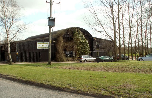
The clubhouse at Barkway Park Golf Club
Earls Wood Picture taken from a public footpath, during a bright spell on an otherwise overcast day.
Earls Wood
Picture taken from a public footpath, during a bright spell on an otherwise overcast day.
Old Milestone Old milestone on the B1368 near to Newsells, Hertfordshire. For close up view see <a title="https://www.geograph.org.uk/photo/1792471" href="https://www.geograph.org.uk/photo/1792471">Link</a> and for more info see <span class="nowrap"><a title="http://milestones.megalithia.com/sites/missing.php?site_status=offmap&site_ngr=TL391366&site_name=Newsells&site_surveyed=2001" rel="nofollow ugc noopener" href="http://milestones.megalithia.com/sites/missing.php?site_status=offmap&site_ngr=TL391366&site_name=Newsells&site_surveyed=2001">Link</a><img style="margin-left:2px;" alt="External link" title="External link - shift click to open in new window" src="https://s1.geograph.org.uk/img/external.png" width="10" height="10"/></span> do look at their home page.
Old Milestone
Old milestone on the B1368 near to Newsells, Hertfordshire. For close up view see Link and for more info see LinkExternal link do look at their home page.
Old Milestone Old milestone on the B1368 near to Newsells, Hertfordshire. For overall view see <a title="https://www.geograph.org.uk/photo/1792462" href="https://www.geograph.org.uk/photo/1792462">Link</a> and for more info see <span class="nowrap"><a title="http://milestones.megalithia.com/sites/missing.php?site_status=offmap&site_ngr=TL391366&site_name=Newsells&site_surveyed=2001" rel="nofollow ugc noopener" href="http://milestones.megalithia.com/sites/missing.php?site_status=offmap&site_ngr=TL391366&site_name=Newsells&site_surveyed=2001">Link</a><img style="margin-left:2px;" alt="External link" title="External link - shift click to open in new window" src="https://s1.geograph.org.uk/img/external.png" width="10" height="10"/></span> do look at their home page.
Old Milestone
Old milestone on the B1368 near to Newsells, Hertfordshire. For overall view see Link and for more info see LinkExternal link do look at their home page.
Heading for Barkway on the B1368 Newsells Estate complex is to the right of photo.
Heading for Barkway on the B1368
Newsells Estate complex is to the right of photo.
Old milestone in autumn leaves
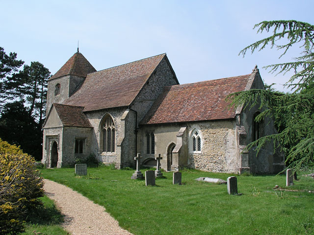
Little Chishill, St Nicholas <span class="nowrap"><a title="http://www.druidic.org/camchurch/churches/ltchishill.htm" rel="nofollow ugc noopener" href="http://www.druidic.org/camchurch/churches/ltchishill.htm">Link</a><img style="margin-left:2px;" alt="External link" title="External link - shift click to open in new window" src="https://s1.geograph.org.uk/img/external.png" width="10" height="10"/></span>
Little Chishill, St Nicholas
Fishing Pond, Nuthampstead The Lake is on the edge of the former WWII Airfield called Nuthampstead. A short Airstrip still remains but the Airfield is now farmland.
Fishing Pond, Nuthampstead
The Lake is on the edge of the former WWII Airfield called Nuthampstead. A short Airstrip still remains but the Airfield is now farmland.
Winter Oilseed Rape A healthy-looking field of winter oilseed-rape at Gipsy Corner Farm
Winter Oilseed Rape
A healthy-looking field of winter oilseed-rape at Gipsy Corner Farm
Thatched cottage in Nuthampstead
After the storm A view across the north Hertfordshire countryside after a heavy rainstorm.
After the storm
A view across the north Hertfordshire countryside after a heavy rainstorm.
A seat, a sign and a milk-churn Country artifacts at Shaftenhoe End
A seat, a sign and a milk-churn
Country artifacts at Shaftenhoe End
Horses and hay-bales Farm scene near Nuthampstead
Horses and hay-bales
Farm scene near Nuthampstead
Little Chishill Game Reserve Entrance to Little Chishill Game Reserve. A big notice warns 'no dogs allowed'!
Little Chishill Game Reserve
Entrance to Little Chishill Game Reserve. A big notice warns 'no dogs allowed'!
Sheepwash Grove, Nuthampstead Sheepwash Grove, a small copse surrounded by arable farmland.
Sheepwash Grove, Nuthampstead
Sheepwash Grove, a small copse surrounded by arable farmland.
Nuthampstead Shooting Ground Sited on the old runways of an American War Time airfield.
Nuthampstead Shooting Ground
Sited on the old runways of an American War Time airfield.
Show me another place!

Messop's Grove is located at Grid Ref: TL4035 (Lat: 52.002962, Lng: 0.048105068)

Administrative County: Hertfordshire

District: North Hertfordshire

Police Authority: Hertfordshire

What 3 Words

///accompany.wage.gardens. Near Royston, Hertfordshire

Related Wikis

Nuthampstead

Nuthampstead is a small village and civil parish in North East Hertfordshire located a few miles south of the town of Royston. In the 2001 census the parish...

Little Chishill

Little Chishill is a village and former civil parish, now in the parish of Great and Little Chishill, in the South Cambridgeshire district, in the county...

River Quin

The River Quin is a small watercourse which rises near Barkway in north east Hertfordshire, England. The river is fed by a number of sources including...

Barkway

Barkway is a long-established village and civil parish in the North Hertfordshire district of Hertfordshire, England, about five miles south-east of...

RAF Barkway

Royal Air Force Barkway or more simply RAF Barkway was one of the smallest Royal Air Force stations in the United Kingdom. It was a Communications Station...

Barkway Chalk Pit

Barkway Chalk Pit is a small (0.3 hectare) nature reserve in Barkway in North Hertfordshire. It was managed by the Herts and Middlesex Wildlife Trust...

Barley, Hertfordshire

Barley is a village and civil parish in the district of North Hertfordshire, England. According to the 2001 census, it has a population of 659, increasing...

Anstey Castle

Anstey Castle was in the village of Anstey, Hertfordshire. It was a 12th-century stone motte and bailey fortress that, according to tradition, was founded...

Nearby Amenities

Located within 500m of 52.002962,0.048105068
Barrier: swing_gate
Lat/Long: 52.001155/0.0534509
The data included in this document is from www.openstreetmap.org. The data is made available under ODbL.

Have you been to Messop's Grove?

Leave your review of Messop's Grove below (or comments, questions and feedback).