Ashplats Wood

Wood, Forest in Sussex Mid Sussex

England

Ashplats Wood

Cook's Pond Viaduct Dormans Park. Confusingly, the water is now called Wilderness Lake. This Surrey County Council page <span class="nowrap"><a title="http://www.surreycc.gov.uk/sccwebsite/sccwspublications.nsf/WebLookupFileResourcesByUNID/docidD191D18A952E56438025704300522D14?openDocument" rel="nofollow ugc noopener" href="http://www.surreycc.gov.uk/sccwebsite/sccwspublications.nsf/WebLookupFileResourcesByUNID/docidD191D18A952E56438025704300522D14?openDocument">Link</a><img style="margin-left:2px;" alt="External link" title="External link - shift click to open in new window" src="https://s1.geograph.org.uk/img/external.png" width="10" height="10"/></span> states that the viaduct is the largest structure on the Croydon to East Grinstead railway.
Cook's Pond Viaduct Credit: Roger W Haworth

Ashplats Wood is a picturesque woodland located in Sussex, England. Set amidst the rolling countryside, this ancient woodland is a haven for nature enthusiasts and offers a tranquil escape from the bustling city life.

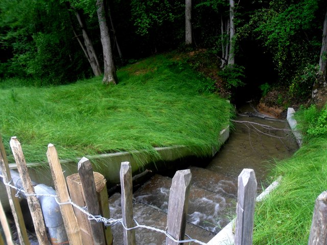
Covering an area of approximately 50 acres, Ashplats Wood is home to a rich diversity of flora and fauna. The woodland consists of a variety of tree species, including oak, beech, ash, and hazel, creating a vibrant and thriving ecosystem. The dense canopy provides shelter for numerous bird species, such as woodpeckers, owls, and warblers, making it a popular spot for birdwatchers.

As visitors wander along the well-maintained trails, they will come across a carpet of wildflowers in the spring, including bluebells, primroses, and violets, painting the forest floor with bursts of color. The wood is also home to a wide range of woodland creatures, such as deer, foxes, badgers, and squirrels, offering plenty of opportunities for wildlife enthusiasts to observe these animals in their natural habitat.

In addition to its natural beauty, Ashplats Wood also has historical significance. The wood has been managed for centuries and has evidence of ancient woodland practices, such as coppicing, which is the traditional method of cutting trees to promote regrowth. This traditional management technique has allowed the wood to maintain its unique character and support a diverse range of plant and animal species.

Overall, Ashplats Wood is a captivating woodland that offers visitors a chance to connect with nature, discover its rich biodiversity, and soak in the tranquility of the beautiful Sussex countryside.

If you have any feedback on the listing, please let us know in the comments section below.

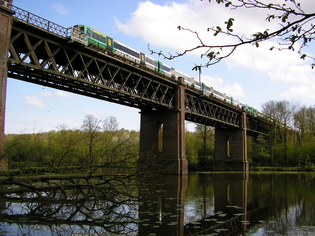
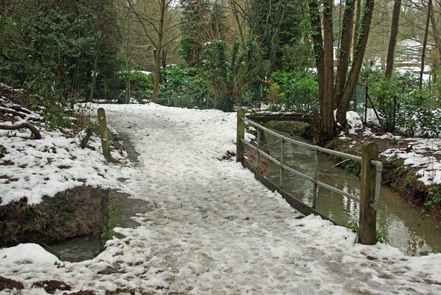
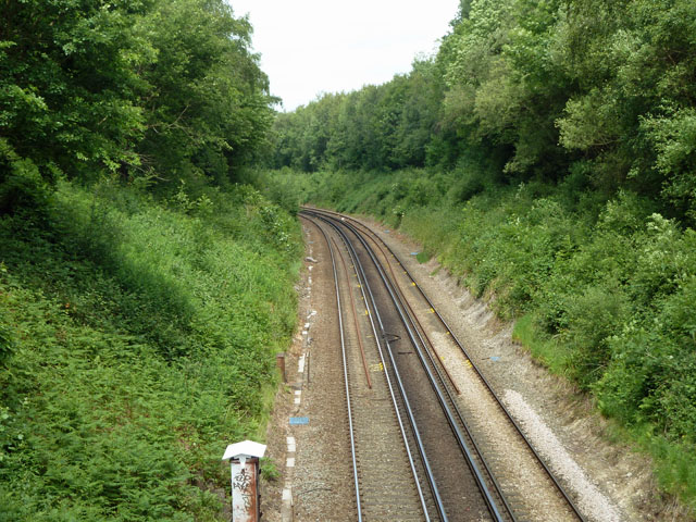
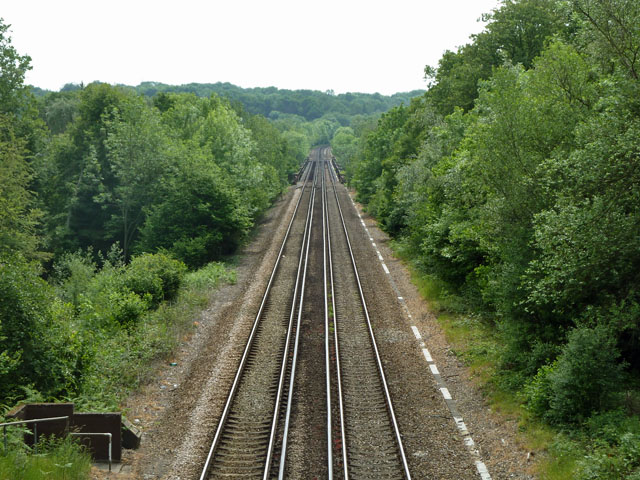
Ashplats Wood Images

Images are sourced within 2km of 51.131571/0.006782201 or Grid Reference TQ4038. Thanks to Geograph Open Source API. All images are credited.

Cook's Pond Viaduct Dormans Park. Confusingly, the water is now called Wilderness Lake. This Surrey County Council page <span class="nowrap"><a title="http://www.surreycc.gov.uk/sccwebsite/sccwspublications.nsf/WebLookupFileResourcesByUNID/docidD191D18A952E56438025704300522D14?openDocument" rel="nofollow ugc noopener" href="http://www.surreycc.gov.uk/sccwebsite/sccwspublications.nsf/WebLookupFileResourcesByUNID/docidD191D18A952E56438025704300522D14?openDocument">Link</a><img style="margin-left:2px;" alt="External link" title="External link - shift click to open in new window" src="https://s1.geograph.org.uk/img/external.png" width="10" height="10"/></span> states that the viaduct is the largest structure on the Croydon to East Grinstead railway.
Cook's Pond Viaduct
Dormans Park. Confusingly, the water is now called Wilderness Lake. This Surrey County Council page LinkExternal link states that the viaduct is the largest structure on the Croydon to East Grinstead railway.
Two bridges The near bridge takes the public bridleway over a side stream of the one seen at right. There is a far steel bridge over the main stream, possibly an old lorry deck frame, but lacking the deck and blocked with a garden fence at one end.
Two bridges
The near bridge takes the public bridleway over a side stream of the one seen at right. There is a far steel bridge over the main stream, possibly an old lorry deck frame, but lacking the deck and blocked with a garden fence at one end.
Railway looking north, Dormans Park A view from the bridge carrying one of the principal roads in the estate - The Approach.
Railway looking north, Dormans Park
A view from the bridge carrying one of the principal roads in the estate - The Approach.
Railway looking south, Dormans Park A view from the bridge carrying The Approach, Dormans Park. Down the line is the Cooks Pond Viaduct, much better seen in <a href="https://www.geograph.org.uk/photo/163811">TQ3940 : Cook's Pond Viaduct</a>.
Railway looking south, Dormans Park
A view from the bridge carrying The Approach, Dormans Park. Down the line is the Cooks Pond Viaduct, much better seen in TQ3940 : Cook's Pond Viaduct.
Weir off Wildnerness Lake A view of a weir in operation, regulating outlet from the Wilderness Lake, Dormans Park.
Weir off Wildnerness Lake
A view of a weir in operation, regulating outlet from the Wilderness Lake, Dormans Park.
Cooks Pond Viaduct Under Reflected Sunset Light View, with a setting sun directly behind the camera, of the Cooks Pond Viaduct.
Cooks Pond Viaduct Under Reflected Sunset Light
View, with a setting sun directly behind the camera, of the Cooks Pond Viaduct.
Under the railway bridge
The Approach, Dormans Park Road in the private estate of Dormans Park.  The house on the right is The Bridge House, designed by the architect P D Hepworth and built in 1934.
The Approach, Dormans Park
Road in the private estate of Dormans Park. The house on the right is The Bridge House, designed by the architect P D Hepworth and built in 1934.
The Approach, Dormans Park Road in the private estate of Dormans Park.
The Approach, Dormans Park
Road in the private estate of Dormans Park.
Railway bridge, The Approach  Bridge carrying the Approach over the East Grinstead railway.
Railway bridge, The Approach
Bridge carrying the Approach over the East Grinstead railway.
Railway to East Grinstead Looking south along the railway to East Grinstead from The Approach railway bridge.

Compare <a href="https://www.geograph.org.uk/photo/2435620">TQ3940 : Railway looking south, Dormans Park</a> from 5 years earlier - note the cutting back of vegetation, presumably to reduce the impact of "leaves on the line", a perennial problem affecting the running of trains.
Railway to East Grinstead
Looking south along the railway to East Grinstead from The Approach railway bridge. Compare TQ3940 : Railway looking south, Dormans Park from 5 years earlier - note the cutting back of vegetation, presumably to reduce the impact of "leaves on the line", a perennial problem affecting the running of trains.
Tandridge Border Path, Boxin Wood The Tandridge Border Path is a  52 mile walk following the boundary of Tandridge District with Kent, Sussex and Greater London, linking the villages and hamlets of East Surrey. Developed in 2000 to commemorate the Millennium. The route has a simple sign <a href="https://www.geograph.org.uk/photo/5263295">TQ3940 : Tandridge Border Path sign</a>.
<span class="nowrap"><a title="http://www.tandridge.gov.uk/leisure/Walks/tandridge_border_path.htm" rel="nofollow ugc noopener" href="http://www.tandridge.gov.uk/leisure/Walks/tandridge_border_path.htm">Link</a><img style="margin-left:2px;" alt="External link" title="External link - shift click to open in new window" src="https://s1.geograph.org.uk/img/external.png" width="10" height="10"/></span>
Tandridge Border Path, Boxin Wood
The Tandridge Border Path is a 52 mile walk following the boundary of Tandridge District with Kent, Sussex and Greater London, linking the villages and hamlets of East Surrey. Developed in 2000 to commemorate the Millennium. The route has a simple sign TQ3940 : Tandridge Border Path sign. LinkExternal link
Tandridge Border Path The Tandridge Border Path is a  52 mile walk following the boundary of Tandridge District with Kent, Sussex and Greater London, linking the villages and hamlets of East Surrey. Developed in 2000 to commemorate the Millennium. The route has a simple sign <a href="https://www.geograph.org.uk/photo/5263295">TQ3940 : Tandridge Border Path sign</a>.
<span class="nowrap"><a title="http://www.tandridge.gov.uk/leisure/Walks/tandridge_border_path.htm" rel="nofollow ugc noopener" href="http://www.tandridge.gov.uk/leisure/Walks/tandridge_border_path.htm">Link</a><img style="margin-left:2px;" alt="External link" title="External link - shift click to open in new window" src="https://s1.geograph.org.uk/img/external.png" width="10" height="10"/></span>
Tandridge Border Path
The Tandridge Border Path is a 52 mile walk following the boundary of Tandridge District with Kent, Sussex and Greater London, linking the villages and hamlets of East Surrey. Developed in 2000 to commemorate the Millennium. The route has a simple sign TQ3940 : Tandridge Border Path sign. LinkExternal link
Footbridge, Tandridge Border Path The Tandridge Border Path is a  52 mile walk following the boundary of Tandridge District with Kent, Sussex and Greater London, linking the villages and hamlets of East Surrey. Developed in 2000 to commemorate the Millennium. The route has a simple sign <a href="https://www.geograph.org.uk/photo/5263295">TQ3940 : Tandridge Border Path sign</a>.
<span class="nowrap"><a title="http://www.tandridge.gov.uk/leisure/Walks/tandridge_border_path.htm" rel="nofollow ugc noopener" href="http://www.tandridge.gov.uk/leisure/Walks/tandridge_border_path.htm">Link</a><img style="margin-left:2px;" alt="External link" title="External link - shift click to open in new window" src="https://s1.geograph.org.uk/img/external.png" width="10" height="10"/></span>
Footbridge, Tandridge Border Path
The Tandridge Border Path is a 52 mile walk following the boundary of Tandridge District with Kent, Sussex and Greater London, linking the villages and hamlets of East Surrey. Developed in 2000 to commemorate the Millennium. The route has a simple sign TQ3940 : Tandridge Border Path sign. LinkExternal link
Cooks Pond Viaduct Cooks Pond Viaduct carries the Oxted Line across Wilderness Lake (formerly Cooks Pond). The Viaduct has 5 spans of 125feet each. It is located just south of Dormans Station.
Cooks Pond Viaduct
Cooks Pond Viaduct carries the Oxted Line across Wilderness Lake (formerly Cooks Pond). The Viaduct has 5 spans of 125feet each. It is located just south of Dormans Station.
Wilderness Lake
Wilderness Lake
Show me another place!

Ashplats Wood is located at Grid Ref: TQ4038 (Lat: 51.131571, Lng: 0.006782201)

Administrative County: West Sussex

District: Mid Sussex

Police Authority: Sussex

What 3 Words

///expose.wonderfully.cake. Near East Grinstead, West Sussex

Nearby Locations

Ashplats Wood

Related Wikis

East Grinstead Town F.C.

East Grinstead Town Football Club is a football club based in East Grinstead, West Sussex, England. They are currently members of the Isthmian League South...

East Grinstead

East Grinstead is a town in West Sussex, England, near the East Sussex, Surrey, and Kent borders, 27 miles (43 km) south of London, 21 miles (34 km) northeast...

East Grinstead Meridian (electoral division)

East Grinstead Meridian is an electoral division of West Sussex in the United Kingdom, and returns one member to sit on West Sussex County Council. �...

Queen Victoria Hospital

The Queen Victoria Hospital (QVH), located in East Grinstead, West Sussex, England is the specialist reconstructive surgery centre for the south east of...

Sackville School, East Grinstead

Sackville School is a coeducational secondary school and sixth form located in East Grinstead, England. In 2020, the number of students was approximately...

Sackville College

Sackville College is a Jacobean almshouse in town of East Grinstead, West Sussex, England. It was founded in 1609 with money left by Robert Sackville,...

St Swithun's Church, East Grinstead

St. Swithun's is a Church of England church in East Grinstead, West Sussex, England, which is a Grade II* listed building.The site had a church since the...

East Grinstead Museum

East Grinstead Museum is located at Cantelupe Road in East Grinstead, West Sussex, England. It was established in 1995 in a purpose-built museum constructed...

Related Videos

Incredible! #shorts #amazing #travel #adventure #england #placestovisit

My sister visited meridian lines in England and sent me some videos. Pretty amazing!

Uk Weather

The weather in the UK it's alternation Today is cold tomorrow is hot or windy or rain So sometimes you don't know what to wear.

Nearby Amenities

Located within 500m of 51.131571,0.006782201
Bus Stop
Chestnut Close
Bus: yes
Naptan AtcoCode: 4400EG0195
Naptan Bearing: E
Naptan CommonName: Chestnut Close
Naptan Indicator: adj
Naptan Landmark: Sycamore Drive
Naptan NaptanCode: wsxapawg
Naptan ShortCommonName: Chestnut Close
Naptan Street: Escotts Drive
Naptan Verified: no
Public Transport: platform
Shelter: no
Source: naptan_import
Lat/Long: 51.128029/0.0052745
Bus Stop
Chestnut Close
Bus: yes
Naptan AtcoCode: 4400EG0196
Naptan Bearing: W
Naptan CommonName: Chestnut Close
Naptan Indicator: adj Sycamore Drive
Naptan Landmark: Sycamore Drive
Naptan NaptanCode: wsxapawj
Naptan ShortCommonName: Chestnut Close
Naptan Street: Escotts Drive
Naptan Verified: no
Public Transport: platform
Shelter: no
Source: naptan_import
Lat/Long: 51.1277856/0.0048312
Lancaster Drive
Naptan AtcoCode: 4400EG0201
Naptan Bearing: NE
Naptan BusStopType: CUS
Naptan CommonName: Lancaster Drive
Naptan Indicator: opp Hillary Close
Naptan Landmark: Hillary Close
Naptan NaptanCode: wsxapdag
Naptan Street: Lancaster Drive
Naptan Verified: no
Note: This bus stop no longer exists
Source: naptan_import
Lat/Long: 51.1350046/0.0044928
Lancaster Drive
Naptan AtcoCode: 4400EG0202
Naptan Bearing: SW
Naptan BusStopType: CUS
Naptan CommonName: Lancaster Drive
Naptan Indicator: opp 65
Naptan Landmark: Hillary Close
Naptan NaptanCode: wsxapdaj
Naptan Street: Lancaster Drive
Naptan Verified: no
Note: This bus stop no longer exists
Source: naptan_import
Lat/Long: 51.1352049/0.0048731
Turning Circle
Lat/Long: 51.1275726/0.0059263
Barrier: stile
Stile: stepover
Lat/Long: 51.1296001/0.0094143
Barrier: stile
Stile: stepover
Lat/Long: 51.1300526/0.0107595
Barrier: kissing_gate
Lat/Long: 51.1311691/0.0127123
Barrier: stile
Step Count: 1
Stile: stepover
Lat/Long: 51.1313072/0.0138113
Turning Circle
Lat/Long: 51.1274657/0.0058138
Post Box
Lynton Park Avenue
Brand: Royal Mail
Brand Wikidata: Q638098
Brand Wikipedia: en:Royal Mail
Check Date Collection Times: 2022-01-24
Collection Plate: CP1
Collection Times: Mo-Fr 09:00; Sa 07:00
Drive Through: no
Note: Collection times correct as of 12th June 2021.
Operator: Royal Mail
Operator Wikidata: Q638098
Post Box Type: pillar
Ref: RH19 123
Royal Cypher: EIIR
Royal Cypher Wikidata: Q33102113
Source: survey
Lat/Long: 51.1336404/0.0008206
Ashplats
Place: suburb
Lat/Long: 51.1357572/0.0048212
Post Box
Brand: Royal Mail
Brand Wikidata: Q638098
Brand Wikipedia: en:Royal Mail
Check Date Collection Times: 2022-01-24
Collection Times: Mo-Fr 09:00; Sa 07:00
Drive Through: no
Operator: Royal Mail
Operator Wikidata: Q638098
Post Box Type: pillar
Ref: RH19 126
Royal Cypher: EIIR
Royal Cypher Wikidata: Q33102113
Lat/Long: 51.1275/0.0073367
Post Box
Brand: Royal Mail
Brand Wikidata: Q638098
Brand Wikipedia: en:Royal Mail
Check Date Collection Times: 2022-01-24
Collection Times: Mo-Fr 09:00; Sa 07:00
Drive Through: no
Operator: Royal Mail
Operator Wikidata: Q638098
Post Box Type: lamp
Ref: RH19 6
Royal Cypher: EIIR
Royal Cypher Wikidata: Q33102113
Lat/Long: 51.1277881/0.0099259
Barrier: entrance
Lat/Long: 51.1286283/0.0063299
Grit Bin
Access: yes
Lat/Long: 51.1358184/0.0087649
Waste Basket
Waste: dog_excrement
Lat/Long: 51.1352329/0.0065248
Ashplats Wood information board
Board Type: nature
Check Date: 2022-01-18
Information: board
Operator: Ashplats Wood
Tourism: information
Lat/Long: 51.1302312/0.0025244
Waste Basket
Lat/Long: 51.1303281/0.0026951
Waste Basket
Waste: dog_excrement
Lat/Long: 51.129777/0.0015202
Bench
Backrest: no
Lat/Long: 51.1301601/0.0025077
Bench
Backrest: yes
Lat/Long: 51.130122/0.0033343
Waste Basket
Lat/Long: 51.1285227/0.0017952
Grit Bin
Lat/Long: 51.1277479/0.0100281
Grit Bin
Lat/Long: 51.1294874/0.0091121
Waste Basket
Waste: dog_excrement
Lat/Long: 51.1340919/0.0126533
The data included in this document is from www.openstreetmap.org. The data is made available under ODbL.

Have you been to Ashplats Wood?

Leave your review of Ashplats Wood below (or comments, questions and feedback).