Eynesbury

Settlement in Huntingdonshire Huntingdonshire

England

Eynesbury

St Neots : Church of St Mary Grade II* listed - <span class="nowrap"><a title="https://historicengland.org.uk/listing/the-list/list-entry/1127993?section=official-list-entry" rel="nofollow ugc noopener" href="https://historicengland.org.uk/listing/the-list/list-entry/1127993?section=official-list-entry">Link</a><img style="margin-left:2px;" alt="External link" title="External link - shift click to open in new window" src="https://s1.geograph.org.uk/img/external.png" width="10" height="10"/></span>.
St Neots : Church of St Mary Credit: Jim Osley

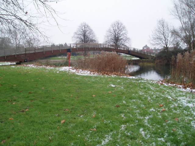
Eynesbury is a small village located in the district of Huntingdonshire, in the county of Cambridgeshire, England. Situated on the western bank of the River Great Ouse, it is approximately 2 miles east of the town of St Neots and about 14 miles west of the city of Cambridge.

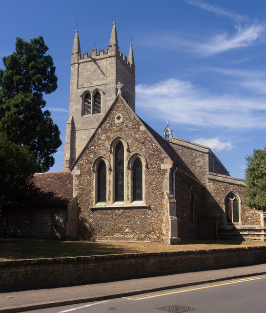
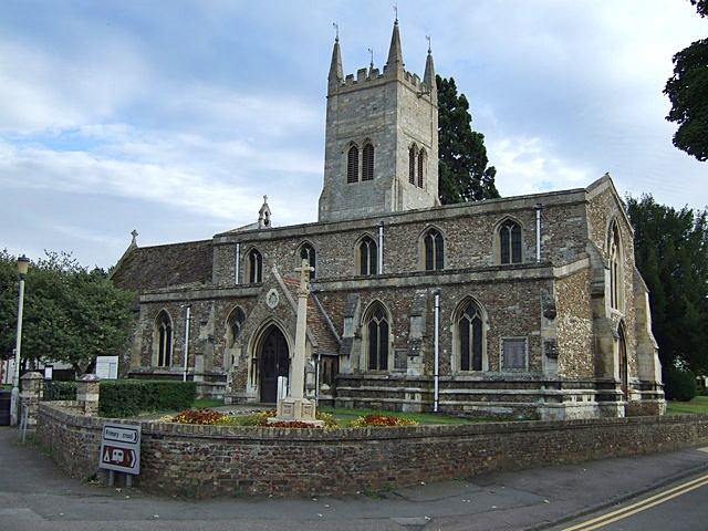
The history of Eynesbury can be traced back to the Roman period, as evidenced by the remains of a Roman villa discovered in the area. The village grew during medieval times, with the construction of St Mary's Church, which still stands as a prominent landmark today.

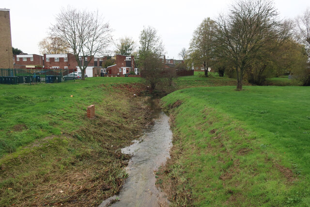
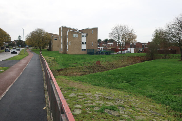
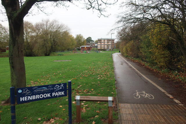
Eynesbury is known for its picturesque surroundings, with the river providing a tranquil setting for leisurely walks and boating activities. The village is also home to a number of green spaces, including Eynesbury Green and Eynesbury Manor Park, which offer recreational opportunities for residents and visitors alike.

In terms of amenities, Eynesbury boasts a range of local shops, including convenience stores, a post office, and a few pubs. The village is well-served by public transportation, with regular bus services connecting it to nearby towns and cities.

Eynesbury is a close-knit community, with a friendly and welcoming atmosphere. It has a strong sense of community spirit, with various local events and activities organized throughout the year. The village also has a primary school, providing education for local children.

Overall, Eynesbury is a charming village that offers a peaceful and idyllic lifestyle, while still being conveniently located near larger towns and cities for additional amenities and entertainment options.

If you have any feedback on the listing, please let us know in the comments section below.

Eynesbury Images

Images are sourced within 2km of 52.21874/-0.27044 or Grid Reference TL1859. Thanks to Geograph Open Source API. All images are credited.

St Neots : Church of St Mary Grade II* listed - <span class="nowrap"><a title="https://historicengland.org.uk/listing/the-list/list-entry/1127993?section=official-list-entry" rel="nofollow ugc noopener" href="https://historicengland.org.uk/listing/the-list/list-entry/1127993?section=official-list-entry">Link</a><img style="margin-left:2px;" alt="External link" title="External link - shift click to open in new window" src="https://s1.geograph.org.uk/img/external.png" width="10" height="10"/></span>.
St Neots : Church of St Mary
Grade II* listed - LinkExternal link.
Construction work near St Neots
Building work East of St Neots
Barford Road Roundabout
Hen Brook, St Neots
Hen Brook, St Neots
Bridge over Hen Brook, St Neots
Henbrook Park, St Neots
Coveris, St Neots Manufacturing various types of packaging.
Coveris, St Neots
Manufacturing various types of packaging.
Marston Business Park, St Neots
Cromwell Road, St Neots
Access road into Sealed Air site, St Neots Off Cromwell Road. Also host to a public footpath.
Access road into Sealed Air site, St Neots
Off Cromwell Road. Also host to a public footpath.
Railway bridge over track, St Neots Carrying the East Coast Main Line across a track that is also a public footpath.
Railway bridge over track, St Neots
Carrying the East Coast Main Line across a track that is also a public footpath.
Cromwell Road, St Neots
Barford Road Seen from the Barford Road Roundabout on the A428, with the Little Barford Power Station in the next square south
Barford Road
Seen from the Barford Road Roundabout on the A428, with the Little Barford Power Station in the next square south
Roundabout exit at Eaton Socon The A428 meets the A1 [entering from the immediate left], and the left leads to a small commercial area, which is a cul-de-sac, and includes The Crown.
Roundabout exit at Eaton Socon
The A428 meets the A1 [entering from the immediate left], and the left leads to a small commercial area, which is a cul-de-sac, and includes The Crown.
St Neots Recycling Centre
The Riverside Park, St Neots
Footbridge over Great Ouse
Show me another place!

Eynesbury is located at Grid Ref: TL1859 (Lat: 52.21874, Lng: -0.27044)

Administrative County: Cambridgeshire

District: Huntingdonshire

Police Authority: Cambridgeshire

What 3 Words

///cones.lifestyle.snipped. Near St Neots, Cambridgeshire

Nearby Locations

Eynesbury

Related Wikis

Eynesbury Rovers F.C.

Eynesbury Rovers Football Club is a football club based in the Eynesbury area of St Neots in Cambridgeshire, England. The club are currently members of...

Eynesbury, Cambridgeshire

Eynesbury is an urban area forming part of St Neots, in the civil parish of St Neots, in the Huntingdonshire district, in the county of Cambridgeshire...

Ernulf Academy

Ernulf Academy is a secondary school with academy status, located in St Neots, Cambridgeshire, England. It is one of two St Neots secondary schools that...

Duloe Brook

Duloe Brook is a minor, roughly 9 km (5.59 mi) long river (or brook) in Bedfordshire that is a tributary to the River Great Ouse. The brook rises in the...

Nearby Amenities

Located within 500m of 52.21874,-0.27044
Mini Roundabout
Direction: clockwise
Lat/Long: 52.2216074/-0.2652587
Traffic Signals
Source: survey
Lat/Long: 52.217354/-0.2637106
Turning Circle
Lat/Long: 52.217499/-0.2638421
Turning Circle
Lat/Long: 52.2196314/-0.2671974
Turning Circle
Lat/Long: 52.2185248/-0.2637496
Pub
The Cambridgeshire Hunter
Lat/Long: 52.2188757/-0.2652767
St Neots Leisure Centre
Leisure: sports_centre
Lat/Long: 52.2156404/-0.2686023
Power: substation
Source: survey
Lat/Long: 52.216291/-0.2671361
Crossing
Button Operated: yes
Crossing: traffic_signals
Crossing Island: no
Source: survey
Traffic Signals Sound: yes
Traffic Signals Vibration: no
Lat/Long: 52.2160244/-0.267645
Bus Stop
Waterloo Drive
Bus: yes
Naptan AtcoCode: 0500HSTNS003
Naptan Bearing: N
Naptan CommonName: Waterloo Drive
Naptan Indicator: opp
Naptan Landmark: Waterloo Drive
Naptan NaptanCode: cmbdtatg
Naptan ShortCommonName: Waterloo Drive
Naptan Street: Berkley Street
Naptan Verified: no
Public Transport: platform
Source: naptan_import
Lat/Long: 52.2192835/-0.2650732
Bus Stop
Howitts Lane
Bench: yes
Bin: yes
Bus: yes
Naptan AtcoCode: 0500HSTNS008
Naptan Bearing: N
Naptan CommonName: Howitts Lane
Naptan Indicator: opp
Naptan Landmark: Howitts Lane
Naptan NaptanCode: cmbdtawa
Naptan ShortCommonName: Howitts Lane
Naptan Street: Berkley Street
Naptan Verified: no
Public Transport: platform
Shelter: yes
Source: naptan_import
Tactile Paving: no
Lat/Long: 52.2213446/-0.2652049
Bus Stop
Waterloo Drive
Bench: no
Bus: yes
Naptan AtcoCode: 0500HSTNS010
Naptan Bearing: S
Naptan CommonName: Waterloo Drive
Naptan Indicator: near
Naptan Landmark: Waterloo Drive
Naptan NaptanCode: cmbdtawg
Naptan ShortCommonName: Waterloo Drive
Naptan Street: Berkley Street
Naptan Verified: no
Public Transport: platform
Shelter: no
Source: naptan_import
Tactile Paving: yes
Lat/Long: 52.2194422/-0.2648545
Bus Stop
Howitts Lane
Bench: no
Bin: no
Bus: yes
Lit: yes
Naptan AtcoCode: 0500HSTNS043
Naptan Bearing: S
Naptan CommonName: Howitts Lane
Naptan Indicator: near
Naptan Landmark: Luke Street
Naptan NaptanCode: cmbdtdpa
Naptan ShortCommonName: Howitts Lane
Naptan Street: Berkley Street
Naptan Verified: no
Public Transport: platform
Shelter: no
Source: naptan_import
Tactile Paving: no
Lat/Long: 52.2217038/-0.2651763
Bus Stop
St Neots Community College forecourt
Bench: no
Bus: yes
Local Ref: IN
Naptan AtcoCode: 0500HSTNS092
Naptan Bearing: N
Naptan BusStopType: CUS
Naptan CommonName: St Neots Community College forecourt
Naptan Indicator: in
Naptan Landmark: St Neots Community College
Naptan NaptanCode: cmbdtgpa
Naptan ShortCommonName: Community College
Naptan Street: Barford Road
Naptan Verified: no
Public Transport: platform
Shelter: no
Source: naptan_import
Tactile Paving: no
Lat/Long: 52.2164598/-0.2681035
Bus Stop
Ferrars Avenue
Bus: yes
Naptan AtcoCode: 0500HSTNS100
Naptan Bearing: N
Naptan CommonName: Ferrars Avenue
Naptan Indicator: opp
Naptan Landmark: Ferrars Avenue
Naptan NaptanCode: cmbdtgtd
Naptan ShortCommonName: Ferrars Avenue
Naptan Street: Hardwick Road
Naptan Verified: no
Public Transport: platform
Shelter: no
Source: naptan_import
Lat/Long: 52.2212052/-0.2704077
Bus Stop
Hardwick Road
Bus: yes
Naptan AtcoCode: 0500HSTNS101
Naptan Bearing: E
Naptan CommonName: Hardwick Road
Naptan Indicator: o/s No 72
Naptan Landmark: Hardwick Road
Naptan NaptanCode: cmbdtgtg
Naptan ShortCommonName: Hardwick Road
Naptan Street: Hardwick Road
Naptan Verified: no
Public Transport: platform
Source: naptan_import
Lat/Long: 52.2195655/-0.2689635
Bicycle Parking
Capacity: 16
Lat/Long: 52.2156764/-0.2689846
Bench
Backrest: no
Check Date: 2021-01-31
Note: Sustrans Portrait Bench
Lat/Long: 52.216283/-0.2749005
Turning Circle
Lat/Long: 52.2229698/-0.2685297
Turning Circle
Lat/Long: 52.217604/-0.2671868
Power: pole
Lat/Long: 52.2210527/-0.2740174
Power: pole
Lat/Long: 52.2197946/-0.2740348
Power: pole
Lat/Long: 52.2223683/-0.2740339
Power: pole
Lat/Long: 52.2219135/-0.2740497
Power: pole
Lat/Long: 52.2206475/-0.2764813
Bench
Lat/Long: 52.222743/-0.2737268
Bench
Lat/Long: 52.2228495/-0.2729952
Turning Circle
Lat/Long: 52.21841/-0.2664654
Generator Method: photovoltaic
Generator Output Electricity: yes
Generator Source: solar
Generator Type: solar_photovoltaic_panel
Location: roof
Power: generator
Lat/Long: 52.2165374/-0.2642834
Generator Method: photovoltaic
Generator Output Electricity: yes
Generator Source: solar
Generator Type: solar_photovoltaic_panel
Location: roof
Power: generator
Lat/Long: 52.2165391/-0.2641922
Generator Method: photovoltaic
Generator Output Electricity: yes
Generator Source: solar
Generator Type: solar_photovoltaic_panel
Location: roof
Power: generator
Lat/Long: 52.2168595/-0.264203
Generator Method: photovoltaic
Generator Output Electricity: yes
Generator Source: solar
Generator Type: solar_photovoltaic_panel
Location: roof
Power: generator
Lat/Long: 52.2167856/-0.2639428
Generator Method: photovoltaic
Generator Output Electricity: yes
Generator Source: solar
Generator Type: solar_photovoltaic_panel
Location: roof
Power: generator
Lat/Long: 52.2167954/-0.2638891
Generator Method: photovoltaic
Generator Output Electricity: yes
Generator Source: solar
Generator Type: solar_photovoltaic_panel
Location: roof
Power: generator
Lat/Long: 52.2162515/-0.2647984
Power: pole
Lat/Long: 52.2186317/-0.2740976
Material: wood
Power: pole
Lat/Long: 52.2163825/-0.2746218
Material: wood
Power: pole
Lat/Long: 52.2155267/-0.2747233
Material: wood
Power: pole
Lat/Long: 52.2174575/-0.2743667
Eynesbury sign
Access: yes
Description: Elegant decorative sign showing that you're at Eynesbury as is common in the country
Historic: monument
Image: https://img.geocaching.com/waymarking/d4edb96a-ec98-4fd3-aeb8-5109674e7d25.JPG
Inscription: Eynesbury
Material: wood
Source: survey
Lat/Long: 52.2215534/-0.2650682
Post Box
Brand: Royal Mail
Brand Wikidata: Q638098
Collection Times: Mo-Fr 09:00; Sa 07:00
Operator: Royal Mail
Operator Wikidata: Q638098
Post Box Type: pillar
Ref: PE19 235D
Royal Cypher: EIIR
Royal Cypher Wikidata: Q33102113
Source: survey
Lat/Long: 52.2186402/-0.265002
Post Box
Drive Through: no
Not Operator Wikidata: Q638098
Operator: Royal Mail
Operator Wikidata: Q638098
Lat/Long: 52.2228586/-0.2692705
Waste Basket
Colour: #000000
Indoor: no
Material: metal
Source: streetlevel imagery;aerial imagery
Waste: trash
Lat/Long: 52.2215277/-0.2653639
Waste Basket
Colour: #000000
Covered: no
Indoor: no
Material: plastic
Source: aerial imagery;streetlevel imagery
Waste: trash
Lat/Long: 52.2216616/-0.2654012
Access: yes
Fee: no
Leisure: garden
Note: Stone structure filled with planted or grown flowers
Operator Type: government
Source: survey
Lat/Long: 52.2216569/-0.2649369
Advertising: board
Direction: 78
Lit: no
Operator: St Neots Town Council
Source: survey
Support: post
Lat/Long: 52.2213591/-0.2652547
Barrier: bollard
Bollard: fixed
Material: wood
Lat/Long: 52.2187777/-0.2748143
C.F. Tebbutt
Historic: memorial
Inscription: C. F. Tebbutt 1900-1985 born at The Ferns, Eynesbury where he lived from 1926-1966. Timber & Building Merchant, local historian & archaeologist, author of St Neots - History of a Huntingdonshire Town
Memorial: plaque
Openplaques Id: 50775
Lat/Long: 52.2212145/-0.2649695
The data included in this document is from www.openstreetmap.org. The data is made available under ODbL.

Have you been to Eynesbury?

Leave your review of Eynesbury below (or comments, questions and feedback).