Woodman's Glade
Wood, Forest in Essex Epping Forest
England
Woodman's Glade

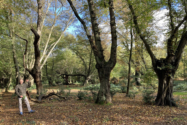
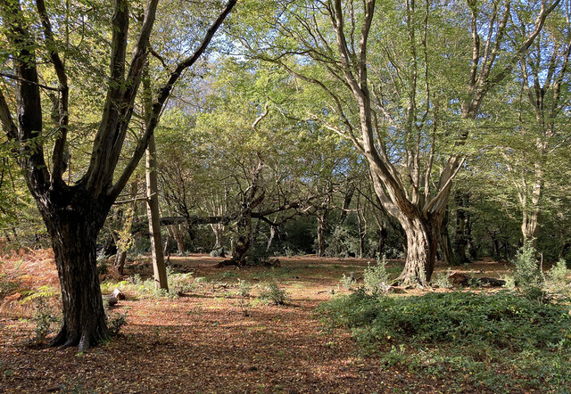
Woodman's Glade, located in Essex, England, is a picturesque and tranquil forested area known for its natural beauty and rich biodiversity. Covering an expansive area, the glade is nestled within the heart of the county, offering a serene escape from the bustling city life.
The glade is predominantly populated by a variety of deciduous trees, including oak, beech, and birch, which create a dense canopy overhead, providing shade and shelter for the diverse wildlife that calls this woodland home. The forest floor is carpeted with a lush undergrowth of ferns, bluebells, and wildflowers, adding a vibrant touch to the landscape.
Woodman's Glade is renowned for its walking trails and nature paths, offering visitors the opportunity to explore the forest's hidden treasures. These well-maintained paths wind through the glade, meandering past babbling brooks, ancient stone walls, and moss-covered rocks, creating a sense of enchantment and wonder.
Wildlife enthusiasts will delight in the numerous species that inhabit the glade. The forest is home to a variety of bird species, including woodpeckers, owls, and songbirds, filling the air with their melodic tunes. Squirrels can be observed gracefully leaping from tree to tree, while badgers and foxes leave traces of their presence along the forest trails.
Woodman's Glade is a popular destination for nature lovers, offering a peaceful retreat where one can immerse themselves in the beauty of the natural world. Whether it be a leisurely stroll, birdwatching, or simply enjoying the tranquility of the forest, Woodman's Glade provides a serene setting for all to appreciate the wonders of nature.
If you have any feedback on the listing, please let us know in the comments section below.
Woodman's Glade Images
Images are sourced within 2km of 51.643343/0.017375117 or Grid Reference TQ3995. Thanks to Geograph Open Source API. All images are credited.


![Looking to Waltham Cross from Lippitts Hill Epping Forest (formerly known as Waltham Forest) is an ancient woodland north-east of London. As a former royal forest dating from the 12th century, it is managed by the City of London Corporation.
The forest is 2,476 hectares in area, comprising woodland, grassland and open heath, forming a 19km long green corridor.
[abstract from Wikipedia article: <span class="nowrap"><a title="http://en.wikipedia.org/wiki/Epping_Forest" rel="nofollow ugc noopener" href="http://en.wikipedia.org/wiki/Epping_Forest">Link</a><img style="margin-left:2px;" alt="External link" title="External link - shift click to open in new window" src="https://s1.geograph.org.uk/img/external.png" width="10" height="10"/></span> ]](https://s1.geograph.org.uk/geophotos/07/36/80/7368061_d3b94360.jpg)

Woodman's Glade is located at Grid Ref: TQ3995 (Lat: 51.643343, Lng: 0.017375117)
Administrative County: Essex
District: Epping Forest
Police Authority: Essex
What 3 Words
///punchy.grand.trips. Near Buckhurst Hill, Essex
Nearby Locations
Related Wikis

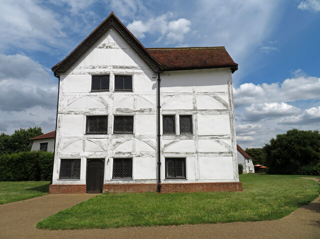
Queen Elizabeth's Hunting Lodge
Queen Elizabeth's Hunting Lodge is a Grade II* listed former hunting lodge, now a museum, on the edge of Epping Forest, at 8 Rangers Road, Chingford, London...
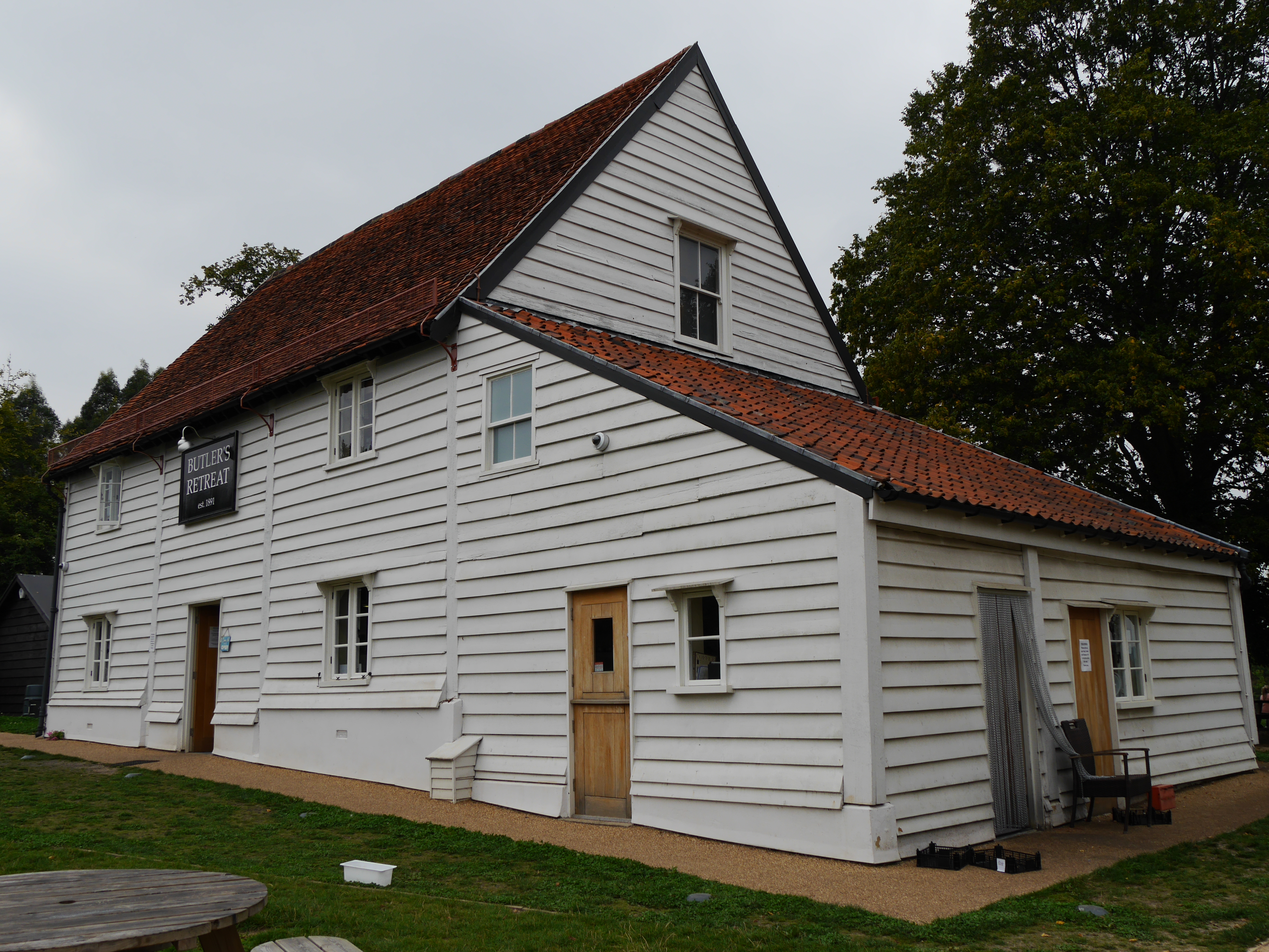
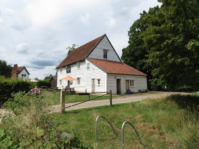
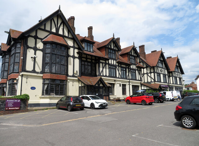
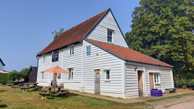
Butler's Retreat
Butler's Retreat is a Grade II listed building at Rangers Road, Chingford, London E4. Originally a barn thought to have been built in the early 19th century...

Chingford Green (ward)
Chingford Green Ward is a political division of the London Borough of Waltham Forest and is one of the six Waltham Forest wards of the Chingford and Woodford...

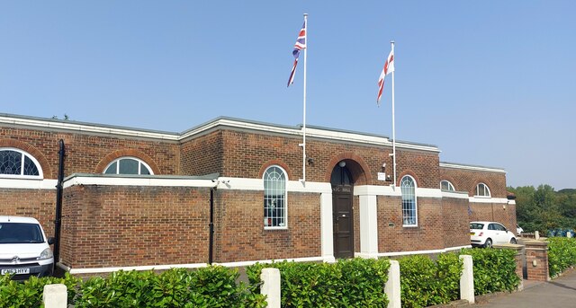
Air Support Unit (Metropolitan Police)
The Air Support Unit (ASU) was a Central Operations branch of London's Metropolitan Police Service. The main responsibility of the unit was to provide...

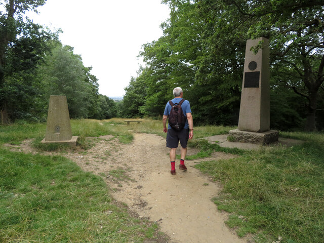
Lippitts Hill
Lippitts Hill is a hill located in Epping Forest at High Beach, Waltham Abbey. It has played several historic roles in the defence and policing of London...

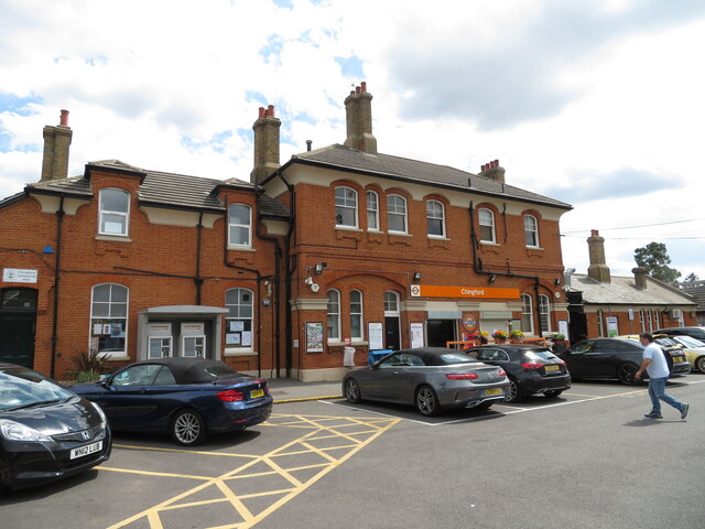
Chingford railway station
Chingford is a railway station located in Chingford in the London Borough of Waltham Forest, east London, operated by London Overground since 31 May 2015...

Gilwell Park
Gilwell Park is a camp site and activity centre in East London located in the Sewardstonebury area of Waltham Abbey, within Epping Forest, near the border...

Gilwell Oak
The Gilwell Oak is an oak tree on the grounds of The Scout Association's headquarters at Gilwell Park, Essex. It is reputed to have been used as a hiding...
Nearby Amenities
Located within 500m of 51.643343,0.017375117Have you been to Woodman's Glade?
Leave your review of Woodman's Glade below (or comments, questions and feedback).