Exning

Settlement in Suffolk West Suffolk

England

Exning

Exning Rd The B1103 runs 4.4 miles from Burwell to Newmarket on the Cambridgeshire - Suffolk border. 
<span class="nowrap"><a title="https://www.sabre-roads.org.uk/wiki/index.php?title=B1103" rel="nofollow ugc noopener" href="https://www.sabre-roads.org.uk/wiki/index.php?title=B1103">Link</a><img style="margin-left:2px;" alt="External link" title="External link - shift click to open in new window" src="https://s1.geograph.org.uk/img/external.png" width="10" height="10"/></span>
Exning Rd Credit: N Chadwick

Exning is a charming village located in the county of Suffolk, England. Situated just three miles north of the market town of Newmarket, it lies on the River Kennett and is surrounded by picturesque countryside. With a population of around 2,500, Exning offers a peaceful and close-knit community.

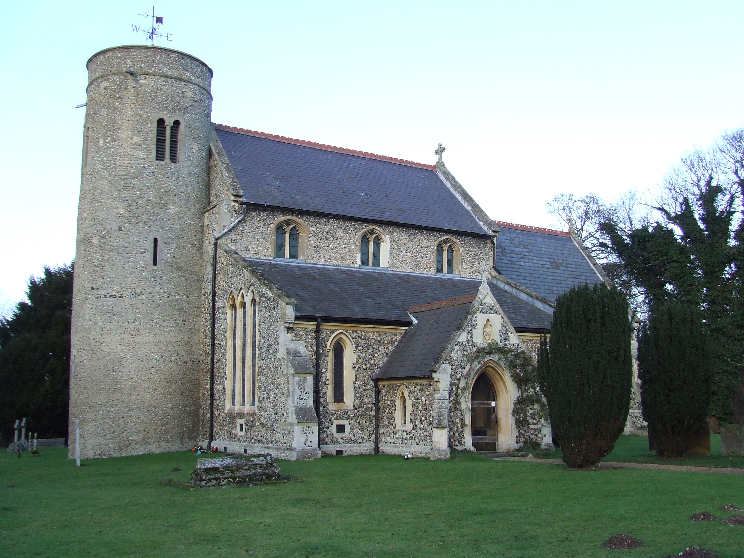
The village is known for its rich history, dating back to Roman times. Evidence of Roman settlements can be found in the form of ruins and archaeological sites throughout the area. Exning Abbey, a former Benedictine nunnery, was founded in the 11th century and is a significant historical landmark.

Despite its small size, Exning offers a range of amenities to its residents. The village has a primary school, a church, several pubs, and a few local shops. For more extensive shopping and entertainment options, the nearby town of Newmarket provides a wider selection.

Exning is renowned for its connection to horse racing. Being in close proximity to Newmarket, which is considered the horse racing capital of the UK, the village attracts equestrian enthusiasts from all over. The Exning Heath, a vast open expanse of land, is often used for horse training and is a popular spot for walkers and nature lovers.

Transport links in Exning are excellent, with easy access to major roads such as the A14 and A11, connecting the village to nearby towns and cities. The village also benefits from regular bus services, making it convenient for commuters and those wishing to explore the surrounding areas.

If you have any feedback on the listing, please let us know in the comments section below.
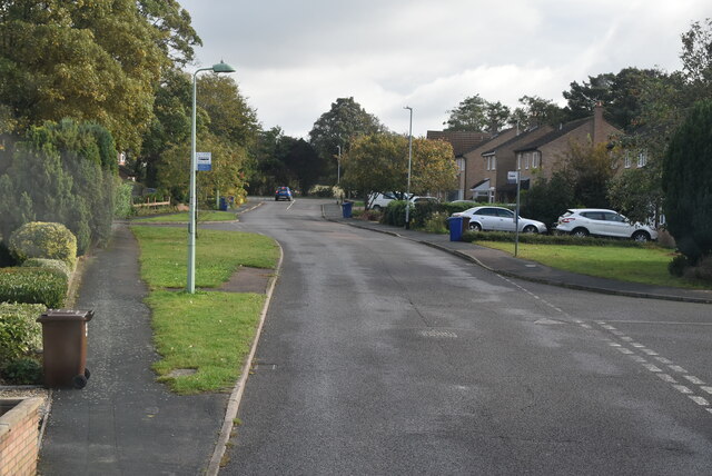
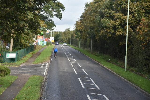
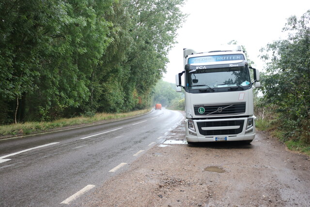
Exning Images

Images are sourced within 2km of 52.266897/0.373223 or Grid Reference TL6265. Thanks to Geograph Open Source API. All images are credited.

Exning Rd The B1103 runs 4.4 miles from Burwell to Newmarket on the Cambridgeshire - Suffolk border. 
<span class="nowrap"><a title="https://www.sabre-roads.org.uk/wiki/index.php?title=B1103" rel="nofollow ugc noopener" href="https://www.sabre-roads.org.uk/wiki/index.php?title=B1103">Link</a><img style="margin-left:2px;" alt="External link" title="External link - shift click to open in new window" src="https://s1.geograph.org.uk/img/external.png" width="10" height="10"/></span>
Exning Rd
The B1103 runs 4.4 miles from Burwell to Newmarket on the Cambridgeshire - Suffolk border. LinkExternal link
Brickfields Avenue
Brickfields Avenue
Brickfields Avenue
Brickfields Avenue
Hyperion Way
Hyperion Way
Hyperion Way, Studlands Park Avenue junction
Studlands Park Avenue
A142 The A142 runs from Chatteris, 26 miles across East Anglia, to Newmarket, via Ely.
<span class="nowrap"><a title="http://www.sabre-roads.org.uk/wiki/index.php?title=A142" rel="nofollow ugc noopener" href="http://www.sabre-roads.org.uk/wiki/index.php?title=A142">Link</a><img style="margin-left:2px;" alt="External link" title="External link - shift click to open in new window" src="https://s1.geograph.org.uk/img/external.png" width="10" height="10"/></span>
A142
The A142 runs from Chatteris, 26 miles across East Anglia, to Newmarket, via Ely. LinkExternal link
A14 The A14 is a major road running 127 miles from Felixstowe to the Catthorpe Interchange, the junction of the M1 and M6 motorways near Rugby. The road connects East Anglia with the West Midlands and The North.
Wikipedia: <span class="nowrap"><a title="http://en.wikipedia.org/wiki/A14_road_(England)" rel="nofollow ugc noopener" href="http://en.wikipedia.org/wiki/A14_road_(England)">Link</a><img style="margin-left:2px;" alt="External link" title="External link - shift click to open in new window" src="https://s1.geograph.org.uk/img/external.png" width="10" height="10"/></span>
A14
The A14 is a major road running 127 miles from Felixstowe to the Catthorpe Interchange, the junction of the M1 and M6 motorways near Rugby. The road connects East Anglia with the West Midlands and The North. Wikipedia: LinkExternal link
Fordham Rd The A142 runs from Chatteris, 26 miles across East Anglia, to Newmarket, via Ely.
<span class="nowrap"><a title="http://www.sabre-roads.org.uk/wiki/index.php?title=A142" rel="nofollow ugc noopener" href="http://www.sabre-roads.org.uk/wiki/index.php?title=A142">Link</a><img style="margin-left:2px;" alt="External link" title="External link - shift click to open in new window" src="https://s1.geograph.org.uk/img/external.png" width="10" height="10"/></span>
Fordham Rd
The A142 runs from Chatteris, 26 miles across East Anglia, to Newmarket, via Ely. LinkExternal link
Retail park by Fordham Road, Newmarket
Burger King on Fordham Road, Newmarket My other visit. <a title="https://www.geograph.org.uk/photo/6564373" href="https://www.geograph.org.uk/photo/6564373">Link</a>
Burger King on Fordham Road, Newmarket
My other visit. Link
Lorry parked on Fordham Road
Show me another place!

Exning is located at Grid Ref: TL6265 (Lat: 52.266897, Lng: 0.373223)

Administrative County: Suffolk

District: West Suffolk

Police Authority: Suffolk

What 3 Words

///sometimes.hazel.evidently. Near Exning, Suffolk

Nearby Locations

Exning

Related Wikis

The Rosery, Exning, Suffolk

The Rosery is an early Victorian country house in the town of Exning, Suffolk, England. The building was converted to a hotel in the 1970s. == Early... ==

Exning

Exning is a village and civil parish in the West Suffolk district of Suffolk in eastern England. It lies just off the A14 trunk road, roughly 12 miles...

Exning Road Halt railway station

Exning Road Halt railway station served the village of Exning, Suffolk, England from 1922 to 1962 on the Cambridge to Mildenhall railway. == History... ==

Landwade

Landwade is a village and former civil parish, now in the parish of Exning, in the West Suffolk district, in the county of Suffolk, England. It is 4 miles...

Newmarket Academy

Newmarket Academy (formerly Newmarket College) is a coeducational secondary school with academy status located in Newmarket in the English county of Suffolk...

Snailwell Meadows

Snailwell Meadows is a 14.8-hectare (37-acre) biological Site of Special Scientific Interest in Snailwell in Cambridgeshire.The meadows are on peat overlying...

Godolphin Stables

Godolphin Stables, also known as Stanley House Stables, is a thoroughbred racehorse ownership, training and breeding operation in Newmarket, Suffolk, which...

Snailwell

Snailwell is a small village and civil parish in East Cambridgeshire, England around 4 kilometres (2.5 mi) north of Newmarket. == History == The parish...

Nearby Amenities

Located within 500m of 52.266897,0.373223
Mini Roundabout
Direction: clockwise
Lat/Long: 52.2665205/0.3745838
Mini Roundabout
Direction: clockwise
Lat/Long: 52.2663869/0.3743912
Crossing
Crossing: zebra
Crossing Island: no
Crossing Markings: zebra
Lat/Long: 52.2658226/0.3691953
Exning
Place: village
Source Name: dictaphone
Wikidata: Q2437858
Lat/Long: 52.2654267/0.3727896
Turning Circle
Lat/Long: 52.2633119/0.3699357
Post Box
Collection Times: Mo-Fr 09:00; Sa 07:00
Operator: Royal Mail
Operator Wikidata: Q638098
Post Box Type: lamp
Ref: CB8 105
Royal Cypher: EIIR
Royal Cypher Wikidata: Q33102113
Source: survey
Lat/Long: 52.2670437/0.3782694
Pub
White Swan
Addr Housenumber: 2
Addr Postcode: CB8 7EW
Addr Street: Oxford Street
Addr Village: Exning
Fhrs Id: 1673540
Source Addr: FHRS Open Data
Lat/Long: 52.265527/0.3698451
Fast Food
Exning Fish Bar
Lat/Long: 52.2659035/0.3689641
Londis
Addr Housenumber: 20
Addr Postcode: CB8 7EW
Addr Street: Oxford Street
Addr Village: Exning
Brand: Londis
Brand Wikidata: Q21008564
Fhrs Id: 1673521
Shop: convenience
Source Addr: FHRS Open Data
Lat/Long: 52.2664503/0.3689047
Pub
The Wheatsheaf
Accommodation: yes
Addr City: Exning
Addr Housenumber: 45
Addr Postcode: CB8 7HA
Addr Street: Chapel Street
Addr Village: Exning
Description: Currently (April 2021) closed, though some hope of reopening.
Fhrs Id: 1674148
Food: yes
Source Addr: FHRS Open Data
Url: http://www.wheatsheafexning.co.uk/
Lat/Long: 52.2639489/0.3703478
Restaurant
The Rosery Hotel
Addr City: Exning
Addr Housenumber: 15
Addr Postcode: CB8 7EH
Addr Street: Church Street
Fhrs Id: 1001733
Phone: +44 1638 577312
Source: receipt
Tourism: hotel
Website: https://www.RoseryHotel.co.uk
Lat/Long: 52.2651497/0.3742947
Post Box
Collection Times: Mo-Fr 09:00; Sa 07:00
Operator: Royal Mail
Operator Wikidata: Q638098
Post Box Type: wall
Ref: CB8 106
Royal Cypher: VR
Royal Cypher Wikidata: Q33102356
Source: survey
Lat/Long: 52.2653802/0.3744513
Bus Stop
St Martins Church
Bus: yes
Fixme: Check Naptan codes
Naptan AtcoCode: 390020238
Naptan Bearing: S
Naptan CommonName: St Martins Church
Naptan Indicator: adj
Naptan Landmark: St Martins Church
Naptan NaptanCode: sufajpdg
Naptan Street: Church Street
Naptan Verified: no
Public Transport: platform
Source: naptan_import
Lat/Long: 52.2642299/0.3751601
Bus Stop
St Martins Church
Bus: yes
Fixme: Check Naptan codes
Naptan AtcoCode: 390020239
Naptan Bearing: N
Naptan CommonName: St Martins Church
Naptan Indicator: opp
Naptan Landmark: St Martins Church
Naptan NaptanCode: sufajpdj
Naptan Street: Church Street
Naptan Verified: no
Public Transport: platform
Source: naptan_import
Lat/Long: 52.2647595/0.3746627
Bus Stop
School
Bus: yes
Fixme: Check Naptan codes
Local Ref: opp
Naptan AtcoCode: 390020240
Naptan Bearing: S
Naptan CommonName: School
Naptan Indicator: opp
Naptan Landmark: School
Naptan NaptanCode: sufajpdm
Naptan Street: Oxford Street
Naptan Verified: no
Public Transport: platform
Source: naptan_import
Lat/Long: 52.2664567/0.3687891
Bus Stop
School
Bus: yes
Fixme: Check Naptan codes
Local Ref: o/s
Naptan AtcoCode: 390020241
Naptan Bearing: N
Naptan CommonName: School
Naptan Indicator: o/s
Naptan Landmark: School
Naptan NaptanCode: sufajpdp
Naptan Street: Oxford Street
Naptan Verified: no
Public Transport: platform
Source: naptan_import
Lat/Long: 52.2660693/0.3688448
Bus Stop
Glanely Gardens
Bus: yes
Naptan AtcoCode: 390020244
Naptan Bearing: E
Naptan CommonName: Glanely Gardens
Naptan Indicator: opp
Naptan Landmark: Glanely Gardens
Naptan NaptanCode: sufajpga
Naptan Street: Windmill Hill
Naptan Verified: no
Public Transport: platform
Source: naptan_import
Lat/Long: 52.2668487/0.3766652
Bus Stop
Glanely Gardens
Bus: yes
Naptan AtcoCode: 390020245
Naptan Bearing: W
Naptan BusStopType: CUS
Naptan CommonName: Glanely Gardens
Naptan Indicator: adj
Naptan Landmark: Glanely Gardens
Naptan NaptanCode: sufajpgd
Naptan Street: Windmill Hill
Naptan Verified: no
Public Transport: platform
Source: naptan_import
Lat/Long: 52.2667565/0.3767776
Bus Stop
George Gibson Close
Bus: yes
Naptan AtcoCode: 390020246
Naptan Bearing: E
Naptan CommonName: George Gibson Close
Naptan Indicator: adj
Naptan Landmark: George Gibson Close
Naptan NaptanCode: sufajpgj
Naptan Street: Windmill Hill
Naptan Verified: no
Public Transport: platform
Source: naptan_import
Lat/Long: 52.26709/0.3785249
Bus Stop
George Gibson Close
Bus: yes
Naptan AtcoCode: 390020247
Naptan Bearing: W
Naptan BusStopType: CUS
Naptan CommonName: George Gibson Close
Naptan Indicator: opp
Naptan Landmark: George Gibson Close
Naptan NaptanCode: sufajpgm
Naptan Street: Windmill Hill
Naptan Verified: no
Public Transport: platform
Source: naptan_import
Lat/Long: 52.266991/0.3784613
Bus Stop
Memorial
Bus: yes
Naptan AtcoCode: 390020248
Naptan Bearing: E
Naptan CommonName: Memorial
Naptan Indicator: adj
Naptan Landmark: Memorial
Naptan NaptanCode: sufajpgp
Naptan Street: Windmill Hill
Naptan Verified: no
Public Transport: platform
Source: naptan_import
Lat/Long: 52.2665462/0.3747143
Bus Stop
Memorial
Bus: yes
Naptan AtcoCode: 390020249
Naptan Bearing: W
Naptan BusStopType: CUS
Naptan CommonName: Memorial
Naptan Indicator: opp
Naptan Landmark: Memorial
Naptan NaptanCode: sufajpgt
Naptan Street: Windmill Hill
Naptan Verified: no
Public Transport: platform
Source: naptan_import
Lat/Long: 52.2664686/0.374549
Post Office
Exning Post Office
Addr City: Newmarket
Addr Housenumber: 20
Addr Postcode: CB8 7EW
Addr Street: Oxford Street
Addr Village: Exning
Opening Hours: Mo-Fr 08:30-19:30; Sa 09:00-19:30; Su 08:00-16:00
Ref Pol Id: 134339
Source Addr: pol_branch_list_2018-01
Source Opening Hours: pol_branch_list_2018-01
Lat/Long: 52.2663922/0.3689556
Post Box
Collection Times: Mo-Fr 09:00; Sa 07:00
Operator: Royal Mail
Operator Wikidata: Q638098
Post Box Type: lamp
Ref: CB8 109
Royal Cypher: EIIR
Royal Cypher Wikidata: Q33102113
Source: survey
Lat/Long: 52.2689141/0.3671086
Post Box
Collection Times: Mo-Fr 17:00; Sa 11:30
Operator: Royal Mail
Operator Wikidata: Q638098
Post Box Design: type_a
Post Box Type: pillar
Ref: CB8 108
Royal Cypher: EIIR
Royal Cypher Wikidata: Q33102113
Source: survey
Lat/Long: 52.2665205/0.3687498
Exning
Man Made: village_sign
Source: survey
Tourism: artwork
Lat/Long: 52.2712981/0.3732012
Turning Circle
Lat/Long: 52.2663793/0.3668008
Fixme: Definitive Statement says this path joins NCN 51 here. Does the path continue as a cycleway?
Lat/Long: 52.2648083/0.367751
Defibrillator
Defibrillator Location: Adjacent to the entrance to Swan Lane Business Park (to the left of the entry road).
Emergency: defibrillator
Indoor: no
Operator: Community Heartbeat Trust
Ref: CHT-9033
Lat/Long: 52.2654632/0.3706817
Addr City: Exning
Addr Housenumber: 9
Addr Postcode: CB8 7FJ
Addr Street: Ascot Close
Lat/Long: 52.266978/0.3700675
Addr City: Exning
Addr Housenumber: 7
Addr Postcode: CB8 7FJ
Addr Street: Ascot Close
Lat/Long: 52.2669658/0.3699973
Addr City: Exning
Addr Housenumber: 8
Addr Postcode: CB8 7FJ
Addr Street: Ascot Close
Lat/Long: 52.2668888/0.3702453
Addr City: Exning
Addr Housenumber: 5
Addr Postcode: CB8 7FJ
Addr Street: Ascot Close
Lat/Long: 52.2669328/0.3697891
Addr City: Exning
Addr Housenumber: 3
Addr Postcode: CB8 7FJ
Addr Street: Ascot Close
Lat/Long: 52.2669217/0.3697189
Addr City: Exning
Addr Housenumber: 6
Addr Postcode: CB8 7FJ
Addr Street: Ascot Close
Lat/Long: 52.2668908/0.3700609
Addr City: Exning
Addr Housenumber: 4
Addr Postcode: CB8 7FJ
Addr Street: Ascot Close
Lat/Long: 52.266875/0.3699583
Addr City: Exning
Addr Housenumber: 2
Addr Postcode: CB8 7FJ
Addr Street: Ascot Close
Lat/Long: 52.2668592/0.3698624
Addr City: Exning
Addr Housenumber: 1
Addr Postcode: CB8 7FJ
Addr Street: Ascot Close
Lat/Long: 52.2668806/0.3695747
Addr City: Exning
Addr Housenumber: 1B
Addr Postcode: CB8 7FJ
Addr Street: Ascot Close
Lat/Long: 52.2668546/0.3694064
Addr City: Exning
Addr Housenumber: 1A
Addr Postcode: CB8 7FJ
Addr Street: Ascot Close
Lat/Long: 52.2668442/0.369329
Street Lamp
Height: 2
Lamp Mount: lamppost
Lamp Type: led
Support: ornamental
Lat/Long: 52.266727/0.3692202
Street Lamp
Height: 2
Lamp Mount: lamppost
Lamp Type: led
Support: ornamental
Lat/Long: 52.2666867/0.3689874
Artwork Type: statue
Tourism: artwork
Lat/Long: 52.2665886/0.3744475
Entrance: main
Lat/Long: 52.2663132/0.3741894
The data included in this document is from www.openstreetmap.org. The data is made available under ODbL.

Have you been to Exning?

Leave your review of Exning below (or comments, questions and feedback).