Castle Wood

Wood, Forest in Lincolnshire East Lindsey

England

Castle Wood

St.Edith's churchyard, South Reston, Lincs. The parishioners of South Reston built a new church here by James Fowler in 1864 ..... it was shamelessly pulled down in 1983. The splendid Perpendicular font with eight heads marks the site, surrounded by the graves of parishioners who most probably worshipped in the church. One of many demolished churches in this part of Lincolnshire.
St.Edith's churchyard, South Reston, Lincs. Credit: Richard Croft

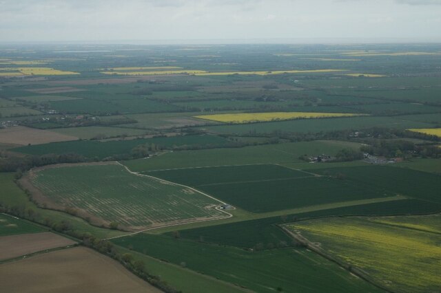
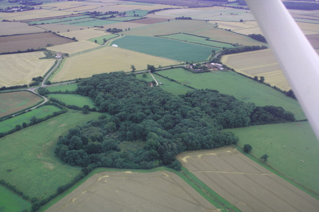
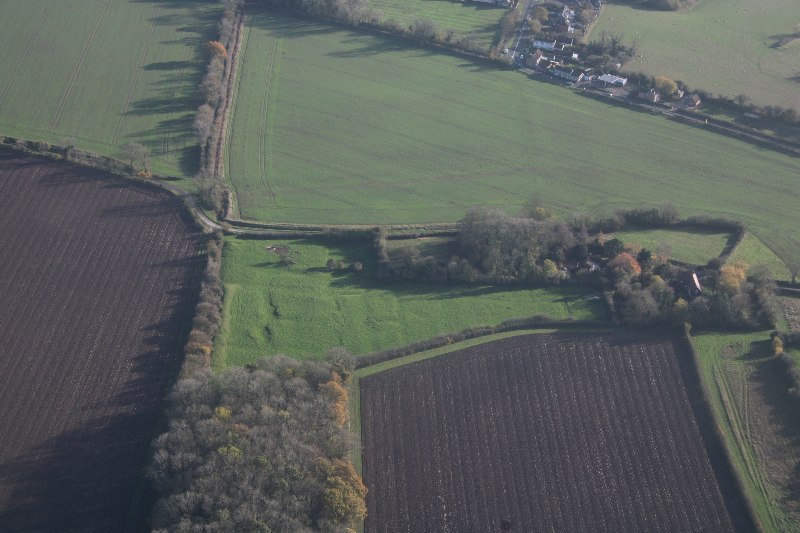
Castle Wood is a picturesque forest located in Lincolnshire, England. Covering an area of approximately 100 acres, this enchanting woodland is nestled between the villages of Castle Bytham and South Witham. It is renowned for its diverse range of flora and fauna, making it a popular destination for nature enthusiasts and hikers.

The woodland is dominated by a mix of deciduous and coniferous trees, including oaks, beeches, and pines. Its dense canopy provides a sheltered habitat for an array of wildlife, such as deer, badgers, foxes, and various bird species, including woodpeckers and owls. The forest floor is adorned with a carpet of wildflowers, ferns, and mosses, creating a vibrant and serene atmosphere.

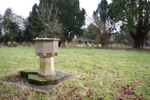
Castle Wood is intersected by a network of well-maintained footpaths, allowing visitors to explore its beauty while enjoying a leisurely stroll or engaging in more challenging hikes. The ancient ruins of Castle Bytham, a medieval fortress dating back to the 11th century, can also be found within the wood, adding a touch of historical significance and intrigue.

The woodland offers a tranquil escape from the hustle and bustle of city life, providing a serene setting for picnics, photography, and quiet contemplation. It is particularly captivating during the autumn months when the foliage transforms into a kaleidoscope of vibrant colors.

Castle Wood is easily accessible by road, with ample parking available nearby. It is managed by the local authorities, who ensure its conservation and protection for future generations to enjoy. Whether seeking solitude, a family outing, or an opportunity to reconnect with nature, Castle Wood is a must-visit destination in Lincolnshire.

If you have any feedback on the listing, please let us know in the comments section below.
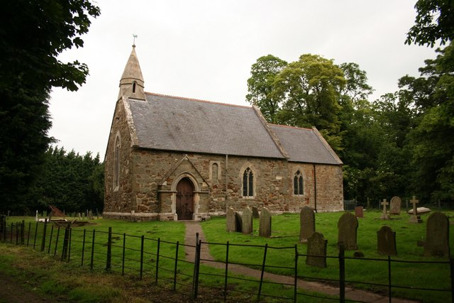
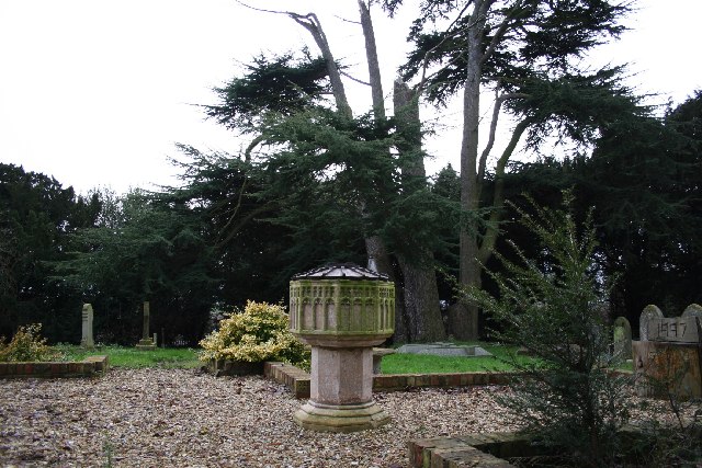
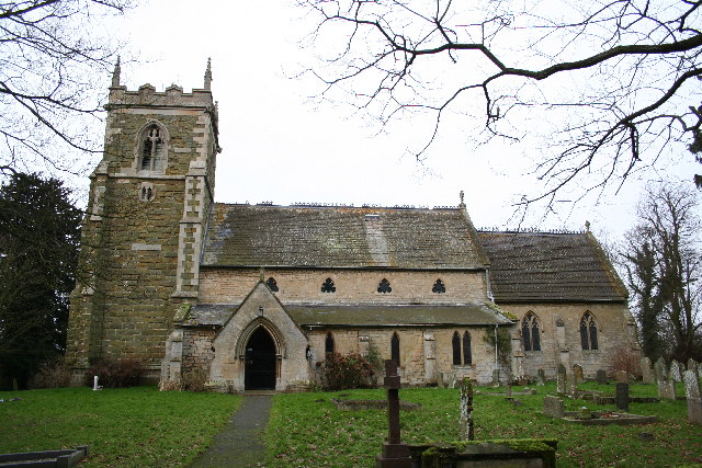
Castle Wood Images

Images are sourced within 2km of 53.329842/0.091830983 or Grid Reference TF3983. Thanks to Geograph Open Source API. All images are credited.

St.Edith's churchyard, South Reston, Lincs. The parishioners of South Reston built a new church here by James Fowler in 1864 ..... it was shamelessly pulled down in 1983. The splendid Perpendicular font with eight heads marks the site, surrounded by the graves of parishioners who most probably worshipped in the church. One of many demolished churches in this part of Lincolnshire.
St.Edith's churchyard, South Reston, Lincs.
The parishioners of South Reston built a new church here by James Fowler in 1864 ..... it was shamelessly pulled down in 1983. The splendid Perpendicular font with eight heads marks the site, surrounded by the graves of parishioners who most probably worshipped in the church. One of many demolished churches in this part of Lincolnshire.
Methodist Church, South Reston A handsome Victorian methodist church that, unlike its Church of England neighbour has survived into the 21st century.
Methodist Church, South Reston
A handsome Victorian methodist church that, unlike its Church of England neighbour has survived into the 21st century.
The Wagon & Horses Popular hostelry in South Reston
The Wagon & Horses
Popular hostelry in South Reston
Farmland between South Reston and Great Carlton, Lincolnshire This is on the boundary between the flat landscape of the Fens and the rolling hills of the Wolds.
Farmland between South Reston and Great Carlton, Lincolnshire
This is on the boundary between the flat landscape of the Fens and the rolling hills of the Wolds.
Out of the Fens Climbing gently away from the flat Fenland farmland towards South Reston.
Out of the Fens
Climbing gently away from the flat Fenland farmland towards South Reston.
Castle Plat Plantation This block of woodland sits just above the 10 metre contour line in the centre of the featured square. Beyond the land drops away to the Lincolnshire Fens, nearly at sea level.
Castle Plat Plantation
This block of woodland sits just above the 10 metre contour line in the centre of the featured square. Beyond the land drops away to the Lincolnshire Fens, nearly at sea level.
Methodist Church South Reston
Public footpaths over the stile at South Reston One of two footpaths to choose from. Close to the Methodist Church. <a href="https://www.geograph.org.uk/photo/1848971">TF4083 : Methodist Church South Reston</a>
Public footpaths over the stile at South Reston
One of two footpaths to choose from. Close to the Methodist Church. TF4083 : Methodist Church South Reston
St Edith's Church, North Reston This small community's church is well hidden to travellers on the A157.
St Edith's Church, North Reston
This small community's church is well hidden to travellers on the A157.
Cut Mark: North Reston, St Edith's Church Cut bench mark on the east angle of the north-east face.  See <a title="https://www.geograph.org.uk/photo/7004346" href="https://www.geograph.org.uk/photo/7004346">Link</a> for a wider view and <span class="nowrap"><a title="https://www.bench-marks.org.uk/bm158426" rel="nofollow ugc noopener" href="https://www.bench-marks.org.uk/bm158426">Link</a><img style="margin-left:2px;" alt="External link" title="External link - shift click to open in new window" src="https://s1.geograph.org.uk/img/external.png" width="10" height="10"/></span> for details.
Cut Mark: North Reston, St Edith's Church
Cut bench mark on the east angle of the north-east face. See Link for a wider view and LinkExternal link for details.
The east end of St Edith's church There is a cut bench mark on the east angle of the north-east face, hidden by the fence.  See <a title="https://www.geograph.org.uk/photo/7004345" href="https://www.geograph.org.uk/photo/7004345">Link</a> for a closer view and <span class="nowrap"><a title="https://www.bench-marks.org.uk/bm158426" rel="nofollow ugc noopener" href="https://www.bench-marks.org.uk/bm158426">Link</a><img style="margin-left:2px;" alt="External link" title="External link - shift click to open in new window" src="https://s1.geograph.org.uk/img/external.png" width="10" height="10"/></span> for details.
The east end of St Edith's church
There is a cut bench mark on the east angle of the north-east face, hidden by the fence. See Link for a closer view and LinkExternal link for details.
The Beck, North Reston: aerial 2022
Historic Park, South Reston: aerial 2022 Recorded on the 1907 Ordnance Survey map, surrounding South Reston Hall Lodge.

See <span class="nowrap"><a title="https://www.heritagegateway.org.uk/Gateway/Results_Single.aspx?uid=MLI92241&resourceID=1006" rel="nofollow ugc noopener" href="https://www.heritagegateway.org.uk/Gateway/Results_Single.aspx?uid=MLI92241&resourceID=1006">Link</a><img style="margin-left:2px;" alt="External link" title="External link - shift click to open in new window" src="https://s1.geograph.org.uk/img/external.png" width="10" height="10"/></span>
Historic Park, South Reston: aerial 2022
Recorded on the 1907 Ordnance Survey map, surrounding South Reston Hall Lodge. See LinkExternal link
Farmland and landing ground near North Reston: aerial 2022
Castle Carlton medieval new town: aerial 2022 (1) See <a href="https://www.geograph.org.uk/photo/5704176">TF3983 : Castle Carlton medieval new town (3): remains of tofts and crofts (aerial 2018)</a> and
<span class="nowrap"><a title="https://www.heritagegateway.org.uk/Gateway/Results_Single.aspx?uid=893278&sort=2&rational=m&recordsperpage=10&maplat=53.33270000&maplong=0.09920000&mapisa=250&mapist=ll&mapilo=0.0992&mapila=53.3327&mapiloe=e&mapilan=n&mapios=TF397838&mapigrn=383838&mapigre=539770&mapipc=&resourceID=19191" rel="nofollow ugc noopener" href="https://www.heritagegateway.org.uk/Gateway/Results_Single.aspx?uid=893278&sort=2&rational=m&recordsperpage=10&maplat=53.33270000&maplong=0.09920000&mapisa=250&mapist=ll&mapilo=0.0992&mapila=53.3327&mapiloe=e&mapilan=n&mapios=TF397838&mapigrn=383838&mapigre=539770&mapipc=&resourceID=19191">Link</a><img style="margin-left:2px;" alt="External link" title="External link - shift click to open in new window" src="https://s1.geograph.org.uk/img/external.png" width="10" height="10"/></span>

There is thought to be a twelfth century charter granting Hugh Bardolf the right to develop a 'new town' at Castle Carlton and therefore give it borough status. The new town was apparently laid out in 50 or 52 tofts and incentives were offered to encourage people to live there. Castle Carlton was an established commercial centre by the thirteenth century and was sometimes known as Market Carlton.
Castle Carlton medieval new town: aerial 2022 (1)
See TF3983 : Castle Carlton medieval new town (3): remains of tofts and crofts (aerial 2018) and LinkExternal link There is thought to be a twelfth century charter granting Hugh Bardolf the right to develop a 'new town' at Castle Carlton and therefore give it borough status. The new town was apparently laid out in 50 or 52 tofts and incentives were offered to encourage people to live there. Castle Carlton was an established commercial centre by the thirteenth century and was sometimes known as Market Carlton.
Castle Carlton medieval new town: aerial 2022 (2) See <a href="https://www.geograph.org.uk/photo/5704176">TF3983 : Castle Carlton medieval new town (3): remains of tofts and crofts (aerial 2018)</a> and
<span class="nowrap"><a title="https://www.heritagegateway.org.uk/Gateway/Results_Single.aspx?uid=893278&sort=2&rational=m&recordsperpage=10&maplat=53.33270000&maplong=0.09920000&mapisa=250&mapist=ll&mapilo=0.0992&mapila=53.3327&mapiloe=e&mapilan=n&mapios=TF397838&mapigrn=383838&mapigre=539770&mapipc=&resourceID=19191" rel="nofollow ugc noopener" href="https://www.heritagegateway.org.uk/Gateway/Results_Single.aspx?uid=893278&sort=2&rational=m&recordsperpage=10&maplat=53.33270000&maplong=0.09920000&mapisa=250&mapist=ll&mapilo=0.0992&mapila=53.3327&mapiloe=e&mapilan=n&mapios=TF397838&mapigrn=383838&mapigre=539770&mapipc=&resourceID=19191">Link</a><img style="margin-left:2px;" alt="External link" title="External link - shift click to open in new window" src="https://s1.geograph.org.uk/img/external.png" width="10" height="10"/></span>

There is thought to be a twelfth century charter granting Hugh Bardolf the right to develop a 'new town' at Castle Carlton and therefore give it borough status. The new town was apparently laid out in 50 or 52 tofts and incentives were offered to encourage people to live there. Castle Carlton was an established commercial centre by the thirteenth century and was sometimes known as Market Carlton.
Castle Carlton medieval new town: aerial 2022 (2)
See TF3983 : Castle Carlton medieval new town (3): remains of tofts and crofts (aerial 2018) and LinkExternal link There is thought to be a twelfth century charter granting Hugh Bardolf the right to develop a 'new town' at Castle Carlton and therefore give it borough status. The new town was apparently laid out in 50 or 52 tofts and incentives were offered to encourage people to live there. Castle Carlton was an established commercial centre by the thirteenth century and was sometimes known as Market Carlton.
North Reston: aerial 2023
Castle Carlton: aerial 2023
Show me another place!

Castle Wood is located at Grid Ref: TF3983 (Lat: 53.329842, Lng: 0.091830983)

Administrative County: Lincolnshire

District: East Lindsey

Police Authority: Lincolnshire

What 3 Words

///sofa.ooze.imperious. Near Manby, Lincolnshire

Related Wikis

Carlton Castle

Castle Hill is the name given to the once substantial motte and bailey, perhaps double bailey, apparently associated with the then new town of Castle Carlton...

Castle Carlton

Castle Carlton is a hamlet and former civil parish, now in the parish of Reston, in the East Lindsey district of Lincolnshire, England. It is approximately...

South Reston

South Reston is a village in the civil parish of Reston, in the East Lindsey district of Lincolnshire, England. It is situated on the A157 road 5 miles...

North Reston

North Reston is a village and former civil parish, now in the parish of Reston, in the East Lindsey district of Lincolnshire, England, and on the A157...

Reston, Lincolnshire

Reston is a civil parish in the East Lindsey district of Lincolnshire, England. It is situated on the A157, and approximately 5 miles (8 km) south from...

Little Carlton

Little Carlton is a village and civil parish in the East Lindsey district of Lincolnshire, England. It is situated approximately 6 miles (10 km) east from...

Great Carlton

Great Carlton is a village and civil parish in the East Lindsey district of Lincolnshire, England. The population of the civil parish at the 2011 census...

Tothill

Tothill is a hamlet in the civil parish of Withern with Stain, in the East Lindsey district of Lincolnshire, England. It is situated about 6 miles (10...

Nearby Amenities

Located within 500m of 53.329842,0.091830983
Power: pole
Lat/Long: 53.3261117/0.0931214
Power: pole
Lat/Long: 53.3321408/0.087849
Power: pole
Lat/Long: 53.3294885/0.0890699
Power: pole
Lat/Long: 53.3282644/0.0905379
Power: pole
Lat/Long: 53.3305559/0.0877847
Power: pole
Lat/Long: 53.3272178/0.091787
Castle Farm
Place: farm
Source: Bing
Lat/Long: 53.3271055/0.0899693
Castle Hill
Historic: castle
Ruins: yes
Source: Bing
Start Date: ~C12
Wikidata: Q5042969
Lat/Long: 53.330851/0.0932013
Rookery Farm
Place: farm
Source: Bing
Lat/Long: 53.3315485/0.097631
The data included in this document is from www.openstreetmap.org. The data is made available under ODbL.

Have you been to Castle Wood?

Leave your review of Castle Wood below (or comments, questions and feedback).