Beech Plantation

Wood, Forest in Surrey Tandridge

England

Beech Plantation

Radio masts and reservoir A familiar sight when driving south out of Warlingham down towards Oxted. The ridge of the North Downs has numerous radio masts, dating back to WWII.
Radio masts and reservoir Credit: Nigel Freeman

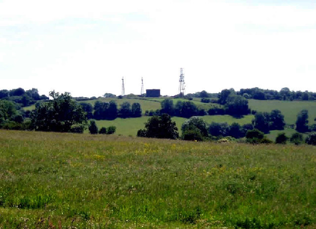
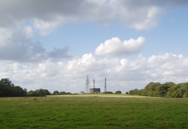
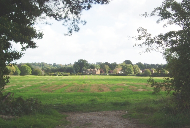
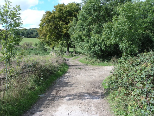
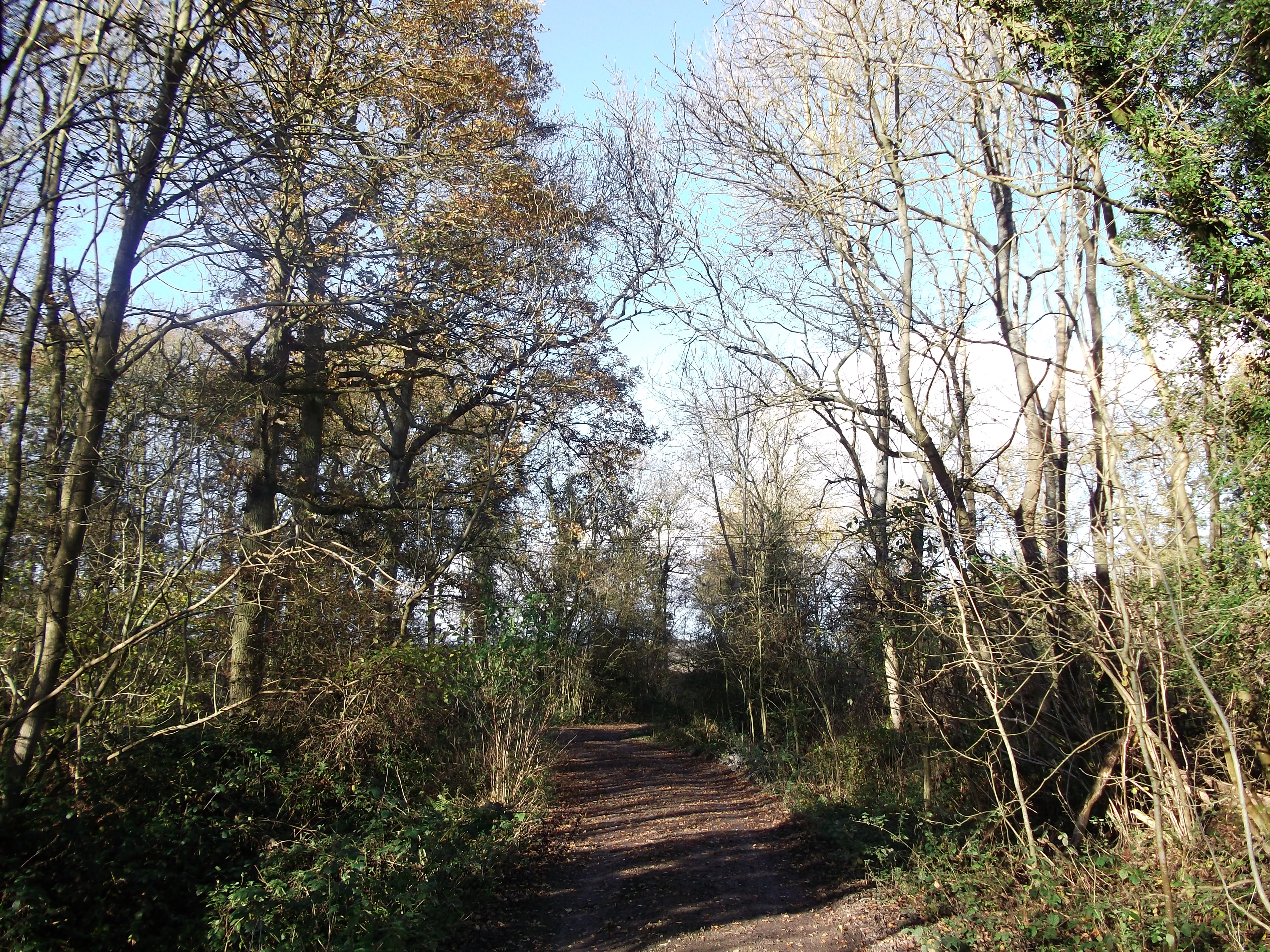
Beech Plantation, located in Surrey, England, is a picturesque wood and forest area that spans across an expansive landscape. Famous for its lush greenery and dense canopies, the plantation is a popular destination for nature enthusiasts and hikers alike.

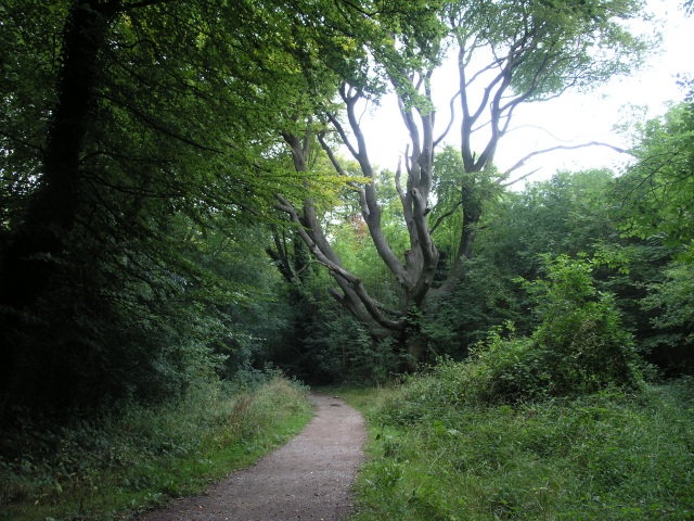
Covering an area of approximately 500 acres, Beech Plantation is primarily dominated by beech trees, which give the area its name. These magnificent trees create a serene and tranquil atmosphere, providing a habitat for a diverse range of flora and fauna. The plantation is also known for its vibrant bluebells that bloom during the spring season, creating a stunning carpet of blue throughout the forest.

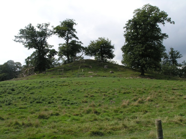
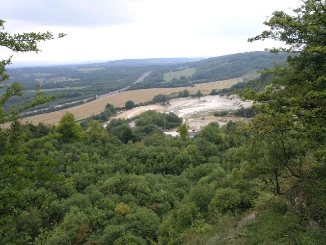
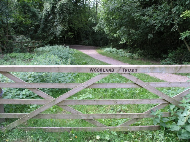
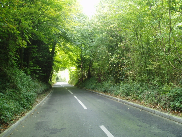
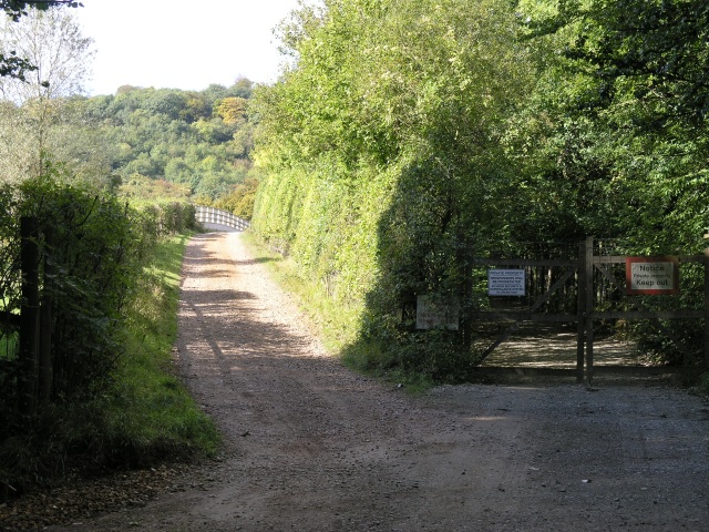
The woodlands of Beech Plantation offer numerous walking trails and paths, allowing visitors to explore its natural beauty. These trails lead visitors through enchanting groves, alongside babbling brooks, and up to breathtaking viewpoints offering panoramic vistas of the surrounding countryside. The plantation is also home to a variety of wildlife, including deer, foxes, and a multitude of bird species, making it an ideal spot for wildlife enthusiasts and birdwatchers.

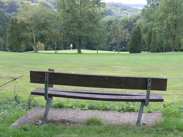
Beech Plantation is well-maintained, with designated picnic areas and benches strategically placed throughout the woodlands, providing an opportunity for visitors to relax and enjoy a picnic amidst the serenity of nature. The plantation is easily accessible, with ample parking facilities available for visitors.

Overall, Beech Plantation in Surrey is a captivating woodland area that offers a tranquil escape from the hustle and bustle of everyday life. Its natural beauty, diverse flora and fauna, and well-maintained trails make it a must-visit destination for nature lovers and outdoor enthusiasts.

If you have any feedback on the listing, please let us know in the comments section below.

Beech Plantation Images

Images are sourced within 2km of 51.272316/-0.016653682 or Grid Reference TQ3854. Thanks to Geograph Open Source API. All images are credited.

Radio masts and reservoir A familiar sight when driving south out of Warlingham down towards Oxted. The ridge of the North Downs has numerous radio masts, dating back to WWII.
Radio masts and reservoir
A familiar sight when driving south out of Warlingham down towards Oxted. The ridge of the North Downs has numerous radio masts, dating back to WWII.
The Mount, near Oxted The Mount is a tumulus, an ancient burial mound near Oxted.
The Mount, near Oxted
The Mount is a tumulus, an ancient burial mound near Oxted.
Railway Bridge, near Oxted A railway bridge where the road passes under the railway on the approach to Oxted
Railway Bridge, near Oxted
A railway bridge where the road passes under the railway on the approach to Oxted
Hay Fields with the North Downs in the background The hay has been collected ready for storage.  In the background a quarry can be seen cutting into the North Downs.
Hay Fields with the North Downs in the background
The hay has been collected ready for storage. In the background a quarry can be seen cutting into the North Downs.
Quarry, looking down from the top Looking down from the edge of the quarry that occupies much of this square.
Quarry, looking down from the top
Looking down from the edge of the quarry that occupies much of this square.
North Downs Golf Course This seat commands a good view of several of the greens on the North Downs Golf Course
North Downs Golf Course
This seat commands a good view of several of the greens on the North Downs Golf Course
Woodland Footpath, part of the Woldingham Country Walk This footpath is managed by the Woodlands Trust and is about 5.5 miles of walk ending up in Woldingham station.
Woodland Footpath, part of the Woldingham Country Walk
This footpath is managed by the Woodlands Trust and is about 5.5 miles of walk ending up in Woldingham station.
Marlesdon Park footpath A public footpath that runs through Marlesdon Park.  Marlesdon Park was a barren stretch of land until Sir Robert Claydon, the Lord Mayer of London (1679-80) built his home and estate there, planting many trees.
Marlesdon Park footpath
A public footpath that runs through Marlesdon Park. Marlesdon Park was a barren stretch of land until Sir Robert Claydon, the Lord Mayer of London (1679-80) built his home and estate there, planting many trees.
Botley Hill Farmhouse Public House A tea-room back in the 80s, but now a pub offering a range of entertainments.
Botley Hill Farmhouse Public House
A tea-room back in the 80s, but now a pub offering a range of entertainments.
Cheverells Farm Cottages, Croydon Road, Warlingham, CR6
Looking northwest from Croydon Road, CR6
Botley Hill junction of B269 and B2024, CR6 Looking west from B2024 Clarks Lane. The B269 goes down Titsey Hill to the left, and, as Croydon Road, northwest towards Warlingham.
Botley Hill junction of B269 and B2024, CR6
Looking west from B2024 Clarks Lane. The B269 goes down Titsey Hill to the left, and, as Croydon Road, northwest towards Warlingham.
Cattle Trough on Woldingham Village Green According to its difficult-to-read inscription, this dates from 1907.
Cattle Trough on Woldingham Village Green
According to its difficult-to-read inscription, this dates from 1907.
Radio aerials and water reservoir The Woldingham Water Reservoir is a landmark from all around.
Radio aerials and water reservoir
The Woldingham Water Reservoir is a landmark from all around.
Narrow steep road past the quarry The road allows you to descend from the north Downs at Woldingham to Oxted
Narrow steep road past the quarry
The road allows you to descend from the north Downs at Woldingham to Oxted
Towards Oxted At the junction of Chalk Pit Road with Barrow Green Road, you can see over a field towards Oxted.
Towards Oxted
At the junction of Chalk Pit Road with Barrow Green Road, you can see over a field towards Oxted.
Country bridleway with M25 bridge in the distance This bridleway runs through the land of Barrow Green Court.  The residents definitely don't want unwanted visitors judging by the multiple signs and security features.  In the distance, the bridlepath can be seen crossing the M25.
Country bridleway with M25 bridge in the distance
This bridleway runs through the land of Barrow Green Court. The residents definitely don't want unwanted visitors judging by the multiple signs and security features. In the distance, the bridlepath can be seen crossing the M25.
Parting of the ways After crossing the M25, this bridleway parts into two.  A nice rural looking scene.  In reality accompanied by the roar of traffic from the M25.
Parting of the ways
After crossing the M25, this bridleway parts into two. A nice rural looking scene. In reality accompanied by the roar of traffic from the M25.
Show me another place!

Beech Plantation is located at Grid Ref: TQ3854 (Lat: 51.272316, Lng: -0.016653682)

Administrative County: Surrey

District: Tandridge

Police Authority: Surrey

What 3 Words

///tens.called.sports. Near Oxted, Surrey

Related Wikis

Titsey Woods

Titsey Woods is a 45.3-hectare (112-acre) biological Site of Special Scientific Interest north-west of Oxted in Surrey.This site is composed of wet semi...

Barrow Green Court

Barrow Green Court is a Grade I listed house near Oxted, Surrey, England.The house was built in the early-17th century, with mid-18th century alterations...

Woldingham and Oxted Downs

Woldingham and Oxted Downs is a 128.4-hectare (317-acre) biological Site of Special Scientific Interest east of Caterham in Surrey.This sloping site on...

All Saints Church, Oxted

All Saints Church is a Roman Catholic Parish church in Oxted, Surrey. Building work on the church started in 1913 and was delayed by World War I. Aspects...

Oxted School

Oxted School is a coeducational secondary school and sixth form located in the English town of Oxted, Surrey. It was opened in 1929 as the first mixed...

Oxted railway station

Oxted railway station is on the Oxted line in southern England, serving the commuter town of Oxted, Surrey. It is 20 miles 25 chains (20.31 miles, 32.69...

Oxted

Oxted is a town and civil parish in the Tandridge district of Surrey, England, at the foot of the North Downs. It is 9 miles (14 km) south south-east of...

Hill Park, Tatsfield

Hill Park, Tatsfield is a 24.5-hectare (61-acre) Local Nature Reserve south of Tatsfield in Surrey. It is owned by Surrey County Council and managed by...

Nearby Amenities

Located within 500m of 51.272316,-0.016653682
Barrier: kissing_gate
Bicycle: no
Foot: yes
Material: metal
Lat/Long: 51.2705393/-0.0169765
Barrier: kissing_gate
Bicycle: no
Foot: yes
Material: metal
Lat/Long: 51.2705035/-0.015758
Oxted Downs
Place: locality
Lat/Long: 51.2724116/-0.0111342
Barrier: kissing_gate
Lat/Long: 51.272871/-0.0139376
Barrier: stile
Foot: yes
Material: wood
Stile: stepover
Lat/Long: 51.2728687/-0.0108618
Barrier: stile
Lat/Long: 51.2728513/-0.0131687
Bench
Lat/Long: 51.271019/-0.0149685
Man Made: mast
Lat/Long: 51.2696365/-0.0158406
Speed Camera
Lat/Long: 51.268131/-0.0184588
Speed Camera
Lat/Long: 51.2683056/-0.0186104
Emergency Bay
Lat/Long: 51.2688404/-0.0153327
Colour: red and white
Marker: aerial
Utility: oil
Lat/Long: 51.2691203/-0.0165528
Colour: white
Marker: post
Material: plastic
Utility: oil
Lat/Long: 51.2691199/-0.0165444
Colour: white
Marker: post
Material: concrete
Utility: oil
Lat/Long: 51.2691659/-0.0163271
The data included in this document is from www.openstreetmap.org. The data is made available under ODbL.

Have you been to Beech Plantation?

Leave your review of Beech Plantation below (or comments, questions and feedback).