Hangingwood Plantation

Wood, Forest in Hertfordshire East Hertfordshire

England

Hangingwood Plantation

A10, southbound The A10 runs 161 miles from London to King's Lynn. via Cambridge and Ely. 
<span class="nowrap"><a title="http://www.sabre-roads.org.uk/wiki/index.php?title=A10" rel="nofollow ugc noopener" href="http://www.sabre-roads.org.uk/wiki/index.php?title=A10">Link</a><img style="margin-left:2px;" alt="External link" title="External link - shift click to open in new window" src="https://s1.geograph.org.uk/img/external.png" width="10" height="10"/></span>
A10, southbound Credit: N Chadwick

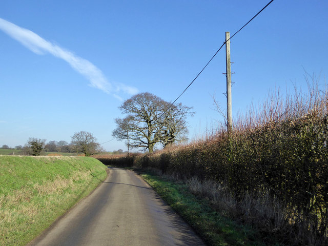
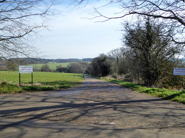
Hangingwood Plantation is a picturesque woodland located in Hertfordshire, England. Covering an area of approximately 500 acres, it is a popular destination for nature enthusiasts and outdoor adventurers alike. The plantation is situated near the village of Hangingwood and is easily accessible by road.

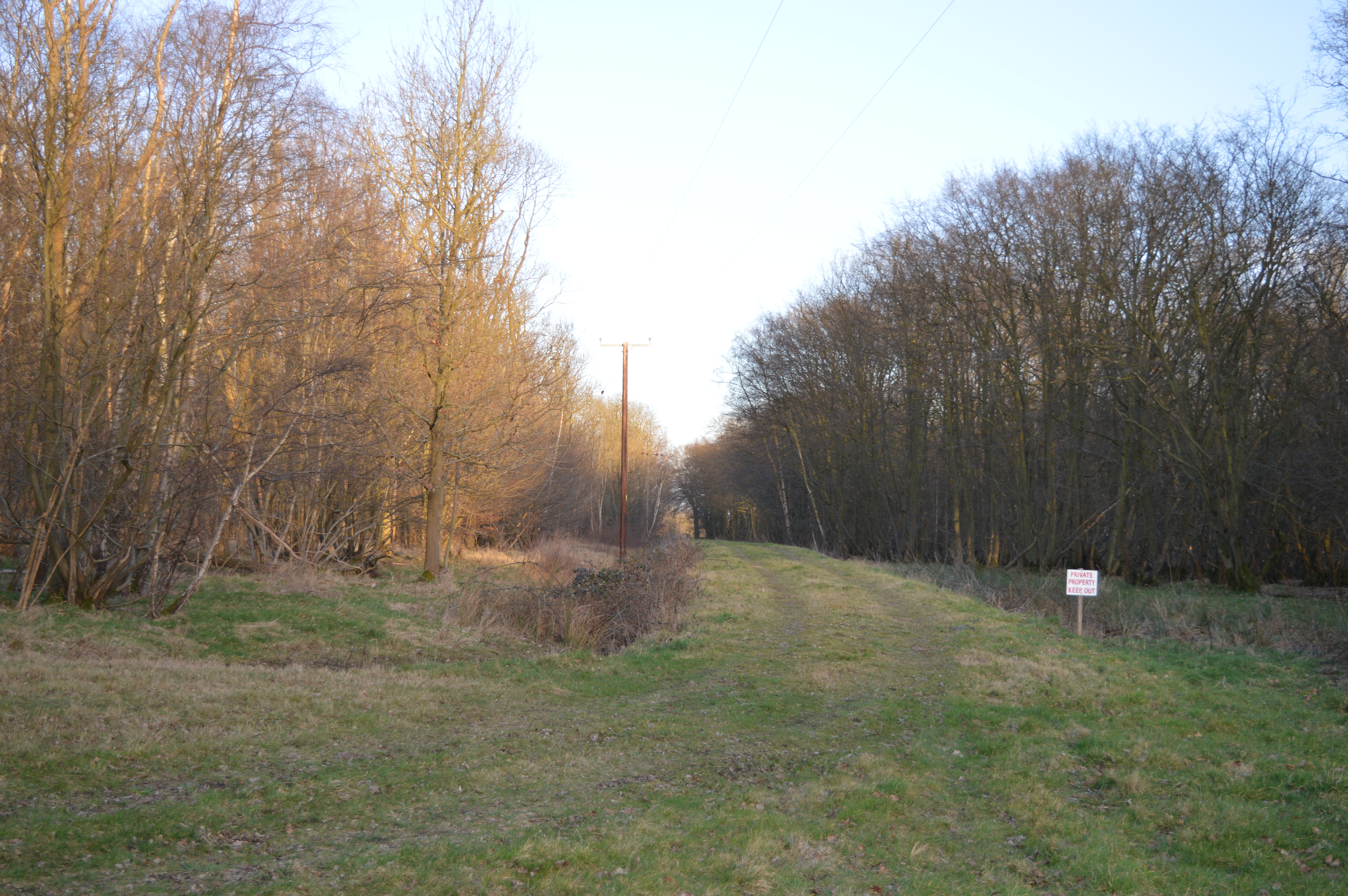
The woodland is characterized by its dense canopy of trees, predominantly consisting of oak, beech, and silver birch. The mature trees create a serene and tranquil atmosphere, offering a perfect retreat from the hustle and bustle of everyday life. Walking through the plantation, visitors can enjoy the sights and sounds of various bird species, including woodpeckers and owls, as well as the occasional glimpse of small mammals such as foxes and squirrels.

Hangingwood Plantation also boasts a network of well-maintained trails, allowing visitors to explore the woodland at their own pace. These trails offer stunning views, especially during the autumn months when the leaves change color, creating a breathtaking display. Additionally, the plantation is home to a diverse range of flora and fauna, with several rare and protected species making their habitat within its boundaries.

For those interested in history, Hangingwood Plantation has a fascinating past. It was once part of a larger estate and has been managed as a woodland for centuries. As a result, it retains its natural beauty and offers a glimpse into the region's rich heritage.

Overall, Hangingwood Plantation is a hidden gem in Hertfordshire, providing a haven of tranquility and natural beauty for visitors to enjoy. Whether you are a nature lover, a history enthusiast, or simply seeking a peaceful escape, this woodland is a must-visit destination.

If you have any feedback on the listing, please let us know in the comments section below.

Hangingwood Plantation Images

Images are sourced within 2km of 51.864709/0.008426697 or Grid Reference TL3820. Thanks to Geograph Open Source API. All images are credited.

A10, southbound The A10 runs 161 miles from London to King's Lynn. via Cambridge and Ely. 
<span class="nowrap"><a title="http://www.sabre-roads.org.uk/wiki/index.php?title=A10" rel="nofollow ugc noopener" href="http://www.sabre-roads.org.uk/wiki/index.php?title=A10">Link</a><img style="margin-left:2px;" alt="External link" title="External link - shift click to open in new window" src="https://s1.geograph.org.uk/img/external.png" width="10" height="10"/></span>
A10, southbound
The A10 runs 161 miles from London to King's Lynn. via Cambridge and Ely. LinkExternal link
Bridge over the A10 The A10 runs 161 miles from London to King's Lynn. via Cambridge and Ely. 
<span class="nowrap"><a title="http://www.sabre-roads.org.uk/wiki/index.php?title=A10" rel="nofollow ugc noopener" href="http://www.sabre-roads.org.uk/wiki/index.php?title=A10">Link</a><img style="margin-left:2px;" alt="External link" title="External link - shift click to open in new window" src="https://s1.geograph.org.uk/img/external.png" width="10" height="10"/></span>
Bridge over the A10
The A10 runs 161 miles from London to King's Lynn. via Cambridge and Ely. LinkExternal link
The A10 The A10 runs 161 miles from London to King's Lynn. via Cambridge and Ely. 
<span class="nowrap"><a title="http://www.sabre-roads.org.uk/wiki/index.php?title=A10" rel="nofollow ugc noopener" href="http://www.sabre-roads.org.uk/wiki/index.php?title=A10">Link</a><img style="margin-left:2px;" alt="External link" title="External link - shift click to open in new window" src="https://s1.geograph.org.uk/img/external.png" width="10" height="10"/></span>
The A10
The A10 runs 161 miles from London to King's Lynn. via Cambridge and Ely. LinkExternal link
A10, southbound The A10 runs 161 miles from London to King's Lynn. via Cambridge and Ely. 
<span class="nowrap"><a title="http://www.sabre-roads.org.uk/wiki/index.php?title=A10" rel="nofollow ugc noopener" href="http://www.sabre-roads.org.uk/wiki/index.php?title=A10">Link</a><img style="margin-left:2px;" alt="External link" title="External link - shift click to open in new window" src="https://s1.geograph.org.uk/img/external.png" width="10" height="10"/></span>
A10, southbound
The A10 runs 161 miles from London to King's Lynn. via Cambridge and Ely. LinkExternal link
Trees by Ermine Street, Colliers End
Houses on Ermine Street, Colliers End These are the first houses coming in from the north. This is the original Roman road now bypassed by the newer A10.
Houses on Ermine Street, Colliers End
These are the first houses coming in from the north. This is the original Roman road now bypassed by the newer A10.
St Mary's Church, Colliers End Redundant. According to this <span class="nowrap"><a title="https://hertfordshirechurches.wordpress.com/2013/05/12/st-mary-colliers-end/" rel="nofollow ugc noopener" href="https://hertfordshirechurches.wordpress.com/2013/05/12/st-mary-colliers-end/">Link</a><img style="margin-left:2px;" alt="External link" title="External link - shift click to open in new window" src="https://s1.geograph.org.uk/img/external.png" width="10" height="10"/></span> the church dates from 1910, and was built to the designs of "the donor of the land Ernest Wickham and the builder Mr C. Pritlove of nearby Wadesmill."
St Mary's Church, Colliers End
Redundant. According to this LinkExternal link the church dates from 1910, and was built to the designs of "the donor of the land Ernest Wickham and the builder Mr C. Pritlove of nearby Wadesmill."
Colliers End village hall Mid 19th-century village hall. Built in 1862 as a Church of England school - as reported at this <span class="nowrap"><a title="http://www.british-history.ac.uk/vch/herts/vol3/pp347-366" rel="nofollow ugc noopener" href="http://www.british-history.ac.uk/vch/herts/vol3/pp347-366">Link</a><img style="margin-left:2px;" alt="External link" title="External link - shift click to open in new window" src="https://s1.geograph.org.uk/img/external.png" width="10" height="10"/></span>.
Colliers End village hall
Mid 19th-century village hall. Built in 1862 as a Church of England school - as reported at this LinkExternal link.
Farmhouse at Fisher's Farm, Colliers End Grade II listed weatherboarded farmhouse: architectural description at this <span class="nowrap"><a title="https://historicengland.org.uk/listing/the-list/list-entry/1102358" rel="nofollow ugc noopener" href="https://historicengland.org.uk/listing/the-list/list-entry/1102358">Link</a><img style="margin-left:2px;" alt="External link" title="External link - shift click to open in new window" src="https://s1.geograph.org.uk/img/external.png" width="10" height="10"/></span>.
Farmhouse at Fisher's Farm, Colliers End
Grade II listed weatherboarded farmhouse: architectural description at this LinkExternal link.
The A10, Colliers End
Layby on the A10, Colliers End
The A10, Colliers End
Northbound A10 Roadworks in the fast lane of the other carriageway.
Northbound A10
Roadworks in the fast lane of the other carriageway.
Northbound A10 Dowsetts Lane crosses the bridge.
Northbound A10
Dowsetts Lane crosses the bridge.
Lane from Barwick to Puckeridge
Private drive to Standon Lordship 'No vehicular right of way'. The truth of that depend on whether a bicycle is regarded as a vehicle, as it is a public bridleway.
Private drive to Standon Lordship
'No vehicular right of way'. The truth of that depend on whether a bicycle is regarded as a vehicle, as it is a public bridleway.
Show me another place!

Hangingwood Plantation is located at Grid Ref: TL3820 (Lat: 51.864709, Lng: 0.008426697)

Administrative County: Hertfordshire

District: East Hertfordshire

Police Authority: Hertfordshire

What 3 Words

///credit.doll.roof. Near Puckeridge, Hertfordshire

Related Wikis

Plashes Wood

Plashes Wood is a 71.9-hectare (178-acre) biological Site of Special Scientific Interest south of Standon in Hertfordshire. The local planning authority...

Colliers End

Colliers End is a village in the civil parish of Standon, in the East Hertfordshire district, in Hertfordshire, England. It lies upon what was the A10...

Barwick, Hertfordshire

Barwick, Great Barwick, and Little Barwick (Berewyk 14th century, and Barrack 19th century) are hamlets in the civil parish of Standon in Hertfordshire...

Standon Green End

Standon Green End is a hamlet situated just off the A10 road between Ware and Puckeridge in Hertfordshire. At the 2011 Census the population of the hamlet...

St Edmund's College, Ware

St Edmund's College is a coeducational private day and boarding school in the British public school tradition, set in 440 acres (1.8 km2) in Ware, Hertfordshire...

Old Hall Green

Old Hall Green is a hamlet in Hertfordshire, England. At the 2011 Census the population was included in the civil parish of Standon. In 1793, an academy...

Standon Preceptory

Standon Preceptory was a Knights Hospitaller foundation in the parish of Standon, in the county of Hertfordshire, England. It was founded before 1154,...

Standon Priory

Standon Priory was a priory in Essex, England. == References ==

Nearby Amenities

Located within 500m of 51.864709,0.008426697
Ford: yes
Surface: unpaved
Lat/Long: 51.8624697/0.0144893
Addr Housenumber: Plashes Farm
Lat/Long: 51.864312/0.0021576
Material: wood
Power: pole
Lat/Long: 51.8620892/0.014138
Material: wood
Power: pole
Lat/Long: 51.8627401/0.0138954
Material: wood
Power: pole
Lat/Long: 51.8625033/0.0139866
Power: pole
Lat/Long: 51.8655519/0.001588
Power: pole
Lat/Long: 51.8647442/0.0019554
Bench
Backrest: no
Check Date: 2021-06-06
Lat/Long: 51.8659568/0.0105803
The data included in this document is from www.openstreetmap.org. The data is made available under ODbL.

Have you been to Hangingwood Plantation?

Leave your review of Hangingwood Plantation below (or comments, questions and feedback).