Birch Wood

Wood, Forest in Surrey

England

Birch Wood

The entrance to the Metropolitan Police Dog Training Establishment There is also one in the Welsh Harp in Kinsgbury where I live.
The entrance to the Metropolitan Police Dog Training Establishment Credit: David Howard

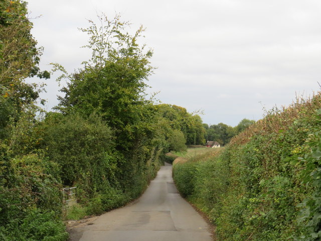
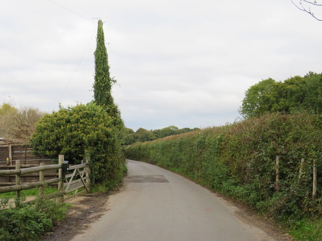
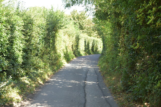
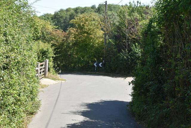
Birch Wood is a beautiful forest located in Surrey, England. The woodland is primarily composed of birch trees, hence its name, and covers a vast area of lush greenery. The forest is a popular destination for nature lovers and outdoor enthusiasts due to its picturesque scenery and tranquil atmosphere.

Birch Wood is home to a diverse range of wildlife, including birds, deer, and squirrels. The forest is a haven for birdwatchers, with various species of birds being spotted throughout the year. Visitors can also enjoy hiking and walking trails that wind through the forest, providing opportunities to explore the natural beauty of the area.

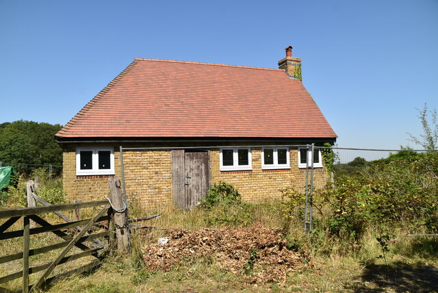
In addition to its natural beauty, Birch Wood also has historical significance. The forest has been used by locals for centuries, with evidence of human activity dating back to ancient times. Today, visitors can still see remnants of old structures and paths that were once used by the inhabitants of the area.

Overall, Birch Wood is a peaceful and serene destination that offers a glimpse into the natural beauty and history of Surrey. Whether you are looking for a relaxing walk in the woods or a chance to spot some wildlife, Birch Wood has something to offer for everyone.

If you have any feedback on the listing, please let us know in the comments section below.
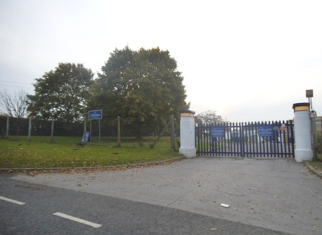
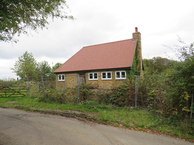
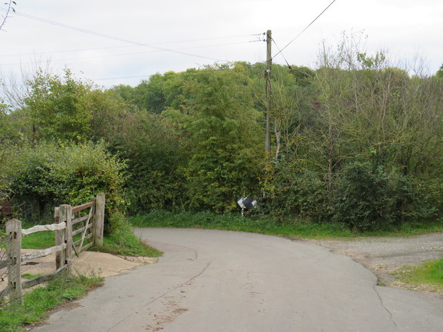
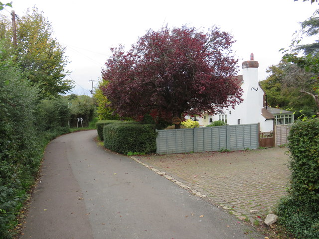
Birch Wood Images

Images are sourced within 2km of 51.357323/-0.014348588 or Grid Reference TQ3863. Thanks to Geograph Open Source API. All images are credited.

The entrance to the Metropolitan Police Dog Training Establishment There is also one in the Welsh Harp in Kinsgbury where I live.
The entrance to the Metropolitan Police Dog Training Establishment
There is also one in the Welsh Harp in Kinsgbury where I live.
Outbuilding near Keston An isolated outbuilding on North Pole Lane, on the outer fringe of south east London.
Outbuilding near Keston
An isolated outbuilding on North Pole Lane, on the outer fringe of south east London.
North Pole Lane, near Keston North Pole Lane is a narrow lane in countryside on the outer fringe of south east London.  Here it has a sharp bend to the left.
North Pole Lane, near Keston
North Pole Lane is a narrow lane in countryside on the outer fringe of south east London. Here it has a sharp bend to the left.
North Pole Lane, near Keston North Pole lane is a narrow lane through countryside on the outer fringe of south east London.
North Pole Lane, near Keston
North Pole lane is a narrow lane through countryside on the outer fringe of south east London.
Nash Lane, near Keston Nash lane is a narrow lane through countryside on the outer fringe of south east London.  Despite its rural setting, this location is within the Greater London boundary.
Nash Lane, near Keston
Nash lane is a narrow lane through countryside on the outer fringe of south east London. Despite its rural setting, this location is within the Greater London boundary.
Nash Lane, near Keston Nash Lane is a minor country lane on the outer fringe of south east London.

The tall green conical shape is not a tree, but a telegraph pole to which greenery has attached itself and grown.
Nash Lane, near Keston
Nash Lane is a minor country lane on the outer fringe of south east London. The tall green conical shape is not a tree, but a telegraph pole to which greenery has attached itself and grown.
Building on North Pole Lane
North Pole Lane
North Pole Lane
Sharp bend, North Pole lane
North Pole Lane
North Pole Lane
April Cottage
April Cottage
Footpath off North Pole Lane
North Pole Lane
North Pole Lane
Footpath off North Pole Lane
Tramlink West Croydon service approaching the Gravel Hill stop, crossing the road of the same name.
Tramlink
West Croydon service approaching the Gravel Hill stop, crossing the road of the same name.
Featherbed Lane
Featherbed Lane
Parkway, New Addington Parkway forms part of the main "spine" road through New Addington.
Parkway, New Addington
Parkway forms part of the main "spine" road through New Addington.
Tram in New Addington A tram in New Addington, in south London's outer suburbs.  The tram system opened in 2000.  Prior to then, New Addington had relied entirely on buses to serve its public transport needs.
Tram in New Addington
A tram in New Addington, in south London's outer suburbs. The tram system opened in 2000. Prior to then, New Addington had relied entirely on buses to serve its public transport needs.
Show me another place!

Birch Wood is located at Grid Ref: TQ3863 (Lat: 51.357323, Lng: -0.014348588)

Unitary Authority: Croydon

Police Authority: Metropolitan

What 3 Words

///bill.cases.saves. Near West Wickham, London

Nearby Locations

Birch Wood

Related Wikis

Fieldway (ward)

Fieldway was a ward in the London Borough of Croydon, covering part of the New Addington estate in London in the United Kingdom. The ward formed part of...

New Addington North (ward)

New Addington North is a ward in the London Borough of Croydon, covering part of the New Addington estate in London in the United Kingdom. The ward currently...

All Saints Catholic School, West Wickham

All Saints Catholic School was a Catholic secondary school located on Layhams Road, West Wickham, London Borough of Bromley. Formerly known as 'St. John...
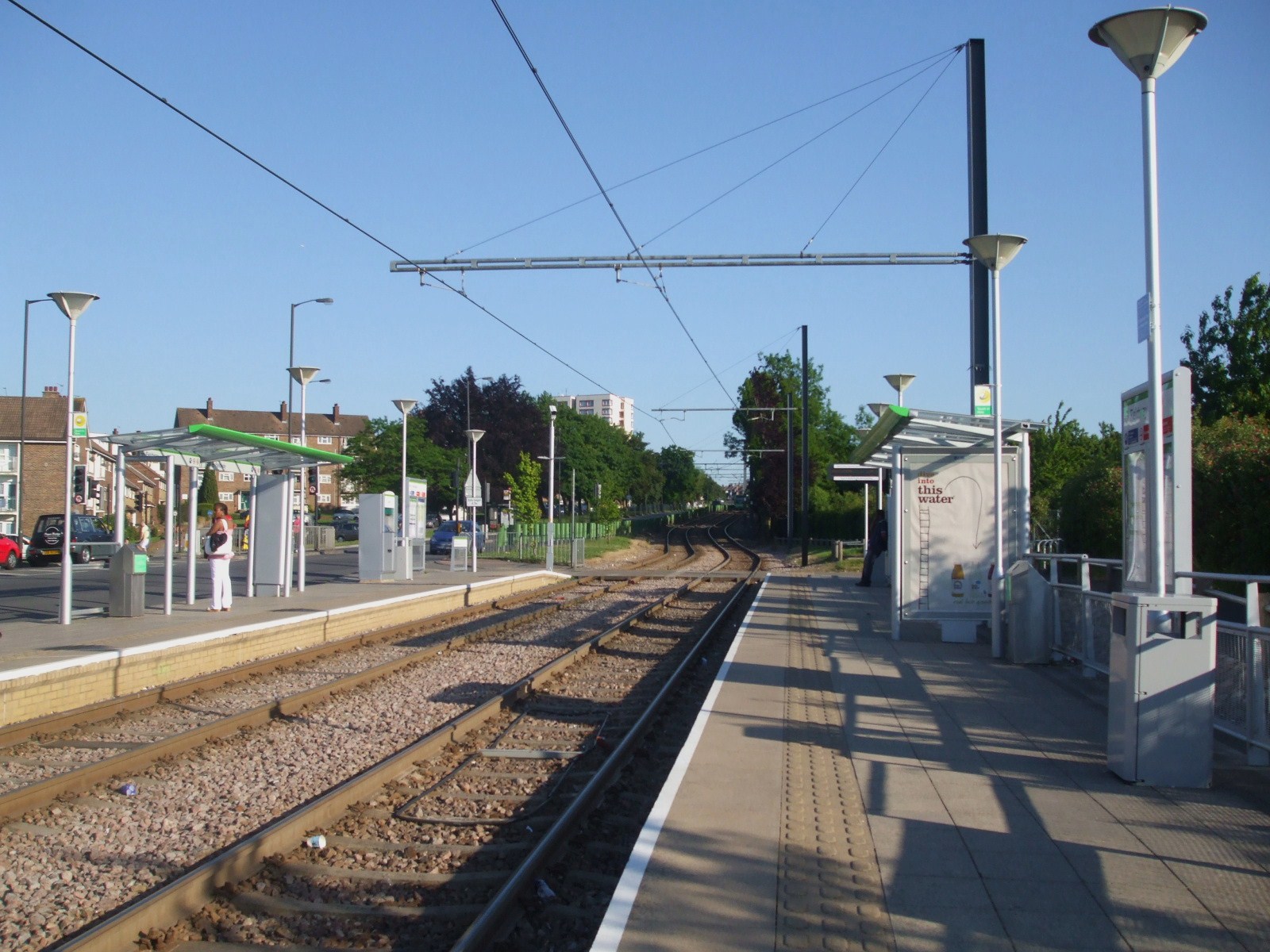
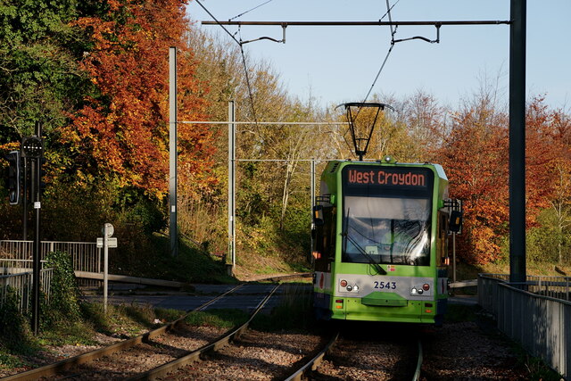
Fieldway tram stop

Fieldway tram stop is a light rail stop serving the Fieldway residential area of New Addington, in the London Borough of Croydon in the southern suburbs...

Nearby Amenities

Located within 500m of 51.357323,-0.014348588
Traffic Calming: hump
Lat/Long: 51.3588159/-0.0181449
Traffic Calming: hump
Lat/Long: 51.35747/-0.0166983
Traffic Calming: hump
Lat/Long: 51.3568663/-0.0163301
Traffic Calming: hump
Lat/Long: 51.3562587/-0.0158545
Traffic Calming: cushion
Lat/Long: 51.3556154/-0.0152845
Crossing
Crossing: unmarked
Crossing Markings: no
Traffic Calming: island
Lat/Long: 51.3534486/-0.0127043
Traffic Calming: hump
Lat/Long: 51.3540698/-0.0183859
Traffic Calming: hump
Lat/Long: 51.354452/-0.0171192
Traffic Calming: hump
Lat/Long: 51.3546695/-0.0097322
Turning Circle
Lat/Long: 51.3535118/-0.0167979
Turning Circle
Source: Bing Maps
Lat/Long: 51.353034/-0.0132754
Turning Circle
Lat/Long: 51.357073/-0.0183111
Turning Circle
Lat/Long: 51.3566591/-0.019756
Turning Circle
Lat/Long: 51.3570282/-0.0208511
Turning Circle
Lat/Long: 51.3573974/-0.0198386
Turning Circle
Lat/Long: 51.3578302/-0.0185923
Bus Stop
Castle Hill School
Bus: yes
Naptan AtcoCode: 490004844E
Naptan Bearing: N
Naptan CommonName: Castle Hill School
Naptan Street: FIELDWAY
Naptan Verified: no
Public Transport: platform
Lat/Long: 51.3557581/-0.0152591
Bus Stop
Castle Hill School
Bus: yes
Naptan AtcoCode: 490004844W
Naptan Bearing: N
Naptan CommonName: Castle Hill School
Naptan Street: FIELDWAY
Naptan Verified: no
Public Transport: platform
Ref: 52993
Source Ref: naptan
Lat/Long: 51.3559528/-0.0157002
Bus Stop
Foxcombe
Bus: yes
Naptan AtcoCode: 490006968S
Naptan Bearing: N
Naptan CommonName: Foxcombe
Naptan Street: FIELDWAY
Naptan Verified: no
Public Transport: platform
Ref: 49328
Source Ref: naptan
Lat/Long: 51.3561018/-0.0205833
Bus Stop
Merrow Way
Bus: yes
Naptan AtcoCode: 490009824N
Naptan Bearing: N
Naptan CommonName: Merrow Way
Naptan Verified: no
Public Transport: platform
Ref: 55515
Source Ref: naptan
Lat/Long: 51.3542732/-0.0138683
Bus Stop
Merrow Way
Bus: yes
Naptan AtcoCode: 490009824S
Naptan Bearing: N
Naptan CommonName: Merrow Way
Naptan Street: MERROW WAY
Naptan Verified: no
Public Transport: platform
Ref: 47263
Source Ref: naptan
Lat/Long: 51.3538172/-0.0132949
Bus Stop
North Walk
Naptan AtcoCode: 490010420E
Naptan Bearing: N
Naptan CommonName: North Walk
Naptan Street: FIELDWAY
Naptan Verified: no
Public Transport: platform
Lat/Long: 51.3583523/-0.0208486
Bus Stop
North Walk
Bus: yes
Naptan AtcoCode: 490010420W
Naptan Bearing: N
Naptan CommonName: North Walk
Naptan Street: FIELDWAY
Naptan Verified: no
Public Transport: platform
Ref: 71538
Source Ref: naptan
Lat/Long: 51.3580564/-0.0210938
Bus Stop
Netley Close
Bus: yes
Naptan AtcoCode: 490010184E
Naptan Bearing: E
Naptan CommonName: Netley Close
Naptan Indicator: Stop
Naptan Verified: no
Public Transport: platform
Ref: 75938
Source Ref: naptan
Lat/Long: 51.3531231/-0.0155517
Bus Stop
The Lindens
Bus: yes
Naptan AtcoCode: 490013449N
Naptan Bearing: N
Naptan CommonName: The Lindens
Naptan Street: FIELDWAY
Naptan Verified: no
Public Transport: platform
Ref: 59120
Source Ref: naptan
Lat/Long: 51.3577959/-0.0170948
Bus Stop
The Coppins
Bus: yes
Naptan AtcoCode: 490013307E
Naptan Bearing: E
Naptan CommonName: The Coppins
Naptan Street: FIELDWAY
Naptan Verified: no
Public Transport: platform
Ref: 56569
Source Ref: naptan
Lat/Long: 51.3550575/-0.0205322
Post Box
Operator: Royal Mail
Operator Wikidata: Q638098
Ref: CR0 568
Lat/Long: 51.3578052/-0.0168141
Post Box
Collection Times: Mo-Fr 17:15; Sa 12:00; Su off
Drive Through: no
Operator: Royal Mail
Operator Wikidata: Q638098
Post Box Type: pillar
Ref: CR0 569
Royal Cypher: EIIR
Royal Cypher Wikidata: Q33102113
Source: survey
Lat/Long: 51.355723/-0.0204309
Crossing
Crossing: marked
Crossing Markings: yes
Source: Bing Maps
Lat/Long: 51.3562455/-0.0212574
Traffic Calming: hump
Lat/Long: 51.3581364/-0.0174441
Crossing
Crossing: uncontrolled
Crossing Ref: zebra
Source: Bing Maps
Lat/Long: 51.3529909/-0.0158857
Crossing
Crossing: unmarked
Crossing Markings: no
Lat/Long: 51.3532375/-0.0151381
Crossing
Crossing: unmarked
Crossing Island: yes
Crossing Markings: no
Lat/Long: 51.3555812/-0.0152532
Turning Circle
Lat/Long: 51.356449/-0.013851
Crossing
Crossing: unmarked
Crossing Island: yes
Crossing Markings: no
Lat/Long: 51.3552599/-0.0201708
Barrier: cycle_barrier
Foot: yes
Source: survey
Lat/Long: 51.3597639/-0.0188485
Barrier: cycle_barrier
Foot: yes
Source: survey
Lat/Long: 51.3599328/-0.0179353
Bus Stop
The Lindens
Bus: yes
Naptan AtcoCode: 490010473N
Naptan Bearing: S
Public Transport: platform
Ref: 49589
Source Ref: naptan
Lat/Long: 51.3577464/-0.0167405
Post Office
Fieldway Post Office
Addr City: Croydon
Addr Housenumber: 9
Addr Parentstreet: Fieldway
Addr Postcode: CR0 9DX
Addr Street: Wayside
Addr Village: New Addington
Opening Hours: Mo-Fr 06:00-22:00; Sa,Su 07:00-22:00
Operator: McColls
Ref Pol Id: 18342
Source: streetlevel imagery
Source Ref Pol Id: pol_branch_list_2018-02
Lat/Long: 51.3560053/-0.0210132
Old Operator: BT
Old Phone: +44 1689 843 939
Removed Amenity: telephone
Source: survey
Lat/Long: 51.3556985/-0.0204015
Pharmacy
Fieldway Pharmacy
Dispensing: yes
Healthcare: pharmacy
Phone: +44 1689 843 111
Source: survey
Lat/Long: 51.3557615/-0.0206182
Traffic Calming: bump
Lat/Long: 51.35576/-0.0158193
Traffic Calming: bump
Lat/Long: 51.355405/-0.0152175
Description: Joint bay for National Grid's underground Beddington–Rowdown 400kV circuit.
Man Made: street_cabinet
Operator: National Grid
Ref: J.B. 33/34
Utility: power
Lat/Long: 51.3532221/-0.0147502
Traffic Calming: bump
Lat/Long: 51.3552353/-0.0151165
Give Way
Direction: forward
Lat/Long: 51.3554758/-0.0149882
Traffic Calming: hump
Lat/Long: 51.3590831/-0.0193609
Traffic Calming: hump
Lat/Long: 51.3587542/-0.0200081
Traffic Calming: hump
Lat/Long: 51.358409/-0.0206209
Traffic Calming: hump
Lat/Long: 51.3560336/-0.0205323
Traffic Calming: hump
Lat/Long: 51.3555606/-0.0125836
Crossing
Crossing: unmarked
Crossing Markings: no
Traffic Calming: island
Lat/Long: 51.3534748/-0.0135837
Man Made: street_cabinet
Lat/Long: 51.3530623/-0.0159103
Turning Circle
Lat/Long: 51.3554518/-0.015502
Give Way
Direction: forward
Lat/Long: 51.3551586/-0.0147345
Crossing
Crossing: marked
Crossing Markings: yes
Lat/Long: 51.3555537/-0.0154807
Ref GB Tflcid: RWG203039
Traffic Calming: cushion
Lat/Long: 51.3554924/-0.0115047
Ref GB Tflcid: RWG203032
Traffic Calming: cushion
Lat/Long: 51.3549649/-0.0151893
Ref GB Tflcid: RWG203031
Traffic Calming: cushion
Lat/Long: 51.3546634/-0.0161526
Ref GB Tflcid: RWG202984
Traffic Calming: cushion
Lat/Long: 51.3540267/-0.0098539
Traffic Calming: hump
Lat/Long: 51.3553997/-0.010634
Crossing
Lat/Long: 51.3549842/-0.0096403
Crossing
Lat/Long: 51.3534203/-0.0134483
Street Lamp
Lat/Long: 51.3530709/-0.0157423
Street Lamp
Lat/Long: 51.3529017/-0.0156264
Street Lamp
Lat/Long: 51.3530897/-0.0131683
Street Lamp
Lat/Long: 51.3535051/-0.0128124
Street Lamp
Lat/Long: 51.353524/-0.0133855
Street Lamp
Lat/Long: 51.3533855/-0.0139649
Street Lamp
Lat/Long: 51.3533581/-0.0145807
Street Lamp
Lat/Long: 51.3532054/-0.0152158
Street Lamp
Lat/Long: 51.354402/-0.0164786
Street Lamp
Lat/Long: 51.3544482/-0.0169129
Street Lamp
Lat/Long: 51.3543975/-0.0172067
Street Lamp
Lat/Long: 51.3542283/-0.0175617
Street Lamp
Lat/Long: 51.3535963/-0.0168308
Street Lamp
Lat/Long: 51.3543325/-0.0178327
Street Lamp
Lat/Long: 51.3538949/-0.0187843
Street Lamp
Lat/Long: 51.3545737/-0.016681
Street Lamp
Lat/Long: 51.355023/-0.0151587
Street Lamp
Lat/Long: 51.3550774/-0.0143512
Street Lamp
Lat/Long: 51.3544819/-0.0140649
Street Lamp
Lat/Long: 51.35432/-0.0147235
Street Lamp
Lat/Long: 51.3539389/-0.0149556
Street Lamp
Lat/Long: 51.3554702/-0.0135295
Street Lamp
Lat/Long: 51.355593/-0.0127699
Street Lamp
Lat/Long: 51.3555885/-0.0120312
Street Lamp
Lat/Long: 51.3555209/-0.0123189
Street Lamp
Lat/Long: 51.3553412/-0.0121881
Street Lamp
Lat/Long: 51.3544585/-0.0133626
Street Lamp
Lat/Long: 51.3541774/-0.0136052
Street Lamp
Lat/Long: 51.3538022/-0.0134347
Street Lamp
Lat/Long: 51.3536191/-0.0130992
Street Lamp
Lat/Long: 51.3545875/-0.0117488
Street Lamp
Lat/Long: 51.354846/-0.0113113
Street Lamp
Lat/Long: 51.3552634/-0.0111562
Street Lamp
Lat/Long: 51.355451/-0.011517
Street Lamp
Lat/Long: 51.3553429/-0.010522
Street Lamp
Lat/Long: 51.3552572/-0.0099231
Street Lamp
Lat/Long: 51.3549018/-0.0097788
Street Lamp
Lat/Long: 51.3545362/-0.0096877
Street Lamp
Lat/Long: 51.3544494/-0.0100791
Street Lamp
Lat/Long: 51.3545261/-0.0106393
Street Lamp
Lat/Long: 51.3544027/-0.010964
Street Lamp
Lat/Long: 51.3540433/-0.0111688
Street Lamp
Lat/Long: 51.3536523/-0.0112437
Street Lamp
Lat/Long: 51.3541869/-0.0098897
Traffic Calming: island
Lat/Long: 51.3552419/-0.0201854
Traffic Calming: island
Lat/Long: 51.3552774/-0.0201591
Street Lamp
Lat/Long: 51.3553707/-0.0202911
Street Lamp
Lat/Long: 51.3552715/-0.020158
Barrier: bollard
Lat/Long: 51.3556313/-0.0203499
Barrier: bollard
Lat/Long: 51.3556223/-0.0203447
Barrier: bollard
Lat/Long: 51.3556098/-0.0203355
Barrier: bollard
Lat/Long: 51.3555971/-0.0203273
Barrier: bollard
Lat/Long: 51.3555854/-0.0203185
Barrier: bollard
Lat/Long: 51.3555722/-0.0203089
Street Lamp
Lat/Long: 51.3554691/-0.0205925
Street Lamp
Lat/Long: 51.355652/-0.0202981
Street Lamp
Lat/Long: 51.3556287/-0.020817
Restaurant
Golden Gate
Cuisine: chinese
Lat/Long: 51.3557045/-0.0204884
Laundrette
Shop: laundry
Lat/Long: 51.355734/-0.020552
Fast Food
Wayside Fish Bar
Cuisine: fish_and_chips
Lat/Long: 51.3557909/-0.0206834
Allure
Beauty: nails
Shop: beauty
Lat/Long: 51.3558183/-0.0207507
Plumbwell
Craft: plumber
Lat/Long: 51.3558481/-0.0208151
Pub
Radnall Tavern
Lat/Long: 51.3555302/-0.0203953
Jesters
Shop: yes
Lat/Long: 51.3558195/-0.0209824
Taxi
Wayside Mini-Cabs
Lat/Long: 51.3558476/-0.0210454
Vintage
Shop: alcohol
Lat/Long: 51.3558617/-0.0210814
Morrisons Daily
Brand: Morrisons Daily
Brand Wikidata: Q99752411
Shop: convenience
Website: https://my.morrisons.com/storefinder/66438/morrisons-daily-new-addington-wayside
Lat/Long: 51.3559804/-0.021033
Waste Basket
Lat/Long: 51.3560064/-0.0208542
Bicycle Parking
Lat/Long: 51.3560155/-0.020888
Barrier: bollard
Lat/Long: 51.3552378/-0.020091
Barrier: bollard
Lat/Long: 51.3552477/-0.0200799
Street Lamp
Lat/Long: 51.3551627/-0.0201781
Street Lamp
Lat/Long: 51.3550712/-0.0201812
Street Lamp
Lat/Long: 51.3550924/-0.0200668
Bench
Lat/Long: 51.3552911/-0.0198255
Street Lamp
Lat/Long: 51.3561399/-0.0206106
Street Lamp
Lat/Long: 51.3560222/-0.0203825
Street Lamp
Lat/Long: 51.3558002/-0.0200735
Street Lamp
Lat/Long: 51.3562818/-0.0211205
Street Lamp
Lat/Long: 51.3563778/-0.021142
Street Lamp
Lat/Long: 51.3563375/-0.0208002
Barrier: bollard
Lat/Long: 51.3562611/-0.0208531
Barrier: bollard
Lat/Long: 51.3562676/-0.0208094
Barrier: bollard
Lat/Long: 51.3562603/-0.0207676
Barrier: bollard
Lat/Long: 51.3562561/-0.0207461
Barrier: bollard
Lat/Long: 51.3562515/-0.0207264
Barrier: bollard
Lat/Long: 51.3562481/-0.0207055
Barrier: bollard
Lat/Long: 51.3562411/-0.0206828
Barrier: bollard
Lat/Long: 51.3563068/-0.021193
Barrier: bollard
Lat/Long: 51.3563114/-0.0212078
Barrier: bollard
Lat/Long: 51.3563156/-0.0212232
Barrier: bollard
Lat/Long: 51.356321/-0.0212392
Doctors
Fieldway Medical Centre
Healthcare: doctor
Lat/Long: 51.3559623/-0.0200667
Street Lamp
Lat/Long: 51.3562824/-0.0198481
Street Lamp
Lat/Long: 51.3557981/-0.019823
Street Lamp
Lat/Long: 51.3562064/-0.0203356
Street Lamp
Lat/Long: 51.3563785/-0.0205331
Street Lamp
Lat/Long: 51.3558795/-0.0191785
Street Lamp
Lat/Long: 51.3561198/-0.0182428
Street Lamp
Lat/Long: 51.3563687/-0.0194491
Street Lamp
Lat/Long: 51.356546/-0.0199034
Street Lamp
Lat/Long: 51.3565531/-0.0203572
Street Lamp
Lat/Long: 51.3567463/-0.0202434
Street Lamp
Lat/Long: 51.3564559/-0.020117
Street Lamp
Lat/Long: 51.3567457/-0.019277
Street Lamp
Lat/Long: 51.3569009/-0.0200292
Street Lamp
Lat/Long: 51.3564919/-0.0185433
Street Lamp
Lat/Long: 51.3564106/-0.0191813
Street Lamp
Lat/Long: 51.3565946/-0.0196704
Street Lamp
Lat/Long: 51.3562601/-0.0185615
Street Lamp
Lat/Long: 51.3562985/-0.0180667
Street Lamp
Lat/Long: 51.3567355/-0.0214731
Street Lamp
Lat/Long: 51.356567/-0.0208425
Street Lamp
Lat/Long: 51.3568266/-0.0209072
Street Lamp
Lat/Long: 51.3565992/-0.0212043
Street Lamp
Lat/Long: 51.3568669/-0.0212563
Street Lamp
Lat/Long: 51.3570257/-0.0214703
Barrier: bollard
Lat/Long: 51.3573557/-0.0214143
Street Lamp
Lat/Long: 51.3571789/-0.0212875
Street Lamp
Lat/Long: 51.3572839/-0.0215229
Street Lamp
Lat/Long: 51.3570811/-0.0207569
Street Lamp
Lat/Long: 51.3578594/-0.0214356
Street Lamp
Lat/Long: 51.357634/-0.0212095
Street Lamp
Lat/Long: 51.3569977/-0.0206199
Street Lamp
Lat/Long: 51.356976/-0.0209779
Street Lamp
Lat/Long: 51.35673/-0.0205381
Street Lamp
Lat/Long: 51.3568961/-0.0202977
Street Lamp
Lat/Long: 51.3572623/-0.0205583
Street Lamp
Lat/Long: 51.3573575/-0.0202341
Street Lamp
Lat/Long: 51.3574634/-0.0200893
Street Lamp
Lat/Long: 51.3577378/-0.0204394
Street Lamp
Lat/Long: 51.3580386/-0.021128
Street Lamp
Lat/Long: 51.357917/-0.021371
Street Lamp
Lat/Long: 51.3578435/-0.0208938
Street Lamp
Lat/Long: 51.3576495/-0.0208017
Street Lamp
Lat/Long: 51.3574984/-0.0205387
Street Lamp
Lat/Long: 51.3574192/-0.0192724
Street Lamp
Lat/Long: 51.3572959/-0.0197732
Street Lamp
Lat/Long: 51.3570843/-0.0203494
Street Lamp
Lat/Long: 51.357616/-0.0197812
Street Lamp
Lat/Long: 51.35811/-0.0202631
Barrier: bollard
Lat/Long: 51.3586837/-0.019767
Barrier: bollard
Lat/Long: 51.3585252/-0.0195562
Street Lamp
Lat/Long: 51.3584753/-0.0194778
Barrier: bollard
Lat/Long: 51.3582077/-0.0191361
Barrier: bollard
Lat/Long: 51.3580489/-0.0189301
Street Lamp
Lat/Long: 51.3580787/-0.0206603
Street Lamp
Lat/Long: 51.3582911/-0.0201812
Street Lamp
Lat/Long: 51.3582505/-0.0196855
Street Lamp
Lat/Long: 51.3584078/-0.0198909
Street Lamp
Lat/Long: 51.358091/-0.0194712
Barrier: bollard
Lat/Long: 51.3578978/-0.0187367
Barrier: bollard
Lat/Long: 51.3578888/-0.0187267
Barrier: bollard
Lat/Long: 51.3578779/-0.018715
Street Lamp
Lat/Long: 51.3588972/-0.0196407
Street Lamp
Lat/Long: 51.3579554/-0.018157
Street Lamp
Lat/Long: 51.3581717/-0.0180635
Street Lamp
Lat/Long: 51.3580025/-0.0178734
Street Lamp
Lat/Long: 51.3583472/-0.0182377
Street Lamp
Lat/Long: 51.3582337/-0.0185549
Street Lamp
Lat/Long: 51.3585231/-0.0184077
Street Lamp
Lat/Long: 51.3585973/-0.0189602
Street Lamp
Lat/Long: 51.3582781/-0.0176821
Barrier: bollard
Lat/Long: 51.357932/-0.0173026
Street Lamp
Lat/Long: 51.3580027/-0.0173455
Street Lamp
Lat/Long: 51.3585814/-0.0179827
Street Lamp
Lat/Long: 51.3588293/-0.0182306
Street Lamp
Lat/Long: 51.3588548/-0.018843
Street Lamp
Lat/Long: 51.3590245/-0.0190365
Street Lamp
Lat/Long: 51.358415/-0.0187909
Street Lamp
Lat/Long: 51.3578391/-0.0183001
Street Lamp
Lat/Long: 51.3577227/-0.017994
Street Lamp
Lat/Long: 51.357396/-0.018725
Street Lamp
Lat/Long: 51.3571899/-0.0191005
Street Lamp
Lat/Long: 51.3575944/-0.0183293
Street Lamp
Lat/Long: 51.3571254/-0.0185994
Street Lamp
Lat/Long: 51.356928/-0.0190358
Street Lamp
Lat/Long: 51.3568434/-0.019067
Street Lamp
Lat/Long: 51.3572001/-0.0182788
Street Lamp
Lat/Long: 51.3569736/-0.0182754
Street Lamp
Lat/Long: 51.3567024/-0.0187222
Barrier: bollard
Lat/Long: 51.3564545/-0.0171065
Barrier: bollard
Lat/Long: 51.3564432/-0.0170945
Barrier: bollard
Lat/Long: 51.3564323/-0.0170812
Barrier: bollard
Lat/Long: 51.3564212/-0.017068
Street Lamp
Lat/Long: 51.3562155/-0.0177707
Street Lamp
Lat/Long: 51.356717/-0.0177778
Street Lamp
Lat/Long: 51.3565887/-0.0175126
Street Lamp
Lat/Long: 51.3563798/-0.0171971
Street Lamp
Lat/Long: 51.356331/-0.0167843
Street Lamp
Lat/Long: 51.3558755/-0.0156438
Street Lamp
Lat/Long: 51.3577985/-0.0171116
Street Lamp
Lat/Long: 51.3566486/-0.0172543
Street Lamp
Lat/Long: 51.3568995/-0.0177612
Barrier: bollard
Lat/Long: 51.3565595/-0.0168487
Barrier: bollard
Lat/Long: 51.3565652/-0.0168635
Barrier: bollard
Lat/Long: 51.3565742/-0.0168812
Barrier: bollard
Lat/Long: 51.3565823/-0.0168993
Street Lamp
Lat/Long: 51.3567388/-0.0165348
Street Lamp
Lat/Long: 51.3572057/-0.01779
Street Lamp
Lat/Long: 51.3569102/-0.017338
Street Lamp
Lat/Long: 51.3570355/-0.0175924
Street Lamp
Lat/Long: 51.3567826/-0.0170867
Traffic Calming: island
Lat/Long: 51.3555976/-0.0152682
Traffic Calming: island
Lat/Long: 51.3555639/-0.0152369
Street Lamp
Lat/Long: 51.356443/-0.0163798
Street Lamp
Lat/Long: 51.3568815/-0.0169526
Street Lamp
Lat/Long: 51.3570739/-0.0172861
Street Lamp
Lat/Long: 51.3568203/-0.0174525
Street Lamp
Lat/Long: 51.357701/-0.0171054
Street Lamp
Lat/Long: 51.3574329/-0.017199
Street Lamp
Lat/Long: 51.3576117/-0.0174289
Street Lamp
Lat/Long: 51.3570628/-0.0179602
Street Lamp
Lat/Long: 51.3565955/-0.0162095
Barrier: bollard
Lat/Long: 51.3568065/-0.0158738
Barrier: bollard
Lat/Long: 51.3568036/-0.015857
Barrier: bollard
Lat/Long: 51.3568134/-0.0158413
Barrier: bollard
Lat/Long: 51.3568219/-0.0158272
Barrier: bollard
Lat/Long: 51.3568307/-0.015811
Barrier: bollard
Lat/Long: 51.3568323/-0.01579
Barrier: bollard
Lat/Long: 51.3568131/-0.0157607
Barrier: bollard
Lat/Long: 51.3568042/-0.0157465
Barrier: bollard
Lat/Long: 51.3567849/-0.0157177
Barrier: bollard
Lat/Long: 51.3567735/-0.0157015
Barrier: bollard
Lat/Long: 51.3567643/-0.0156874
Barrier: bollard
Lat/Long: 51.3567525/-0.0156685
Barrier: bollard
Lat/Long: 51.3567411/-0.0156496
Barrier: bollard
Lat/Long: 51.356728/-0.0156287
Barrier: bollard
Lat/Long: 51.3567185/-0.0156125
Barrier: bollard
Lat/Long: 51.3567077/-0.0156004
Barrier: bollard
Lat/Long: 51.3566996/-0.0156125
Barrier: bollard
Lat/Long: 51.356692/-0.0156256
Barrier: bollard
Lat/Long: 51.3566829/-0.0156397
Street Lamp
Lat/Long: 51.3567987/-0.0157245
Street Lamp
Lat/Long: 51.3570209/-0.0159428
Barrier: bollard
Lat/Long: 51.357505/-0.016234
Barrier: bollard
Lat/Long: 51.3575008/-0.0162583
Barrier: bollard
Lat/Long: 51.3574965/-0.0162799
Barrier: bollard
Lat/Long: 51.3574925/-0.0163011
Barrier: bollard
Lat/Long: 51.3574899/-0.0163217
Barrier: bollard
Lat/Long: 51.357384/-0.016196
Barrier: bollard
Lat/Long: 51.3573751/-0.0161843
Barrier: bollard
Lat/Long: 51.3573655/-0.0161701
Barrier: bollard
Lat/Long: 51.3573448/-0.0161416
Barrier: bollard
Lat/Long: 51.3573342/-0.0161273
Barrier: bollard
Lat/Long: 51.3572973/-0.0160777
Barrier: bollard
Lat/Long: 51.3572851/-0.0160692
Barrier: bollard
Lat/Long: 51.3572715/-0.016065
Street Lamp
Lat/Long: 51.3573965/-0.0161923
Street Lamp
Lat/Long: 51.3572191/-0.0160238
Street Lamp
Lat/Long: 51.3576963/-0.0167291
Barrier: bollard
Lat/Long: 51.3584854/-0.017396
Barrier: bollard
Lat/Long: 51.3584943/-0.0173751
Barrier: bollard
Lat/Long: 51.3585052/-0.0173517
Barrier: bollard
Lat/Long: 51.3585013/-0.0173229
Barrier: bollard
Lat/Long: 51.3585116/-0.0173045
Barrier: bollard
Lat/Long: 51.3587303/-0.0176407
Barrier: bollard
Lat/Long: 51.3587356/-0.0176457
Street Lamp
Lat/Long: 51.3564034/-0.0158964
Street Lamp
Lat/Long: 51.3564973/-0.0156106
Street Lamp
Lat/Long: 51.3561333/-0.0156626
Street Lamp
Lat/Long: 51.3557729/-0.0152629
Street Lamp
Lat/Long: 51.3554981/-0.0152956
Street Lamp
Lat/Long: 51.3558207/-0.0144454
Street Lamp
Lat/Long: 51.3562018/-0.0141089
Street Lamp
Lat/Long: 51.3564016/-0.0136797
Street Lamp
Lat/Long: 51.3562868/-0.0144087
Street Lamp
Lat/Long: 51.3560374/-0.0149778
Street Lamp
Lat/Long: 51.3561674/-0.0148634
Street Lamp
Lat/Long: 51.3561102/-0.0152565
Street Lamp
Lat/Long: 51.3564169/-0.0150236
Street Lamp
Lat/Long: 51.3566669/-0.0153799
Street Lamp
Lat/Long: 51.3568751/-0.0151291
Street Lamp
Lat/Long: 51.3576498/-0.0163065
Street Lamp
Lat/Long: 51.3578377/-0.016591
Street Lamp
Lat/Long: 51.3580447/-0.0166701
Street Lamp
Lat/Long: 51.3587279/-0.0174
Barrier: bollard
Lat/Long: 51.359133/-0.0179524
Barrier: bollard
Lat/Long: 51.3591206/-0.0179519
Barrier: bollard
Lat/Long: 51.3591268/-0.0179778
Barrier: bollard
Lat/Long: 51.3591161/-0.0179992
Barrier: bollard
Lat/Long: 51.3591044/-0.0180251
Barrier: bollard
Lat/Long: 51.3593097/-0.0180896
Street Lamp
Lat/Long: 51.359082/-0.0184449
Barrier: bollard
Lat/Long: 51.3593718/-0.0184678
Barrier: bollard
Lat/Long: 51.359392/-0.0184388
Street Lamp
Lat/Long: 51.3554928/-0.0157568
Barrier: bollard
Lat/Long: 51.3554938/-0.0156168
Barrier: bollard
Lat/Long: 51.3555036/-0.0155961
The data included in this document is from www.openstreetmap.org. The data is made available under ODbL.

Have you been to Birch Wood?

Leave your review of Birch Wood below (or comments, questions and feedback).