Badgerseye Plantation

Wood, Forest in Hertfordshire East Hertfordshire

England

Badgerseye Plantation

A10, southbound The A10 runs 161 miles from London to King's Lynn. via Cambridge and Ely. 
<span class="nowrap"><a title="http://www.sabre-roads.org.uk/wiki/index.php?title=A10" rel="nofollow ugc noopener" href="http://www.sabre-roads.org.uk/wiki/index.php?title=A10">Link</a><img style="margin-left:2px;" alt="External link" title="External link - shift click to open in new window" src="https://s1.geograph.org.uk/img/external.png" width="10" height="10"/></span>
A10, southbound Credit: N Chadwick

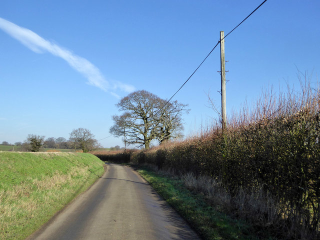
Badgerseye Plantation is a picturesque woodland located in Hertfordshire, England. Situated in the heart of the county, this forested area covers a vast expanse of approximately 500 acres. The plantation is renowned for its natural beauty and rich biodiversity, making it a popular destination for nature enthusiasts and outdoor adventurers.

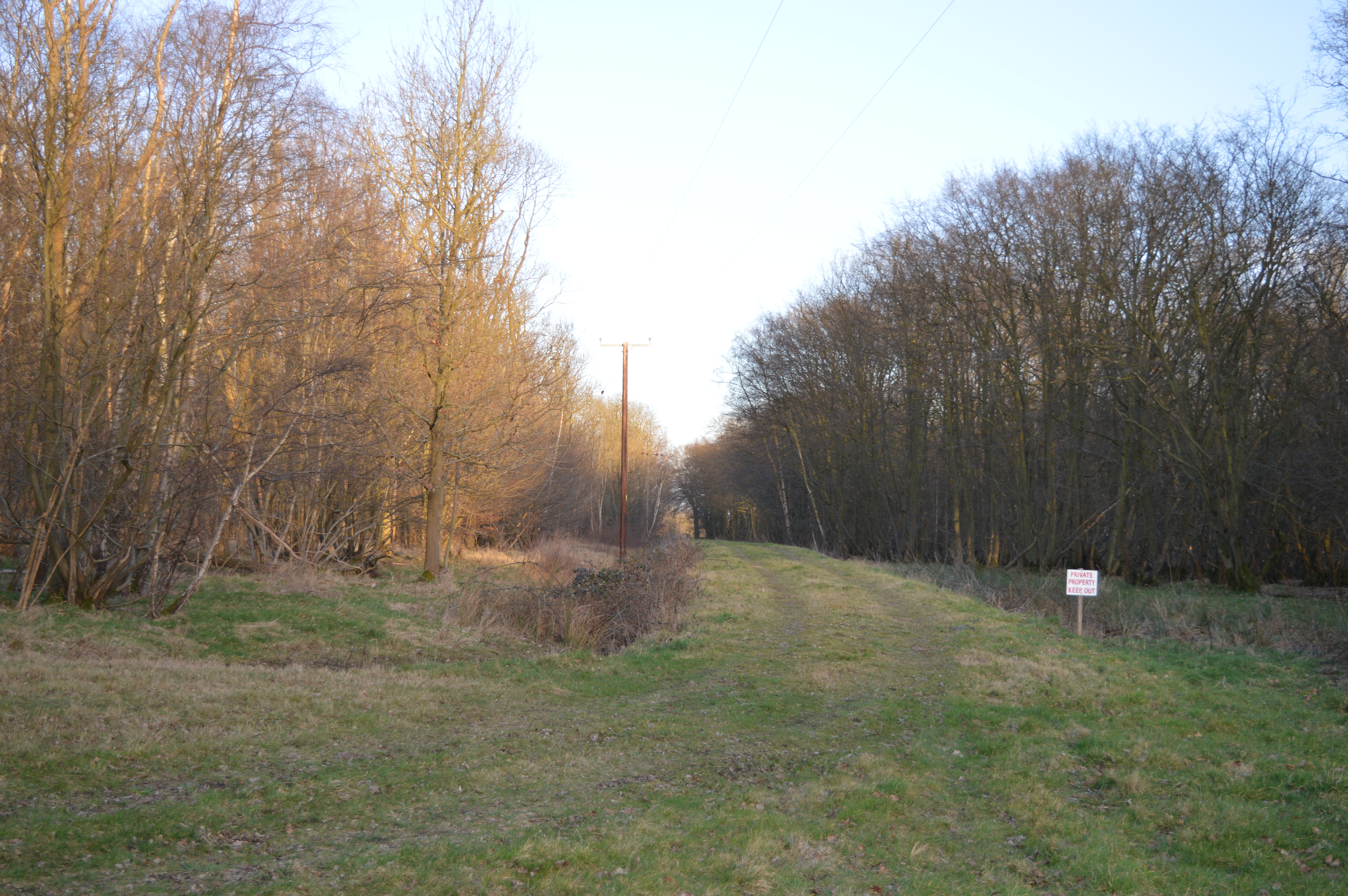
The woodland is primarily composed of a mix of native tree species, including oak, beech, and birch. These towering trees create a dense canopy overhead, providing a habitat for a wide variety of flora and fauna. Wildflowers, such as bluebells and primroses, carpet the forest floor in spring, adding a burst of color to the landscape.

Badgerseye Plantation is also home to a diverse range of wildlife. Visitors may encounter deer, squirrels, and foxes roaming freely throughout the woodland. The plantation is particularly known for its badger population, with numerous setts scattered across the area. As a result, the site has gained its name from the distinctive markings found on badgers' faces.

The woodland offers a network of well-maintained trails, allowing visitors to explore the plantation's natural wonders on foot or by bike. These paths wind through the forest, offering breathtaking views of ancient trees, babbling brooks, and peaceful clearings. The plantation also features a designated picnic area, providing visitors with the opportunity to relax and enjoy the tranquil surroundings.

Badgerseye Plantation is a cherished natural gem in Hertfordshire, offering a serene escape from the hustle and bustle of city life. Whether for a leisurely stroll, wildlife spotting, or simply immersing oneself in the beauty of nature, this woodland provides an idyllic setting for all who venture within its bounds.

If you have any feedback on the listing, please let us know in the comments section below.

Badgerseye Plantation Images

Images are sourced within 2km of 51.860552/-0.001997248 or Grid Reference TL3719. Thanks to Geograph Open Source API. All images are credited.

A10, southbound The A10 runs 161 miles from London to King's Lynn. via Cambridge and Ely. 
<span class="nowrap"><a title="http://www.sabre-roads.org.uk/wiki/index.php?title=A10" rel="nofollow ugc noopener" href="http://www.sabre-roads.org.uk/wiki/index.php?title=A10">Link</a><img style="margin-left:2px;" alt="External link" title="External link - shift click to open in new window" src="https://s1.geograph.org.uk/img/external.png" width="10" height="10"/></span>
A10, southbound
The A10 runs 161 miles from London to King's Lynn. via Cambridge and Ely. LinkExternal link
Bridge over the A10 The A10 runs 161 miles from London to King's Lynn. via Cambridge and Ely. 
<span class="nowrap"><a title="http://www.sabre-roads.org.uk/wiki/index.php?title=A10" rel="nofollow ugc noopener" href="http://www.sabre-roads.org.uk/wiki/index.php?title=A10">Link</a><img style="margin-left:2px;" alt="External link" title="External link - shift click to open in new window" src="https://s1.geograph.org.uk/img/external.png" width="10" height="10"/></span>
Bridge over the A10
The A10 runs 161 miles from London to King's Lynn. via Cambridge and Ely. LinkExternal link
The A10 The A10 runs 161 miles from London to King's Lynn. via Cambridge and Ely. 
<span class="nowrap"><a title="http://www.sabre-roads.org.uk/wiki/index.php?title=A10" rel="nofollow ugc noopener" href="http://www.sabre-roads.org.uk/wiki/index.php?title=A10">Link</a><img style="margin-left:2px;" alt="External link" title="External link - shift click to open in new window" src="https://s1.geograph.org.uk/img/external.png" width="10" height="10"/></span>
The A10
The A10 runs 161 miles from London to King's Lynn. via Cambridge and Ely. LinkExternal link
A10, southbound The A10 runs 161 miles from London to King's Lynn. via Cambridge and Ely. 
<span class="nowrap"><a title="http://www.sabre-roads.org.uk/wiki/index.php?title=A10" rel="nofollow ugc noopener" href="http://www.sabre-roads.org.uk/wiki/index.php?title=A10">Link</a><img style="margin-left:2px;" alt="External link" title="External link - shift click to open in new window" src="https://s1.geograph.org.uk/img/external.png" width="10" height="10"/></span>
A10, southbound
The A10 runs 161 miles from London to King's Lynn. via Cambridge and Ely. LinkExternal link
Houses on Ermine Street, Colliers End These are the first houses coming in from the north. This is the original Roman road now bypassed by the newer A10.
Houses on Ermine Street, Colliers End
These are the first houses coming in from the north. This is the original Roman road now bypassed by the newer A10.
St Mary's Church, Colliers End Redundant. According to this <span class="nowrap"><a title="https://hertfordshirechurches.wordpress.com/2013/05/12/st-mary-colliers-end/" rel="nofollow ugc noopener" href="https://hertfordshirechurches.wordpress.com/2013/05/12/st-mary-colliers-end/">Link</a><img style="margin-left:2px;" alt="External link" title="External link - shift click to open in new window" src="https://s1.geograph.org.uk/img/external.png" width="10" height="10"/></span> the church dates from 1910, and was built to the designs of "the donor of the land Ernest Wickham and the builder Mr C. Pritlove of nearby Wadesmill."
St Mary's Church, Colliers End
Redundant. According to this LinkExternal link the church dates from 1910, and was built to the designs of "the donor of the land Ernest Wickham and the builder Mr C. Pritlove of nearby Wadesmill."
Colliers End village hall Mid 19th-century village hall. Built in 1862 as a Church of England school - as reported at this <span class="nowrap"><a title="http://www.british-history.ac.uk/vch/herts/vol3/pp347-366" rel="nofollow ugc noopener" href="http://www.british-history.ac.uk/vch/herts/vol3/pp347-366">Link</a><img style="margin-left:2px;" alt="External link" title="External link - shift click to open in new window" src="https://s1.geograph.org.uk/img/external.png" width="10" height="10"/></span>.
Colliers End village hall
Mid 19th-century village hall. Built in 1862 as a Church of England school - as reported at this LinkExternal link.
Farmhouse at Fisher's Farm, Colliers End Grade II listed weatherboarded farmhouse: architectural description at this <span class="nowrap"><a title="https://historicengland.org.uk/listing/the-list/list-entry/1102358" rel="nofollow ugc noopener" href="https://historicengland.org.uk/listing/the-list/list-entry/1102358">Link</a><img style="margin-left:2px;" alt="External link" title="External link - shift click to open in new window" src="https://s1.geograph.org.uk/img/external.png" width="10" height="10"/></span>.
Farmhouse at Fisher's Farm, Colliers End
Grade II listed weatherboarded farmhouse: architectural description at this LinkExternal link.
The A10, Colliers End
Layby on the A10, Colliers End
The A10, Colliers End
Northbound A10 Roadworks in the fast lane of the other carriageway.
Northbound A10
Roadworks in the fast lane of the other carriageway.
Northbound A10 Dowsetts Lane crosses the bridge.
Northbound A10
Dowsetts Lane crosses the bridge.
Lane from Barwick to Puckeridge
Old Milestone by Ermine Street, Colliers End, Standon parish Metal plate attached to stone post by the former A10, in parish of STANDON (EAST HERTFORDSHIRE District), Colliers End, near 'Lamb and Flag' PH, in pavement adjacent to telephone kiosk, on West side of road. Wadesmill plate, erected by the Wadesmill turnpike trust in the 19th century. 

Inscription reads:-
LONDON
25
WARE
4
BUNTINGFORD
6

Grade II listed.  
List Entry Number: 1347490 <span class="nowrap"><a title="https://historicengland.org.uk/listing/the-list/list-entry/1347490" rel="nofollow ugc noopener" href="https://historicengland.org.uk/listing/the-list/list-entry/1347490">Link</a><img style="margin-left:2px;" alt="External link" title="External link - shift click to open in new window" src="https://s1.geograph.org.uk/img/external.png" width="10" height="10"/></span>

Milestone Society National ID: HE_LK25.
Old Milestone by Ermine Street, Colliers End, Standon parish
Metal plate attached to stone post by the former A10, in parish of STANDON (EAST HERTFORDSHIRE District), Colliers End, near 'Lamb and Flag' PH, in pavement adjacent to telephone kiosk, on West side of road. Wadesmill plate, erected by the Wadesmill turnpike trust in the 19th century. Inscription reads:- LONDON 25 WARE 4 BUNTINGFORD 6 Grade II listed. List Entry Number: 1347490 LinkExternal link Milestone Society National ID: HE_LK25.
Arches Hall, Standon, Essex The 1980 winner of The Oaks, Bireme, ridden by Willie Carson, trained by Dick Hern and owned by Richard Hollingsworth was still living when I visited in 2001.  At 2:34:33 she was a very fast runner.
Arches Hall, Standon, Essex
The 1980 winner of The Oaks, Bireme, ridden by Willie Carson, trained by Dick Hern and owned by Richard Hollingsworth was still living when I visited in 2001. At 2:34:33 she was a very fast runner.
Latchford Ford A little used road in the village of Latchford crossing the River Rib.
Latchford Ford
A little used road in the village of Latchford crossing the River Rib.
Show me another place!

Badgerseye Plantation is located at Grid Ref: TL3719 (Lat: 51.860552, Lng: -0.001997248)

Administrative County: Hertfordshire

District: East Hertfordshire

Police Authority: Hertfordshire

What 3 Words

///feast.comical.those. Near Puckeridge, Hertfordshire

Related Wikis

Plashes Wood

Plashes Wood is a 71.9-hectare (178-acre) biological Site of Special Scientific Interest south of Standon in Hertfordshire. The local planning authority...

Colliers End

Colliers End is a village in the civil parish of Standon, in the East Hertfordshire district, in Hertfordshire, England. It lies upon what was the A10...

Barwick, Hertfordshire

Barwick, Great Barwick, and Little Barwick (Berewyk 14th century, and Barrack 19th century) are hamlets in the civil parish of Standon in Hertfordshire...

Standon Green End

Standon Green End is a hamlet situated just off the A10 road between Ware and Puckeridge in Hertfordshire. At the 2011 Census the population of the hamlet...

Nearby Amenities

Located within 500m of 51.860552,-0.001997248
Parking
Access: yes
Fee: no
Parking: surface
Lat/Long: 51.8615309/-0.0078026
Parking
Access: yes
Fee: no
Parking: surface
Lat/Long: 51.8632933/-0.0072043
The data included in this document is from www.openstreetmap.org. The data is made available under ODbL.

Have you been to Badgerseye Plantation?

Leave your review of Badgerseye Plantation below (or comments, questions and feedback).