Broadfield Spring

Wood, Forest in Hertfordshire East Hertfordshire

England

Broadfield Spring
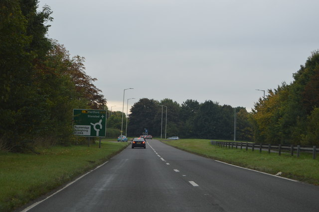
A10 approaching a roundabout The A10 runs 161 miles from London to King's Lynn. via Cambridge and Ely. 
<span class="nowrap"><a title="http://www.sabre-roads.org.uk/wiki/index.php?title=A10" rel="nofollow ugc noopener" href="http://www.sabre-roads.org.uk/wiki/index.php?title=A10">Link</a><img style="margin-left:2px;" alt="External link" title="External link - shift click to open in new window" src="https://s1.geograph.org.uk/img/external.png" width="10" height="10"/></span>
A10 approaching a roundabout Credit: N Chadwick

Broadfield Spring is a charming woodland located in Hertfordshire, England. Situated in the eastern part of the county, this natural gem covers an area of approximately 50 acres. The woodland is part of the larger Broadfield Wood and is beloved by locals and visitors alike for its tranquil and picturesque setting.

The forest is predominantly composed of broadleaf trees, including oak, beech, and hornbeam, which create a dense and verdant canopy. The ground beneath is covered in a rich carpet of wildflowers, ferns, and mosses, adding to the area's natural beauty. This diverse ecosystem provides a habitat for a wide range of wildlife, including various bird species, small mammals, and insects.

Broadfield Spring is particularly renowned for its stunning bluebell displays during the spring season. The woodland floor is transformed into a sea of vibrant blue, attracting photographers, nature enthusiasts, and families looking to enjoy a peaceful stroll amidst the picturesque scenery.

The woodland offers several well-maintained footpaths, allowing visitors to explore the area at their leisure. Along the trails, visitors may come across small streams, bridges, and even the occasional wooden sculpture, enhancing the overall experience.

Broadfield Spring is a popular destination for both local residents and tourists seeking a peaceful escape from the hustle and bustle of everyday life. Its natural beauty, tranquil atmosphere, and diverse wildlife make it an idyllic spot for nature lovers and those looking to reconnect with the great outdoors.

If you have any feedback on the listing, please let us know in the comments section below.

Broadfield Spring Images

Images are sourced within 2km of 51.885148/-0.001633187 or Grid Reference TL3722. Thanks to Geograph Open Source API. All images are credited.

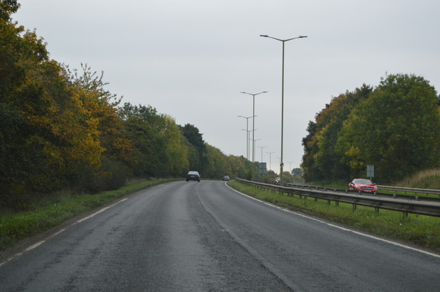
A10 approaching a roundabout The A10 runs 161 miles from London to King's Lynn. via Cambridge and Ely. 
<span class="nowrap"><a title="http://www.sabre-roads.org.uk/wiki/index.php?title=A10" rel="nofollow ugc noopener" href="http://www.sabre-roads.org.uk/wiki/index.php?title=A10">Link</a><img style="margin-left:2px;" alt="External link" title="External link - shift click to open in new window" src="https://s1.geograph.org.uk/img/external.png" width="10" height="10"/></span>
A10 approaching a roundabout
The A10 runs 161 miles from London to King's Lynn. via Cambridge and Ely. LinkExternal link
A10, Puckeridge bypass The A10 runs 161 miles from London to King's Lynn. via Cambridge and Ely. 
<span class="nowrap"><a title="http://www.sabre-roads.org.uk/wiki/index.php?title=A10" rel="nofollow ugc noopener" href="http://www.sabre-roads.org.uk/wiki/index.php?title=A10">Link</a><img style="margin-left:2px;" alt="External link" title="External link - shift click to open in new window" src="https://s1.geograph.org.uk/img/external.png" width="10" height="10"/></span>
A10, Puckeridge bypass
The A10 runs 161 miles from London to King's Lynn. via Cambridge and Ely. LinkExternal link
A10, end of Puckeridge bypass The A10 runs 161 miles from London to King's Lynn. via Cambridge and Ely. 
<span class="nowrap"><a title="http://www.sabre-roads.org.uk/wiki/index.php?title=A10" rel="nofollow ugc noopener" href="http://www.sabre-roads.org.uk/wiki/index.php?title=A10">Link</a><img style="margin-left:2px;" alt="External link" title="External link - shift click to open in new window" src="https://s1.geograph.org.uk/img/external.png" width="10" height="10"/></span>
A10, end of Puckeridge bypass
The A10 runs 161 miles from London to King's Lynn. via Cambridge and Ely. LinkExternal link
A10, southbound The A10 runs 161 miles from London to King's Lynn. via Cambridge and Ely. 
<span class="nowrap"><a title="http://www.sabre-roads.org.uk/wiki/index.php?title=A10" rel="nofollow ugc noopener" href="http://www.sabre-roads.org.uk/wiki/index.php?title=A10">Link</a><img style="margin-left:2px;" alt="External link" title="External link - shift click to open in new window" src="https://s1.geograph.org.uk/img/external.png" width="10" height="10"/></span>
A10, southbound
The A10 runs 161 miles from London to King's Lynn. via Cambridge and Ely. LinkExternal link
Bridge over the A10 The A10 runs 161 miles from London to King's Lynn. via Cambridge and Ely. 
<span class="nowrap"><a title="http://www.sabre-roads.org.uk/wiki/index.php?title=A10" rel="nofollow ugc noopener" href="http://www.sabre-roads.org.uk/wiki/index.php?title=A10">Link</a><img style="margin-left:2px;" alt="External link" title="External link - shift click to open in new window" src="https://s1.geograph.org.uk/img/external.png" width="10" height="10"/></span>
Bridge over the A10
The A10 runs 161 miles from London to King's Lynn. via Cambridge and Ely. LinkExternal link
The A10 The A10 runs 161 miles from London to King's Lynn. via Cambridge and Ely. 
<span class="nowrap"><a title="http://www.sabre-roads.org.uk/wiki/index.php?title=A10" rel="nofollow ugc noopener" href="http://www.sabre-roads.org.uk/wiki/index.php?title=A10">Link</a><img style="margin-left:2px;" alt="External link" title="External link - shift click to open in new window" src="https://s1.geograph.org.uk/img/external.png" width="10" height="10"/></span>
The A10
The A10 runs 161 miles from London to King's Lynn. via Cambridge and Ely. LinkExternal link
Attended petrol station on Cambridge Road, Puckeridge I was running very low and this was the first petrol station I found in over ten miles. They kept it attended as changing the pumps would cost too much, and charged about an extra 6p a litre to cover the labour costs.
Attended petrol station on Cambridge Road, Puckeridge
I was running very low and this was the first petrol station I found in over ten miles. They kept it attended as changing the pumps would cost too much, and charged about an extra 6p a litre to cover the labour costs.
Petrol station entrance on Cambridge Road, Puckeridge All I can say is it was a welcome sight as a public toilet would be.
Petrol station entrance on Cambridge Road, Puckeridge
All I can say is it was a welcome sight as a public toilet would be.
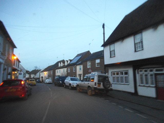
Dusk on Puckeridge High Street A typical old English village little changed from the day it was built.
Dusk on Puckeridge High Street
A typical old English village little changed from the day it was built.
Puckeridge High Street
The entrance to KB Tyres, Puckeridge
Trees by Ermine Street, Colliers End
Houses on Ermine Street, Colliers End These are the first houses coming in from the north. This is the original Roman road now bypassed by the newer A10.
Houses on Ermine Street, Colliers End
These are the first houses coming in from the north. This is the original Roman road now bypassed by the newer A10.
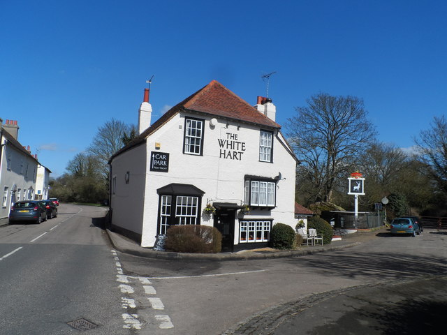
The White Hart Pub, Puckeridge Built in C17. See <span class="nowrap"><a title="http://www.britishlistedbuildings.co.uk/en-161073-the-white-hart-public-house-standon-hert#.Vvbd1OKLTIU" rel="nofollow ugc noopener" href="http://www.britishlistedbuildings.co.uk/en-161073-the-white-hart-public-house-standon-hert#.Vvbd1OKLTIU">Link</a><img style="margin-left:2px;" alt="External link" title="External link - shift click to open in new window" src="https://s1.geograph.org.uk/img/external.png" width="10" height="10"/></span> for entry in British Listed Buildings
The White Hart Pub, Puckeridge
Built in C17. See LinkExternal link for entry in British Listed Buildings
Show me another place!

Broadfield Spring is located at Grid Ref: TL3722 (Lat: 51.885148, Lng: -0.001633187)

Administrative County: Hertfordshire

District: East Hertfordshire

Police Authority: Hertfordshire

What 3 Words

///loaders.nuptials.flagpole. Near Puckeridge, Hertfordshire

Nearby Locations

Broadfield Spring

Related Wikis

St Edmund's College, Ware

St Edmund's College is a coeducational private day and boarding school in the British public school tradition, set in 440 acres (1.8 km2) in Ware, Hertfordshire...

Old Hall Green

Old Hall Green is a hamlet in Hertfordshire, England. At the 2011 Census the population was included in the civil parish of Standon. In 1793, an academy...

Standon Priory

Standon Priory was a priory in Essex, England. == References ==

Puckeridge

Puckeridge is a village in East Hertfordshire, England with a population of 3,561 (2011 Census). It is in the civil parish of Standon. == History == The...

East Hertfordshire

East Hertfordshire is one of ten local government districts in Hertfordshire, England. Its council is based in Hertford, the county town of Hertfordshire...

Standon railway station

Standon railway station served the village of Standon, Hertfordshire, England, from 1863 to 1965 on the Buntingford branch line. == History == The station...

Colliers End

Colliers End is a village in the civil parish of Standon, in the East Hertfordshire district, in Hertfordshire, England. It lies upon what was the A10...

Braughing (Roman town)

Braughing was a small town in the Roman province of Britannia. Its name in Latin is unknown. == Location == Today the site is partially occupied by the...

Nearby Amenities

Located within 500m of 51.885148,-0.001633187
Barrier: kissing_gate
Lat/Long: 51.8867665/0.00096
Crossing
Crossing: unmarked
Crossing Island: yes
Crossing Markings: no
Tactile Paving: yes
Lat/Long: 51.8822762/0.0011559
Maxspeed: 70 mph
Maxspeed Type: GB:nsl_dual
Traffic Sign: maxspeed
Traffic Sign Direction: forward
Lat/Long: 51.8848871/0.0054148
Material: wood
Power: pole
Lat/Long: 51.8858909/0.0047158
Power: pole
Lat/Long: 51.8843148/-0.0046666
Power: pole
Lat/Long: 51.8845234/-0.0016142
Power: pole
Lat/Long: 51.8844187/-0.003138
Power: pole
Lat/Long: 51.8842159/-0.0061418
Material: wood
Power: pole
Lat/Long: 51.8847499/0.0013949
Power: pole
Lat/Long: 51.8820711/-0.0058363
Material: wood
Power: pole
Lat/Long: 51.8848115/0.0022052
Power: pole
Lat/Long: 51.8840876/-0.0076441
Power: pole
Lat/Long: 51.8832664/-0.0060241
Material: wood
Power: pole
Lat/Long: 51.8846373/-0.0001286
Barrier: cycle_barrier
Lat/Long: 51.8821386/0.0013773
Crossing
Crossing: unmarked
Crossing Markings: no
Tactile Paving: yes
Lat/Long: 51.8822992/0.0009613
Artwork Type: graffiti
Tourism: artwork
Lat/Long: 51.8822197/0.002687
Inscription: 0° Meridian Millennium 2000 Standon Parish
Marker: yes
Lat/Long: 51.8826662/-0.0015153
Fixme: Needs survey, presumably to do with the prime meridian.
Marker: yes
Lat/Long: 51.8820825/-0.0015341
Traffic Calming: island
Lat/Long: 51.8822931/0.0010929
The data included in this document is from www.openstreetmap.org. The data is made available under ODbL.

Have you been to Broadfield Spring?

Leave your review of Broadfield Spring below (or comments, questions and feedback).