Rose Shaw

Wood, Forest in Sussex Mid Sussex

England

Rose Shaw

Yew Tree Cottage Listed buildings and structures are officially designated as being of special architectural, historical or cultural significance. There are over half a million listed structures in the United Kingdom, covered by around 375,000 listings.
Listed status is more commonly associated with buildings or groups of buildings, however it can cover many other structures, including bridges, headstones, steps, ponds, monuments, walls, phone boxes, wrecks, parks, and heritage sites, and in more recent times a road crossing (Abbey Road) and graffiti art (Banksy 'Spy-booth') have been included.

In England and Wales there are three main listing designations;
Grade I (2.5%) - exceptional interest, sometimes considered to be internationally important.
Grade II* (5.5%) - particularly important buildings of more than special interest. 
Grade II (92%) - nationally important and of special interest. 

There are also locally listed structures (at the discretion of local authorities) using A, B and C designations.

In Scotland three classifications are also used but the criteria are different. There are around 47,500 Listed buildings.
Category A (8%)- generally equivalent to Grade I and II* in England and Wales
Category B (51%)- this appears generally to cover the ground of Grade II, recognising national importance.
Category C (41%)- buildings of local importance, probably with some overlap with English Grade II.

In Northern Ireland the criteria are similar to Scotland, but the classifications are:
Grade A (2.3%)
Grade B+ (4.7%)
Grade B (93%)

Read more at Wikipedia <span class="nowrap"><a title="http://en.wikipedia.org/wiki/Listed_building" rel="nofollow ugc noopener" href="http://en.wikipedia.org/wiki/Listed_building">Link</a><img style="margin-left:2px;" alt="External link" title="External link - shift click to open in new window" src="https://s1.geograph.org.uk/img/external.png" width="10" height="10"/></span>
Yew Tree Cottage Credit: N Chadwick

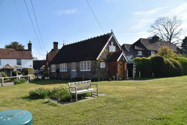
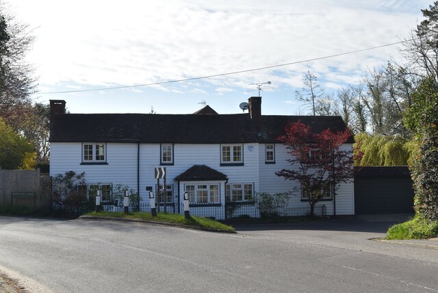
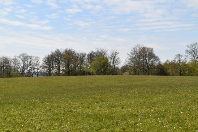
Rose Shaw is a charming and picturesque woodland located in Sussex, England. Nestled within the sprawling countryside, this forested area is known for its natural beauty and peaceful ambiance. Spanning over a vast expanse, Rose Shaw is an idyllic retreat for nature lovers, hikers, and those seeking solace in the tranquil surroundings.

The forest is characterized by its dense growth of tall, mature trees, primarily consisting of oak, beech, and chestnut varieties. These majestic trees create a lush canopy overhead, offering shade and shelter to the diverse flora and fauna that call Rose Shaw their home. The forest floor is adorned with a rich carpet of wildflowers, ferns, and mosses, adding to the enchanting atmosphere.

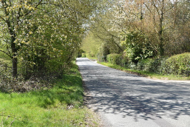
Visitors to Rose Shaw have the opportunity to explore an extensive network of well-marked trails that wind their way through the woodland. These paths cater to all levels of hiking ability, from leisurely strolls to more challenging treks. Along the way, hikers may encounter babbling brooks, small ponds, and even hidden waterfalls, adding to the allure of the forest.

The forest also provides a habitat for a wide range of wildlife, including deer, foxes, badgers, and various species of birds. Nature enthusiasts will delight in the chance to observe these creatures in their natural habitat, making Rose Shaw a popular spot for birdwatching and wildlife photography.

Overall, Rose Shaw in Sussex is a stunning woodland retreat, offering visitors an opportunity to immerse themselves in the beauty of nature. Whether it's for a peaceful walk, a chance to observe wildlife, or simply to enjoy the serenity of the forest, Rose Shaw is a must-visit destination for nature enthusiasts.

If you have any feedback on the listing, please let us know in the comments section below.
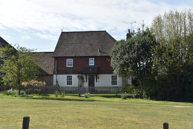
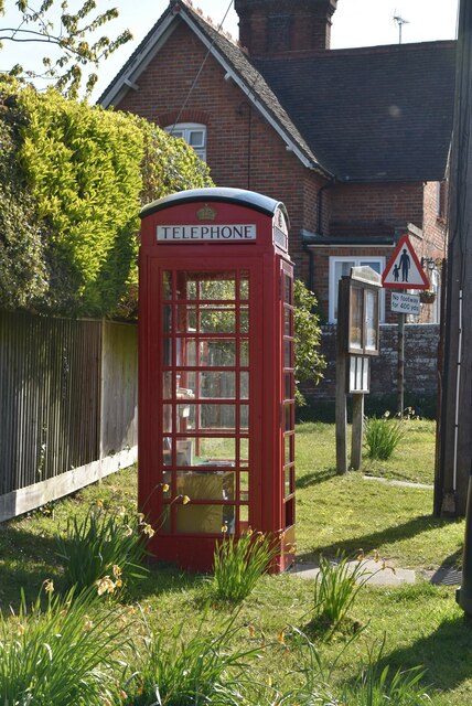
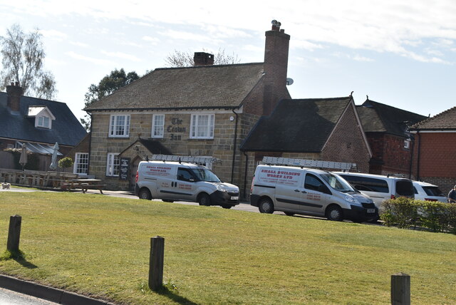
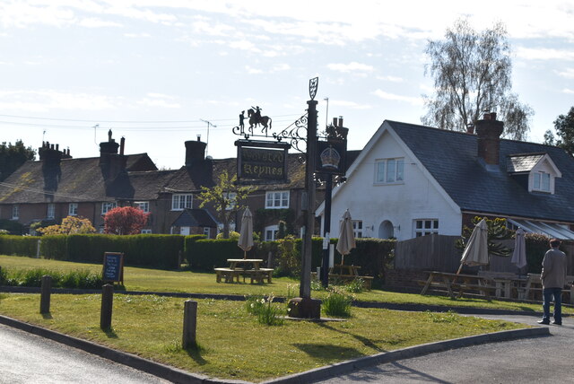
Rose Shaw Images

Images are sourced within 2km of 51.02261/-0.042102597 or Grid Reference TQ3726. Thanks to Geograph Open Source API. All images are credited.

Yew Tree Cottage Listed buildings and structures are officially designated as being of special architectural, historical or cultural significance. There are over half a million listed structures in the United Kingdom, covered by around 375,000 listings.
Listed status is more commonly associated with buildings or groups of buildings, however it can cover many other structures, including bridges, headstones, steps, ponds, monuments, walls, phone boxes, wrecks, parks, and heritage sites, and in more recent times a road crossing (Abbey Road) and graffiti art (Banksy 'Spy-booth') have been included.

In England and Wales there are three main listing designations;
Grade I (2.5%) - exceptional interest, sometimes considered to be internationally important.
Grade II* (5.5%) - particularly important buildings of more than special interest. 
Grade II (92%) - nationally important and of special interest. 

There are also locally listed structures (at the discretion of local authorities) using A, B and C designations.

In Scotland three classifications are also used but the criteria are different. There are around 47,500 Listed buildings.
Category A (8%)- generally equivalent to Grade I and II* in England and Wales
Category B (51%)- this appears generally to cover the ground of Grade II, recognising national importance.
Category C (41%)- buildings of local importance, probably with some overlap with English Grade II.

In Northern Ireland the criteria are similar to Scotland, but the classifications are:
Grade A (2.3%)
Grade B+ (4.7%)
Grade B (93%)

Read more at Wikipedia <span class="nowrap"><a title="http://en.wikipedia.org/wiki/Listed_building" rel="nofollow ugc noopener" href="http://en.wikipedia.org/wiki/Listed_building">Link</a><img style="margin-left:2px;" alt="External link" title="External link - shift click to open in new window" src="https://s1.geograph.org.uk/img/external.png" width="10" height="10"/></span>
Yew Tree Cottage
Listed buildings and structures are officially designated as being of special architectural, historical or cultural significance. There are over half a million listed structures in the United Kingdom, covered by around 375,000 listings. Listed status is more commonly associated with buildings or groups of buildings, however it can cover many other structures, including bridges, headstones, steps, ponds, monuments, walls, phone boxes, wrecks, parks, and heritage sites, and in more recent times a road crossing (Abbey Road) and graffiti art (Banksy 'Spy-booth') have been included. In England and Wales there are three main listing designations; Grade I (2.5%) - exceptional interest, sometimes considered to be internationally important. Grade II* (5.5%) - particularly important buildings of more than special interest. Grade II (92%) - nationally important and of special interest. There are also locally listed structures (at the discretion of local authorities) using A, B and C designations. In Scotland three classifications are also used but the criteria are different. There are around 47,500 Listed buildings. Category A (8%)- generally equivalent to Grade I and II* in England and Wales Category B (51%)- this appears generally to cover the ground of Grade II, recognising national importance. Category C (41%)- buildings of local importance, probably with some overlap with English Grade II. In Northern Ireland the criteria are similar to Scotland, but the classifications are: Grade A (2.3%) Grade B+ (4.7%) Grade B (93%) Read more at Wikipedia LinkExternal link
The Green Man Listed buildings and structures are officially designated as being of special architectural, historical or cultural significance. There are over half a million listed structures in the United Kingdom, covered by around 375,000 listings.
Listed status is more commonly associated with buildings or groups of buildings, however it can cover many other structures, including bridges, headstones, steps, ponds, monuments, walls, phone boxes, wrecks, parks, and heritage sites, and in more recent times a road crossing (Abbey Road) and graffiti art (Banksy 'Spy-booth') have been included.

In England and Wales there are three main listing designations;
Grade I (2.5%) - exceptional interest, sometimes considered to be internationally important.
Grade II* (5.5%) - particularly important buildings of more than special interest. 
Grade II (92%) - nationally important and of special interest. 

There are also locally listed structures (at the discretion of local authorities) using A, B and C designations.

In Scotland three classifications are also used but the criteria are different. There are around 47,500 Listed buildings.
Category A (8%)- generally equivalent to Grade I and II* in England and Wales
Category B (51%)- this appears generally to cover the ground of Grade II, recognising national importance.
Category C (41%)- buildings of local importance, probably with some overlap with English Grade II.

In Northern Ireland the criteria are similar to Scotland, but the classifications are:
Grade A (2.3%)
Grade B+ (4.7%)
Grade B (93%)

Read more at Wikipedia <span class="nowrap"><a title="http://en.wikipedia.org/wiki/Listed_building" rel="nofollow ugc noopener" href="http://en.wikipedia.org/wiki/Listed_building">Link</a><img style="margin-left:2px;" alt="External link" title="External link - shift click to open in new window" src="https://s1.geograph.org.uk/img/external.png" width="10" height="10"/></span>
The Green Man
Listed buildings and structures are officially designated as being of special architectural, historical or cultural significance. There are over half a million listed structures in the United Kingdom, covered by around 375,000 listings. Listed status is more commonly associated with buildings or groups of buildings, however it can cover many other structures, including bridges, headstones, steps, ponds, monuments, walls, phone boxes, wrecks, parks, and heritage sites, and in more recent times a road crossing (Abbey Road) and graffiti art (Banksy 'Spy-booth') have been included. In England and Wales there are three main listing designations; Grade I (2.5%) - exceptional interest, sometimes considered to be internationally important. Grade II* (5.5%) - particularly important buildings of more than special interest. Grade II (92%) - nationally important and of special interest. There are also locally listed structures (at the discretion of local authorities) using A, B and C designations. In Scotland three classifications are also used but the criteria are different. There are around 47,500 Listed buildings. Category A (8%)- generally equivalent to Grade I and II* in England and Wales Category B (51%)- this appears generally to cover the ground of Grade II, recognising national importance. Category C (41%)- buildings of local importance, probably with some overlap with English Grade II. In Northern Ireland the criteria are similar to Scotland, but the classifications are: Grade A (2.3%) Grade B+ (4.7%) Grade B (93%) Read more at Wikipedia LinkExternal link
Telephone kiosk Horsted Keynes is a village in the Mid Sussex District of West Sussex. It has a village green, two pubs, post office, village store & village hall.
Wikipedia: <span class="nowrap"><a title="https://en.wikipedia.org/wiki/Horsted_Keynes" rel="nofollow ugc noopener" href="https://en.wikipedia.org/wiki/Horsted_Keynes">Link</a><img style="margin-left:2px;" alt="External link" title="External link - shift click to open in new window" src="https://s1.geograph.org.uk/img/external.png" width="10" height="10"/></span>
Telephone kiosk
Horsted Keynes is a village in the Mid Sussex District of West Sussex. It has a village green, two pubs, post office, village store & village hall. Wikipedia: LinkExternal link
The Crown Inn The most popular pub name in the UK. Representative of the King or Queen.
The Crown Inn
The most popular pub name in the UK. Representative of the King or Queen.
Village sign
Village sign
Mission Hall, Horsted Keynes Horsted Keynes is a village in the Mid Sussex District of West Sussex. It has a village green, two pubs, post office, village store & village hall.
Wikipedia: <span class="nowrap"><a title="https://en.wikipedia.org/wiki/Horsted_Keynes" rel="nofollow ugc noopener" href="https://en.wikipedia.org/wiki/Horsted_Keynes">Link</a><img style="margin-left:2px;" alt="External link" title="External link - shift click to open in new window" src="https://s1.geograph.org.uk/img/external.png" width="10" height="10"/></span>
Mission Hall, Horsted Keynes
Horsted Keynes is a village in the Mid Sussex District of West Sussex. It has a village green, two pubs, post office, village store & village hall. Wikipedia: LinkExternal link
Hope Cottages Horsted Keynes is a village in the Mid Sussex District of West Sussex. It has a village green, two pubs, post office, village store & village hall.
Wikipedia: <span class="nowrap"><a title="https://en.wikipedia.org/wiki/Horsted_Keynes" rel="nofollow ugc noopener" href="https://en.wikipedia.org/wiki/Horsted_Keynes">Link</a><img style="margin-left:2px;" alt="External link" title="External link - shift click to open in new window" src="https://s1.geograph.org.uk/img/external.png" width="10" height="10"/></span>
Hope Cottages
Horsted Keynes is a village in the Mid Sussex District of West Sussex. It has a village green, two pubs, post office, village store & village hall. Wikipedia: LinkExternal link
Sussex Border Path The Sussex Border Path is a footpath route nearly 150 miles long around the inland boundary of the county of Sussex. The county owes its origins to the kingdom of the South Saxons and can claim to have one of the longest inland county boundaries from Emsworth to Rye. The route was devised in 1983 and is well signed along most of the route. Website <span class="nowrap"><a title="http://www.sussexborderpath.co.uk/" rel="nofollow ugc noopener" href="http://www.sussexborderpath.co.uk/">Link</a><img style="margin-left:2px;" alt="External link" title="External link - shift click to open in new window" src="https://s1.geograph.org.uk/img/external.png" width="10" height="10"/></span> 
Map: <a title="https://www.geograph.org.uk/search.php?i=40140109&page=1&displayclass=map#i=40140109&page=1&displayclass=map&zoom=2&lat=51.03263&lon=-0.05427&layers=FTTB00000000000T" href="https://www.geograph.org.uk/search.php?i=40140109&page=1&displayclass=map#i=40140109&page=1&displayclass=map&zoom=2&lat=51.03263&lon=-0.05427&layers=FTTB00000000000T">Link</a>
Sussex Border Path
The Sussex Border Path is a footpath route nearly 150 miles long around the inland boundary of the county of Sussex. The county owes its origins to the kingdom of the South Saxons and can claim to have one of the longest inland county boundaries from Emsworth to Rye. The route was devised in 1983 and is well signed along most of the route. Website LinkExternal link Map: Link
Kiln Wood
Kiln Wood
Cowstock Wood
Cowstock Wood
Cowstock Wood
Cowstock Wood
Sussex meadow
Sussex meadow
Garden Cottage
Garden Cottage
April Cottage
April Cottage
Cowstock Wood
Cowstock Wood
Freshfield Lane
Freshfield Lane
Freshfield Lane
Freshfield Lane
Sheep grazing
Sheep grazing
Show me another place!

Rose Shaw is located at Grid Ref: TQ3726 (Lat: 51.02261, Lng: -0.042102597)

Administrative County: West Sussex

District: Mid Sussex

Police Authority: Sussex

What 3 Words

///surprised.trending.relax. Near Horsted Keynes, West Sussex

Related Wikis

Freshfield Lane

Freshfield Lane is a 17-hectare (42-acre) geological Site of Special Scientific Interest east of Haywards Heath in West Sussex. It is a Geological Conservation...

Bluebell Railway

The Bluebell Railway is an 11 mi (17.7 km) heritage line almost entirely in West Sussex in England, except for Sheffield Park which is in East Sussex....

Horsted Keynes

Horsted Keynes KAYNZ is a village and civil parish in the Mid Sussex District of West Sussex, England. The village is about 5 miles (8 km) north east...

Forest Way

The Forest Way is a linear Country park providing walking, cycling, horse riding and the quiet enjoyment of the countryside. It runs for around 16 km...

Great Walstead School

Great Walstead School is a private day school for girls and boys between the ages of 2½ and 13 years with a Christian ethos. It has some 400 children in...

Lindfield & High Weald (electoral division)

Lindfield & High Weald is an electoral division of West Sussex in the United Kingdom, and returns one member to sit on West Sussex County Council. ��2...

St Giles' Church, Horsted Keynes

St Giles' Church is an Anglican church in the village of Horsted Keynes in Mid Sussex, one of seven local government districts in the English county of...

Eastern Road Nature Reserve

Eastern Road Nature Reserve is a 3.5-hectare (8.6-acre) Local Nature Reserve on the eastern outskirts of Haywards Heath in West Sussex. It is owned and...

Nearby Amenities

Located within 500m of 51.02261,-0.042102597
Railway: crossing
Lat/Long: 51.0197143/-0.0379239
Barrier: kissing_gate
Lat/Long: 51.020617/-0.0359284
Barrier: stile
Lat/Long: 51.0198857/-0.0378057
Barrier: stile
Lat/Long: 51.0198924/-0.0376874
The data included in this document is from www.openstreetmap.org. The data is made available under ODbL.

Have you been to Rose Shaw?

Leave your review of Rose Shaw below (or comments, questions and feedback).