Pancake Spring

Wood, Forest in Hertfordshire East Hertfordshire

England

Pancake Spring
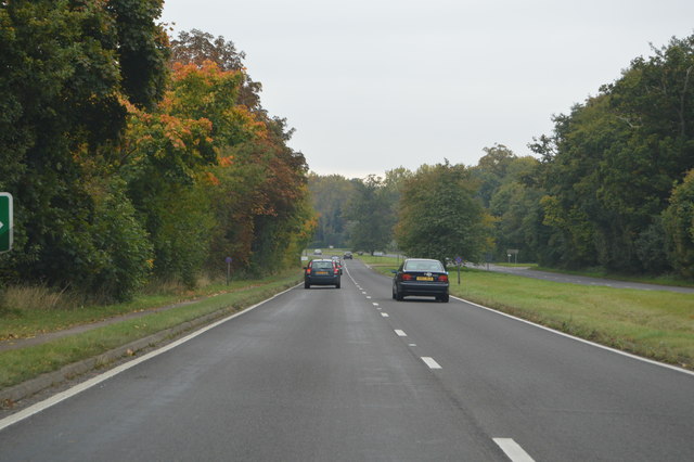
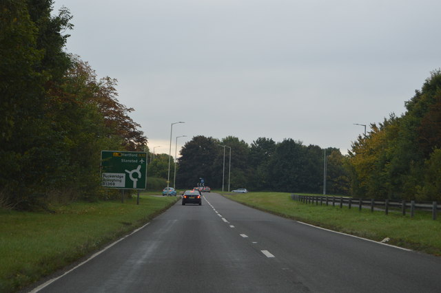
A10, southbound The A10 runs 161 miles from London to King's Lynn. via Cambridge and Ely. 
<span class="nowrap"><a title="http://www.sabre-roads.org.uk/wiki/index.php?title=A10" rel="nofollow ugc noopener" href="http://www.sabre-roads.org.uk/wiki/index.php?title=A10">Link</a><img style="margin-left:2px;" alt="External link" title="External link - shift click to open in new window" src="https://s1.geograph.org.uk/img/external.png" width="10" height="10"/></span>
A10, southbound Credit: N Chadwick

Pancake Spring is a charming woodland area located in Hertfordshire, England. Situated in the heart of the county, it is a popular destination for nature enthusiasts and families seeking a peaceful retreat. The woodland is characterized by its dense, lush trees, predominantly oak and beech, which provide a picturesque backdrop throughout the year.

Covering an area of approximately 50 acres, Pancake Spring boasts a diverse range of flora and fauna. The forest floor is carpeted with bluebells in the springtime, creating a breathtaking spectacle for visitors. The wood is also home to a variety of wildlife, including squirrels, rabbits, and a wide array of bird species, making it a haven for birdwatchers.

The woodland is intersected by a meandering stream, known as Pancake Spring, from which the area derives its name. This babbling brook not only adds to the tranquil atmosphere but also provides a habitat for various aquatic creatures. The stream is particularly popular with children who enjoy paddling and exploring the small pools and waterfalls along its course.

Pancake Spring offers a network of well-maintained walking trails, allowing visitors to fully immerse themselves in the natural beauty of the area. The paths wind through the woodland, offering glimpses of enchanting clearings and secluded picnic spots.

Managed by the local council, the woodland is easily accessible, with ample parking available nearby. Visitors are encouraged to follow the designated trails, respect the environment, and take their litter home with them.

Overall, Pancake Spring in Hertfordshire is a captivating woodland retreat, offering a peaceful respite from the hustle and bustle of everyday life.

If you have any feedback on the listing, please let us know in the comments section below.

Pancake Spring Images

Images are sourced within 2km of 51.889777/-0.004683134 or Grid Reference TL3723. Thanks to Geograph Open Source API. All images are credited.

A10, southbound The A10 runs 161 miles from London to King's Lynn. via Cambridge and Ely. 
<span class="nowrap"><a title="http://www.sabre-roads.org.uk/wiki/index.php?title=A10" rel="nofollow ugc noopener" href="http://www.sabre-roads.org.uk/wiki/index.php?title=A10">Link</a><img style="margin-left:2px;" alt="External link" title="External link - shift click to open in new window" src="https://s1.geograph.org.uk/img/external.png" width="10" height="10"/></span>
A10, southbound
The A10 runs 161 miles from London to King's Lynn. via Cambridge and Ely. LinkExternal link
A10 approaching a roundabout The A10 runs 161 miles from London to King's Lynn. via Cambridge and Ely. 
<span class="nowrap"><a title="http://www.sabre-roads.org.uk/wiki/index.php?title=A10" rel="nofollow ugc noopener" href="http://www.sabre-roads.org.uk/wiki/index.php?title=A10">Link</a><img style="margin-left:2px;" alt="External link" title="External link - shift click to open in new window" src="https://s1.geograph.org.uk/img/external.png" width="10" height="10"/></span>
A10 approaching a roundabout
The A10 runs 161 miles from London to King's Lynn. via Cambridge and Ely. LinkExternal link
A10, Puckeridge bypass The A10 runs 161 miles from London to King's Lynn. via Cambridge and Ely. 
<span class="nowrap"><a title="http://www.sabre-roads.org.uk/wiki/index.php?title=A10" rel="nofollow ugc noopener" href="http://www.sabre-roads.org.uk/wiki/index.php?title=A10">Link</a><img style="margin-left:2px;" alt="External link" title="External link - shift click to open in new window" src="https://s1.geograph.org.uk/img/external.png" width="10" height="10"/></span>
A10, Puckeridge bypass
The A10 runs 161 miles from London to King's Lynn. via Cambridge and Ely. LinkExternal link
A10, end of Puckeridge bypass The A10 runs 161 miles from London to King's Lynn. via Cambridge and Ely. 
<span class="nowrap"><a title="http://www.sabre-roads.org.uk/wiki/index.php?title=A10" rel="nofollow ugc noopener" href="http://www.sabre-roads.org.uk/wiki/index.php?title=A10">Link</a><img style="margin-left:2px;" alt="External link" title="External link - shift click to open in new window" src="https://s1.geograph.org.uk/img/external.png" width="10" height="10"/></span>
A10, end of Puckeridge bypass
The A10 runs 161 miles from London to King's Lynn. via Cambridge and Ely. LinkExternal link
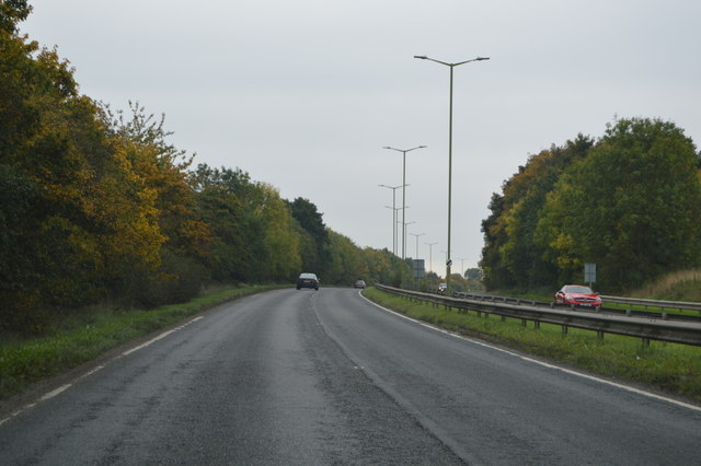
A10, southbound The A10 runs 161 miles from London to King's Lynn. via Cambridge and Ely. 
<span class="nowrap"><a title="http://www.sabre-roads.org.uk/wiki/index.php?title=A10" rel="nofollow ugc noopener" href="http://www.sabre-roads.org.uk/wiki/index.php?title=A10">Link</a><img style="margin-left:2px;" alt="External link" title="External link - shift click to open in new window" src="https://s1.geograph.org.uk/img/external.png" width="10" height="10"/></span>
A10, southbound
The A10 runs 161 miles from London to King's Lynn. via Cambridge and Ely. LinkExternal link
Bridge over the A10 The A10 runs 161 miles from London to King's Lynn. via Cambridge and Ely. 
<span class="nowrap"><a title="http://www.sabre-roads.org.uk/wiki/index.php?title=A10" rel="nofollow ugc noopener" href="http://www.sabre-roads.org.uk/wiki/index.php?title=A10">Link</a><img style="margin-left:2px;" alt="External link" title="External link - shift click to open in new window" src="https://s1.geograph.org.uk/img/external.png" width="10" height="10"/></span>
Bridge over the A10
The A10 runs 161 miles from London to King's Lynn. via Cambridge and Ely. LinkExternal link
Attended petrol station on Cambridge Road, Puckeridge I was running very low and this was the first petrol station I found in over ten miles. They kept it attended as changing the pumps would cost too much, and charged about an extra 6p a litre to cover the labour costs.
Attended petrol station on Cambridge Road, Puckeridge
I was running very low and this was the first petrol station I found in over ten miles. They kept it attended as changing the pumps would cost too much, and charged about an extra 6p a litre to cover the labour costs.
Petrol station entrance on Cambridge Road, Puckeridge All I can say is it was a welcome sight as a public toilet would be.
Petrol station entrance on Cambridge Road, Puckeridge
All I can say is it was a welcome sight as a public toilet would be.
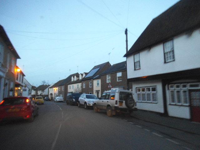
Dusk on Puckeridge High Street A typical old English village little changed from the day it was built.
Dusk on Puckeridge High Street
A typical old English village little changed from the day it was built.
Puckeridge High Street
The entrance to KB Tyres, Puckeridge
Trees by Ermine Street, Colliers End
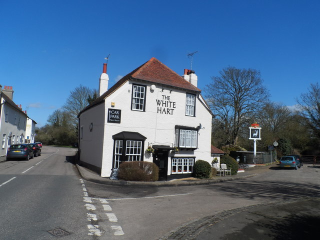
The White Hart Pub, Puckeridge Built in C17. See <span class="nowrap"><a title="http://www.britishlistedbuildings.co.uk/en-161073-the-white-hart-public-house-standon-hert#.Vvbd1OKLTIU" rel="nofollow ugc noopener" href="http://www.britishlistedbuildings.co.uk/en-161073-the-white-hart-public-house-standon-hert#.Vvbd1OKLTIU">Link</a><img style="margin-left:2px;" alt="External link" title="External link - shift click to open in new window" src="https://s1.geograph.org.uk/img/external.png" width="10" height="10"/></span> for entry in British Listed Buildings
The White Hart Pub, Puckeridge
Built in C17. See LinkExternal link for entry in British Listed Buildings
Show me another place!

Pancake Spring is located at Grid Ref: TL3723 (Lat: 51.889777, Lng: -0.004683134)

Administrative County: Hertfordshire

District: East Hertfordshire

Police Authority: Hertfordshire

What 3 Words

///stalemate.saddens.define. Near Puckeridge, Hertfordshire

Related Wikis

St Edmund's College, Ware

St Edmund's College is a coeducational private day and boarding school in the British public school tradition, set in 440 acres (1.8 km2) in Ware, Hertfordshire...

Standon Priory

Standon Priory was a priory in Essex, England. == References ==

Old Hall Green

Old Hall Green is a hamlet in Hertfordshire, England. At the 2011 Census the population was included in the civil parish of Standon. In 1793, an academy...

Puckeridge

Puckeridge is a village in East Hertfordshire, England with a population of 3,561 (2011 Census). It is in the civil parish of Standon. == History == The...

Nearby Amenities

Located within 500m of 51.889777,-0.004683134
Barrier: kissing_gate
Lat/Long: 51.8922991/-0.0066648
Barrier: kissing_gate
Lat/Long: 51.891996/-0.0037251
Barrier: kissing_gate
Lat/Long: 51.8922679/-0.0010252
Barrier: kissing_gate
Lat/Long: 51.8920435/-0.0039283
The data included in this document is from www.openstreetmap.org. The data is made available under ODbL.

Have you been to Pancake Spring?

Leave your review of Pancake Spring below (or comments, questions and feedback).