Dean Shaw

Wood, Forest in Surrey Tandridge

England

Dean Shaw

Posterngate Farm, South Godstone, Surrey Part of the extensive grounds of Posterngate Farm, where the many activities include the maintenance of a herd of pedigree Charollais, and a lake for trout fishing.  There is even a small business park.  
And this photograph 'wraps up' the TQ34 hectad, of which I have claimed 48 first geographs.
Posterngate Farm, South Godstone, Surrey Credit: Dr Neil Clifton

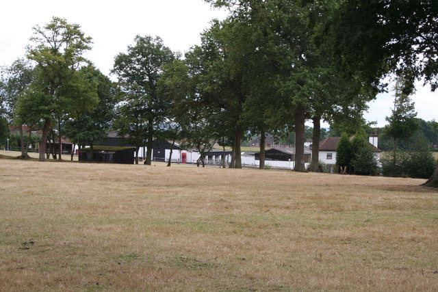
Dean Shaw is a picturesque woodland area located in Surrey, England. It is a part of the larger Surrey (Wood, Forest) and is known for its natural beauty and serene atmosphere. The wood is situated near the village of Shamley Green and covers an area of approximately 100 acres.

Dean Shaw is primarily composed of deciduous trees, such as oak, beech, and birch, which create a stunning canopy during the spring and summer months. The wood is also home to a diverse range of wildlife, including deer, foxes, squirrels, and various species of birds.

The wood offers a tranquil escape for residents and visitors alike, with numerous walking trails and paths that wind through the trees. These paths provide opportunities for leisurely strolls, jogging, or simply immersing oneself in the natural surroundings. There are also designated picnic areas where visitors can relax and enjoy a meal in the great outdoors.

Dean Shaw has a rich history, dating back centuries. It has been used for timber production, hunting, and recreation over the years. Today, it is managed by the local council, ensuring the preservation of its natural heritage and maintaining its accessibility to the public.

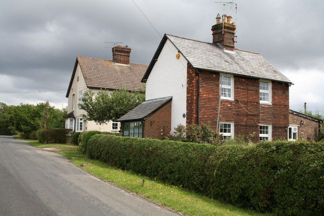
The wood is easily accessible by car and public transport, with parking facilities available nearby. It is a popular destination for nature enthusiasts, families, and those seeking a peaceful retreat from the bustling city life. Whether it is for a leisurely walk, birdwatching, or simply enjoying the beauty of nature, Dean Shaw offers a truly enchanting experience for all who visit.

If you have any feedback on the listing, please let us know in the comments section below.

Dean Shaw Images

Images are sourced within 2km of 51.236941/-0.037114017 or Grid Reference TQ3750. Thanks to Geograph Open Source API. All images are credited.

Posterngate Farm, South Godstone, Surrey Part of the extensive grounds of Posterngate Farm, where the many activities include the maintenance of a herd of pedigree Charollais, and a lake for trout fishing.  There is even a small business park.  
And this photograph 'wraps up' the TQ34 hectad, of which I have claimed 48 first geographs.
Posterngate Farm, South Godstone, Surrey
Part of the extensive grounds of Posterngate Farm, where the many activities include the maintenance of a herd of pedigree Charollais, and a lake for trout fishing. There is even a small business park. And this photograph 'wraps up' the TQ34 hectad, of which I have claimed 48 first geographs.
Piper's Wood  and Oilseed Rape Field A field of ripe oilseed rape can be seen in the foreground with Piper's wood behind.
Piper's Wood and Oilseed Rape Field
A field of ripe oilseed rape can be seen in the foreground with Piper's wood behind.
Nursery Cottage, Gibbs Brook Lane, Surrey. Nursery Cottage is the nearer of these two houses on the east side of Gibbs Brook Lane, near its north end.  The other house is King's Green.
Nursery Cottage, Gibbs Brook Lane, Surrey.
Nursery Cottage is the nearer of these two houses on the east side of Gibbs Brook Lane, near its north end. The other house is King's Green.
Oast House at Newhouse Farm, Tandridge Lane, Tandridge, Surrey Twin round kiln oast house, converted to home. The majority of the conical roofs are missing along with cowls.
Oast House at Newhouse Farm, Tandridge Lane, Tandridge, Surrey
Twin round kiln oast house, converted to home. The majority of the conical roofs are missing along with cowls.
Approach to Tandridge Lane - Southlands Lane junction The road sign shows the main route to bend to the right with a side road to the left. Tandridge Lane is in the foreground - it then turns left, and the main route bends right to become Southlands Lane. The junction has been remodelled at some time - formerly the side branch was to the right and Tandridge Lane was the through route.
Approach to Tandridge Lane - Southlands Lane junction
The road sign shows the main route to bend to the right with a side road to the left. Tandridge Lane is in the foreground - it then turns left, and the main route bends right to become Southlands Lane. The junction has been remodelled at some time - formerly the side branch was to the right and Tandridge Lane was the through route.
Cottages, Chathill A rather isolated row of cottages.
Cottages, Chathill
A rather isolated row of cottages.
At the junction New Road meets Miles Lane. Paygate Wood is ahead.
At the junction
New Road meets Miles Lane. Paygate Wood is ahead.
Cottages on Hart's Lane Handily placed for the pub - just round the corner to the Fox and Hounds on Tilburstow Hill Road.
Cottages on Hart's Lane
Handily placed for the pub - just round the corner to the Fox and Hounds on Tilburstow Hill Road.
The road going north-east from Chathill
Surrey:  The A22 at Harts Hill Continuous heavy traffic passes along this part of the A22.  Here we are looking northwards.
Surrey: The A22 at Harts Hill
Continuous heavy traffic passes along this part of the A22. Here we are looking northwards.
The Fox and Hounds, South Godstone Although somewhat remote from South Godstone village, this attractive pub seemed to be doing a thriving trade on a weekday lunchtime. Daffodils have appeared along the fence - some of the first to be seen in this unusually late spring.
The Fox and Hounds, South Godstone
Although somewhat remote from South Godstone village, this attractive pub seemed to be doing a thriving trade on a weekday lunchtime. Daffodils have appeared along the fence - some of the first to be seen in this unusually late spring.
Harts Lane, South Godstone Looking along Harts Lane, towards the A22 and South Godstone village, from its junction with Tilburstow Hill Road.
Harts Lane, South Godstone
Looking along Harts Lane, towards the A22 and South Godstone village, from its junction with Tilburstow Hill Road.
Footpath towards South Godstone A decrepit gateway marks the start of this path leading down from Tilburstowhill Common to the A22.
Footpath towards South Godstone
A decrepit gateway marks the start of this path leading down from Tilburstowhill Common to the A22.
Eastbourne Road, Godstone
Eastbourne Road, South Godstone
Houses on Miles Lane, Chathill
Show me another place!

Dean Shaw is located at Grid Ref: TQ3750 (Lat: 51.236941, Lng: -0.037114017)

Administrative County: Surrey

District: Tandridge

Police Authority: Surrey

What 3 Words

///jazz.flip.table. Near Godstone, Surrey

Related Wikis

Tandridge

Tandridge is a village and civil parish in the Tandridge District, in the county of Surrey, England. Its nucleus is on a rise of the Greensand Ridge between...

Godstone Ponds

Godstone Ponds is a 13.6-hectare (34-acre) biological Site of Special Scientific Interest in Godstone in Surrey. Bay Pond is an educational nature reserve...

Tandridge Hundred

Tandridge Hundred was a hundred in Surrey, England. It comprised areas in the Tandridge District, the easternmost part of the county, bordering Kent, West...

Bay Pond

Bay Pond is a 7-hectare (17-acre) nature reserve in Godstone in Surrey. It is managed by the Surrey Wildlife Trust. It is part of Godstone Ponds Site...

Godstone

Godstone is a village and civil parish in the Tandridge District of Surrey, England. It is 6 miles (9.7 km) east of Reigate, 3 miles (4.8 km) west of Oxted...

Tilburstow Hill

Tilburstow Hill is a 9-hectare (22-acre) nature reserve south-east of Godstone in Surrey. It is managed by the Surrey Wildlife Trust.This is a semi-natural...

A25 road

The A25 road is an east–west main road in the South-East of England. Its carries traffic east from Guildford, Surrey, eastward through Surrey and into...

Godstone railway station

Godstone railway station is on the Redhill to Tonbridge Line and serves Godstone in Surrey, England. It is 28 miles 13 chains (28.16 miles, 45.32 km) measured...

Nearby Amenities

Located within 500m of 51.236941,-0.037114017
Tandridge
Place: village
Source: npe
Lat/Long: 51.2393372/-0.0344318
Tandridge Hall
Building: yes
Source: npe
Lat/Long: 51.2362333/-0.0322476
Barrier: stile
Lat/Long: 51.2354502/-0.0351415
Barrier: stile
Lat/Long: 51.2345267/-0.0374688
Barrier: kissing_gate
Lat/Long: 51.2394969/-0.0327118
Post Box
Collection Times: Mo-Fr 17:30; Sa 07:30
Operator: Royal Mail
Post Box Mounting: pier
Post Box Type: lamp
Ref: RH8 107
Royal Cypher: EIIR
Royal Cypher Wikidata: Q33102113
Lat/Long: 51.2401357/-0.0346139
Barrier: stile
Lat/Long: 51.2341232/-0.0383695
Barrier: stile
Lat/Long: 51.2343679/-0.0379304
Barrier: stile
Lat/Long: 51.2343835/-0.0378225
Power: pole
Source: Bing
Lat/Long: 51.2360851/-0.0415769
Power: pole
Source: Bing
Lat/Long: 51.2363353/-0.0395143
Power: pole
Source: Bing
Lat/Long: 51.236248/-0.0421885
Power: pole
Source: Bing
Lat/Long: 51.2357072/-0.0404236
Power: pole
Source: Bing
Lat/Long: 51.2335475/-0.0369072
Power: pole
Source: Bing
Lat/Long: 51.2328354/-0.0363278
Priority: backward
Traffic Calming: choker
Lat/Long: 51.237041/-0.0349324
Waste Basket
Source: gps
Waste: dog_excrement
Lat/Long: 51.2354763/-0.035027
Colour: white
Marker: stile
Utility: oil
Lat/Long: 51.2344378/-0.0430421
The data included in this document is from www.openstreetmap.org. The data is made available under ODbL.

Have you been to Dean Shaw?

Leave your review of Dean Shaw below (or comments, questions and feedback).