Bradford Wood

Wood, Forest in Surrey Tandridge

England

Bradford Wood

Posterngate Farm, South Godstone, Surrey Part of the extensive grounds of Posterngate Farm, where the many activities include the maintenance of a herd of pedigree Charollais, and a lake for trout fishing.  There is even a small business park.  
And this photograph 'wraps up' the TQ34 hectad, of which I have claimed 48 first geographs.
Posterngate Farm, South Godstone, Surrey Credit: Dr Neil Clifton

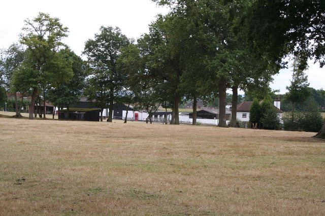
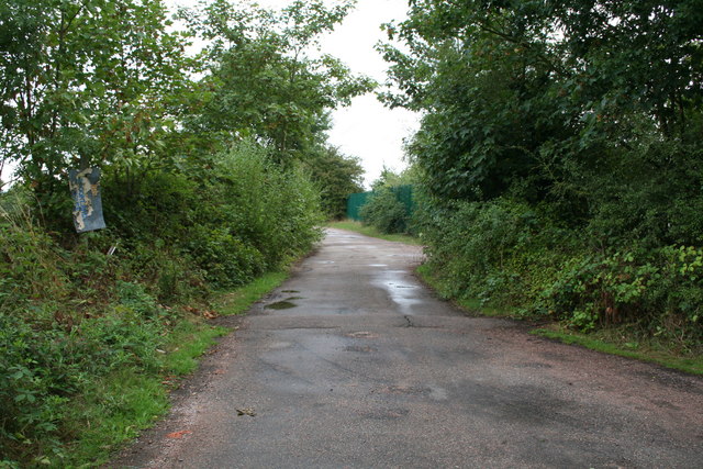
Bradford Wood is a picturesque natural area located in Surrey, England. Covering an extensive area, it is renowned for its dense forest and pristine woodlands. The wood is part of the larger Surrey Hills Area of Outstanding Natural Beauty, which showcases the stunning landscapes and rich biodiversity of the region.

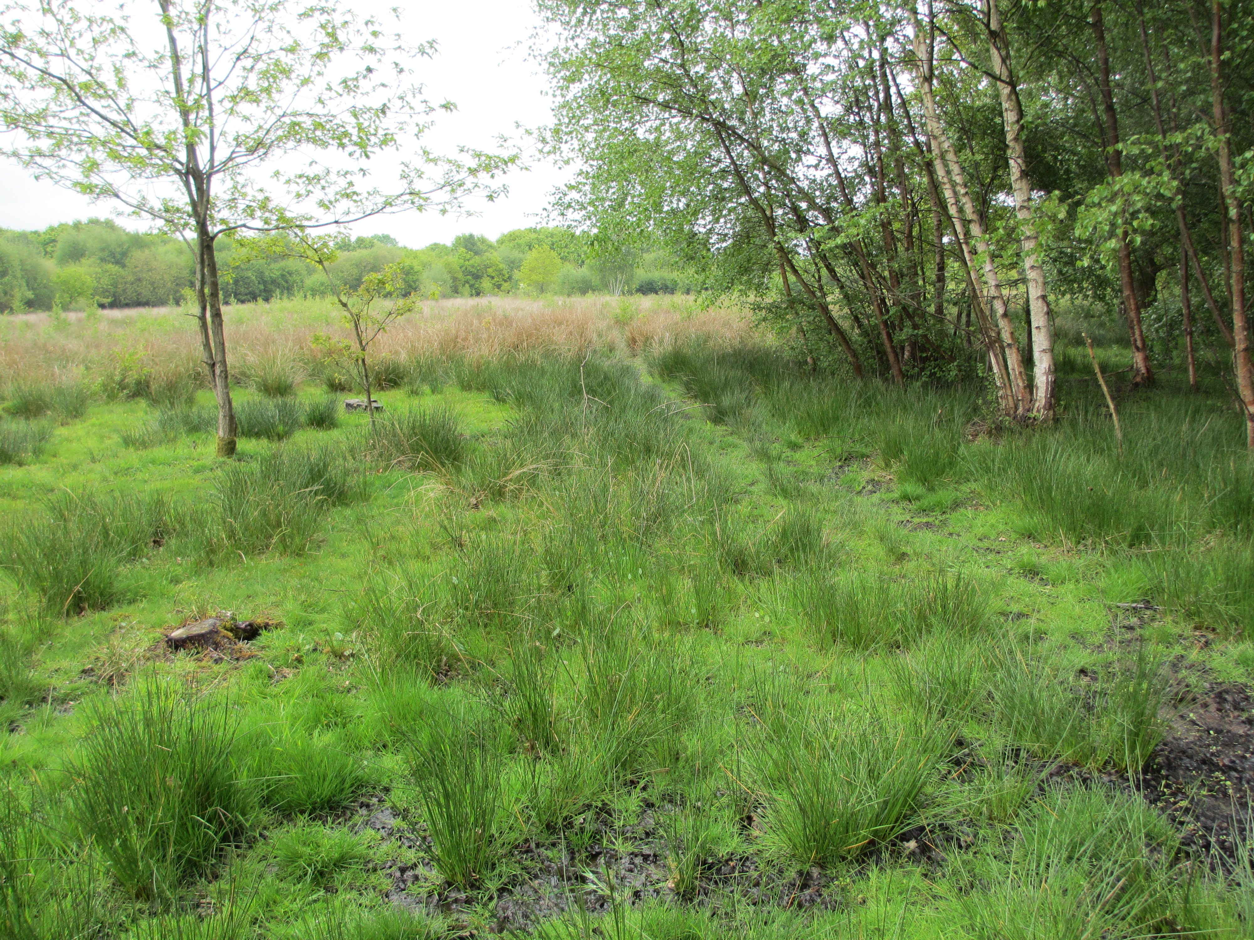
The wood is characterized by its diverse range of tree species, including oak, birch, beech, and pine. These trees create a lush canopy that provides a habitat for a variety of wildlife, such as deer, foxes, birds, and numerous insects. The wood is a popular destination for nature enthusiasts, hikers, and photographers who are captivated by its tranquil atmosphere and stunning scenery.

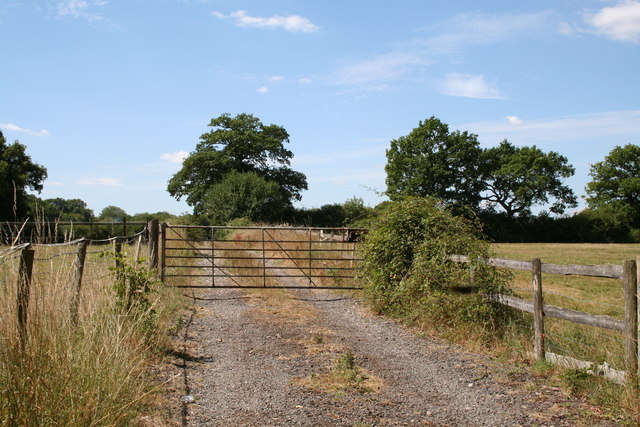
Visitors can explore the wood through a network of well-maintained paths and trails that wind their way through the forest. These routes offer a chance to immerse oneself in the natural beauty of the area and discover hidden gems, such as secluded ponds and meadows bursting with wildflowers. The wood also features several picnic spots, allowing visitors to relax and enjoy the peaceful surroundings.

In addition to its natural wonders, Bradford Wood holds historical significance. It is believed to have been part of the hunting grounds for nobility during the medieval period and has remnants of ancient earthworks and pathways. The wood has been preserved over the years, and efforts have been made to protect and conserve its valuable ecosystem.

Overall, Bradford Wood in Surrey is a captivating destination that offers an escape from the hustle and bustle of everyday life. Its lush forests, diverse wildlife, and rich history make it a must-visit location for those seeking a connection with nature and a glimpse into the region's past.

If you have any feedback on the listing, please let us know in the comments section below.

Bradford Wood Images

Images are sourced within 2km of 51.209251/-0.041355537 or Grid Reference TQ3647. Thanks to Geograph Open Source API. All images are credited.

Posterngate Farm, South Godstone, Surrey Part of the extensive grounds of Posterngate Farm, where the many activities include the maintenance of a herd of pedigree Charollais, and a lake for trout fishing.  There is even a small business park.  
And this photograph 'wraps up' the TQ34 hectad, of which I have claimed 48 first geographs.
Posterngate Farm, South Godstone, Surrey
Part of the extensive grounds of Posterngate Farm, where the many activities include the maintenance of a herd of pedigree Charollais, and a lake for trout fishing. There is even a small business park. And this photograph 'wraps up' the TQ34 hectad, of which I have claimed 48 first geographs.
South Godstone South Godstone is 3 miles south of Godstone village and developed when the Tonbridge railway line was built in the 19th century.
South Godstone
South Godstone is 3 miles south of Godstone village and developed when the Tonbridge railway line was built in the 19th century.
Railway Bridge Crowhurst Lane End railway bridge has a narrow width hence the traffic lights. The Brickmakers Arms Pub is just past the bridge.
Railway Bridge
Crowhurst Lane End railway bridge has a narrow width hence the traffic lights. The Brickmakers Arms Pub is just past the bridge.
Piper's Wood  and Oilseed Rape Field A field of ripe oilseed rape can be seen in the foreground with Piper's wood behind.
Piper's Wood and Oilseed Rape Field
A field of ripe oilseed rape can be seen in the foreground with Piper's wood behind.
Footpath across railway line Footpath crossing the Tonbridge to Redhill railway line.
Footpath across railway line
Footpath crossing the Tonbridge to Redhill railway line.
S K Camping and Leisure, Anglefield Corner, Surrey On the A22 south of Godstone.  A vast range of equipment for the outdoor holiday enthusiast. There is also a garden centre adjoining.
S K Camping and Leisure, Anglefield Corner, Surrey
On the A22 south of Godstone. A vast range of equipment for the outdoor holiday enthusiast. There is also a garden centre adjoining.
The road to Nowhere, Surrey Surprisingly this lane does not appear in any form at all on the 1:25000 map, nor is there any indication of anywhere it could serve.  The gate is firmly padlocked.  No farm stock or arable crop is visible.
The road to Nowhere, Surrey
Surprisingly this lane does not appear in any form at all on the 1:25000 map, nor is there any indication of anywhere it could serve. The gate is firmly padlocked. No farm stock or arable crop is visible.
Houses in Terra Cotta Road, Surrey Terra Cotta Road leads westwards off Tilburstow Hill Road.  It continues past these houses to end in a small business park.  These houses are probably the nearest you will get to 'affordable' houses in the Godstone area - but you will get a shock if you enquire the price.
Houses in Terra Cotta Road, Surrey
Terra Cotta Road leads westwards off Tilburstow Hill Road. It continues past these houses to end in a small business park. These houses are probably the nearest you will get to 'affordable' houses in the Godstone area - but you will get a shock if you enquire the price.
Little Chef restaurant, South Godstone, Surrey On the west side of the A22.
I suppose some people must actually eat in these establishments, otherwise they would not be there.
Little Chef restaurant, South Godstone, Surrey
On the west side of the A22. I suppose some people must actually eat in these establishments, otherwise they would not be there.
Road and public footpath near Blindley Heath, Surrey This footpath is the southern leg of a group of paths which link the A22 eastwards across to Tandridge Lane.  The path is metalled at the western end to give access to a small number of properties.
Road and public footpath near Blindley Heath, Surrey
This footpath is the southern leg of a group of paths which link the A22 eastwards across to Tandridge Lane. The path is metalled at the western end to give access to a small number of properties.
Ancient barn, Blackgrove Farm, Surrey. On the east side of Tandridge Lane.  Parts of this barn, which is still in use, date from around 1490.
Ancient barn, Blackgrove Farm, Surrey.
On the east side of Tandridge Lane. Parts of this barn, which is still in use, date from around 1490.
Buttons Mead Farm,  Tandridge Lane, Surrey All is in apple-pie order at Buttons Mead, where horse rearing is an important activity.
Buttons Mead Farm, Tandridge Lane, Surrey
All is in apple-pie order at Buttons Mead, where horse rearing is an important activity.
Ponies near Crowhurst Lane, Surrey A sharp shower of rain had just begun as we reached these friendly ponies being groomed in a field not far south of Crowhurst Lane.
Ponies near Crowhurst Lane, Surrey
A sharp shower of rain had just begun as we reached these friendly ponies being groomed in a field not far south of Crowhurst Lane.
Pumping station This building would appear to have no door and no window.  It is surrounded by high-security fencing through which I had to poke the camera to take the photograph.
Pumping station
This building would appear to have no door and no window. It is surrounded by high-security fencing through which I had to poke the camera to take the photograph.
Godstone Station, Surrey
The Lagham Public House, Eastbourne Road, South Godstone, Surrey
Eastbourne Road, South Godstone
Cottages, Chathill A rather isolated row of cottages.
Cottages, Chathill
A rather isolated row of cottages.
Show me another place!

Bradford Wood is located at Grid Ref: TQ3647 (Lat: 51.209251, Lng: -0.041355537)

Administrative County: Surrey

District: Tandridge

Police Authority: Surrey

What 3 Words

///slot.donor.reform. Near Blindley Heath, Surrey

Nearby Locations

Bradford Wood

Related Wikis

Godstone railway station

Godstone railway station is on the Redhill to Tonbridge Line and serves Godstone in Surrey, England. It is 28 miles 13 chains (28.16 miles, 45.32 km) measured...

Crowhurst Place

Crowhurst Place, Crowhurst, Surrey, England is a medieval hall house dating from the early 15th century. In the 20th century, the house was reconstructed...

Crowhurst Yew

The Crowhurst Yew is a yew tree in the churchyard of St George's Church in Crowhurst, Surrey, England. It is thought to be about 4,000 years old. Its girth...

Crowhurst, Surrey

Crowhurst is a village and civil parish in the Tandridge district of Surrey, England. The nearest town is Oxted, 3 miles (5 km) to the north. Rated two...

Blindley Heath SSSI

Blindley Heath SSSI is a 26.3-hectare (65-acre) biological Site of Special Scientific Interest in the hamlet Blindley Heath, on the southern outskirts...

Tandridge

Tandridge is a village and civil parish in the Tandridge District, in the county of Surrey, England. Its nucleus is on a rise of the Greensand Ridge between...

Tilburstow Hill

Tilburstow Hill is a 9-hectare (22-acre) nature reserve south-east of Godstone in Surrey. It is managed by the Surrey Wildlife Trust.This is a semi-natural...

Lingfield F.C.

Lingfield Football Club are a football club based in the village of Lingfield, near East Grinstead, Surrey, England. The club is affiliated to the Surrey...

Nearby Amenities

Located within 500m of 51.209251,-0.041355537
Lagham Lodge
Building: yes
Source: npe
Lat/Long: 51.2116635/-0.0389114
Barrier: kissing_gate
Lat/Long: 51.2101656/-0.0344172
Turning Circle
Lat/Long: 51.2060065/-0.0366936
Power: pole
Lat/Long: 51.2069473/-0.0463539
Power: pole
Lat/Long: 51.2078076/-0.0462708
Power: pole
Lat/Long: 51.2086529/-0.0461742
Power: pole
Lat/Long: 51.2095434/-0.0461474
Power: pole
Lat/Long: 51.2105936/-0.045619
Power: pole
Lat/Long: 51.2126284/-0.0447366
Power: pole
Lat/Long: 51.2116388/-0.0451496
The data included in this document is from www.openstreetmap.org. The data is made available under ODbL.

Have you been to Bradford Wood?

Leave your review of Bradford Wood below (or comments, questions and feedback).