Little Church Wood

Wood, Forest in Surrey Tandridge

England

Little Church Wood

Radio masts and reservoir A familiar sight when driving south out of Warlingham down towards Oxted. The ridge of the North Downs has numerous radio masts, dating back to WWII.
Radio masts and reservoir Credit: Nigel Freeman

Little Church Wood is a picturesque woodland located in Surrey, England. Nestled within the Surrey Hills area of outstanding natural beauty, this enchanting forest offers visitors a tranquil escape from the hustle and bustle of everyday life.

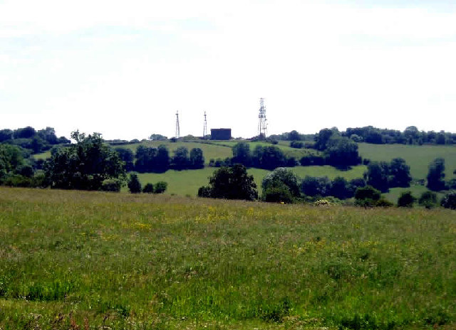
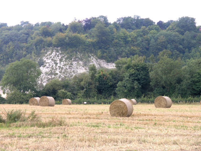
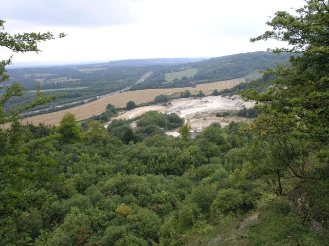
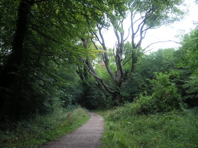
Covering an area of approximately 30 acres, Little Church Wood is renowned for its diverse range of tree species, including oak, beech, and ash. These majestic trees provide a stunning backdrop for nature enthusiasts and photographers alike. The forest floor is adorned with a rich carpet of bluebells during springtime, creating a breathtaking sight and attracting a plethora of wildlife.

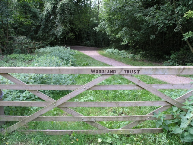
The wood is intersected by a network of well-maintained footpaths, allowing visitors to explore its hidden gems at their leisure. These pathways wind their way through the forest, leading to charming clearings and secluded spots perfect for picnics or simply enjoying the serenity of nature. A small stream meanders through the wood, adding to its idyllic charm.

Little Church Wood is also home to a variety of wildlife, with sightings of deer, foxes, and numerous bird species being common. It serves as an important habitat for many woodland creatures, offering shelter and sustenance in its lush surroundings.

Managed by the local council, the woodland is accessible to the public free of charge. It is a popular destination for families, walkers, and nature lovers, who can enjoy the beauty of the forest throughout the year. Whether one seeks a peaceful stroll, a place for outdoor activities, or simply a tranquil retreat, Little Church Wood provides an enchanting experience for all who visit.

If you have any feedback on the listing, please let us know in the comments section below.

Little Church Wood Images

Images are sourced within 2km of 51.279959/-0.038965892 or Grid Reference TQ3655. Thanks to Geograph Open Source API. All images are credited.

Radio masts and reservoir A familiar sight when driving south out of Warlingham down towards Oxted. The ridge of the North Downs has numerous radio masts, dating back to WWII.
Radio masts and reservoir
A familiar sight when driving south out of Warlingham down towards Oxted. The ridge of the North Downs has numerous radio masts, dating back to WWII.
Woldingham Station CR3 Situated 700 feet above sea level on top of the North Downs, Woldingham is in a recognised area of natural beauty. The station is on the line which connects East Grinstead with London, opened in 1884 as the Croydon, Oxted and East Grinstead Railway.
Woldingham Station CR3
Situated 700 feet above sea level on top of the North Downs, Woldingham is in a recognised area of natural beauty. The station is on the line which connects East Grinstead with London, opened in 1884 as the Croydon, Oxted and East Grinstead Railway.
Hay Fields with the North Downs in the background The hay has been collected ready for storage.  In the background a quarry can be seen cutting into the North Downs.
Hay Fields with the North Downs in the background
The hay has been collected ready for storage. In the background a quarry can be seen cutting into the North Downs.
Quarry, looking down from the top Looking down from the edge of the quarry that occupies much of this square.
Quarry, looking down from the top
Looking down from the edge of the quarry that occupies much of this square.
North Downs Golf Course This seat commands a good view of several of the greens on the North Downs Golf Course
North Downs Golf Course
This seat commands a good view of several of the greens on the North Downs Golf Course
Woodland Footpath, part of the Woldingham Country Walk This footpath is managed by the Woodlands Trust and is about 5.5 miles of walk ending up in Woldingham station.
Woodland Footpath, part of the Woldingham Country Walk
This footpath is managed by the Woodlands Trust and is about 5.5 miles of walk ending up in Woldingham station.
Marlesdon Park footpath A public footpath that runs through Marlesdon Park.  Marlesdon Park was a barren stretch of land until Sir Robert Claydon, the Lord Mayer of London (1679-80) built his home and estate there, planting many trees.
Marlesdon Park footpath
A public footpath that runs through Marlesdon Park. Marlesdon Park was a barren stretch of land until Sir Robert Claydon, the Lord Mayer of London (1679-80) built his home and estate there, planting many trees.
Slines Oak Road, Woldingham CR3 View northwest from end of Butlers Dene Road.
Slines Oak Road, Woldingham CR3
View northwest from end of Butlers Dene Road.
Path North of Woldingham The path runs between Woldingham Garden Village and Woldingham.  This view is South East, towards Woldingham, in a wood with many yew trees.
Path North of Woldingham
The path runs between Woldingham Garden Village and Woldingham. This view is South East, towards Woldingham, in a wood with many yew trees.
Field South West of Woldingham Used for horses, this field is bordered by Little Church Wood and, on the right of the photo, the railway line between Croydon and Oxted.
Field South West of Woldingham
Used for horses, this field is bordered by Little Church Wood and, on the right of the photo, the railway line between Croydon and Oxted.
Cattle Trough on Woldingham Village Green According to its difficult-to-read inscription, this dates from 1907.
Cattle Trough on Woldingham Village Green
According to its difficult-to-read inscription, this dates from 1907.
Radio aerials and water reservoir The Woldingham Water Reservoir is a landmark from all around.
Radio aerials and water reservoir
The Woldingham Water Reservoir is a landmark from all around.
Narrow steep road past the quarry The road allows you to descend from the north Downs at Woldingham to Oxted
Narrow steep road past the quarry
The road allows you to descend from the north Downs at Woldingham to Oxted
Convent of the Sacred Heart, Marden Park, Woldingham, Surrey Viewed looking northwards from the public bridleway
Convent of the Sacred Heart, Marden Park, Woldingham, Surrey
Viewed looking northwards from the public bridleway
Millennium Centre, Woldingham School, Surrey Just a small part of this large progressive Roman Catholic girls' school
Millennium Centre, Woldingham School, Surrey
Just a small part of this large progressive Roman Catholic girls' school
Mixed dairy herd at Marden Hillboxes Farm, Surrey The herd includes Herefords and Holstein Friesians as well as the three Channel Islands breeds
Mixed dairy herd at Marden Hillboxes Farm, Surrey
The herd includes Herefords and Holstein Friesians as well as the three Channel Islands breeds
St Agatha's Church, Woldingham, Surrey The ancient parish church of Woldingham
St Agatha's Church, Woldingham, Surrey
The ancient parish church of Woldingham
Woldingham water tower Above the door is written ESW Co 1931 - the East Surrey Water Company now forms part of the larger Sutton and East Surrey Water Company.  Old 1 inch maps point to this being the highest point on the North Downs, at (pre metric!) 882 feet (as opposed to the trig point in the next square to the east which until recently was normally claimed as the highest point - see <a href="https://www.geograph.org.uk/photo/788400">TQ3955 : Botley Hill trig point</a> for discussion), so presumably there is no problem with water pressure in Woldingham!
Woldingham water tower
Above the door is written ESW Co 1931 - the East Surrey Water Company now forms part of the larger Sutton and East Surrey Water Company. Old 1 inch maps point to this being the highest point on the North Downs, at (pre metric!) 882 feet (as opposed to the trig point in the next square to the east which until recently was normally claimed as the highest point - see TQ3955 : Botley Hill trig point for discussion), so presumably there is no problem with water pressure in Woldingham!
Show me another place!

Little Church Wood is located at Grid Ref: TQ3655 (Lat: 51.279959, Lng: -0.038965892)

Administrative County: Surrey

District: Tandridge

Police Authority: Surrey

What 3 Words

///farm.moon.hood. Near Woldingham, Surrey

Related Wikis

Hill Park, Tatsfield

Hill Park, Tatsfield is a 24.5-hectare (61-acre) Local Nature Reserve south of Tatsfield in Surrey. It is owned by Surrey County Council and managed by...

Woldingham

Woldingham is a village and civil parish high on the North Downs between Oxted and Warlingham in Surrey, England, within the M25, 17.5 miles (28.2 km)...

Woldingham School

Woldingham School is an independent boarding and day school for girls, located in the former Marden Park of 700 acres (280 ha) outside the village of Woldingham...

Woldingham and Oxted Downs

Woldingham and Oxted Downs is a 128.4-hectare (317-acre) biological Site of Special Scientific Interest east of Caterham in Surrey.This sloping site on...

Nearby Amenities

Located within 500m of 51.279959,-0.038965892
Created By: Merkaartor 0.11
Lat/Long: 51.2832729/-0.0385702
Created By: Merkaartor 0.11
Lat/Long: 51.2836017/-0.038892
Created By: Merkaartor 0.11
Lat/Long: 51.284219/-0.039568
Bus Stop
Green
Bench: no
Naptan AtcoCode: 40004410126A
Naptan Bearing: NW
Naptan CommonName: Green
Naptan Indicator: Just after
Naptan Landmark: Green
Naptan NaptanCode: surdpamj
Naptan Street: Station Road
Naptan Verified: no
Public Transport: platform
Shelter: no
Source: naptan_import
Tactile Paving: no
Wheelchair: limited
Lat/Long: 51.2838736/-0.0358987
Bus Stop
Green
Bench: no
Bin: no
Naptan AtcoCode: 40004410126B
Naptan Bearing: SE
Naptan CommonName: Green
Naptan Indicator: Opp
Naptan Landmark: Green
Naptan NaptanCode: surdpamp
Naptan Street: Station Road
Naptan Verified: no
Public Transport: platform
Shelter: no
Source: naptan_import
Tactile Paving: no
Wheelchair: limited
Lat/Long: 51.2836887/-0.0354205
Bus Stop
Northdowns Golf Club
Naptan AtcoCode: 40004410127A
Naptan Bearing: N
Naptan CommonName: Northdowns Golf Club
Naptan Indicator: Opp
Naptan Landmark: Northdowns Golf Club
Naptan NaptanCode: surdpamt
Naptan Street: North Down Road
Naptan Verified: no
Public Transport: platform
Source: naptan_import
Wheelchair: yes
Lat/Long: 51.2770948/-0.0336811
Bus Stop
Meadow Way
Naptan AtcoCode: 40004410225A
Naptan Bearing: N
Naptan CommonName: Meadow Way
Naptan Indicator: Just after
Naptan Landmark: Meadow Way
Naptan NaptanCode: surdpmga
Naptan Street: North Down Road
Naptan Verified: no
Public Transport: platform
Source: naptan_import
Wheelchair: limited
Lat/Long: 51.2802377/-0.0344396
Bus Stop
Meadow Way
Naptan AtcoCode: 40004410225B
Naptan Bearing: S
Naptan CommonName: Meadow Way
Naptan Indicator: Just Before
Naptan Landmark: Meadow Way
Naptan NaptanCode: surdpmgd
Naptan Street: North Down Road
Naptan Verified: no
Public Transport: platform
Source: naptan_import
Wheelchair: no
Lat/Long: 51.2799832/-0.0341671
Barrier: stile
Bicycle: no
Foot: yes
Material: metal
Stile: stepover
Lat/Long: 51.282586/-0.0436578
Post Box
Collection Times: Mo-Fr 09:00; Sa 07:00; Su off
Drive Through: no
Operator: Royal Mail
Post Box Type: lamp
Ref: CR3 553D
Royal Cypher: EIIR
Royal Cypher Wikidata: Q33102113
Source: survey
Lat/Long: 51.2830897/-0.0351092
Woldingham Village Club
Addr City: Woldingham
Addr Street: Upper Court Road
Club: social
Source: survey
Lat/Long: 51.2832682/-0.0342613
The data included in this document is from www.openstreetmap.org. The data is made available under ODbL.

Have you been to Little Church Wood?

Leave your review of Little Church Wood below (or comments, questions and feedback).