Anchor Wood

Wood, Forest in Sussex Mid Sussex

England

Anchor Wood

Pylon, Wilderness Wood
Pylon, Wilderness Wood Credit: N Chadwick

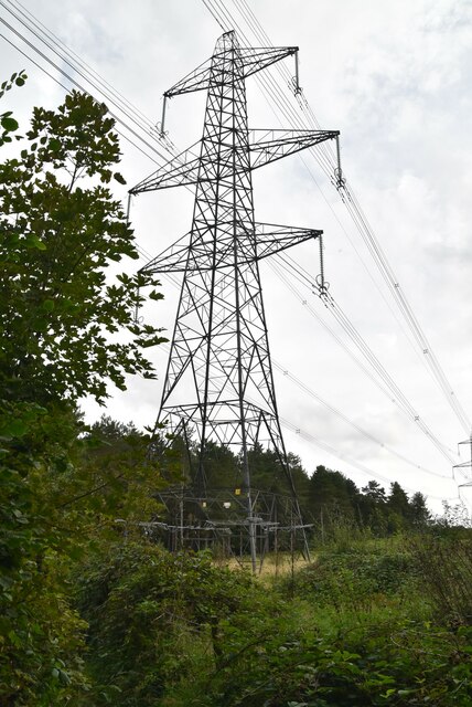
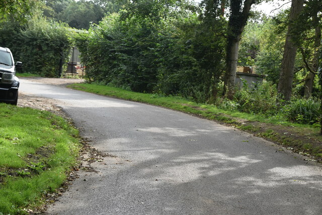
Anchor Wood is a sprawling woodland located in Sussex, England. Covering an area of approximately 500 acres, it is renowned for its natural beauty and diverse ecosystem. The wood is predominantly composed of a mixture of deciduous and coniferous trees, creating a rich tapestry of colors throughout the year.

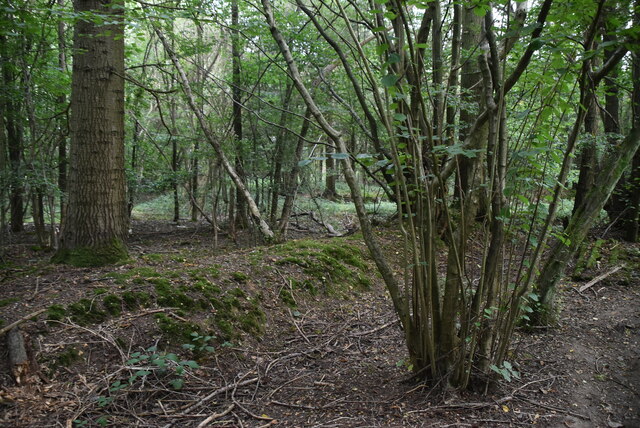
The wood is home to a wide variety of flora and fauna, making it a popular destination for nature enthusiasts and wildlife photographers. Visitors can expect to see native species such as oak, beech, and ash trees, as well as a vibrant carpet of bluebells during the spring months. The wood also provides a habitat for numerous bird species, including woodpeckers, owls, and various songbirds.

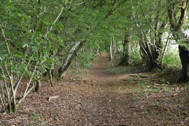
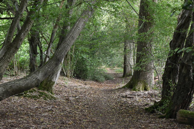
Several well-maintained walking trails meander through Anchor Wood, allowing visitors to explore its natural wonders at their own pace. These trails provide opportunities for spotting wildlife, enjoying picnics, or simply immersing oneself in the tranquility of the surroundings.

In addition to its natural beauty, Anchor Wood also boasts a rich cultural history. The wood was once a vital resource for the local community, providing timber for various industries. Today, remnants of this history can still be seen in the form of old saw pits and charcoal burners.

Whether it's for a leisurely stroll, a birdwatching expedition, or simply a peaceful escape from the hustle and bustle of everyday life, Anchor Wood offers a truly enchanting experience for all who visit.

If you have any feedback on the listing, please let us know in the comments section below.

Anchor Wood Images

Images are sourced within 2km of 50.988976/-0.053435649 or Grid Reference TQ3622. Thanks to Geograph Open Source API. All images are credited.

Pylon, Wilderness Wood
Sussex Border Path, Wilderness Wood The Sussex Border Path is a footpath route nearly 150 miles long around the inland boundary of the county of Sussex. The county owes its origins to the kingdom of the South Saxons and can claim to have one of the longest inland county boundaries from Emsworth to Rye. The route was devised in 1983 and is well signed along most of the route. Website <span class="nowrap"><a title="http://www.sussexborderpath.co.uk/" rel="nofollow ugc noopener" href="http://www.sussexborderpath.co.uk/">Link</a><img style="margin-left:2px;" alt="External link" title="External link - shift click to open in new window" src="https://s1.geograph.org.uk/img/external.png" width="10" height="10"/></span> 
Map: <a title="https://www.geograph.org.uk/search.php?i=40140109&page=1&displayclass=map#i=40140109&page=1&displayclass=map&zoom=2&lat=51.03263&lon=-0.05427&layers=FTTB00000000000T" href="https://www.geograph.org.uk/search.php?i=40140109&page=1&displayclass=map#i=40140109&page=1&displayclass=map&zoom=2&lat=51.03263&lon=-0.05427&layers=FTTB00000000000T">Link</a>
Sussex Border Path, Wilderness Wood
The Sussex Border Path is a footpath route nearly 150 miles long around the inland boundary of the county of Sussex. The county owes its origins to the kingdom of the South Saxons and can claim to have one of the longest inland county boundaries from Emsworth to Rye. The route was devised in 1983 and is well signed along most of the route. Website LinkExternal link Map: Link
Wilderness Wood
Wilderness Wood
Ham Lane The Sussex Border Path is a footpath route nearly 150 miles long around the inland boundary of the county of Sussex. The county owes its origins to the kingdom of the South Saxons and can claim to have one of the longest inland county boundaries from Emsworth to Rye. The route was devised in 1983 and is well signed along most of the route. Website <span class="nowrap"><a title="http://www.sussexborderpath.co.uk/" rel="nofollow ugc noopener" href="http://www.sussexborderpath.co.uk/">Link</a><img style="margin-left:2px;" alt="External link" title="External link - shift click to open in new window" src="https://s1.geograph.org.uk/img/external.png" width="10" height="10"/></span> 
Map: <a title="https://www.geograph.org.uk/search.php?i=40140109&page=1&displayclass=map#i=40140109&page=1&displayclass=map&zoom=2&lat=51.03263&lon=-0.05427&layers=FTTB00000000000T" href="https://www.geograph.org.uk/search.php?i=40140109&page=1&displayclass=map#i=40140109&page=1&displayclass=map&zoom=2&lat=51.03263&lon=-0.05427&layers=FTTB00000000000T">Link</a>
Ham Lane
The Sussex Border Path is a footpath route nearly 150 miles long around the inland boundary of the county of Sussex. The county owes its origins to the kingdom of the South Saxons and can claim to have one of the longest inland county boundaries from Emsworth to Rye. The route was devised in 1983 and is well signed along most of the route. Website LinkExternal link Map: Link
Ham Wood
Ham Wood
Ham Wood
Ham Wood
Sussex Border Path, Ham Wood The Sussex Border Path is a footpath route nearly 150 miles long around the inland boundary of the county of Sussex. The county owes its origins to the kingdom of the South Saxons and can claim to have one of the longest inland county boundaries from Emsworth to Rye. The route was devised in 1983 and is well signed along most of the route. Website <span class="nowrap"><a title="http://www.sussexborderpath.co.uk/" rel="nofollow ugc noopener" href="http://www.sussexborderpath.co.uk/">Link</a><img style="margin-left:2px;" alt="External link" title="External link - shift click to open in new window" src="https://s1.geograph.org.uk/img/external.png" width="10" height="10"/></span> 
Map: <a title="https://www.geograph.org.uk/search.php?i=40140109&page=1&displayclass=map#i=40140109&page=1&displayclass=map&zoom=2&lat=51.03263&lon=-0.05427&layers=FTTB00000000000T" href="https://www.geograph.org.uk/search.php?i=40140109&page=1&displayclass=map#i=40140109&page=1&displayclass=map&zoom=2&lat=51.03263&lon=-0.05427&layers=FTTB00000000000T">Link</a>
Sussex Border Path, Ham Wood
The Sussex Border Path is a footpath route nearly 150 miles long around the inland boundary of the county of Sussex. The county owes its origins to the kingdom of the South Saxons and can claim to have one of the longest inland county boundaries from Emsworth to Rye. The route was devised in 1983 and is well signed along most of the route. Website LinkExternal link Map: Link
Ham Wood
Ham Wood
Sussex Border Path, Ham Wood The Sussex Border Path is a footpath route nearly 150 miles long around the inland boundary of the county of Sussex. The county owes its origins to the kingdom of the South Saxons and can claim to have one of the longest inland county boundaries from Emsworth to Rye. The route was devised in 1983 and is well signed along most of the route. Website <span class="nowrap"><a title="http://www.sussexborderpath.co.uk/" rel="nofollow ugc noopener" href="http://www.sussexborderpath.co.uk/">Link</a><img style="margin-left:2px;" alt="External link" title="External link - shift click to open in new window" src="https://s1.geograph.org.uk/img/external.png" width="10" height="10"/></span> 
Map: <a title="https://www.geograph.org.uk/search.php?i=40140109&page=1&displayclass=map#i=40140109&page=1&displayclass=map&zoom=2&lat=51.03263&lon=-0.05427&layers=FTTB00000000000T" href="https://www.geograph.org.uk/search.php?i=40140109&page=1&displayclass=map#i=40140109&page=1&displayclass=map&zoom=2&lat=51.03263&lon=-0.05427&layers=FTTB00000000000T">Link</a>
Sussex Border Path, Ham Wood
The Sussex Border Path is a footpath route nearly 150 miles long around the inland boundary of the county of Sussex. The county owes its origins to the kingdom of the South Saxons and can claim to have one of the longest inland county boundaries from Emsworth to Rye. The route was devised in 1983 and is well signed along most of the route. Website LinkExternal link Map: Link
Ploughed field near Ham Wood
Sussex Border Path The Sussex Border Path is a footpath route nearly 150 miles long around the inland boundary of the county of Sussex. The county owes its origins to the kingdom of the South Saxons and can claim to have one of the longest inland county boundaries from Emsworth to Rye. The route was devised in 1983 and is well signed along most of the route. Website <span class="nowrap"><a title="http://www.sussexborderpath.co.uk/" rel="nofollow ugc noopener" href="http://www.sussexborderpath.co.uk/">Link</a><img style="margin-left:2px;" alt="External link" title="External link - shift click to open in new window" src="https://s1.geograph.org.uk/img/external.png" width="10" height="10"/></span> 
Map: <a title="https://www.geograph.org.uk/search.php?i=40140109&page=1&displayclass=map#i=40140109&page=1&displayclass=map&zoom=2&lat=51.03263&lon=-0.05427&layers=FTTB00000000000T" href="https://www.geograph.org.uk/search.php?i=40140109&page=1&displayclass=map#i=40140109&page=1&displayclass=map&zoom=2&lat=51.03263&lon=-0.05427&layers=FTTB00000000000T">Link</a>
Sussex Border Path
The Sussex Border Path is a footpath route nearly 150 miles long around the inland boundary of the county of Sussex. The county owes its origins to the kingdom of the South Saxons and can claim to have one of the longest inland county boundaries from Emsworth to Rye. The route was devised in 1983 and is well signed along most of the route. Website LinkExternal link Map: Link
Pellingford Brook
Pellingford Brook
Stile, Sussex Border Path
Field Barn
Field Barn
Sussex Border Path
Sussex Border Path
Stile, Sussex Border Path The Sussex Border Path is a footpath route nearly 150 miles long around the inland boundary of the county of Sussex. The county owes its origins to the kingdom of the South Saxons and can claim to have one of the longest inland county boundaries from Emsworth to Rye. The route was devised in 1983 and is well signed along most of the route. Website <span class="nowrap"><a title="http://www.sussexborderpath.co.uk/" rel="nofollow ugc noopener" href="http://www.sussexborderpath.co.uk/">Link</a><img style="margin-left:2px;" alt="External link" title="External link - shift click to open in new window" src="https://s1.geograph.org.uk/img/external.png" width="10" height="10"/></span> 
Map: <a title="https://www.geograph.org.uk/search.php?i=40140109&page=1&displayclass=map#i=40140109&page=1&displayclass=map&zoom=2&lat=51.03263&lon=-0.05427&layers=FTTB00000000000T" href="https://www.geograph.org.uk/search.php?i=40140109&page=1&displayclass=map#i=40140109&page=1&displayclass=map&zoom=2&lat=51.03263&lon=-0.05427&layers=FTTB00000000000T">Link</a>
Stile, Sussex Border Path
The Sussex Border Path is a footpath route nearly 150 miles long around the inland boundary of the county of Sussex. The county owes its origins to the kingdom of the South Saxons and can claim to have one of the longest inland county boundaries from Emsworth to Rye. The route was devised in 1983 and is well signed along most of the route. Website LinkExternal link Map: Link
Farm track
Farm track
Farm track
Farm track
Show me another place!

Anchor Wood is located at Grid Ref: TQ3622 (Lat: 50.988976, Lng: -0.053435649)

Administrative County: West Sussex

District: Mid Sussex

Police Authority: Sussex

What 3 Words

///roof.wicked.allows. Near Wivelsfield Green, East Sussex

Nearby Locations

Anchor Wood

Related Wikis

Scaynes Hill

Scaynes Hill is a village in the civil parish of Lindfield Rural in the Mid Sussex District of West Sussex, England. It lies on the A272 road 2.2 miles...

Great Walstead School

Great Walstead School is a private day school for girls and boys between the ages of 2½ and 13 years with a Christian ethos. It has some 400 children in...

Lindfield Rural

Lindfield Rural is a civil parish in the Mid Sussex District of West Sussex, England. It is located on the southern slopes of the Weald, five miles (8...

Walstead

Walstead is a hamlet located 1.5 kilometres (0.93 mi) south east of Lindfield, West Sussex, England. The hamlet is the home of Great Walstead School, Paxhill...

Nearby Amenities

Located within 500m of 50.988976,-0.053435649
Scaynes Hill
Is In: East Sussex; England; United Kingdom
Place: village
Source: npe
Wikidata: Q7430656
Lat/Long: 50.9928026/-0.051063
Bus Stop
The Farmers PH
Bus: yes
Naptan AtcoCode: 4400EG0001
Naptan Bearing: E
Naptan CommonName: The Farmers PH
Naptan Indicator: opp Orchard Close
Naptan Landmark: Orchard Close
Naptan NaptanCode: wsxamjwm
Naptan Street: Lewes Road
Naptan Verified: no
Public Transport: platform
Shelter: no
Source: naptan_import
Lat/Long: 50.9919141/-0.0526217
Bus Stop
Ham Lane
Bus: yes
Naptan AtcoCode: 4400EG0127
Naptan Bearing: NW
Naptan CommonName: Ham Lane
Naptan Indicator: adj Ham Lane
Naptan Landmark: Ham Lane
Naptan NaptanCode: wsxamwjp
Naptan Street: Lewes Road
Naptan Verified: no
Public Transport: platform
Source: naptan_import
Lat/Long: 50.9928236/-0.0560357
Bus Stop
Ham Lane
Bus: yes
Naptan AtcoCode: 4400EG0128
Naptan Bearing: SE
Naptan CommonName: Ham Lane
Naptan Indicator: opp Ham Lane
Naptan Landmark: Ham Lane
Naptan NaptanCode: wsxamwjt
Naptan Street: Lewes Road
Naptan Verified: no
Public Transport: platform
Source: naptan_import
Lat/Long: 50.9928621/-0.0556493
Barrier: stile
Lat/Long: 50.9846259/-0.0551771
Bus Stop
The Farmers PH
Bus: yes
Naptan AtcoCode: 4400EG0002
Naptan Bearing: W
Naptan CommonName: The Farmers PH
Naptan Indicator: adj Orchard Close
Naptan Landmark: Orchard Close
Naptan NaptanCode: wsxamjwp
Naptan Street: Lewes Road
Naptan Verified: no
Public Transport: platform
Source: naptan_import
Lat/Long: 50.9919679/-0.0533726
Post Box
Brand: Royal Mail
Brand Wikidata: Q638098
Brand Wikipedia: en:Royal Mail
Operator: Royal Mail
Operator Wikidata: Q638098
Post Box Type: wall
Ref: RH17 109
Royal Cypher: GR
Royal Cypher Wikidata: Q33102273
Lat/Long: 50.9913006/-0.0516547
Atm
Lat/Long: 50.9910265/-0.0509252
Crossing
Bicycle: no
Button Operated: yes
Crossing: traffic_signals
Crossing Island: no
Crossing Ref: puffin
Kerb: lowered
Tactile Paving: yes
Traffic Signals Sound: yes
Lat/Long: 50.9921834/-0.0539833
Public Footpath
Information: guidepost
Tourism: information
Lat/Long: 50.9912922/-0.0515967
Crossing
Bicycle: no
Button Operated: yes
Crossing: traffic_signals
Crossing Island: no
Crossing Ref: puffin
Kerb: lowered
Tactile Paving: yes
Traffic Signals Sound: yes
Lat/Long: 50.9915558/-0.051923
Power: pole
Lat/Long: 50.9845812/-0.0532267
Power: pole
Lat/Long: 50.9847693/-0.0514754
Barrier: stile
Lat/Long: 50.9884527/-0.0474872
Barrier: stile
Lat/Long: 50.9852562/-0.0506819
The data included in this document is from www.openstreetmap.org. The data is made available under ODbL.

Have you been to Anchor Wood?

Leave your review of Anchor Wood below (or comments, questions and feedback).