Belt Plantation

Wood, Forest in Lincolnshire East Lindsey

England

Belt Plantation

Direction Sign – Signpost on the crossroads in South Ormsby Located on the northeast side of the crossroads of Bluestone Heath Road and South Road in South Ormsby cum Ketsby parish. 3 arms and no finial. 

Milestone Society National ID: LI_TF3675
Direction Sign – Signpost on the crossroads in South Ormsby Credit: A Riley

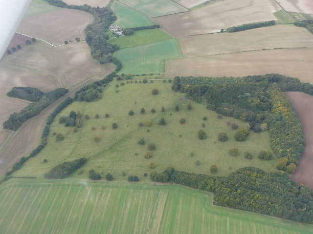
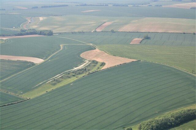
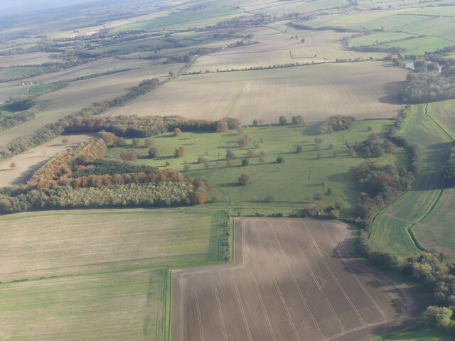
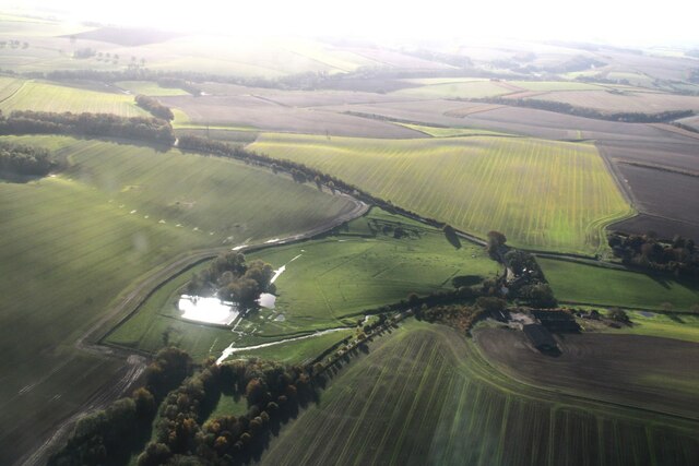
Belt Plantation, located in Lincolnshire, is a vast and picturesque woodland area known for its dense forest cover and natural beauty. Situated near the village of Belt, this plantation spans over a considerable area and is a popular destination for nature enthusiasts and outdoor enthusiasts alike.

The woodland in Belt Plantation primarily consists of a mix of deciduous and coniferous trees, creating a diverse and vibrant ecosystem. The plantation is home to a variety of tree species, including oak, ash, beech, pine, and spruce. This rich diversity of vegetation provides a habitat for numerous wildlife species, such as deer, rabbits, squirrels, and a plethora of bird species.

Visitors to Belt Plantation can explore the area through a network of well-maintained trails and footpaths, allowing them to immerse themselves in the serene surroundings and observe the flora and fauna. The woodland's tranquil atmosphere makes it an ideal spot for walking, hiking, and birdwatching.

In addition to its natural splendor, Belt Plantation also serves as an important site for environmental conservation and sustainability efforts. The plantation is managed by local authorities who prioritize the preservation and maintenance of the woodland, ensuring its longevity and ecological balance.

Overall, Belt Plantation is a haven for nature lovers, offering a peaceful retreat from the hustle and bustle of urban life. Its scenic beauty, diverse vegetation, and abundant wildlife make it a must-visit destination for anyone seeking solace in the heart of Lincolnshire's woodlands.

If you have any feedback on the listing, please let us know in the comments section below.

Belt Plantation Images

Images are sourced within 2km of 53.279369/0.048384551 or Grid Reference TF3677. Thanks to Geograph Open Source API. All images are credited.

Direction Sign – Signpost on the crossroads in South Ormsby Located on the northeast side of the crossroads of Bluestone Heath Road and South Road in South Ormsby cum Ketsby parish. 3 arms and no finial. 

Milestone Society National ID: LI_TF3675
Direction Sign – Signpost on the crossroads in South Ormsby
Located on the northeast side of the crossroads of Bluestone Heath Road and South Road in South Ormsby cum Ketsby parish. 3 arms and no finial. Milestone Society National ID: LI_TF3675
Soilmarks on field S of Burwell: aerial 2021 (1)
Soilmarks on field S of Burwell: aerial 2021 (2)
Deserted village of Walmsgate: aerial 2021 (1) See <span class="nowrap"><a title="https://www.heritagegateway.org.uk/Gateway/Results_Single.aspx?uid=MLI43614&resourceID=1006" rel="nofollow ugc noopener" href="https://www.heritagegateway.org.uk/Gateway/Results_Single.aspx?uid=MLI43614&resourceID=1006">Link</a><img style="margin-left:2px;" alt="External link" title="External link - shift click to open in new window" src="https://s1.geograph.org.uk/img/external.png" width="10" height="10"/></span>.

Also contains a ruined church: <span class="nowrap"><a title="https://www.heritagegateway.org.uk/Gateway/Results_Single.aspx?uid=MLI93273&resourceID=1006" rel="nofollow ugc noopener" href="https://www.heritagegateway.org.uk/Gateway/Results_Single.aspx?uid=MLI93273&resourceID=1006">Link</a><img style="margin-left:2px;" alt="External link" title="External link - shift click to open in new window" src="https://s1.geograph.org.uk/img/external.png" width="10" height="10"/></span>
Deserted village of Walmsgate: aerial 2021 (1)
See LinkExternal link. Also contains a ruined church: LinkExternal link
Deserted village of Walmsgate: aerial 2021 (2) See <span class="nowrap"><a title="https://www.heritagegateway.org.uk/Gateway/Results_Single.aspx?uid=MLI43614&resourceID=1006" rel="nofollow ugc noopener" href="https://www.heritagegateway.org.uk/Gateway/Results_Single.aspx?uid=MLI43614&resourceID=1006">Link</a><img style="margin-left:2px;" alt="External link" title="External link - shift click to open in new window" src="https://s1.geograph.org.uk/img/external.png" width="10" height="10"/></span>.

Also contains a ruined church: <span class="nowrap"><a title="https://www.heritagegateway.org.uk/Gateway/Results_Single.aspx?uid=MLI93273&resourceID=1006" rel="nofollow ugc noopener" href="https://www.heritagegateway.org.uk/Gateway/Results_Single.aspx?uid=MLI93273&resourceID=1006">Link</a><img style="margin-left:2px;" alt="External link" title="External link - shift click to open in new window" src="https://s1.geograph.org.uk/img/external.png" width="10" height="10"/></span>
Deserted village of Walmsgate: aerial 2021 (2)
See LinkExternal link. Also contains a ruined church: LinkExternal link
Footpath to Swaby
Footpath to Swaby
Footbridge over a drain near Valley Farm The footbridge isn't on a public footpath. The public footpath turns to the right just beyond the bridge.
Footbridge over a drain near Valley Farm
The footbridge isn't on a public footpath. The public footpath turns to the right just beyond the bridge.
Valley west of Walmsgate: aerial 2023 (1)
Valley west of Walmsgate: aerial 2023 (2)
Walmsgate to Burwell: aerial 2023
Towards Ketsby: aerial 2023
Site of Deserted Village of Walmsgate: aerial 2023 See: <span class="nowrap"><a title="https://www.heritagegateway.org.uk/Gateway/Results_Single.aspx?uid=MLI43614&resourceID=1006" rel="nofollow ugc noopener" href="https://www.heritagegateway.org.uk/Gateway/Results_Single.aspx?uid=MLI43614&resourceID=1006">Link</a><img style="margin-left:2px;" alt="External link" title="External link - shift click to open in new window" src="https://s1.geograph.org.uk/img/external.png" width="10" height="10"/></span>
Site of Deserted Village of Walmsgate: aerial 2023
See: LinkExternal link
Parallel valleys SE of Ketsby: aerial 2023
Burwell: aerial 2023 (1)
Burwell: aerial 2023 (2)
Burwell: aerial 2023 (3)
Valley between Walmsgate and Burwell: aerial 2023
Public Bridleway to Swaby As you crest the ridge on the way to Walmsgate, branch off to Swaby and Whitepit
Public Bridleway to Swaby
As you crest the ridge on the way to Walmsgate, branch off to Swaby and Whitepit
Show me another place!

Belt Plantation is located at Grid Ref: TF3677 (Lat: 53.279369, Lng: 0.048384551)

Administrative County: Lincolnshire

District: East Lindsey

Police Authority: Lincolnshire

What 3 Words

///metro.deeply.gratitude. Near Burwell, Lincolnshire

Related Wikis

Walmsgate

Walmsgate is a hamlet in the civil parish of Burwell, in the East Lindsey district of Lincolnshire, England. It is situated on the A16 road, 6 miles (10...
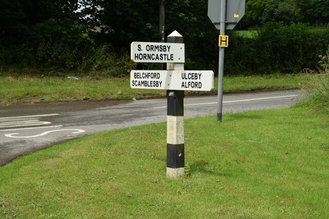
Ketsby

Ketsby is a hamlet in the civil parish of South Ormsby in the East Lindsey district of Lincolnshire, England. It is situated 5 miles (8.0 km) west from...

South Ormsby

South Ormsby, sometimes called South Ormesby, is a village in the East Lindsey district of Lincolnshire, England. It is situated 1 mile (1.6 km) west from...

Swaby

Swaby is a civil parish and village in the East Lindsey district of Lincolnshire, England, about 8 miles (13 km) north from Spilsby, and 6 miles (9.7 km...

Nearby Amenities

Located within 500m of 53.279369,0.048384551
Bus Stop
Letter Box
Naptan AtcoCode: 270000014412
Naptan Bearing: NW
Naptan CommonName: Letter Box
Naptan Indicator: opp
Naptan Landmark: Letter Box
Naptan NaptanCode: linjpmpa
Naptan Street: Main Road
Naptan Verified: no
Source: naptan_import
Lat/Long: 53.2835606/0.0468632
Bus Stop
Letter Box
Naptan AtcoCode: 2700LW000439
Naptan Bearing: SE
Naptan CommonName: Letter Box
Naptan Indicator: adj
Naptan Landmark: Letter Box
Naptan NaptanCode: linadpmg
Naptan Street: Main Road
Naptan Verified: no
Source: naptan_import
Lat/Long: 53.2835357/0.0472671
Walmsgate
Place: hamlet
Source: Bing
Lat/Long: 53.2831293/0.0449961
The Lodge
Place: isolated_dwelling
Source: Bing
Lat/Long: 53.2806995/0.0504188
Historic Amenity: place_of_worship
Lat/Long: 53.2810125/0.0437494
Power: pole
Lat/Long: 53.2808084/0.0552208
Power: pole
Lat/Long: 53.2815232/0.053993
Power: pole
Lat/Long: 53.2820768/0.0529643
Power: pole
Lat/Long: 53.2826302/0.0519524
Power: pole
Lat/Long: 53.2832873/0.0507535
The data included in this document is from www.openstreetmap.org. The data is made available under ODbL.

Have you been to Belt Plantation?

Leave your review of Belt Plantation below (or comments, questions and feedback).